|
|
Post by fots2 on Sept 13, 2012 19:13:01 GMT 8
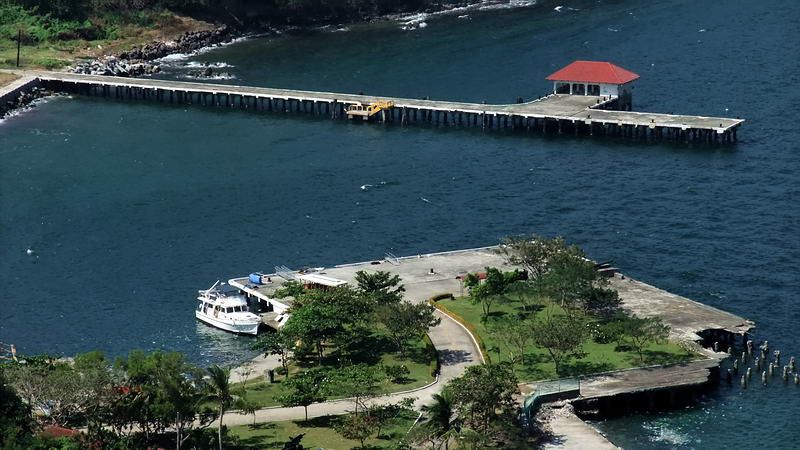
Here are recent photos of the two docks I mentioned above that have been changed from their original configurations. Patty’s photos in Reply #306 show them as they looked during WWII.  Engineer Dock at the top of the photo. (A piece has been added).  South Dock. (A piece has been removed). |
|
|
|
Post by okla on Sept 14, 2012 0:52:39 GMT 8
Hey Fots....I, once again, want to thank you for your top notch, color photos of our favorite place. I am continually amazed at what a bleak, moonscape, image Corregidor presents in 1942-45 photographs, especially when compared to modern, up to date pics, and extra-especially (is that a word???) in comparison to your always superior contributions. Photographs from the 1930s seem to show Corregidor to be a very manicured, neat, locale, although the greenery is not as pronounced, and the wartime depictions, of course, look something like the Western Front in 1918. It is so obvious that the "re-seeding" efforts in Postwar Years has taken complete possession of the island. It would appear that a Regiment of "cutters" armed with bolos could be kept busy full time from now till doomsday keeping the Jungle at bay. Thanks again for your stuff. Cheers.  |
|
|
|
Post by rlbj25 on Sept 14, 2012 10:34:55 GMT 8
fots's pic of North Dock makes me envious of the lucky people who get to stop off at Corregidor as they troll the Philippines on their private yacht (looks like a Grand Banks 42 Heritage EU, the perfect boat for the purpose). That would be the life for me.
I keep telling the wife that I'll move to the Fils tomorrow if she gets her old job back and buys me a boat so I can take myself to Corregidor. Don't get why she hasn't taken me up on that yet.
|
|
|
|
Post by fots2 on Sept 15, 2012 11:01:50 GMT 8
okla,
The differences in Corregidor views during the periods you mention are indeed amazing. Even later photos taken in the 80s do not have anywhere near the vegetation that you see today. It seemed to explode the past couple decades. Some remote places are much more difficult to explore today than years ago. With the spreading of thick vines then it seems that this will get worse.
|
|
|
|
Post by fots2 on Sept 15, 2012 11:05:09 GMT 8
Hey rlbj25,
Someday the boat docked there will be yours...keep dreaming. Imagine all the isolated places you can visit. It sounds like an adventure every day. Good luck.
|
|
|
|
Post by The Phantom on Sept 19, 2012 4:42:13 GMT 8
The photo above, reply # 304, is described as Japanese 1942, nice shot fots.
If so, is that 1917 75 mm covering the road just above the entrance into eastern Malinta Tunnel?
Not on top of Malinta hill but on the road above the eastern entrance?
As the trucks and Ambulance (?) on the road below would not be visible from the top?
Or is it on the top of the hill?
There also appears to be a bulldozer busy on a road up high.
And are those the makeshift covered shacks that the prisoners built in 92ND Garage after the surrender to stay out of the blistering sun--- off in the distance?
Is that 75 set there, apparently in working condition, to cover the prisoners entering and exiting Malinta Tunnel after the capture?
To keep them on the tail in case they wanted to try to escape?
|
|
|
|
Post by okla on Sept 19, 2012 6:24:01 GMT 8
Hey Phantom....Those do, indeed, appear to be shacks, tents, "lean toos" making up a "shanty town" in the 92nd Area. There was plenty of material lying about on Corregidor to prepare crude shelters from the sun,etc. I am amazed, with their record of POW treatment, that the Gentlemen from the North allowed the Corregidor survivors to construct such shelters. Just my humble. Cheers.
|
|
|
|
Post by fots2 on Sept 19, 2012 20:01:27 GMT 8
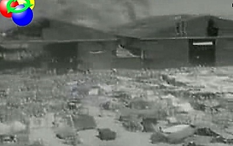
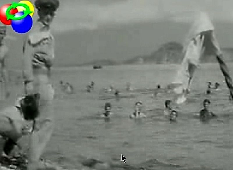
Hi Phantom and okla, As the road passes above the Malinta Tunnel East entrance, it is only about half way up the hill. I am pretty sure the view in the Japanese photo is from the top of the hill. Yes those shacks at 92nd Garage would be the temporary quarters of the POWS. I expect these photos were taken at the same time that the two newsreels were filmed. The date would be sometime after the surrender but before the POWs left the island. The second newsreel actually shows the POWs, here are a couple fuzzy screen captures from it.  The two large buildings at the rear were the garages and repair shops of the 92nd Philippine Scouts. They were formerly hangars.  POWs swimming with Caballo Island in the background. |
|
|
|
Post by chadhill on Sept 26, 2012 12:08:43 GMT 8
I was trying to get more focused blowups of the structures south (left) of the collapsed 75mm shelter:  Then I came upon this closeup view from one of the 1942 Japanese newsreels, which shows an empty 75mm shelter. The edge of the roof for the collapsed 75mm shelter is in the upper right corner.  Compare the terrain and the structure to the left of the empty 75mm shelter with the photo below, from Philippine Expeditionary Force. It looks to be the same shelter, with gun installed.  |
|
|
|
Post by fortman on Sept 26, 2012 23:07:20 GMT 8
Chad,
It is definitely the same shelter. Compare the shape of the tree branches appearing above the left edge of the shelter roof and the long pole resting on the tree. It is also in both views.
fortman
|
|