|
|
Post by okla on Sept 27, 2012 0:57:20 GMT 8
Hey Guys....Also that piece of rumpled canvas or possible crumpled sheet metal shown just under the left corner of the shelter roof is a dead give away as to this being the same structure, methinks. Cheers.
|
|
|
|
Post by fots2 on Sept 27, 2012 20:03:34 GMT 8
Good Day Gents, I have looked at these photos in the past and I agree with your observations. These structures took a pounding again in 1945 so even less of them can be seen today. The gun shelter with the slanted roof is completely demolished with only concrete rubble lying around. 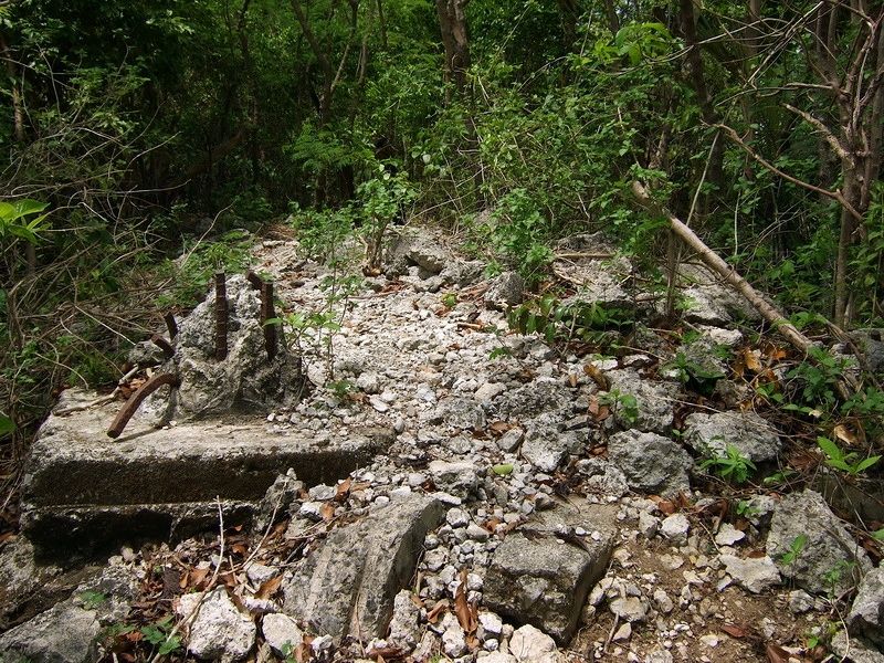 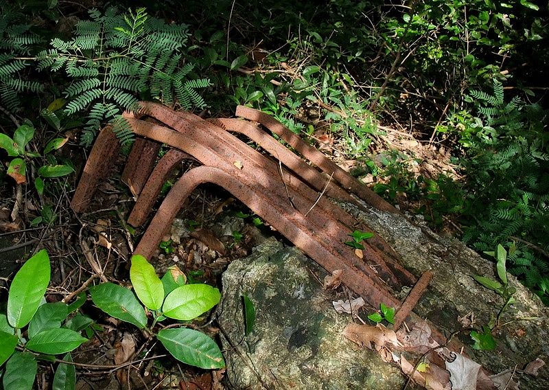 Part of the intact shelter you see in the photos is still standing but it is heavily damaged. 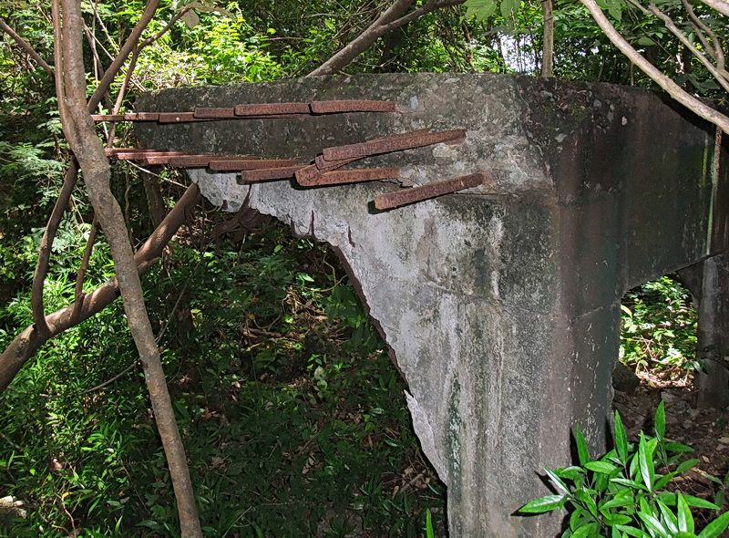 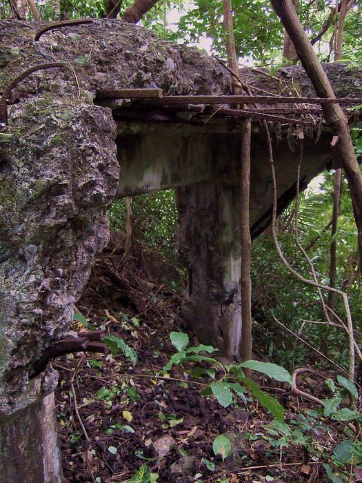 The structure sticking up at the rear is G-IV-3. Today what remains of it are two interconnected concrete rectangular rooms. The upper section of the building appears to have been wooden. Both rooms have concrete pedestals for mounting range and direction instruments. 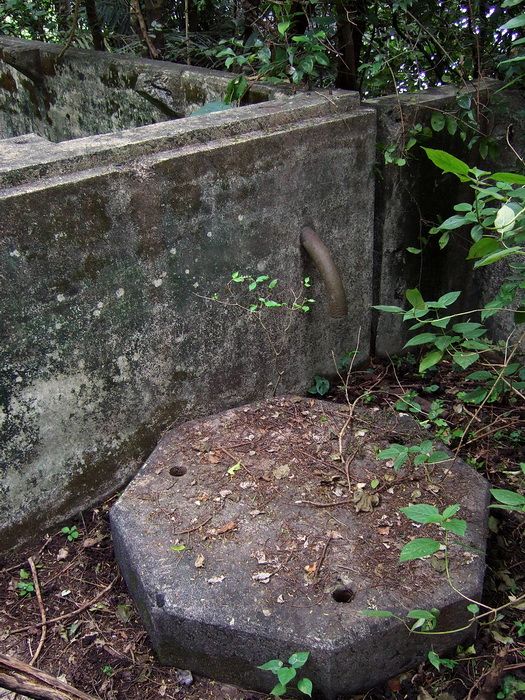 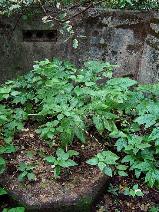 |
|
|
|
Post by okla on Sept 27, 2012 21:14:12 GMT 8
Hey Fots...Thanks for posting. All these shots continue to show that the Jungle is "King" on Corregidor these days. I love all the greenery, but it certainly hides a lot of "goodies". Cheers.
|
|
|
|
Post by chadhill on Sept 27, 2012 22:58:04 GMT 8
Fots, thanks for posting those pictures...not much left of the structures today. The present condition of the two 75mm shelters makes me wonder if armyjunk's aerial photo of Malinta Hill, where they are shown more intact, was taken before the 1945 battle had ended.  1942 newsreel pic of the collapsed shelter:  Would this be looking out from what is labeled "Shelter 2" in armyjunk's photo, rather than from the other intact shelter that is closer to the old land defense magazine on the northern side of the hill?  |
|
|
|
Post by chadhill on Sept 29, 2012 12:57:46 GMT 8
Could there have been a fourth 75mm gun shelter on top of Malinta Hill in 1942? We already know that three shelters existed: 1. One just south of the old land defense magazine; this is the gun shelter seen in the 1942 newsreel with the pom-pom gun up on the little hill beyond. It is the shelter furthest to the right in armyjunk's aerial photo. 2. the collapsed shelter, seen in the newsreel, the Philippine Expeditionary Force photo and in armyjunk's aerial photo. 3. the shelter furthest south on the ridge, between the collapsed shelter and G-IV-3. It is also seen in the newsreel, a Philippine Expeditionary Force photo and in armyjunk's aerial view. Fots has provided us with wonderful photography that shows the remains of those shelters today. But the 1936 map of this area has puzzled me.  The map shows another 75mm position on the northern edge of the ridge, west of Searchlight #8 and just SW of EG-IV-3, the "bathtub" command post. I am not aware of any surviving photographs of a gun shelter there, and as far as I know there are no remains of one there today, either. I've thought that possibly this shelter may have been relocated south in early 1942 to make room for the pom-pom gun, since space is critical here. While recently watching one of the 1942 Japanese newsreels I noticed something interesting:  We are looking almost due north here, and slightly downhill from the small knoll the pom-pom was mounted on. I think that what is probably an upper section of the bathtub command post EG-IV-3 is in the top center of the photo. To it's left there is a structure that resembles a 75mm gun shelter. This structure would seem to be just SW of the "tub", agreeing with the 1936 map. Here is another view, looking more slightly to the NW. Part of the overturned pom-pom gun can be seen.  I know, I know...yet another SWAG. Hope I ain't seeing pink elephants and beating this horse to death  |
|
|
|
Post by fots2 on Sept 29, 2012 15:27:23 GMT 8
Hi Chad, Response to Reply # 323 I can only guess but I think armyjunk’s aerial photo was taken before the 1945 battle had ended. I will repost one of his photos with some labels changed/added. 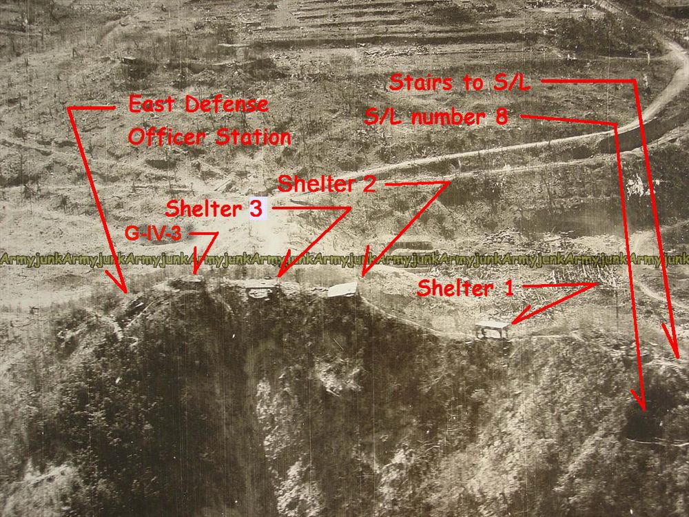 1945 photo courtesy of armyjunk. Regarding the 1942 newsreel photo of the collapsed shelter, I believe that you are correct in that it is Shelter #2 in the above photo. Your third photo would also be the same shelter taken from the opposite side looking east this time. The following two photos appear to be taken from Shelters #2 and #3, both looking eastward. The views of the roads down below is similar and show the main road going towards the Malinta Tunnel East entrance which is out of sight at the bottom. The first photo (below) was probably taken from the intact Shelter #3. Judging from the shadows it is a morning photo so no shadow on the gun. I don’t think this view is from Shelter #1 due to the angle of the roads you can see. We are almost over the top of the tunnel entrance here. 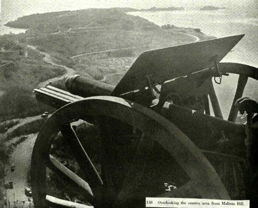 In the second photo (below), this shelter is damaged so I assume it is #2. Look over the upper gun shield at the road down below. The view is limited but similar. I see the same “Z” intersection as seen in the previous photo toward the left. Vehicle placement is different so some of them must have survived and were being used by the Japanese. 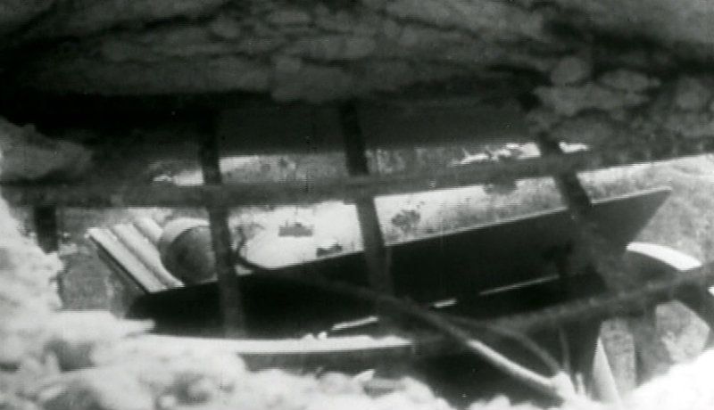 |
|
|
|
Post by fots2 on Sept 29, 2012 15:30:24 GMT 8
Response to Reply #324.
I always thought that there were a total of three 75mm gun shelters on top of Malinta Hill solely due to what I see remaining today. However I have noticed the most northern one shown on the 1936 map and could not explain it. Was it removed or is the map incorrect? I do not know. There is no evidence of a shelter to be seen there. As you point out we may be seeing part of it in the newsreel but it seems impossible to know for sure. The 1935 and earlier maps do not show the shelters at all.
An obvious 1936 map error is the location of the single shelter shown further south. It is facing east but shows G-IV-3 directly in front (east) of it. You cannot shoot through a building! As you know, there are actually two shelters near here. Both of them are slightly north of G-IV-3 as seen in armyjunk’s photo.
Could there have been a fourth shelter on top of Malinta Hill (at some time)? I would say it is possible but as of now I see no clear evidence to support the idea. As far as I know only the 1936 map gives us any indication that this shelter may have existed. Like anything we discuss it is worth kicking the ground away at this location next time I am up on the hill. Good old Corregidor is still full of surprises.
|
|
|
|
Post by pdh54 on Sept 29, 2012 23:07:34 GMT 8
|
|
|
|
Post by fots2 on Sept 30, 2012 17:02:08 GMT 8
Thank-you for the photo and link Patty. I have not seen that particular view before.
As for photo size after cropping, try this simple trick. I don't know what editing program you are using but look for a tool called "Resize". Among other things you should see "Width and Height" numbers that are adjustable.
An example of a small photo after cropping is 300 x 200 (for a landscape view). Change the 300 (Width) number to 800 or 1000 to create a copy of the photo at near full page width. (Caution: there should be a box named "Preserve Aspect Ratio", make sure it is checked).
With increased size comes increased distortion though. Experimenting with the numbers may give you the result you are looking for. Good luck.
|
|
|
|
Post by chadhill on Sept 30, 2012 23:44:10 GMT 8
Fots, thanks for reposting armyjunk's photo with some labeling changes. I'll refer to them from this point on as needed. I agree that the PEF photo (the second pic in your Reply #325) was very probably taken from Shelter 3. But I think that the bottom photo (in Reply #325) may have been taken from Shelter 3 also. The newsreel photo of the collapsed shelter in Reply #323 shows the fallen roof resting directly on top of the gun. It looks like part of the weapon has been salvaged already, too. I wondered about the placing of the 75mm shelter next to G-IV-3 on the 1936 map. Thanks for clarifying that apparent error. I agree that the newsreel photo looking north from beside the pom-pom gun isn't strong enough evidence by itself to say that there was a fourth gun shelter on top of Malinta Hill in 1942. But I sure would like to hear about your next expedition up there! ;D  Here's another off-the-wall SWAG. Look directly above the top of the roof of the "75mm SHELTER ?" in both photos in Reply #324. Is that Gorda Point in the distant background? On a map Gorda Point would seem to be too far to the NW to be visible over that structure. Just trying to maintain my SA (situational awareness)...but maybe I'm seeing pink elephants again. (Gorda Point, Bataan photo courtesy fots2)  On a final thought, back in Reply #296 you posted this photo and mentioned that it was probably taken at the site of Shelter 1. Seeing how the gun aligns with Engineer Wharf and North Dock, I wondered if the pic could have been taken at the "fourth" shelter just SW of EG-IV-3, and began digging around.  The newsreel photo below was taken, as you know, beside Shelter 1, and looks up the little hill to the pom-pom gun. Notice the shape of the tree branches on the left side of each photo. I'd say it confirms that the photo was indeed taken at Shelter 1, and not at the "fourth" shelter.  |
|