Post by fots2 on Dec 5, 2009 21:26:17 GMT 8
Here is a quick visit to the Rock Point area on the north-west coast of Corregidor. Just inland of the point is Searchlight #2.
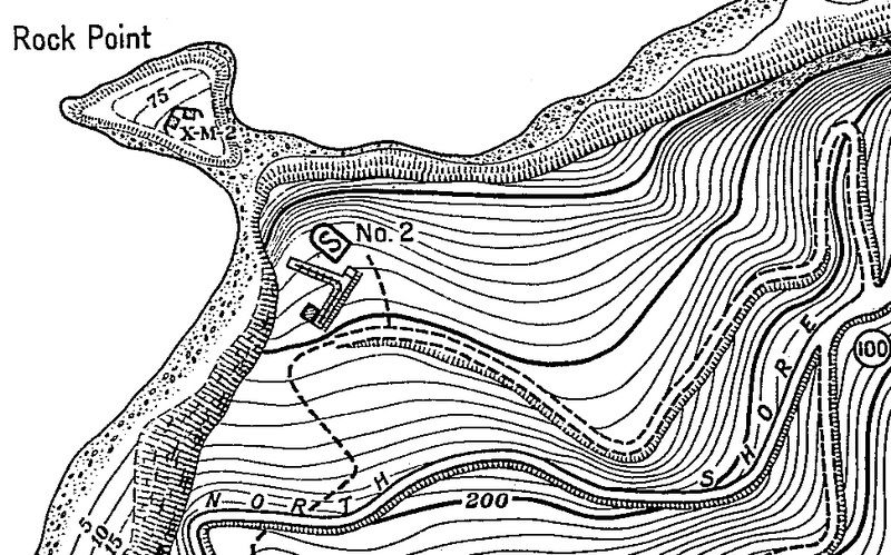
Map of Rock Point with Searchlight #2 above it. The cliff face has moved inland recently due to a large landslide. A small portion of the end of the searchlight track is now overhanging the cliff.
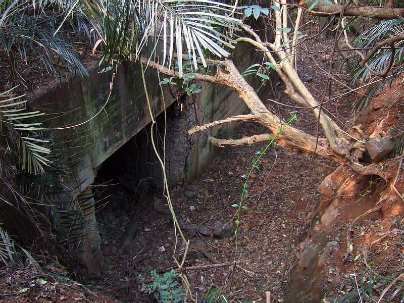
Since the old road is so overgrown it is best to make your way down the hillside from the North Shore Road. Here is the first view you see as you approach Searchlight #2. The entrance to the searchlight shelter is visible plus part of the wall.
To prepare the searchlight for operation, it would be rolled out of the shelter on a track. The track turned left 90 degrees passing along the wall and then turns left again to its final position out near the cliff.
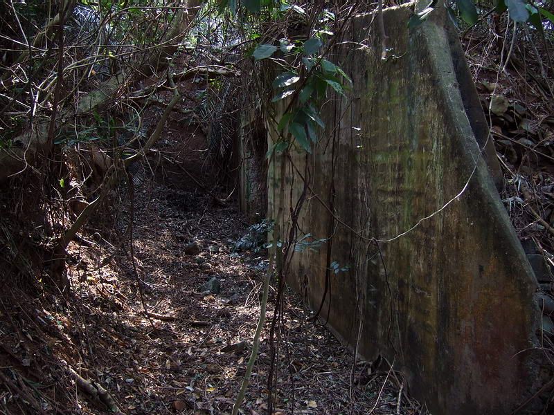
The view along the wall which is almost parallel to the cliff.

The view straight out towards the cliff.
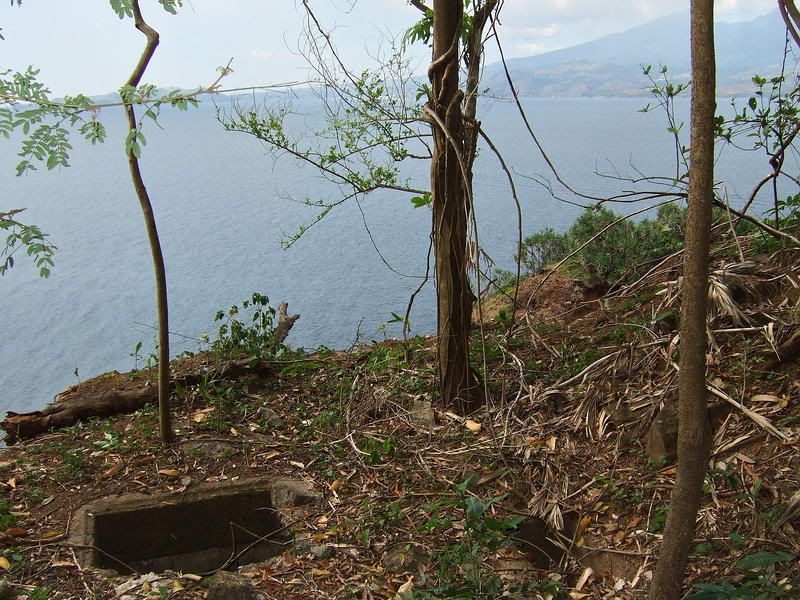
The new cliff face is at the end of (or actually slightly under) the end of the searchlight track.
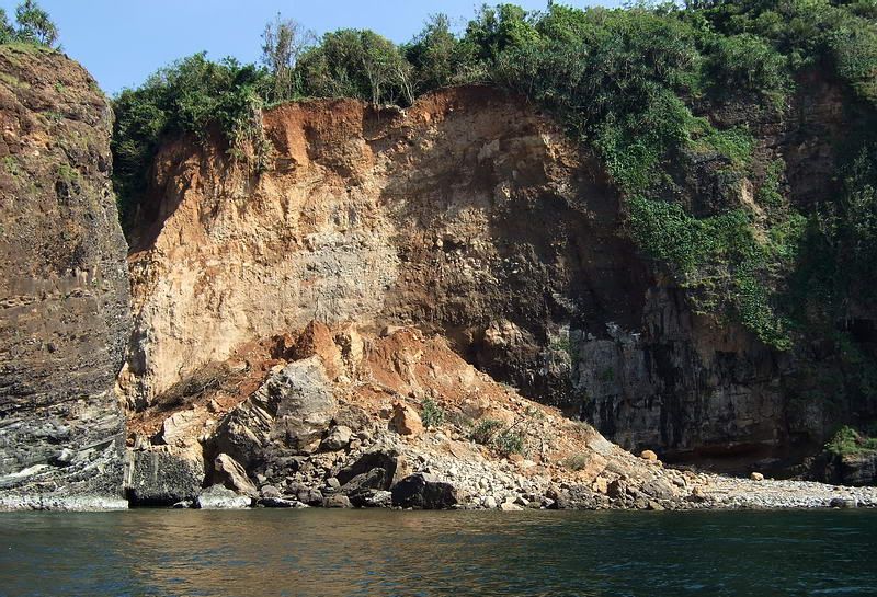
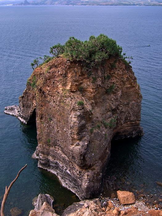
Boat view of the recent landslide. At the top of the new cliff you can see a ‘V’ with white concrete at the bottom. This is the outer end of the searchlight track overhanging the cliff.
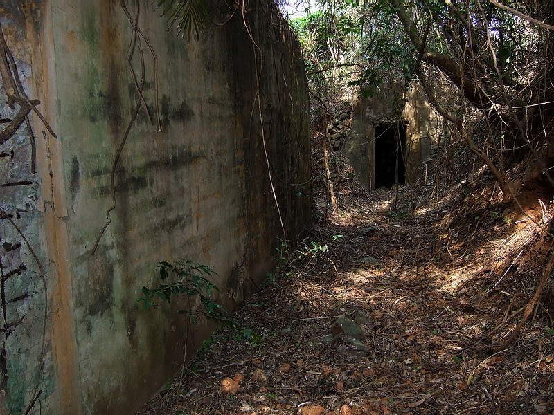
The view back along the wall to the searchlight shelter.
The doorway to the searchlight shelter.

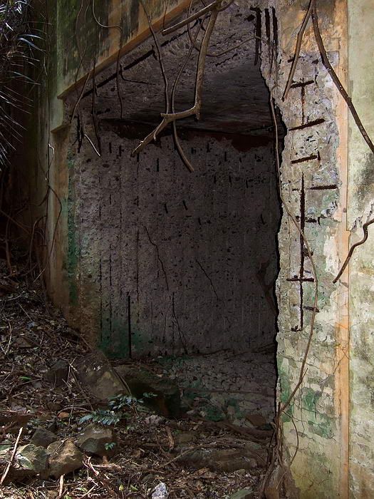
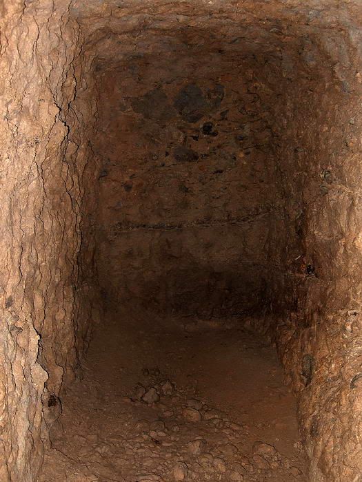
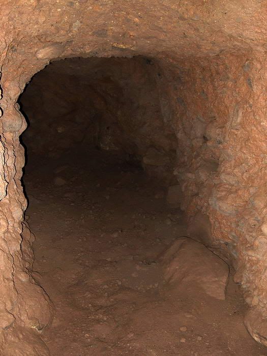
Viewing directly into the searchlight shelter.
I was standing at the doorway to the shelter when I took the above photo. From the doorway to the new cliff face is approximately 36 feet. The rear wall of the shelter is obviously even closer to the cliff. I wonder if the next landslide will take the whole searchlight?
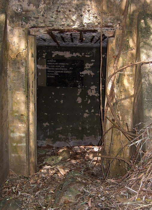
This little building may have been the searchlight control room or at the very least, the communications centre.
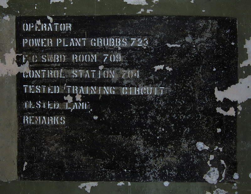
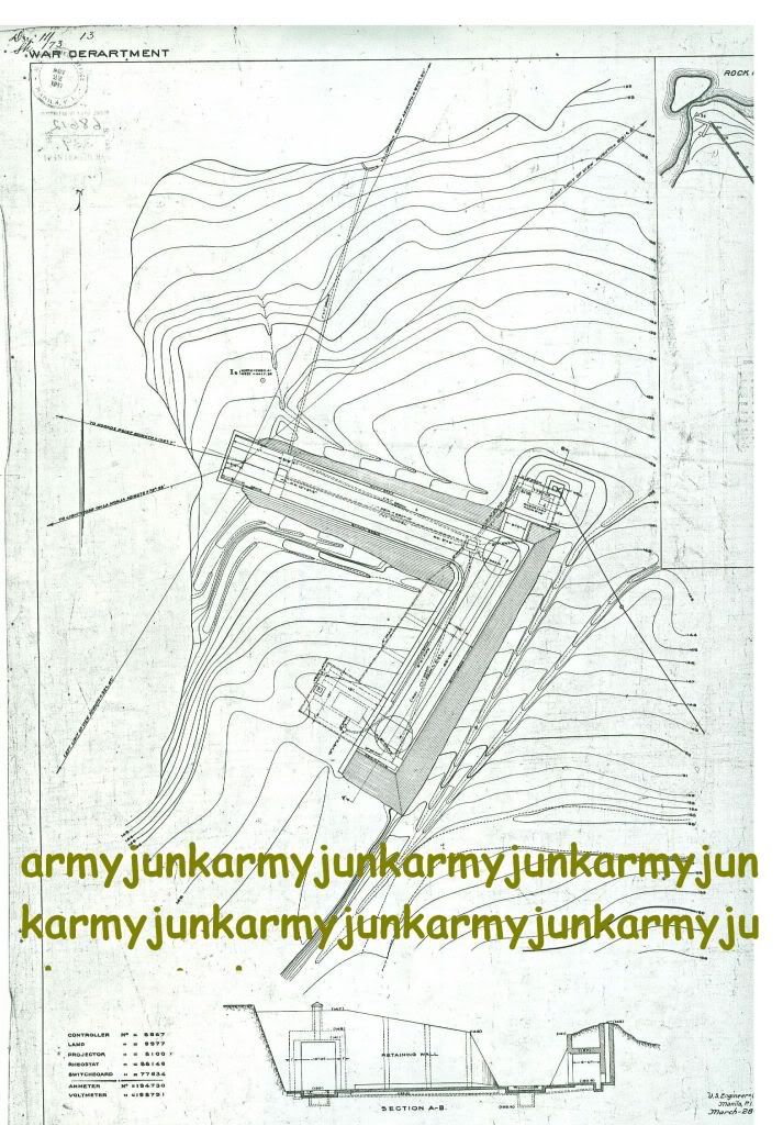
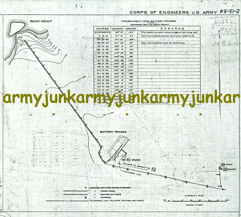
This phone directory may explain why there is no diesel generator building here. It looks like they got their power from the nearest battery, Battery Grubbs.
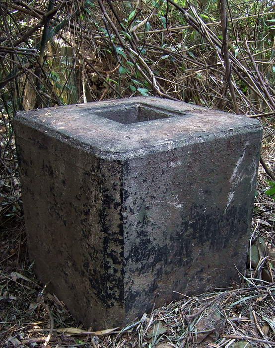
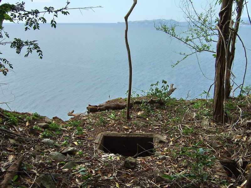
shaft on top of the control room.
Opposite the long concrete wall is an embankment containing two rough unlined tunnels. The left side tunnel goes straight in and ends 6 to 8 feet from the entrance. Not much to see here.
The view along the searchlight wall showing the embankment at the rear. Note the tunnel entrance to the right. (left side tunnel)
Closer view of this tunnel entrance.
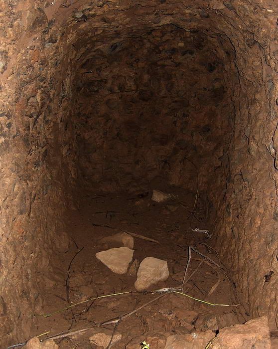
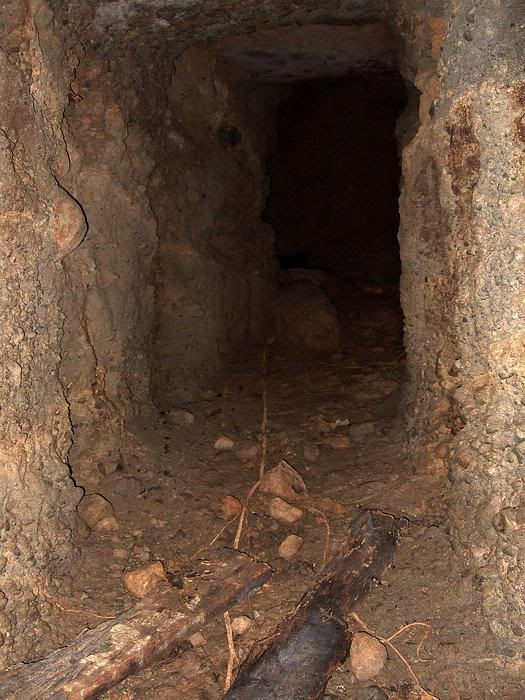
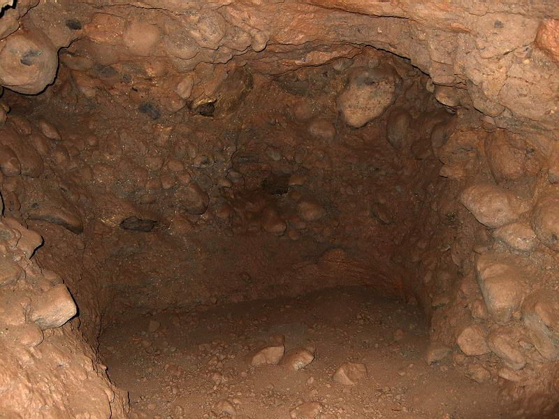
View from the entrance directly into the very short tunnel.
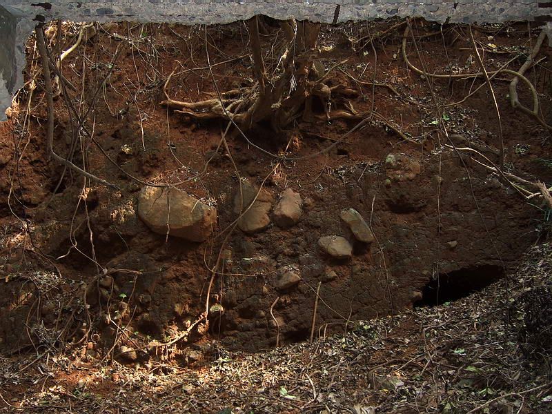
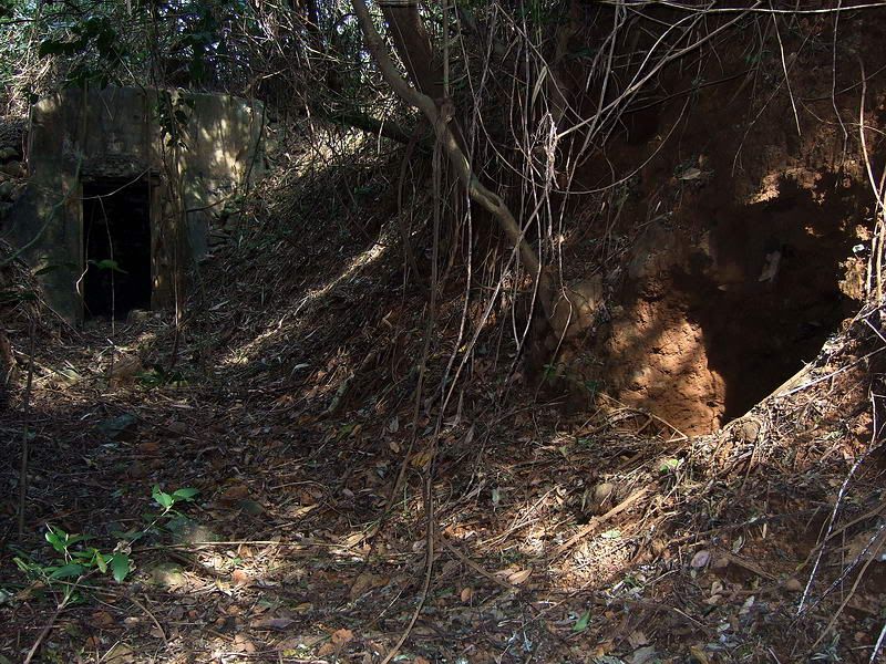
Looking out the searchlight shelter, note the mostly collapsed entrance to another tunnel. (right side tunnel)
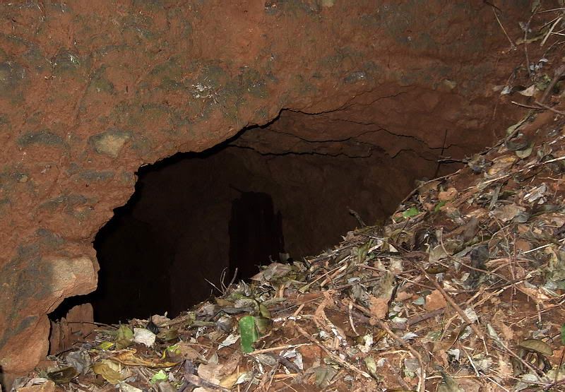
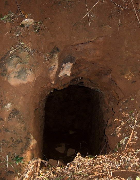
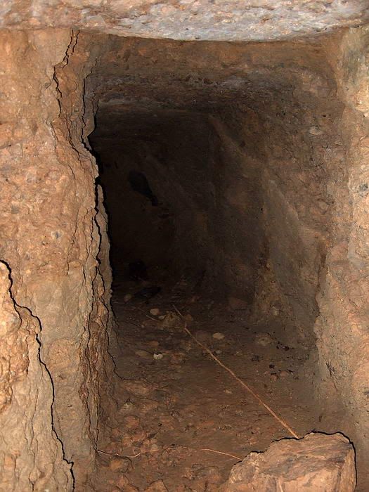
Closer view of this tunnel entrance. It is easy to slide into this tunnel.
The view back out the tunnel entrance.
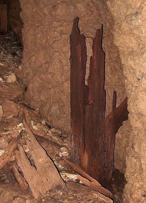
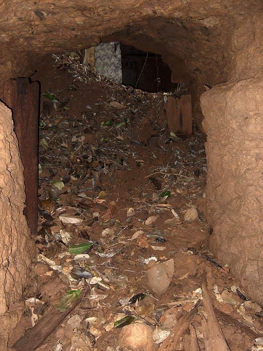
Near the entrance are vertical wooden beams buried on each side of the tunnel.
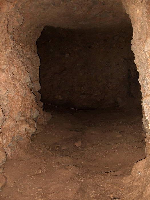
This tunnel goes straight in a short ways to a ‘T’ intersection.
At the ‘T’ intersection, the tunnel to the left is a dead end after only 10 feet or so. The end is very square and relatively smooth giving me the impression that they did not intend to tunnel any further in this direction.
The tunnel to the right slopes down and has a gentle turn to the left.
Looking back up the tunnel.
Soon you come to a ‘L’ intersection where the tunnel continues to the right.

Looking back up the tunnel from the ‘L’ intersection.
Past the ‘L’ intersection and looking back. To the left you can see the tunnel’s upward slope as it heads back towards the entrance.
The tunnel continues curving towards the left.
Dead end. I wonder if this is why the cliff collapsed. It looks like sandstone and not solid rock. There are no drill holes. Perhaps this tunnel was dug with picks and shovels.
I did not measure the total distance but I would estimate the final end is about 50 or 60 feet from the entrance. There is no airshaft or second entrance to this tunnel.
Finally, a view of Rock Point looking down from Searchlight #2.
Searchlight #2 is a little difficult to get to but it is very intact when compared to some of the other ones. Although it is an interesting place to visit I wonder if it is a bit dangerous now. Perhaps the new cliff face is still unstable, time will tell.

Map of Rock Point with Searchlight #2 above it. The cliff face has moved inland recently due to a large landslide. A small portion of the end of the searchlight track is now overhanging the cliff.
Since the old road is so overgrown it is best to make your way down the hillside from the North Shore Road. Here is the first view you see as you approach Searchlight #2. The entrance to the searchlight shelter is visible plus part of the wall.
To prepare the searchlight for operation, it would be rolled out of the shelter on a track. The track turned left 90 degrees passing along the wall and then turns left again to its final position out near the cliff.
The view along the wall which is almost parallel to the cliff.
The view straight out towards the cliff.
The new cliff face is at the end of (or actually slightly under) the end of the searchlight track.
Boat view of the recent landslide. At the top of the new cliff you can see a ‘V’ with white concrete at the bottom. This is the outer end of the searchlight track overhanging the cliff.
The view back along the wall to the searchlight shelter.
The doorway to the searchlight shelter.
Viewing directly into the searchlight shelter.
I was standing at the doorway to the shelter when I took the above photo. From the doorway to the new cliff face is approximately 36 feet. The rear wall of the shelter is obviously even closer to the cliff. I wonder if the next landslide will take the whole searchlight?
This little building may have been the searchlight control room or at the very least, the communications centre.
This phone directory may explain why there is no diesel generator building here. It looks like they got their power from the nearest battery, Battery Grubbs.
shaft on top of the control room.
Opposite the long concrete wall is an embankment containing two rough unlined tunnels. The left side tunnel goes straight in and ends 6 to 8 feet from the entrance. Not much to see here.
The view along the searchlight wall showing the embankment at the rear. Note the tunnel entrance to the right. (left side tunnel)
Closer view of this tunnel entrance.
View from the entrance directly into the very short tunnel.
Looking out the searchlight shelter, note the mostly collapsed entrance to another tunnel. (right side tunnel)
Closer view of this tunnel entrance. It is easy to slide into this tunnel.
The view back out the tunnel entrance.
Near the entrance are vertical wooden beams buried on each side of the tunnel.
This tunnel goes straight in a short ways to a ‘T’ intersection.
At the ‘T’ intersection, the tunnel to the left is a dead end after only 10 feet or so. The end is very square and relatively smooth giving me the impression that they did not intend to tunnel any further in this direction.
The tunnel to the right slopes down and has a gentle turn to the left.
Looking back up the tunnel.
Soon you come to a ‘L’ intersection where the tunnel continues to the right.
Looking back up the tunnel from the ‘L’ intersection.
Past the ‘L’ intersection and looking back. To the left you can see the tunnel’s upward slope as it heads back towards the entrance.
The tunnel continues curving towards the left.
Dead end. I wonder if this is why the cliff collapsed. It looks like sandstone and not solid rock. There are no drill holes. Perhaps this tunnel was dug with picks and shovels.
I did not measure the total distance but I would estimate the final end is about 50 or 60 feet from the entrance. There is no airshaft or second entrance to this tunnel.
Finally, a view of Rock Point looking down from Searchlight #2.
Searchlight #2 is a little difficult to get to but it is very intact when compared to some of the other ones. Although it is an interesting place to visit I wonder if it is a bit dangerous now. Perhaps the new cliff face is still unstable, time will tell.


 ? You gotta be kidding?