If you are not bored with the previous batch, here are the rest of the photos.
On Middleside, a large infantry barracks was constructed between 1914 and 1917. It consisted of nine individual sections within two long concrete buildings. One section was HQ and the other eight were barracks. (8 barracks x 150 men/barrack = 1,200 men total capacity). The cost per barrack was #37,085.40.
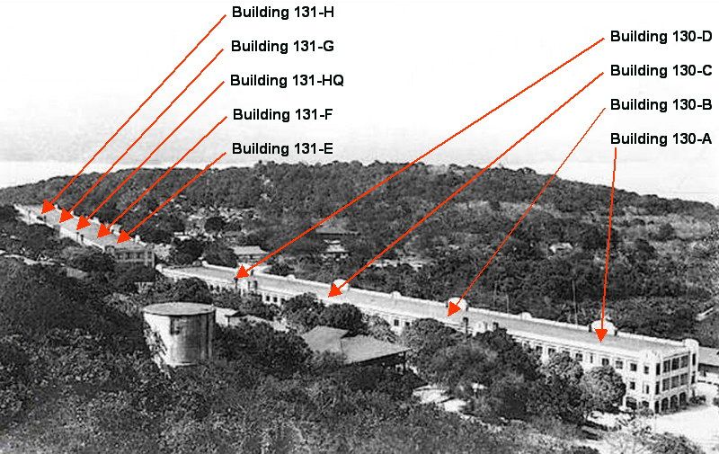
View of Middleside Barracks in 1930.

The eastern part of Middleside Barracks seen in this 1945 photo received much more battle damage than the western part.

At the eastern end of this barracks, here is a look at Building 130-A. There is no grass or hedges in sight so the building was probably just finished when this photo was taken. The completed construction date was November 27, 1914.
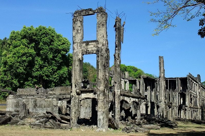
Today sections 130-A and 130-B are almost completely destroyed. If you look closely you will see reinforcing bars that are keeping 130-C from collapsing. Most other buildings look reasonably solid but are constantly deteriorating. Every time I go there I see more concrete that has fallen from ceilings and upper floors.

The opposite corner of Building 130-A looking along the rear of Middleside Barracks.
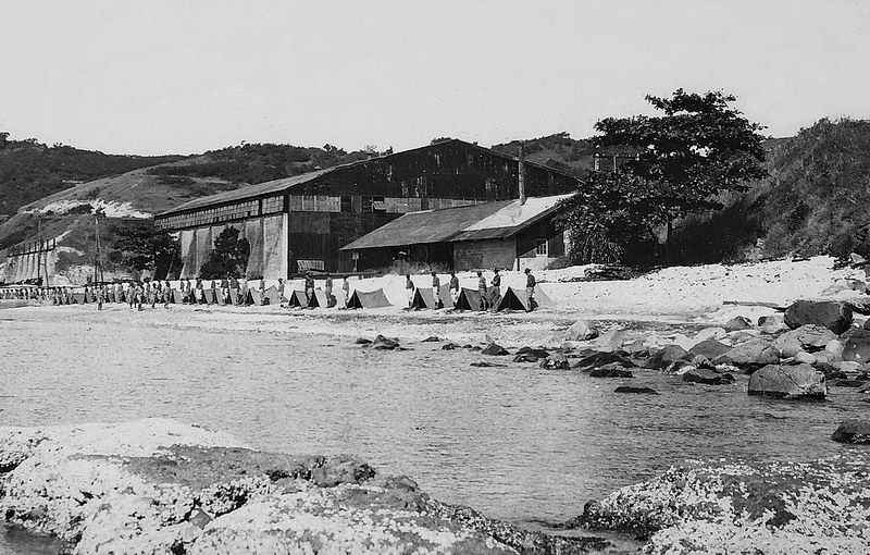
1933 or 1934 photo taken at 92nd Garage area on Tailside. (McGarraugh Collection, courtesy Glen Williford)
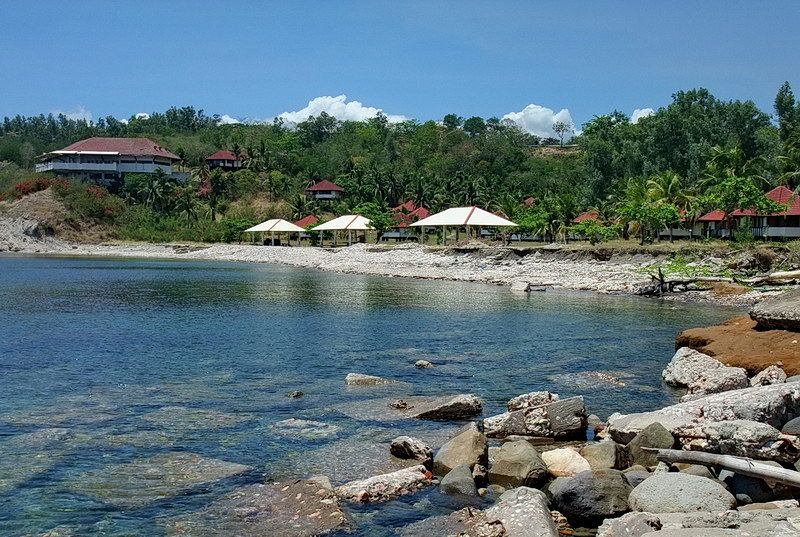
A similar view of the area where the ‘failed’ resort now sits.

Building 480 is the “Nipa Hut” Trolley Station on Middleside. Constructed in 1916 at a cost of $225, it had wooden upper walls and a galvanized roof.
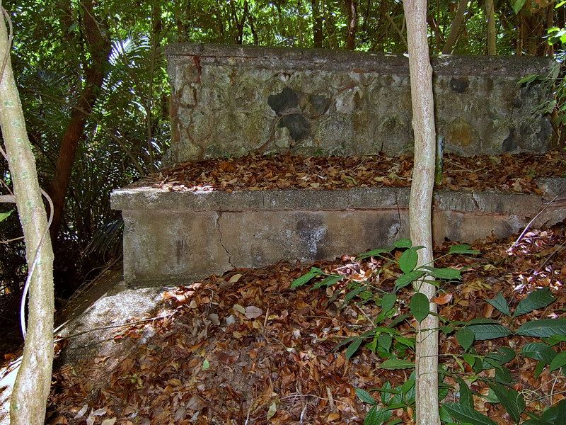
The wood and galvanized metal are long gone but this structure is still the best remaining example of a Corregidor Island trolley station. The metal railing has also disapeared. This is the left corner of the station showing the partial concrete/rock wall, concrete floor and foundation.
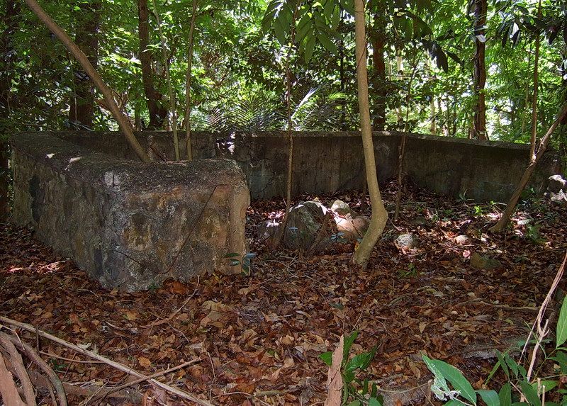
Front view where you can see some of the partial concrete/rock walls.
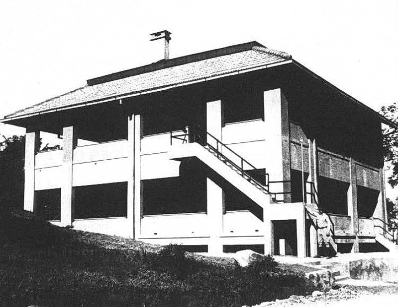
Just below the Fort Mills Hospital is a structure called the “Hospital Steward’s Quarters”. This 1921 building was 46’x42’, two stories high and housed two families. An exterior staircase leads to the second floor.
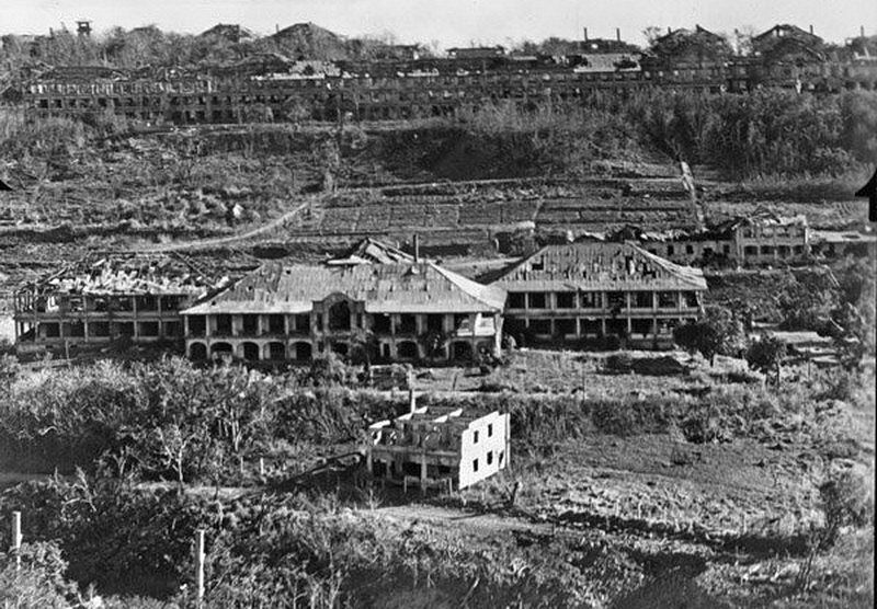
These quarters seen near bottom center were heavily damaged during the war.
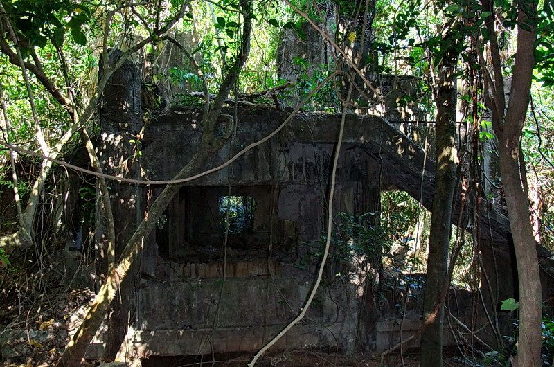 The location of the Steward’s Quarters is very overgrown these days. Most of the top floor walls and a few of the bottom floor walls are gone but the exterior staircase is still intact.
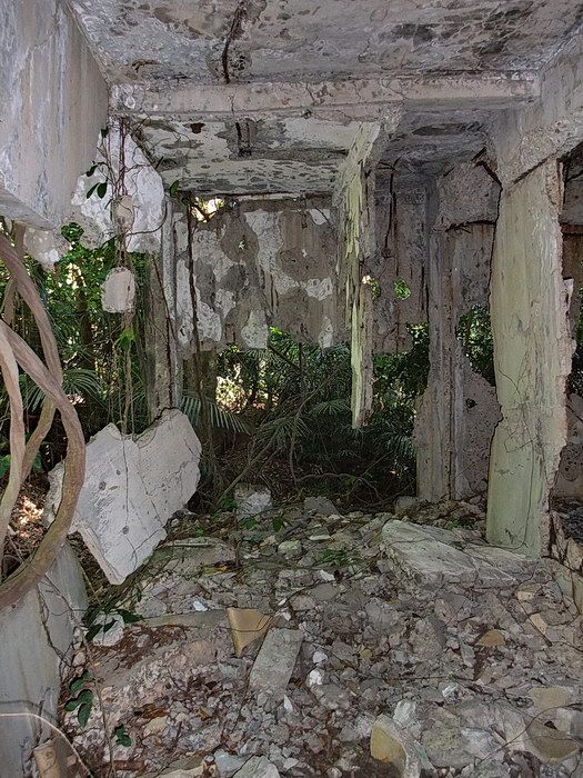
Interior views of the Steward’s Quarters.
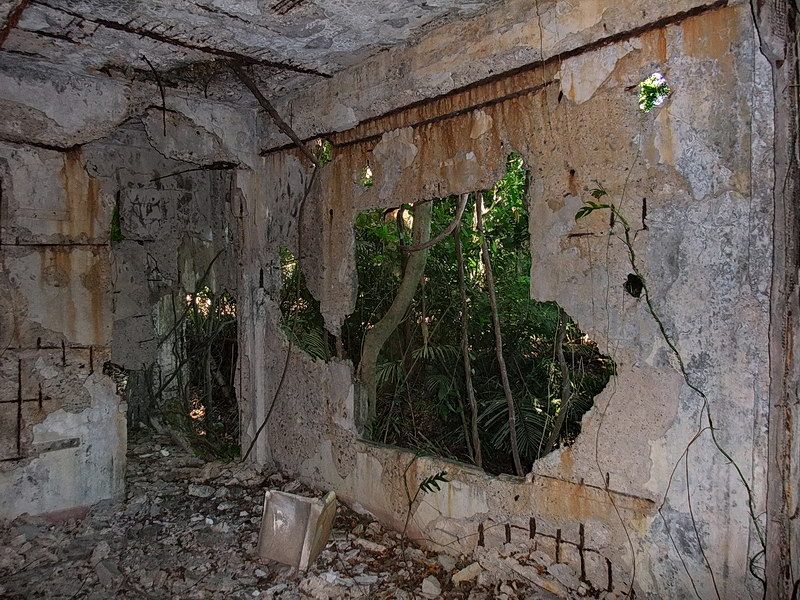
Interior views of the Steward’s Quarters.
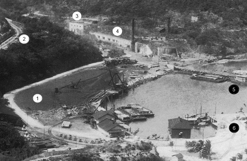
On Corregidor, coal was the source of energy to produce electricity for the Central Power and Cold Storage Plant (#4). A large Coal basin (#1) was located along the shoreline between the Engineer Dock (#5) and the North Dock (#6). In 1930, a Diesel Electric Plant (#3) was constructed which I expect then became the prime source of power. These power plants provided all normal operating power to the whole island including the trolley system (#2).
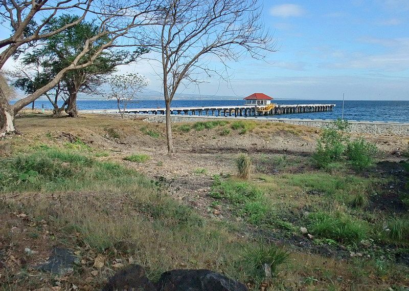
The Coal Basin is little more than a depression along the shoreline these days.
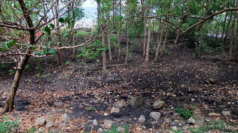
You can still find coal down there at low tide.
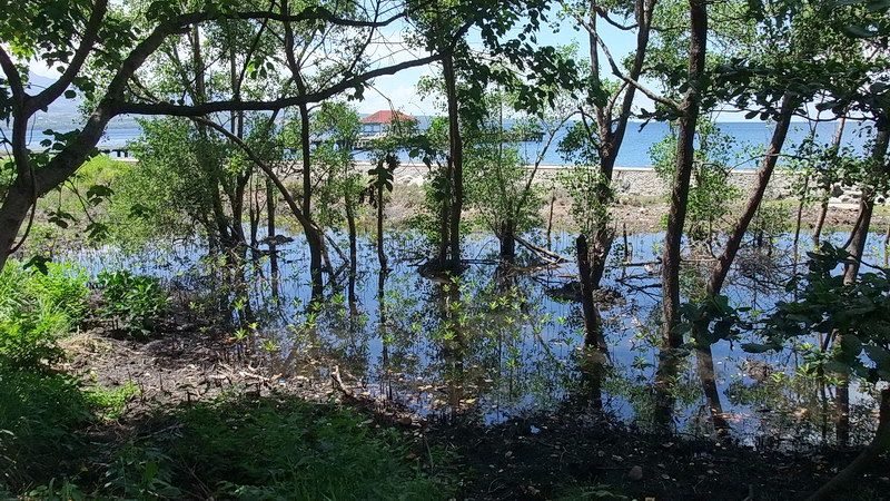
At high tide, the basin floods.
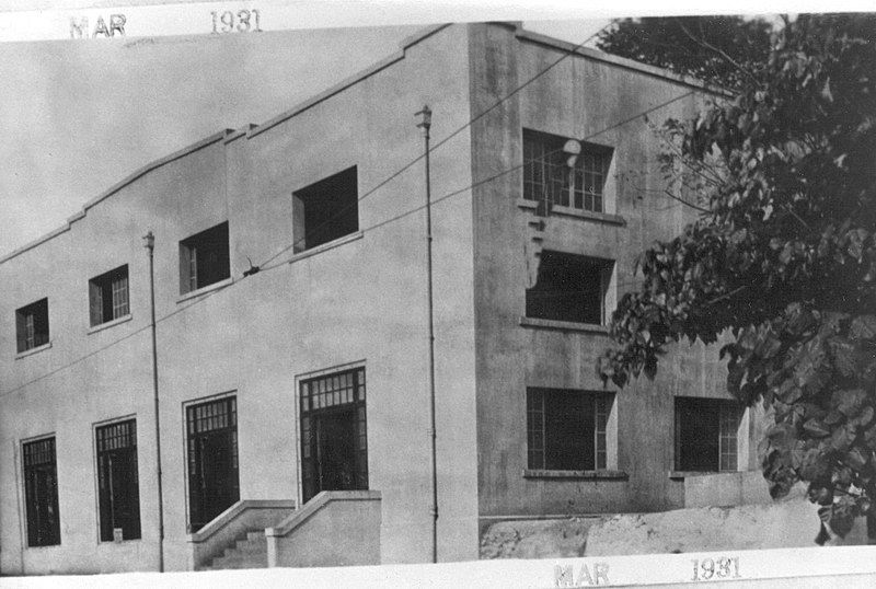
A view of the Diesel Electric Plant taken in 1931.
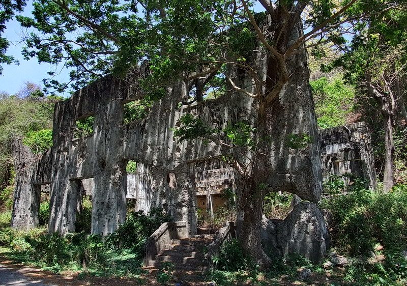
Along with many other unprotected structures, it was heavily damaged during the war.
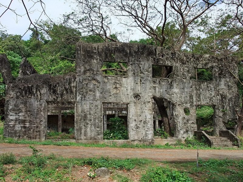
Another view of the front of the Diesel Electric Plant.

The Central Power and Cold Storage Plant which was constructed in 1915 at a cost of $247,867.31. An earlier plant was decommissioned when this larger one came online.

The same Plant today. The Corregidor Foundation still uses this building for diesel electric power generation and storage.
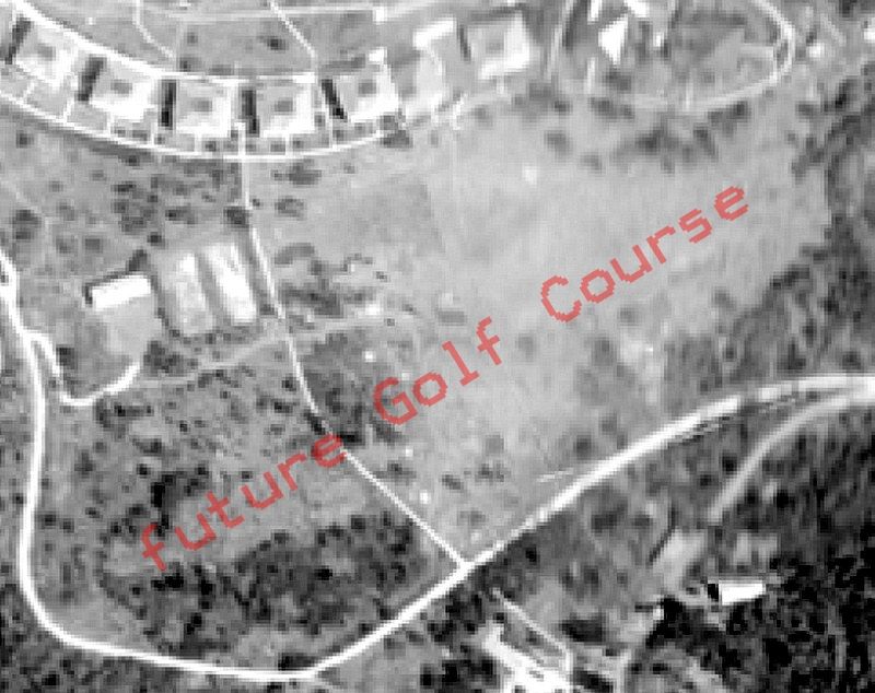
This 1920 or 1921 aerial view of an undeveloped field below the Senior Officer’s Quarters shows us that the Corregidor 9-hole Golf Course does not exist yet. I do not know exactly year of construction but it would have been between 1921 and 1923. It does not appear on the 1921 map but does show up in a 1923 aerial photo. The Corregidor (Officer’s) Club was built in 1924.

By 1923, the Golf Course can be seen in this aerial photo.

A view of the Golf Course looking across Caballo Island in Manila Bay. (McGarraugh Collection, courtesy Glen Williford)

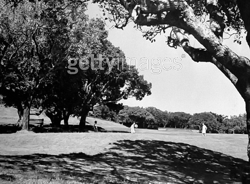
Note the bench under the tree. It is the “concrete ends with wooden seat” style. (courtesy gettyimages, 1941)

1940 or 1941 photo of the Golf Course showing the Corregidor Club in the background. (Paul Cornwall photo)
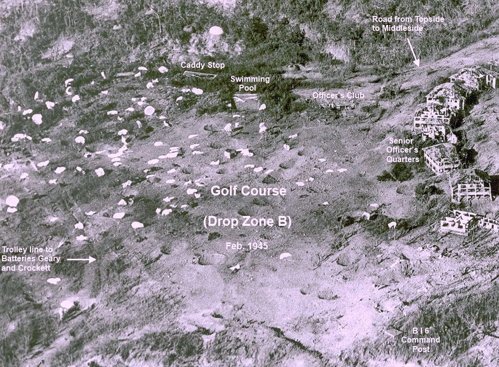
A few short years later in February of 1945, the Golf Course was designated as ‘Drop Zone B’ for the airborne assault to retake the island from the Japanese. White parachutes litter the ground.
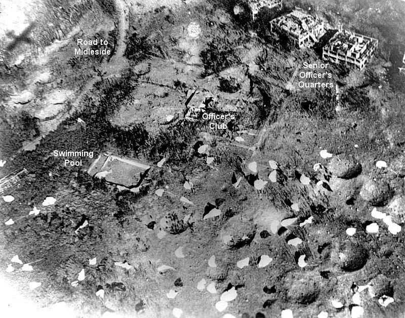
This photo as taken on the morning of February 16th, 1945 as the assault was underway. Near the center of the photo, note paratroopers have gathered in a large crater. These deep craters still exist.

Ground view at Drop Zone B as 503d Paratroopers complete their jump. (courtesy 503d PRCT Heritage Bn)
So what remains of this Golf Course today? Unfortunately, very little. On two occasions earlier this year, one of them with Phantom, I wandered around this reforested area in search of anything obvious. I was also looking for any evidence of a 3-inch AA gun battery (Battery Globe) that was set up here before the 1942 surrender.
As I mentioned earlier, the big craters are still there after all these years. When standing on the bottom of one of them, the edge of it at level ground is about 4 feet above my head.
We are reasonably confident in saying that we found one of the Tee Off spots. The location is a small level area on an otherwise sloping course. There is a man-made stone embankment on the downhill side and concrete steps up to the Tee. Remember the concrete and wood bench seen in the 1941 photo? Eagle-eyed Phantom found one of the ends under leaves and branches beside the Tee. There is some evidence of defensive positions however I was hoping for more. The Golf Course did not allow me many opportunities for photos but here are a few anyway.

Phanton standing on the Tee.
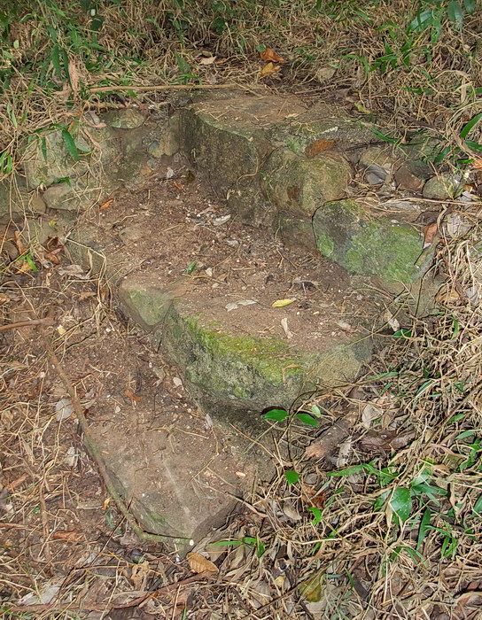
Steps up to the Tee Off area.
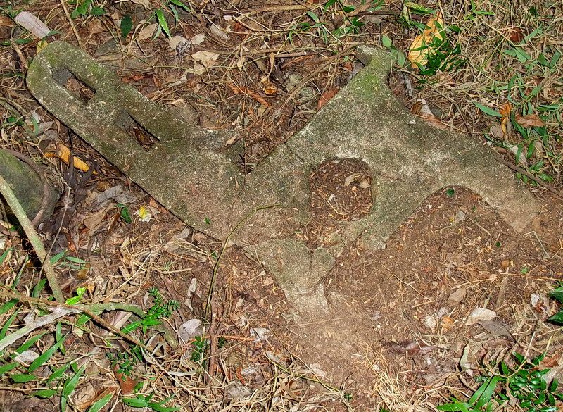
The concrete end of a bench.
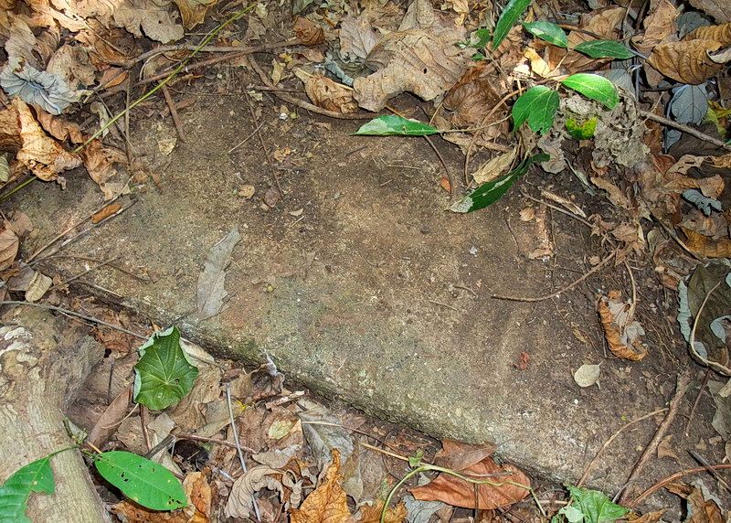
The map shows a walkway across the Golf Course connecting Battery Geary to Topside. When the GPS told me that I was on top of it, I kicked away leaves and there it was.
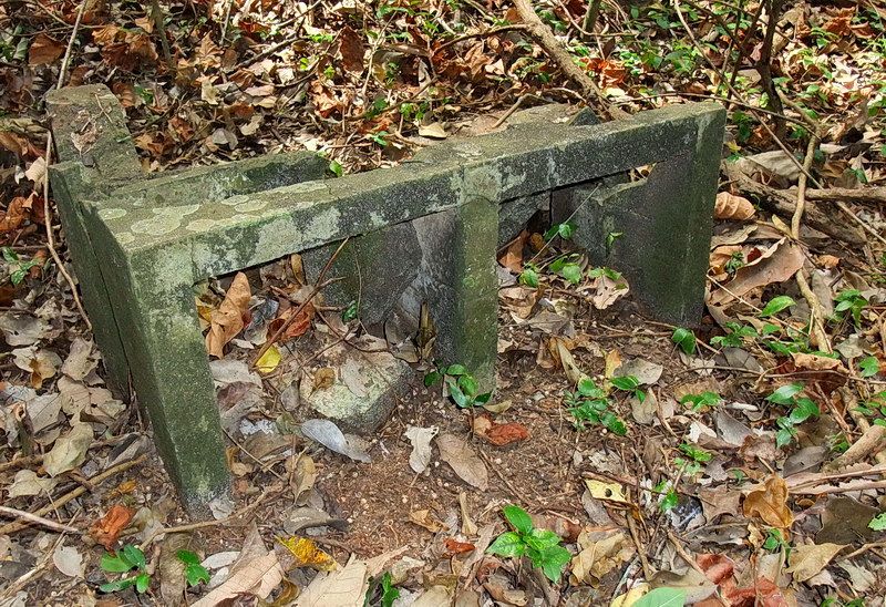
A piece of concrete lies on its side and looks like a two basin sink. Did they wash golf balls here?
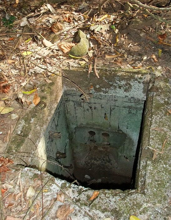
This deep Cable Terminal is near the lower edge of the course. You can see four conduit holes half way down the far wall. Cut-off metal ladder rungs can be seen at the left side.
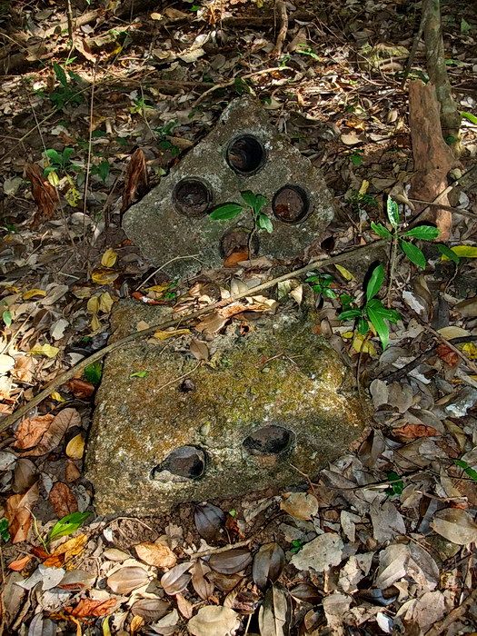
Bombs and shells appear to have unearthed some of the buried conduit pieces. Someone collected quite a few of them and they lie near some rock lined positions. I cannot determine what positions these were.
On the western side of the Golf Course there are definitely man-made defensive positions. They may have been part of Battery Globe. Today they are still obvious but very difficult to photograph as they just look like hollow circular mounds,..I didn't bother.
Beside the road to Middleside are two concrete positions that sit in ideal places to defend the terrain below them. They were hurriedly made as corrugated metal was used as forms for the walls. Both have slotted entrances and rectangular storage boxes into the inside wall. I’ll guess that this was for ammo storage.
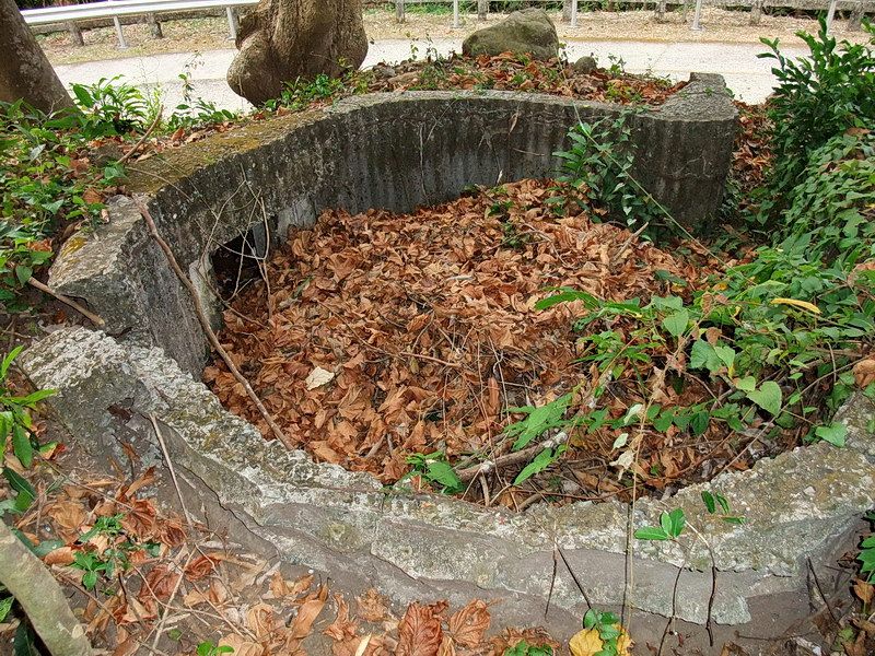
One of the concrete defensive positions after being cleared of brush recently. The entrance can be seen at top right.

The entrance to the second concrete position which is still hidden in the vegetation.

Battery Grubbs Gun #2 drills. (McGarraugh Collection, courtesy Glen Williford)

Gun #2 has been sitting on the platform since WWII.
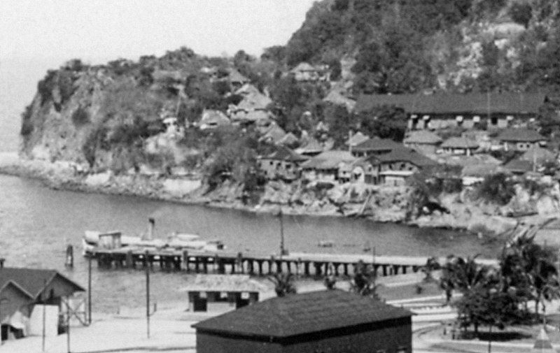
This undated photo is an early view of Lorcha Dock with Malinta Point in the background.
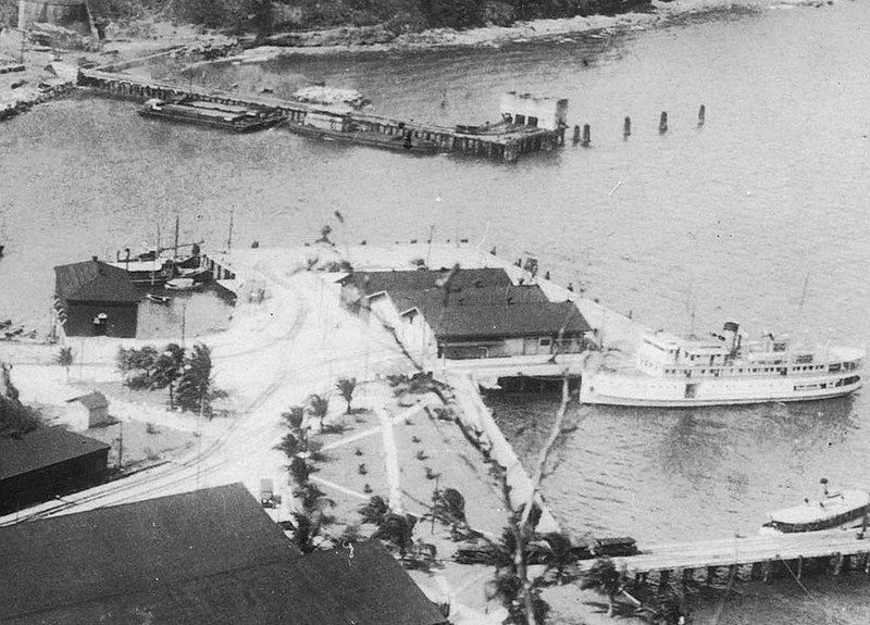
At bottom right in this photo you can see a trolley on Lorcha Dock.
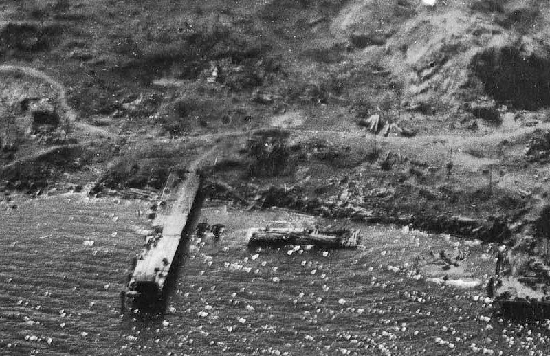
By February of 1945, the dock and Bottomside terrain has changed significantly.
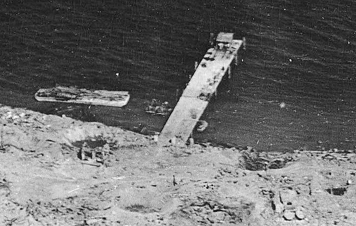
An other February 1945 view of Lorcha Dock.

On this particular day in 1949, the dock was being used to disembark some visitors.

I do not know the date but I have been told that severe damage to Lorcha resulted from a failed attempt to dock a Philippine Navy LST. This 1978 photo shows the dock in very poor shape.

In 2005 it was even worse.
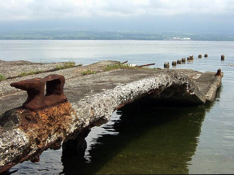
2006 photo.
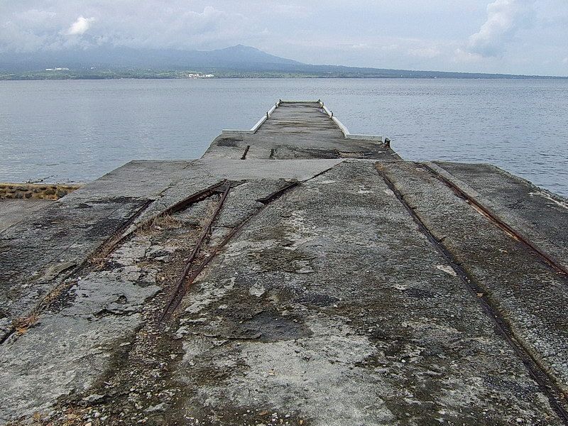
2009 view of a rebuilt Lorcha Dock.

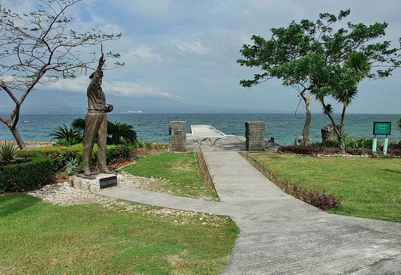


On March 2nd 1945, General MacArthur returned to Corregidor Island. In addition to the Topside ceremony he also made a tour of the island. Here he and his group are driving by the eastern end of the Mile Long Barracks.
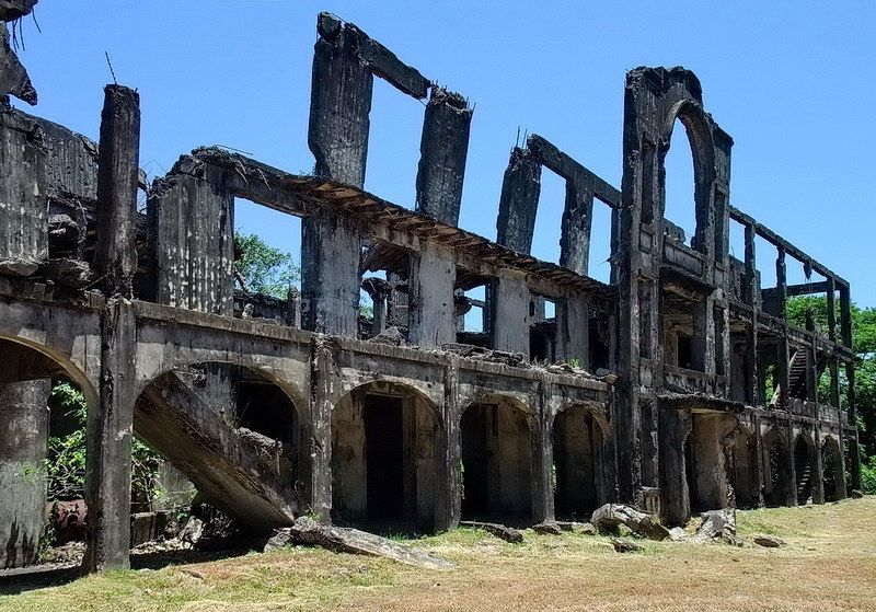
The same view of Mile Long Barracks.
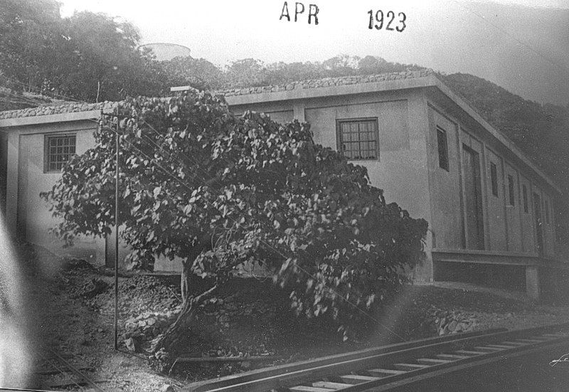
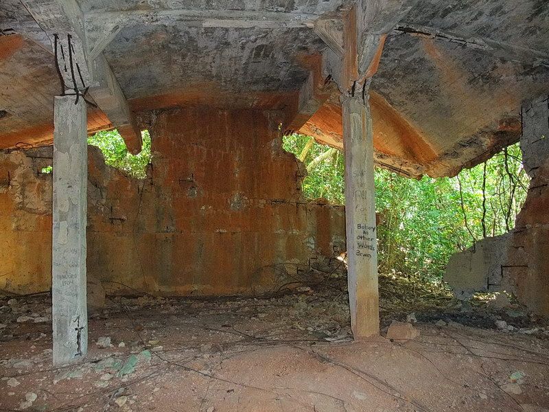
Here is an example of a photo that I cannot recreate today. This 1923 photo shows a large magazine beside the trolley line between Bottomside and Middleside. Structure #533 as it was designated was heavily damaged during the war. Trees and other vegetation are thick here now but I can show you some interior views.


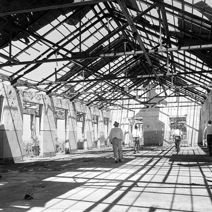
Another of the 1949 tour photos shows them on the top floor of a barracks building.

I cannot say that this is exactly the same room but it is close. This is on the top floor of the Mile Long Barracks.
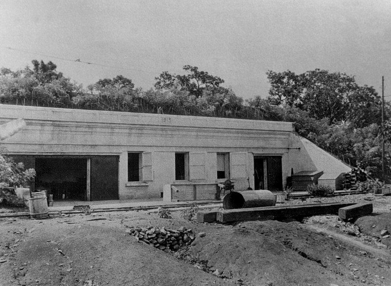 In this photo we see the Ordinance Machine Shop still under construction. It was completed in 1915 at a cost of $10,439.61.
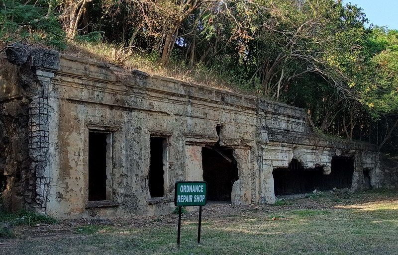
Fighting which ended with a gruesome event took place here in 1945.

A damaged ‘1915’ construction date is still visible at the top of the facade.
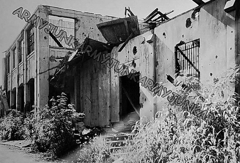
Rear view of the Post Commissary taken post-war. (courtesy armyjunk)
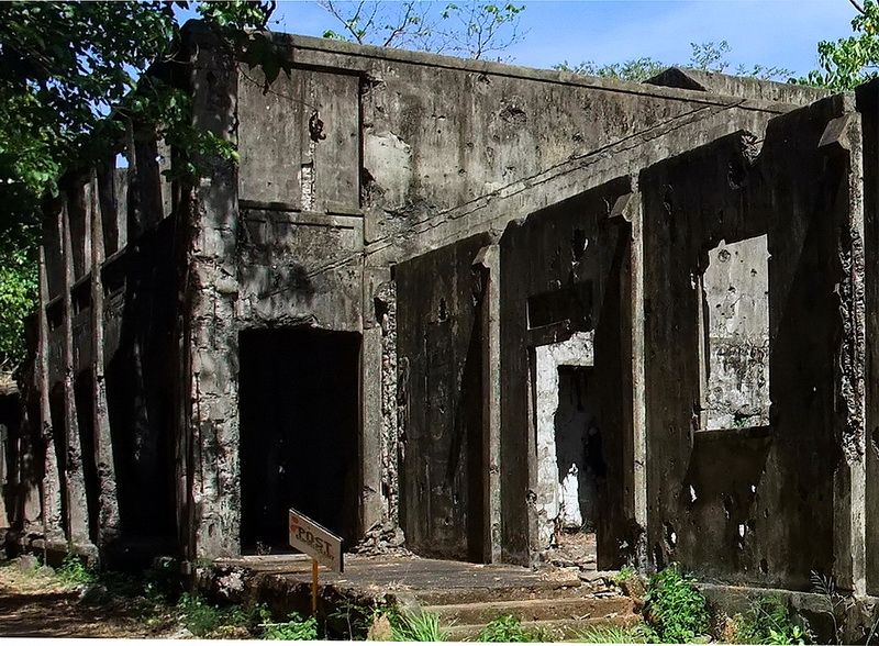
The same structure today.
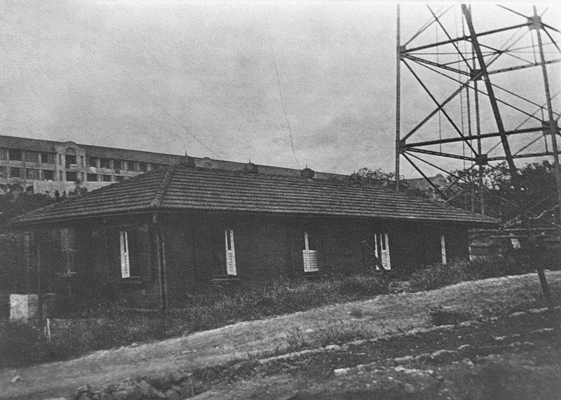
Radio Station #1 was on Topside west of the Parade Ground. This above ground building was made of concrete but not reinforced so it took heavy damage during the war. The building still remains hidden in the jungle but is little more than four exterior walls and one or two interior walls. The date of completion for Radio #1 was 1911.
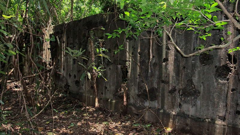
One of the battle damaged exterior walls.
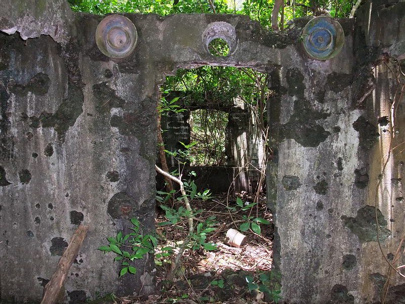
The main entrance with big ceramic isolators(?) above the doorway. Antenna cables connected from here out to a nearby antenna tower. A long antenna was strung between two of these towers.
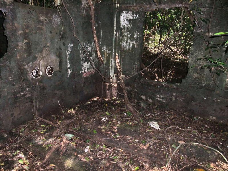
Interior view of one of the rooms showing pedestals on the floor for mounting equipment.

Each of the two antenna towers had four concrete supports. Here is one of them.
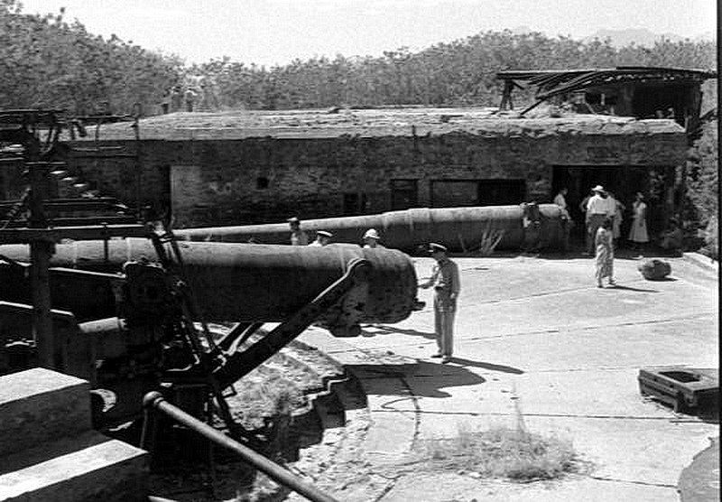
A final 1949 trip photo where we are looking across Battery Wheeler from the Gun #2 position.
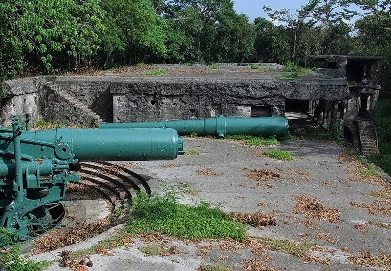
The same view today.

Battery Wheeler 12-inch Disappearing Gun #2. The barrel of Gun #1 lies in the background.
Corregidor has a fascinating history. You are probably over-dosed with these photos by now so its time to quit. I may post some more someday.