It has been awhile since I have posted ‘Then and Now’ photos so here is another batch. You will notice that is some instances it is impossible to get similar “Now” photos due to trees or other changes to the terrain. In those cases I have captured views in the immediate area as best I can to show you what it looks like there today. Here is the first half of 151 photos in total.
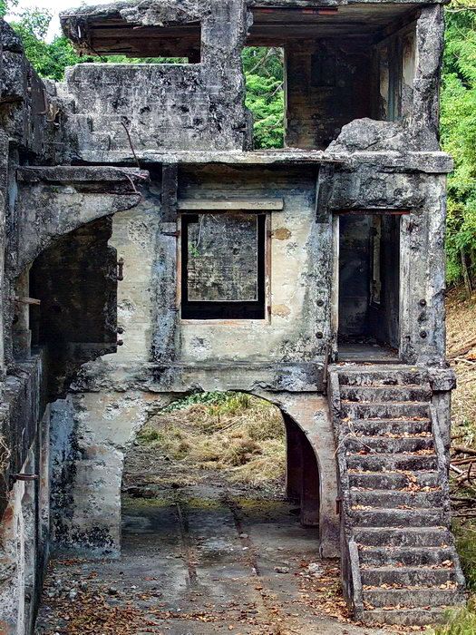
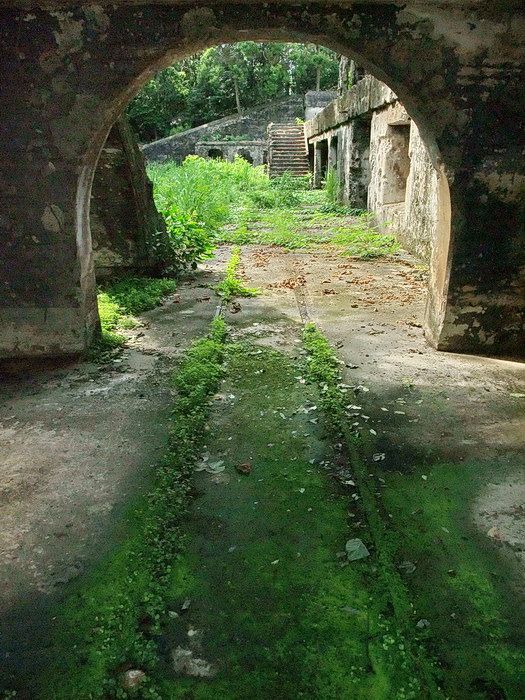
Armyjunk made us aware of a series of photos taken by a group that toured Corregidor in 1949. The first three photos were taken in the same location because the placement of 12-inch shells and damage to the concrete arch is identical.
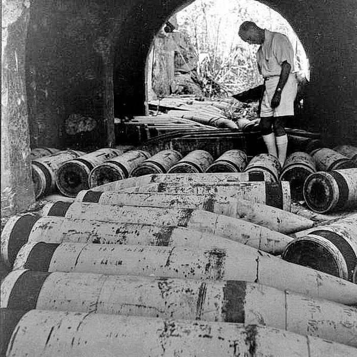
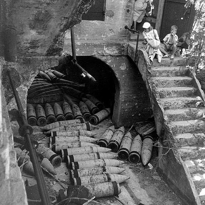
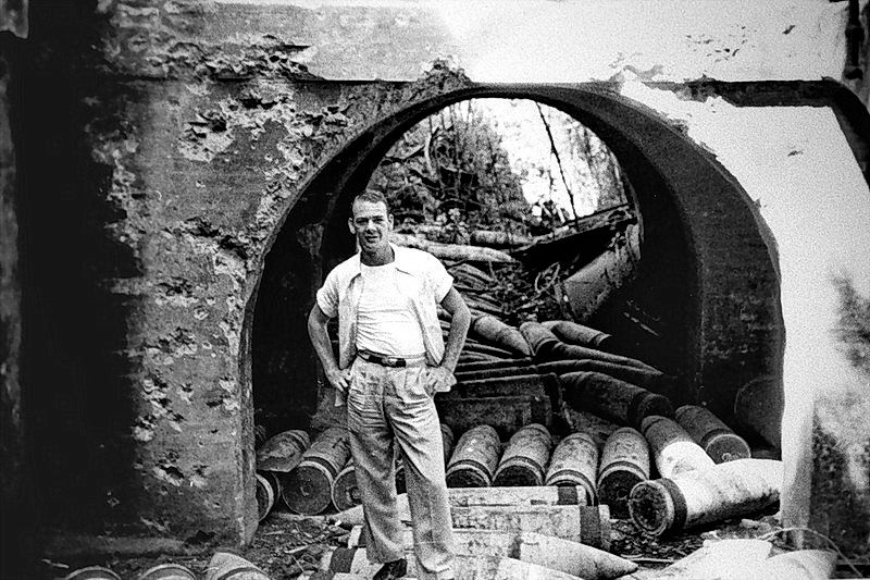
Where was this? The location is Battery Wheeler at the arch where the trolley delivered shells and powder which was off-loaded into adjacent magazines. Above the arch are two rooms which serve as Battery Control. The Plotting Room is below the Observing Room which sits on top.
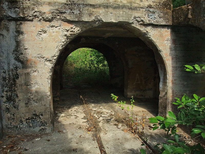
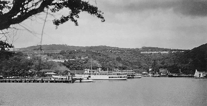
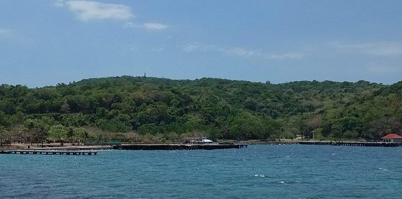
In some old documents, the body of water along the north part of Bottomside is referred to as 'Corregidor Bay'. Here we are looking in a westerly direction towards Middleside. All of the structures seen on the hill still exist (more or less) but are now totally hidden from view by trees.
Fort Mills had three crematoriums. One on Topside, Middleside and Bottomside. The following photo shows Building #59, the crematorium which was located near Battery Grubbs. It had a capacity of 2 ½ tons per day, had a galvanized roof and walls plus concrete floors. Construction was completed in 1914.
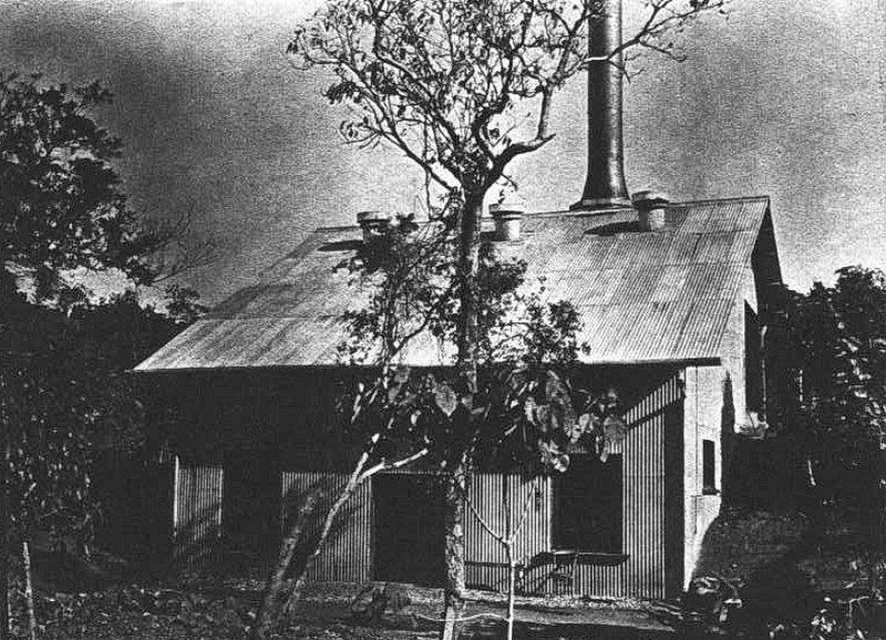
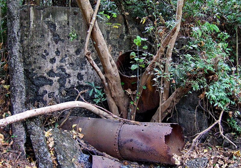
Note that the smoke stack seen in the old photo has a flared section at the bottom. This flared section can be seen today behind the stack in the foreground.
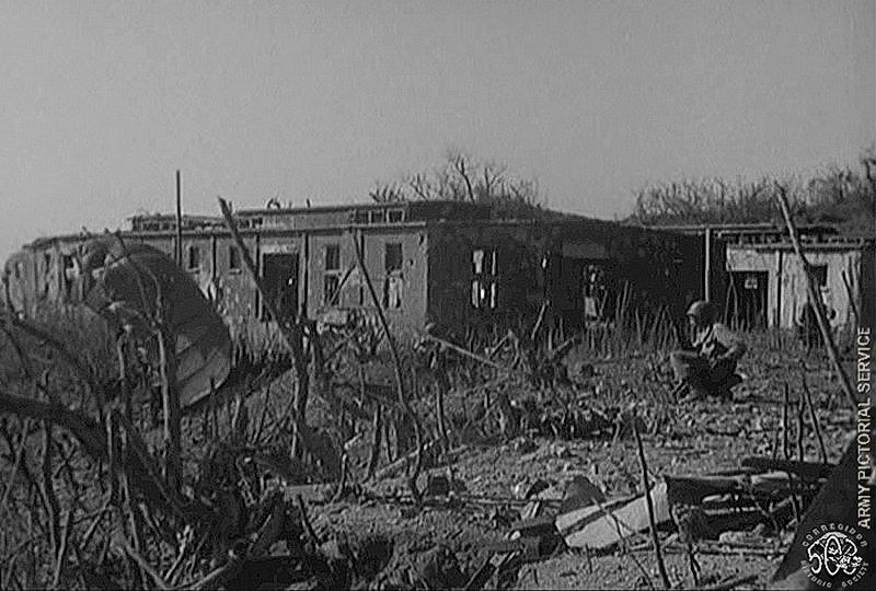
In 1963, a documentary film about the retaking of Corregidor was released called “Fortress in the Sea”. Included in this film is battle footage taken on the morning of February 16th, 1945. (The fuzzy photo below is a screen capture from that film). To help indentify what we are looking at, I labeled a few locations. We can see 503d Paratroopers walking down hill with orders to (I assume) help cover the amphibious assault on Black Beach which was planned for later that morning.
I have seen this film a few times and wondered if this mostly destroyed building with one upright wall still exists and exactly where it was located. I had an idea where it was but did not remember such a wall. The area where this screen capture was shot is very grown up now and it is difficult to get around without cutting vegetation to clear a path.
Since the concrete floor and upright wall appears to be near an embankment which drops off towards Bottomside, I made my way along the edge. (When visiting nearby structures we usually keep further back from here along the trolley line as the walking is easier). A few minutes later I saw a concrete wall throught the vines and branches. Only when I got close could I see that it was a single wall with two windows and a rubble strewn concrete floor. Many more chunks of concrete rubble lie beside this building including a crater or two not far away. I cleared away enough branches for some photos but no way can I get a view similar to the screen capture anymore.
Where is this wall? It is located on a little plateau just below the eastern end of the Golf Course. In February of 1945, the Golf Course was Drop Zone #2. Below the plateau is the road down to Middleside. Here sits five QMS storehouses and the trolley lines which pass beside them.
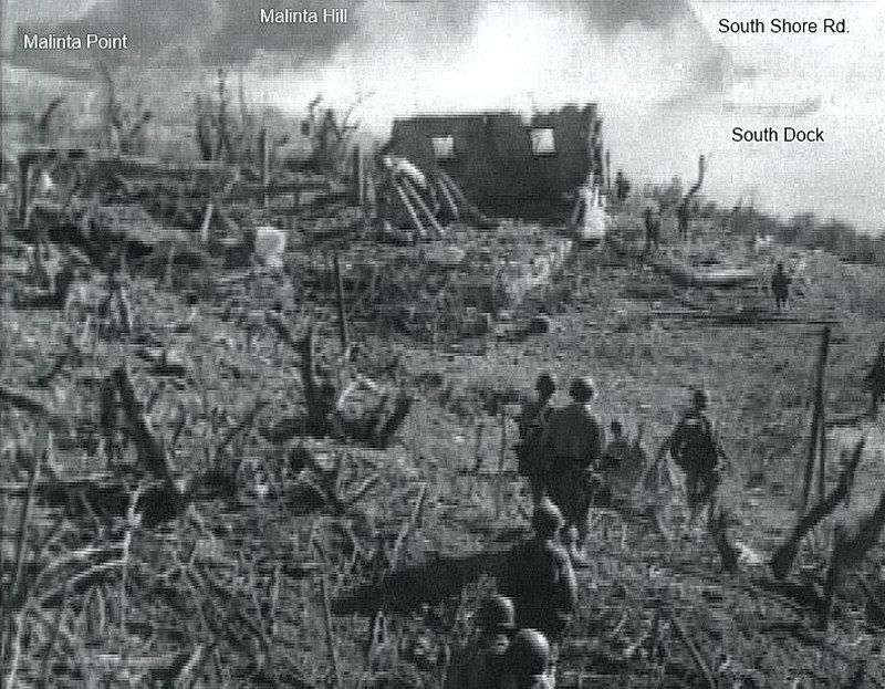
Here is the single remaining wall facing down hill. You can see the structure had a concrete floor and there is more rubble to the left of it. Bottomside is in the distance. (courtesy Fortress in the Sea)
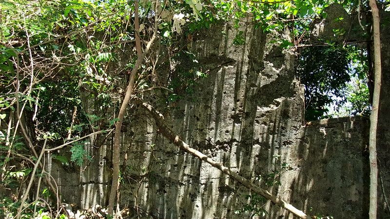
The wall with two windows.
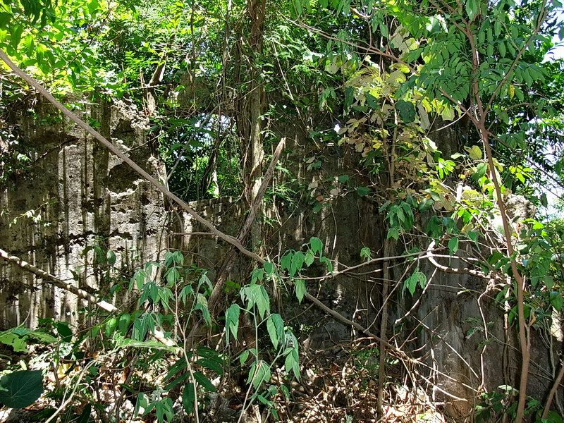
View of the right side corner of the wall including one window. A bit of destroyed wall to the right is still there.
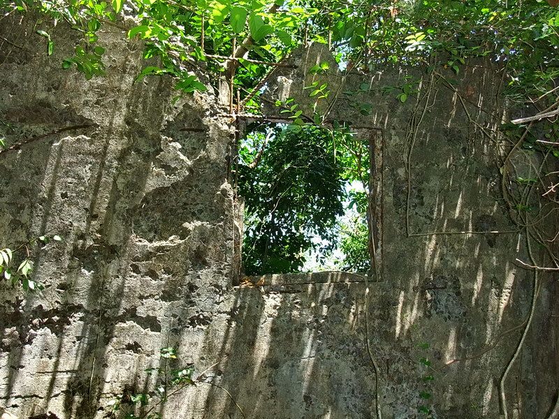
Close-up of the right-side window. The upper left corner is damaged which can also be seen in the screen capture.
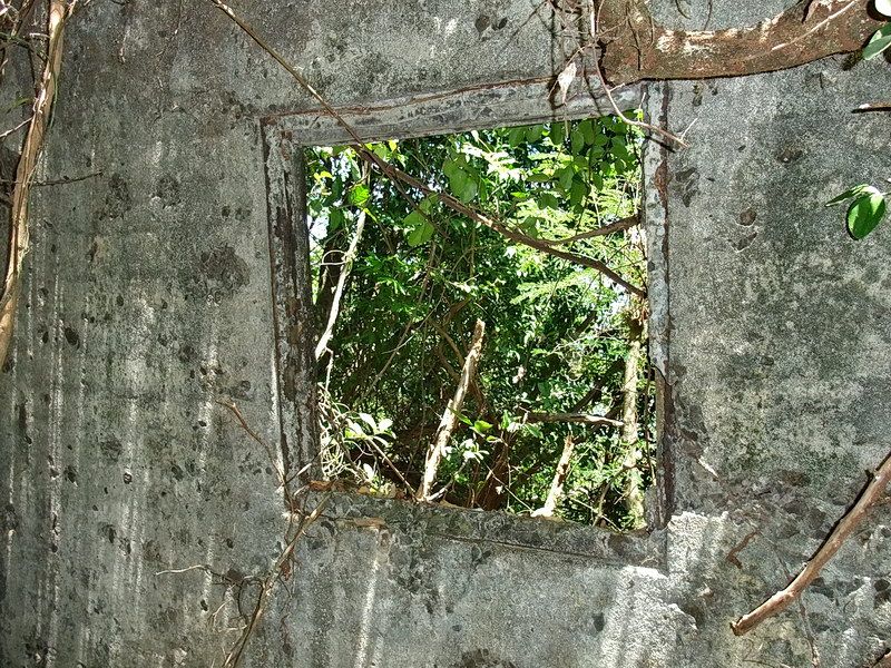
The left-side window with wooden frame.
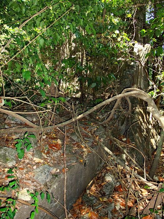
A section of the raised concrete floor. The upright wall is straight ahead hidden by leaves.
While in the area I also checked out another old photo. As it turns out, it was taken very close to the “wall” photo. It shows a paratrooper and a parachute in front of some of the QMC storehouses that I just mentioned. These storehouses are unique today in that they have raised center roof areas that I expect were for ventilation. It is difficult to see but three storehouses can be seen in this photo. These structures still exist today.
QMC Storehouse #76 is in the foreground. Some paratroopers missed the Golf Course which is just over the hill to the right. (courtesy Corregidor Historic Society)
Here is a 1945 view of the five QMC storehouses. Near bottom center you can see the upright wall with two windows. Due to all the vegetation at the time, I did not realize that this single wall is the corner of bombed-out storehouse #75.

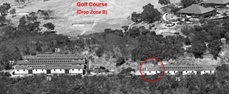
This pre-war photo clearly shows the storehouses in question and the Golf Course behind them.
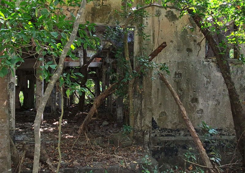
The side entrance to QMC storehouse #76.
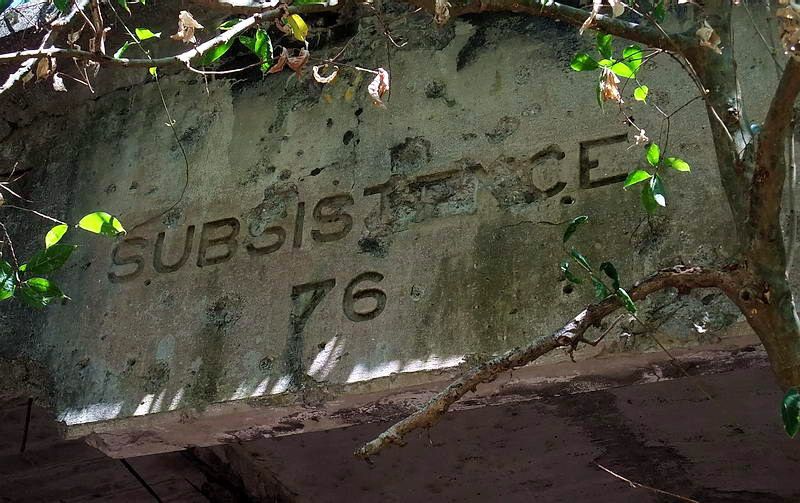
The raised center section of the length of the roof.
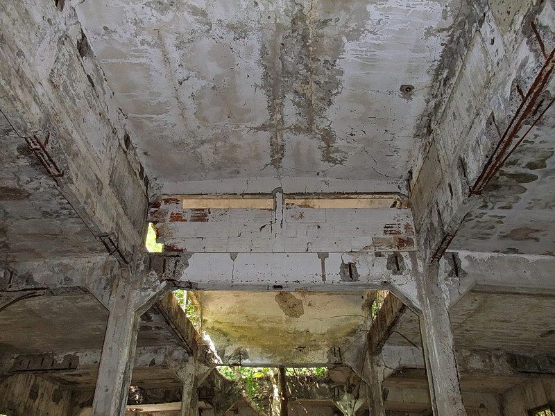
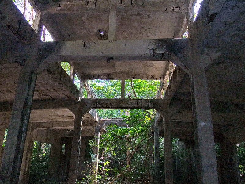
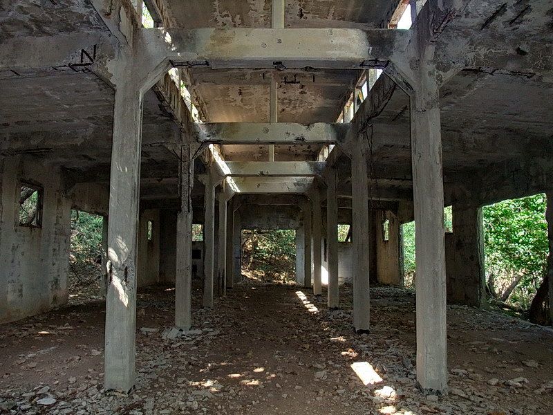
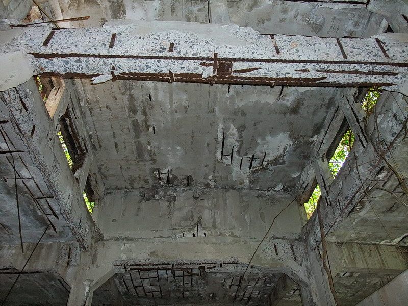
Corregidor had observation aircraft to extend their eyes well over the horizon. On the south side of the island, a seaplane base was constructed complete with ramps, concrete aprons and hangars. The completion date was 1921.
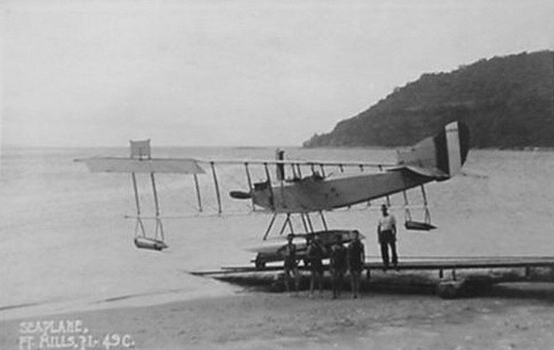
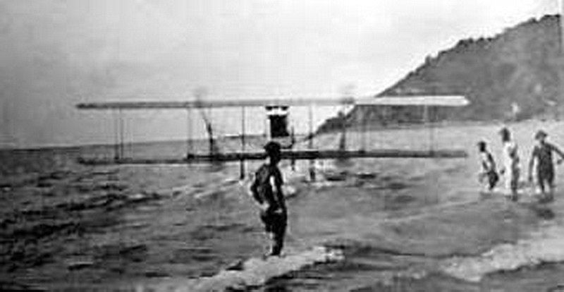
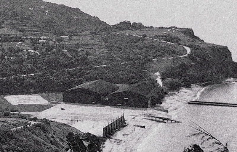
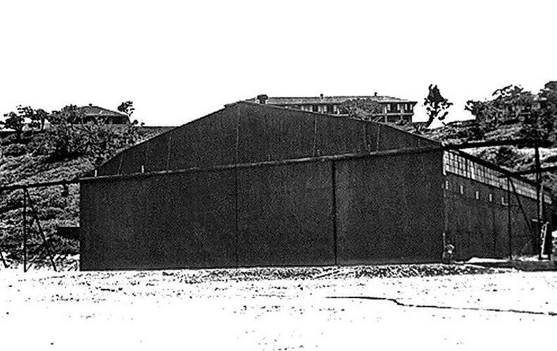
Note the big sliding doors that rolled on rails.
After seaplanes were withdrawn, the hangar facilities were eventually transfered from the Air Corps to the QMC in 1931. These structures were assigned to the 92nd Coast Artillery (Philippine Scouts) as their garage area. After the surrender in May of 1942, the Japanese kept the Filipino and American prisoners here before their transfer to Manila.
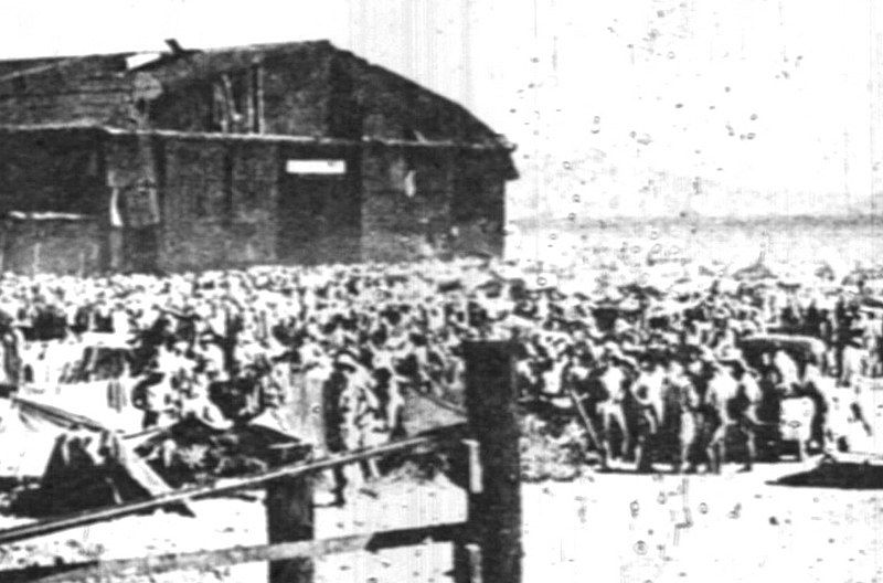
POWs at the 92nd Garage area.
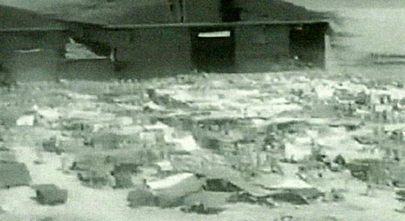
POWs at the 92nd Garage area.
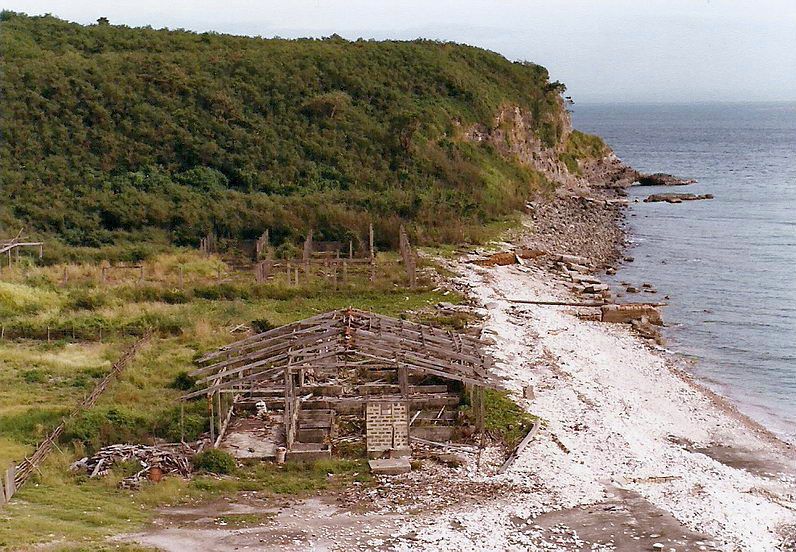
1986 view of the 92nd Garage area. (courtesy chadhill).
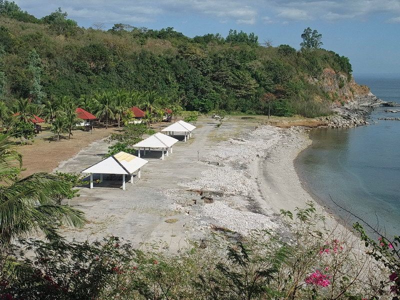
A look at the same place today. A failed “Resort” occupies the area.
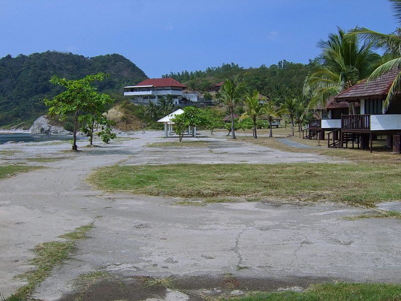
A huge concrete pad is still very evident.
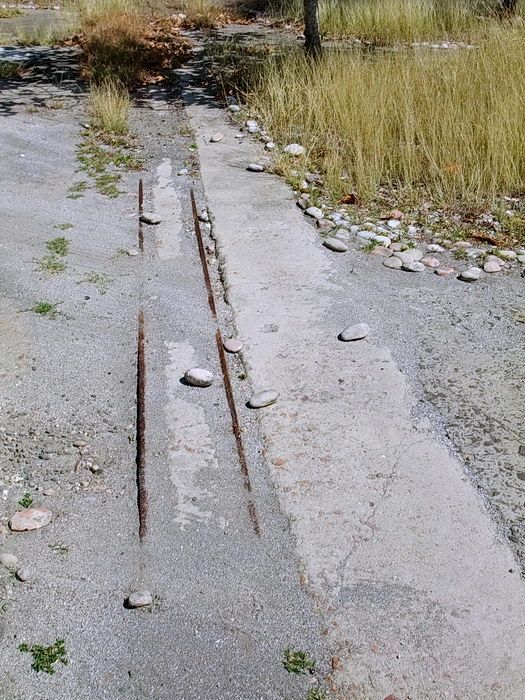
So what remains of the hangar buildings? Only rails for the sliding doors that were embedded into the concrete.
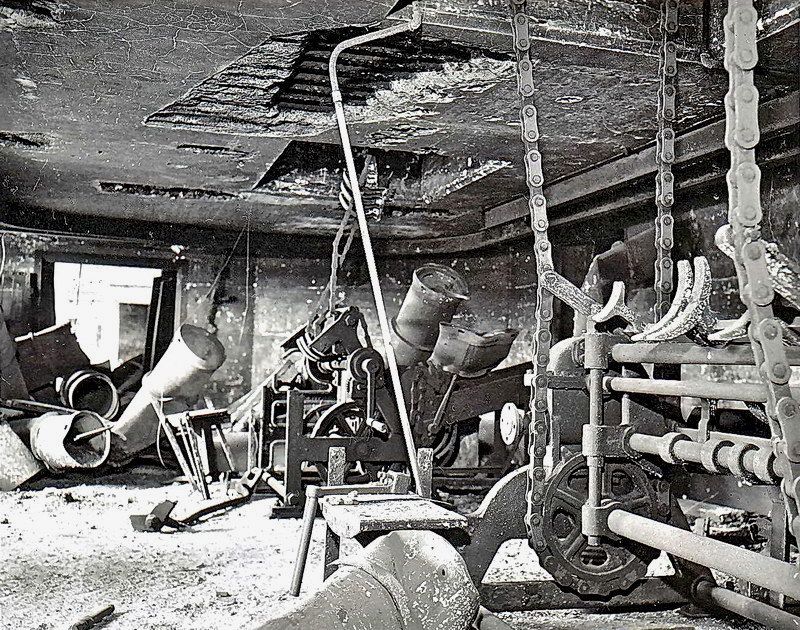
Post-war view in the Hoist Room of a 12-inch gun battery. The hoist in the foreground with the huge “bicycle chain” was for the heavy shells.
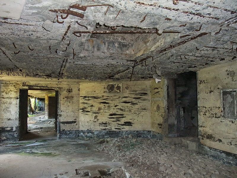
Present day view of the same Hoist Room. (Hoist Room #2 at Battery Cheney). The streaks on the far wall is someone’s attempt at covering up graffiti with black paint. Sometime in the past, scrappers stripped the ceiling of quite a bit of rebar.
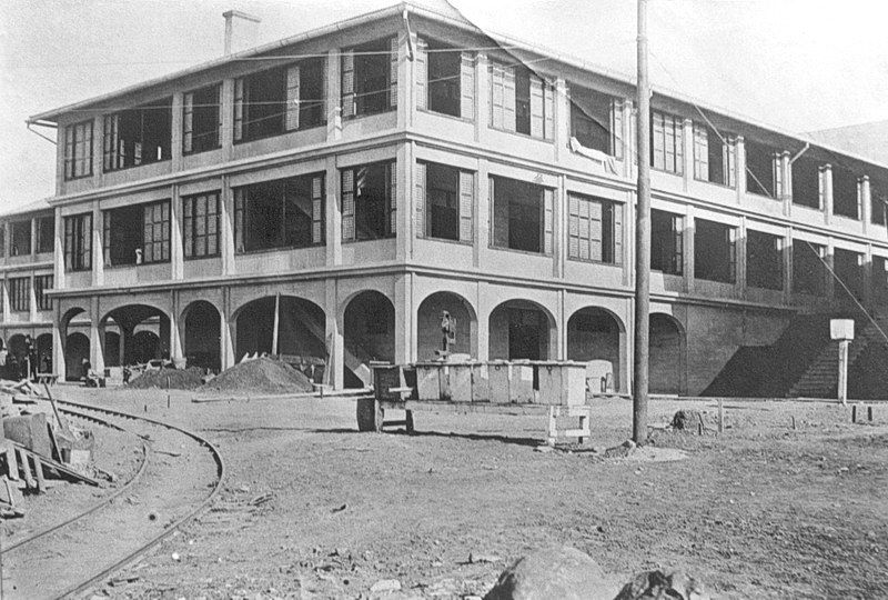 The Fort Mills Hospital is under construction. The whole structure consisted of four sections that were supposed to resemble a cross. This particular section (number 79-D) at the rear of the hospital was completed in 1913 at a cost of $38,000.
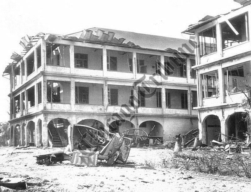
The same structure in March of 1942. (courtesy Chicago Tribune)
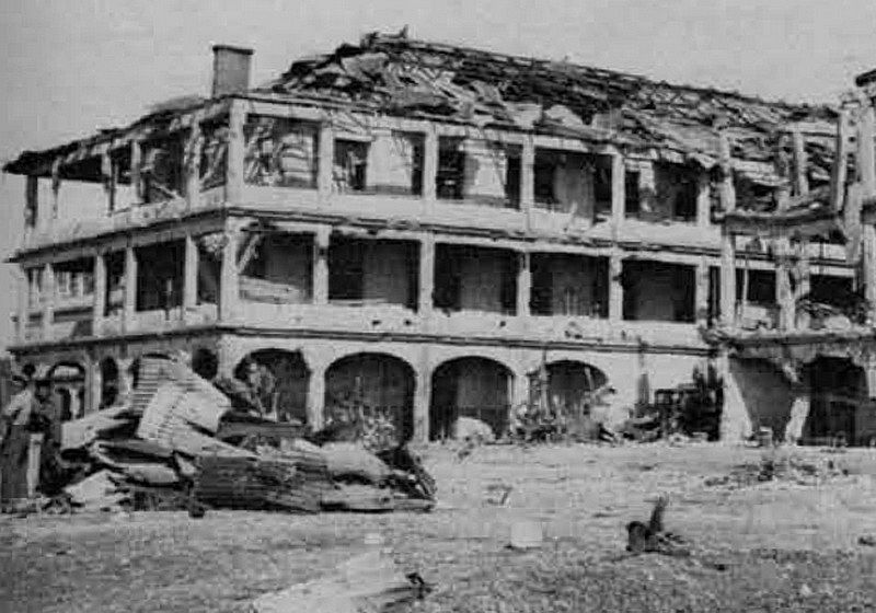
By 1945, it was even more damaged.
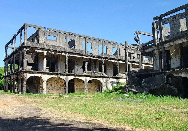
A view of 79-D today.
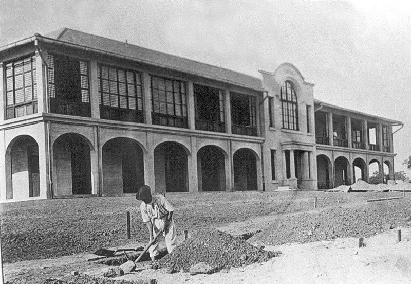
Here is section 79-A at the front of the hospital. At a cost of $50,500, it was also completed in 1913.
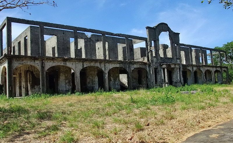
A view of 79-A today.
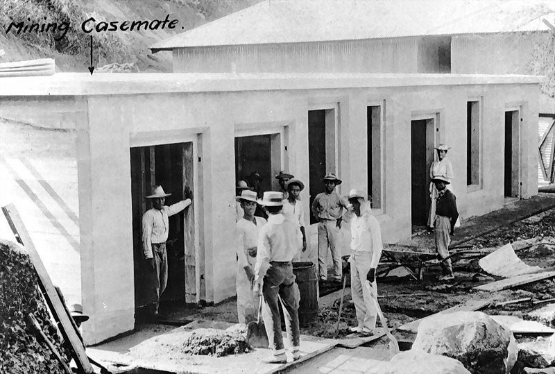
The North Mine Casemate on Bottomside was completed on Feb.18 1910 and was later converted into an Instrument Room.
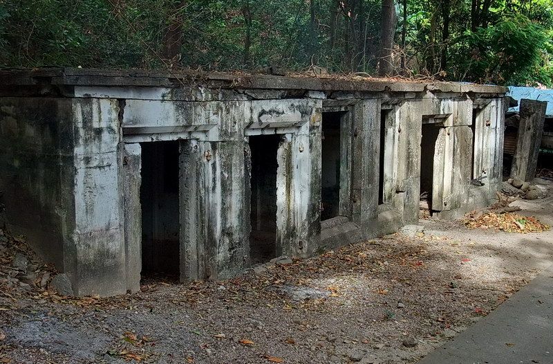
Today part of this structure is used for storage.
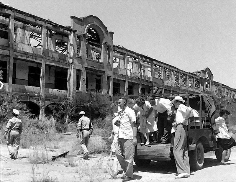
The tour in 1949 stops in front of the Mile Long Barracks.
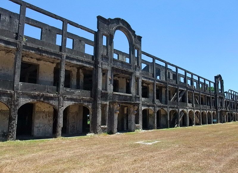
The same view 64 years later in 2013.
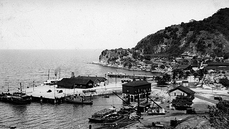
The North Dock on Bottomside.
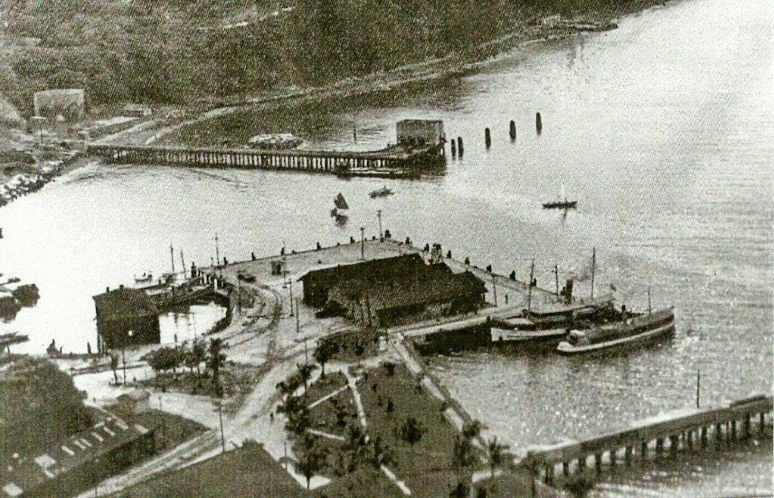
Another view of the North Dock.
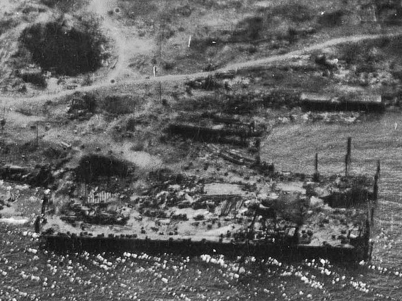
This view during the 1945 retaking of the island shows considerable damage to the dock.
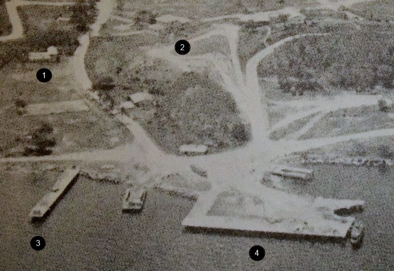
In this 1971 photo, much of Bottomside has been cleaned up. Labeled items are (1) Corregidor Chapel, (2) the previous Corregidor Inn, (3) Lorcha Dock and (4) North Dock. Notice that the bottom left corner of the North Dock is intact.
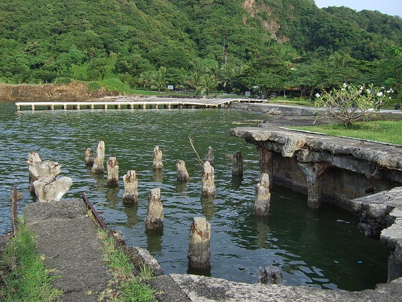
I do not know when that corner of the dock either got damaged or collapsed.
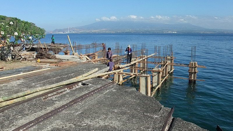
In April of 2013, work was started to repair the North Dock. This was a request by the Philippine Navy to CFI who wants a larger dock for their LST and other ships. Included in the project is reinforcement of the whole dock.
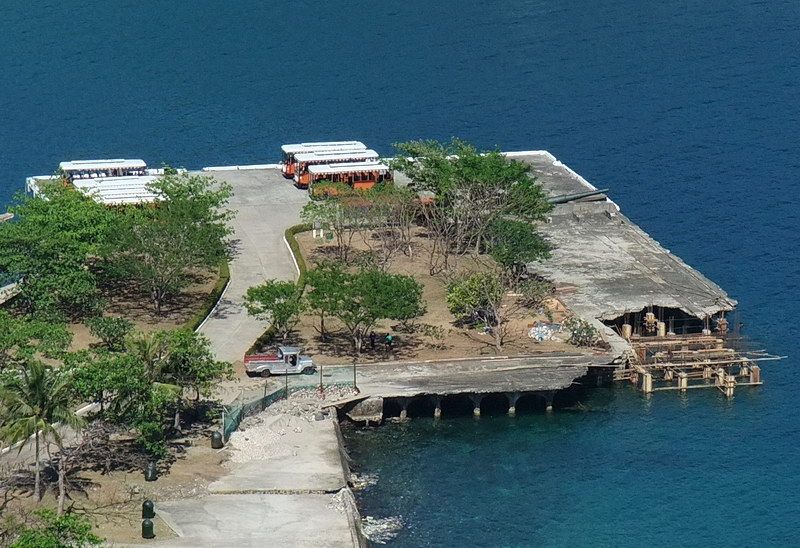
2013 view of the North Dock taken from Malinta Hill.
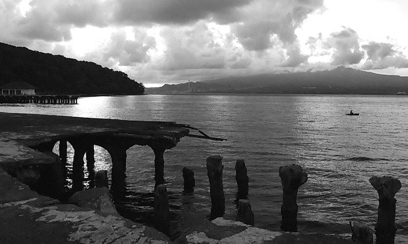
The last of the damaged North Dock sunset views.
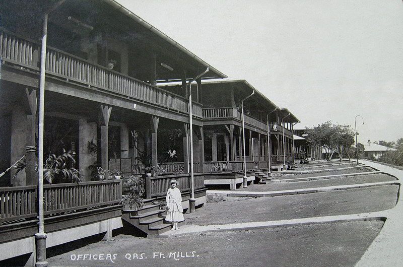
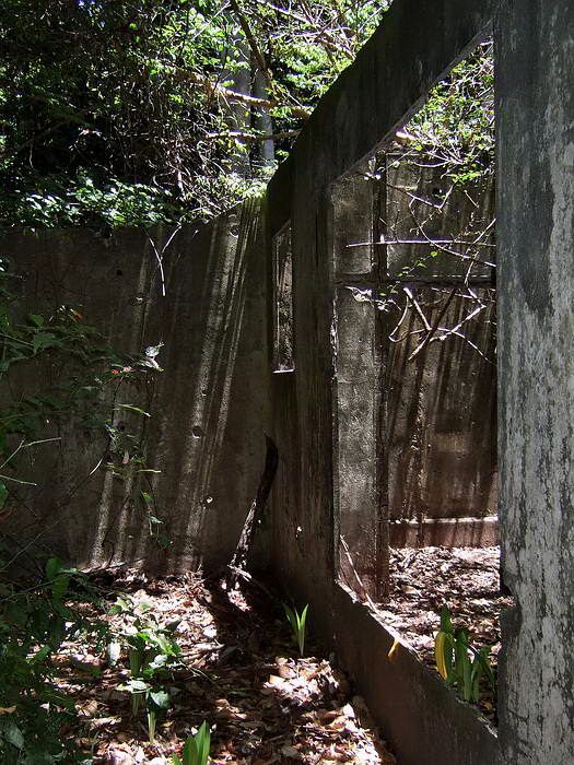
At Middleside there are two rows of Junior Officer’s Quarters along the hillside between Middleside Barracks and the Hospital. Since these structures were constructed with very thin concrete walls and little to no reinforcement, not many of them remain today. Most are just concrete floors, staircases and rubble now. A couple of them still have walls standing. Here is a look at the upper row of Junior Officer’s Quarters, Building #102 is in the foreground. The other three photos show Quarters which remain today.
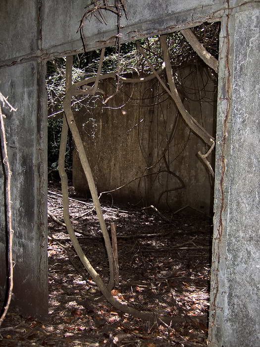
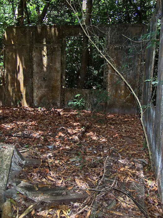
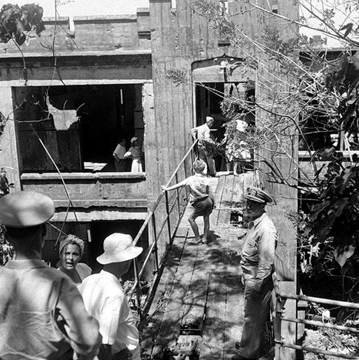
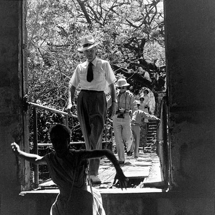
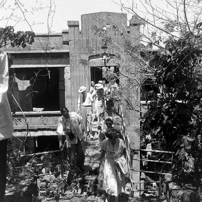
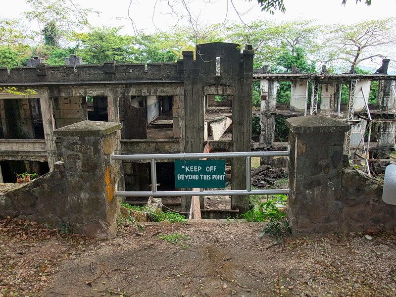
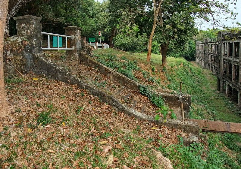
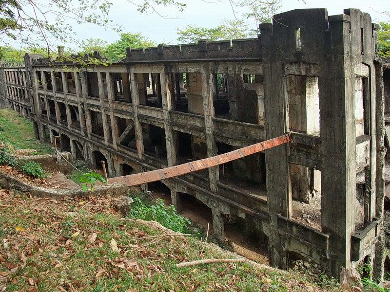
More photos from the 1949 tour show the group visiting Middleside Barracks. The road to Topside passes along the rear of the barracks and is about level with the top floor. As you can see, there was an elevated walkway from the road to the barracks. Today this walkway is gone and the top floor of the barracks has deteriorating to the point of being unsafe.
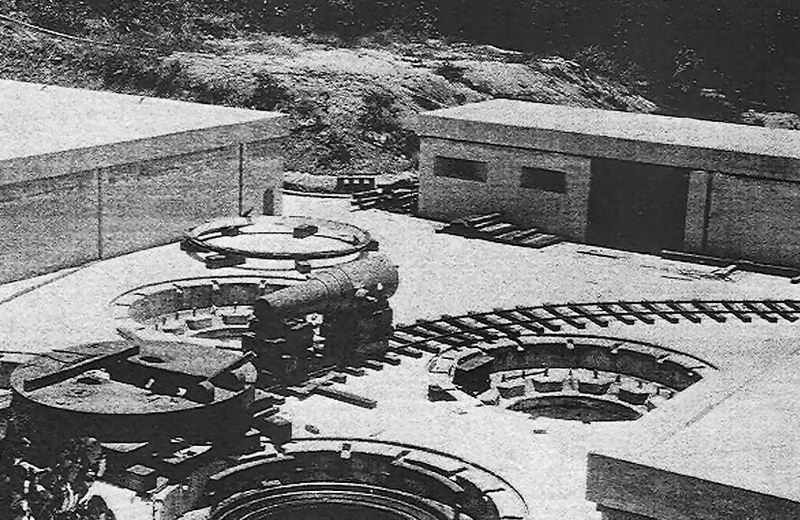
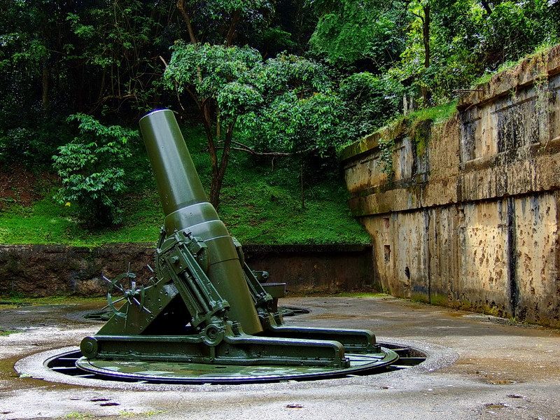
This photo shows Battery Way when it was still under construction. It was completed in 1910.
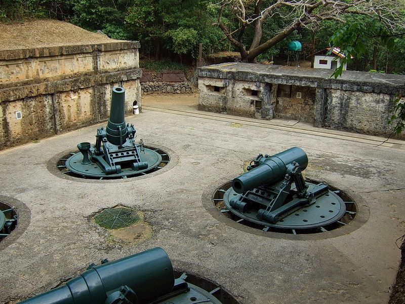
Note the extra layer of bomb-proofing that was later added to the magazines. All of Battery Way’s magazines survived the war intact.
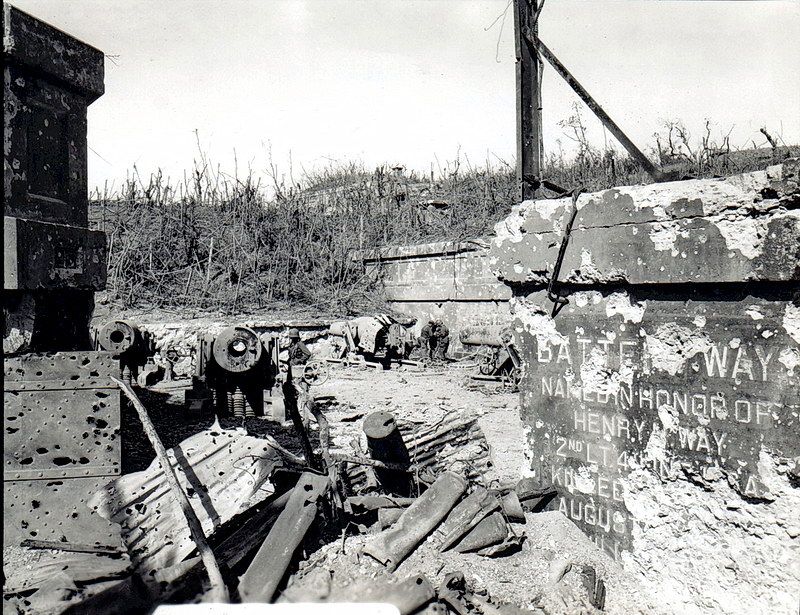
This was the condition of Battery Way in 1945.
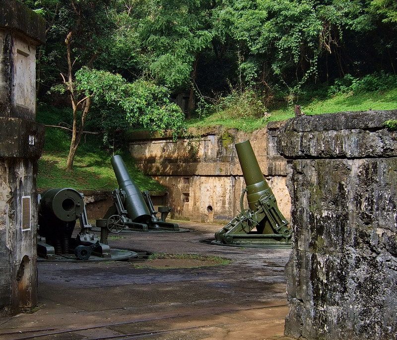
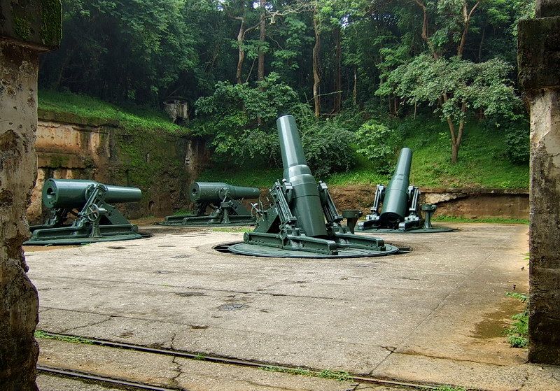
Part 2 coming soon...