|
|
Post by tomasctt on Nov 1, 2010 16:10:51 GMT 8
Just wanted to share a few pix from yesterday's trek up Mt Pico de Loro, Cavite. I dunno if this is the correct subforum on this board to post. AFAIK, the Japanese had spotters at Pico de Loro to coordinate fire on Forts Mills, Hughes, Drum, and Frank. From the summit, this is the view of the aforementioned forts: Fort Mills, Hughes, and Drum: 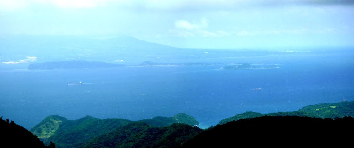 Cropped photo/close-up of Fort Drum: 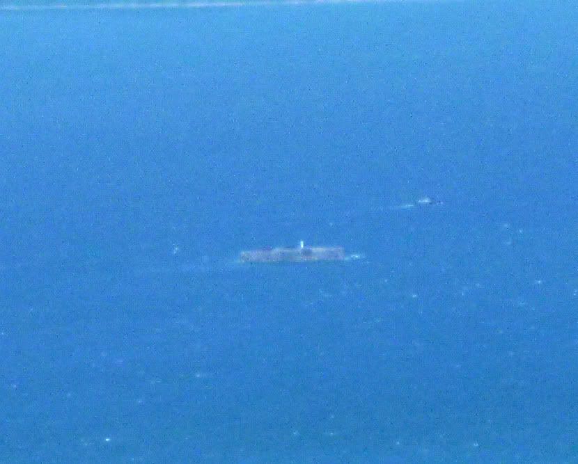 Fort Frank: 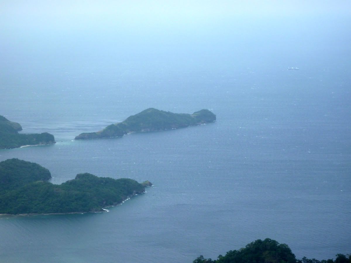 Just me at the summit with Fort Frank behind: 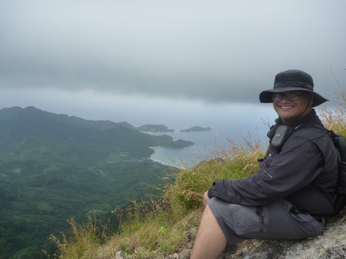 |
|
|
|
Post by EXO on Nov 1, 2010 16:48:35 GMT 8
Great photos, particularly that one of Fort Frank.
( I've put you over here with the Trip Reports, but there's a redirect notice so you get the benefit of the redirection.)
That last photo looks like you took it from a perch so high and windswept, it made me shiver.
|
|
|
|
Post by batteryboy on Nov 1, 2010 16:53:17 GMT 8
Hi Tomas, Nice shots and glad you made it there and got back safely. Just a comment on your last two pics. they are not of Carabao Island (Fort Frank). You should have panned your camera a little more to the right. 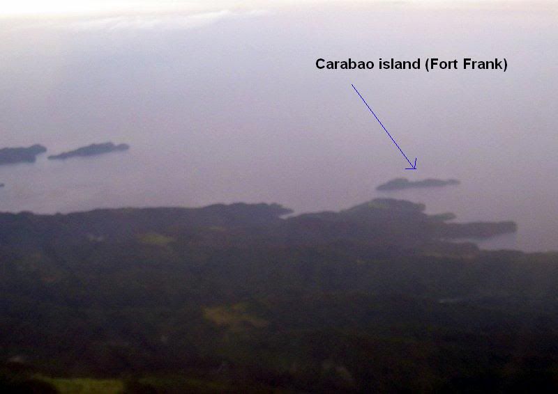 Sorry for the blurred photo as I took this in an A-430 as we were approaching our final landing run. Here are two more shots also taken from an airliner. 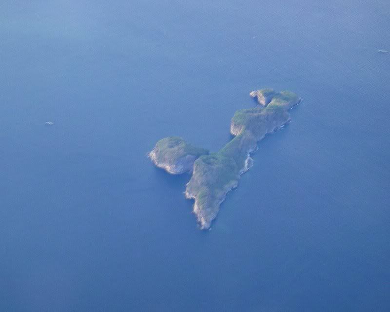 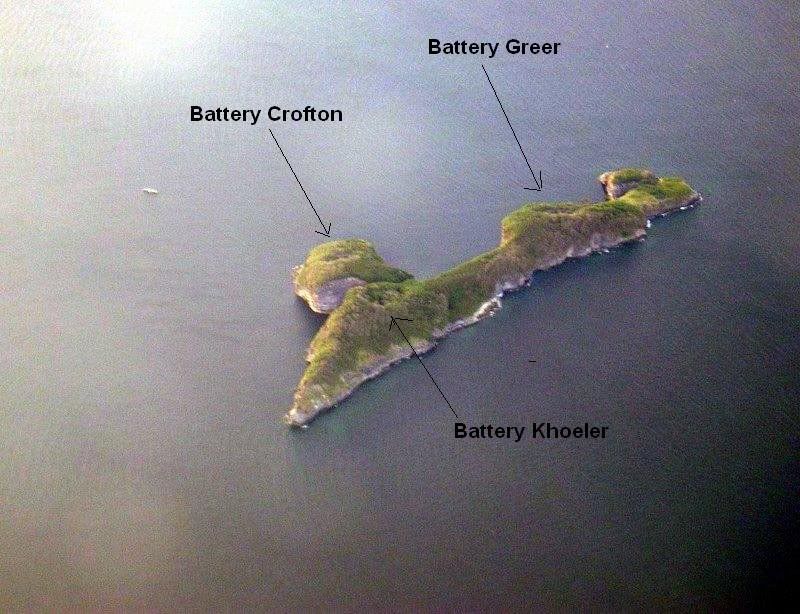 Cheers, |
|
|
|
Post by tomasctt on Nov 1, 2010 16:56:08 GMT 8
Thanks for the move.  Summit was 664+ meters above sea level. And it was very very windy yesterday, chilly. At sea level, everything looks so far away, it makes me wonder how powerful those guns are that these were able to shell the forts. Up on the mountain, I see how "narrow" the bay was. From atop, the forts look so close. With artillery technology nowadays, a modern 155mm gun situated near the entrance can cover the entire area. But I digress.... Wasn't able to take a trip to the Marine Base and inquire about boat trips to Fort Frank and Drum because it was already night time when we got out of the mountain (we got lost on the way back). Next time, if there's time, I'll go visit the Marine Base where Fort Frank is just a stone's throw away. |
|
|
|
Post by tomasctt on Nov 1, 2010 16:58:21 GMT 8
ACK! Thanks for the correction BB. That island's shape looked like Fort Frank (from memory), so I focused on it. It's location near the Marine Base also got me thinking it was Fort Frank. I'll dig around the pix I have, maybe Fort Frank was in one of the pix. |
|
|
|
Post by batteryboy on Nov 1, 2010 17:07:45 GMT 8
Its Ok Tomas, you may have taken a few of it in your stash Even the early 155mm can cover the entire bay area at that time. Battery Frank North (four 155mm GPFs on Panama Mounts on Fort Frank) fired to both Japanese artillery positions in Cavite and Bataan. The Japanese (before the arrival of the 240mm) was using mostly 105mm, 150mm (gun and howitzers) to shell Fort Frank, Drum while the longer 150mm can hit Caballo and Corregidor. Reason: they can be adjusted to proper elevation levels for a longer firing range. |
|
|
|
Post by fots2 on Nov 1, 2010 22:28:24 GMT 8
Hi tomasctt,
Great views you posted there. You are at a higher elevation than I expected you to be.
|
|
|
|
Post by okla on Nov 2, 2010 0:04:16 GMT 8
Hey Tomas....Thanks for these excellent pix. I am always amazed at what a view the Nipponese had from the heights of Cavite and Bataan (after Genl King's capitulation). Those guys, especially the ones on "the Rock" and at Hughes were literally in the bulls eye of the Japanese's artillery. Postscript...I do hope you had on your "long johns" on the summit of Pico de Loro. I shivered at bit just viewing the photo. Cheers.
|
|


