Here is a little follow-up to the above trip report.
Earlier this year near the end of the dry season, Karl and I headed for the tail of Corregidor. He wanted to see Lt. Lawrence’s gun position and the second concrete defensive wall. After that we would head further east looking for any sign of Lawrence’s other positions. Along the way we stopped at the cemeteries.
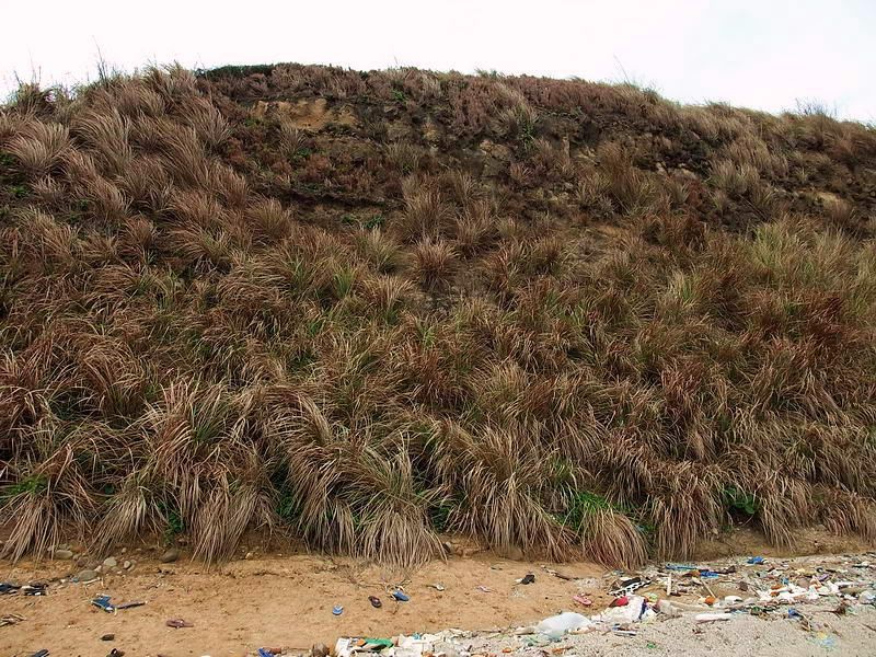
The day was overcast so actually quite good for taking photos of the gun position without harsh lighting contrast. Even though it was the dry season, the dead grasses and vines were thick any place where we left the little trail that had been made earlier.
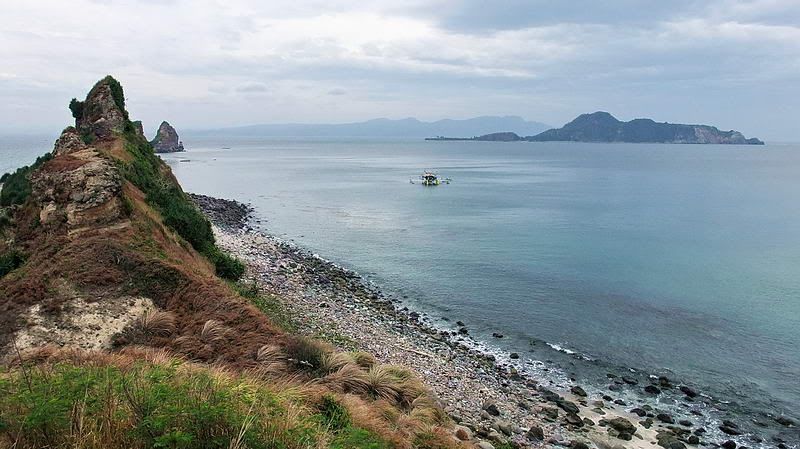
As we made our way east, there is a brief spot where the north and south side cliffs fade away. Here you can go left or right down to either beach. Past this location the curved tail of Corregidor is steep and narrow. We followed the top of this ridge until we could go no further. Vertical rock was in front of us.
Another day I would like to walk along the beach past here looking for another way to get on top. There still is a section of the tail we did not see and there may be something of interest up there. Unfortunately that day we did not find any other gun positions. It was still an interesting day with great views.
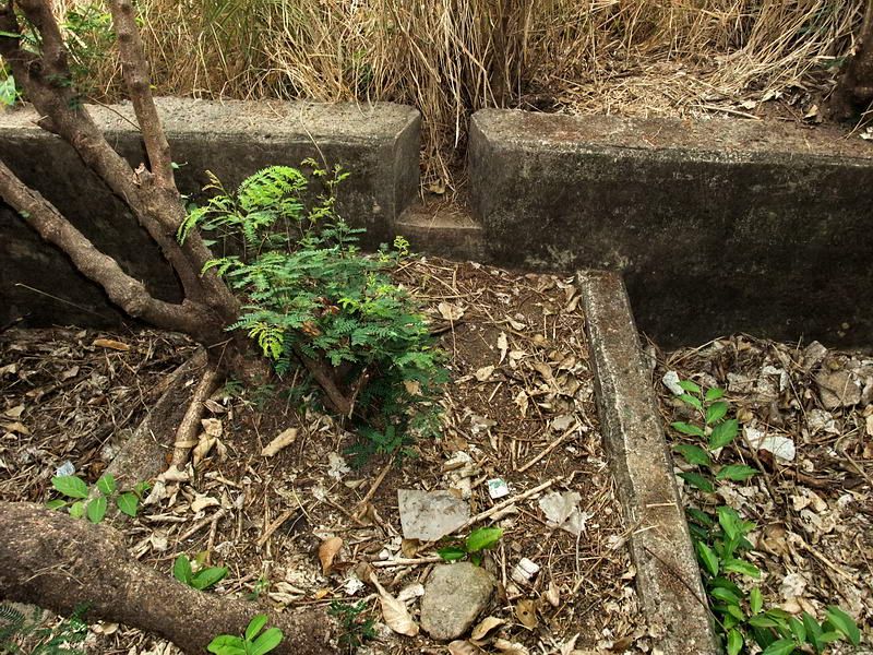
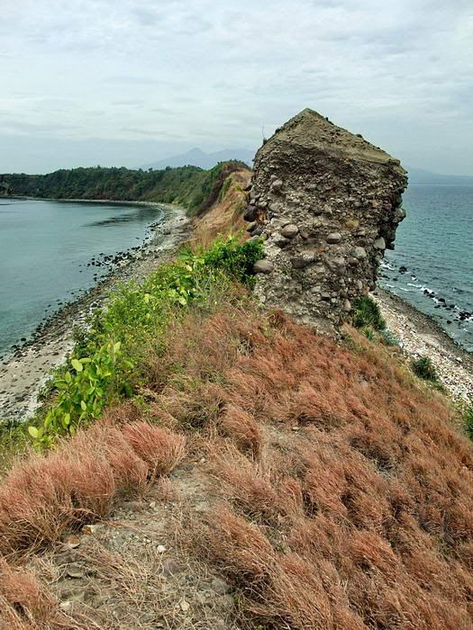
I don’t think a day goes by on Corregidor when we do not learn something new. When returning to Kindley Field, we noticed a piece of grey concrete through the dead vines off to our left. We were very close to the most easterly defensive wall but had not noticed this before. When we got over there we could see another wall. Were there actually three of them?
It took a minute of clearing vines and grass to see that we were actually looking at a different section of the same wall I just mentioned. The vegetation was so thick that none of us had ever seen this part before. The total number of concrete defensive walls is still two.
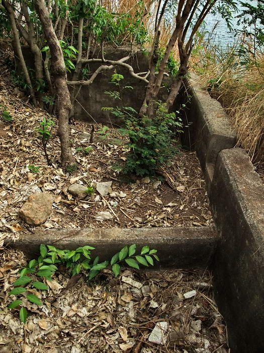
The two walls appear to have been built to defend against an enemy coming at them from the tail of the island. The western side of the walls are earth filled to within a few feet of the top however the eastern side is well over our heads.
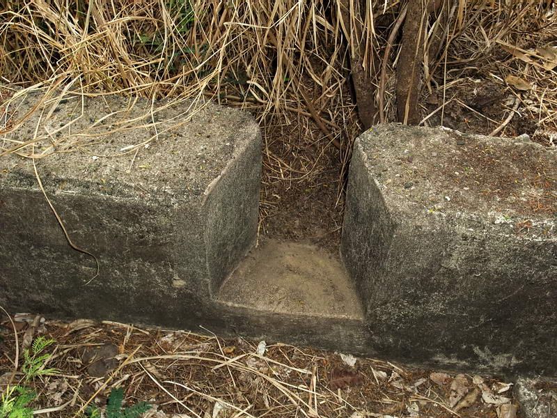
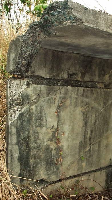
The eastern side has evenly spaced perpendicular concrete supports. All are all broken so in the past I wondered what this wall had originally looked like. This day I got my answer. The section of the most eastern wall that we just found is virtually undamaged.
The perpendicular supports held up a small section of horizontal concrete at the top of the wall. Imagine a defender kneeling or crouching on the western side of the wall. The horizontal part could support his rifle or machine gun tripod facing east. If the enemy advanced as far as the wall, it was not only over their heads but had a lip at the top to prevent easy scaling. Seems like a good design to a novice like me.
Here are a few photos from our hike.
Gun Position #2.
A close-up of the gun barrel slot in the front wall.
Standing in Gun Position #1 and looking towards Gun Position #2. The cliff down to the north side beach is just past the far wall. The position is cleaned out quite well now thanks to the help of Phantom and Jim Moffett a couple months earlier.
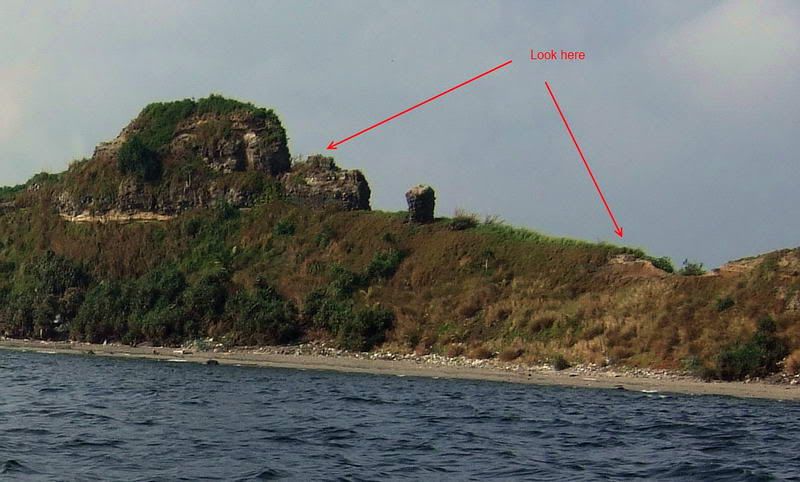
During a boat trip in the past, I had taken photos of potential locations of more gun positions. Here are two of them I had printed to take with me.
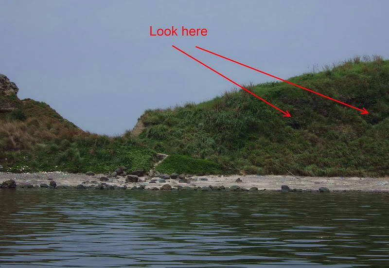
Dark areas in the slope are labeled for inspection. This photo also shows the low area where you can get down to either beach. This is a view of the north side where the Japanese tried to land in 1942.
Here is the same slope in the dry season. The two dark areas turned out to be just shade in eroded spots.
Another labeled photo of the same ridge a bit further east. I could not get up to the highest point to have a look. Next time, approaching from the left may be possible.
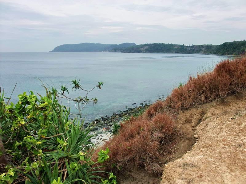
This view is looking east just before you reach the low area between the two beaches. Caballo Island (Fort Hughes) is to the right and the coast of Cavite in the background.
At the low area this is the view looking west along Corregidor Island.
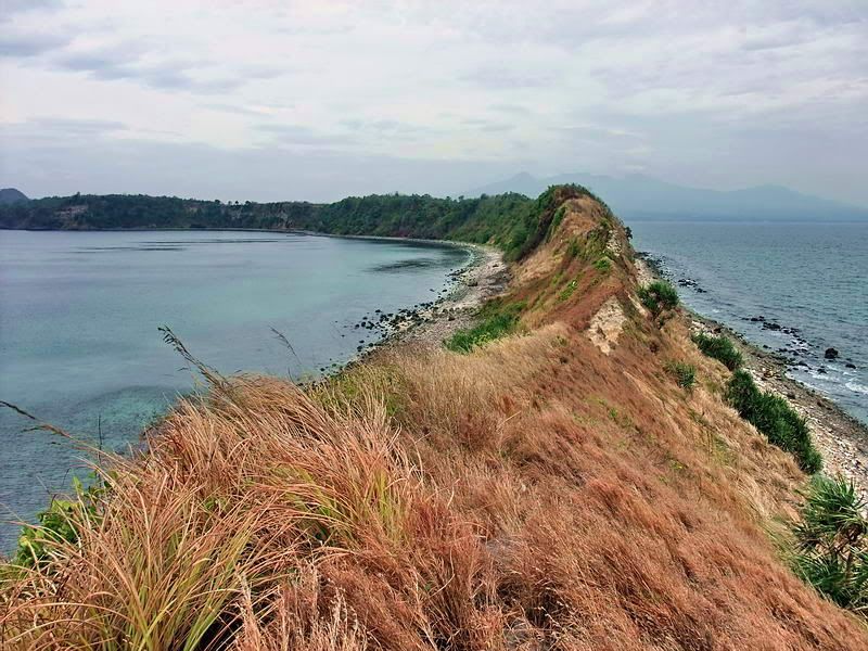
Back up on the ridge I took this photo looking behind me to the west. The low area is just ahead where you can see the bare rock. You can definitely see the curved tail of Corregidor in this view. Mount Mariveles on Bataan is in the distance.
Continuing east, here is the view looking west again. See how narrow the tail of Corregidor is.
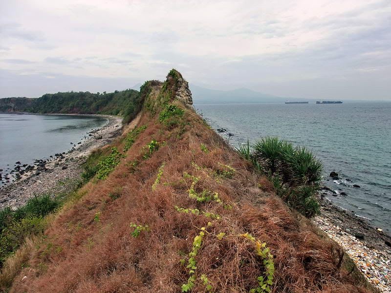
This is a far as I could go that day. Steep rock behind me prevents me from getting any further. No sign of any defenses up here or on the northern slope.
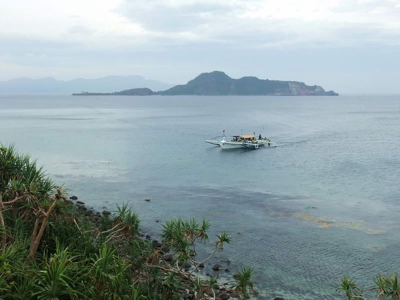
A look at nearby Caballo Island.
Its time to head back to civilization now. The nearest road is at Kindley Field and there are no cleared trails between here and there.
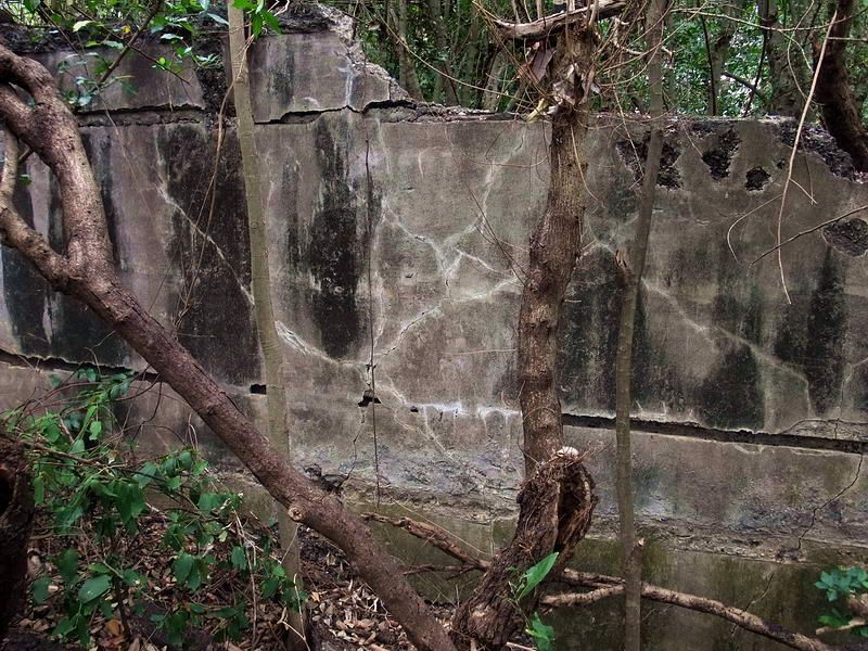
Here is a look at the tall east side of one of the walls (eastern wall).
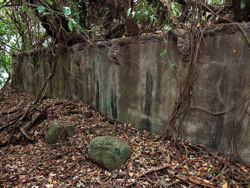
The other (western) wall is more open on the eastern side so you can easily see the damaged perpendicular concrete supports.
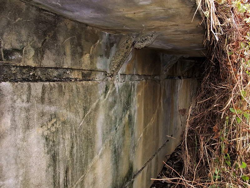
This is the new section of wall that we found. Now we can see the short horizontal section on top facing east. To the right is a sample of the vegetation we had to clear away before taking this photo.
At the top of the south side cliff you can see one end of the wall that almost completely stretches across the island. See that the eastern side of the wall (in the forefront) is quite high. The grass shows you that the soil at the western side is within a couple feet of the top of the wall.


