|
|
Post by fots2 on Jul 18, 2012 20:14:33 GMT 8
As EXO says, the main Malinta Tunnel shaft was relined in the 70s or 80s so that is why it looks undamaged today. Since the bare rock shaft is quite a bit larger than the new concrete lining, I wonder if any thought went into rebuilding the lining to the same dimensions as the original one. It is probably close but I doubt that was much of a concern. I agree with his (a) and (b) comments. In the “scary” tunnels we were talking about earlier, the ceiling had collapsed due to explosions in 1945 and we were walking of tons of uneven broken rock high above the original tunnel floor. Here is a view not many people have seen. I took this photo looking at the rounded top of a concrete lined tunnel (seen left to right in the photo). A perpendicular lateral can be seen at mid bottom. Notice how much higher the actual rock shaft is for both the tunnel and the lateral.  Where was this photo taken? I am standing on broken concrete of a south side lateral looking at the lining of the main east-west Malinta Tunnel. |
|
|
|
Post by fots2 on Jul 18, 2012 17:41:51 GMT 8
Sherwino, Tagumpay Hill that you are exploring is the exact location where we are guessing that the two tunnels beside the airstrip were dug (at the base of it adjacent to the airstrip). I think you are correct that the airstrip extended longer than the labeling on the Google Earth photo. In fact, it looks to stop just short of where the Pucot Rives crosses the road. (closer to your house).  Map courtesy of armyjunk |
|
|
|
Post by fots2 on Jul 18, 2012 13:23:35 GMT 8
armyjunk,
After a preliminary tour, fireball and I have an idea where the two tunnels may have been located. The city of Mariveles has grown to such an extent that what was the airfield is now totally covered by densely packed houses. Getting to the hillside where we would like to look will involve tramping across lots of private property. It is worth the effort however I have not been back there lately to do it. Someday perhaps.
|
|
|
|
Post by fots2 on Jul 18, 2012 12:54:30 GMT 8
Thanks armyjunk for the information. I have not seen these figures nor bothered to measure very much of it. The figures seem reasonable with a couple of exceptions. The angle of the Hospital air shafts seems low but it might be correct.
Two figures that are way off are the height and width of the Hospital vent passages. Since we seem to see these figures often I wonder if they originally were this size and at some later date the passages were enlarged. I have read that Malinta Tunnel construction work continued even after the war started, so much for the 1922 to 1932 construction dates that are often quoted.
|
|
|
|
Post by fots2 on Jul 16, 2012 22:45:42 GMT 8
EXO,
I suppose I should “never say never” but the reason would have to be very good for me to go in there again. The south side Navy tunnel past the big blast cavern is much worse than the tunnel south of the QM area so I will say “never” to that one.
Hey, I have a photo of you in the tunnel south of the QM area if you want it.
|
|
|
|
Post by fots2 on Jul 16, 2012 22:44:18 GMT 8
Hi pdh54 and okla,
Thank-you for the comments. Taking photos along with the hiking and exploring makes for a great trip every time I visit Corregidor. It never gets boring.
|
|
|
|
Post by fots2 on Jul 16, 2012 14:41:54 GMT 8
oozlefinch, you are a smart man. I have been as far south as you can go in that tunnel and it is a bit scary for sure. Once I was with EXO and a couple other times alone when doing the map surveys about three years ago. Walking/crawling on jagged collapsed tunnel roof is not the wisest thing to do. Actually it was this tunnel and the southernmost Navy tunnel that woke me up to stop doing such stupid things. I will go as far as the semi-collapsed areas in those tunnels now. Speaking of the QM tunnel South entrance, we estimated we got roughly 40 feet or so from it. The broken rock tunnel narrowed down to about a foot high and there was a breeze coming into the tunnel towards us. Also, we saw roots growing down through fractures in the rock so we knew we were close to the end. Many people do not realize that the Malinta (QM) Tunnel South Entrance still exists. It goes in about 15 feet before what looks to be a complete collapse. We do know that wind can get past here though as we felt it from inside the tunnel. Hey EXO, are you game to get into there again? I will wait for you on the outside buddy… ;D  Here is an example of what it is like to walk along a passage which is actually a collapsed tunnel roof. Some places you can stand up and other places you have to crawl. Walking can be a bit tricky as the rocks you step on can be loose and at the same time keeping an eye on the jagged ceiling so as to not split you head wide open. Add humidity and the rocks get slippery. 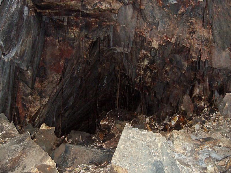 This view must have been near the end as I can see roots hanging down from cracks in the ceiling. 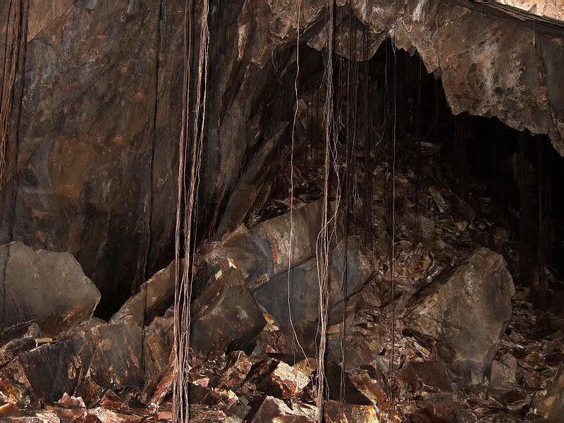 More roots near the end. 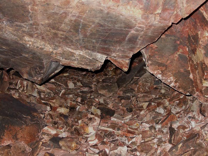 This is as far south as we could go. A gap about one foot high continued for about 10 feet then we saw only broken rock. There was a breeze coming out of here so the South Shore Road was not far away. 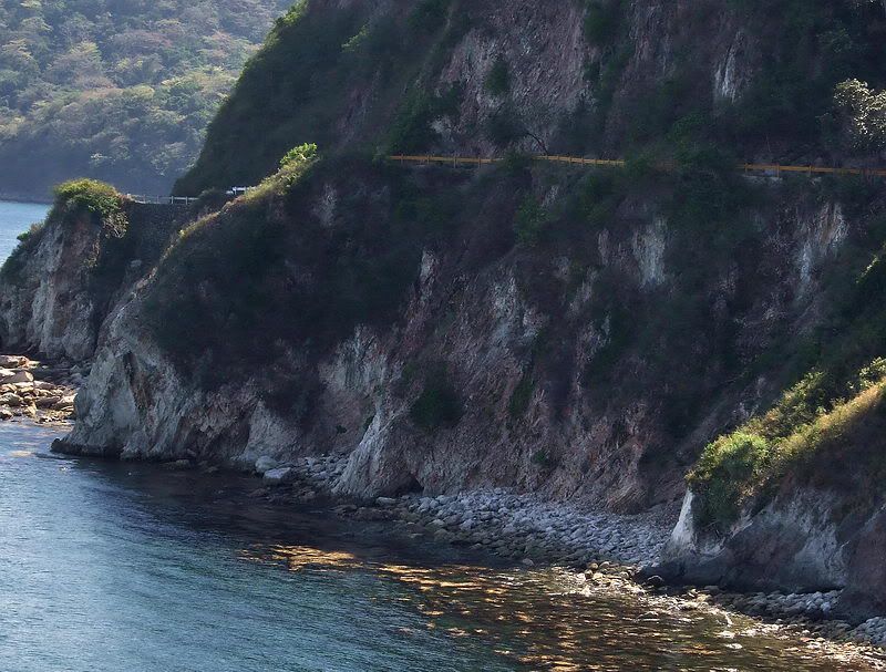 Here is the south side of Malinta Hill. Winding around it is the South Shore Road. About mid photo at road level are the remnants of the South Entrance. 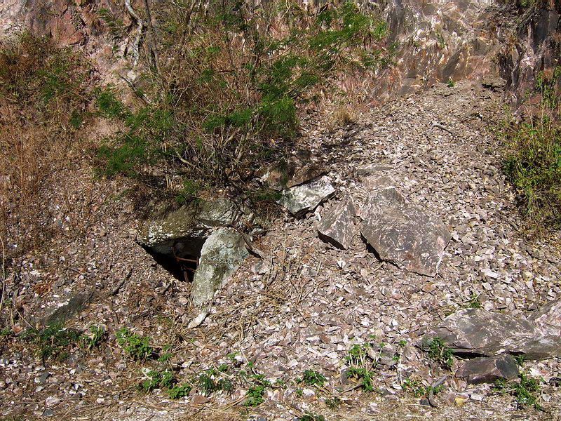 In the dry season, maintenance people cleared the road a few years ago and by cutting bushes they exposed the South Entrance. It is heavily damaged but you can see the opening, the concrete ceiling and one wall. 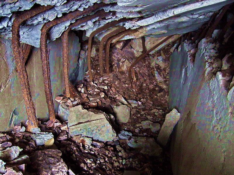 If you slide inside here is the view you see at what appears to be a complete collapse. For some reason I find these old tunnels fascinating and there still is much to learn. |
|
|
|
Post by fots2 on Jul 16, 2012 10:45:39 GMT 8
Hi oozlefinch, Your description sounds pretty good. Here is a recent photo of the area taken standing on the road and looking east towards the SW Malinta hillside. The two tunnels are located here. I was in both of them last month so they still exist. In this photo, the tunnels are located behind trees at the mid to left side of the photo and about a third of the way up from the bottom.  |
|
|
|
Post by fots2 on Jul 16, 2012 10:29:03 GMT 8
Hi Chad,
Malinta Tunnel main shaft length:
As I stood in front of the tunnel entrances, one simple question came to mind. Where do people start their measurements from? i.e doorway to doorway, edge of tunnel roof to edge of tunnel roof (the actual tunnel) or do they include the outer concrete walls at each entrance. I chose the edge of tunnel roof to edge of tunnel roof as the doors are recessed about six feet on both ends and do not reflect the total length.
My measurements, close but not exact, can certainly let you know whether the tunnel is nearer to 836 or 1,500 feet.
Answer: 814 feet.
The difference between 814 feet and 836 feet may be due to (1) my measurements not being precise, (2) not measuring between the same two points as whoever did it before or (3) that the tunnel is actually a bit shorter now due to all the west entrance war damage. Perhaps a combination of “all of the above”.
|
|
|
|
Post by fots2 on Jul 15, 2012 20:05:03 GMT 8
Hi oozlefinch,
If there ever was a topic that needs chadhill and okla’s detailed attention, it is the Malinta Navy Tunnels. After doing surveys and some research three years ago we learned a lot but not enough to 100% positively identify them. We all have ‘opinions’ but not enough evidence to upgrade them to ‘fact’.
I will try to explain a bit about the tunnels and hopefully it makes sense.
Since Navy tunnel “Queen” was not even thought of until 1939, then the single tunnel entrance seen on the 1936 map cannot be it. Actually I can confirm that the entrance shown at the SW corner of Malinta Hill (1936 map) is the original Malinta Storage System ‘South’ entrance as labeled on the 1934 tunnel plan. Due to cave-ins this planned network of tunnels was abandoned after preliminary work was done on the entrance and a few laterals. (The plan for these tunnels were shifted from Lateral #3 further east to Lateral #8 and became the QM tunnels and south entrance that we know of today).
When the Navy realized that they would most likely lose Cavite when a war started, they provided funds to the Army in 1939 to construct bombproof tunnels in the SW side of Malinta Hill. This was to be the new HQ of the Sixteenth Naval District. Contracts are mentioned for four new tunnels however a few books/documents mention five tunnels. This is logical if the abandoned old South entrance was incorporated into plans for the Navy Tunnels. There is photographic evidence for a total of five tunnels.
If you go to Corregidor today and start walking the South Shore Road that goes around Malinta Hill, you will soon come to an area used as a dump by maintenance people for grass, leaves and branches. It is located between the road and the steep hillside. Hidden in the trees behind the dump are the two remaining Navy tunnels. The one on the left was the original South entrance and this is what is shown on the 1936 map. The one on the right is believed by some to be Queen.
|
|


