|
|
Post by Karl Welteke on Dec 12, 2012 11:52:21 GMT 8
This is the 4th segment of this Ft. Frank, Carabao Island visit. It covers Battery Greer, the open gun pit area, the concrete covered Ammo Handling area which is the on the same level and then the two gun control stations near by but are on a higher ground. 31 more images have been uploaded this time to my Photobucket image sharing account for a total now of 179 images. My graph is just a rough thing and can’t be considered accurate at all. Each image has a description. This segment, like the 3rd one ended up in the front but stayed in sequence, the order I wanted them to be. Here are now 179 images in my Photobucket account which all have descriptions: app.photobucket.com/u/PI-Sailor/a/74135eca-a6dc-4699-b26d9f899535cedc?field=TITLE&desc=ascIf it doesn’t open, try copy and paste in a browser! Battery Greer has three levels, maybe even four if we count the battery control stations higher up. So this is the 3rd level up. The gun pit area is open but the ammunition handling area is covered with heavy concrete, don’t know how thick and from above it looks like an area for a helicopter to land. One noteworthy item is that we actual seen a remaining gun part in the gun pit/well! A NOTE to Sherwino re picture #4 at the previous reply: I just don’t know what purpose this set up served, was there something sitting below or was there machinery sitting on top? One thing for sure though we used that as a passage to go the rear of the battery at this level and then exit it to the north end of the island. Here are some sample images: This is the graph for my 4th segment, 31 images, of this visit to Carabao Island and covers the open gun pit area, the ammunition handling spaces and the gun controls. At the ammo handling area are also a few spaces but I can’t reconstruct now which space is where on this level. 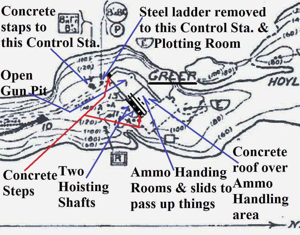 One of several spaces on this, what I call the 3rd level. Above here is a large blank and bare concrete area that could be a helicopter landing area. This is maybe the largest space in the Ammo handling area, I don’t know how thick the concrete is above here. In this album are only Battery Greer images. 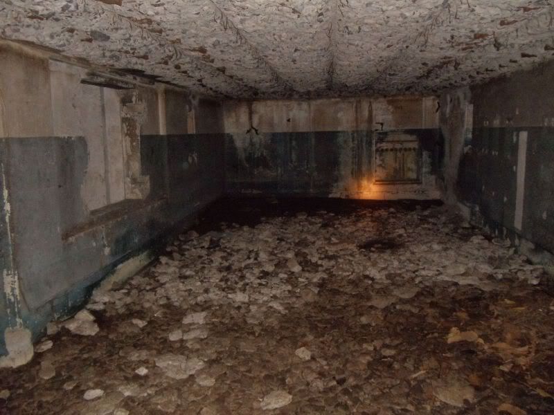 Here are two twin slots for passing stuff up from the Magazine area, Battery Greer. 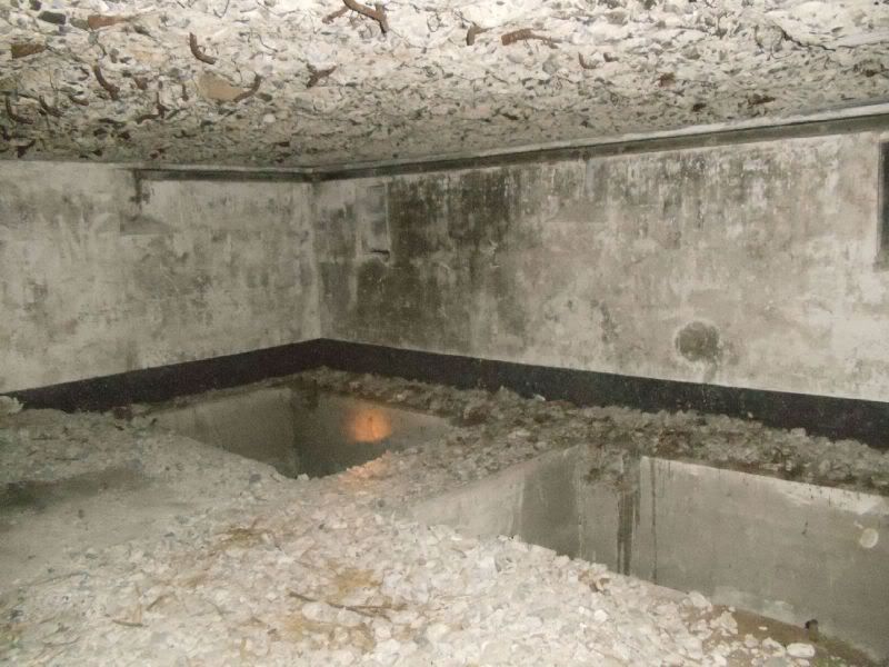 In this segment I only have this shot of 1 of 2 ammo hoisting shafts. The overnight scrappers were apparently afraid to fall in there and provided guard rails. 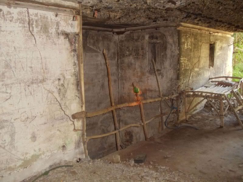 One of two set of steps coming from the Battery Greer magazine area. 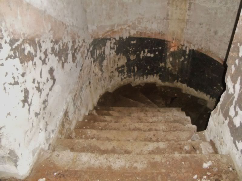 Wow!!!, I didn’t notice it before but this seems to be the only gun part of all the guns on Carabao Island, the ex Ft. Frank that is left now. 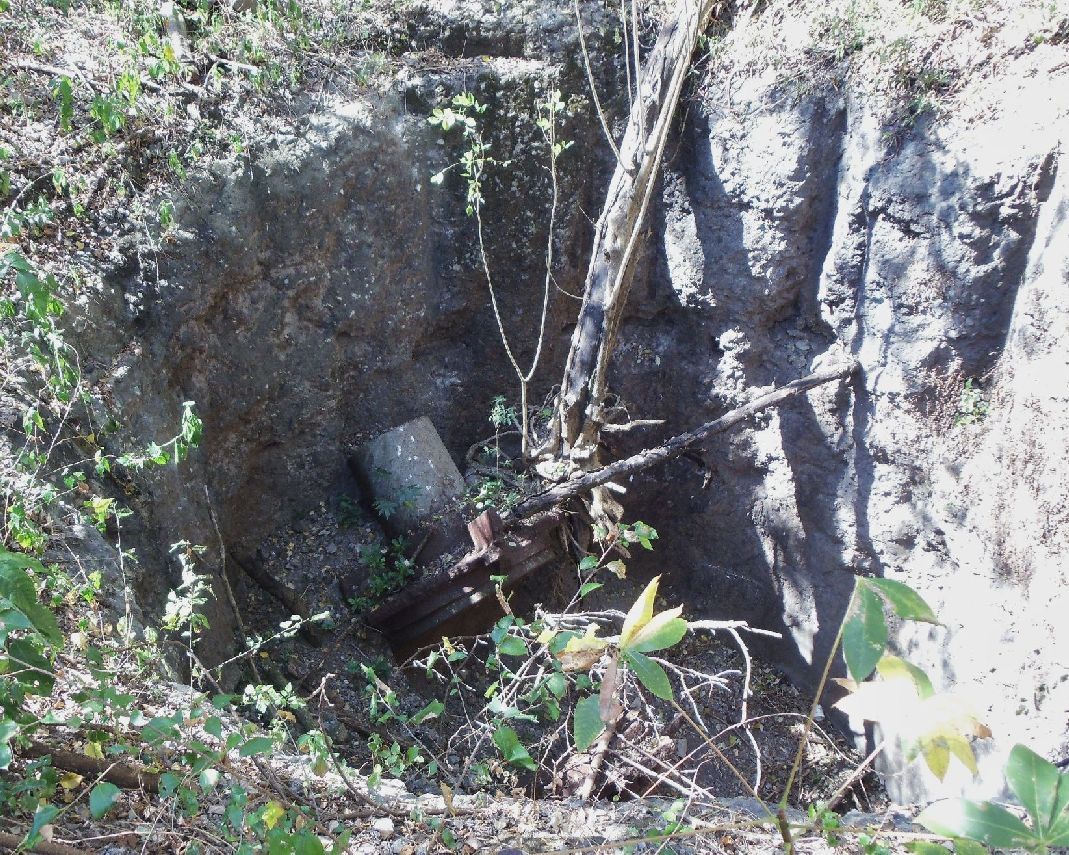 Close-up of the last pic, showing a remaining gun part in the gun pit or well of Battery Greer. 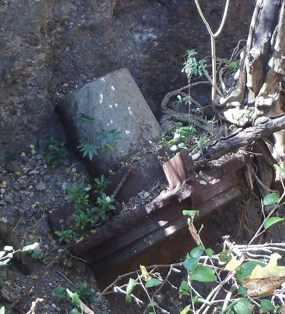 We just left Battery Greer Magazine area, entered the long tunnel, John bringing up the rear and where I’m standing, to my left, is a passage and where once were steps to the battery plotting room. 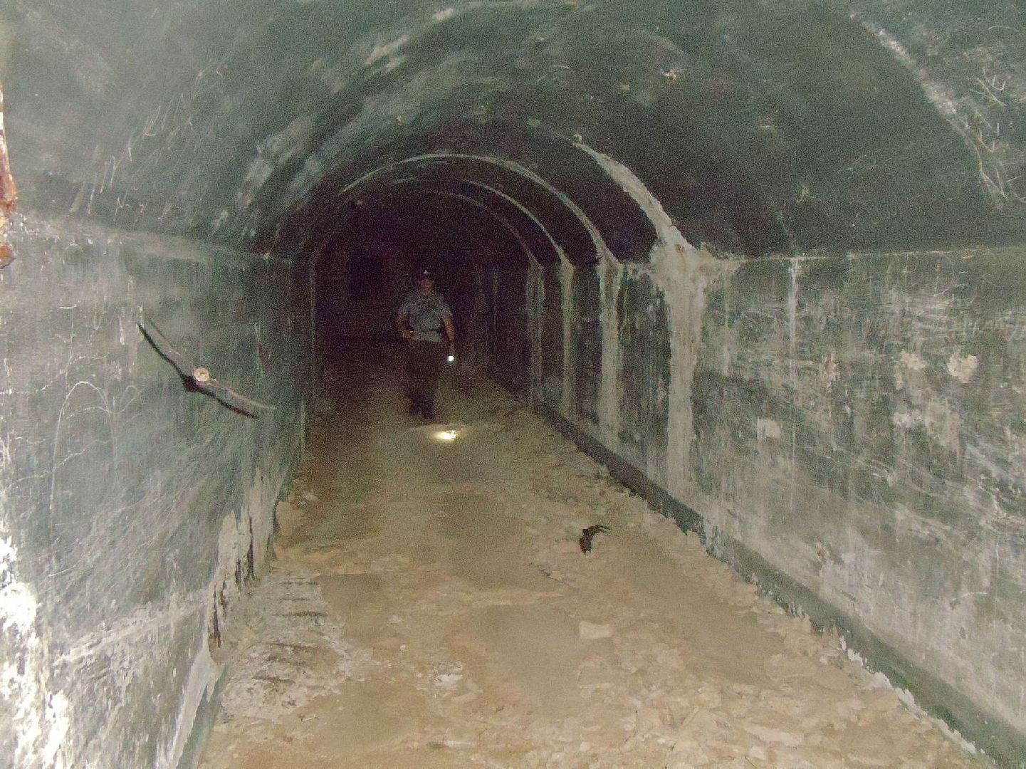 This shot is from the passageway from the Battery Greer Control down to the plotting room at left. Is now angled to the right, that is where another missing set of steps came from, the long Battery Greer Tunnel. 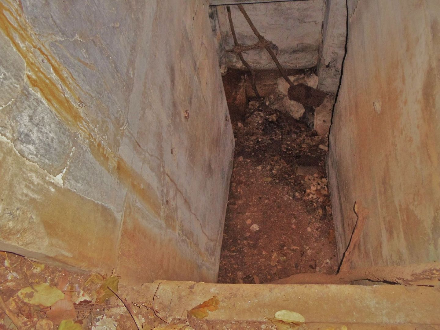 |
|
|
|
Post by oozlefinch on Dec 12, 2012 12:33:06 GMT 8
Karl, thanx for posting your collection. It's easier than pulling out my slides. I've always thought Carabao was a neat place, probably due to all of the protective tunnels for the gun batteries. When I was first there, 25 years ago, all of the guns were gone, of course, but the batteries were in better condition. The scrappers had done a lot of work on the re-bar, but not like today. Woodcutters had done a good job of clearing a lot of the gun platforms so that picture taking was a lot easier. Even the Panama Mounts were in better shape back then. I remember seeing that metal piece in the pit and wondered why it hadn't been taken. It certainly shouldn't have been that hard, not after taking a 14" gun tube and carriage. It's a little amazing that it's still there. I don't think any of the scrappers have bothered to look in the pit.
|
|
|
|
Post by fireball on Dec 12, 2012 22:28:51 GMT 8
The wood fence for the ammo hoist shaft appears to have been part of a larger (and well organised) camp and I believe that they are the ones who cleared the undergrowth from around the remaining gun part and also renovated the path to the old wharf area.
Sherwino: I think, but maybe wrong, that those rectangular spaces you asked about are for machinery - possibly the power plant - underneath them the service tunnel connects through to the cliff face.
|
|
|
|
Post by fots2 on Dec 13, 2012 14:19:52 GMT 8
Karl, those are very good reports you have been posting. The labeled aerial shots and maps of all the locations visited are difficult to do but they look fine to me. They are good references for everyone when looking at the photos. See you on the Rock next month.
|
|
|
|
Post by okla on Dec 13, 2012 21:27:58 GMT 8
Hey Karl....I, totally, agree with Fots. The maps/labeling/etc "seal the deal" for me. This brings everything into a nice, neat package for referencing while sifting thru the photos. Great job. Cheers.
|
|
|
|
Post by Karl Welteke on Dec 15, 2012 13:53:43 GMT 8
Carabao Island, ex Fort Frank via Cavite with fots2 2012-11-23 This is the 5th and last segment of this Ft. Frank, Carabao Island visit. It covers the distilling plant by the wall, our try to board Limbones Island and the boat ride back to Santa Mercedes Village 27 more images have been uploaded this time to my Photobucket image sharing account for a total now of 206 images. My starting graph, I provided, about the wall and distilling plant is a reference because in the descriptions I use north/south etc directions. Each image has a description. This segment, like the 3rd anf the 4th ones ended up in the front but stayed in sequence, the order I wanted them to be. Here are now 206 images in my Photobucket account which all have descriptions: app.photobucket.com/u/PI-Sailor/a/74135eca-a6dc-4699-b26d9f899535cedc?field=TITLE&desc=ascIf it doesn’t open, try copy and paste in a browser! I think the main point about the Limbones Island visit try is, that if you visit it with a outrigger banka boat one needs a substantial plank at the old Army landing. The water is too deep and you just cant step off the boat and walk ashore. But there is a cove very near, just around the point; there is a ledge and one walk around the point, along that ledge from that very near cove. Here are some sample images: Here is the graph as reference for the next seven images (in the album) which are about the distilling plant inside the wall on Carabao Island, the former Ft. Frank. 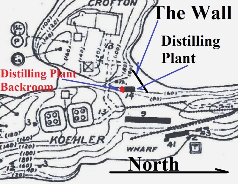 The ex Fort Frank distilling plant structure, this is the SE corner. Notice the hole, that has been dug a long time ago, in the front and an opening at the back wall to the distilling plant back room. 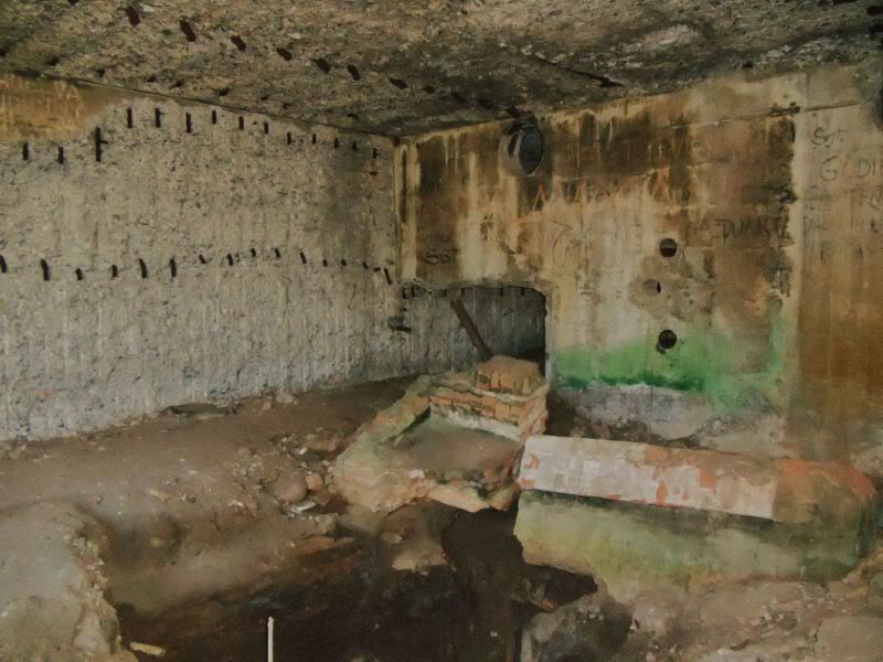 The hole in the middle that has been dug a long time ago, shot in the same direction as the last shot. 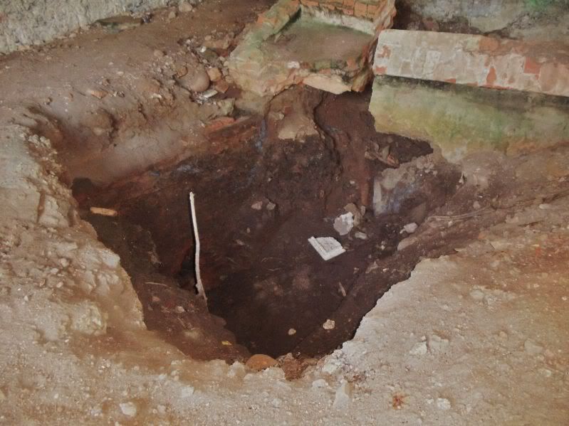 This shot is from the NW corner towards the wall. And one can see the opening under the wall where most people probably enter Carabao Island. It was not too hard today, low tide. A big banka will not come close enough like a small banka. 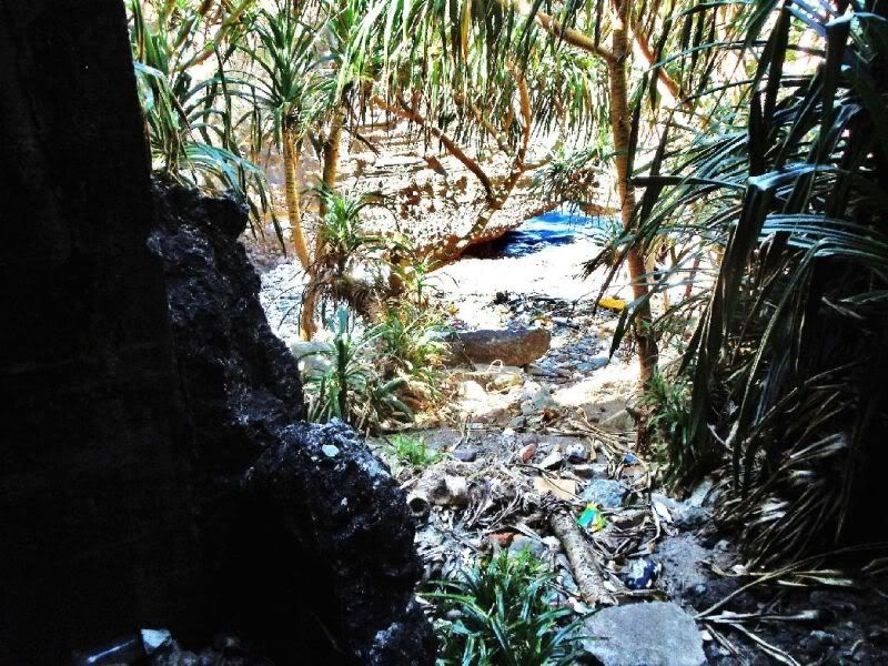 This picture has the actual GPS track our boat took back to Limbones island and Santa Mercedes Village. 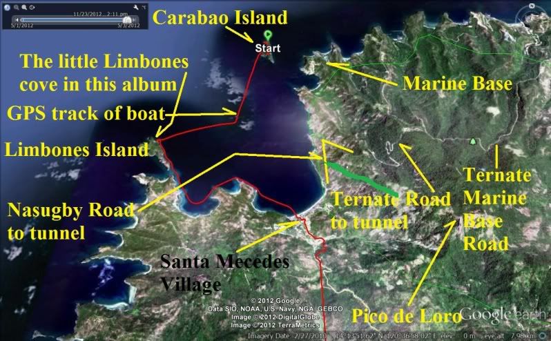 Leaving Carabao Island and we are looking back at the foot hills of Pico de Loro mountain 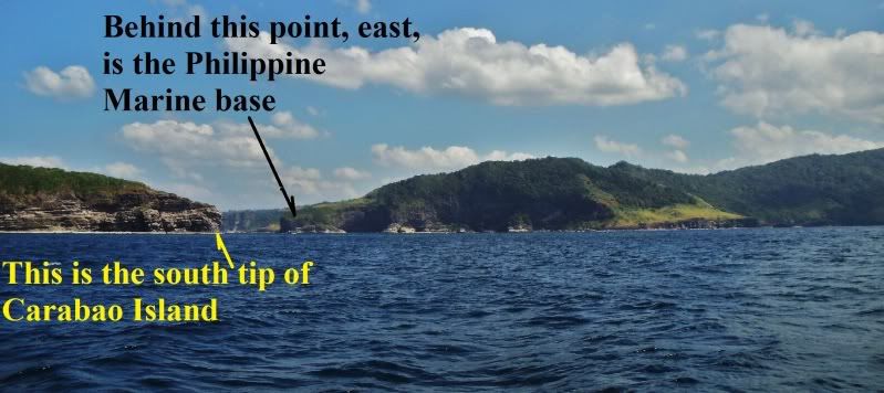 This is one of two valleys, ravines, coming down from Mt. Pico de Loro, west of the Marine Base. 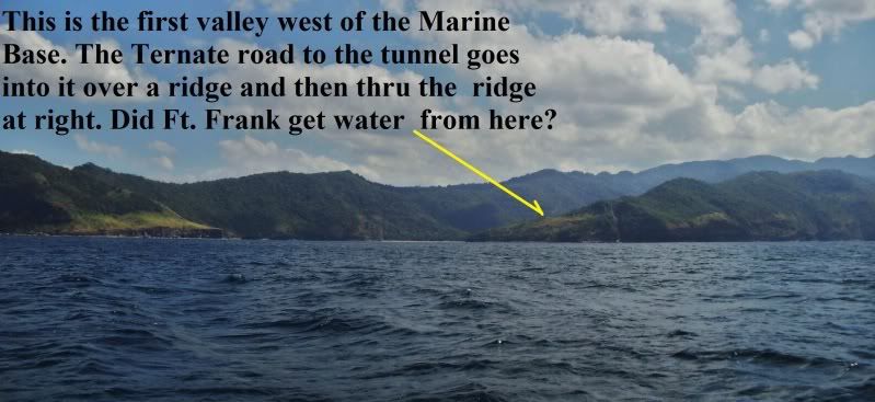 The coastline between Santa Mercedes at right and the Marine Base at left. 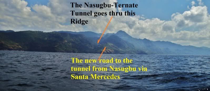 The coastline between Santa Mercedes at right and the Marine Base at left. 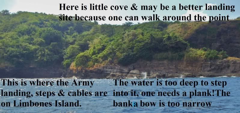 Very near to the landing area in the last picture is a cove and a ledge can be used to walk from that cove to the Army landing area. 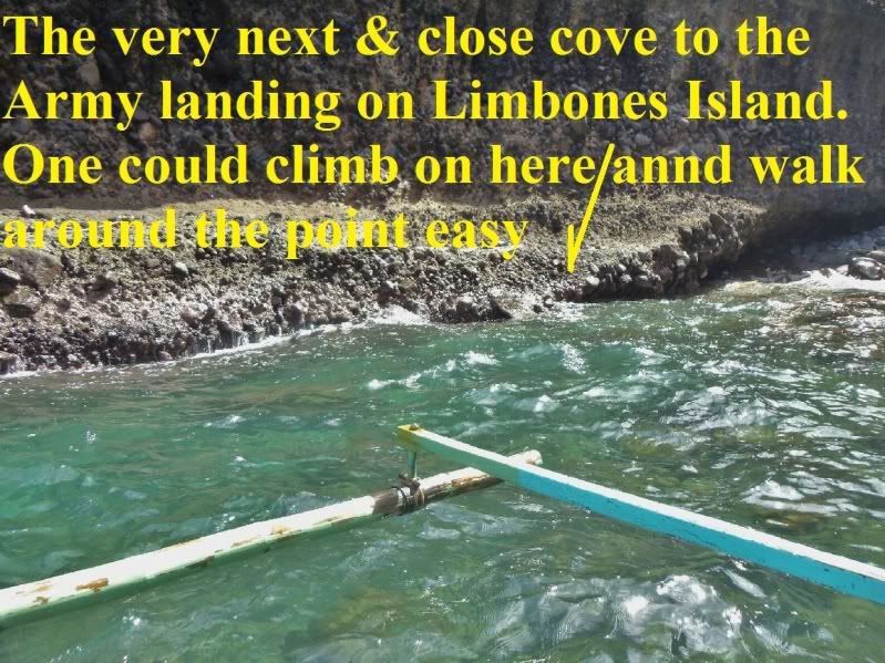 A fuller view of the cove near the army landing area. The keel of our boat hit one of those rock pretty hard because of the waves and I would be worried also so the boat backed off and then the water was too deep. 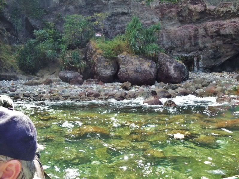 ------------------------------------------------------------------ These last two pictures didn’t upload but one day in the future I'll try to correct that! Corrected it on 2024-02-02 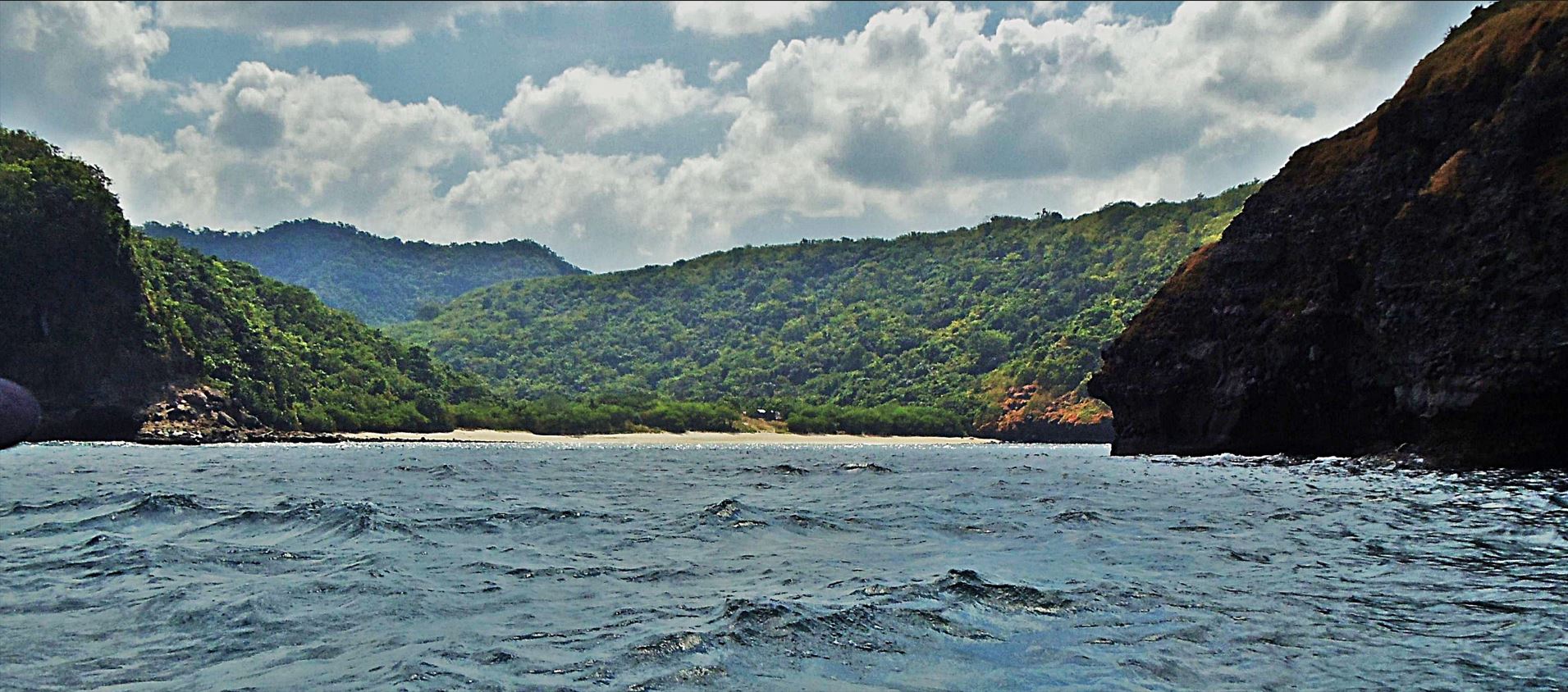 Zg659. Sta. Mercedes We are on our way back to Santa Mercedes hugging the shoreline. Opposite of the Limbones Island south end, on the mainland is this lovely cove. 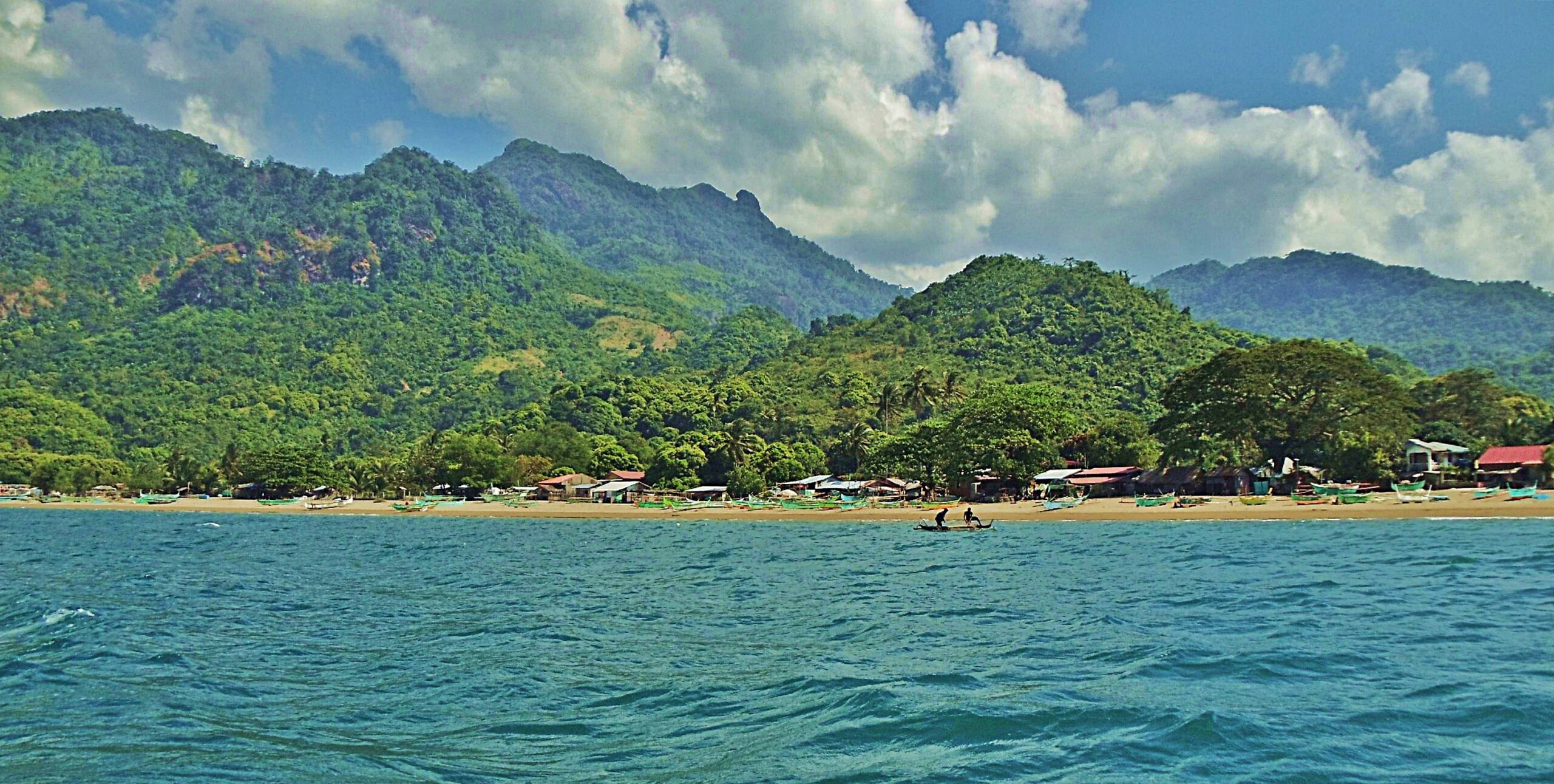 Zg660. Sta. Mercedes. The east end of Santa Mercedes Village and the Pico de Loro Mountain. We are back at Santa Mercedes and will start our next adventure. |
|
|
|
Post by Karl Welteke on Dec 16, 2012 6:29:00 GMT 8
Here are 4 images related to my recent entries re Fort Frank. They are from Tony (batteryboy) our resident expert on just about everything re WWII history and the Philippines. They are already posted at this thread: corregidor.proboards.com/index.cgi?board=talk&action=display&thread=651But I like to show them again on the Ft. Frank page. At the corregidor.org web pages is this entry about the history of Ft Frank from Charles M. Bogart www.corregidor.org/chs_bogart/bogart2.htmYou need to copy and paste this URL into a browser, sorry! If you like to know the history of Ft. Frank you should read this corregidor.org entry! And I reproduce a few paragraphs here from his report in regards the water situation in view that I showed a few pictures from desalination plant: On February 16 1942 the Japanese struck what appeared to be a death blow to Fort Frank, by blowing up the pipeline that carried fresh water from the Calumpan Dam on the mainland to the fort. Though Fort Frank had a distillation plant that was not put into operation, it was vulnerable to shell fire and low on fuel. Japanese troops were in such close proximity to Fort Frank that the following day the three 75mm beach defense guns were able to open on Japanese troops moving about in the open on the mainland. Loss of the gasoline supplies on 19th Feb 1942 heightened Fort Frank's critical fuel problem. To conserve fuel, Colonel Boudreau called for volunteers to return to the mainland and repair the blown water pipe. A party of 15 men landed later that day and began to repair the water pipe. While so engaged they were attacked by a number of Japanese, but assisted by Fort Frank's 75mm gut beat off the attack, killing 25 to 30 of the enemy. The engagement however prevented the water line from being repaired. With fuel stocks running low a new attempt was made on March 9 to repair the water line. Under cover of a barrage of shells from the 75mm guns a party landed on the mainland and after nine hours repaired the break. Amazingly, the Japanese did not interfere with the repair of the water pipe though it lay on ground they occupied. For the remainder of March, Fort Frank was to have ample water. On April 10 Fort Frank permanently lost its mainland water supply when the Japanese removed two lengths of pipe from the water line. As no extra pipe existed, Fort Frank was unable to repair the break and was forced to fall back on its distillation plant. 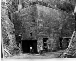 The desalination plant before the war. Photo is from Tony (battery boy) 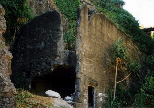 A picture of the whole desalination plant in recent years. Photo is from Tony (battery boy) 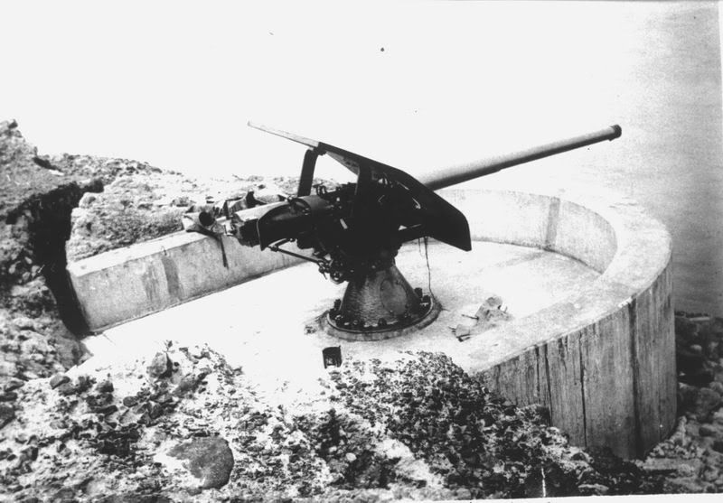 One of the Battery Hoyle guns on Ft. Frank, pre war. Photo is from Tony (battery boy) 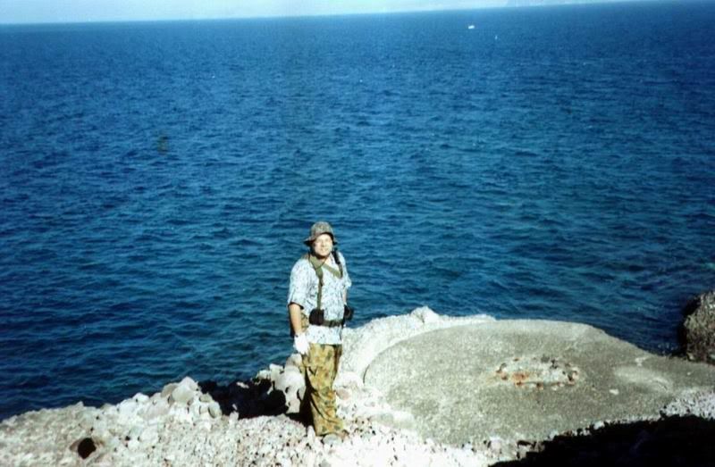 Tony (battery boy) at Battery Hoyle in recent years. Photo is from Tony (battery boy) |
|
|
|
Post by oozlefinch on Dec 17, 2012 14:07:02 GMT 8
Although I have been unable to find any evidence of a tunnel, I was informed that one was dug from the wharf, through the island, to the desalination plant, through which coal was transported to heat the boiler. Does anyone else have any info on this tunnel?
|
|
Deleted
Deleted Member
Posts: 0
|
Post by Deleted on Mar 8, 2014 13:45:57 GMT 8
Perhaps I can help answer the water question. A dam was built on the Cavite side, north of the peak of Mount Pico de Loro (Parrot's Beak). As of mid-1990s, the concrete dam complex was still there. My Dad has many photos of it. The freshwater stream was still there in the 1990s.
From the dam, water flowed thru a large (outside diameter easily 5 or 6 feet) reinforced concrete pipe that led down to the beach immediately landside from Carabao Island, where it terminated in a steel pipe (of about 8-10 inch diameter?) that ran under the bay and up to Fort Frank, right at the Water Desalinization Plant. Again, we have photos of this pipeline on the beach.
Recent maps lead me to believe the area where the pipe ran down to the beach mainland side is also where the Phil Marines built a base of some sort (wasn't there when I left the Philippines!!!).
|
|
|
|
Post by Karl Welteke on Apr 4, 2014 15:09:41 GMT 8
COASTAL DEFENSE STUDY GROUP VISITS CARABAO ISLAND 2014 FEB. 28TH Again I joined the Coastal Defense Study Group (CDSG) people and visited Carabao Island, the ex Fort Frank on this date. I made an album of this visit. Once on the island we went different ways and so this album is only about entering and leaving Carabao Island. On this visit the Philippine Marines ordered us off the island stating that it is now included in their training area. We only got to enjoy about 2 hours on the island. The CDSG people are an association exploring and maintain the history of Coastal Defense in the USA and all over the World. They organize tours to visit Coastal Defense sites all over the world and visit the Manila Bay Defense Forts every so many years. This group was 20 people + and was an international group! Here is their website: cdsg.org/Our visit to Carabao Island, the ex Fort Frank, was organized as usually with the help of the Corregidor Foundation Incorporated (CFI) which runs the island for the Philippine Government. We hired the large passenger banca (boat) available on the island. As required CFI notified the Philippine Coast Guard Post on the island and as usual they provided an armed one man escort. It is noteworthy to say that neither us, CFI or the Philippine Coast Guard had any idea about the changes of authority over Carabao Island, the ex Fort Frank. Our forum addressed this recent incident at this URL: CARABAO ISLAND - FORT FRANK - NO TRESPASSING corregidor.proboards.com/thread/1618/carabao-island-fort-frank-trespassingThis is my album with 26 images about the CDSG visiting Carabao Island: app.photobucket.com/u/PI-Sailor/a/c9c34bfc-30f7-4d8c-aa3a-aee7e3b99abc?field=TITLE&desc=ascCopy and paste it into a browser, sorry, the new technique! Here are some sample pictures: 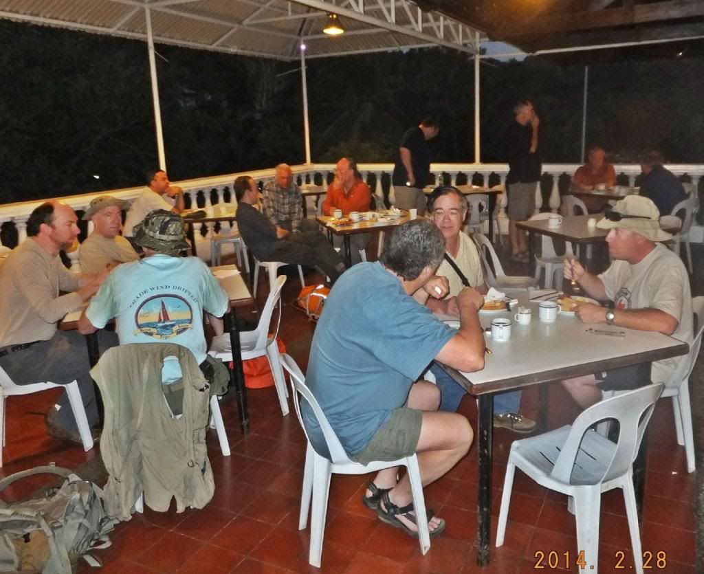 X123-- CDSG personnel rose early on Corregidor Island for a visit to Carabao Island, the ex Fort Frank. 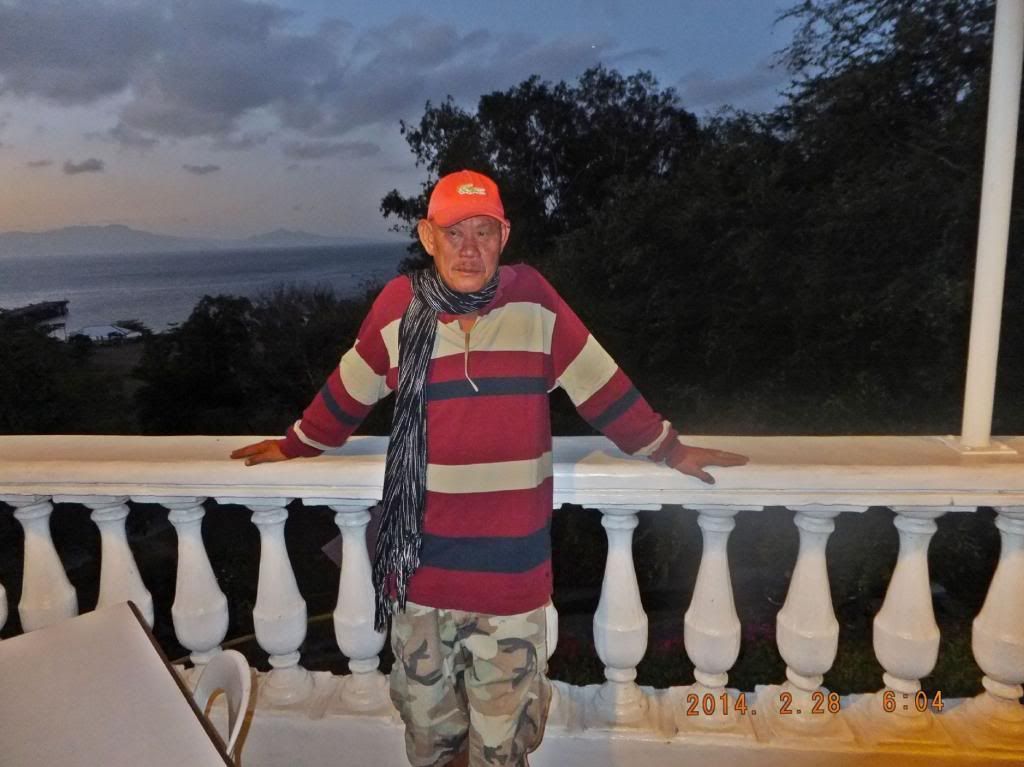 X124-- Mr. Ron Benadero, the resident Manager on Corregidor Island for CFI, made sure everything was running as scheduled. 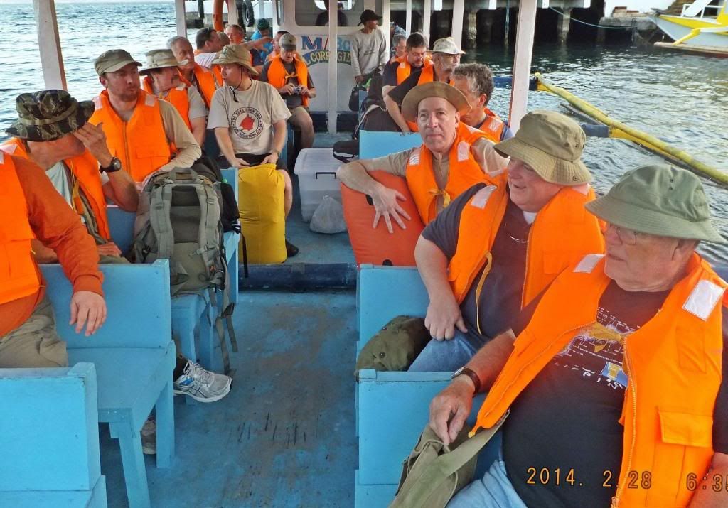 X125-- The crew and passengers are on board the motor boat El Corregidor and we are off the Carabao Island, the ex Ft. Frank and other islands. 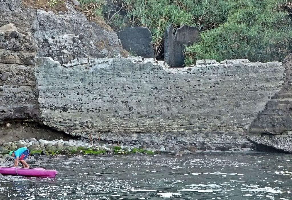 X126-- At –The Wall-, west side of Carabao Island, the boat crew used a kayak to help in mooring the bow of the boat. 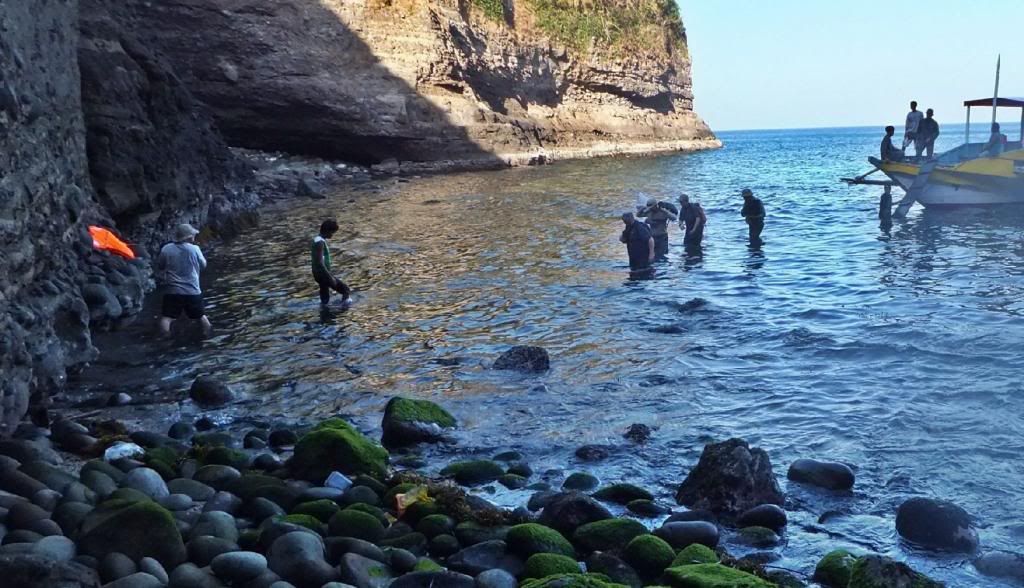 X127-- CDSG Landing Party starting walking towards shore at -The Wall- on ex Ft. Frank. The problem with big boats is that they don’t want to get very close, so not to damage the boat’s keel, by it bouncing hard on one of those rocks!! 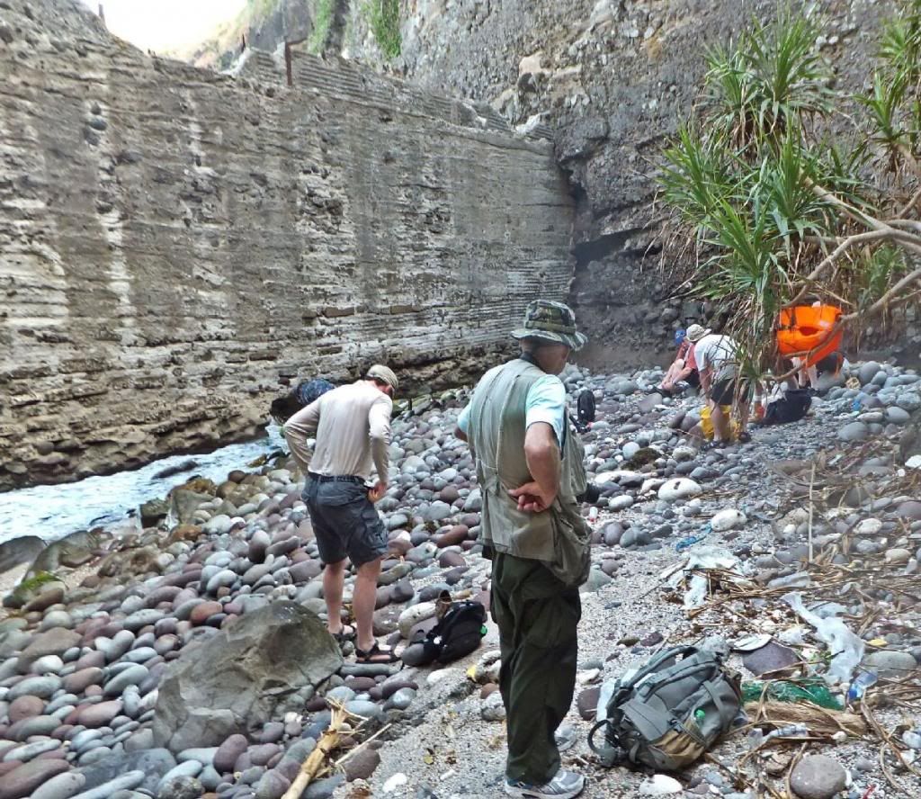 X128-- CDSG Landing Party reached the Carabao Island shore at -The Wall- on ex Ft. Frank. Going under –The Wall- was easy today because of the low tide. Notice the scrappers demolished the bottom of the whole length of –The Wall-. This has happened in the last 6 years, my estimate. 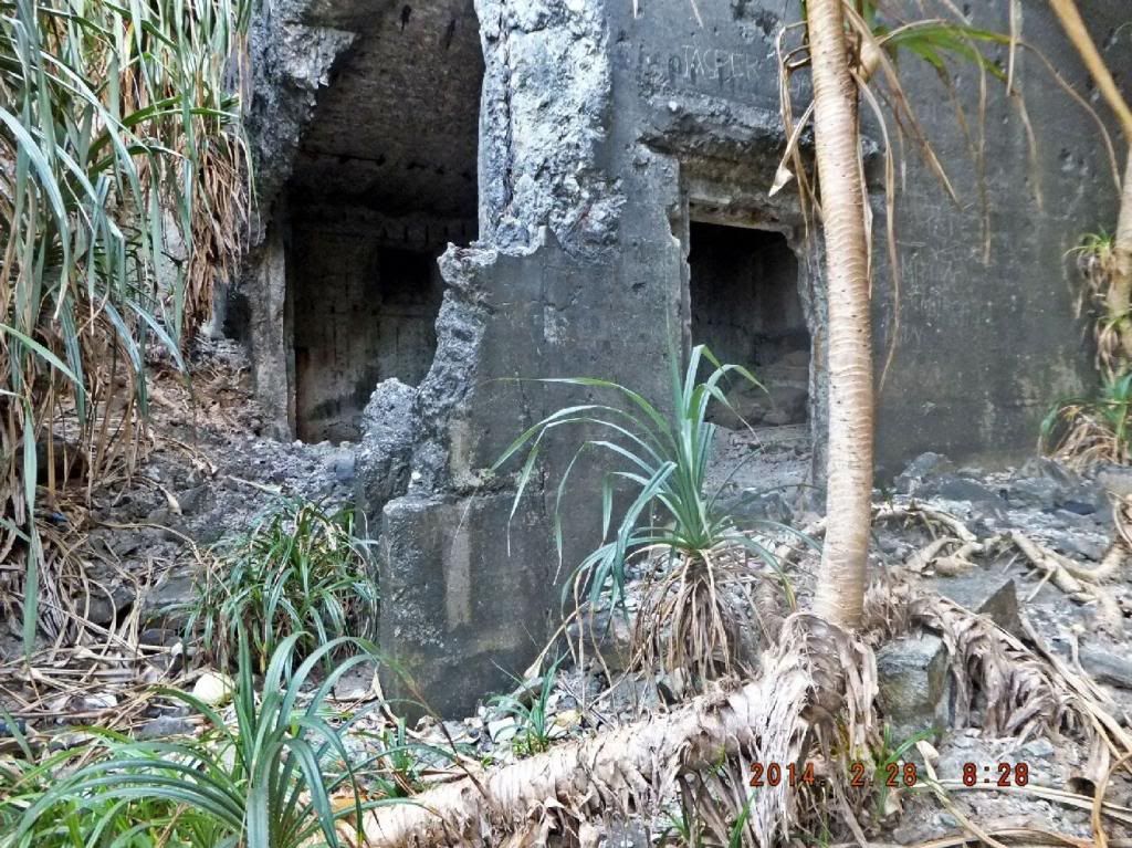 X129-- The CDSG landing party changed to dry cloth and shoes, took note of the wrecked ex Ft Frank water distilling plant and entered the ex fort. 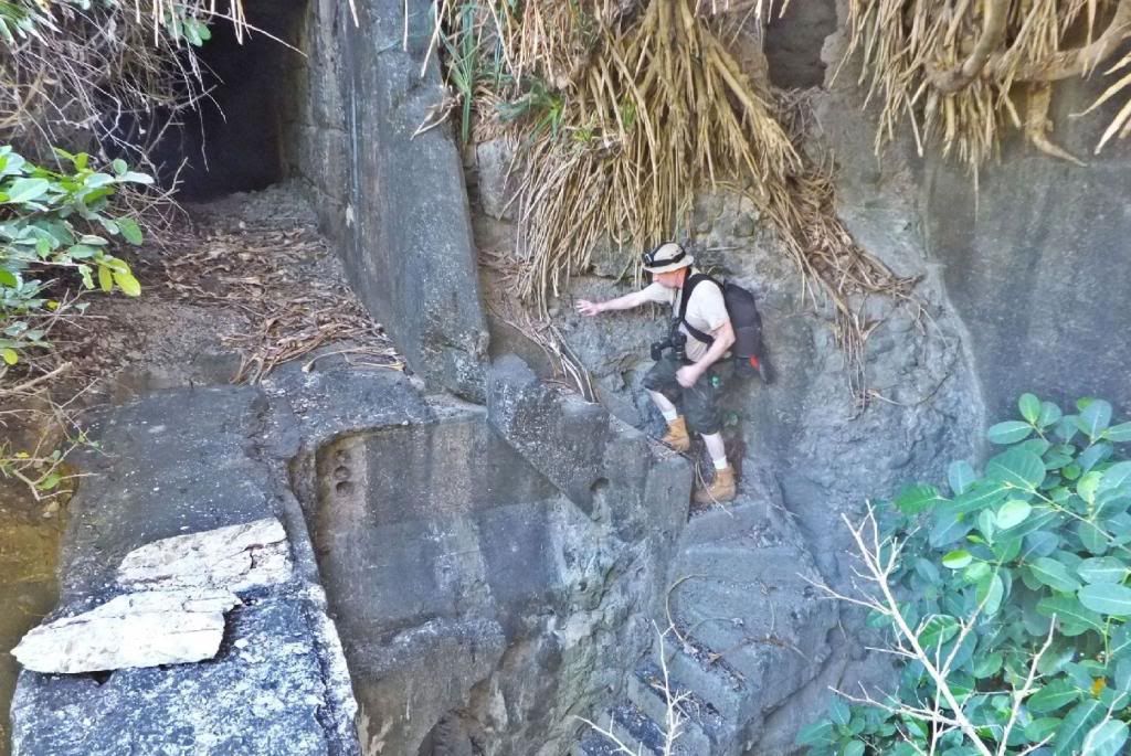 X122-- This shot shows the steps coming up from -The Wall- and the CDSG leader is in front. I shot this picture from the bridge-way from the main-body of the island to Battery Croften. I am standing at the Battery Croften entrance. 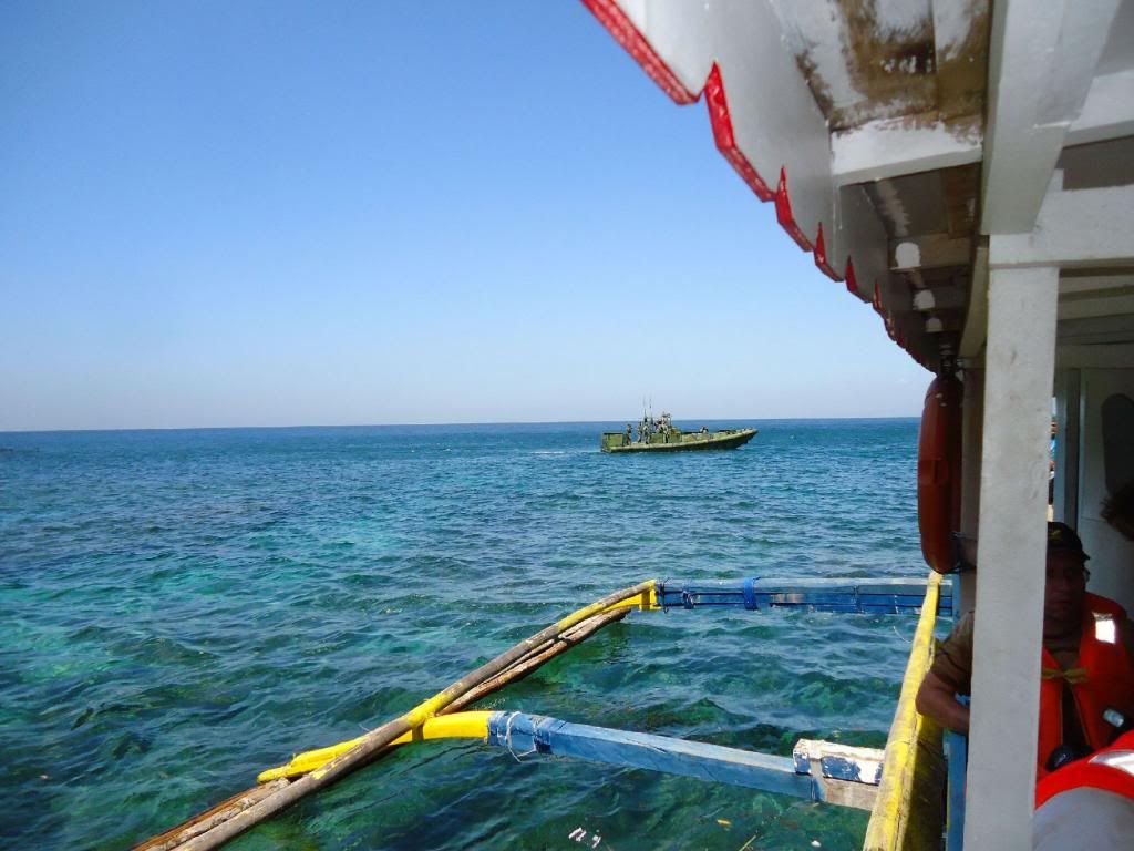 X131-- The Philippine Marine rubber patrol craft which probably discovered us and called the banca boat in to execute expelling us from the island. 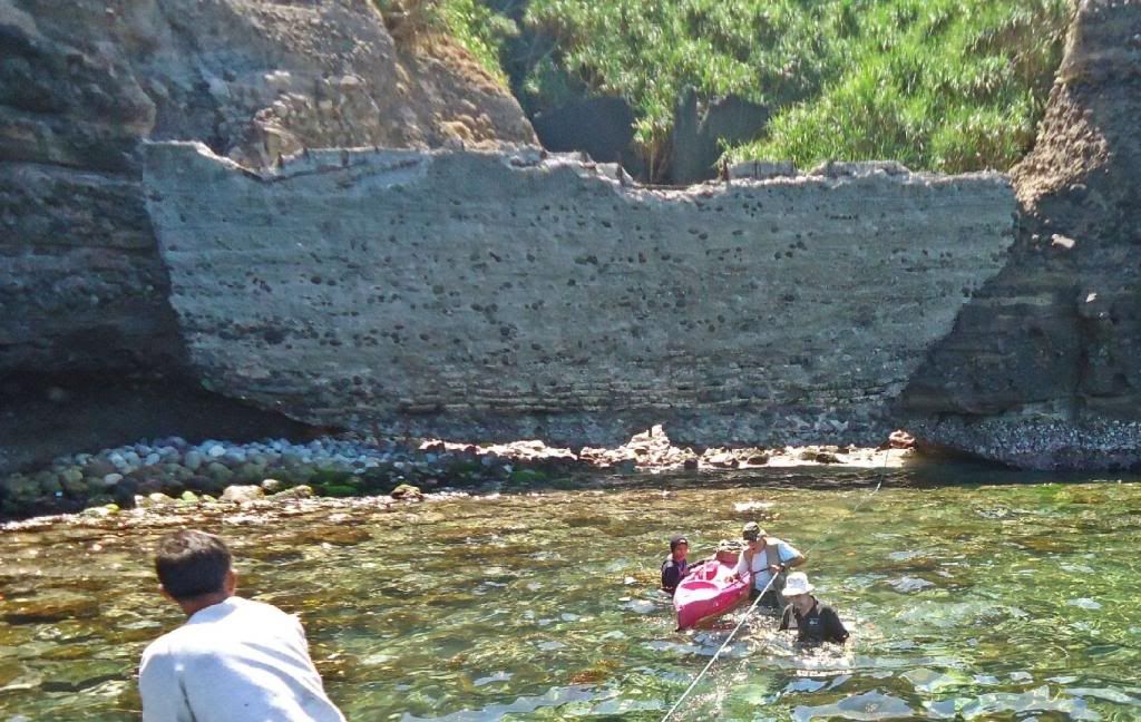 X132-- On Carabao Island, the ex Fort Frank, the last CDSG person is returning safely to the boat, the tide is up, the boat was further out and the kayak helped getting our gear back on board dry. In this picture one can clearly see the progress of the scrappers in undermining The Wall, west side of Carabao Island, the ex Ft. Frank. The whole length of the bottom of –The Wall- has been shipped away by the scrappers. 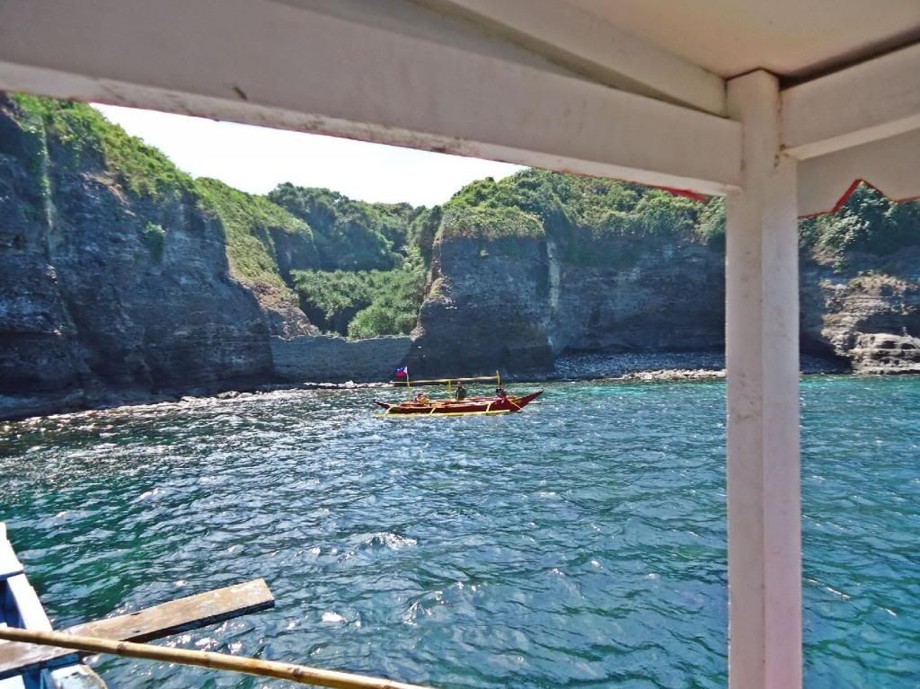 X133-- Good bye Carabao Island, the ex Ft. Frank, will we ever enter it again? What will happen to this historical Place now? The Military was in charge before and ALL THE GUNS DISAPPEARED FOREVER!!! 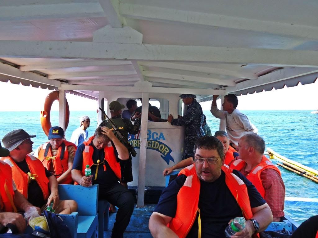 X134-- Disappointed and dejected after this experience we prepared to return to Corregidor. All the plans and the great expense coming here to the Philippines to see our proud joint history in the fight for Freedom was cut very short!!! 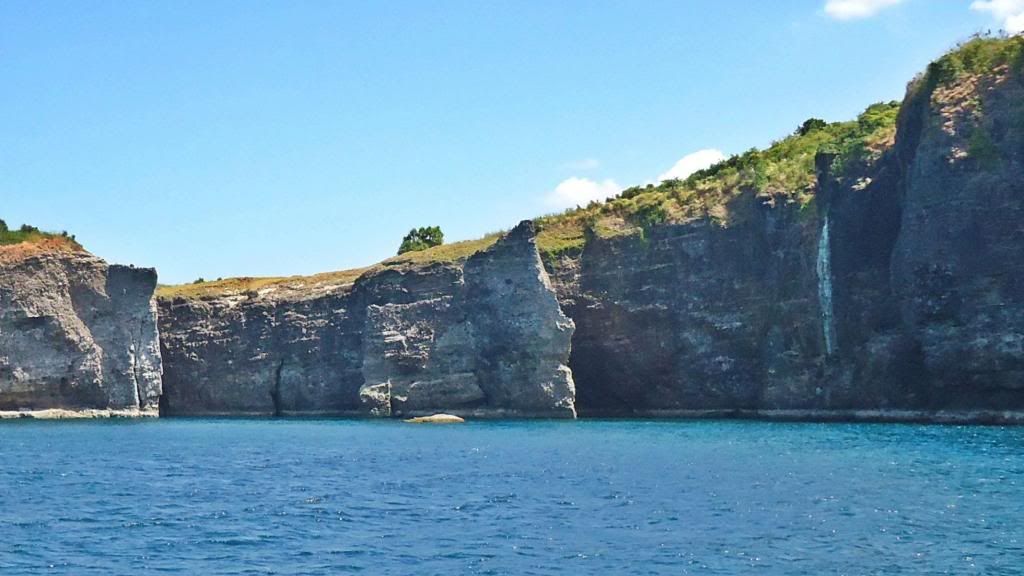 X135-- Looking at the west side of Carabao island, the ex Fort Frank. The high point at right is the location of Battery Greer, a single 14 inch US Army Costal Battery artillery piece. |
|


