|
|
Post by Karl Welteke on Mar 11, 2022 16:27:07 GMT 8
US Naval Station Olongapo Early 1900s These two early 1900 images of the US Naval Station of Olongapo and the large US Marine Corps Presence then, were sent to me by my US Marine (Ret) Friend Bert Caloud. If you are interested, these two and many more are in this album: philippine-sailor.net/usmc-earl-hancock-pete-ellis-u-s-m-c-photographs-olongapo-early-1900s-2nd-album/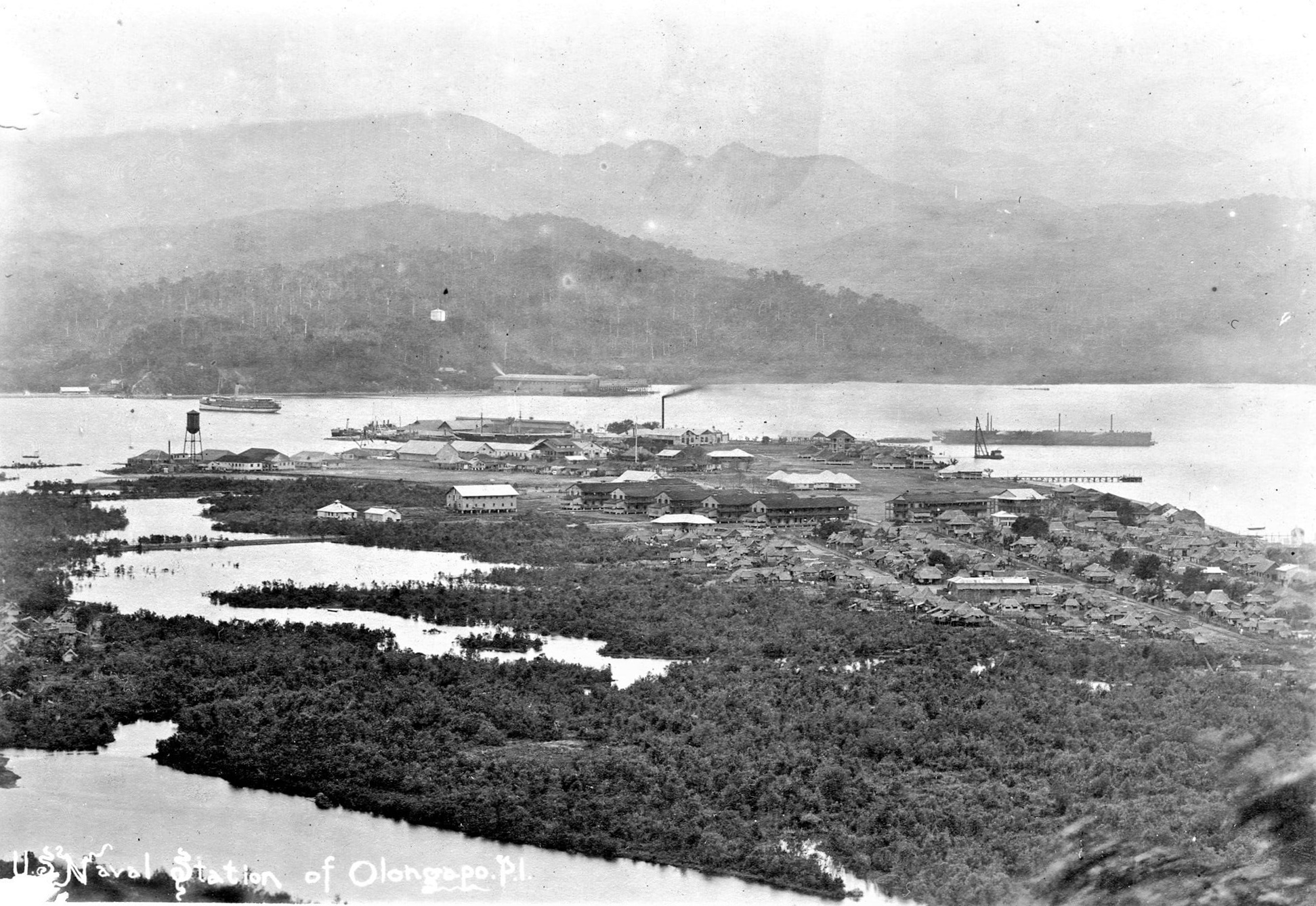 Zf570. This Naval Station of Olongapo picture in the early 1900s is in this album already but this one is much clearer. It seems to have been shot from the Kalaklan Ridge and it is much clearer and it seems to be zoomed in 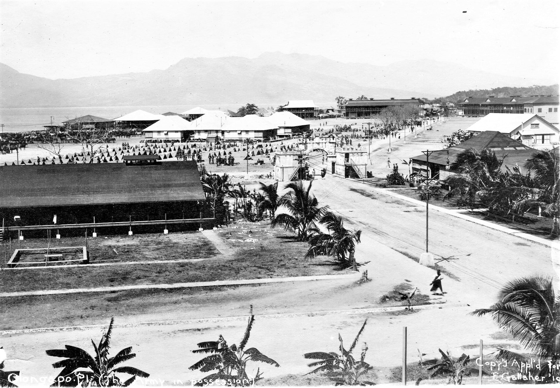 Zf571. This Naval Station of Olongapo picture in the early 1900s, I have not seen before. This picture really shows a large Marine Corps presence, look at all those tents and the horses at left. Or could it be that the Army came for a visit? Notice the Naval Station of Olongapo West Gate, now called the Spanish Gate. So, this picture shows clearly that the area outside the Spanish Gate was a US Marine Corps area. Those Two Story Buildings are Marine Corps Barracks. |
|
|
|
Post by Karl Welteke on Mar 24, 2022 13:26:20 GMT 8
Subic Bay News SUBIC BAY METROPOLITAN AUTHORITY News Archive from 2022-01-01 to 2022-12-31 A record of past and present news about Subic Bay. Click this URL www.mysubicbay.com.ph/news/2022Three sample images from the Subic Bay News:  U892. A contingent of the US Marine Corps arrived at the Subic Bay International Airport in preparation for Balikatan 2022 to begin next week. This is a Subic Bay 2022 News image.  U893. A large Subic Bay Freeport Zone images. This is a Subic Bay 2022 News image.  U894. This is smaller Subic Bay Freeport Zone images. This is a Subic Bay 2022 News image. |
|
|
|
Post by Karl Welteke on Apr 5, 2022 13:35:39 GMT 8
SBMA inspects the on-going construction of Magsaysay Bridge. 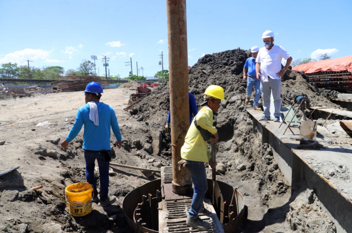 Zf640. SBMA Chairman and Administrator Rolen C. Paulino (in white polo shirt) inspects the on-going construction of Magsaysay Bridge which links the city of Olongapo and the Subic Bay Freeport zone on Friday, March 25. He urged the contractors to expedite the construction of the said bridge as it delays the development of the Subic Bay Freeport Zone. We called that bridge and I still do: “The Main Gate Bridge”. During our time that was the only way to Magsaysay Drive in Olongapo City and that was a top priority for many of us Marines and Sailors when Liberty Call went down. This construction of a new bridge to replace it has been dragging on at least 2 years, I believe. The new SBMA Chairman had a look, so the Subic News Link says, this is the URL, click here: subicnewslink.blogspot.com/2022/03/look-sbma-chairman-inspects-magsaysay.htmlIn the previous page (page 22) of this thread, the Main Gate Bridge or Magsaysay Bridge is shown several times and shows the slow progress of the construction. |
|
|
|
Post by Karl Welteke on Jun 22, 2022 18:23:44 GMT 8
The new Subic Bay Fire Station The new SBFZ Fire Station (on the former Subic Bay Naval Station) is inaugurated. The former Subic Bay Naval Base Fire Station was rebuilt at the now Subic Bay Freeport Zone (SBFZ) by the Metropolitan Authority (SBMA) in 2022. On the 20th June 2022, I drove by and it was inaugurated this date. I took these 6 images, plus the Google Earth map is provided. Award certificates were also handed out and in one picture we can see the Spanish Gate. For this presentation I chose only 4 images! 18 images have been uploaded into this album in my webpage (It contains 2 old Naval Station maps which can be downloaded in high resolution. 7 images are of the inauguration and 11 images are of the station how it looked in 2013. This is the URL: philippine-sailor.net/the-new-subic-bay-fire-station/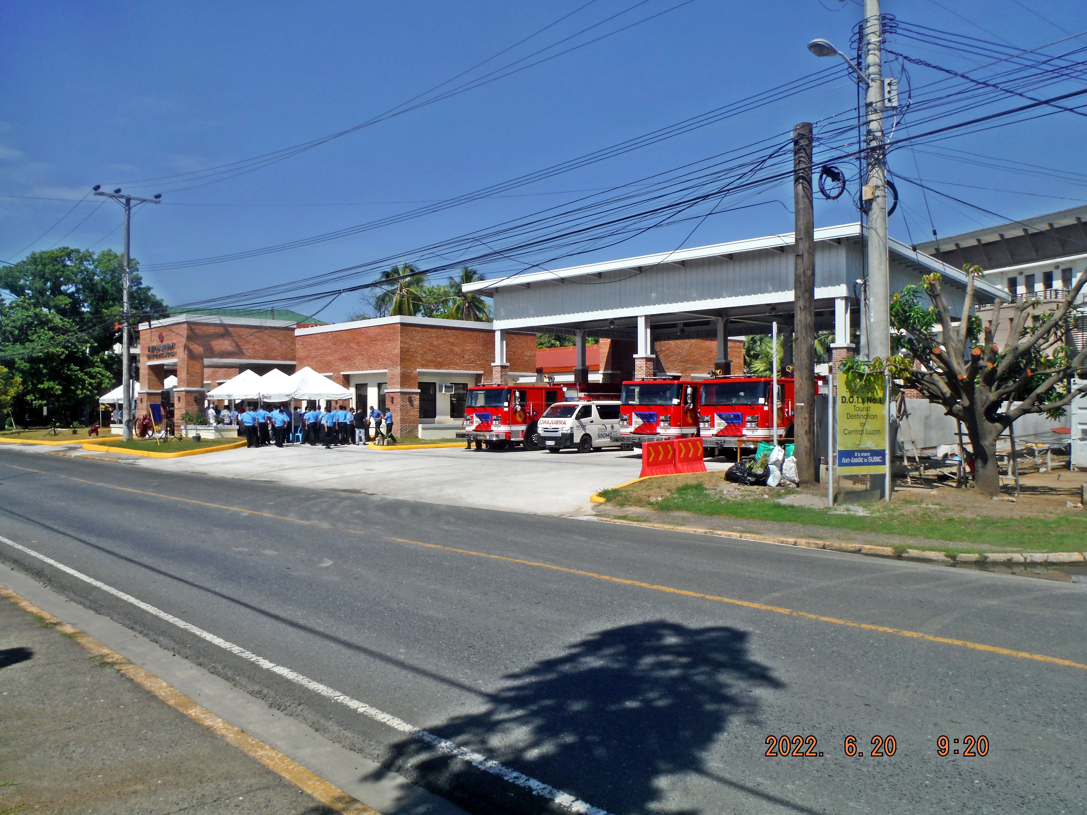 This is one of 7 images of the inauguration of the newly rebuilt Subic Bay Freeport Zone Fire Station on the 20th June 2022. 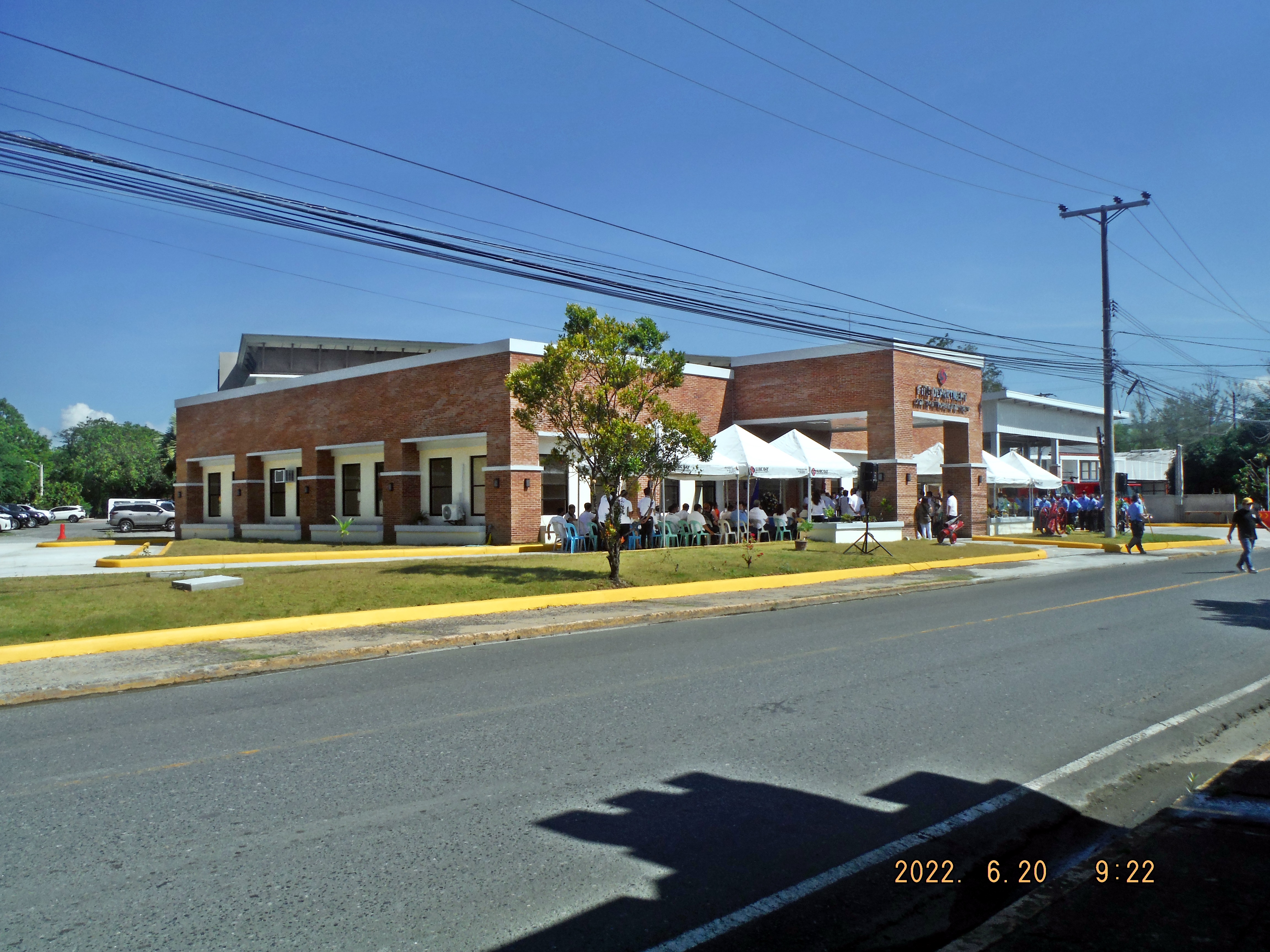 This is one of 7 images of the inauguration of the newly rebuilt Subic Bay Freeport Zone Fire Station on the 20th June 2022. For your orientation, this is how the fire Station looked like on the 26th Dec 2013.  This is on of 11 images of the Subic Bay Freeport Zone Fire Station on the 26th Dec. 2013. This was the original Fire Station of the former Subic Bay Naval Station. These pictures were shot going around the fire station counter clock wise. A 1985 Subic Bay Naval Station map and the area map of the former naval station in the fire station as of 2013 is provided. At the proper location a link is provided to down load them in high resolution. Note a large hotel exist now where the MWR had a large building for vehicles, I think. 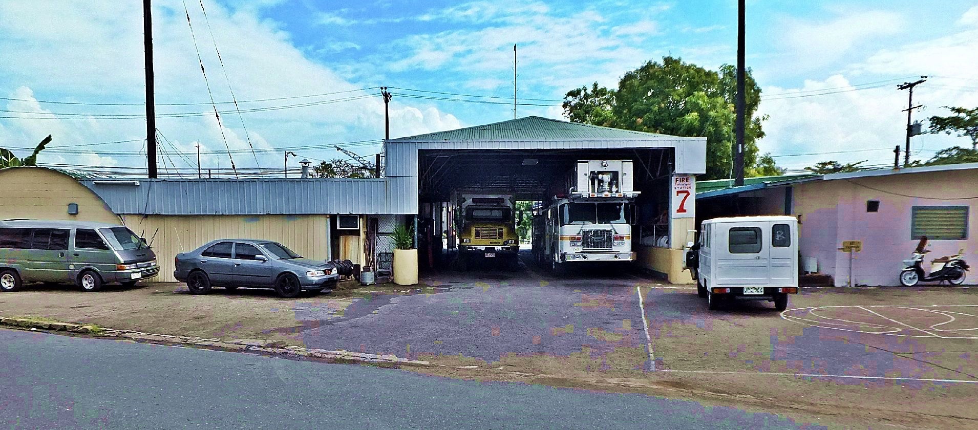 This is on of 11 images of the Subic Bay Freeport Zone Fire Station on the 26th Dec. 2013. This was the original Fire Station of the former Subic Bay Naval Station. These pictures were shot going around the fire station counter clock wise. A 1985 Subic Bay Naval Station map and the area map of the former naval station in the fire station as of 2013 is provided. At the proper location a link is provided to down load them in high resolution. Note a large hotel exist now where the MWR had a large building for vehicles, I think. |
|
|
|
Post by Karl Welteke on Jun 29, 2022 18:37:29 GMT 8
Olongapo 4th July 1919 Victory Parade Eight images about Olongapo on the Subic Bay Naval Reservation in 1919 of a victory Parade on the 4th of July 1919. Olongapo, then, was located just west of the Spanish Gate of the Navy Yard, Olongapo Naval Station. These pictures were provided by the MacArthur Memorial in Norfolk, Virginia. This collection is from a former Santo Tomas internee, Jane Frederickson; nee Doner. Her collection is now Record Group-173. In the collection were photocopies of those photos. No photographs, just the photocopies, the MacArthur Memorial doesn’t know where she got the originals, she copied them from. Hopefully somewhere in the collection there will be an explanation. These 8 images have been uploaded in high resolution into this Flickr album: Uploaded to Flickr Subic Bay Historic Collection, to the album Subic Bay Historic Images in high resolution: www.flickr.com/photos/44567569@N00/sets/72157647790469238/For this notice, I chose only 2 images: 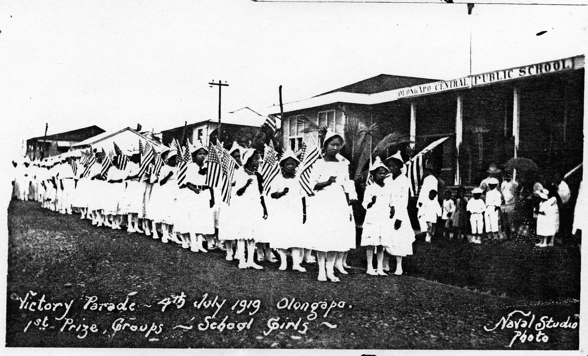 Zf682. This is one of 8 Eight images about Olongapo on the Subic Bay Naval Reservation in 1919 of a victory Parade on the 4th of July 1919. Olongapo, then, was located just west of the Spanish Gate of the Navy Yard, Olongapo Naval Station. These pictures were provided by the MacArthur Memorial in Norfolk, Virginia. 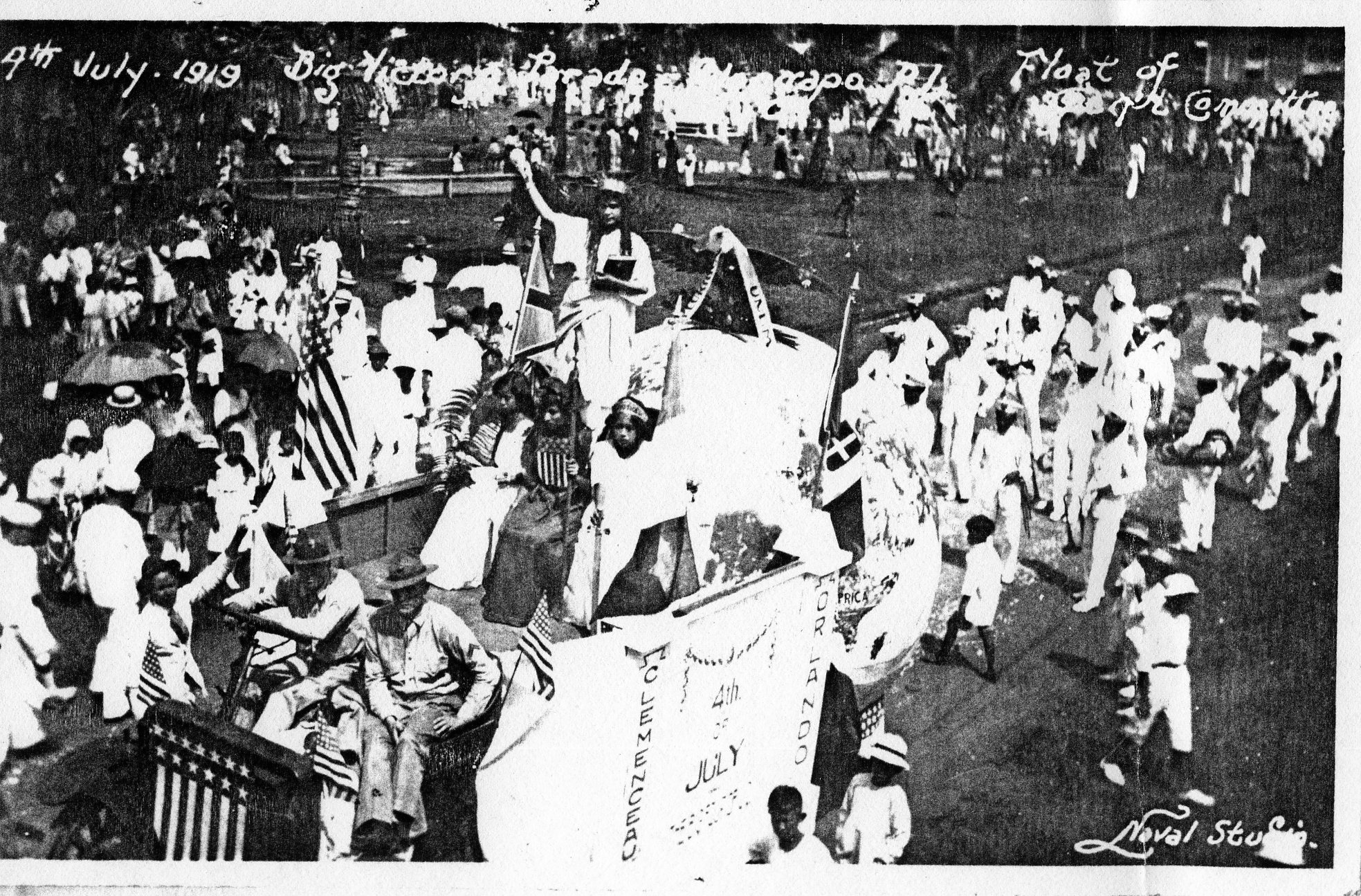 Zf683. This is one of 8 Eight images about Olongapo on the Subic Bay Naval Reservation in 1919 of a victory Parade on the 4th of July 1919. Olongapo, then, was located just west of the Spanish Gate of the Navy Yard, Olongapo Naval Station. These pictures were provided by the MacArthur Memorial in Norfolk, Virginia. |
|
|
|
Post by Karl Welteke on Jul 29, 2022 9:44:57 GMT 8
Ex Hanjin Gate & Beach Area, 2022-07-28 Drove to the ex Hanjin Gate area to explore changes and make a contact with a boat to explore further up the coast in the future, accomplished the goals. Found 3 busses parked and about 4 trucks waiting to go inside for pick-ups. Looked at a quarry not far from the gate, outside the gate, below the quarry and all the way about 8/10 of a Km, the whole area is restricted, no squatters, none, nobody, many guards. Further north I found plenty of boats to hire and arranged transportation for next week. WARNING! There are too many pictures (about 120), so I advice you don’t open the album less you are really interested in this area: app.photobucket.com/u/PI-Sailor/a/3eb3f6a1-b480-45e6-bbba-2259282957a0 I find all my walks interesting, I enjoy the countryside and like to mingle with the people. The pictures are divided into 10 groups of pictures and for this presentation I chose only 3 sample pictures but I leave the descriptions for all 10 groups stay. There is another option of look at a sample picture from the 10 groups in my Facebook presentation if interested: Uploaded to my Facebook and shared with: WESTPAC Sailor, SBH3, NAVSTA and The Raging Main. www.facebook.com/karlwilhelm.welteke/posts/pfbid0kaz1fAa2WwgdEK2GEjvo4BztboNbV7Y1TDmUFkQ3zjDejm6ZNW4rRi41L8NarfZbl One of 5 images at the ex Hanjin Shipyard gate area, saw busses which bring workers, saw trucks waiting to go inside to pick up things, saw women at the start of the Agusuhin Valley trail, waiting for friends with a horse which arrived just then. My car was parked at that spot. The picture of the gate is blurred but you get the idea how it looks and that it is guarded and didn’t let me in. 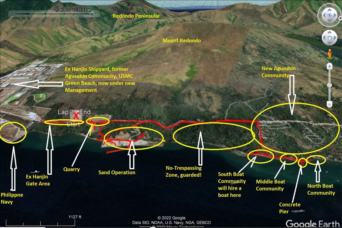 One of 8 images with data of my walk to explore the area around the ex Hanjin Shipyard with my GPS, data, Google Earth images of the area. One of 15 images of the quarry near the ex Hanjin Shipyard gate, it occupies both side of the Hanjin Road. It is active and it seems some infrastructure work is going on. 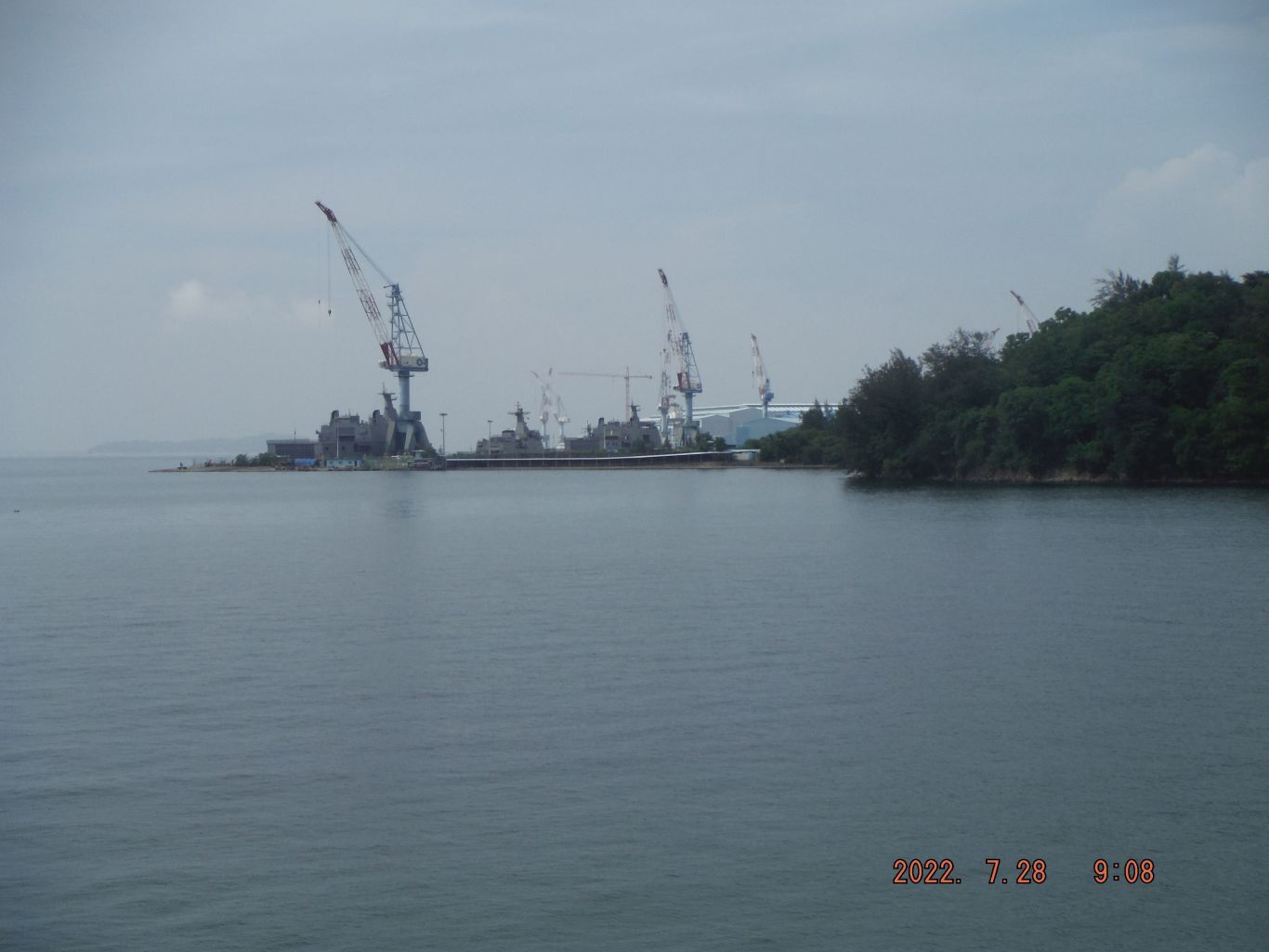 One of three images of the NE corner of the ex Hanjin Shipyard, the Philippine Navy has moved in. I can make out one of the new type of landing craft built on the model of the old Navy LCU, Landing Craft Utility but this is a ship now and is much larger than the LCU. I suspect the many POVs (Privately Owned Vehicles) I saw on the Hanjin Road, coming and going, are connected to the Philippine Navy there. One of 38 images of the Seafront Sand Operation, at the NW corner of the venue is a water hole. This sand operation has a pier and other facilities. One of 12 images of an area between the sand operation place and the first and south boat community, it is guarded, and has many No Trespassing signs and boundary marker flags, at one end, along the Hanjin Road, was a nipa guard shack and an old couple came to the highway to get a LPG tank from the relocated Agusuhin Village. The area is about 0.6 km long at the beach and about 0.8 Km long along the road stretch. In this area is also the 3rd Bridge of the Hanjin Road. It seems POV travel has picked up and I took one picture with a POV. This is one of 12 images of the point where I descended to the beach which is the south end of the new Agusuhin. I made a deal with a family to boat me to the next valley, the south one of the former Hanjin Shipyard for next week. South of this boat community is the No-Trespassing Zone. 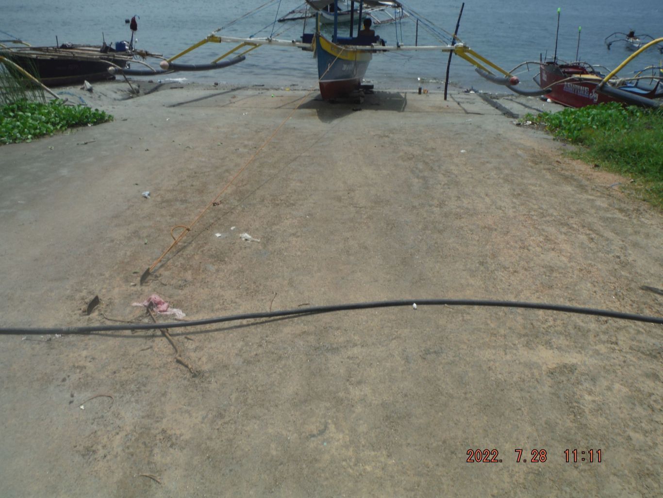 This is one of 10 images of the 2nd boat community I visited today but I did not reach the former Gains Beach. I have walked along this beach 2 decades ago and it was easier then. Now there are a lot more people here and many built fences which made it difficult to walk along the beach. Another noteworthy thing is the most of the boats now use plastic tubes as boat outriggers now. This section has a long and wide concrete boat launching ramp or the ramp was for loading or off-loading of landing crafts. It may have been built in WWII but I don’t know. This is one of 4 images of the 3rd boat community I visited today; I actually only got to the south end of this community. Again fences made it difficult so I turned back. And again I did not reach the former Gains Beach which in WWII, 1945, was a Submarine Base. Notice there is a concrete pier between the Middle and the north boat communities. This is one of 11 images of a concrete pier between, what I call the Middle and North Boat Communities. Perhaps the pier has been hear about 15 years but I don’t who built it or for what purpose. Some of the pictures were shot in a round way, clockwise from left to right. A large house stands at the end of the pier and its fences made walking a problem. But I just do what the natives do, I go where they go. |
|
|
|
Post by Karl Welteke on Aug 7, 2022 18:00:22 GMT 8
Agila Subic Yard, ex Hanjin 2022-08-03 After all the recent news about the former Hanjin Shipyard in Subic Bay, I wanted to have a closer look. This yard is now called the Agila Subic. I rented a boat at the north side of the yard and drove to the south side and climbed up the ridge south of the yard. I took pictures of this trip and share them here. Except for the Philippine Navy having started their new NOB Subic Base, I did not see any real activities except a small cluster of automobiles at the south end. The boat drive distance, one way, was 5.63 Km! Uploaded 10 images to my Facebook for a short presentation and shared with: Naval Station, SBH3, WESTPAC Sailor, Subic Bay Expats. www.facebook.com/karlwilhelm.welteke/posts/pfbid06itA4YHG1bKUnw71VZRGjhD8p4tSWs7kYRkwEYsde3bvpEPvTaxR1PA8N15ADJQ9l30 pictures were uploaded to this Flickr album in high resolution, if you are interested: www.flickr.com/photos/44567569@N00/albums/72177720301113847For this forum presentation I chose these 5 images!  220803b. One of 2 images of my GPS track and elevation graph, going up the ridge south of the Agila Subic Yard, ex Hanjin.  220803c. One of several images of the Agila Subic Yard waterfront, ex Hanjin, north to south.  220803d. One of several images of the Agila Subic Yard waterfront, ex Hanjin south end.  220803e. One of several images of the Agila Subic Yard, ex Hanjin, from a ridgeline.  220803e. One of several images of the Agila Subic Yard, ex Hanjin, from a ridgeline. |
|
|
|
Post by Karl Welteke on Aug 10, 2022 19:53:36 GMT 8
Kinabuksan Valley, around Agila Yard Trip 3rd Aug. 22. On this trip I actually created 5 albums but I only posted the Philippine Naval Base and the Agila Subic Yard so far. So, I created a 6th album, this one, with only a few select images (31 pics) of the other three albums. This is the URL in my Flickr account; the pics are in a higher resolution: www.flickr.com/photos/44567569@N00/albums/72177720301144954This is a story of two valleys and a ridge between them, on the Redondo Peninsular; they only can be visited by boat. The Redondo Peninsular separates the bay of Subic Bay from the West Philippine Sea (Called the South China Sea internationally). In the Agusuhin Valley, which was the USMC Green Beach training facility, then the area was used to build an oil platform. But then the people got removed and resettled so Hanjin could build its shipyard. The Kinabuksan Valley is still lovely but how much longer? Only 3 sample images were chosen for this forum presentation with these descriptions: 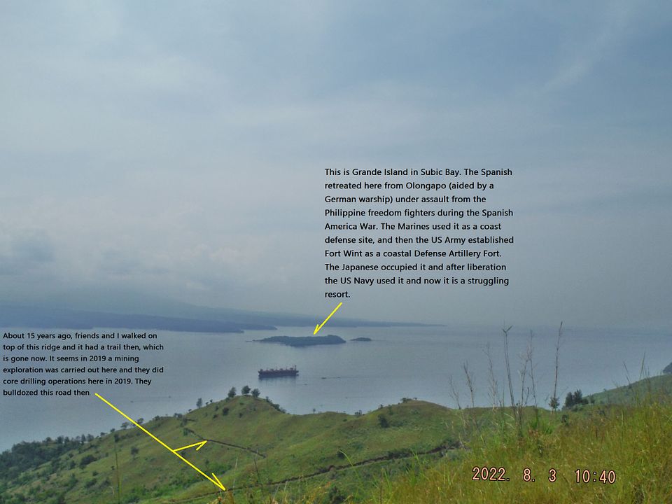 Z001. (11) 220803 Kinabuksan-Agila Subic Ridge 03. This is one of 5 images of my walk up the forked ridge between the Agusuhin Valley where the Agila Subic Yard is now and the Kinabuksan Valley. A guide helped me find the way and stayed with me. We used a new road cut into this ridge for a mine exploration in 2019. We came across 3 markers (one is shown here) where core drilling operations were conducted. This operation seems to have been conducted by the Mega Philippine Inc. according to those markers. 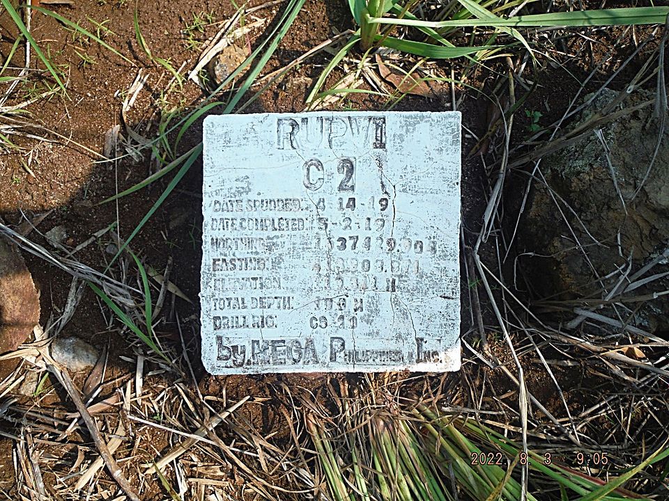 Z002. (12) 220803 Kinabuksan-Agila Subic Ridge 03. This is one of 5 images of my walk up the forked ridge between the Agusuhin Valley where the Agila Subic Yard is now and the Kinabuksan Valley. A guide helped me find the way and stayed with me. We used a new road cut into this ridge for a mine exploration in 2019. We came across 3 markers (one is shown here) where core drilling operations were conducted. This operation seems to have been conducted by the Mega Philippine Inc. according to those markers. 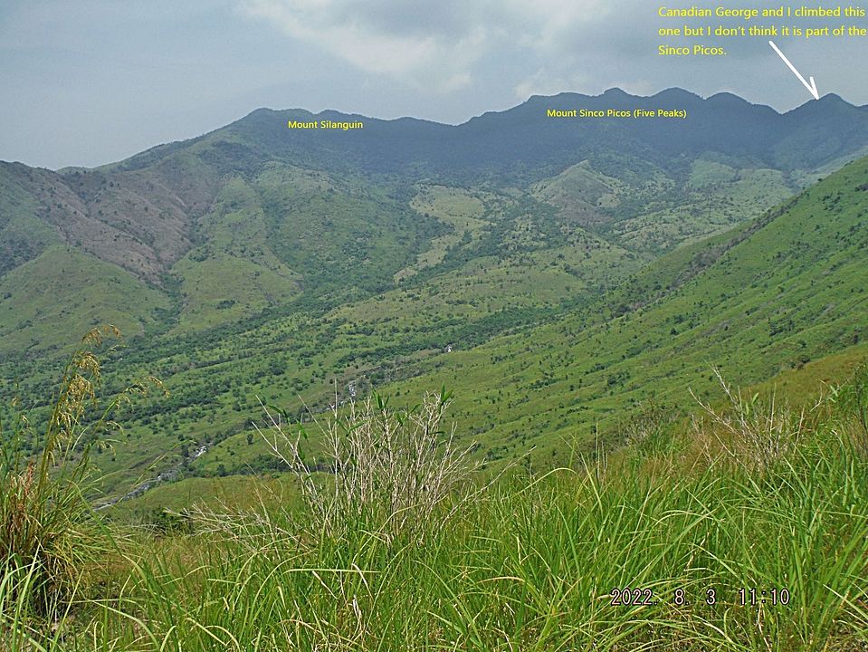 Z003. (14) 220803b Kinabuksan, Agila, G.E., my GPS track. This is one of 5 images on top and from the forked ridge between the Agusuhin Valley where the Agila Subic Yard is now and the Kinabuksan Valley. The first pic is the map with my GPS track. The 5th pic shows our descend from this ridge. The other three pics show the Kinabuksan Valley, Mount Silanguin and Mount Cinco Picos (Five Peaks). The Agusuhin Valley, where the Agila Subic Yard (ex Hanjin) is now, used to look like that. |
|
|
|
Post by Karl Welteke on Aug 14, 2022 16:31:16 GMT 8
Karl’s This and That Picture (Subic Bay 2022) Cleaned up one of my folders of pictures to be named, filed etc. Decided to post them and write a description. I uploaded 17 images into two venues, take your pick: Uploaded to my Photobucket account, Philippines including my walks, No 2 Phil. Events by year, 2022 OC, BB, Zam. Ctc. app.photobucket.com/u/PI-Sailor/a/59305549-7baf-4a04-96bf-5143cb6cb10eUploaded to my Facebook and shared with: NAVSTA SUBIC, Association of Military Divers, Barrio Barretto Bars etc, Subic Bay Expats www.facebook.com/karlwilhelm.welteke/posts/pfbid02QqvWBg4uvSgFjibC9zMDTTkNf4Ez2fZvdywWNJNaCNMWfkRfcAoB8PRTtYH2hNNwlFor this forum presentation I chose these 4 images! 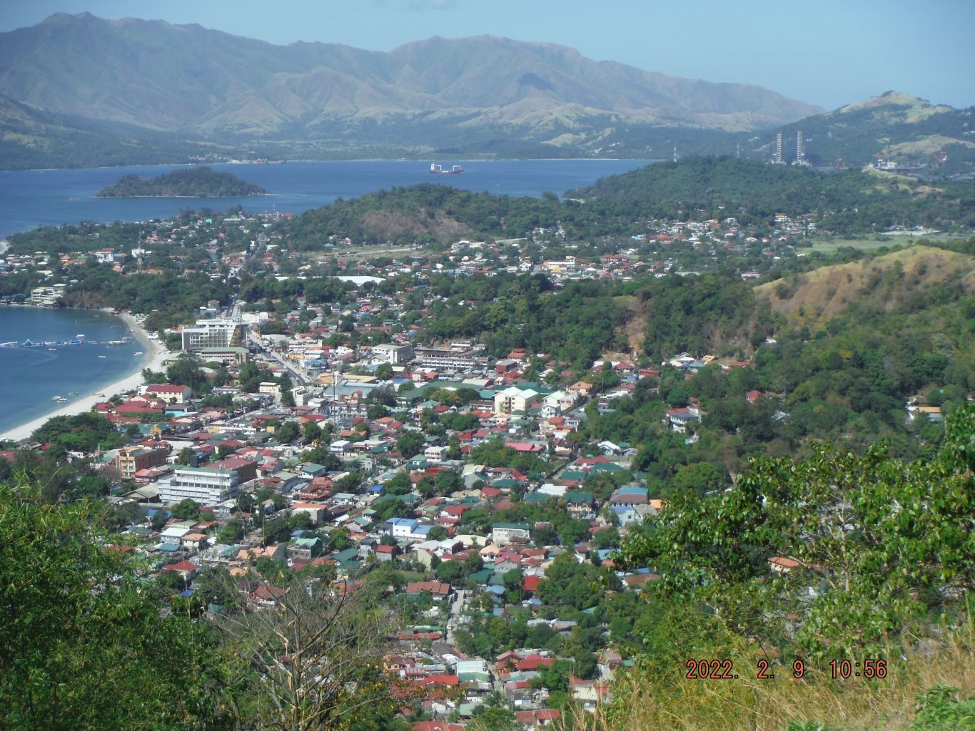 A view of Barrio Barretto from Kalaklan Ridge, hard to believe it was a rifle range until WWII and a Naval Supply Depot in 1945 and remained so maybe until 1958. 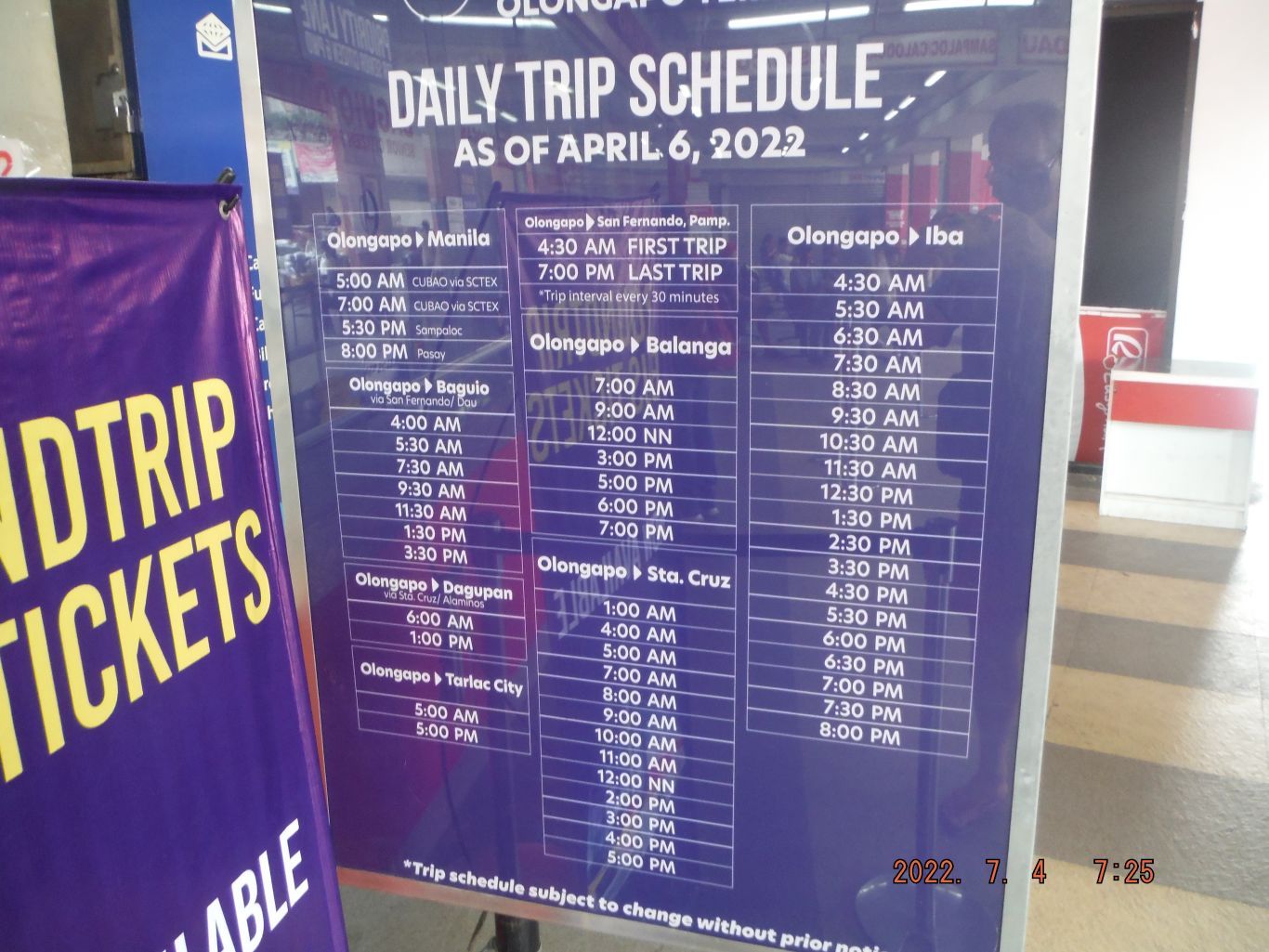 The new Victory Liner bus schedule. It has increased destination and frequency as the virus from Red China is reduced in its terror capacity. 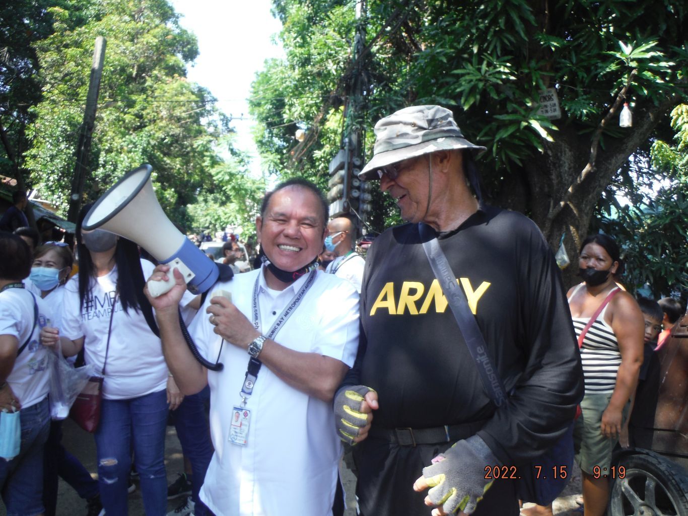 I walk a lot, this day with my friend Alan. We met the Chairman of the Subic Bay Freeport Zone (SBFZ) Mr. Rolen Paulino, he was handing out rice to residents on Abra Street in Barrio Barretto. I asked him for a picture, he agreed. I also asked him about the delay of the Main gate bridge replacement in the SBFZ, our old Naval Base. He said something will move soon! Why do I have an Army shirt on? It is a good shirt for hiking and the soldiers are my brothers, proud to wear that shirt! 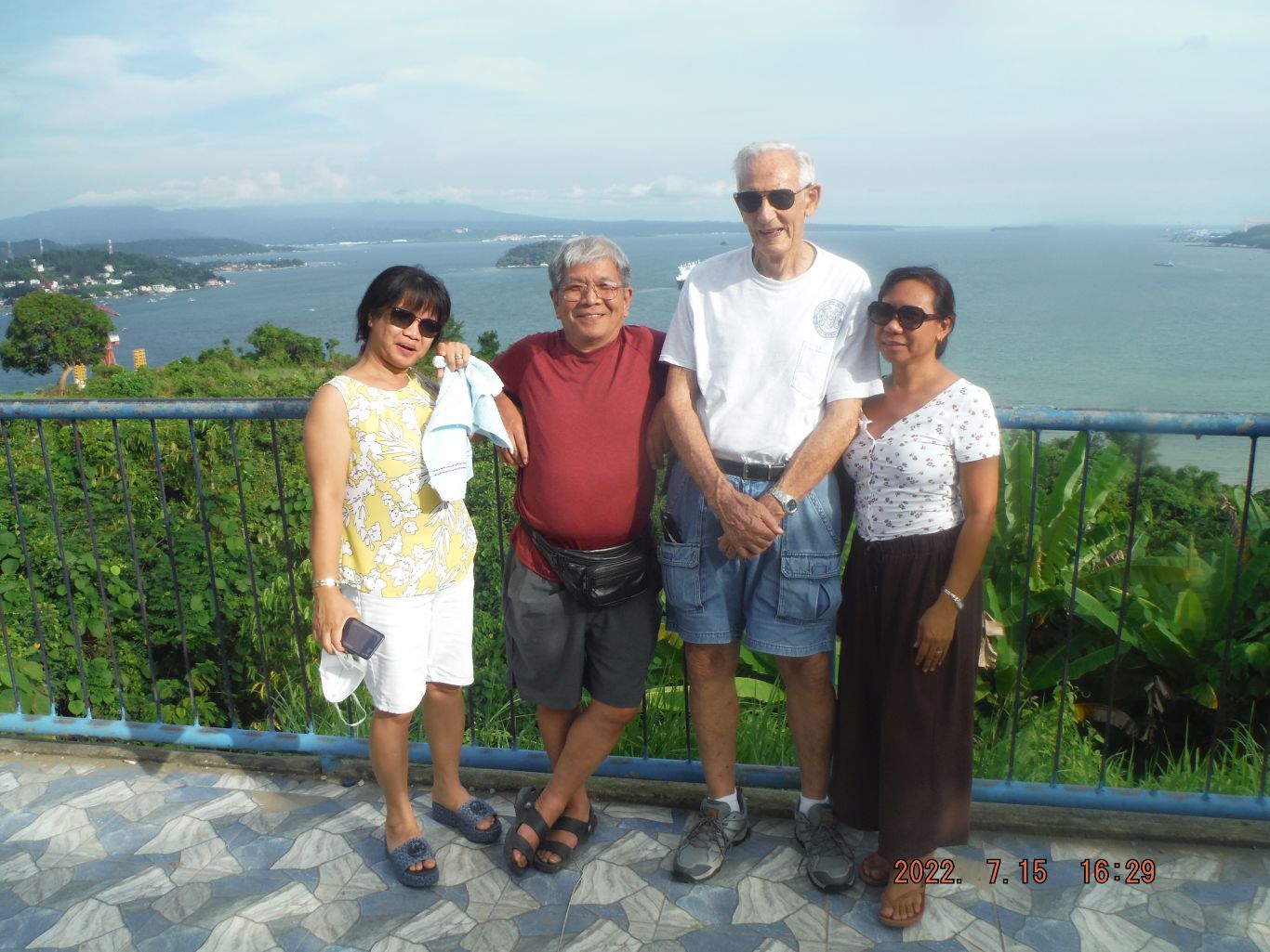 Since the virus from Red China is in retreat visitors are returning to the Philippines. This is one of 4 images of my friend Bill ENCM MDV, we go back to our first meet in Viet Nam in 1966 when we cleared a spot in the Da Nang river of a WWII wreck for the German Hospital Ship Helgoland. And my friend Alan, who is a retired Navy Store Keeper (SK). We all served on the USS Beaufort ATS-2. These 4 pictures were shot from a view deck overlooking the bay of Subic Bay from the north end. |
|
|
|
Post by Karl Welteke on Nov 25, 2022 13:51:54 GMT 8
SBFZ Perimeter Walk 22-11-22 SBFZ is the former Subic Bay Naval Base I parked in New Cabalan in the area of the Olongapo Landfill, walked to and thru the SBFZ Fence; then all the way to the Pastolan Rd. On the way checked out a new road and gate to the new massive Taiwan Investment, the road/trail to Tipo. Climbed a rock hill just past the Bangal Gate and then came back. I posted and shared many pictures in these 3 venues: Uploaded 24 images, a small album for this walk into my webpage, Subic Bay, Subic Bay No.1 Group: philippine-sailor.net/sbfz-perimeter-walk-22-11-22/Uploaded to my FB as a new album, 24 images, and shared with: WESTPAC SAILOR, RUMP, Subic Bay Expats, I remember Subic Bay Naval Station, www.facebook.com/media/set/?set=a.10224992775120282&type=3Uploaded to Photobucket, 92 images, Philippines including my walks, Zambales albums, SBFZ ex Naval Base Subic Bay, SBFZ 2020 to 2024: app.photobucket.com/u/PI-Sailor/a/a0a41871-b56d-49d2-bd38-e4a486be284eFor this forum presentation I chose these 10 images but I let stand, the descriptions I used, for the Photobucket album: 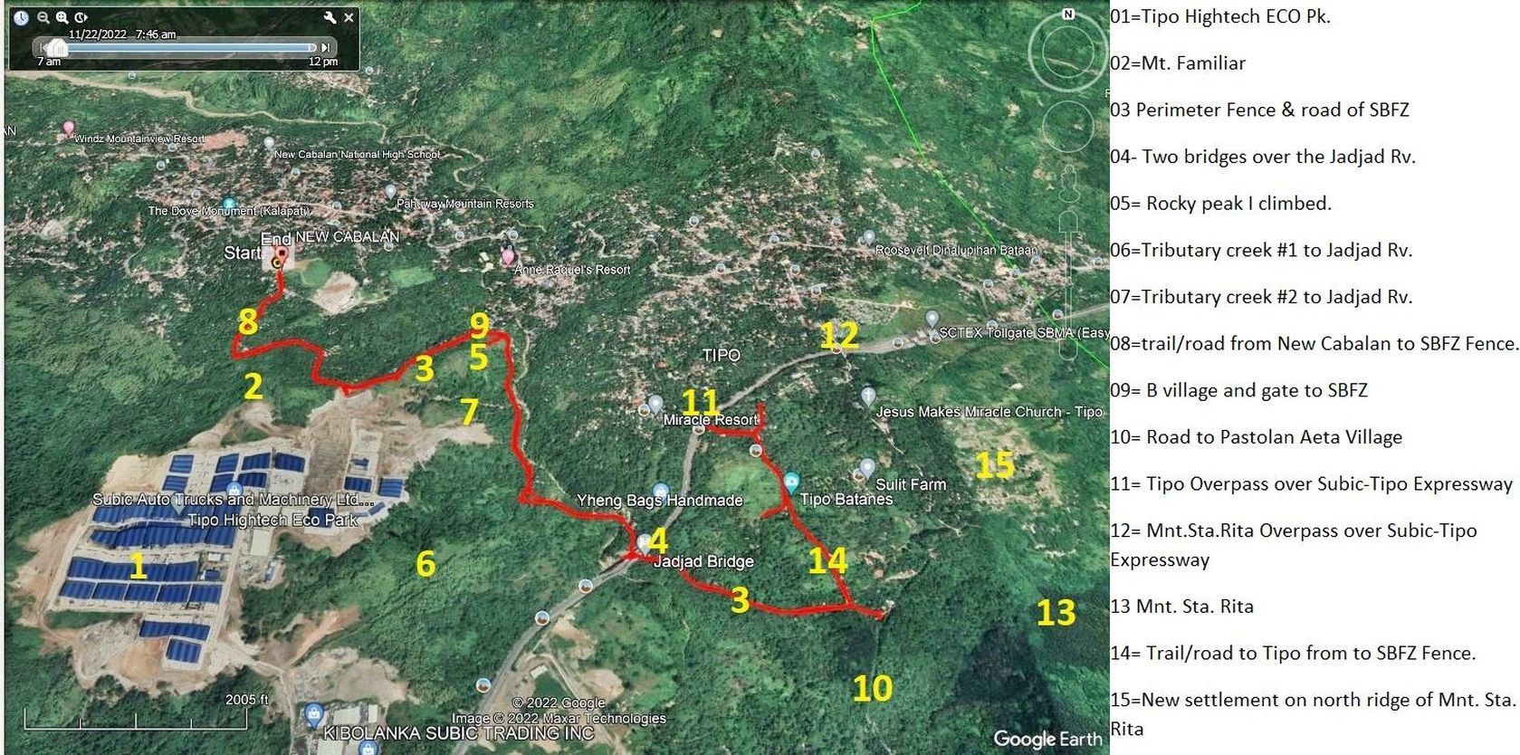 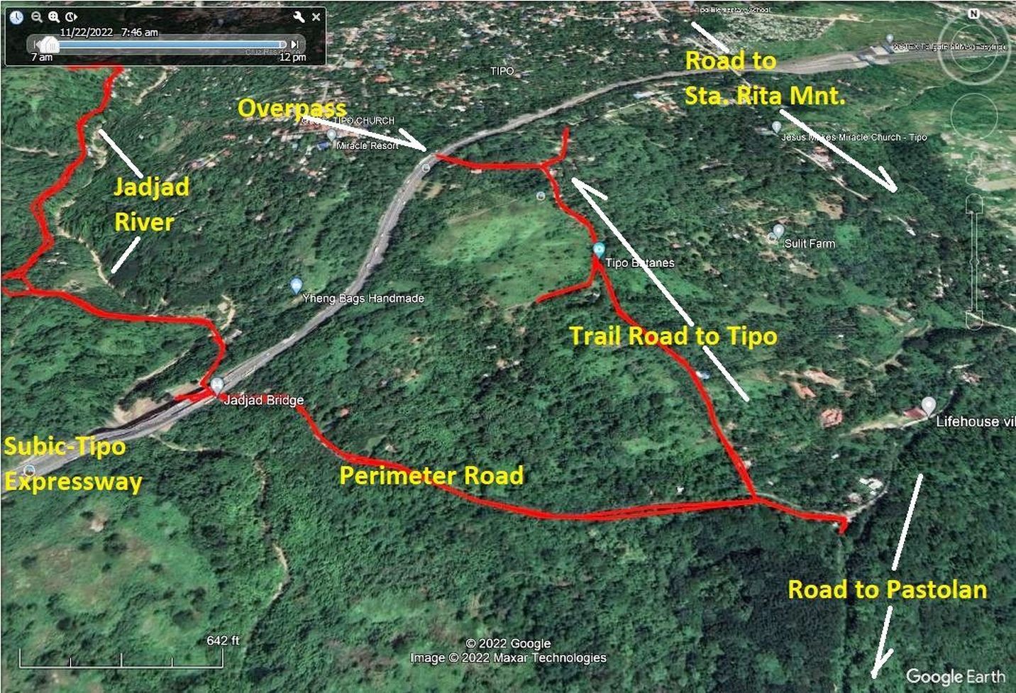 Pictures #000 to 009 show my GPS Track, maps and other data of this walk. I marked important landmarks onto the Google Earth images. Pictures #010 to 016 show the first section along the perimeter road from where I entered thru the SBFZ Perimeter Fence in New Cabalan. The new and massive Tipo Hightech ECO Park is cutting a new access road, apparently from the SBFZ Perimeter Road, not too far from the Brgy. Bangal open gate. We have a view of Sta. Rita Mountain in the clouds and the PLDT Mountain with all the communication towers. There are also views of the Tipo Hightech ECO Park and what I call the Tributary creek #2 to the Jadjad Rv. Pictures #017 to 028 are images of my walk/climb up the rocky hill and views from it. We see views of the rocky hill, PLDT Mountain, the peaks we see from Olongapo, very far from here. We see images of Brgy. New Cabalan Bangal. 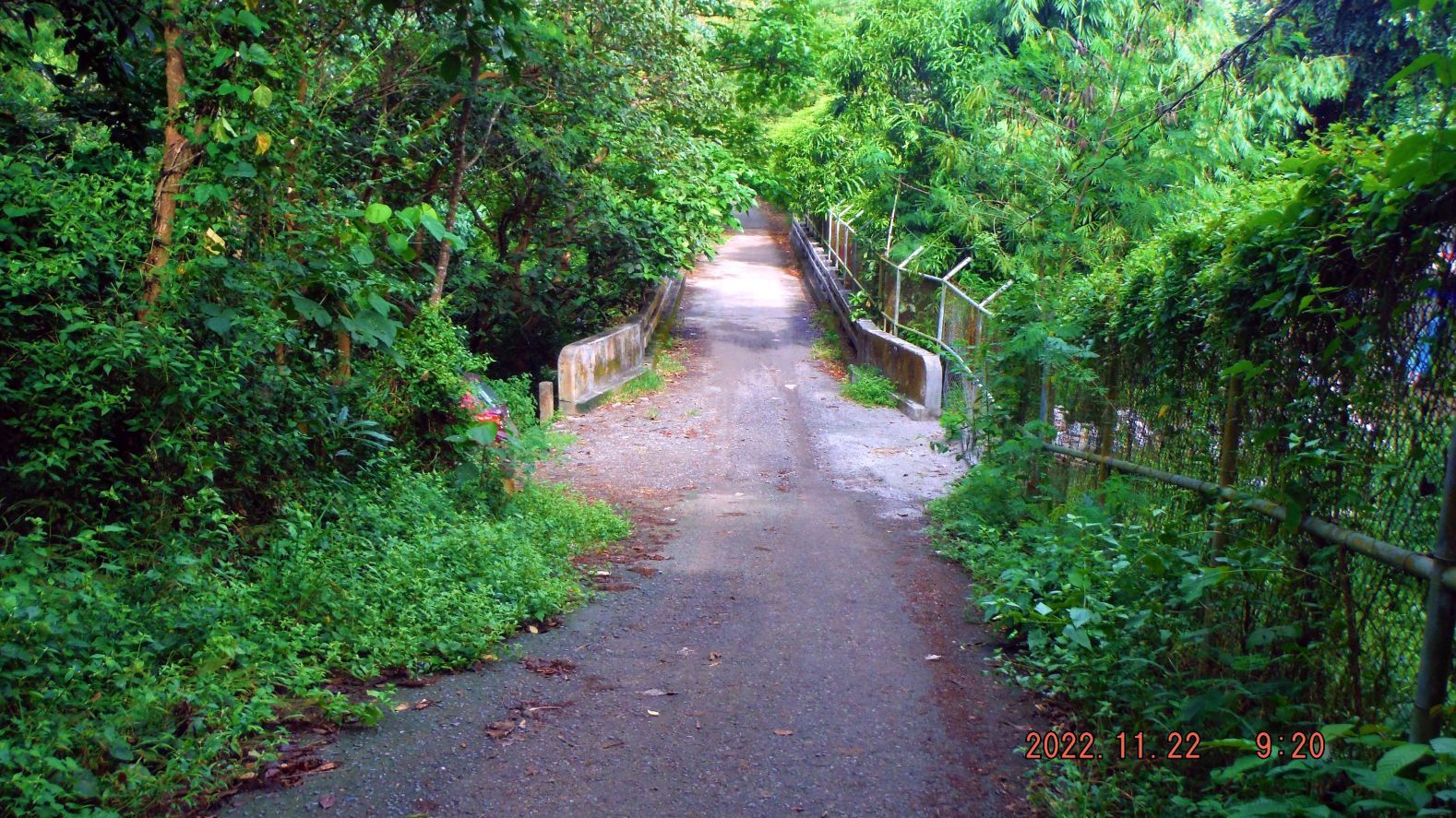 Pictures #029 to 033 show pictures of the continuation of the walk along the SBFZ Perimeter Road and Fence from the rocky hill I climbed to the Subic-Tipo Expressway bridges over the Jadjad River. We see a warning sign of the Xantheng Subic Int’l Corp, I guess the mother corporation of Tipo Hightech ECO Park. If you it up in Google Earth, they seem to sub lease their large buildings. We see the SBFZ Perimeter Road Bridge over the Jadjad River, the dirt road to the SBFZ Tipo Gate and the approach to the big bridges over the Jadjad River. The Tipo Hightech ECO Park seems to spread all the way to here. 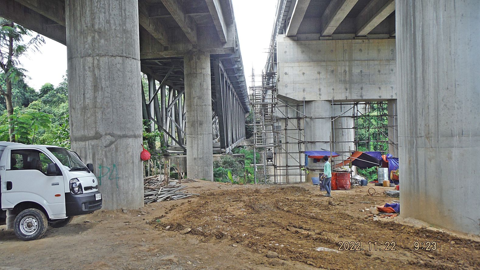 Pictures #034 to 039 show the Subic-Tipo Expressway Bridges over the Jadjad River and that recently a project of Capacity Expansion was carried out. 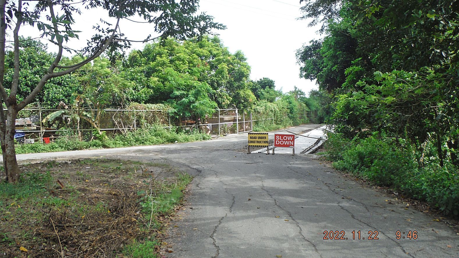 Pictures #040 to 044 continuation of the walk along the SBFZ Perimeter Road and Fence from the Jadjad River bridges to the intersection with the road to the Aeta Pastolan Village, coming from the National Highway and which passes the entrance gate to Sta. Rita Mountain. That road is also being improved, I turned around here. 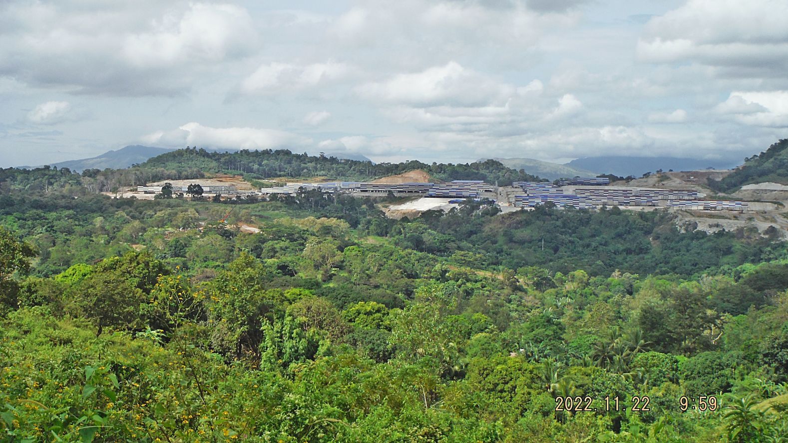 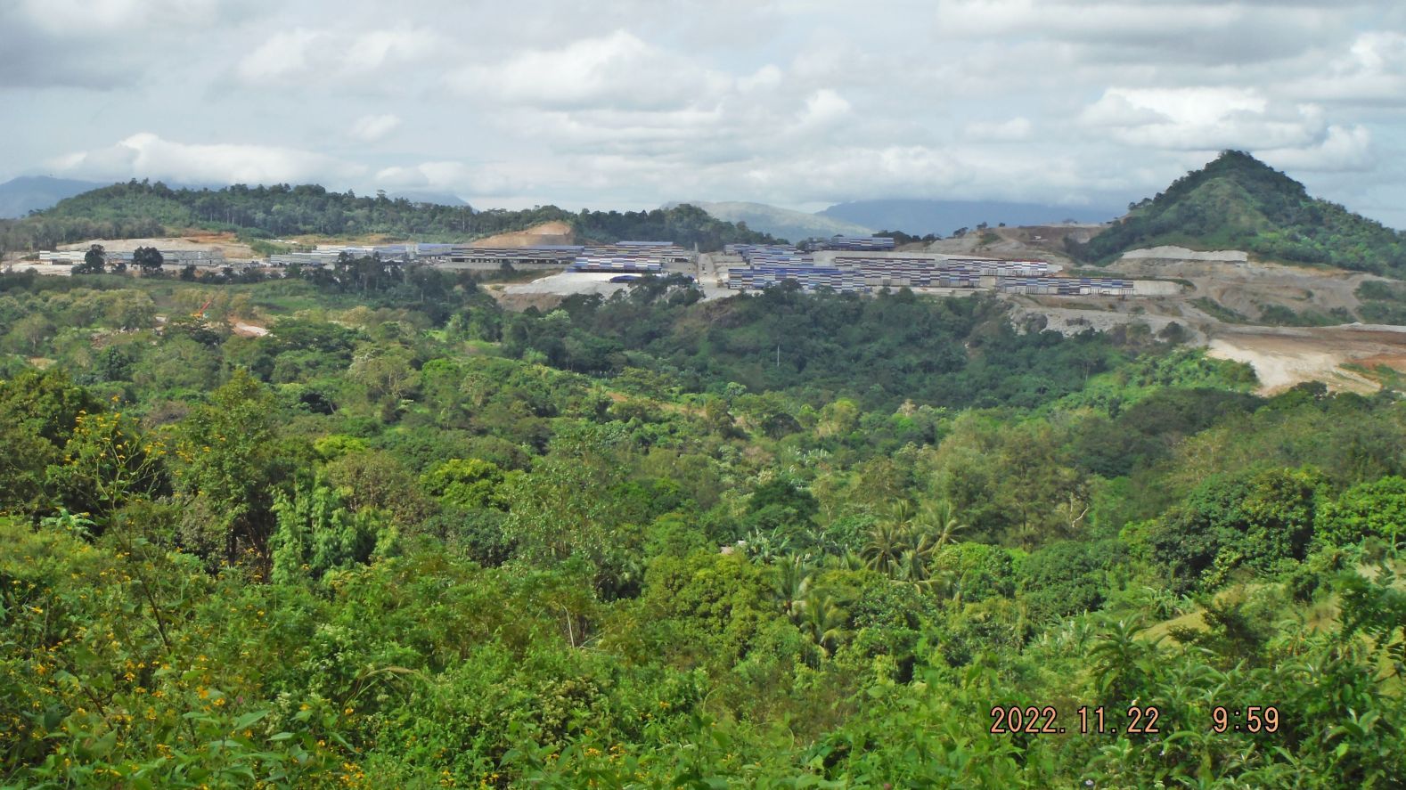 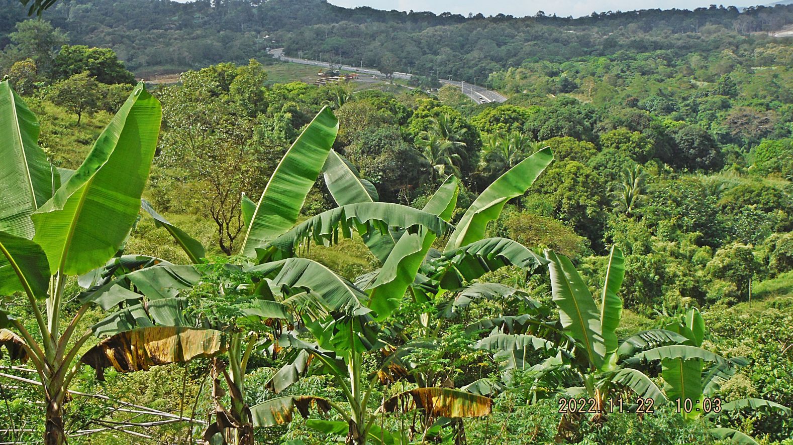 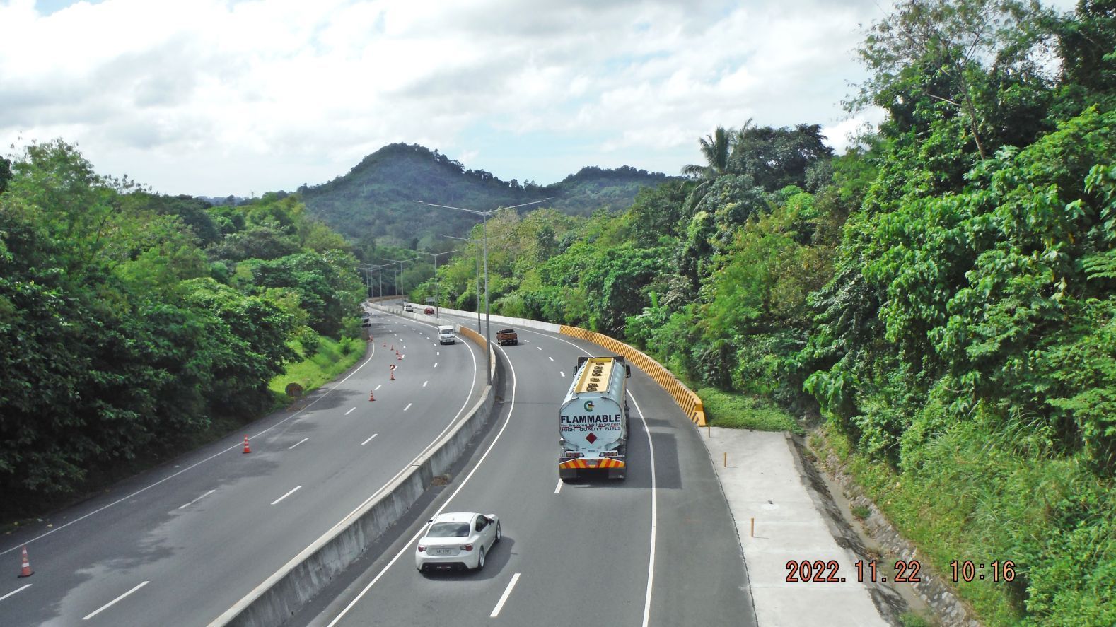 Pictures #045 to 065 are from my side trip to Brgy. Tipo. First of all we get a great view of the massive development/investment of the Xantheng Corp. thru their Tipo Hightech ECO Park Company. They have spread out from the SBFZ Tipo Gate at left to the Familiar Hill at right. We also have a good view of the Subic Tipo Expressway. We have several images of the Tipo Road Overpass Bridge over the express way. The picture of roads and residences are in Tipo, a section on this side of the express way. We also see a charcoal pile. Pictures #066 to 070 are from my return walk along the SBFZ Perimeter Road to the Perimeter Road Bridge over the Jadjad River. We see a car but I only saw bridge project four wheel vehicles but a number of tricycles and motor bikes. 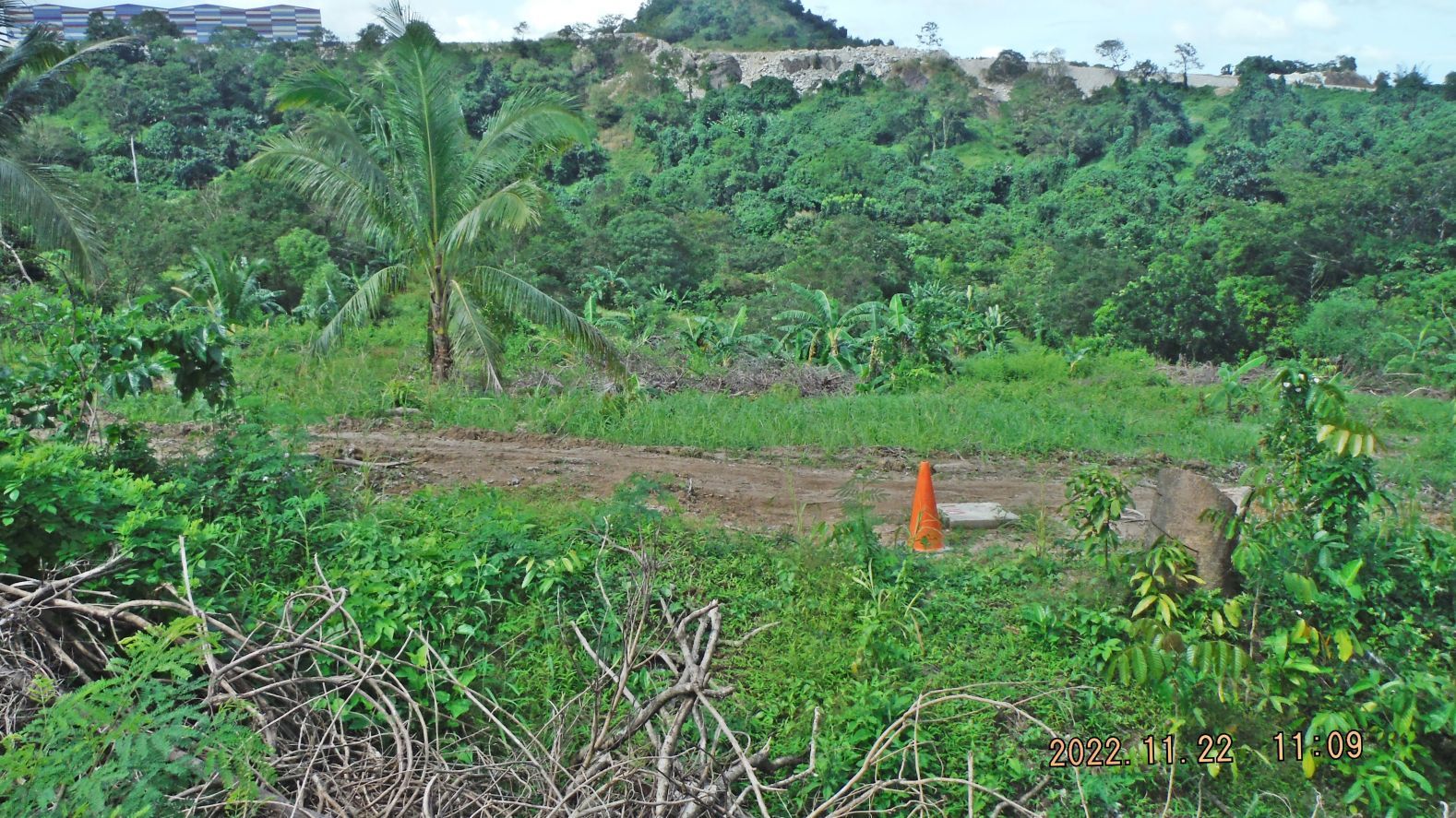 Pictures #071 to 077 are from another short side trip, this spot is between the perimeter road bridge over the Jadjad River and the rocky hill I climbed. This is directly next to the perimeter road and fence on one side and the opposite direction is towards the Tipo Hightech ECO Park Development. Woods are being cleared and there is another tributary creek between us and the development. We see survey markings. Pictures #078 to 084 are from the continuation of my return march along the SBFZ perimeter road/fence. It is the section between the area that is being cleared and back to the Brgy. Bangal Gate, We are passing the Tributary creeks #1 and #2 to the Jadjad Rv. We pass again the rocks where I started the climb up the rocky hill. Pictures #085 to 092 is the last section of my walk and are shot from the Brgy Bangal Gate to the new Tipo Hightech ECO Park new back road entrance. Between the Brgy. Bangal Gate, under the rocky hill, and the new Tip Hightech ECO Park new back entrance is a low point and I got the views of the Tributary creek #2 to Jadjad Rv. from there |
|