|
|
Post by Karl Welteke on Apr 16, 2015 15:10:29 GMT 8
NO LIBERTY IS SUBIC BAY TO SPEAK OF, 2015 April 15 This is what the Rappler.com said on this date. Below is the URL. www.rappler.com/business/industries/89966-olongapo-subic-businesses-us-troops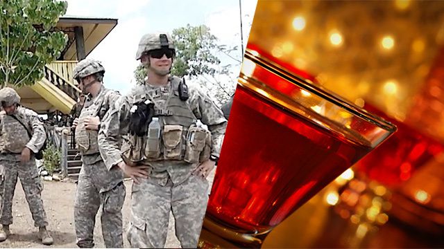 X253. The picture from the above URL and the lead paragraph of the report is below. OLONGAPO CITY, Philippines – Nightclubs and other businesses in Olongapo City and nearby Subic Bay Freeport are clamoring for the lifting of shore leave restrictions on US servicemen when their ships dock here. The leave policy was implemented in late 2014 following the death of Filipino transgender Jennifer Laude allegedly at the hands of US Marine Joseph Scott Pemberton. Nearly 7,000 American soldiers participating in war games in the Philippines this April will have to follow the restrictions involving a 10 pm curfew and a ban on entering bars and nightclubs. It also means the movement of US troops outside official activities will be strictly limited within the vicinity of their respective hotels. Owners and managers of nightclubs and bars and other businesses say these restrictions on shore leave have adversely affected their businesses. |
|
|
|
Post by Karl Welteke on May 6, 2015 16:53:13 GMT 8
Navy Divers at the Olongapo Station in the 1930s. 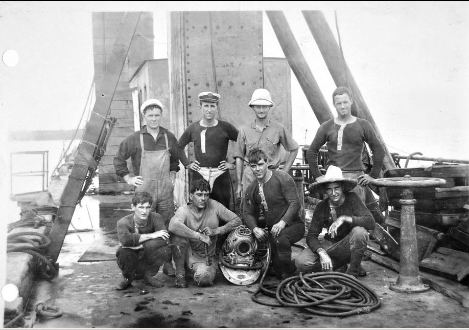 X362. This picture was sent by Glen Williford, he discovered it doing research work in the National Archives. He said this: Found this the other day at the archives, Navy divers at the Olongapo Station in the 1930s. Thought you'd enjoy it. Glen Glen Williford is a writer about WWII Harbor Defenses. I visited the ex Fort Wint on Grande Island with him and his Coast Defense Study Group colleagues two times. |
|
|
|
Post by Karl Welteke on May 12, 2015 16:40:01 GMT 8
NEW HOTEL IN BARRETTO, DENNITO IS THE NAME. Things are moving in the Subic Bay area, new things are happening. To all who worried what will happen to Subic Bay after my Navy left, don’t worry. Subic Bay is doing fine and Sailors are still welcome! 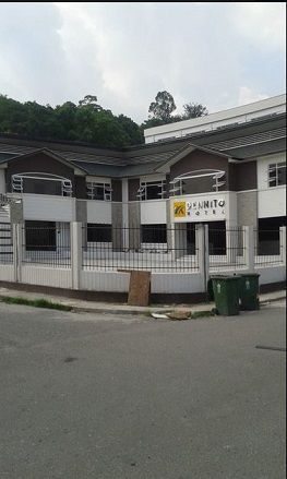 X401. New hotel in Barrio Barretto the Dennito Hotel, on the corner of Gabaya St. and Del Pilar St. due to open soon. It kind of blocks the view of our almost historical Marmont Hotel. This photo is from my Shipmate Tom Stone, we served together in a couple commands. 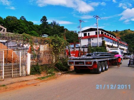 X402.This is how it looked in 2011, when they got started. Note the Marmont Hotel, this will tell you where the new hotel is. 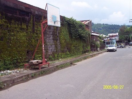 X403. Here is how the side, facing Gabaya St., looked in 2005 and continued looking that way until about 2012. |
|
|
|
Post by Karl Welteke on Jun 15, 2015 14:01:51 GMT 8
SUBIC BAY 2015 CHANGES, US NAVY OR NO NAVY, LIFE GOES ON Just took and uploaded some 2015 Subic Bay images, they are mostly of Barrio Barretto where many US Veterans, Locals and Visitors from all over mingle. This is the URL with 24 images so far: s74.photobucket.com/user/PI-Sailor/library/Philippines/No%202%20Phil%20Events%20Group%20Albums/2015%20OC%20BB%20SB%20ZAM%20events/Subic%202015%201st%20Half?sort=9&page=1or tinyurl.com/z2wvvzyHere are only 7 sample image: 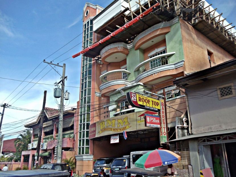 X559 the Roof Top Hotel is adding one more floor; this hotel is part of the Coffee Shop and the BMM Mini Mart is also part of this enterprise. It is the only and first place in Barretto with an elevator. 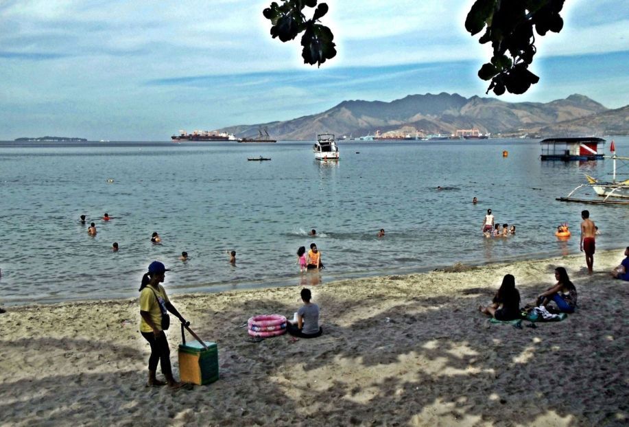 X560 looking at the bay of Subic Bay, it is Sunday, the 14th of June from Barretto’s beach park Drift Wood. The rain has not started yet and many people went to the beach. 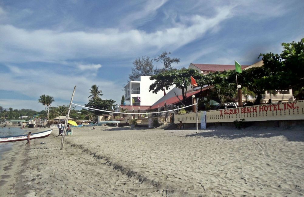 X561 the tall building with the red roof was recently added to the Suzuki Hotel and the white building next to it is also new and is getting its finishing touches. It is also a hotel. Barretto is booming! 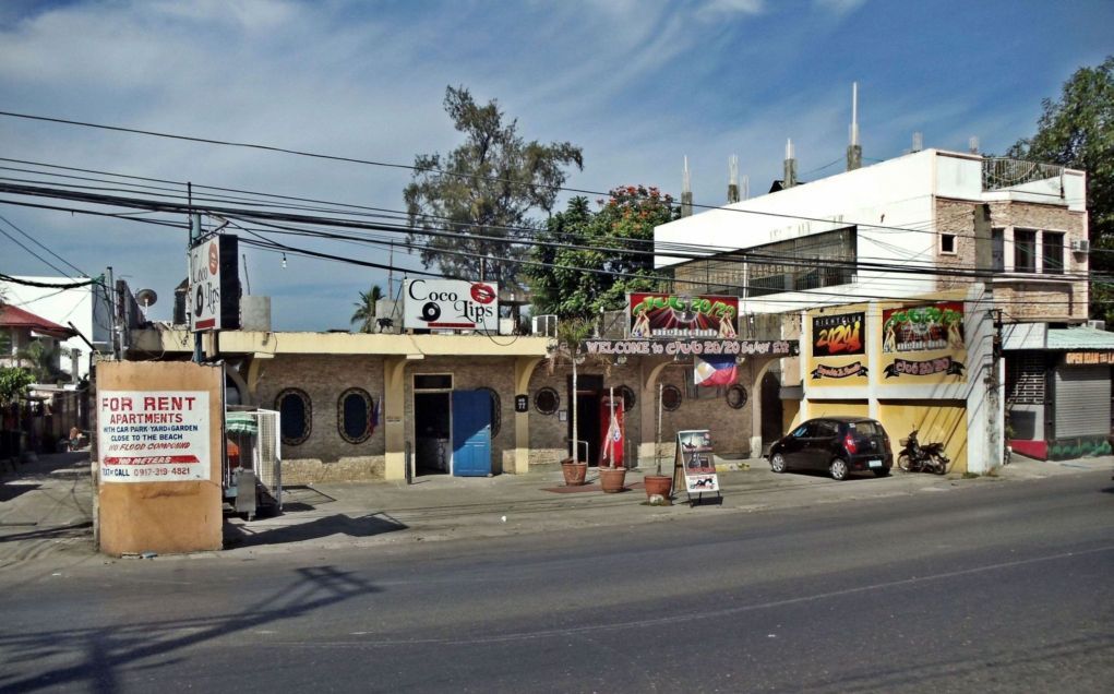 X562 there are many Girly Bars in Barretto now, these are just two examples. During our Base Days this was the ABRA KADABRA Bar. I just stepped on the Highway coming out of that little alley at left shooting the beach shots. 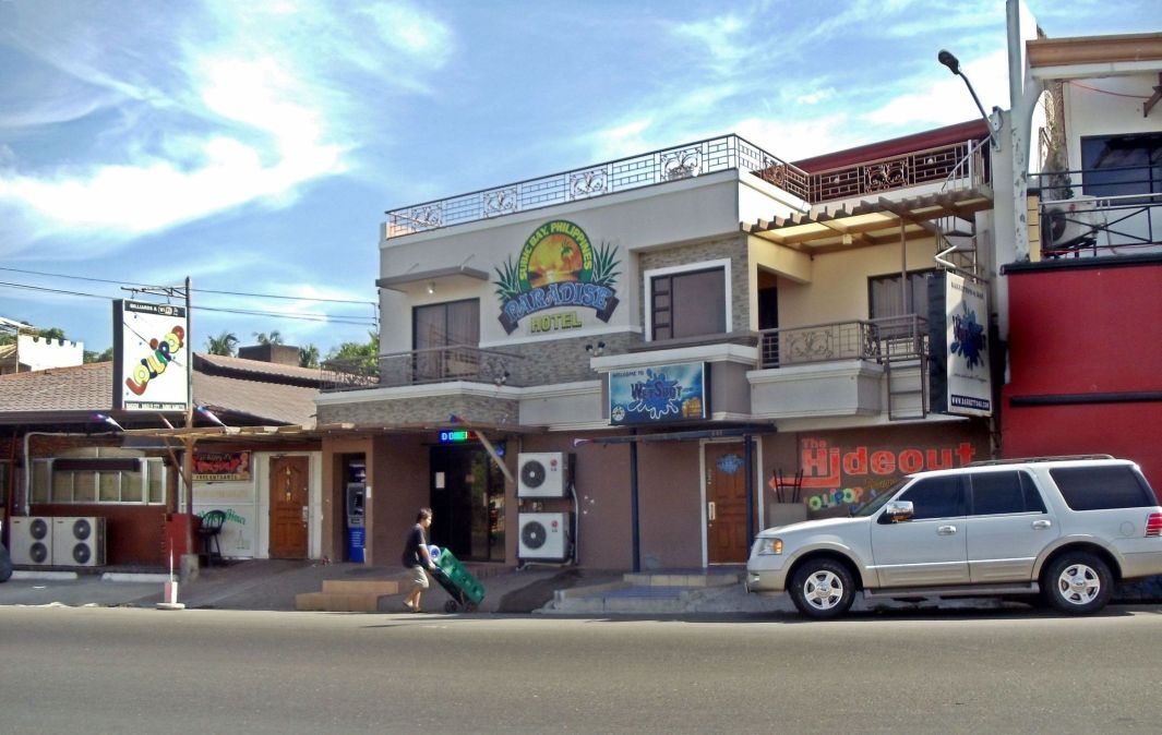 X563 this was the popular Dryden place, it was sold, it burned and is rebuilt but the Dryden name has disappeared. 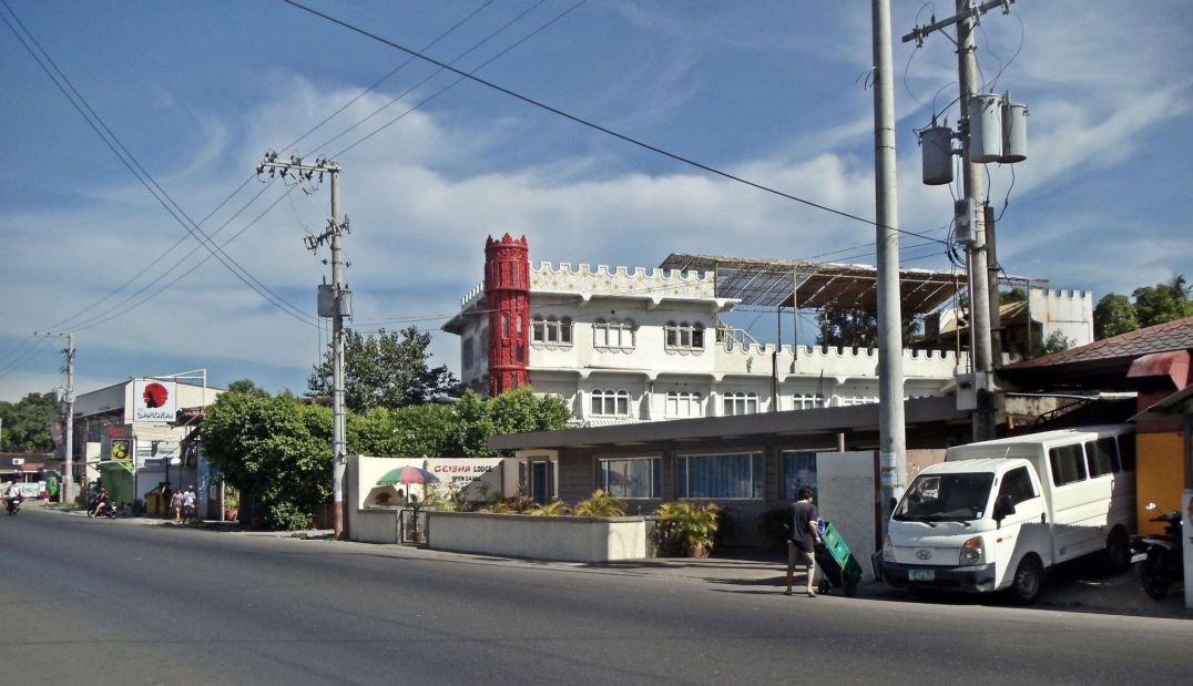 X564 the Geisha Lodge must be the oldest tourist business in Barretto and is still in operation. The Samurai Hotel in back is still a familiar site but has changed hands. 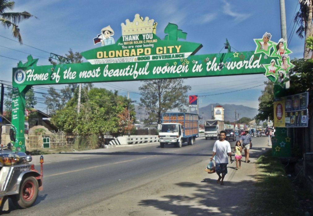 X565 this is the end of Olongapo City and Barrio Barretto and the sign says we have a new Major. The flood last year was to the top of the bridge rail. There is a new gas station, there are at least 10 new ones since the Base closed. 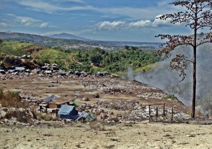 X566 this is the Smokey Mountain (Landfill) of the Subic Town (Municipality). I had walked to here, then to the White Rock Hotel and then back to Barretto and home via Baloy Beach. |
|
|
|
Post by Karl Welteke on Jun 17, 2015 20:21:54 GMT 8
|
|
|
|
Post by Karl Welteke on Jul 2, 2015 18:32:10 GMT 8
SUMMER VIEWS 2015 OF SUBIC BAY As usual I keep walking in my general area in Luzon Island and sometime I take pictures. These pictures are mostly from the former Subic Naval Base, a couple shots are from out of the former base. I shoot when I see changes or of something I have not seen before. There are 27 images in this album: s74.photobucket.com/user/PI-Sailor/library/SBFZ%20Ex%20Naval%20Base%20Subic%20Bay/SBFZ%202014%20and%202015/Summer%20Views%202015?sort=9&page=1or tinyurl.com/nzhewpwHere are 11 sample images but they are much smaller than in the album: 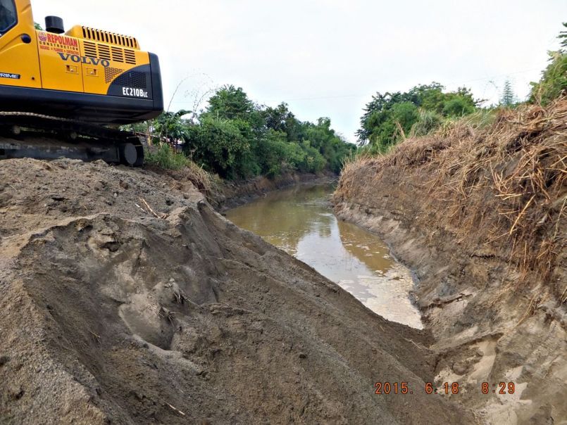 X662 this the oldest picture and that is why it is first. It is important for the many Subic Service people who bought houses in the Santa Monica Subdivision. That place has got flooded many times since the Mt. Pinatubo eruption. The flooding is caused by this Matain River. As far as I know this is the first serious dredging of the Matain River and they went up river a long way, I hope it will make a difference. 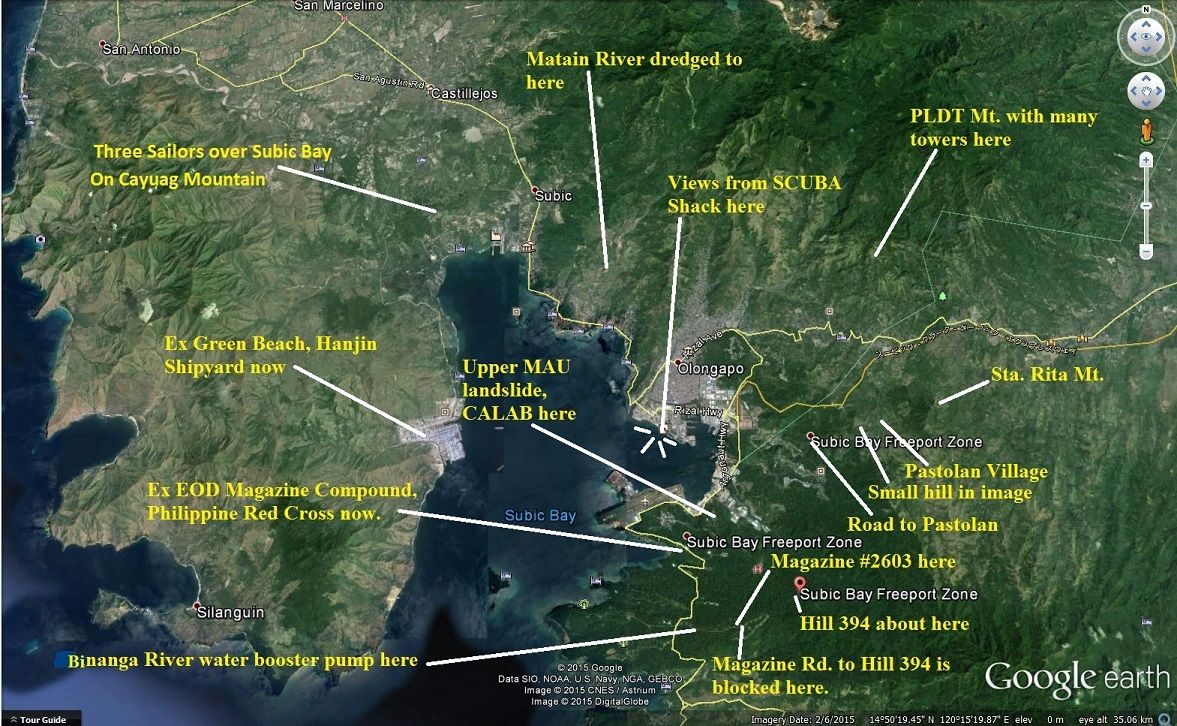 X663 this map is marked with each area and event of the pictures I present in this album. 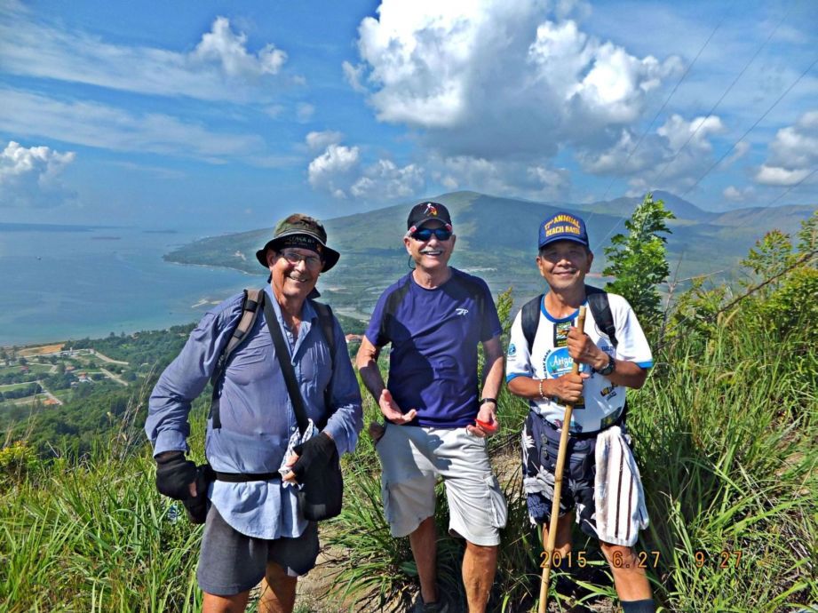 X664 this is Karl-Wilhelm Welteke, Charlie Moser and Alan Yu on Cayuag Mountain and we see Subic Bay left, Redondo Mountain behind us. Because of views like this we enjoy walking. 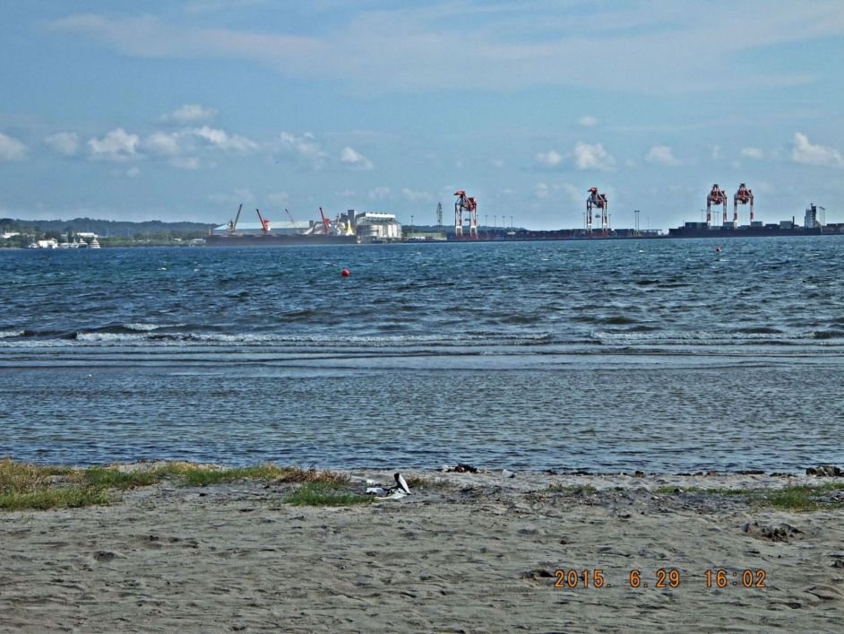 X665 I’m sitting bay side of the SCUBA Shack on SBFZ, the ex US Naval Base, the location of the left ship is Leyte Wharf, the Carrier Pier. That area is now a grain port. 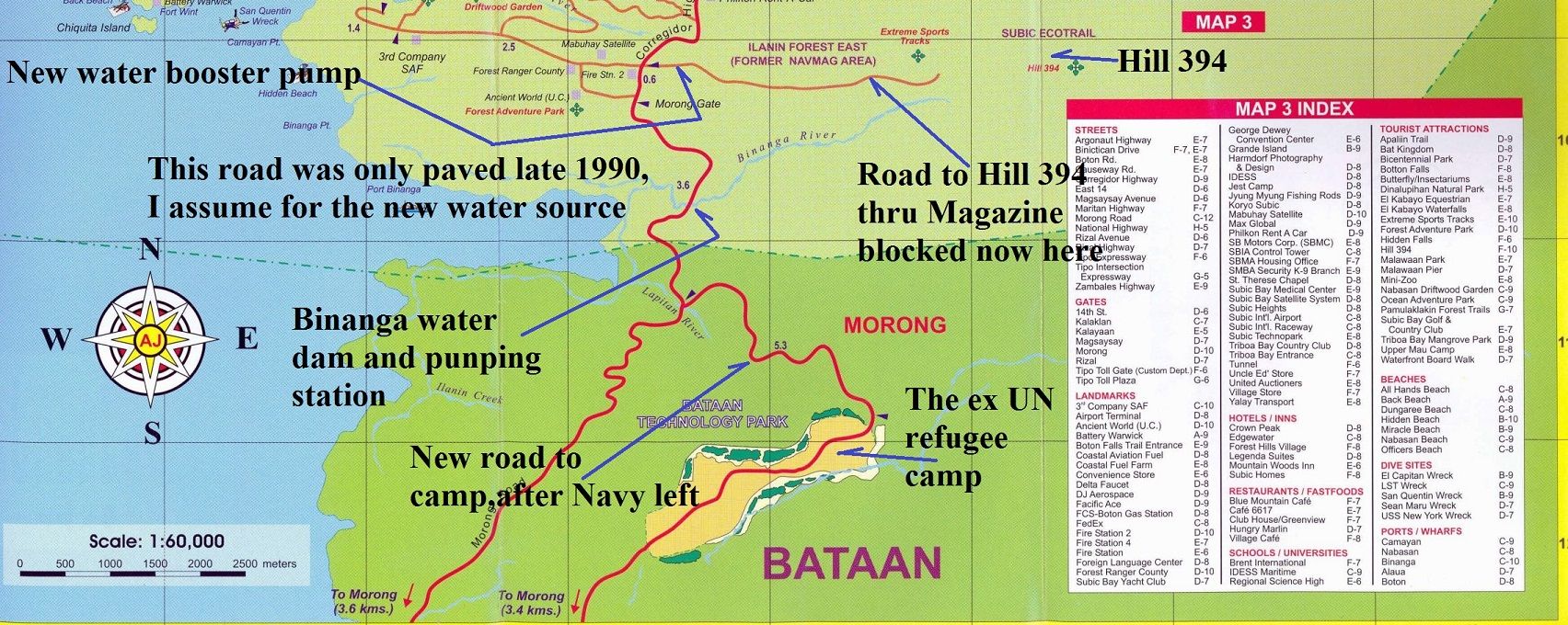 X666 a map of the area around the Morong Gate, SBFZ, and the normal human during our time did not have a chance to see this area, but now we can. 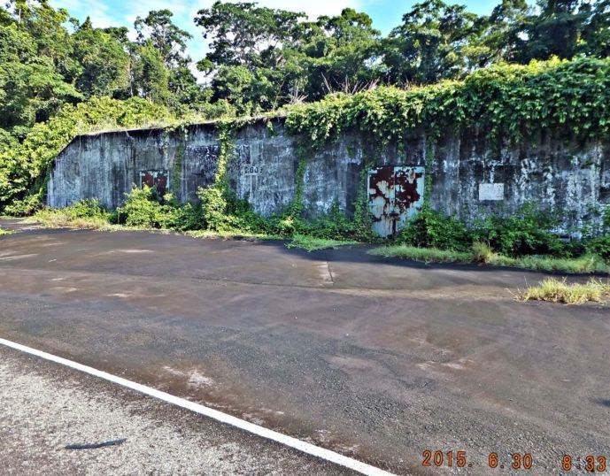 X667 we entered the east part of the former Naval Magazine to reach the start of the eco road to Hill 394; I think the area is called Group 6. The magazines are very large but are seldom used now days. A big change, the most eastern part of Group 6 of the ex Naval Magazine is used now by the Orica Co. and so we could not get to the road to Hill 394. 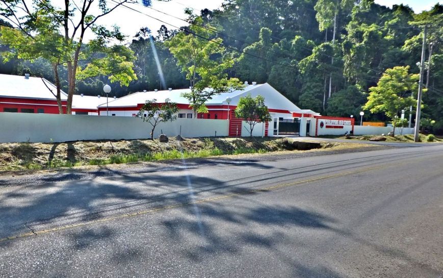 X668 We then exited the former Naval Magazine and noticed another big change. This compound that was used by the Military Explosive Ordinance Disposal Teams (EOD) has been taking over by the Philippine Red Cross. 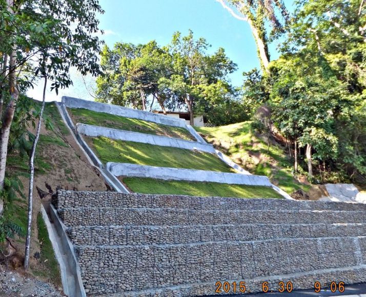 X669 this is the lower perimeter of the former Upper MAU compound (SBFZ), a few years ago there was a landslide here and now the area has been repaired. Across the road from that landslide was the CALAB (Calibration Laboratory) it also got buried partially by the landslide; it is now mostly cleaned up but remains unused. Look at the first entry of the first page of the thread and compare; I reported the landslide then. 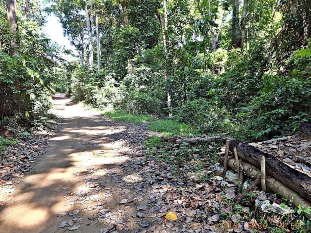 X670 on this day we also walked to the Aeta (Negrito) Village, calle Pastolan on the former Base. One starts at the Binictican Golf course and follows about a 4 km long forest road. This is a dirt bike ramp, so it was recently used for that purpose. We noticed many changes in the village. 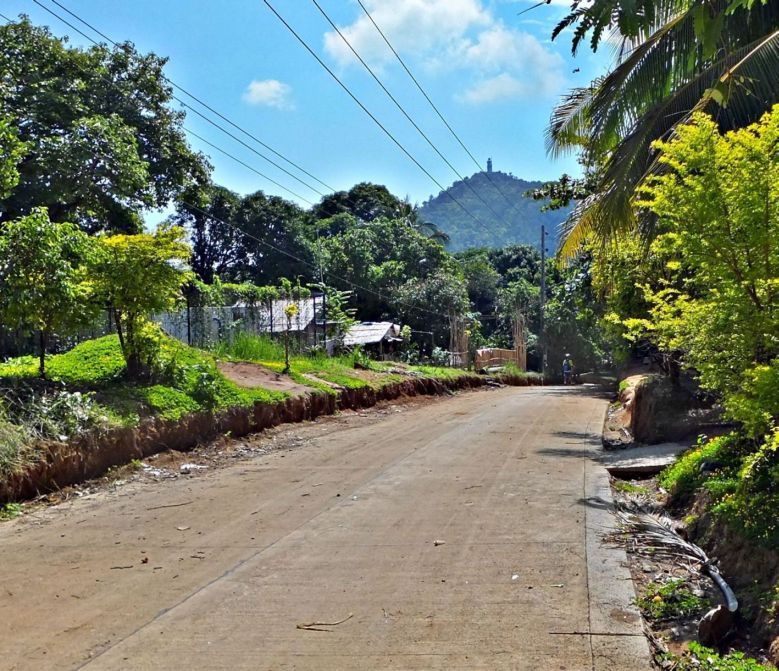 X671 Now we are really entering Pastolan Village, that is Santa Rita Mountain, it is the NE corner of SBFZ, the ex Naval Base. Well, another change, the village has a hard surfaced road now, all the way from the Olongapo Highway. 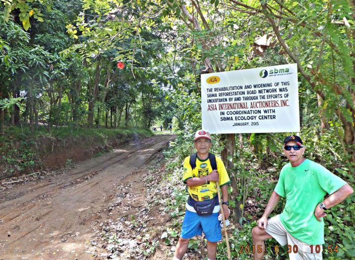 X672 this is the trail to the Pastolan Road from a ridge line near and south of Sta. Rita. The same benefactor, the AIA Inc. is helping out here. At this point we called it a day and returned. |
|
|
|
Post by Karl Welteke on Jul 13, 2015 18:08:02 GMT 8
MORE CHANGES IN SUBIC BAY 2015 21 new images were added to my album Subic Bay 2015. The rainy season has finally started, so a few images cover that. I got reacquainted, this year, with a young Sailor who went thru my Navy Diving School in Pearl Harbor about 1984. After he advanced thru 1st Class Diver School and served as one he volunteered to become a SEAL, made it and made it a career. He met his Filipina Bride in the Arabian Peninsula many years ago and they tied the knot here in Pundaquet, San Antonio, Zambales yesterday. Many Expats have settled there because this place is along the beach near the Capones Islands. It is a beautiful place. An US Civilian Mexican Gulf Diver built a grand and large watering hole, solid heavy steel construction and all open sides, great in the tropics. It is called the “Car Wash”. This is the URL, scroll to the 2nd page of the album: s74.photobucket.com/user/PI-Sailor/library/Philippines/No%202%20Phil%20Events%20Group%20Albums/2015%20OC%20BB%20SB%20ZAM%20events/Subic%202015?sort=9&page=1or tinyurl.com/o3qzwymHere are 3 sample images: 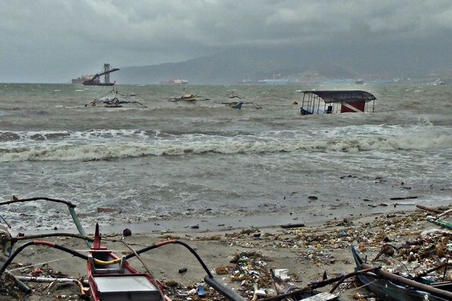 X727 11th July 2015 Subic Bay view in front of Driftwood Beach and the Arizona Hotel, the rainy season finally has started. This is Barrio Barretto, the Arizona Hotel Dive Platform and the banka boats are rocking and rolling in the surf. The Korean Shipyard Hanjin is across the bay, that used to be Green Beach, the US Marine Corps Training Area. 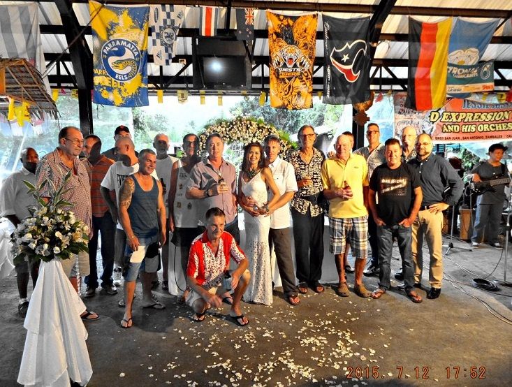 X728 12th July 2015 David Kowalski and long time bride marry in the grand Car Wash watering hole in Pundaquet, San Antonio, Zambales. The Car Wash open bar is located near the Aussie Village there. Most of those international Expats live in the Pundaquet Beach area; some on lease property and some on fee simple lots. 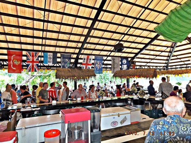 X729 the grand Car Wash is nice place in Pundaquet. The whole area became popular because the US Navy had the San Miguel Communication Station only 3 Km up the beach. The US – Allied landing on the 29th Jan. 1945 occurred along the beach from where the San Miguel Communication Station was later up to the next village San Narciso. Because of the Navy Communication Station many Sailors and Marines settled in the San Antonio area after retirement. |
|
|
|
Post by Karl Welteke on Jul 14, 2015 20:37:44 GMT 8
THEN AND NOW IMAGES OF SUBIC BAY We, here in Subic Bay been aware of that Seabee Camp picture for many years. And some of us have been climbing on that hill and compared the views. A friend of mine, Scott Paul, put that double image together and I thought it is time to share it. I added the Google image and marked it up with information about Subic Bay that I have been able to gather over the years. 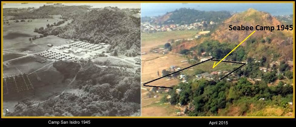 X737 double image of the San Isidro Village back valley 1945 and 2015 put together by Scott Paul. The original 1945 picture came from Seabee web pages! 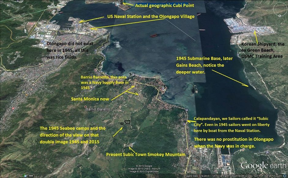 X738 a Google Earth image of Subic Bay marked up by Karl. |
|
|
|
Post by cbuehler on Jul 15, 2015 0:22:42 GMT 8
More great stuff Karl! I am fascinated with that Subic Bay image you marked up. Just where was the 1945 Olongapo town? Was it in the same spot, just smaller or what? We can see how it is packed in along that river.
And Calapandayan; was that what was called Subic City back in 45 too? Has Barrio Baretto replaced this area for Liberty recreation?
Is there anything that remains at the Sub base that is now Gains Beach?
CB
|
|
|
|
Post by Karl Welteke on Jul 15, 2015 17:08:47 GMT 8
RESPONSE TO CBUEHLER’S REPLY 2015-07-14, HISTORICAL SUBIC BAY IMAGES Up to about 1950 Olongapo Village and the Base were one and the same. Sure, there must have been secure Navy areas like the ship repair areas. But on or in the area that became the Naval Station (NAVSTA) after WWII or the Subic Bay Freeport Zone (SBFZ) after 1992 were different residential areas along the Main Street (Dewey Ave. today) and other streets or dry land patches. With the full independence of the Philippines (4th July 1946) and the scheduled loss of the Navy Cavite and Sangley Point Stations everything changed. It started perhaps in the late 1945, Olongapo was being moved off the Base, massive dredging and building started. Look at my entry in this thread on page 3, dated 16th March 2015, image X175 (Life Mag. image 1953) how all that work was shaping up the new NAVSTA. Here are three images that kind of document that Olongapo did not exist where it is now and the Olongapo residential areas were spread out in the area that became the new NAVSTA and then the SBFZ in later years. 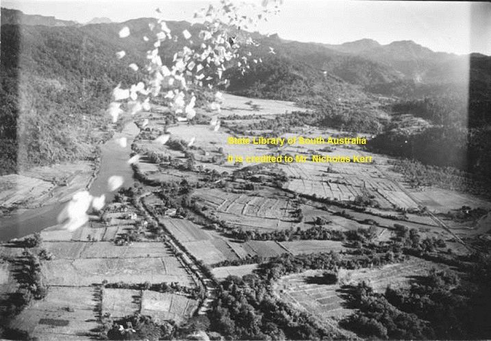 X739 (P1) this area is where the city of Olongapo is now, I certainly recognize the roads, they still run this way today. Leaflets are being dropped 1944 or 1945, perhaps in preparation of the coming landing on the 29th Jan 1945. This image came from the State Library of South Australia where WWII intelligence images are stored and it is credited to Mr. Nicholas Kerr. 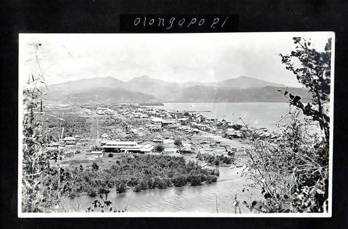 X740 (P2) lots of Olongapo residential houses are along the beach what became the NAVSTA Subic Bay later and the SBFZ now. This is a pre WWII image and came from a Subic Bay USMC webpage. 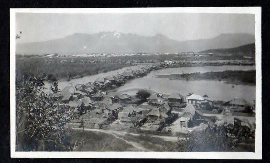 X741 P3 this is another pre WWII image and came from a Subic Bay USMC webpage. It shows how wet it was in the area what became the NAVSTA Subic Bay later and the SBFZ now. Cluster of Olongapo residential houses are at many places. Thru all the dredging at the turn of 1950 everything changed and this was no more. These three images are available in a bigger size in this album, look for the numbers P1 to P3: s74.photobucket.com/user/PI-Sailor/library/SBFZ%20Ex%20Naval%20Base%20Subic%20Bay/SBFZ%202004%20and%20earlier/Subic%20Bay%20Historic%201?sort=9&page=1or tinyurl.com/qfkkdp7About Calapandayan, the place we sailors called Subic City I do not know what sailors called it then, maybe just Subic. It seems in 1945 one had to have boat connections to get there. During my time, the 60s and 70s, we older sailors did not like the big bars in Olongapo with loud live rock music. We went on to Barrio Barretto where we could sit in the shade along the shore of the bay and enjoy cold beers and shoot the Bull. Those bars and restaurants then catered to our type of sailors and so Barretto developed to an international resort area now because of us. It has the only beach in Olongapo outside the Base, SBFZ now. Calapandayan caters to Filipinos now. And the bar life as we knew it in Olongapo during our time does not exist anymore. About the area of the 1945 Sub Base and Gains Beach, this is already covered in this thread and it does answer your questions. Look at Page 2, at my entry SUBMARINE BASE IN SUBIC BAY 1945, dated 1st Oct 2014. |
|