|
|
Post by Karl Welteke on Dec 11, 2018 20:52:15 GMT 8
Fireball, my hat is off to you. You got bigger balls then I. This entry is generated in response to fireball’s entry of Dec 9. 2018 in this thread. Your last entry is a real adventure story! Like you, the Mt Pinatubo explosion attracts me because it such a graphic image of the force of nature! I wished I had more time and engage you more about your and trips by others to Mt Volcano. Just let me add 4 images for the heck of it. In a few hours my family and I will hit the road by car and we will go to the Return of the Bells Ceremony in Balangiga on Samar Island. 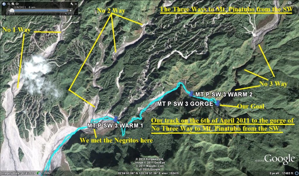 Zc985. This is an image of the approach ways to Mt. Pinatubo from the SW. Fireball and I discussed them and he chose the one I call The No 1 Way. I generated this image in 2011 when we explored the No3 Way. I considered it to risky to enter that long gorge of No3 Way. 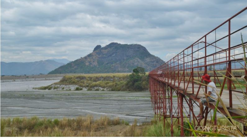 Zc986. The bridge to Mt. Pinatubo from a Chinese Mine for black sand (inoperative at this time). This is the one fireball used; the hill in the middle of the Lahar Field is Mt, Bagang. I could find my own picture so this picture came from this website: playintourist.blogspot.com/2018/03/mt-bagang-zambales.html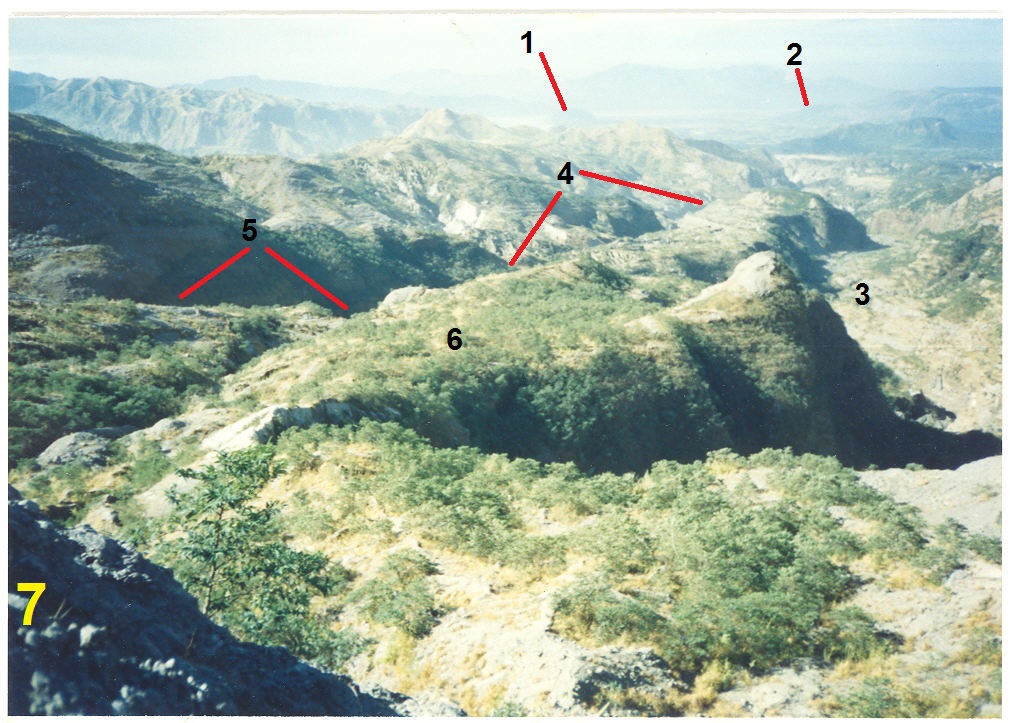 Zc987. This is a picture of our 1999 trip to Mt. Pinatubo from the SW, the San Marcelino direction. Key to the numbers on the image: 1= Mt. Bagang, 2= Santa Fe, Barrio of San Marcelino which was buried by this Lahar, 3= This is what I call No1 Way to Mt. Pinatubo from the SW,4= when my friend MacK and I came this way in 1999 we chose to come up that way, I don’t remember why, maybe more water was coming from there, 5= That was the end of the line of that valley but we were able to climb up to No 6, No 7 was bare slick rocky knoll and we decided we had to cross it to continue. I chickened out and quit here but my friend Mack continued all the way. 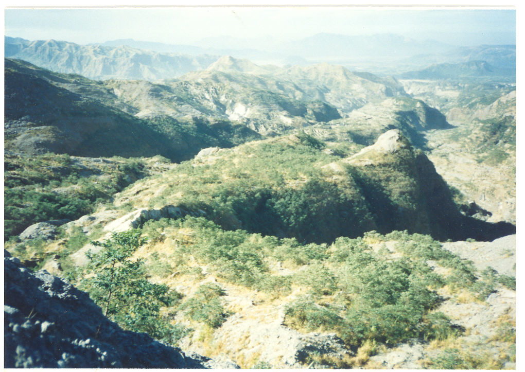 Zc988. This is a picture of our 1999 trip to Mt. Pinatubo from the SW, the San Marcelino direction. This is the unmarked copy. |
|
|
|
Post by Karl Welteke on Dec 20, 2018 15:07:12 GMT 8
Ferry Batangas of the FastCat ferry service as it is loaded in Matnog 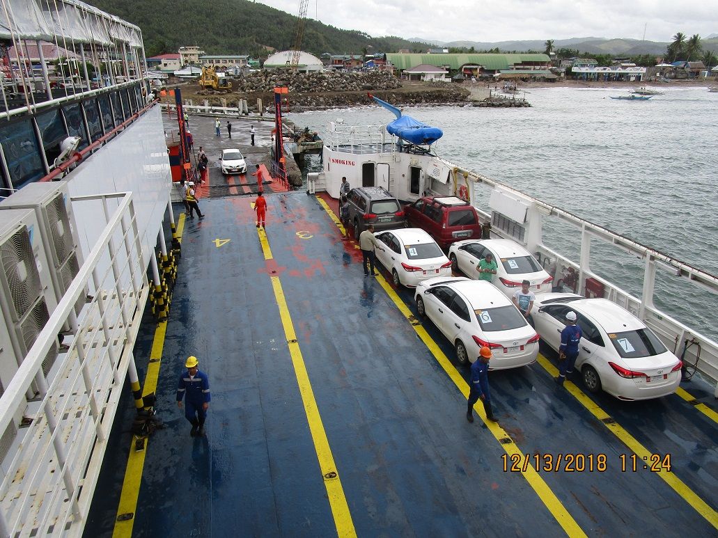 Z239. Ferry Batangas of the FastCat ferry service as it is loaded in Matnog 13th Dec. 2018 Friends and relatives Greetings from our family coconut hacienda in Bon Ot Big on the north shore of the San Bernardino Strait. This picture is shot on the ferry Batangas of the FastCat ferry service as it is loaded in Matnog on Luzon Island. I was on my way to Balangiga for the Return of the Church Bells. The red car right forward is mine. I am writing with a handicap, the keyboard of my brand-new Dell lap-top with the unfamiliar (to me) Microsoft Edge program is unusable. So I am writing with the on screen keyboard, that takes some practice. I was unable to transfer all my email addresses, so if you would please send me your email address. So far I only recaptured about 15 or so. The family and I plan to be back in Olongapo on the 5th of Jan. |
|
|
|
Post by Karl Welteke on Jan 17, 2019 19:34:42 GMT 8
Another little adventure story from the San Bernardino Strait. My wife comes from a village here and we have a fair size house and compound in the village Bon Ot Big. Bicol is wet at this time, not like western Central Luzon. The weather topped off our visit with Tropical Depression (TD) Usman. We parked our car one village further east, no drive-able road to this village. And that road to Matnog promptly got blocked by landslides. I feared the worse but next day it was cleared and we could leave on schedule. This album is about Bon OT and the river mouth. These pictures were shot between 2018-12-28 to 31 in Bon Ot Big about Tropical Depression (TD) Usman and a few days later showing some of the damage caused by this TD. I established 2 albums with 38 pictures each: Uploaded to Photobucket: s74.photobucket.com/user/PI-Sailor/library/Family/Family%20in%20PI%20Sub%20Album%201/2017-2019%20Family%20Albums/Bon%20Ot%20B%20TD%20Usman%202018-12-28%20to%2031?sort=9&page=1Uploaded to Facebook: www.facebook.com/pg/Welteke/photos/?tab=album&album_id=2141201599306448For this forum presentation I only share 10 images. They are uploaded to my Photobucket account, as the server. Because of Photobucket’s quality of service not all pictures may open. 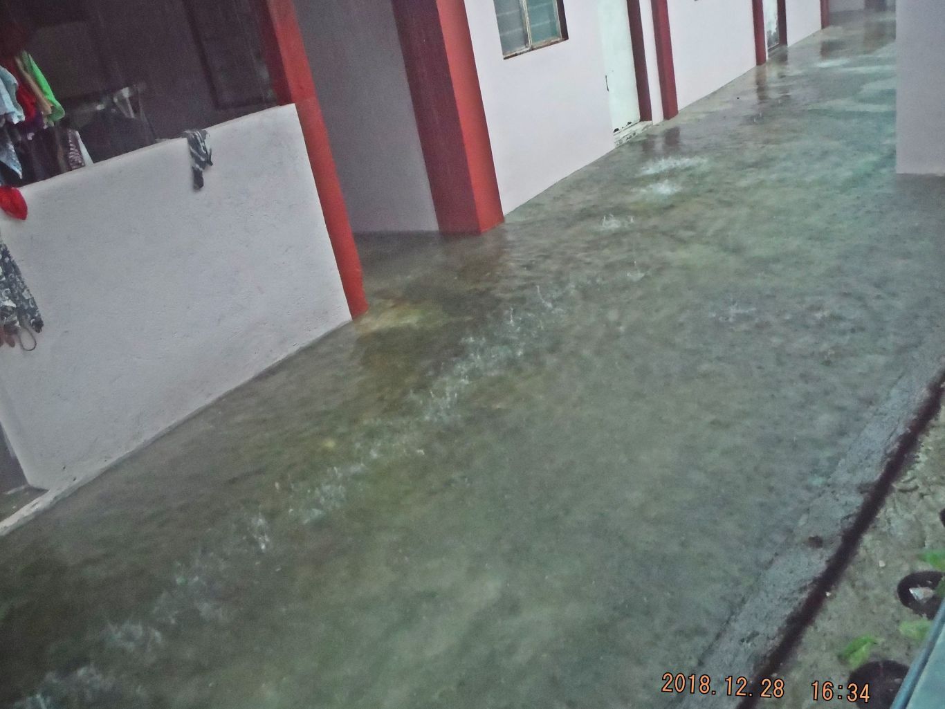 Z307. One of 6 images of our house in Bon Ot Big on the 28th Dec. 2018, Friday, during the heavy rain from Tropical Depression Usman (TD). This picture does not show it but it was a very strong driving rain. A lake formed in our compound but because we sit high it does not get too deep. 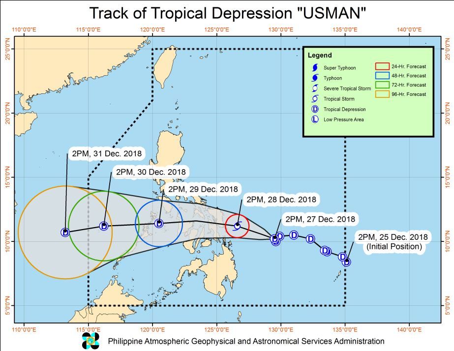 Z308. The track of Tropical Depression Usman (TD). 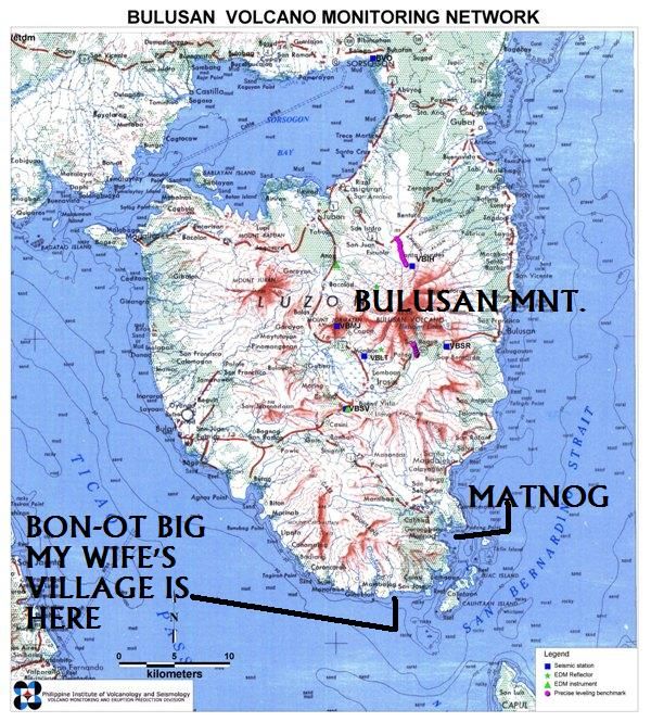 Z309. Sorsogon Province and the San Bernardino Strait. 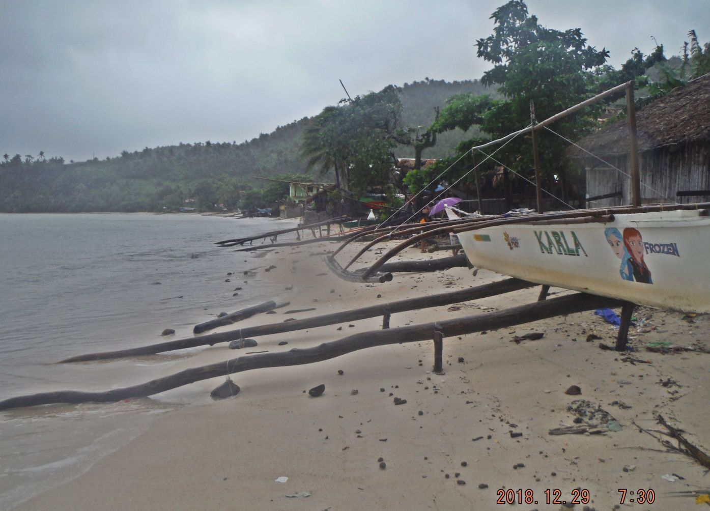 Z310. One of 5 images of the Bon Ot Big Beach on the 29th Dec. 2019, Saturday, after the heavy rain from Tropical Depression Usman (TD) passed, our boat Karla is one of the few boats left on the beach. Karla is the nickname of our daughter. Z310. Photobucket doesn't let this picture open, at least not on my PC; here is the alternative, click on this IMG Thumb:  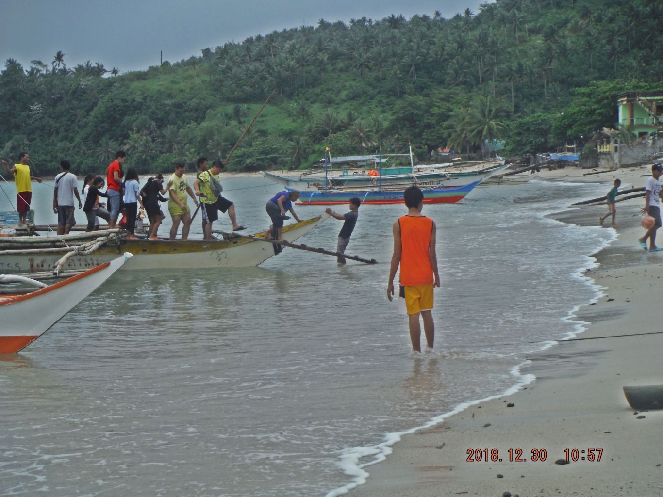 Z311. One of 9 images of the Bon Ot Big Beach on the 30th Dec. 2019, Sunday, after the heavy rain from Tropical Depression Usman (TD) passed. A boat from another village dropped off some Bon Ot Big natives, 2 yellow shirts are Koreans. This was the first day the boats start running again. I had walked the whole 12 km road early this morning to Matnog, to check up on the landslides and had arrived back to the village a little earlier by boat. 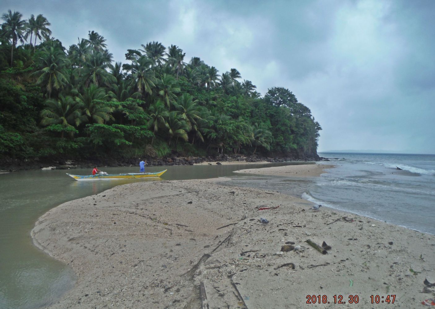 Z312. One of 11 images of the Bon Ot Big River Mouth on the 30th Dec. 2019, Sunday, after the heavy rain from Tropical Depression Usman (TD) passed. Some sand is washed away; a concrete piece from a pig stall got washed out into the strait. You can see that concrete in the breaking wave at right. 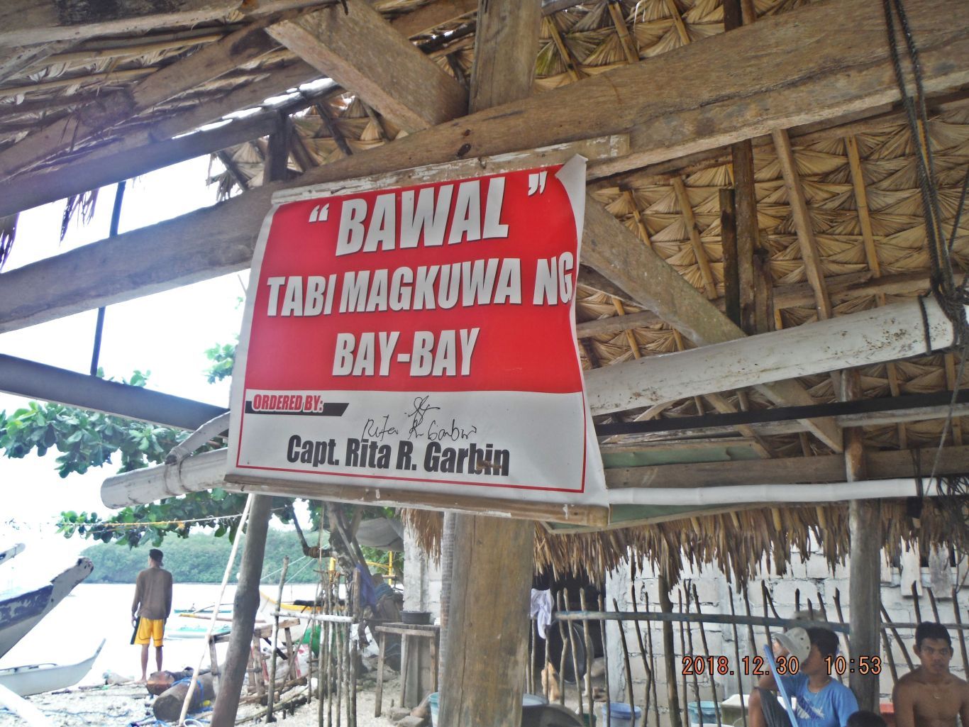 Z313. One of 11 images of the Bon Ot Big River Mouth on the 30th Dec. 2019, Sunday, after the heavy rain from Tropical Depression Usman (TD) passed. This sign says, moving sand {mostly coral pieces) from here is forbidden. Loss of part of the sand bar at the river mouth may be because of that reason. 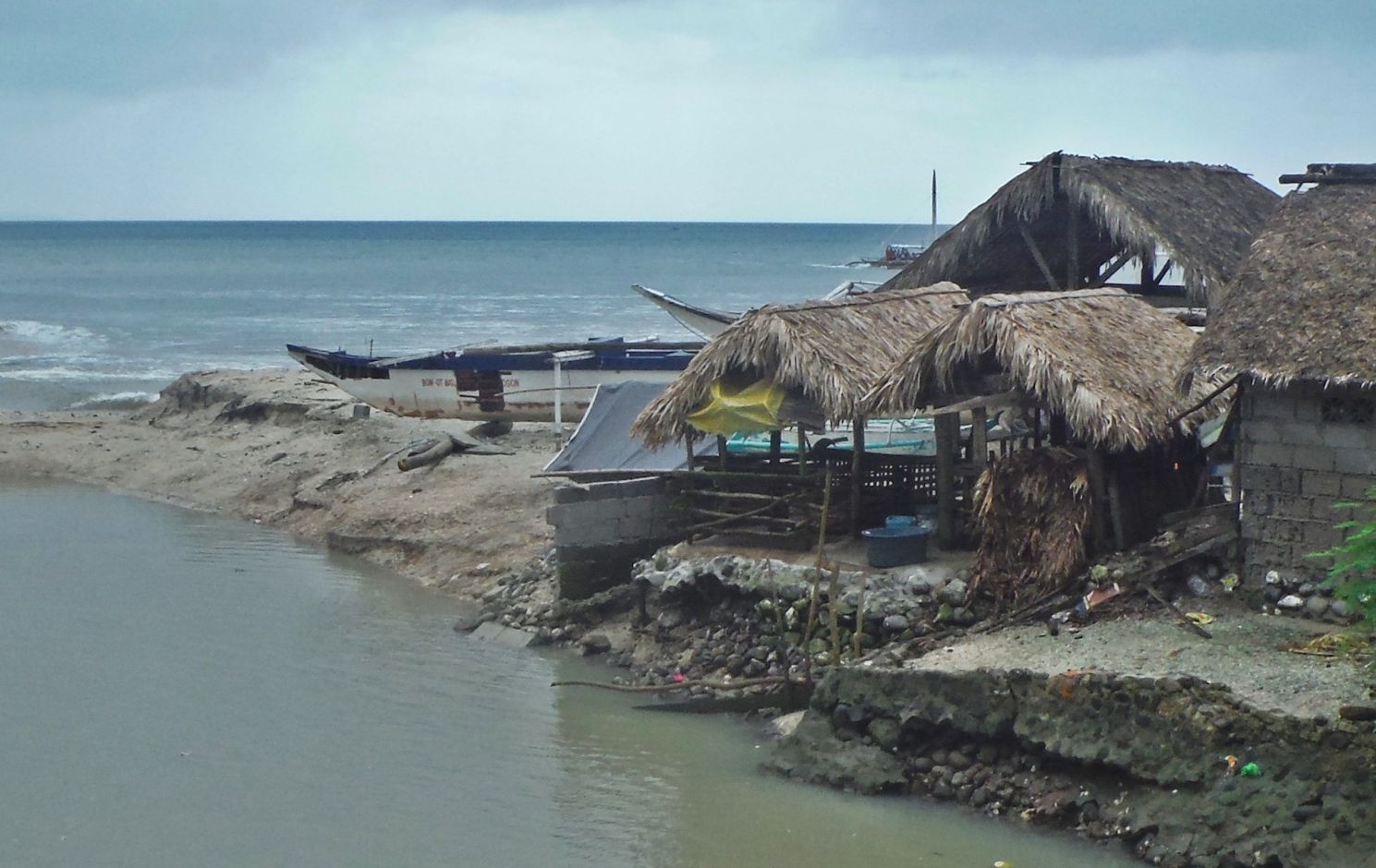 Z314. One of 6 images of and from the new Bon Ot Big River Bridge on the 30th Dec. 2019, Sunday, after the heavy rain from Tropical Depression Usman (TD) passed. Most of the boats were parked inside here, notice river bank damage. One more heavy rain could wash more of the sandbar away and there go the pigs. 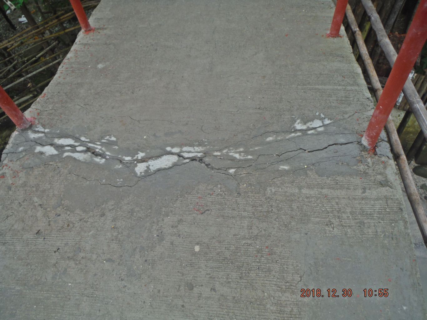 Z315. One of 6 images of and from the new Bon Ot Big River Bridge on the 30th Dec. 2019, Sunday, after the heavy rain from Tropical Depression Usman (TD) passed. Notice the crack in the brand new bridge, the strong river current, because of the TD, caused those pilings to settle or move and then caused the crack in the brand new bridge. Because of the new bridge, many motorbikes have bought and many people travel that way to Matnog, vice the boats. 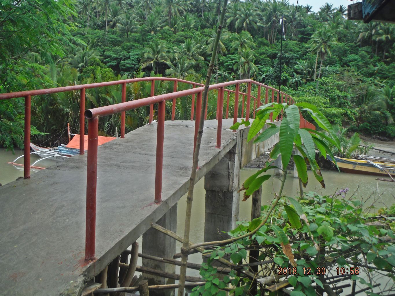 Z316. One of 6 images of and from the new Bon Ot Big River Bridge on the 30th Dec. 2019, Sunday, after the heavy rain from Tropical Depression Usman (TD) passed. The bridge deck cracked at the near pilings but it still can be used. Without that bridge, sometime I had to cross the river chest deep in the past. So, like all, I appreciate that new bridge very much and hope it will hold up. |
|
|
|
Post by Karl Welteke on Jan 19, 2019 13:06:52 GMT 8
Matnog Terminal, Gateway to the Visayan Islands. Tropical Depression Usman (TD) passed over this area on the 28th Dec. 2018. On the 30th Dec. some small boats started operating again. I walked from Culasi to Matnog to check on the landslides. Then I met my wife there who had come by boat and we returned to our village by boat that afternoon. These scenes are about Matnog, 2 days after TD Usman passed by here. 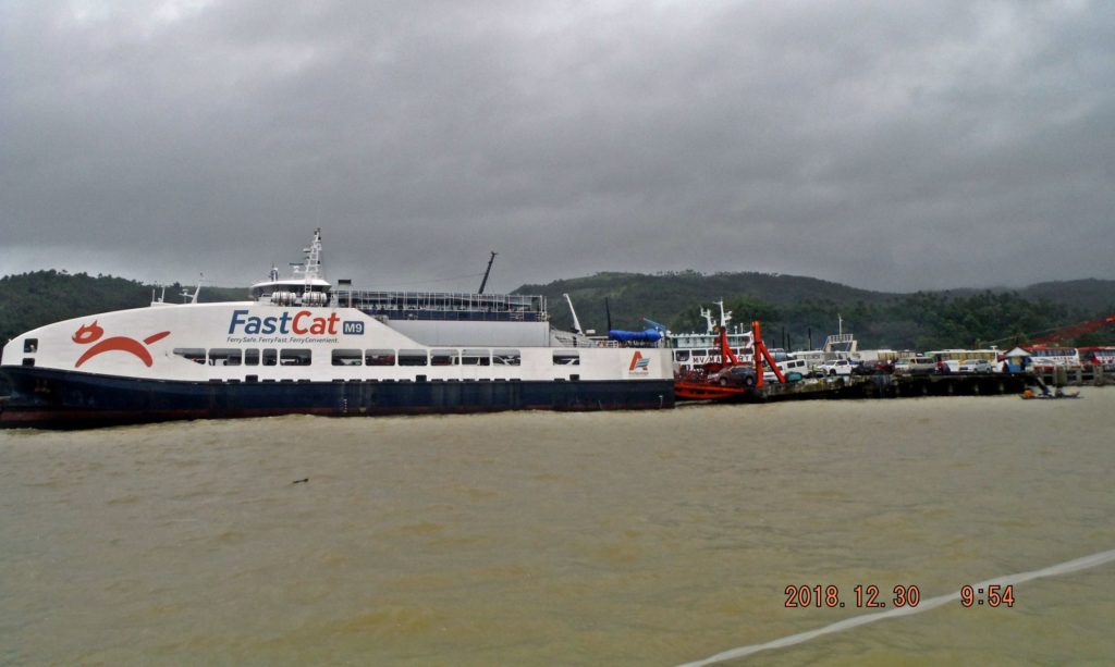 Zc994. This is a ferry of Fast Cat Co, in this picture she prepares to load vehicles. The ferries from this port cross the San Bernardino Strait to a port on Samar. The ferries of this company go to the port of San Isidro on Samar, which is further south than Port Allen where some of the other ferries go. I used this very ferry with my car on the 13th Dec 2018 on my way to the Balangiga Bells Turnover Ceremony on the 15th Dec. 2018. I bought a ticket from the internet for 2400 peso. On my way back I paid for the ticket in San Isidro and paid only 1500 peso, another lesson learned. For this forum presentation, I only chose the above picture but I established 2 albums with 39 images. If you are interested these are the two albums: Uploaded to Photobucket: s74.photobucket.com/user/PI-Sailor/library/Family/Family%20in%20PI%20Sub%20Album%201/2017-2019%20Family%20Albums/Matnog%20TD%20Usman%202%20days%20later%202018-12-30?sort=9&page=1Uploaded to Facebook: www.facebook.com/karlwilhelm.welteke/media_set?set=a.10215434697054304&type=3&uploaded=40 |
|
|
|
Post by Karl Welteke on Mar 21, 2019 19:03:59 GMT 8
Calvary Hill, Tacloban City, Philippines; Crucifixion of Jesus Recently I visited parts of Leyte and Samar twice. These trips are always very interesting and I try to look at history everywhere. Well the Jesus story is also history, might as well brush up on that, especially when the people of Tacloban made such a fine display. Stations of Jesus Crucifixion On the last day we finally found time to walk up the Calvary Hill, Tacloban City, Philippines. The people of Tacloban recreated the stations of Jesus Crucifixion. I think it is well done and is worth a visit. You also will see also a huge water reservoir tank and have a fairly good view of Tacloban City from above. If you want to view all 61 images, use this URL: philippine-sailor.net/2019/03/21/calvary-hill-tacloban-city-philippines-crucifixion-of-jesus/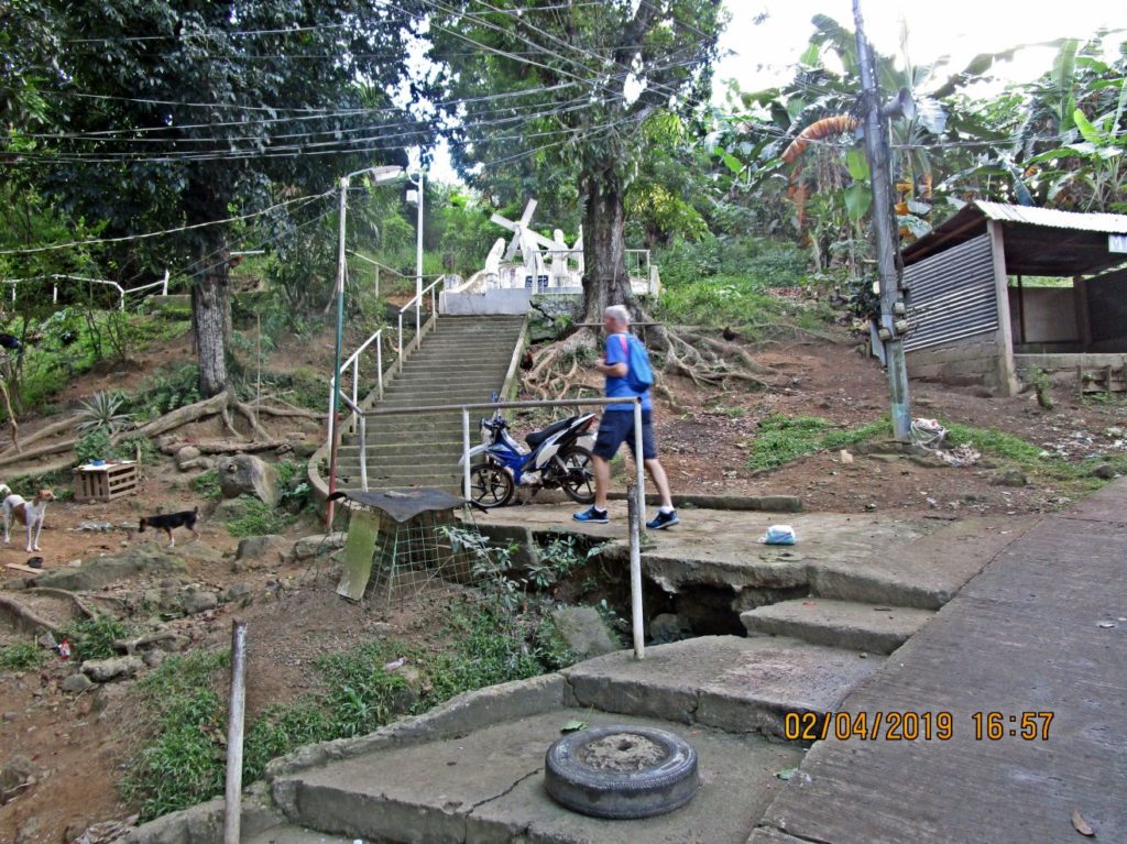 Ze083-My friend Harald and I start walking up Calvary Hill, in Tacloban, and follow the Stations of Jesus Crucifixion. 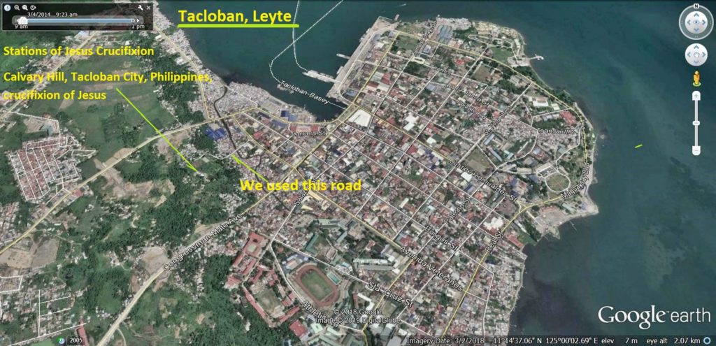 Ze084-Google Earth image showing the location of the Calvary Hill, Tacloban City, Philippines; Crucifixion of Jesus. 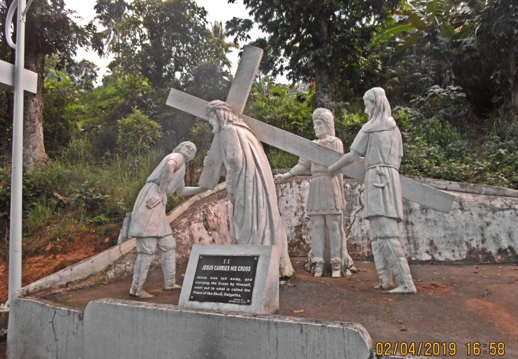 Ze086-Jesus carries his Cross; this is the 2nd station in the Crucifixion of Jesus on the Calvary Hill, Tacloban City, Philippines  Ze087-Jesus carries his Cross; this is the 2nd station in the Crucifixion of Jesus on the Calvary Hill, Tacloban City, Philippines, zoomed in. 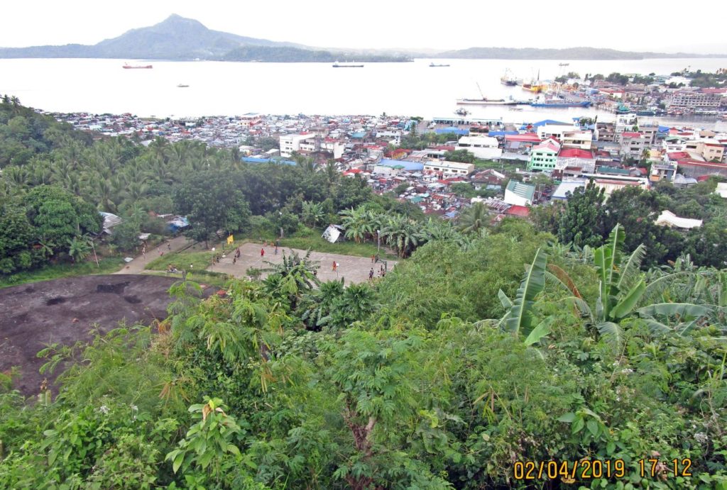 Ze136-A view from Calvary Hill, Tacloban City, Philippines; Crucifixion of Jesus. In the distance is Samar Island. If you want to view all 61 images, use this URL: philippine-sailor.net/2019/03/21/calvary-hill-tacloban-city-philippines-crucifixion-of-jesus/- |
|
|
|
Post by Karl Welteke on Mar 29, 2019 17:18:22 GMT 8
Tacloban in Leyte visit 2019-01-31 to 02-04
My family friend Harald and I visited Tacloban on those dates. We generated 123 images, however I did not write any descriptions. We visited the City Hall area, the Leyte Park Resort, the Leyte Capitol Building (History), the Harbor and market. About 120 images
Here are two sample images:
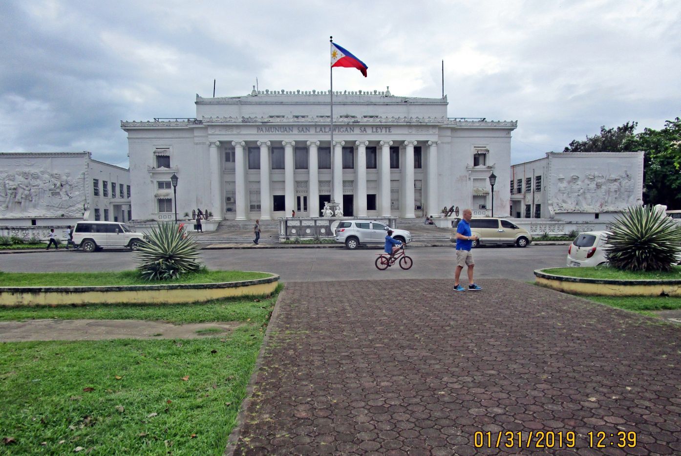
The Leyte Province Capitol Building
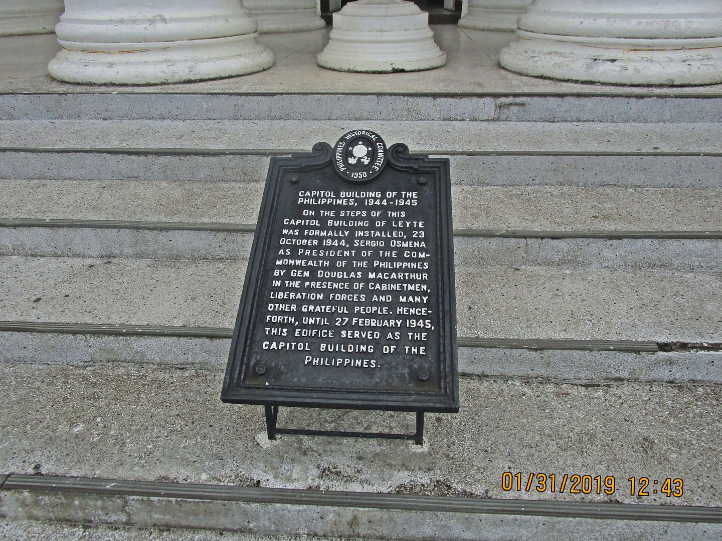
The Leyte Provincial Capitol Marker says this:
On the steps of this capitol building of Leyte was formally installed 23 October 1944. Sergio Osmeña as president of the Commonwealth of the Philippines by General Douglas MacArthur in the presence of cabinetmen, liberation forces and many other grateful people. Henceforth, until 27 February 1945, this edifice served as the Capitol Building of the Philippines.
Here are two more historical images from WWII
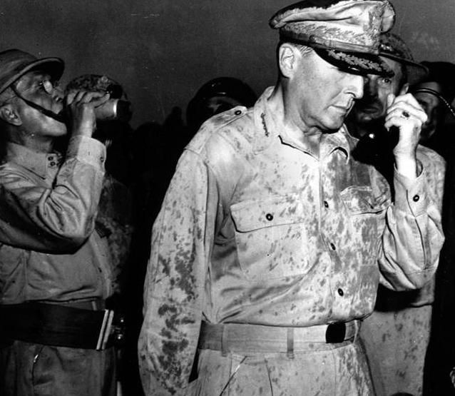
MacArthur was now able to declare “I Have Returned”. In a speech, delivered via radio message from a portable radio set at Leyte, on October 20, 1944 he sent this message:
This is the Voice of Freedom,
General MacArthur speaking.
People of the Philippines: I have returned.
By the grace of Almighty God our forces stand again on Philippine soil – soil consecrated in the blood of our two peoples. We have come, dedicated and committed to the task of destroying every vestige of enemy control over your daily lives, and of restoring, upon a foundation of indestructible strength, the liberties of your people.
At my side is your President, Sergio Osmena, worthy successor of that great patriot, Manuel Quezon, with members of his cabinet. The seat of your government is now therefore firmly re-established on Philippine soil.
The hour of your redemption is here. Your patriots have demonstrated an unswerving and resolute devotion to the principles of freedom that challenges the best that is written on the pages of human history.
I now call upon your supreme effort that the enemy may know from the temper of an aroused and outraged people within that he has a force there to contend with no less violent than is the force committed from without.
Rally to me. Let the indomitable spirit of Bataan and Corregidor lead on. As the lines of battle roll forward to bring you within the zone of operations, rise and strike!
For future generations of your sons and daughters, strike! In the name of your sacred dead, strike!
Let no heart be faint. Let every arm be steeled. The guidance of Divine God points the way. Follow in His name to the Holy Grail of righteous victory!
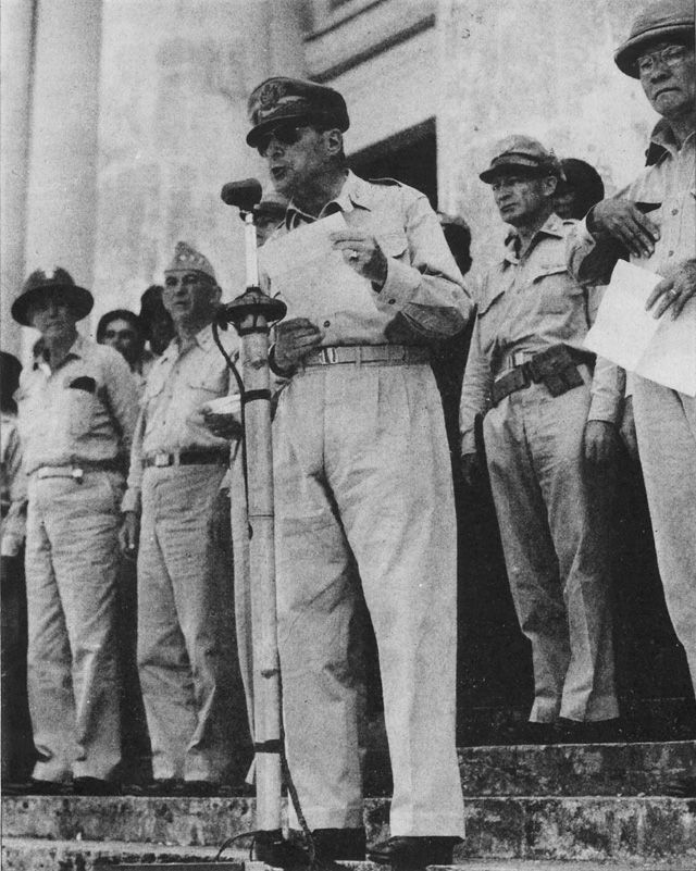
GENERAL McARTHUR reads his Proclamation of Liberation at Tacloban, Leyte, soon after U.S. landings. In background, left to right: VAdm T. C. Kinkaid, LtGen Walter Krueger, CG Sixth Army, unidentified AAF officer, and President Sergio Osmena.
My pictures (about 120) are uploaded into these two albums:
Uploaded to my Facebook Bon Ot:
www.facebook.com/pg/Welteke/photos/?tab=album&album_id=2250008008425806
Uploaded to my Photobucket account:
s74.photobucket.com/user/PI-Sailor/library/Philippines/Other%20Phil-Areas%20No%201/Leyte/Tacloban%202019-01-31%20to%2002-04?sort=9&page=1
|
|
|
|
Post by Karl Welteke on Mar 31, 2019 14:52:20 GMT 8
San Juanico Bridge A friend and I crossed the bridge twice on the 1st Feb. 2019. It is an important bridge in the development of Samar and Leyte. The Allied could have used it WWII but it did not exist then and the Japanese would have blown it. This is one more interesting geographical point in exploring the Philippines. Wikipedia says this about the San Juanico Bridge: San Juanico Bridge (Filipino: Tulay ng San Juanico and Spanish: Puente de San Juanico) is part of the Pan-Philippine Highway and stretches from Samar to Leyte across the San Juanico Strait in the Philippines. Its longest length is a steel girder viaduct built on reinforced concrete piers, and its main span is of an arch-shaped truss design. Constructed during the Marcos administration using Japanese Official Development Assistance (ODA) loans, it has a total length of 2.16 kilometers (1.34 mi) - the longest bridge spanning a body of seawater in the Philippines Above text is from Wikipedia: en.wikipedia.org/wiki/San_Juanico_BridgeHere are two sample images: 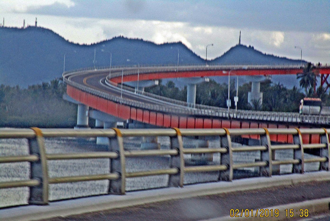 Z443. This is one of ten images crossing the San Juanico Bridge on the 1st. Feb. 2019 from Samar to Leyte. 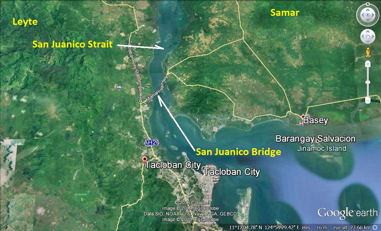 Z444. Thus is the location of the San Juanico Bridge from Google Earth. I established two albums with 20 images, take your pick: Uploaded to the Photobucket: s74.photobucket.com/user/PI-Sailor/library/Philippines/Other%20Phil-Areas%20No%201/Leyte/San%20Juanico%20Bridge?sort=9&page=1Uploaded to the Bon-Ot Facebook page as an album: www.facebook.com/pg/Welteke/photos/?tab=album&album_id=2252191281540812 |
|
|
|
Post by Karl Welteke on Aug 2, 2019 16:17:46 GMT 8
Visited Lingayen Gulf, a place of historic events! Islandia Hotel-100 Islands We visited 100 Islands in Alaminos City, part of Pangasinan on the 3rd of March 2019. We stayed at the Islandia Hotel, the price was right, 1800 peso for a twin room, including breakfast. You might consider it, it was a pleasant hotel. This album is just about the hotel. I made an album with 18 images about the hotel: philippine-sailor.net/2019/08/02/islandia-hotel-100-islands/ Here are 2 sample images:  Ze461. (07) the history of the Islandia Hotel is mentioned in this Philippine Daily Inquirer article. The hotel has this URL, click here: www.web36.islandiahotelph.com/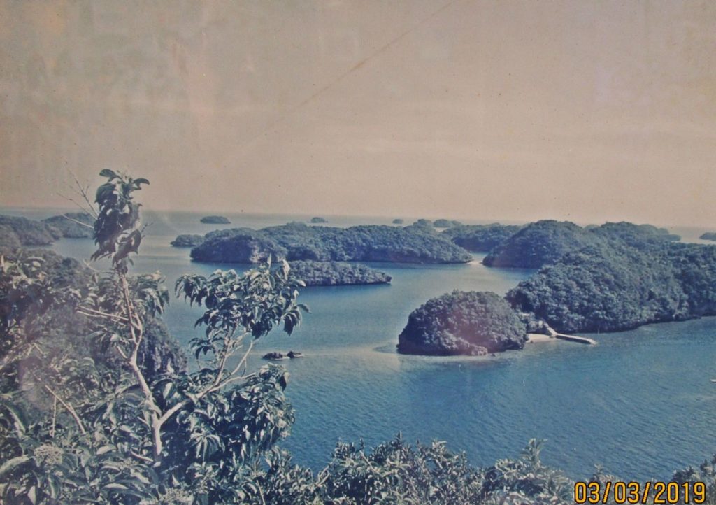 Ze462. (08) a nice picture of the 100 Islands was hanging on the wall with a lot of other stuff. |
|
|
|
Post by Karl Welteke on Aug 5, 2019 18:04:48 GMT 8
100 Islands 2019-03-03 with Harald Harald and I took a short trip to 100 Islands, by car, from our home base Olongapo 2019-03-03. These are the pictures we took. In most cases the pictures without the date imprint are Heralds and mine have the imprint less I cropped it. The Hundred Islands National Park is the first national park and a protected area located in Alaminos, Pangasinan in the northern Philippines. The islands, totalling 124 at low tide and 123 at high tide, are scattered in Lingayen Gulf covering an area of 16.76 square kilometres. Wikipedia Lingayen is of course infamous and famous because the Japanese aggressors landed here in 1941; but then the Liberators under General MacArthur landed here in 1945 and liberated Luzon. I established 2 albums in two different accounts with 57 pictures; the links to the albums are at the end of this presentation. For this from presentation I chose these 9 images:  U287. This is 1 of 12 images (in the albums) of the 100 Island Reception Grounds, along the Lingayen Golf coast, in Alaminos, Pangasinan. To me they looked attractive.  U288. This is 1 of 12 images (in the albums) of the 100 Island Reception Grounds, along the Lingayen Golf coast, in Alaminos, Pangasinan. To me they looked attractive. This is where you sign up, pay and get guided.  U289. This is 1 of 12 images (in the albums) of the 100 Island Reception Grounds, along the Lingayen Golf coast, in Alaminos, Pangasinan. To me they looked attractive. This is the free parking area.  U290. This is 1 of 10 images (in the albums) that show the steps, the fees how to sign up to visit the 100 Islands. It was impressive; the staff and boat crews were very helpful. I wish they would have something like this for Corregidor!!!!!!!  U291. This is 1 of 10 images (in the albums) that show the steps, the fees how to sign up to visit the 100 Islands. It was impressive; the staff and boat crews were very helpful. I wish they would have something like this for Corregidor!!!!!!!  U292. This is 1 of 8 images (in the albums) of the boats for rent at the 100 islands. They are supervised by the 100 Island Tourist Office. After you pay a young guide/aid takes you to your boat and turns you over to the boat crew HASSLE FREE! Outstanding!  U293. This is 1 of 17 images (in the albums) of the actual 100 Islands, most of these pictures are from Harald, all shot on 2019-03-03.  U294. This is 1 of 17 images (in the albums) of the actual 100 Islands, most of these pictures are from Harald, all shot on 2019-03-03.  U295. This is 1 of 17 images (in the albums) of the actual 100 Islands, most of these pictures are from Harald, all shot on 2019-03-03. Here are the links to the two albums I established: Uploaded to Facebook: www.facebook.com/karlwilhelm.welteke/media_set?set=a.10216784680083036&type=3Uploaded to Photobucket: s74.photobucket.com/user/PI-Sailor/library/Philippines/Other%20Phil-Areas%20No%201/Pangasinan/100%20Islands%202019-03-03%20with%20HaraldFrom Wikipedia: The History of 100 Islands: The islands are believed to be about two million years old. There are actually ancient corals that extend well inland, in an area previously comprising the seabed of an ancient sea. The lowering of the sea level has exposed them to the surface. The peculiar "mushroom-like" shapes of some of the islands were caused by the eroding action of the ocean waves. The national park was created by Presidential Proclamation No. 667, covering an area of 16.76 square kilometers (6.47 sq mi) and signed by President Manuel L. Quezon on January 18, 1940, for the benefit and enjoyment of the people of the Philippines and known as the Hundred Islands National Park (HINP). The Republic Act No. 3655 signed on June 22, 1962, created the Hundred Islands Conservation and Development Authority (HICDA), for the conservation, development and management of HINP. The park including Lucap Bay was transferred from HICDA to the Philippine Tourism Authority (PTA) by virtue of Section 35 of Presidential Decree No. 564. On April 27, 1982 under Proclamation No. 2183, the national park including Lucap Bay and its foreshore areas, beginning from Sitio Telbang to the east to Sitio Recudo to the west, were declared as a Tourist Zone and Marine Reserve under the control and administration of the PTA. Subsequently under the Presidential Proclamation No. 2237 enacted on November 6, 1982, the parcels of land reserve for the Marine Fisheries Multi-Purpose Farm (created under Proclamation No. 1282 of June 21, 1974) were withdrawn and were also placed under the control and supervision of the Tourism Authority for development purposes. The Executive Order No. 436 signed by President Gloria Macapagal-Arroyo on June 21, 2005 transferred the administration, management, maintenance, and operation of the whole Hundred Islands National Park (HINP), including all the activities, facilities, and improvements thereafter, from the Philippine Tourism Authority (PTA) to the city government of Alaminos, Pangasinan in pursuit of Republic Act No. 7160, otherwise known as the Local Government Code of 1991, which encouraged the transfer of power and authority from the national government to local government units, in line with the government’s devolution program mandated by the Constitution. |
|
|
|
Post by Karl Welteke on Aug 7, 2019 17:25:49 GMT 8
Bolinao Town, Cape Bolinao Lighthouse, Anda Island 2019-03-03 If one has the time, a little extra to spend there are many things to see in the Philippines. And if you have wheels, that makes it a bit easier. On the 2nd & 3rd of March hopped into the car and cruised around. I’m based at Olongapo City. I uploaded 27 images into this web page: philippine-sailor.net/2019/08/07/bolinao-town-cape-bolinao-lighthouse-anda-island-2019-03-03/ For this forum presentation I chose these 9 sample images: 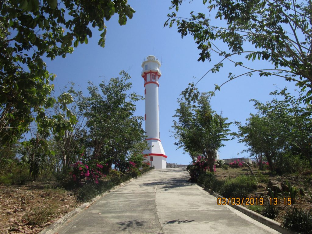 Ze473. (0a) the Cape Bolinao Lighthouse, it was a good road down from Bolinao Town, there are a few resorts on the way, some are not cheap. 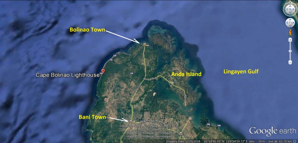 Ze474. (0b) the map to show you where the Cape Bolinao Lighthouse is. 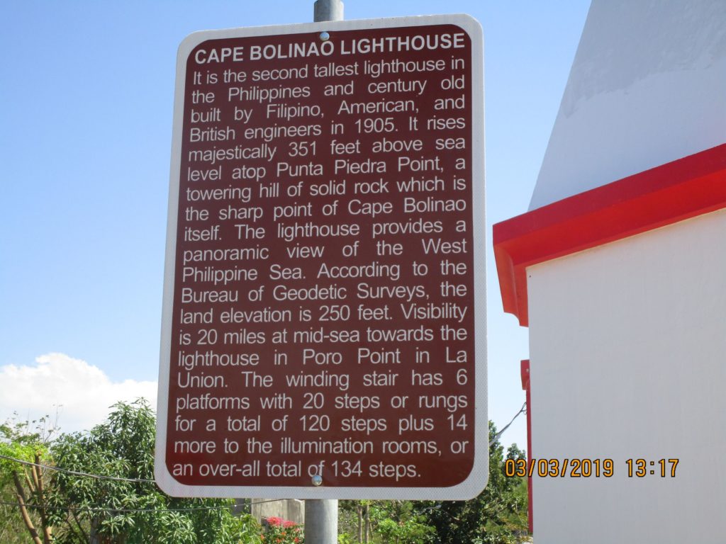 Ze475. (0c) this is the description of the Bolinao Lighthouse. 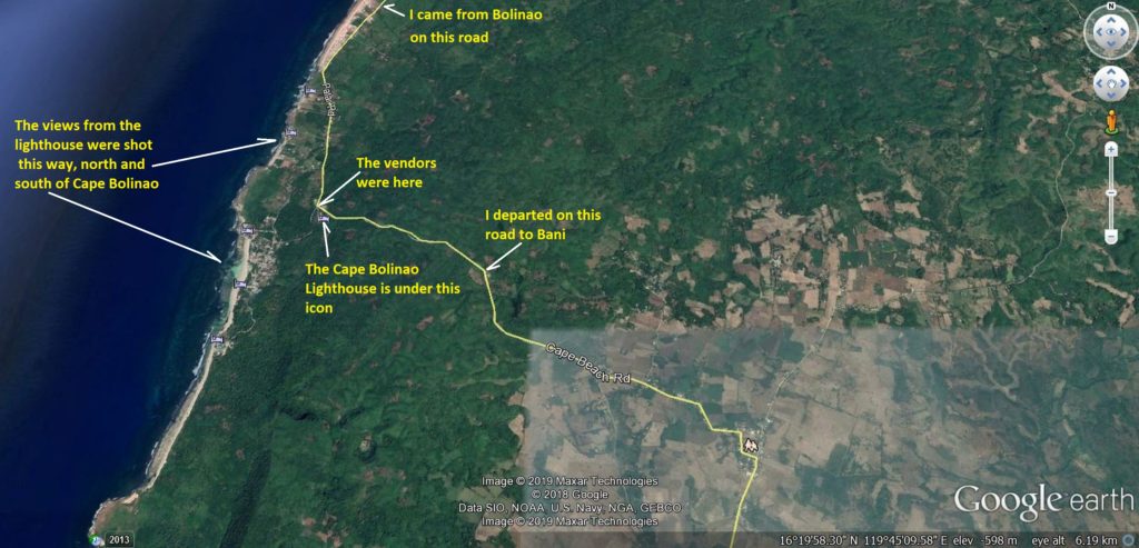 Ze477. (0d) here is a Google Earth map with the landmarks around the Cape Bolinao Lighthouse. If you look close a number of resort or hotels icons showed up all along the Cape Bolinao Coast. 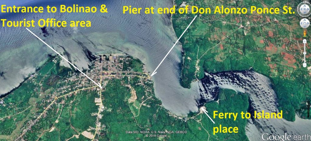 Ze480. (0g) this is the Google Earth map of Bolinao Town and the points I visited. 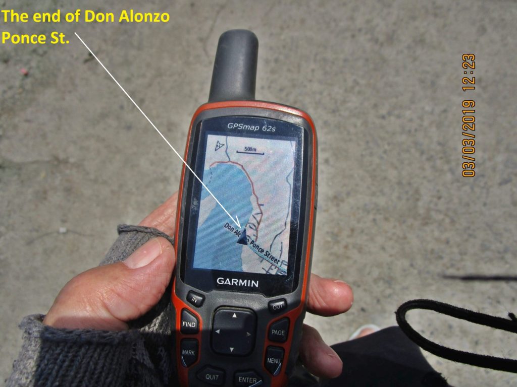 Ze483. (0j) often I use my Garmin Handheld GPS device; it has a Philippine road map in it to verify where I am. In deed I am at the end of the Don Alonzo Ponce St” in Bolinao Town. 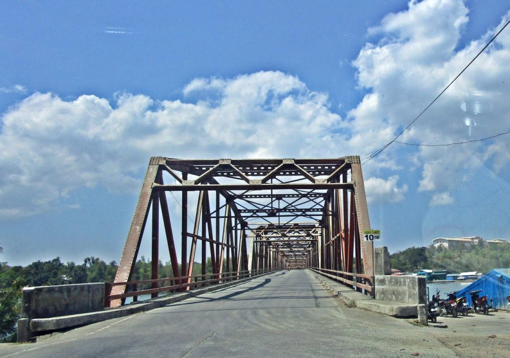 Ze488. (1a) this is the bridge to Anda Island in Lingayen Gulf; the real name of the island may be Cabarruyan Island. This actually was my first stop because I came from Alaminos. 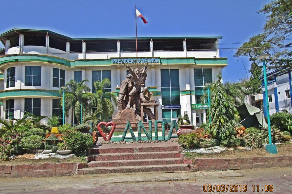 Ze491. (1d) the Anda Town Hall still has the Spanish designation. 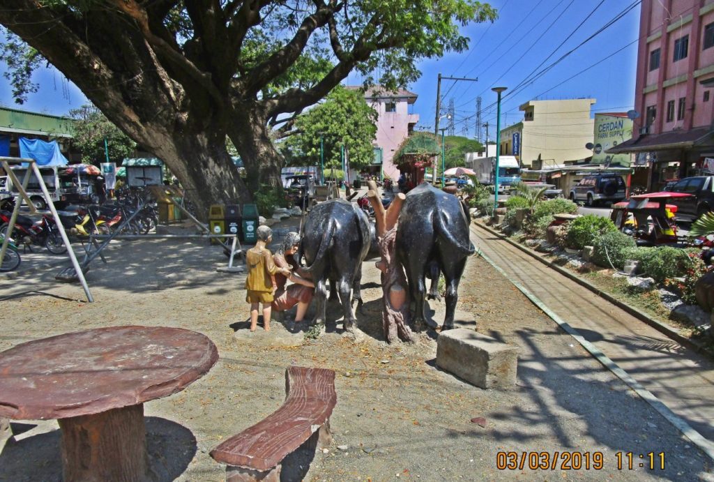 Ze492. (1e) we are at the Anda Town Plaza and we see a most impressive tree and this Carabao Stature |
|


