|
|
Post by Karl Welteke on Jan 5, 2024 18:45:01 GMT 8
Andres Bonifacio Shrine, Maragondon I have visited the Andres Bonifacio Shrine in Maragondon in Cavite twice now and took pictures. Numerous pictures have been posted but for this forum presentation I chose these 7 attached images: 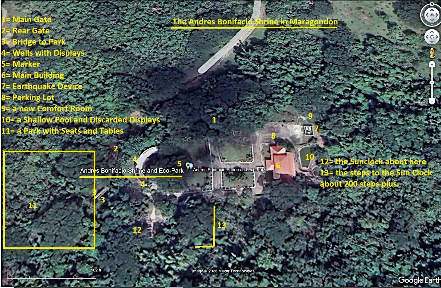 01 Bonifacio Shrine, 11th Dec. 2023, what is there to see at the Andres Bonifacio Shrine? ----------------------------------------- 2017, Andres Bonifacio Shrine, Maragondon 30 Oct. Took the family thru the province of Cavite including Maragondon Town to visit the Andres Bonifacio Shrine on the 30th of Oct. 2017. It is kept in good shape but there are no learning materials posted in the building or the whole shrine. It is almost an adventure getting there because it is the foot hills and very few people around to show the direction getting there. Posted 60 images without descriptions. The picture titles have a very short description in it! app.photobucket.com/u/PI-Sailor/a/f529cdaf-ba7e-4b98-9c85-992a7b2f5053?field=TITLE&desc=ascIf it doesn’t open, try copy and paste into a browser!  171030b the Bonofacio Shrine. 002. After you enter the shrine area, look right and this is what you see. This is a 2017 image. --------------------------------------- 2023, uploaded 70 images to my Photobucket account in Philippine Historical Places No 1, Andres Bonifacio Shrines and Marker on the 11th Dec. 2023. I noticed the Bayani Wall was completely changed with different displays, the ceiling in the main building is repaired now and one more toilette structure was added. app.photobucket.com/u/PI-Sailor/a/24a8773e-9b34-4f15-b7b3-8493bbb47033?field=TITLE&desc=ascIf it doesn’t open, try copy and paste into a browser!  z09 17 Bonifacio Shrine, 11th Dec. 2023. This is the main building at the Andres Bonifacio Shrine; and I’m glad to see that the false ceiling is repaired. In 2017 it was beginning to fall down at a very few places. This is a 11th Dec. 2023 image.  z11 43 Bonifacio Shrine, 11th Dec. 2023. This is the main change from 2017; the discarded displays are deposited behind the shallow pool behind the main building. This is a 11th Dec. 2023 image. ---------------------------------------- Bonifacio Shrine Sun Clock 11 Dec. 2023 On this day I revisited the Andres Bonifacio Shrine in Maragondon, the caretaker made me aware of over 200 steps going to a sun clock and views were available up there. So, I followed him up, enjoyed it and took these pictures. Uploaded 20 images to Photobucket at Philippine Historical Places No. 1, Andres Bonifacio Shrine and Marker: app.photobucket.com/u/PI-Sailor/a/0235fb50-4ff3-432d-83e4-41e74a1c11ba?field=TITLE&desc=ascIf it doesn’t open, try copy and paste into a browser! 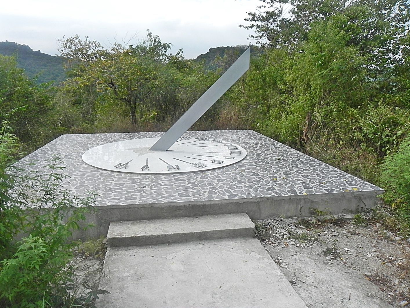 z12 11 Bonifacio Shrine Sun Clock. This is the sun clock at the Andres Bonifacio Shrine; this could also be a change, maybe it was installed after 2017. This is a 11th Dec. 2023 image.  z13 03 Bonifacio Shrine Sun Clock. The care taker at the Andres Bonifacio Shrine told the exact number of the steps going up to the sun clock but I forgot, but do remember it was over 200 steps. This is a 11th Dec. 2023 image.  z14 08 Bonifacio Shrine Sun Clock. This view is in an about northerly direction, towards the defense forts in Manila Bay. I imagine, exactly in this area, the Japanese placed their artillery to pound the forts in Manila Bay. This is a 11th Dec. 2023 image. ------------------------------------------------------ A Park at the Andres Bonifacio Shrine 231211 On this visit to the Andres Bonifacio Shrine 11 Dec. 2023, I learned there is sun clock and a park existed which I had not noticed on my last visit 2017. I noticed a walkway and bridge at the SW corner of the shrine and followed it. The park is neglected but I took these pictures anyway. Uploaded 13 images into this album at: app.photobucket.com/u/PI-Sailor/a/e12c6111-8be9-4078-9a11-2de7fdcfe6e1?field=TITLE&desc=ascIf it doesn’t open, try copy and paste into a browser! No pictures are provided, always pressured to post less! |
|
|
|
Post by Karl Welteke on Mar 4, 2024 16:50:09 GMT 8
New dirt road in Matain Rv. Valley 2024 I like to walk and came across an interesting find. Note: This is not about war or history but it is about Subic Bay. So, to all my Corregidor and History friends, just skip it if this is a pain to you! On my hike on the 3rd of March 2024, I came across two backhoes cutting a new dirt road from the Matain River Valley to the Mangahan Valley. This was a Sunday and one backhoe was parked at a dead-end stretch; the other was working on a way down to the Mangahan Valley. I speculate it is a private enterprise; there is no Government project sign. I don’t think it is the electric distribution organization; they might not even like that the new road cuts so close to the tower concrete bases. I have no idea what it is for. Is it for development up at these hills or a crossing over the hills to connect two valleys? For this forum presentation I chose these 7 Images. The URLs to the full albums are at the end! Picture descriptions: ------------------------------------ Pictures #00 to #04 are maps, data and my GPS track of my walk on the west hills in the Matain River Valley, Municipality of Subic. 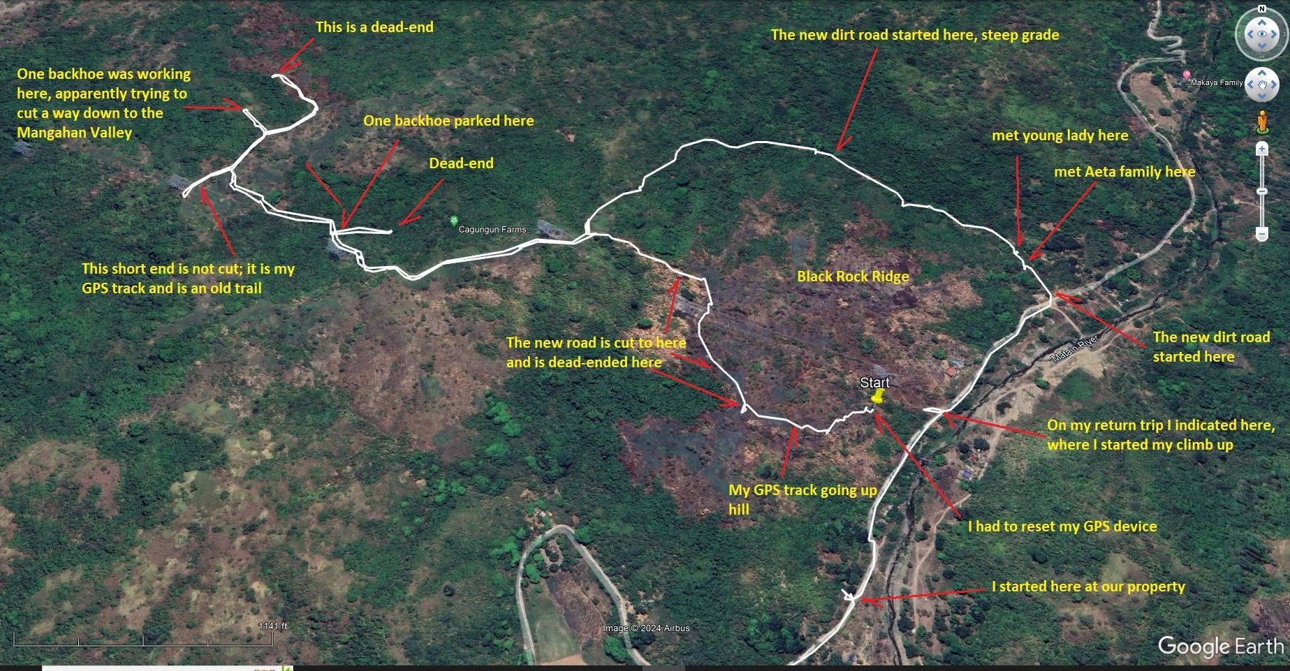 Pic #4 -------------------------------------------- Pictures #05 to #19 are images of the beginning of my walk up to the west hills in the Matain River Valley. The walk is pretty much under the new high Voltage line just put there. I have views of the Matain River Valley where I started the walk, the Black Rock Ridge (my name) and down-stream the Matain River and we see the Barretto Bypass Road being constructed. We also see the new dirt road was cut this direction but has a dead-end where I started up this hill. 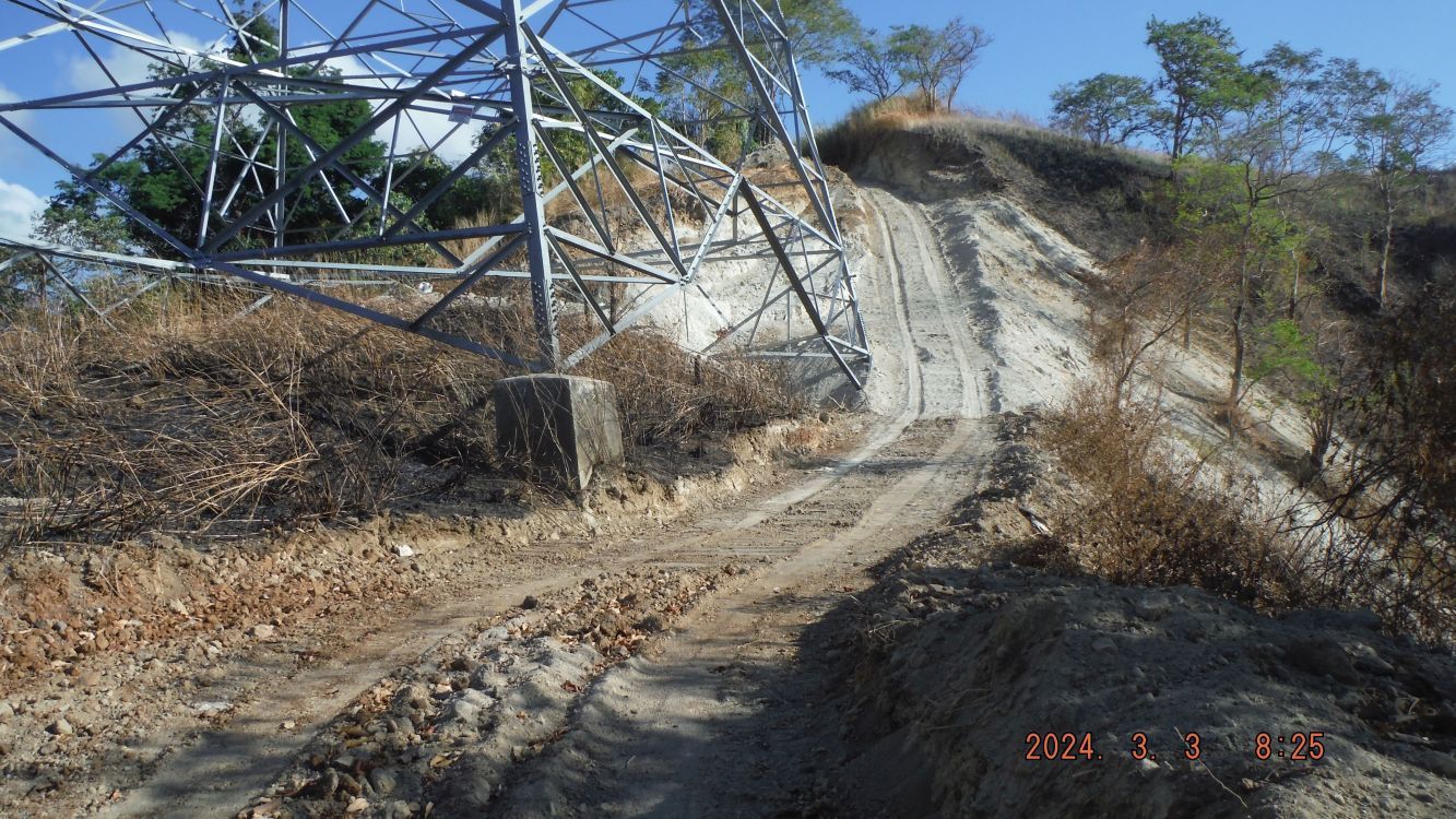 Pic #16 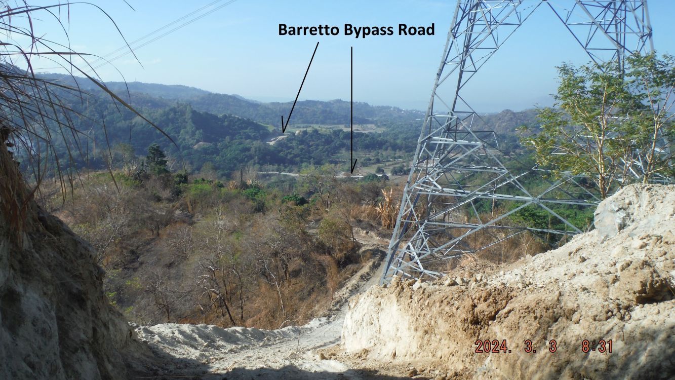 Pic #19 -------------------------------------------------------- Pictures #20 to #31 are views of the newly constructed dirt road, more or less following the new high voltage line just put there. We see one of the backhoes parked on a stretch of road which is a dead end. We have scenic view in all 4 directions, back to where I started, the lower Matain River Valley, the West Hills, the ridge line towards the Dizon Mine and the Mangahan Valley. 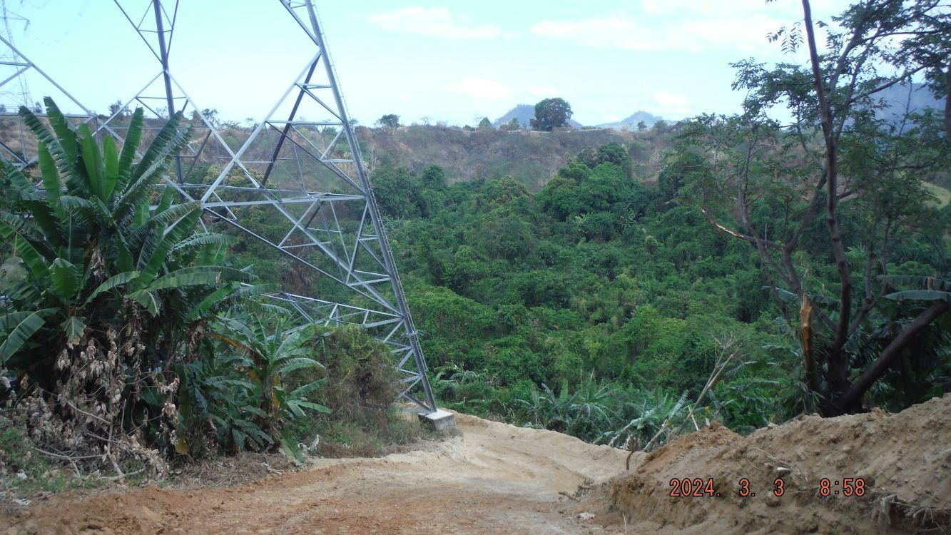 Pic #28 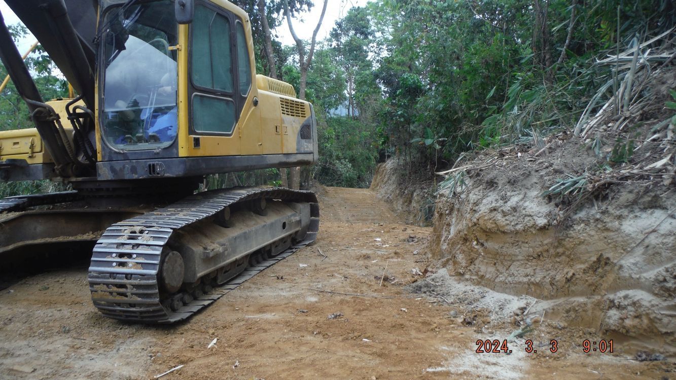 Pic #30 -------------------------------------------------------------- Pictures 32 to #46 are views of the new dirt road continuing to the last ridge where it goes down to the Mangahan Valley. We see the dead end at right and the back hoe at work, apparently trying to cut a way down to the Mangahan Valley. We have scenic view in all 4 directions, Kalaklan Ridge, the direction where I came from, the West Hills, Subic Town, the ridge line towards the Dizon Mine and the Mangahan Valley. 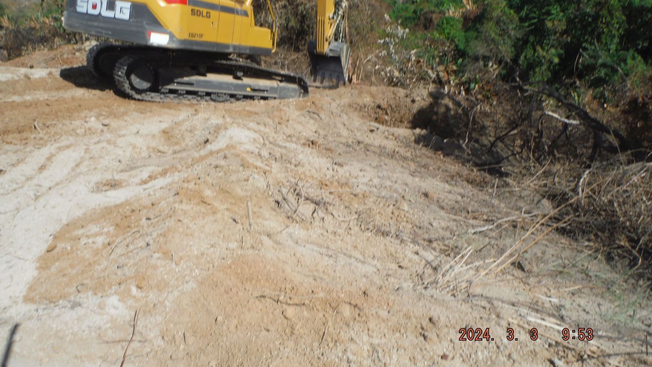 Pic #45 ------------------------------------------------------- Pictures #47 to #51 are views of the steep starting section of the new dirt road coming from the valley north of the Black Rock Ridge. 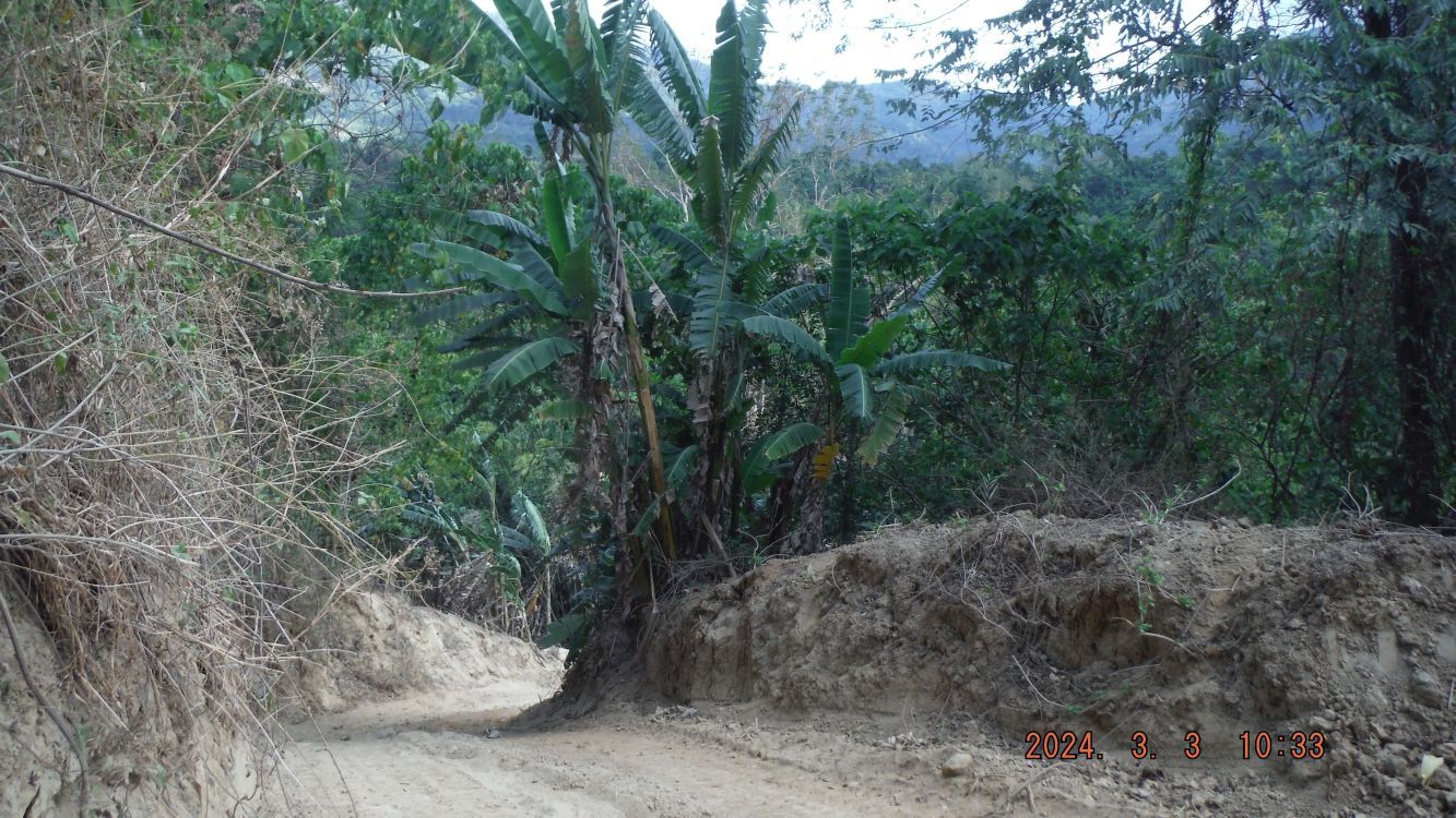 Pic #48 --------------------------------------------------- No pictures provided for these descriptions! Pictures #52 to #57 are of the new dirt road as it runs along the creek and valley north of the Black Rock Ridge, it starts at the concreted Matain River Valley Road, about 300 meter long. I met a young lady who tended to her property there, and a large Aeta (Negrito) family, but the adults were shy. Pictures #58 to #62 are views of my return walk to my family property along the Matain River Valley Road. One nice house is located under the new high voltage line. Picture #62 is the trail where I started the walk up the hill but is not indicated on my GPS track because I had to reset the device. Pictures #63 to #67 are views of my return walk to Barretto but these pictures show only the high voltage towers where I just walked under them and discovered that a new dirt road is being built there. The last 2 pictures are of the Matain River in Naugsol Village. If interested: Posted in FB as an album, 68 images, and shared them with: SBH3, US SB NAVFAC, Barretto Asso., Barretto Bars, Raging Main: URL for the FB post: www.facebook.com/karlwilhelm.welteke/posts/pfbid02jvej9VFZMaoa6m8PsQP1iqGzVzPh2wznAEv99tsFfkc48aeTCSdvumV5hznKoLHulURL for the FB album: www.facebook.com/media/set/?set=a.10227624753398094&type=3Posted 68 pics in a PhB as an album: Philippines incl. group, Sub Group No2 Phil events by year, 2024 OC, SB,BB,Zam app.photobucket.com/u/PI-Sailor/a/b7086ccc-998d-452f-b345-2a8935a911c5?field=TITLE&desc=ascNOTICE The last 3 URL links do not open when clicked!!!!!!!!!!!!!!!!!!! Try to copy the URL and place into another browser! That worked for me. I don’t know what is happening! It seems the links only works if you copy it and paste into another browser. This is happening to me in this forum lately. Help!! |
|
|
|
Post by Karl Welteke on Mar 21, 2024 14:04:36 GMT 8
Sitio Alibang, new dirt road above Sitio Alibang is a small community, mostly Aeta, of Barrio Naugsol, Subic Town and is about 5 km up the Matain River. A few days ago, I walked up on the hill above my family new property, which is in that place but on the right side, the west side of the Matain River. From this height I noticed a new trail, which looked to me as a new Carabao sled trail and I checked it on this day. I learned and it seems a solar power company is building a new high voltage line and built this new dirt road service road. For this forum presentation I chose these 5 images, links for the albums are in back. Photo descriptions, I let all of them stay here. #001 imaged was shot on the 3rd of March and I spotted this new trail which is in the hills above Sitio Alibang is a small community, mostly Aeta of Barrio Naugsol, Subic Town and is about 5 km up the Matain River. --------------------------------------------------- #002 to #005 are images of my track and data in exploring the new dirt road above Sitio Alibang is a small community, mostly Aeta of Barrio Naugsol, Subic Town and is about 5 km up the Matain River. 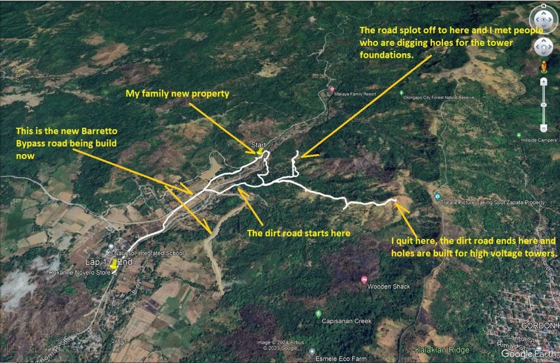 Z212. (002 Alibang above 240320) ------------------------------------------------------------------ #006 to 038 are images of entering Alibang, finding the new road, following the left branch of the road. I met people at the end of the branch road and they were digging holes for the electrical high voltage tower. Two Chinese surveyors were just leaving; they did not know English or Tagalog. So, these images are of the branch road and the views I was able to enjoy. I marked 2 pictures to indicate my new property and the thin layer of Mount Pinatubo ash. And I spotted a car, high up, on the new road, on the west side of the Matain River. 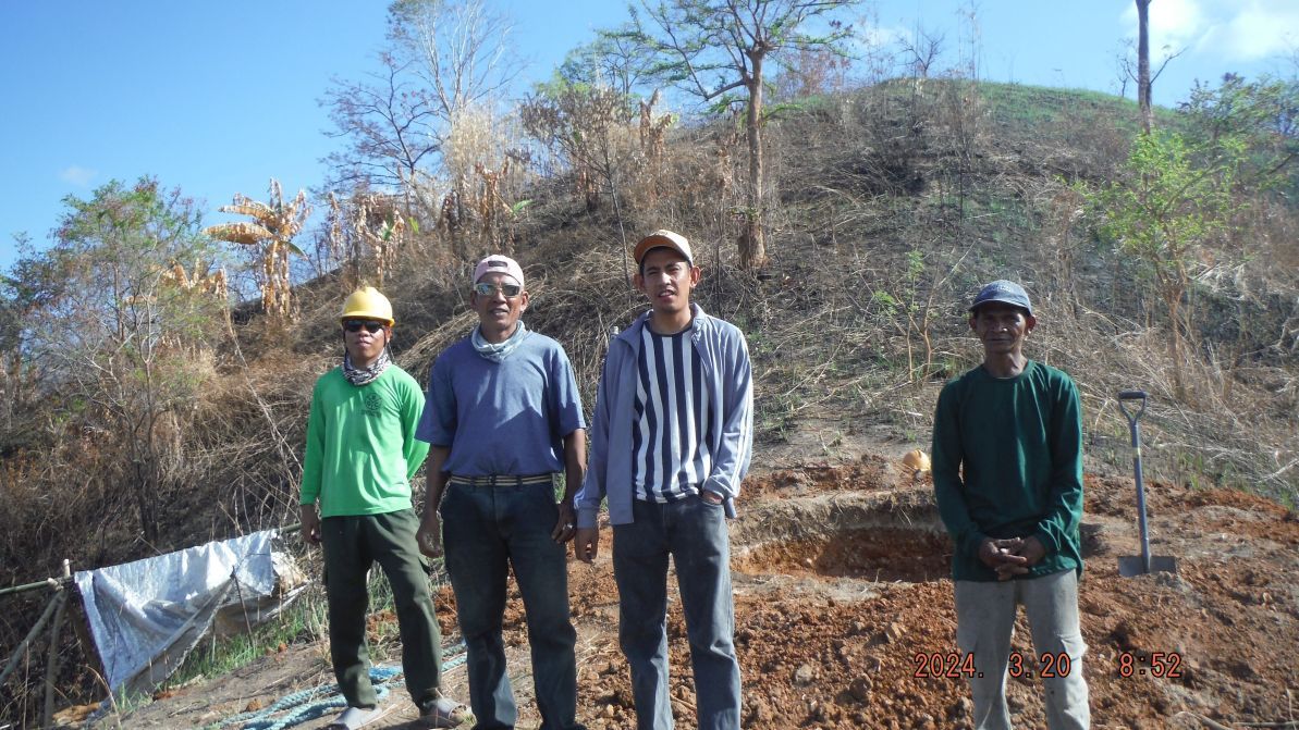 Z213. (021 Alibang above 240320)  Z214. (023 Alibang above 240320)  Z215. (024 Alibang above 240320) ------------------------------------------------ #039 to #091 are images of the longer road going up. I had hoped that it would go all the way up to the Kalaklan Ridge, but it did not. At the dead end, at about the 270 meter height it was a dead end and maybe a tower is going to be built here. I marked the picture where and why I decided to turn around. At my age of 82 it seemed too risky now to me. I had walked on top of the ridge many years ago but I decided those days are gone for me. 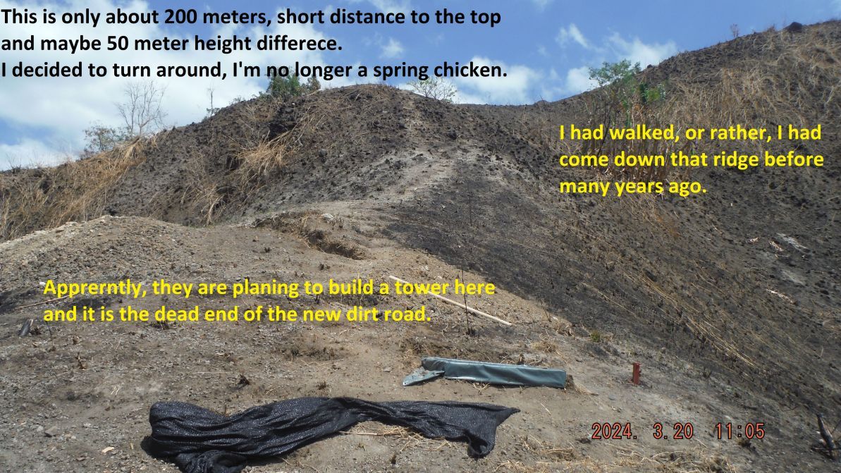 Z216. (083 Alibang above 240320) --------------------------------------------------- #092 to 095 images are of the start, beginning of this new dirt road to build a new power line. ----------------------------------------------------- The two photo albums: 95 images have been posted into an album at my Photobucket account, Philippines including my walks group, No 2 Phil events by year group, 2024 OC, BB, ZAM &SB group app.photobucket.com/u/PI-Sailor/a/1af23367-baa5-4a09-b195-0ee74736368b?field=TITLE&desc=asc--------------------------------------------------- Uploaded 25 images into this FB album and shared with: Raging Main, SBH3, BB Bars, SB Expats, BB Resident Assoc., This is the FB posting URL: www.facebook.com/karlwilhelm.welteke/posts/pfbid029mUoG4gGGnzc9taSgP9d8LCdHBq15QacpaNLpmbtRoKGS46MB4yf5AWDJKEywyBylThis is the album URL: www.facebook.com/media/set/?set=a.10227696794559078&type=3 |
|
|
|
Post by Karl Welteke on Apr 15, 2024 12:57:04 GMT 8
Barangay Cawag Valley to Subic Town walk 2024 Apr. 12 Took a trice to the starting point and walked back to Subic Town. The purpose was to get an update of this stretch of road and document changes. For this forum presentation I chose these 10 images! Links for more pictures and in high resolution are at the end of this email text! ----------------------------------------------- 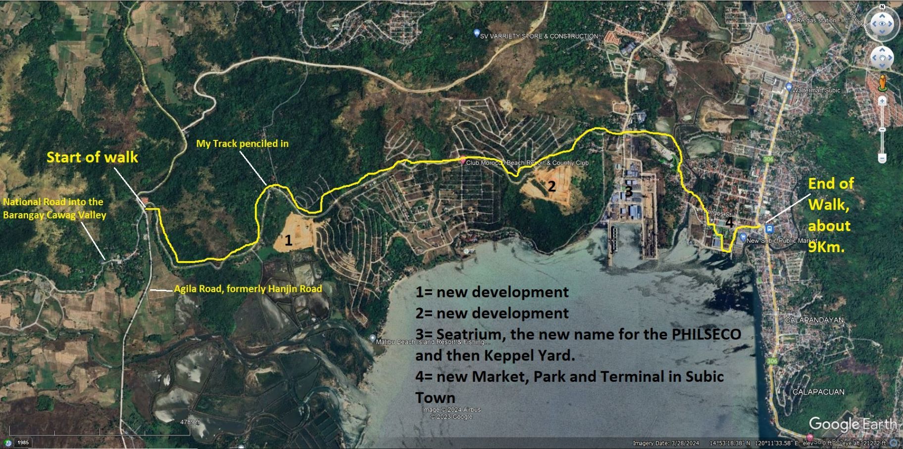 #02 my penciled in track of the walk on this Google Earth image of the Subic Town area . I marked in some landmarks in this album. --------------------------------------------------- 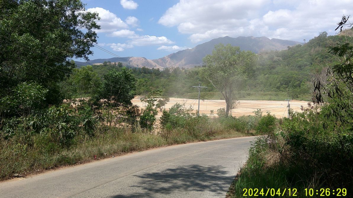 #12 is an image of the first development I came across, there was no project sign. But a lot of dump trucks were hauling dirt here and it seems they got the dirt at the second project. ---------------------------------------------------------- 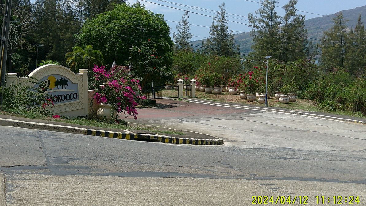 #30 image is the main gate to the Morocco Club area. I asked the guard whether I could walk to the clubhouse and he answered in the affirmative. Next time, was not on my plan today. ------------------------------------------------------- 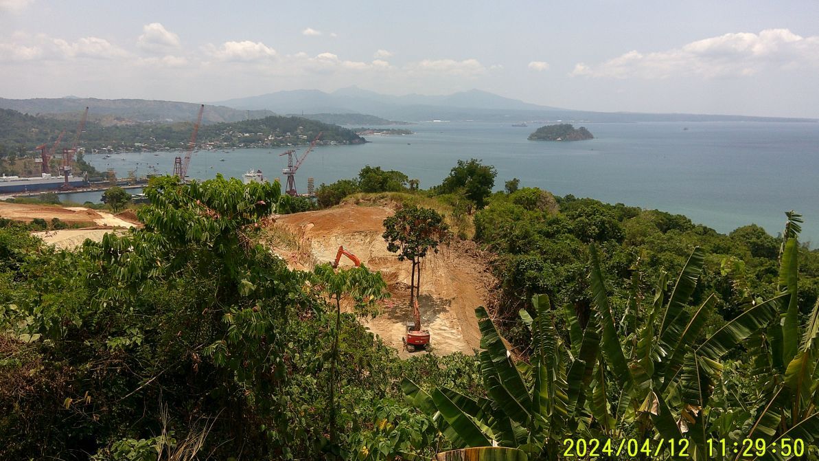 #35. #34 and #35 images are of the second development I came across. --------------------------------------------------------------- 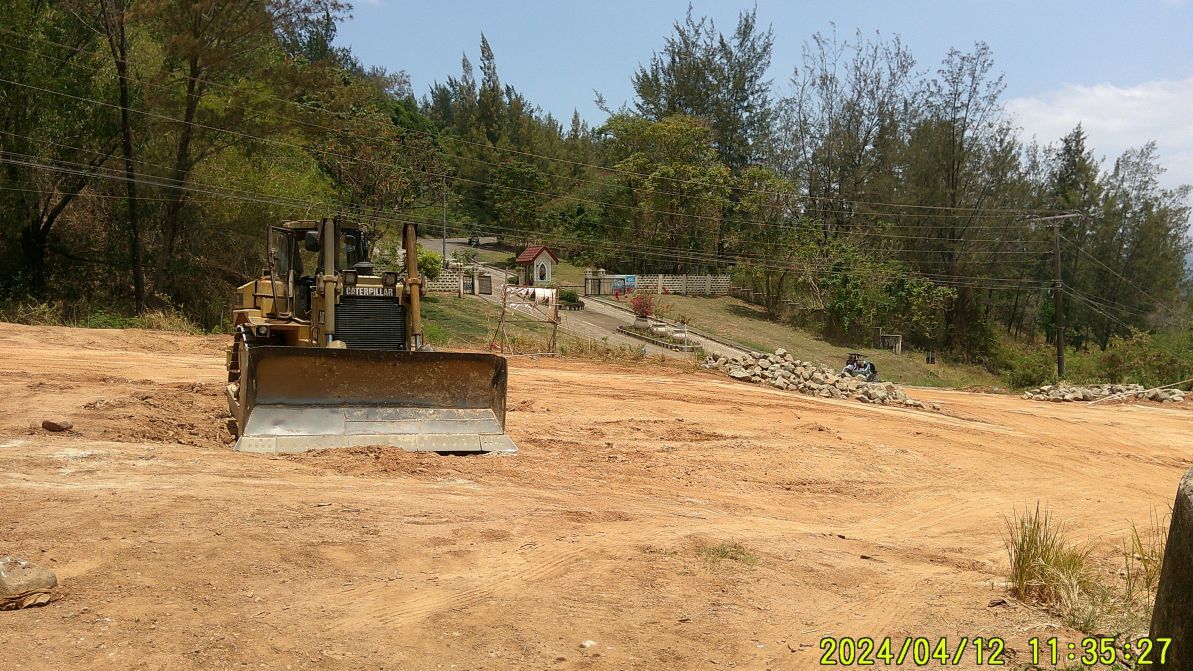 #42. #42 and #43 are images of another Morocco gate, to the villas on the Saddle Mountain, the name on my map. The pictures #34 and #35 of the second development were shot from the area of this gate. ---------------------------------------------------------------- 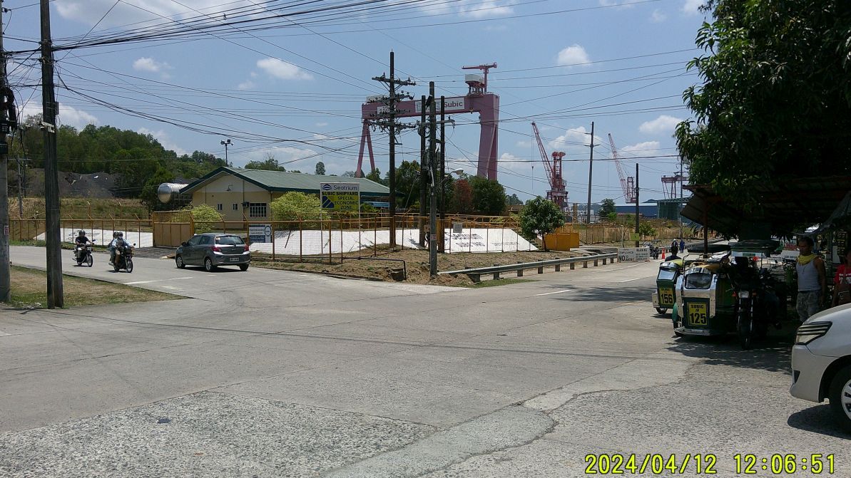 \ #49 image shows that the former PHILSECO Yard, then Keppel now has this name Seatrium. ------------------------------------------------------------------- 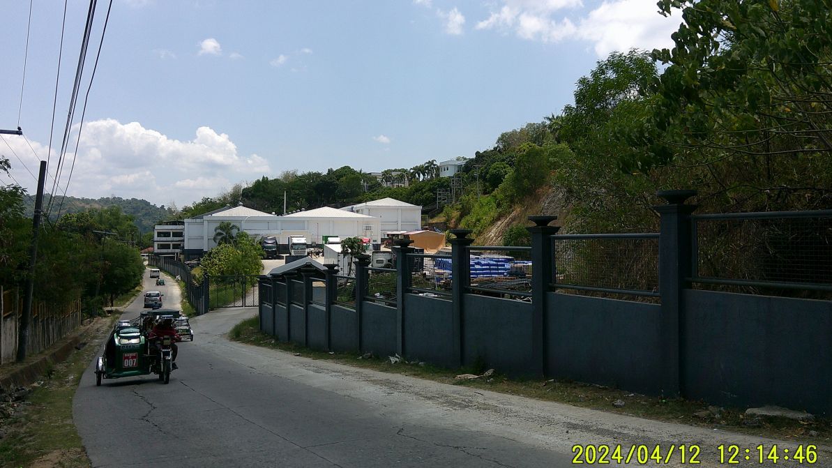 #55 image is of this impressive looking Belgian enterprise with the name of DLA. It is located on the narrow road from the former PHILSECO Yard to the Subic Town Market area. -----------------------------------------------------------------  #67. #67 #69 images show that a new park is being built in the Subic Town downtown and market area. ---------------------------------------------------------- 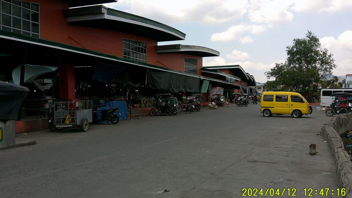 #70 is the new Subic Town market, the old one burned down some years ago. ---------------------------------------------------------- 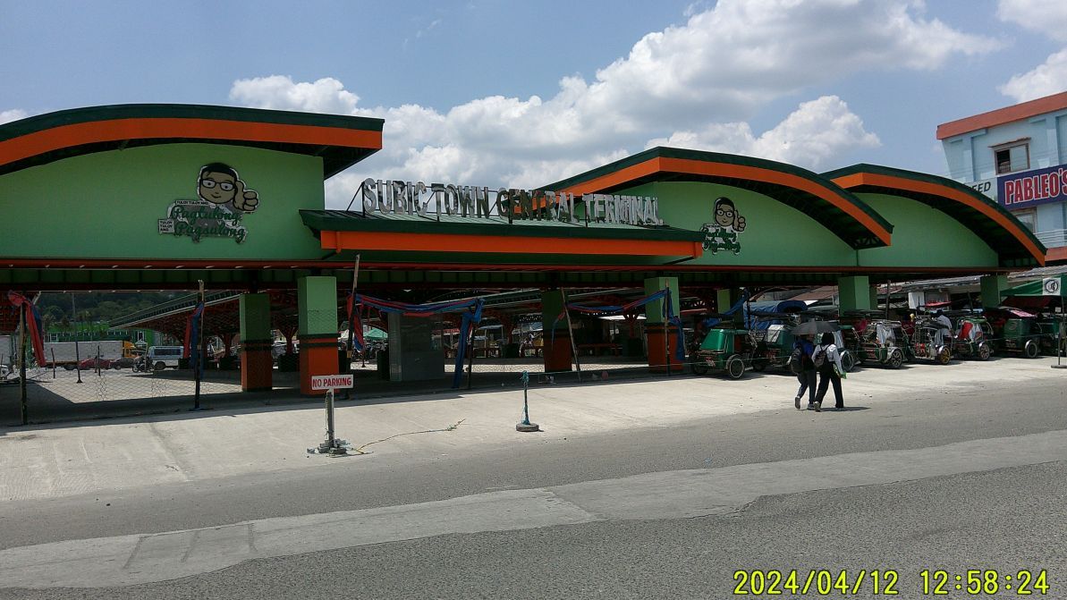 #83 image shows the brand-new terminal, Subic Town never had a proper one. If you are interested, Uploaded 86 images into this Photobucket album. These 86 unedited images have been posted in low resolution in this Photobucket album, nor have I put down any specific image description. app.photobucket.com/u/PI-Sailor/a/be38866b-19a1-44cf-b284-eb1b90ca00be?field=TITLE&desc=ascTwo short albums with 19 images have been created and the pictures have descriptions: Posted 19 images in Facebook, low resolution: www.facebook.com/karlwilhelm.welteke/posts/pfbid0r7RptZJAfHDYrBoJFaQkfwdCNZ64PNB39yRFMoVvuctK3cQEMxHxthJvtvtKsDw7lUploaded 19 images to this Flickr album in high resolution and the pictures have descriptions. Barangay Cawag Valley to Subic Town walk 2024 Apr. 12 www.flickr.com/photos/44567569@N00/albums/72177720316226763If the URLs don’t open------
Try to copy the URL and place it into another browser!
I don’t know what is happening! It seems these links only work if you copy it and paste into another browser. |
|
|
|
Post by Karl Welteke on May 13, 2024 18:26:23 GMT 8
Friends At wife’s home village Bon Ot Big and I am exploring the area. I thought, let me say “Hello” to all. This is in the San Bernadino Strait area. We US Navy Salvage Sailors took our tows thru this Strait to Subic Bay. In WWII the Imperial Japanese Navy came thru here twice and challenged the US Navy “to their regret”. Bon Ot. Big Mountains, Genablan Bridge 240511 Walked up the ridgeline between Bon Ot Big and Genablan, weather was great and got some nice scenery shots. Descended to the Genablan Valley, up-river, and then walked downriver on the left side, the Genablan Oriental side. I noticed the Aremar Construction Corp. is building a causeway across the river, apparently to construct a road bridge over the Genablan River to continue the road to Bulan. For this forum presentation I chose these 8 images, 45 images are available at these URLs: Uploaded to Facebook into an album with 45 images: Album URL: www.facebook.com/media/set/?set=a.849009190576187&type=3Posting Facebook URL: www.facebook.com/Welteke/posts/pfbid0BAesBRLgcdFuxXbRrXeFHe87KYnEvvt2JDQ2DwCD1nJkYqD9G8D9UrjDyuJavWD3lUploaded 45 images into this Photobucket album, Sorsogon 2024 on group, Sorsogon Province albums #1, Philippines including my walks: app.photobucket.com/u/PI-Sailor/a/b1b8a27b-5caa-4752-a00e-02328464d80b?field=TITLE&desc=ascTry to copy this URL and place into another browser!
I do not know what is happening! It seems this link only works if you copy it and paste into another browser.-----------------------------------  #01 pic is the first view of the Bon Ot Big Valley. --------------------------------------  #02.  #03. #02 & 03 pics are Google earth graphs of the San Bernardino Straight area and the track of my walk. --------------------------------------------------  #17. #04 to #22 pics are scenery shots from on top of the ridge between Genablan and Bon Ot Big in all directions, use the Google Earth image to find the directions. I love these views, especially on a sunny day like this. One got watch the heat affecting one’s body though! ----------------------------------------------------  #30.  #31. #25 to #35 images show the work of the Aremar Corp. hauling dirt for the causeway across the Genablan River, plus we see views of the unfinished road leading to it. The new Matnog to Bulan Road is only concreted to Genablan Sadai (Small). An engineer told me that in this year they also will finish the bridge in Bon Ot Big. -----------------------------------------------  #41. #41 to #45 images show the end of my trail, a couple of Bon Ot Big shots from the new road above it. Believe it or not, a small world indeed, pic #42 shows the garage of retired USN Gunners Mate, who I happened to know from my Hawaii days, and he is here now! The last two pics show the Waterfront Road of Bon Ot Big and I believe what is a new gate to the Bon Ot Big Elementary School at the end of the Waterfront Road. |
|
|
|
Post by Karl Welteke on May 19, 2024 16:14:56 GMT 8
Barcelona Ruins, Barcelona Ruins Park Edna Binkowski, the historian and writer of the book Codename High Pockets, a story of resistance against the Japanese occupier of the Philippines, asked me to take pictures of the Barcelona Ruins. She had interviewed the Tsubaki Club dancer Flora Corcuera in this town but lost her pictures. The text of this presentation is from this Government LGU Webpage. barcelona.sorsogon.gov.ph/home/general-information/history/For this Forum presentation I chose these 14 images. The picture numbers refer to the 47-image presentation in the Flickr album! Uploaded 47 images in high resolution into this Flickr album and put it into the Other Luzon Albums collection: www.flickr.com/photos/44567569@N00/albums/72177720316993443Try to copy these URLs and place them into another browser!
I do not know what is happening! It seems these links only work if you copy them and paste them into another browser.
------------------------------------------------ Pictures a01 to a15 are of the Presidencia Building which was the seat of Spanish government headed by a Governadorcillo. Built along the coastline of the Pacific Ocean, the Presidencia Building doubled as fortress against pirate and Moro attacks. Local accounts tell that underneath the building is a tunnel that leads to the church.  #a01.  #a03.  #a05a.  #a05b.  #a07.  #a12.  #a14. ------------------------------------------------------------ Pictures b00 to b15 are of the Barcelona Church with St. Joseph [Husband of Mary] as patron saint. In building the church, natives-Barcelonanons or, malignly branded indios [by Spaniards] — the lowest-ranked group in the then Spanish racial hierarchy — who proved to be deeply religious and good Christians hence obedient, were tapped by the friars and did labor by hands. Coral rocks and lime, without concrete and steel bars, were used in building the massive structure.  #b00.  #b03.  #b07. ------------------------------------------------ Pictures c01 to c06 are of the other building built by the Spaniards, the Escuela Pia or a school building purposely to cater to their children or those of the illustrados or the few educated class in those times. During American colonization of the town, from 1898 to 1946, the Escuela Pia acquired an English name, and was popularly called the Stone Building. It served as classrooms to school children of families from all walks of life in the central district of Barcelona until the building was condemned for reasons of safety. Like the Presidencia Building, ruins of the Escuela Pia or Stone Building is what remains of it today.  #c01.  #c04.  #c05. -------------------------------------------------------- Pictures d01 to d14 are of the Barcelona Ruins Park where special interest events happen all year round — such as game fishing competition, motorcycle ride, agri-trade fair, Valentine, Christmas and New Year decorations display, and cultural events including Happy Life, a community dance event for physical and mental health wellness.  #d01. |
|
|
|
Post by Karl Welteke on May 28, 2024 17:47:56 GMT 8
Bon Ot Big High School Graduation Walk, 240528 A Moment of Philippine Life This presentation has 10 images. One of my last walks in Bon Ot Big as we will soon return to Subic Bay, to our main home. This is the ridge between Genablan and Bon Ot Big. I had planned to descend near the high school but I heard the graduation speeches and music, so, I had a closer look. If you are interested: All 23 pictures can be viewed and downloaded in high resolution, here in this Flickr album: www.flickr.com/photos/44567569@N00/albums/72177720317374143/And all 23 images, low resolution, were uploaded into this Bon Ot Big Facebook page as an album: Posting URL in Bon Ot Big Facebook page: www.facebook.com/Welteke/posts/pfbid0254iCk48y8UdK44PSqVc9BKyNNVk7MdShEJtcvYAfsr79F4JvYDsHZcsd7S9GakhZlThe album URL is this: www.facebook.com/media/set/?set=a.859457959531310&type=3Sorry, but you need to copy the above URLs and paste them into a new browser! --------------------------------  #00 image shows the Genablan Occidental side of Genablan River, we are looking west, in the direction of Masbate, which is on the horizon. I noticed the new road from Matnog to Bulan is making progress. I had planned to take no pictures because I have many from the ridge but the progress of the road is noteworthy. -----------------------------------  #01 image of Bon Ot Big from the ridge as I descended, I shot it, because that is the best angle view of the village on this visit. ------------------------------------------- #02 to #15 images are all pictures of the Bon Ot Big High School Graduation as it was finished and the students, parents and visitors were leaving. You will notice that most Filipinos are always ready for a picture.  #03 image.  #05 image.  #09 image.  #11 image.  #14 image. ------------------------------------------- #16 to #22 images are of the high school gate area. One vehicle came, perhaps a VIP visitor or a well to do relative. Notice the one wheel wide concrete path to the school has been replaced with the vehicle wide dirt road in connection with the ongoing project of building the Matnog-Bulan Road.  #17 image.  #19 image.  #22 image. |
|
|
|
Post by Karl Welteke on Sept 6, 2024 15:29:03 GMT 8
Hernani, Storm Surge 1897. My nephew and I visited the Our Lady of Seven Dolors Church Ruins on the 22 of May 2024. Visiting the eastern shores of the Visayan Islands has become one of my hobbies. Samar and Leyte are full of history, including Phil.-US History and that attracts me. My pictures didn’t turn out so good, so I borrowed the first two from this Facebook Page: Eastern Samar and Culture- www.facebook.com/LopeCRobredilloWe all know about the Typhoon Haiyan, known in the Philippines as Super Typhoon Yolanda, During those days the GMA News published this article: A history of storms: 1890s newspaper reveals devastating Leyte typhoon: www.gmanetwork.com/news/scitech/science/335673/a-history-of-storms-1890s-newspaper-reveals-devastating-leyte-typhoon/story/ This article caught my attention that 400 Europeans died, I think that was more that from Typhoon Haiyan: The news story went on to detail: “It is estimated that 400 Europeans and 6000 natives lost their lives, many being drowned by the rush of water, while others were killed by the violence of the wind. Several towns have been swept or blown away.” The Municipality of Hernani also was affected and the church ruins still remain and should be a warning to all when the Typhoons strike! I wish the Hernani Community or the Province Authorities would make it a proper tourist spot as a typhoon warning to all!!!  01 Hernani, Storm Surge 1897. This picture is cutesy of the Facebook Page: Eastern Samar and Culture, EASTERN SAMAR HISTORY AND CULTURE is administered by Lope C Robredillo, SThD, Chair of the Diocesan www.facebook.com/LopeCRobredillo 02 Hernani, Storm Surge 1897. This picture is cutesy of the Facebook Page: Eastern Samar and Culture, EASTERN SAMAR HISTORY AND CULTURE is administered by Lope C Robredillo, SThD, Chair of the Diocesan www.facebook.com/LopeCRobredillo 02a Hernani, Storm Surge 1897. This is a Google Earth graph of the SE Corner of Samar; I underlined some other towns of History.  03 Hernani, Storm Surge 1897. We have arrived; this sign is just about 100 meters north of the Our Lady of Seven Dolors Church Ruins.  06 Hernani, Storm Surge 1897. This is the front of the Our Lady of Seven Dolors Church Ruins, facing the East Samar Coastal Road. The ruins are grown over!  07 Hernani, Storm Surge 1897. This is the front of the Our Lady of Seven Dolors Church Ruins, facing the East Samar Coastal Road. The ruins are grown over!  08 Hernani, Storm Surge 1897. This is the front of the Our Lady of Seven Dolors Church Ruins, facing the East Samar Coastal Road. It shows a window above the Church Door. The ruins are grown over!  09 Hernani, Storm Surge 1897. A local man passed thru Our Lady of Seven Dolors Church Ruins, perhaps with firewood from the scrub between the church and the Pacific Ocean Beach.  10 Hernani, Storm Surge 1897. An inside view of the Our Lady of Seven Dolors Church Ruins. As I said my pictures did not turn out very good, sorry.  11 Hernani, Storm Surge 1897. Between the Our Lady of Seven Dolors Church Ruins and the Pacific Ocean Beach are coconuts and scrub, there was no clear path to reach the beach from this church ruin. |
|


