|
|
Post by Karl Welteke on Mar 20, 2022 10:38:14 GMT 8
Nagsasa Cove to Pundaquit boat ride, 2022-03-15 For this forum presentation I chose 3 images. After I finished my hike to Nagsasa Cove I rented a boat to go to Pundaquit. On the ride to Pundaquit I took 55 pictures of the coastline. The pictures are presented alphabetically and in the order they were shot. These 55 images plus 4 sections of maps are in this Flickr album, and they are uploaded in high resolution: www.flickr.com/photos/44567569@N00/albums/72177720297458112/with/51947276266/A short version with 14 images was established in my Facebook account: In the descriptions of the images are often references of serial numbers and how many pictures based on the pictures in the Flickr album, so bear with me! 3 images with descriptions:  U887. #00b this is one of 4 map pictures in this album, Nagsasa Cove to Pundaquit boat ride, 2022-03-15 so that you might orient yourself as to where the pictures were shot.  U888. #10 this is one of 15 shots of leaving Nagsasa Cove, numbered #01 to #15 and show the Nagsasa Cove, the northern coastal point we got to get around. On pic #8 we some the very low rocks and in picture # 10 Tabones Island comes into view.  U889. #34 this is one of 13 images of the rough coast between Anawangin Cove and Pundaquit Beach. Picture # 45 shows the minor beaches and coves, called Diego’s Cove and Agnain Cove. The pictures are numbered # 34 to # 46. In the picture #42 the smaller Capones Island, called Camara Island comes into view. Pictures #36 to #40 show the large rock island at the northern point of Anwangin Cove and several very low rocks coming out of the water and I watch with a little concern my boat and other boats going thru those low rock outcroppings. |
|
|
|
Post by Karl Welteke on Mar 30, 2022 15:00:50 GMT 8
Repair of links in the page about the Ipo and Angat Dams. The repair also had to be done for the La Mesa Reservoir entry. All three dams are VERY IMPORTANT for the waters supply to Metro Manila. That was also a high priority for Gen MacArthur in WWII who sent his forces there to liberate and safeguard these dams. All three dams are covered in this Corregidor forum page, scroll down: corregidor.proboards.com/thread/1655/excursions-philippines?page=5 , scroll down To stir up your interest to revisit that page I repost these 5 images about those dams.  Zc037. A WWII map about the seizure of the Ipo Dam from the above webpage: The Triumph in the Philippines.  Zc040. Monument dedicated to all those who died in the Battle for Ipo Dam. It is located along the road leading to the dam. Credit is to this web page for this picture: kontedstories.blogspot.com/2014/07/general-yamashita-and-his-glittering.html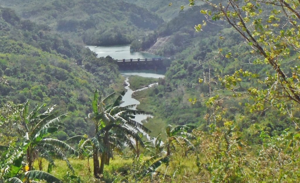 Zc044. We got a view of the Ipo Dam after all while we are on our way from the gate to the Ipo Dam going to the Angat Dam; zoomed in. 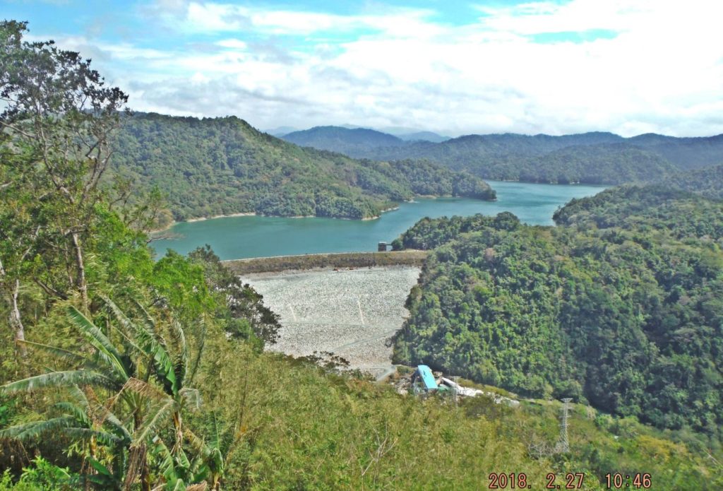 Zc048. The Angat Dam and Hydro Power Plant 2018-02-27. 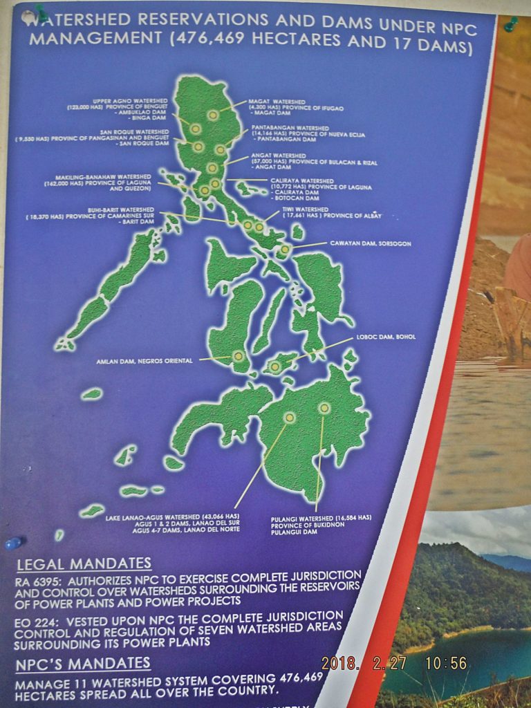 Zc062. This is a graphic showing the watershed areas that surround about 17 water dams and hydroelectric power plants. This information and image is posted at the visitor building near the viewing deck of the Angat Dam and Hydro Power Plant 2018-02-27. |
|
|
|
Post by Karl Welteke on Oct 11, 2022 19:10:22 GMT 8
Various Images, San Fernando L.U. Recently, a friend and I visited San Fernando, La Union to retrace the movement of the Oryoku Maru POW survivors when they were loaded on other ships to Japan. I already established 6 albums about that visit for specific subjects or venues. This is the 7th album, called Various Images, San Fernando, L.U. it has images which I found interesting for various reasons. Several pics are actually from Bauang, the municipality south of San Fernando and the Naguilian gateway to Baguio. The subjects are various images-11 pics; The North and South Central Schools (our guide Miss Dominique H. in two pictures)-10 shots; the Poro Point Baywalk (includes 2 pics in direction of former L-Shaped Pier)-9-shots and the La Union Capitol complex-17 shots. Uploaded to Photobucket, Philippine Historic, Oryoku Maru POW survivors in San Fernando, La Union, app.photobucket.com/u/PI-Sailor/a/34cde1ff-15e6-4dab-be78-84d665b0448fThis is the description of the first 6 pictures. This is one of 6 images which we shot in the vicinity of the La Union Maritime Police Station. We parked here, shot a pic of the police sign and the entrance to the port area which is under construction. We also shot a pic of an abandoned old Philippine house, a typical Filipino vendor with his jeepney packed and the landmark high rise near the PNR Station at the corner of Ancheta St. and Mabini St. This is the description of the next and last 5 pictures. This is one of 5 images in San Fernando, but most are actually shot in Bauang, one is of our hotel, we stumbled into the old VFW Post 9892 Building, which is now a restaurant for Arabic cuisine and was a German style Bakery before that. The first picture is a typical tire repair place, a vulcanizing shop. ------------------------------------------- 10 pics of the South and North Central Schools This is one of 10 images of the South and North Central Schools, they are east of the City Hall, about 0.8 Km.; the City Administrator suggested checking it out because they are perhaps prewar schools. Two pictures show our most friendly and helpful guide Miss Dominique H. from the City Tourism Office. ---------------------------------------------------- 9 Baywalk Pictures This is one of 9 images of the Poro Point Baywalk or where shot from the Baywalk. At least 2 shots are in the direction of the former L-Shaped Pier where the POWs had to jump or were pushed into boats. --------------------------------------------------- This is one of 17 images of the La Union Capitol complex on a small ridge just east, close and above the central part of San Fernando City Center. The complex exists of a few structures and it has a pagoda at a view point over the San Fernando City. =============================================== This is the URL for this group of albums; one has to click on the box (7sub-albums): app.photobucket.com/u/PI-Sailor/a/7139fff7-2d9f-4a64-bc27-64556e4c230dFor this forum presentation I chose these 11 pics. 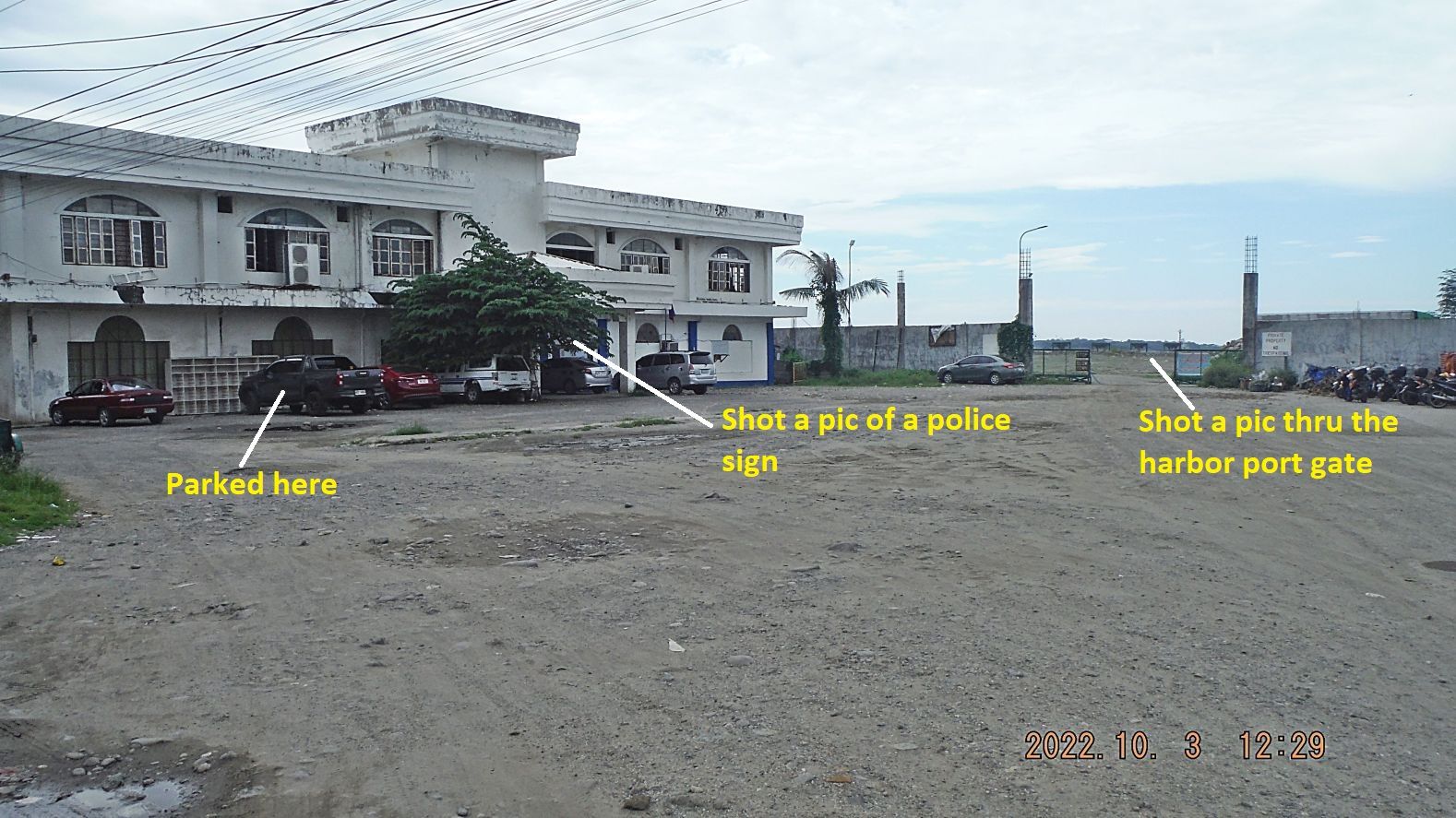 01 221004k 02 Pics of San Fernando, L.U. This is where we found safe and easy parking. 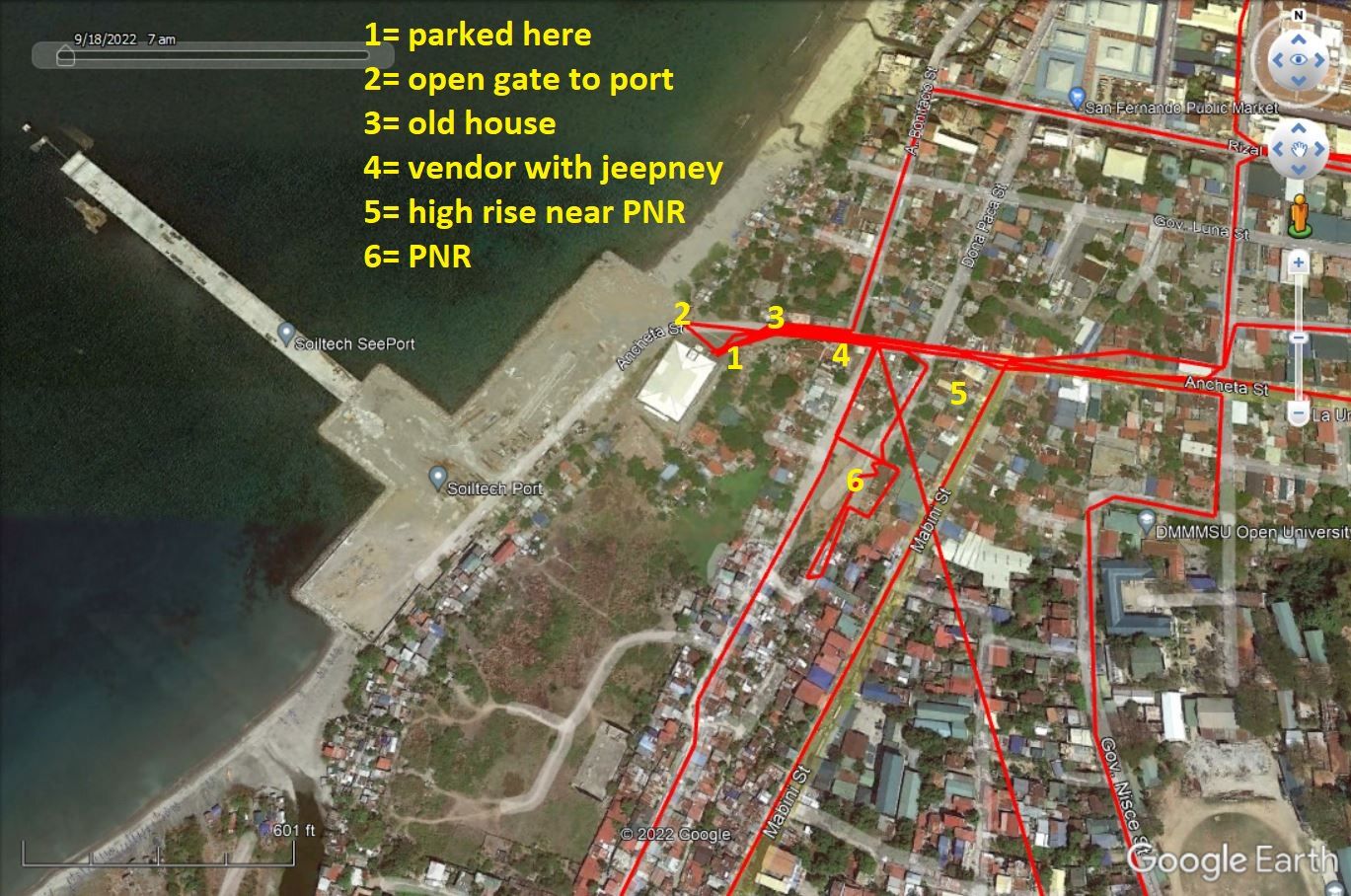 01 221004k 02a Pics of San Fernando, L.U. This is where we found safe and easy parking and we shot some images of interest. 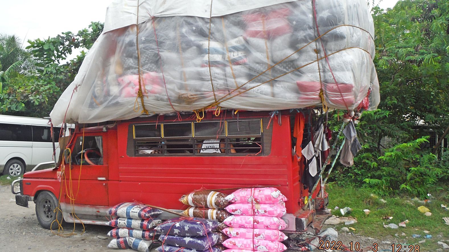 05 221004k 00 Pics of San Fernando, L.U. To me that is an interesting picture. It represents to me the hard struggle Filipinos fight every day to make a living. 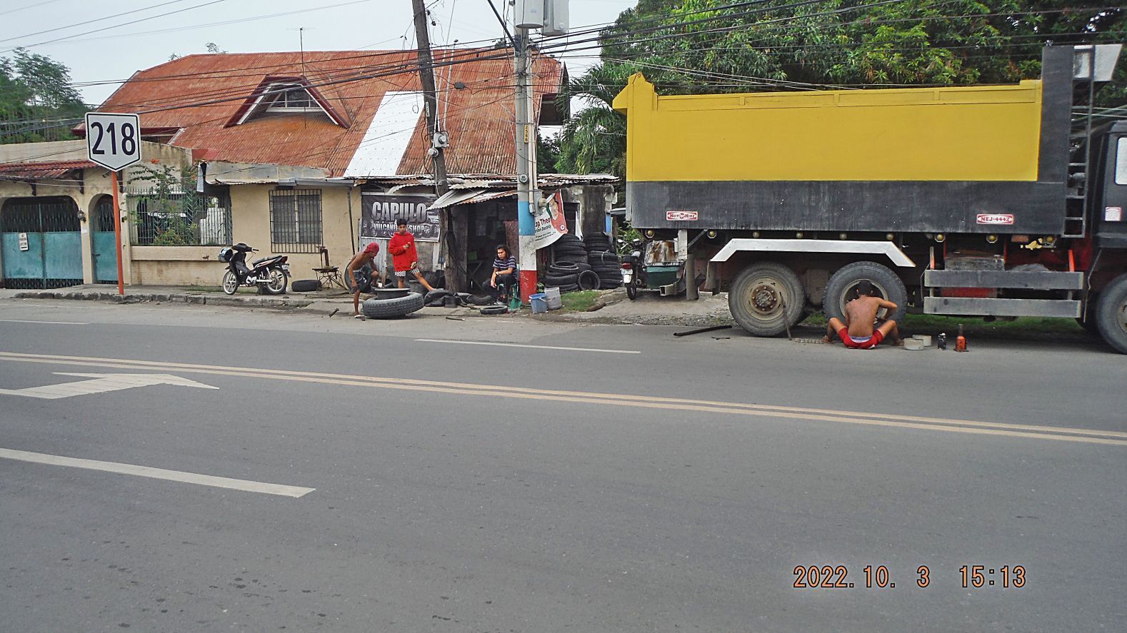 07 221004k 05 Pics of San Fernando, L.U. To me that is an interesting picture. It represents to me the hard struggle Filipinos fight every day to make a living. This picture was shot near the Tomb of the Unknown Soldier on Pennsylvania Ave. 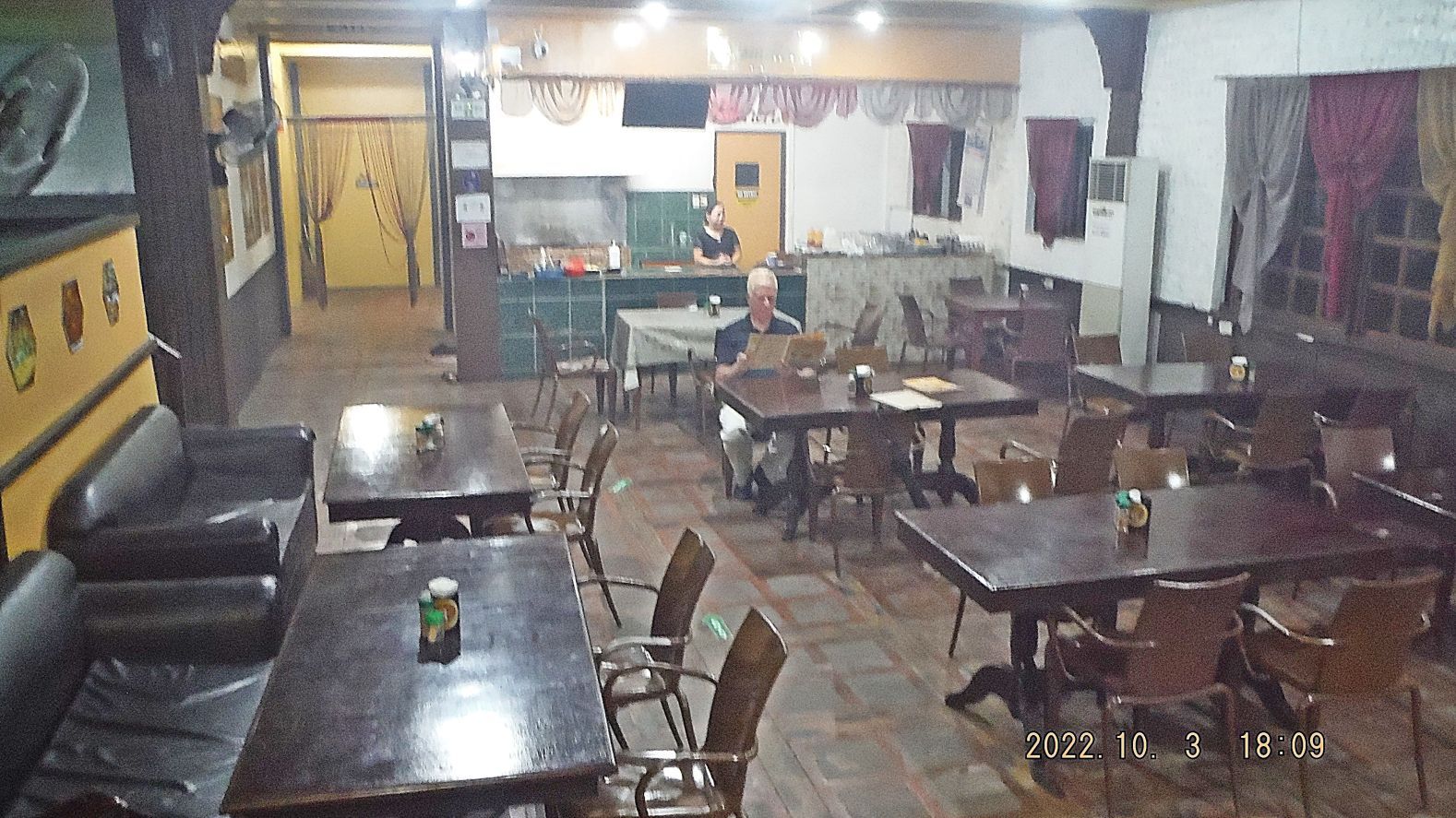 221004k 06 Pics of San Fernando, L.U. This place was the former cantina of VFW Post 9892 in Bauang, La Union. Now it is a restaurant for Arabic cuisine. On our Google map it said German Bakery. It was only about 150 yards south of our hotel and when we stepped in; we both remembered it as the VFW Post 9892 Cantina. So both, the VFW Cantina and the German Bakery, are history now. 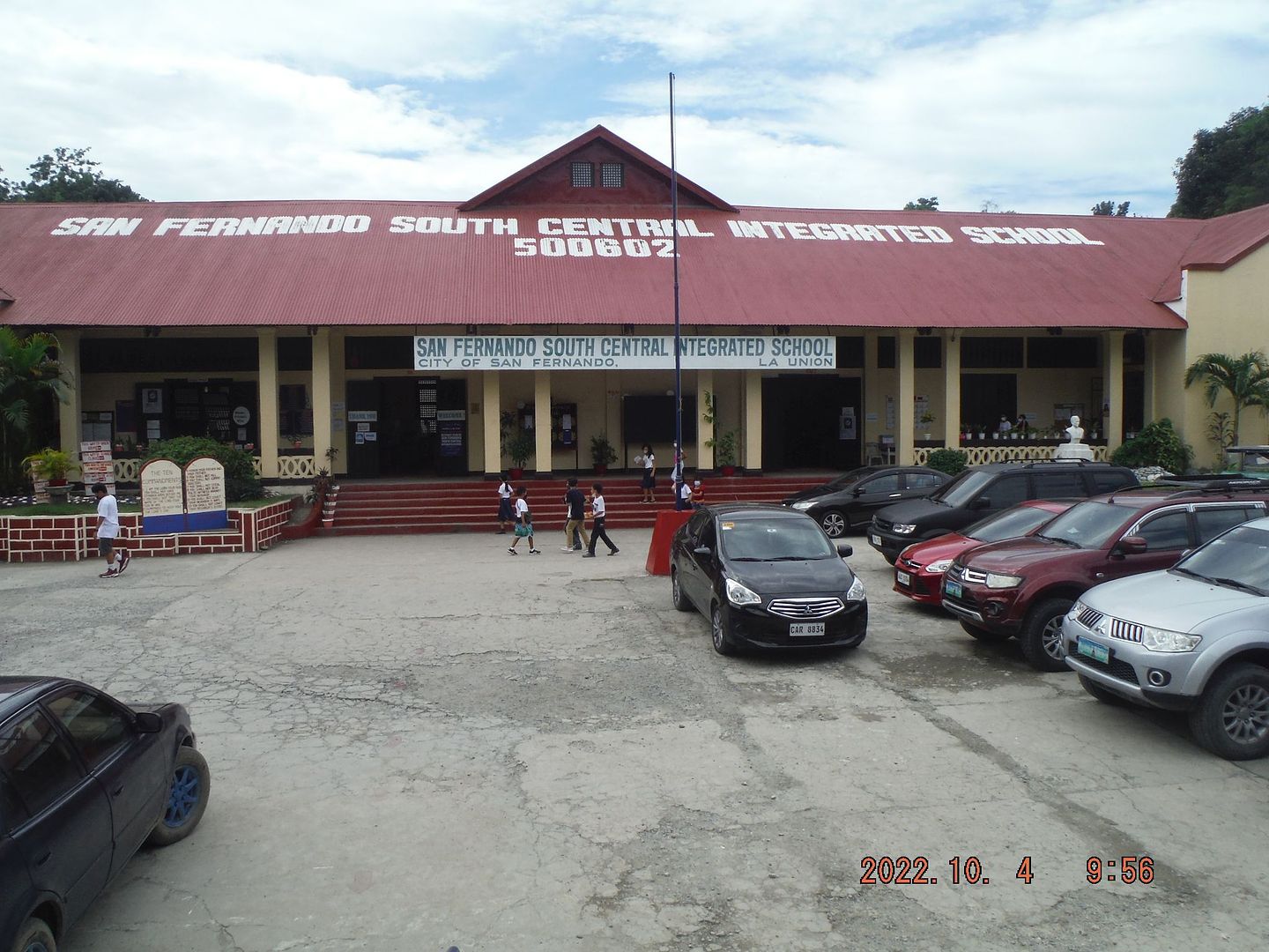 221004r 03 South & North Central San Fernando, L.U. Schools. We went here because this school probably existed before WWII. 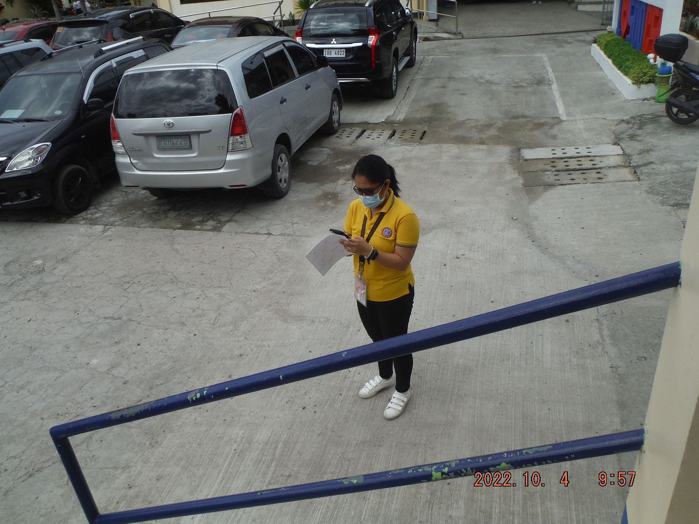 221004r 05 South & North Central San Fernando, L.U. Schools.Dominique. This is Miss Dominique H. from the San Fernando Tourist Office and helped us in many ways and she was a very efficient and friendly City Officer. 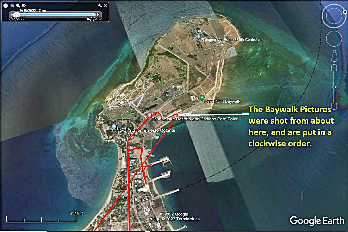 221004s 01 Poro Point Bay Walk. The location of the Poro Point Baywalk and the spot where we took the pictures from. 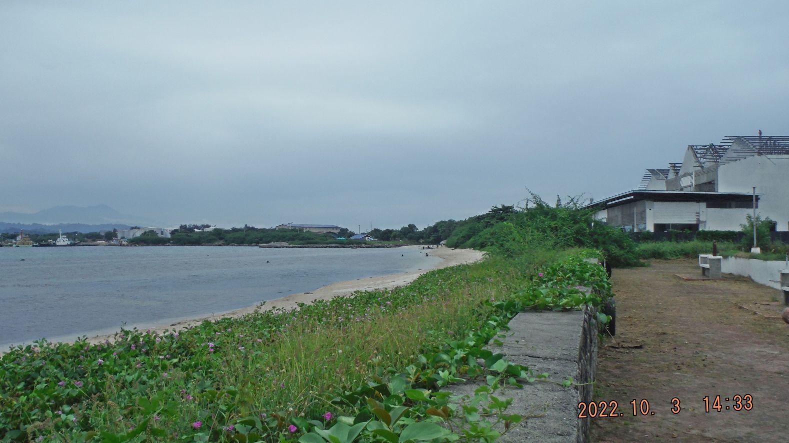 221004s 07 Poro Point Bay Walk. This is shot in the direction of the former L-Shaped Pier where the POWs had to jump or where pushed down into boats in Dec. 1944, shot from the Baywalk. 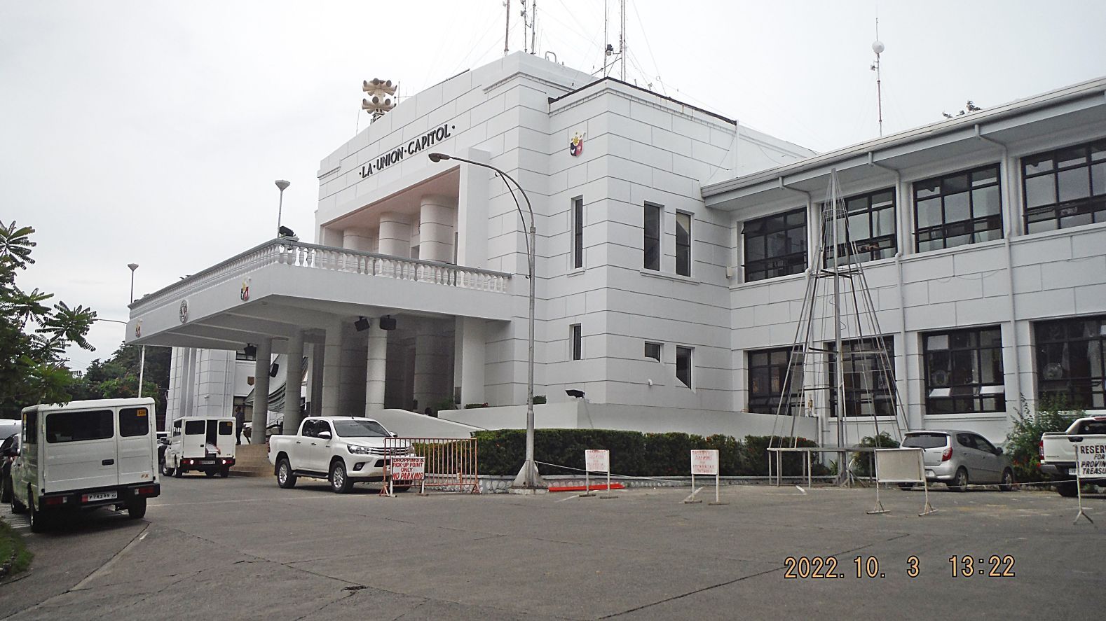 221004u 09 Capitol Complex, La Union. The La Union Capitol Building. 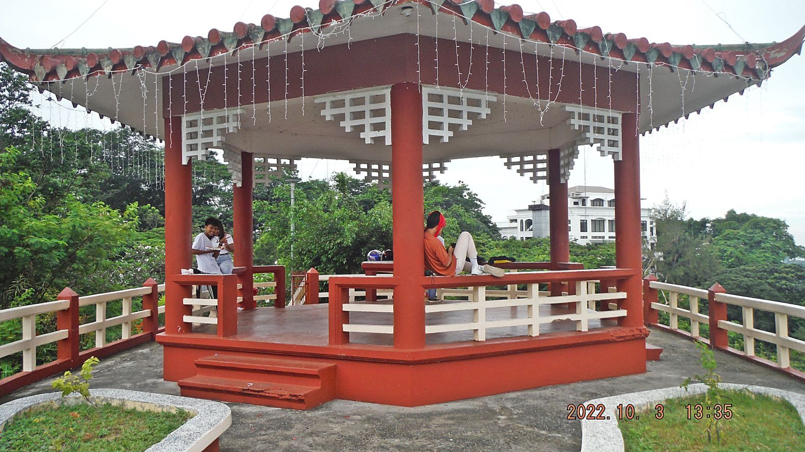 221004u 14 Capitol Complex, La Union. This is a pagoda type structure at the La Union Capitol Complex. A great place for a view shot of San Fernando from above. Young people seem to visit here for rendezvous. |
|
|
|
Post by Karl Welteke on Nov 7, 2022 15:23:26 GMT 8
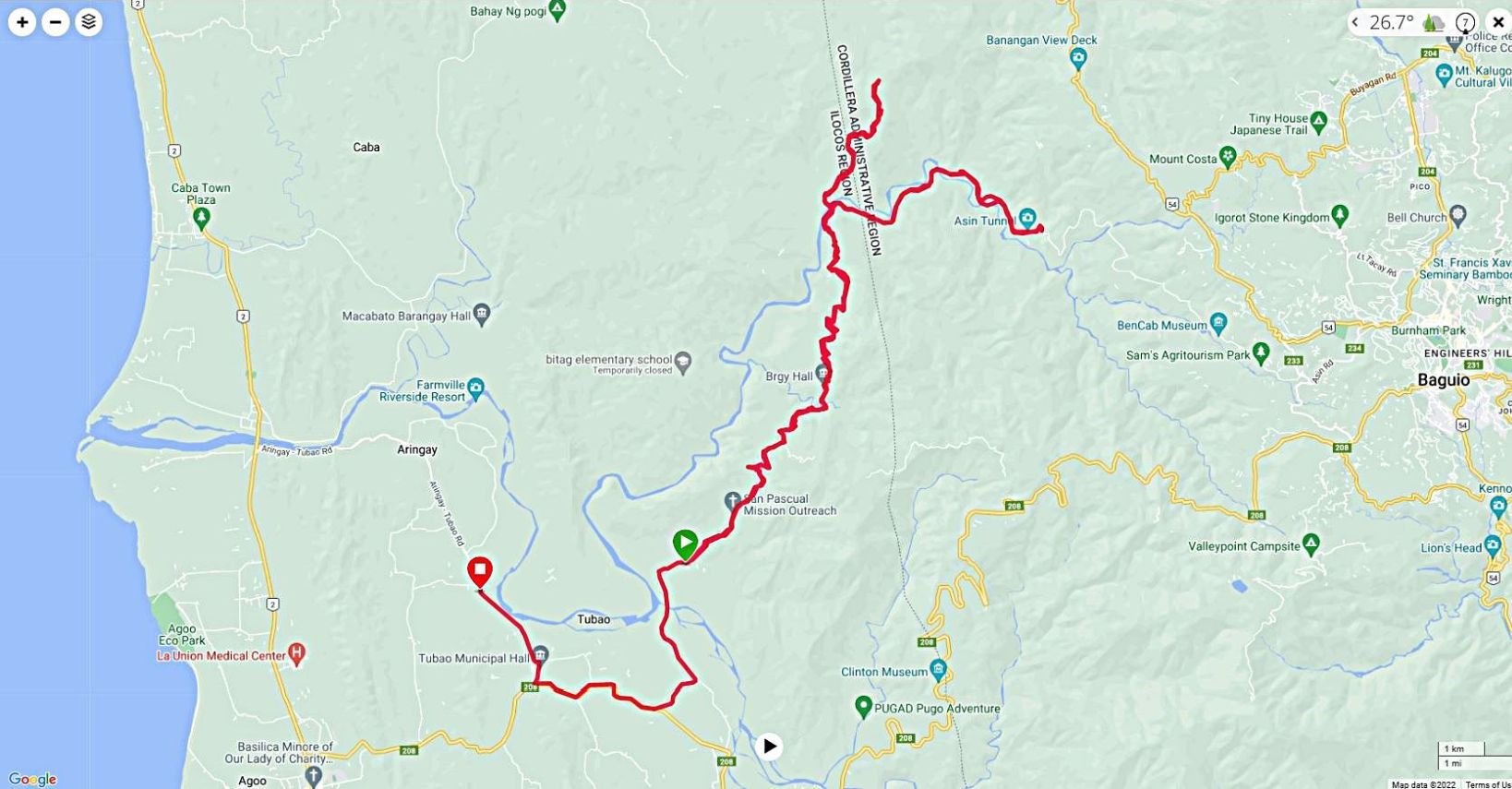
Tubao-Asin Rd. to Baguio 22-10-17 The full name of the road is Anduyan-Rizal-San Pascual-Nangalesan-Asin Road and is put in shape to ease the Baguio traffic on the Marcos Highway. This was a drive to explore this 4th Road to Baguio from the SW direction. I always wanted to walk it but I think, I won't do it now, too many up and downs; too much for me now. It is a good 2 lane concrete road with intact bridges, and can be used, little traffic. I made a side trip to the Gallano Rice Terraces area but had to turn around when it became a dirt road and it did not look good. Over the very area was hard fighting in 1945 by the American and Philippine forces to capture Baguio, going this way. Click here: HyperWar: US Army in WWII: Triumph In the Philippines (ibiblio.org) 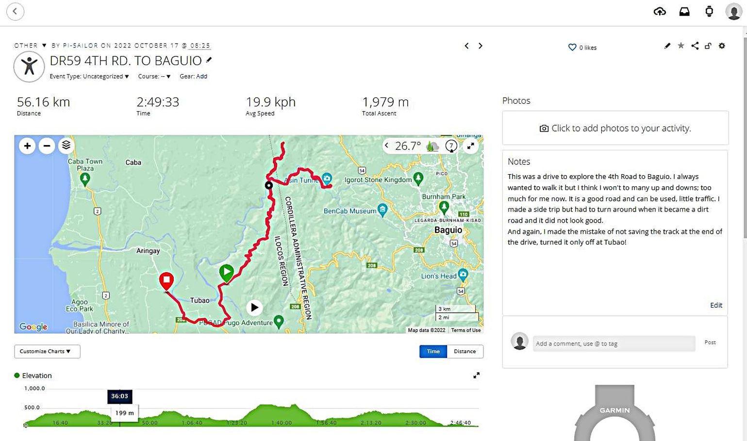 Images # 00 to 06 show my GPS track maps and other data of this drive exploring the Tubao-Asin Rd. to Baguio, also called this 4th Road to Baguio from the SW direction. And again, I made the mistake of not saving the track at the end of the drive; I turned it off late at Tubao! 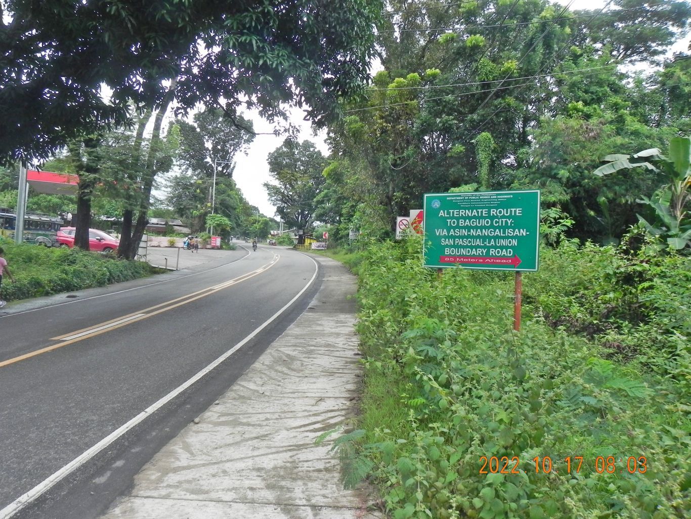 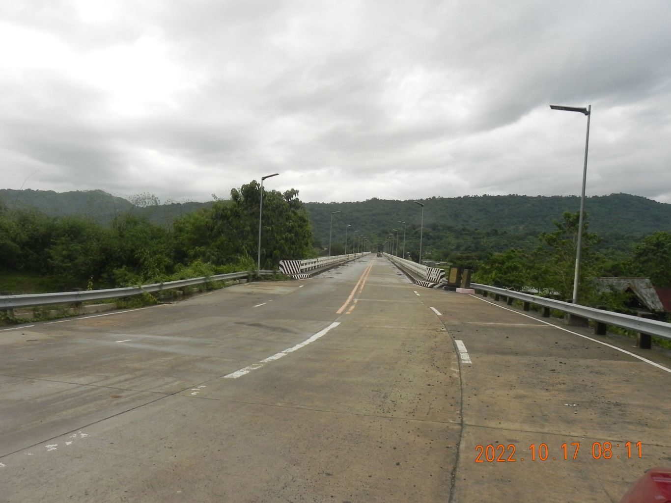 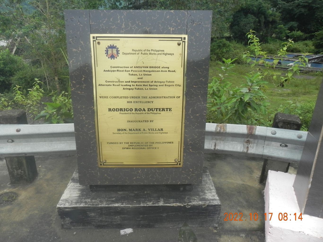 Images # 07 to 21 show the Anduyan Bridge, approaches to and from the bridge, the plaques inaugurating this new bridge, we have views from the bridge, up and down the Ifugao River (La Union) even the tributary river is also called Ifugao River on the maps provided. The higher hills are in the direction of Baguio (up-river) or the ridge line on the other end of the bridge, a defunct resort is at the bridge south end. Images # 22 to 26 are a few shots of the road to the Gallano Rice Terraces area, two shots are back towards the plains of the Ifugao River where we just came from. 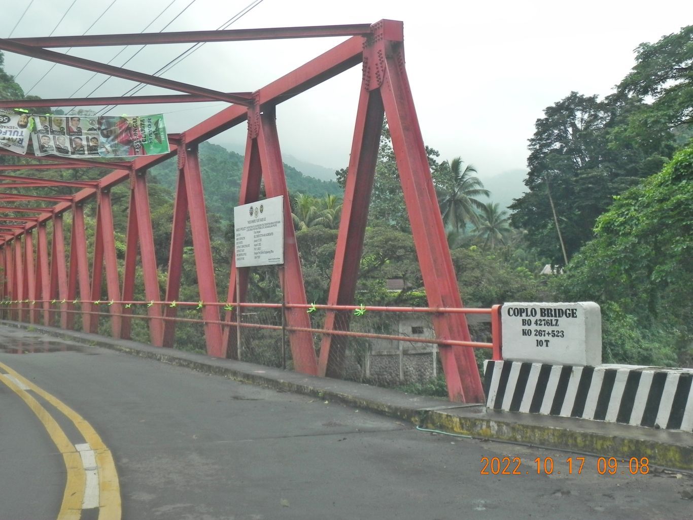 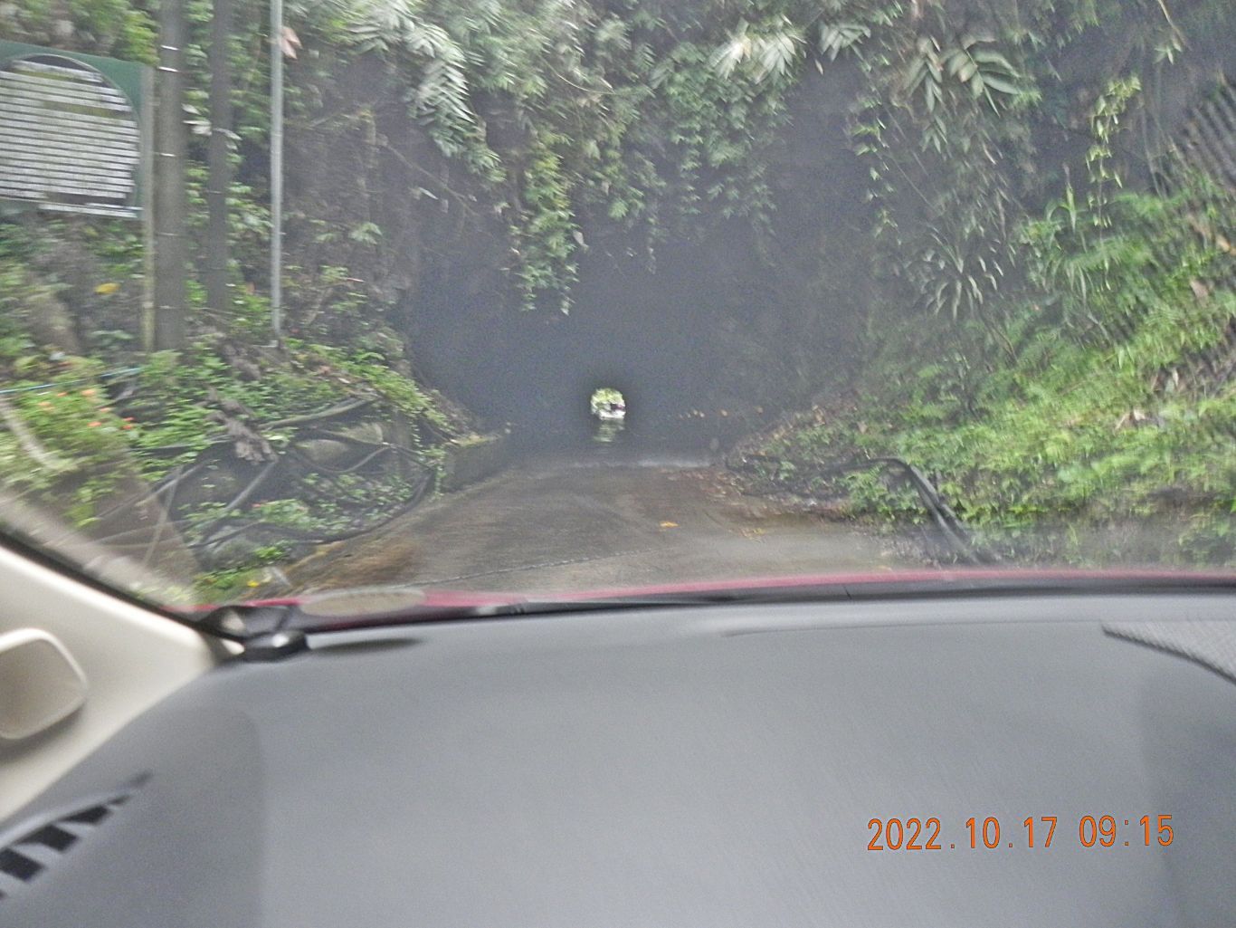 Images # 27 to 29 are 2 bridges in the Nangalesan area, just west and down from Asin and the 3rd pic, # 29, is the entrance of the lower tunnel of 2 tunnels on this road which were built during the Spanish Times for possible use of building a railroad to Baguio. Images #30 to 32 are images just on the other end of the lower tunnel of 2 tunnels on this road which were built during the Spanish Times for possible use of building a railroad to Baguio. Only one vehicle at the time can pass thru the tunnels, so, you got to be alert. I went thru the tunnel, across one more bridge and turned around. 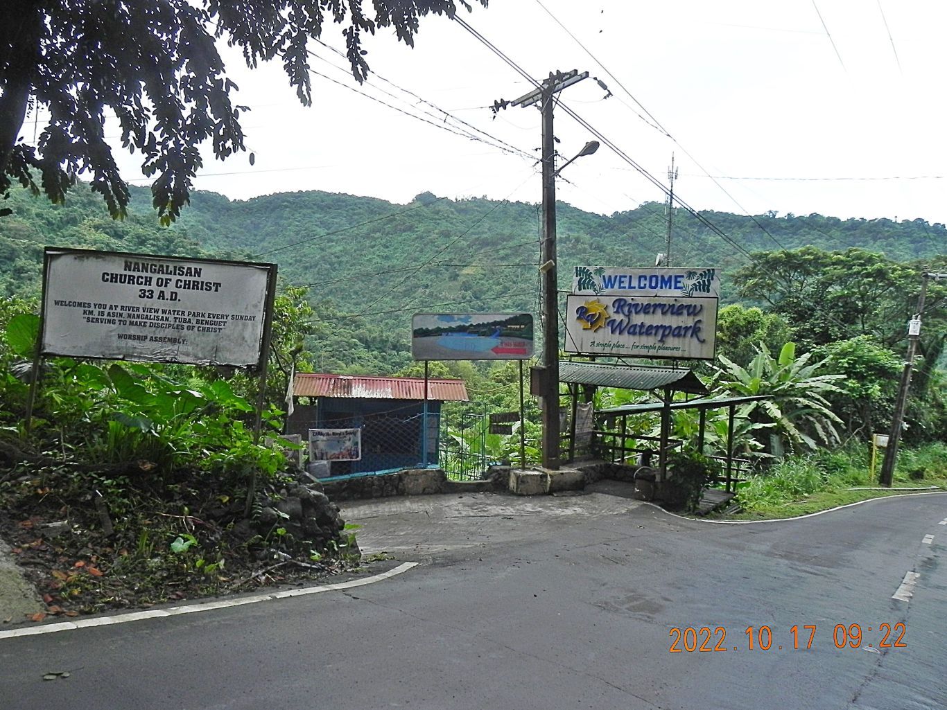 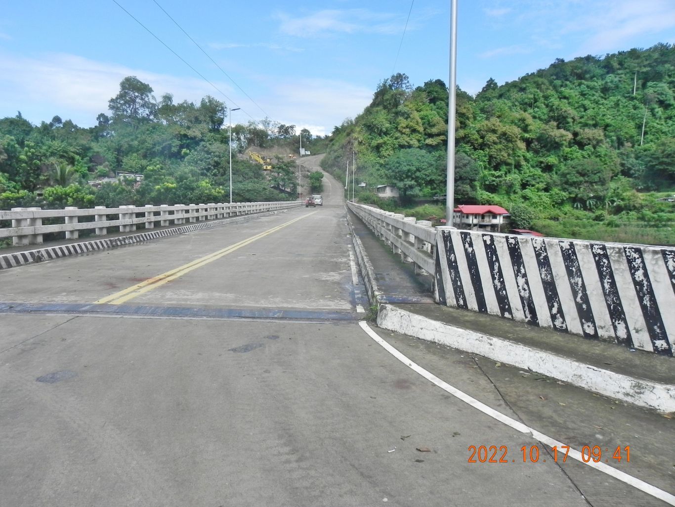 Images #33 to 49 are from the short stretch which starts at the lower tunnel at Asin and goes down-road thru Asin and Nangalesan, across two bridges and crossing the big and long bridge over the Ifugao River towards the Gallano Rice Terraces. 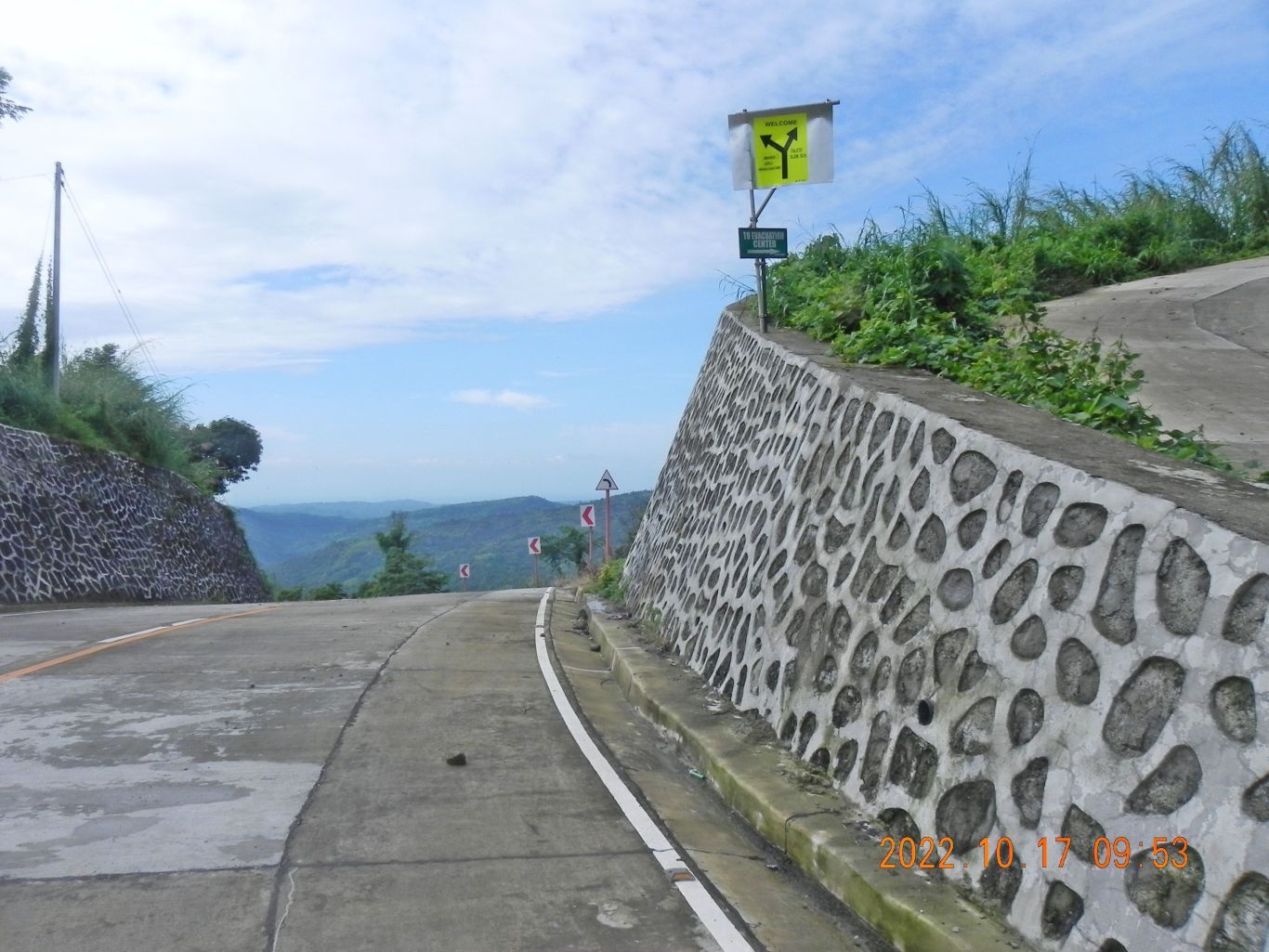 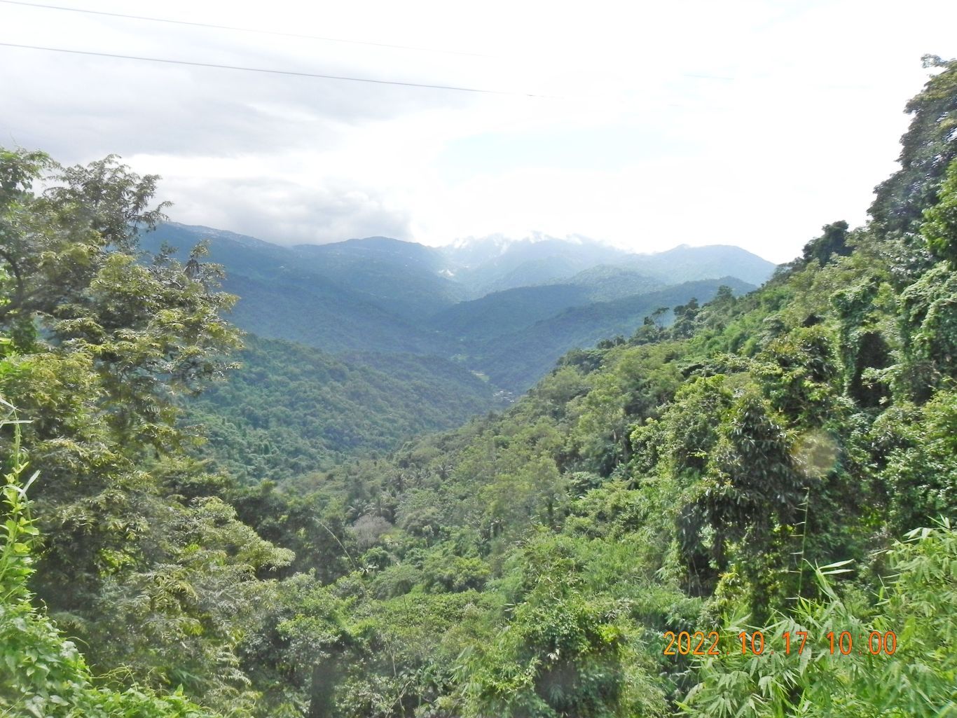 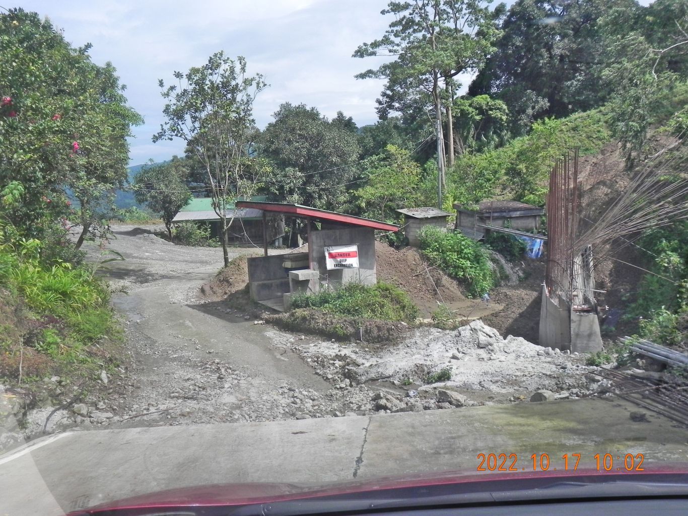 Images #50 to 58 are the side trip up to the Gallano Rice Terraces area with views all around including the heights to Baguio. The good concrete road ended as concrete and the dirt road continuing did not look to good for my car. 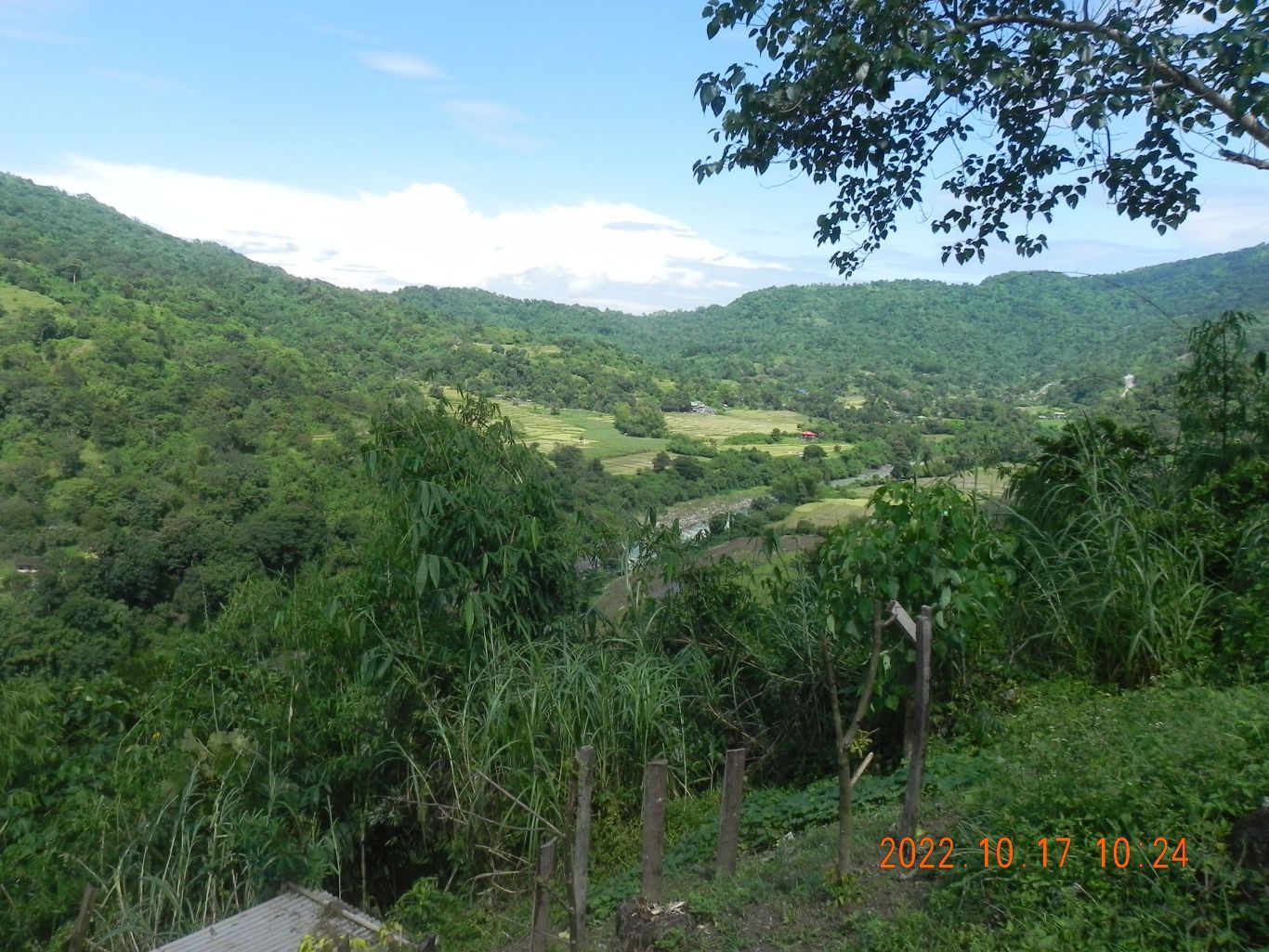 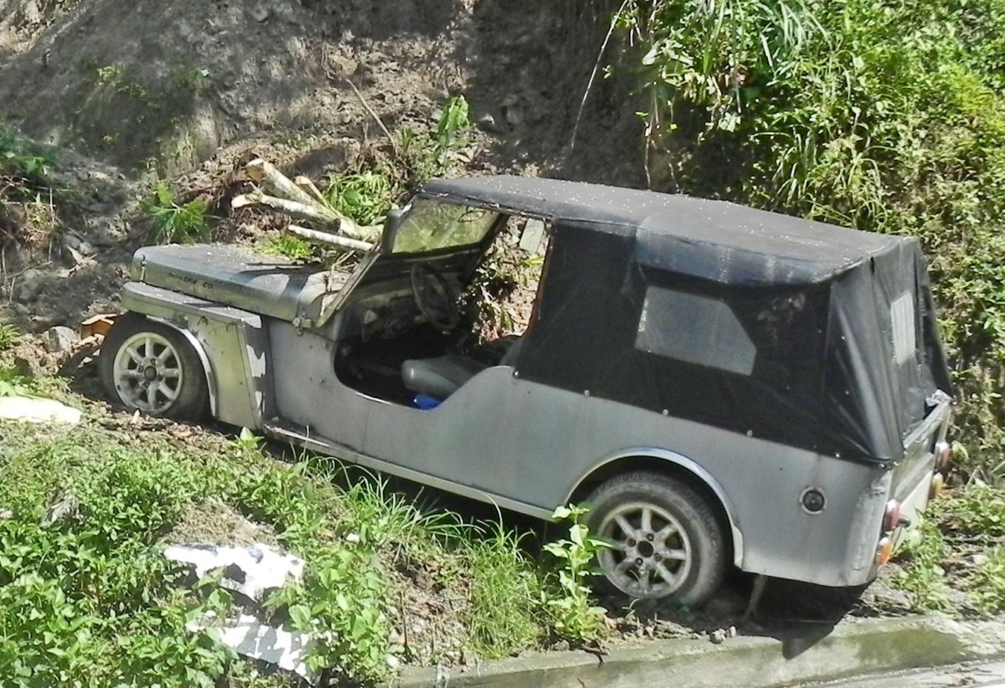 Images # 59 to 68 are from the Asin-Tubao Road, now on our way back. They start after we crossed the bridge over the Ifugao River, back onto the Asin-Tubao Road; many pics are shots across the Ifugao River towards the heights of the Gallano Rice Terraces. The last 2 shots are of an owner type jeep that got partially buried by a small land slide. 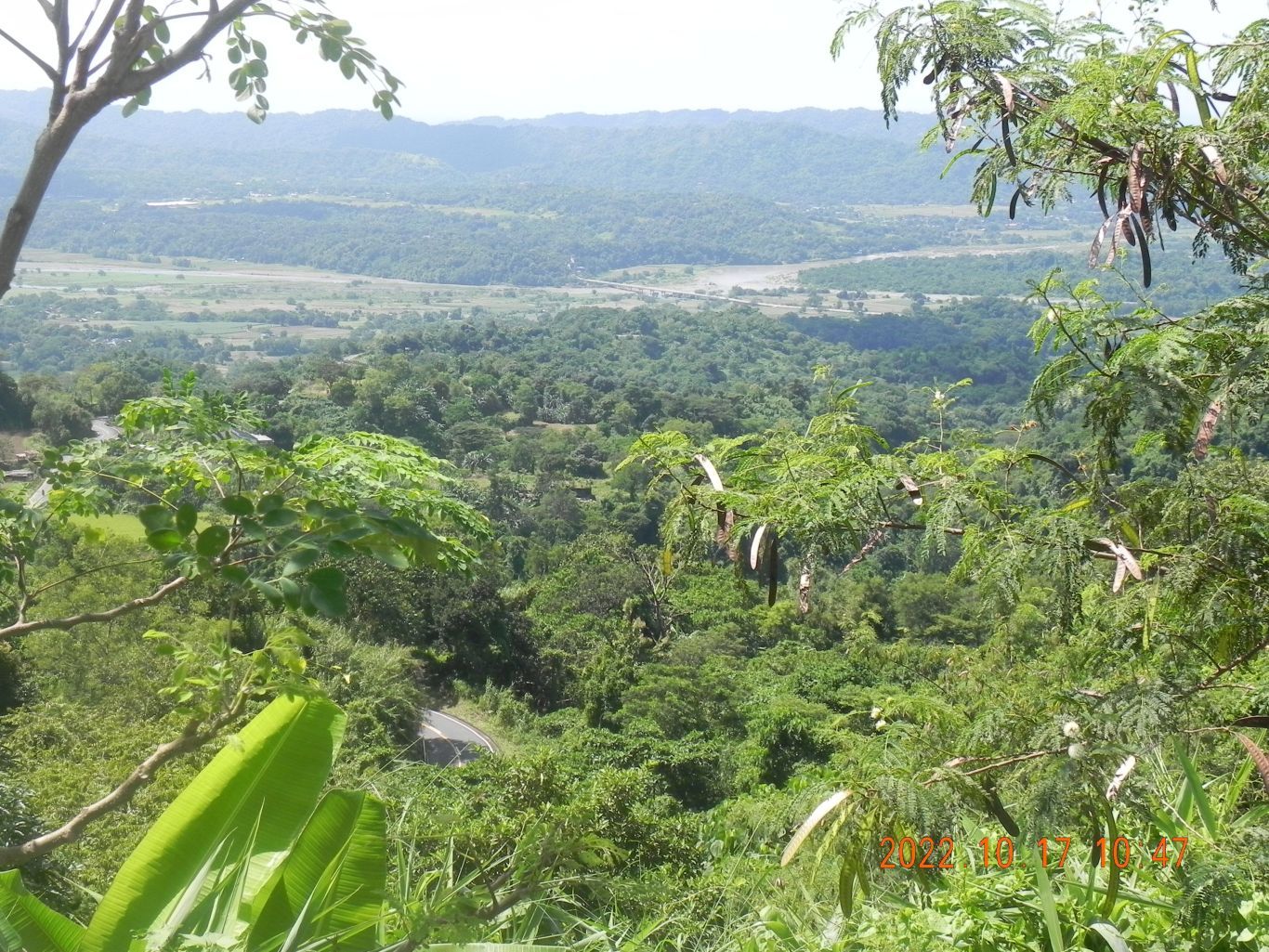 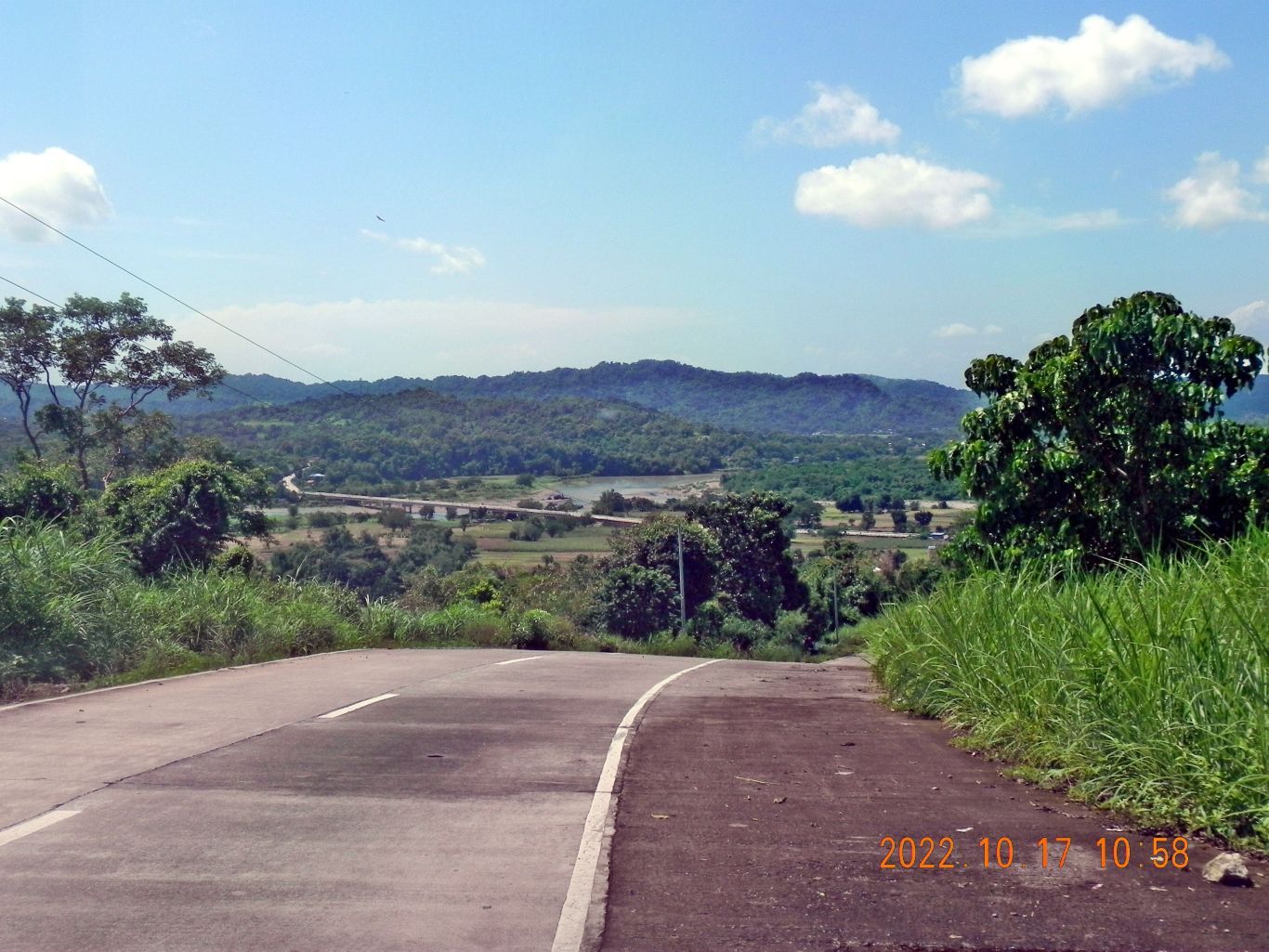 Images #69 to 76 are views of my last leg of this exploring trip of the Tubao to Asin Road. I’m approaching the Anduyan Bridge area where I started. |
|
|
|
Post by Karl Welteke on Nov 10, 2022 17:31:06 GMT 8
Pindangan Ruins, San Fernando, La U. 22-10-18 The ruins are advertised as a tourist spot and I went to see them. They are impressive to me. It was a large church, for various reasons it was relocated to the present San Fernando downtown location. An earthquake was the final straw to move. It is still catholic property and the Carmelite Sisters are in charge of the whole and greater compound. These two WebPages tell the story and both sites have nicer pictures of the ruins than mine. Webpage: launiontayo.com.ph www.launiontayo.com.ph/banner/pindangan-ruins/Another webpage which is malso very nice with good pictures: www.thetempleguy.org/2019/09/pindangan-ruins-san-fernando-la-union.htmlI posted 24 images into this Photobucket account album: Uploaded to Photobucket, Philippines including my walks, North Luzon Group, La Union Visit 2022-10-17 to 21: app.photobucket.com/u/PI-Sailor/a/d129a059-e575-41a7-a5c5-4302762d60ecFor this Forum presentation I chose these 3 images but I’m letting stand here the descriptions for all the 24 images. Karl Picture descriptions: 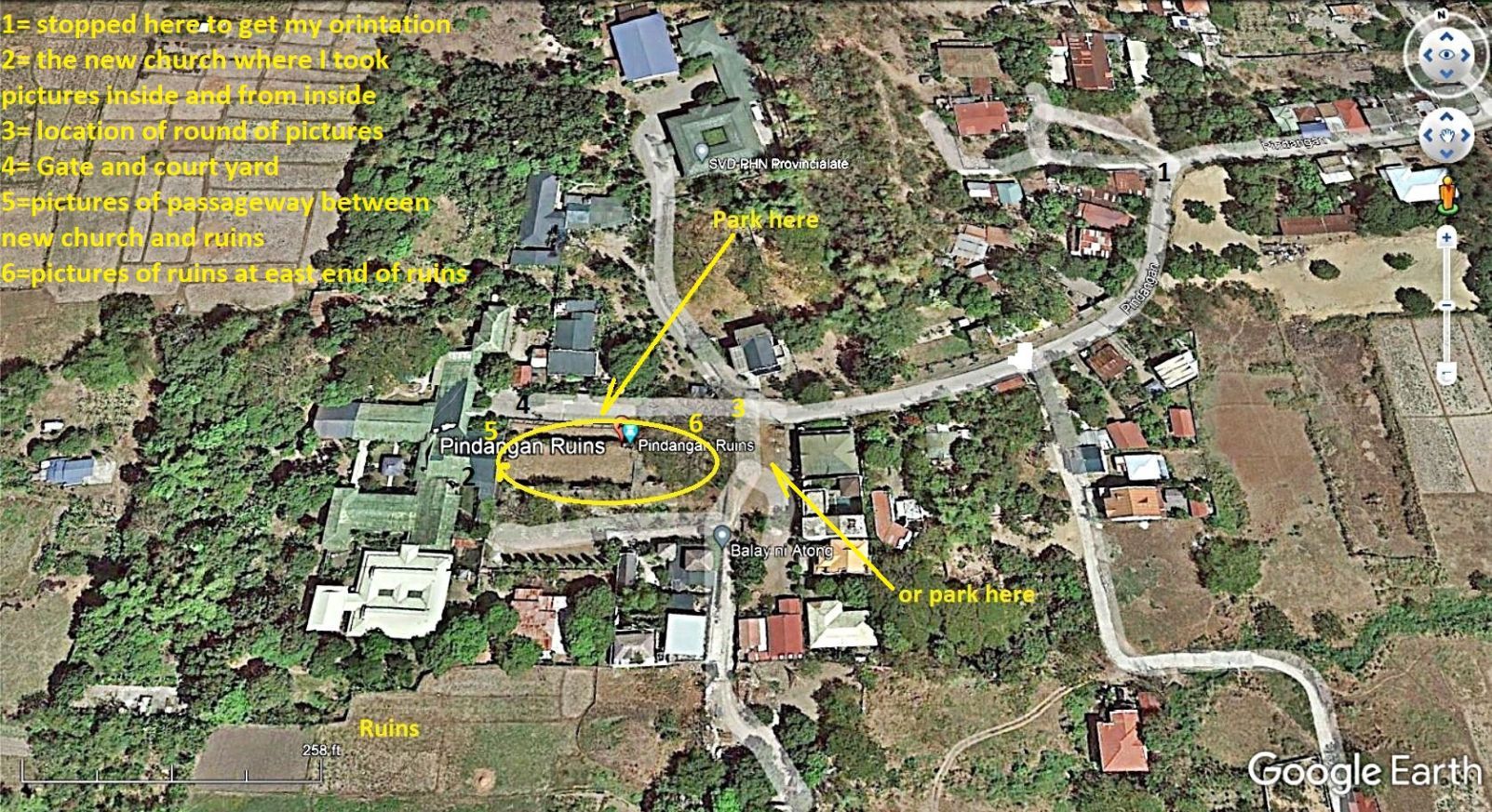 Images #00 to 04 are Google Earth images as to where the Pindangan Ruins are and include a road sign and one location I stopped to get my orientation. Images #05 to 08 are a round of pictures from the corner of the property, the point where one arrives and which is called location #3 on my marked Google Earth map image. Images #09 to 12 are two pictures inside the new Carmelite Sisters Church and two shot of the ruins thru the chicken wire mesh at the east end of the new church. 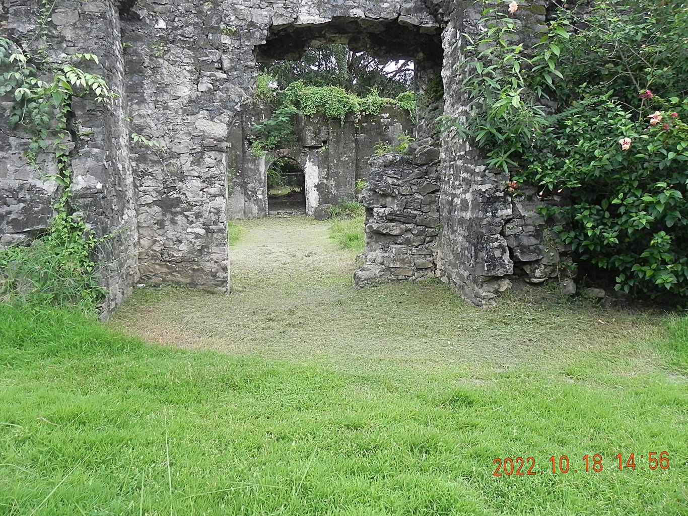 Images #13 to 15 are shots of the Pindangan Ruins from the North West corner of the ruins complex. One picture shows a passageway between the new church and the ruins. Images #16 to 18 are images of the entrance gate to the Carmelite Sisters complex, which is where I entered and proceeded into the new church. That was all that was accessible today. 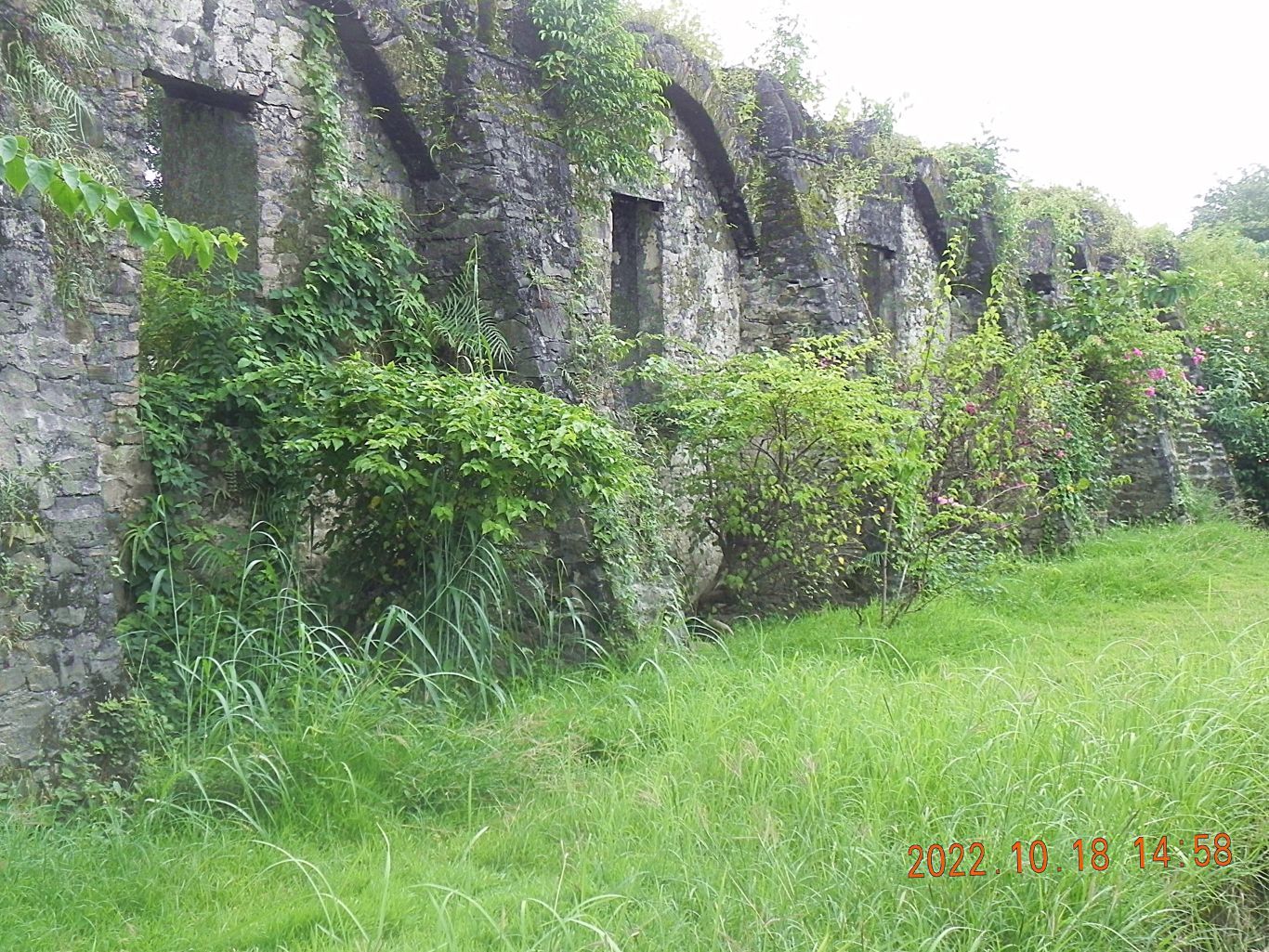 Images #19 to 23 are shots of the Pindangan Ruins from outside the fence and are shot of the east end of the ruins. Webpage: launiontayo.com.ph www.launiontayo.com.ph/banner/pindangan-ruins/Sacredly and holy, the Pindangan Ruins stood at Brgy. San Vicente, San Fernando City, La Union. It is located near Camp Oscar Florendo, Police Regional Office 1, about 500 meters from the national highway. Despite attacks of natural phenomenon, it has sustained its sanctity throughout the centuries. According to history, “Pindangan” is the original name of the City of San Fernando, La Union. It is an ilocano dialect which refers to a place where meat is sun-dried. The place was called “Pindangan” because the people used to make abundant sun-dried meat (with salt) as a way of preservation. Pindangan Ruins,to be specific, is an old catholic church. It is already 253 years old for it was built by the Frayles or the Spanish priests in 1764. During the Spanish times when Catholicism was greatly introduced in the Philippines, it was where majority of people used to attend mass consistently as the locals slowly learned and embraced the religion. Because it was located near the sea, pirates and foreign invaders who by any chance, step to the coastal areas of the City often attack the place that was why the clergy decided to transfer the church to Brgy. Tanqui then to Brgy. Cabaroan and afterwards to its present location in front of the city auditorium, in which it has it’s widely-known name St. William the Hermit Parish. At present, the Pindangan Ruins is still undergoing strict preservation, plan of renovation by the government or by the rightful people is none so far. On second thought, it is better to stay at it was because it is the only one in town that best characterizes old Spanish-influenced structures. It was purely made of stones and until now, the walls of the church still stand powerfully. Mosses crawl and dominate these stone walls. A visit to the place is not just somehow a product of curiosity but more of a passion to experience and feel ancient fashion. There is still life at Pindangan Ruins. Despite being known as “nagpanawan”, church people do still perform religious activities there. Not far from the site, there is a new structure composed of a church and orphanage. Another thing that one wouldn’t want to miss in the place is the old ancient well that supplies cold water on its neighboring places way back time. It reminds everyone that there was really life there many years ago. Since it is considered sacred, Pindangan Ruins is not often opened for everybody. Pindangan Ruins is somehow the best destination for tourist and even educational trips since it is not just a simple or wonderful place, it is an artistic and religious place, it is history. Another webpage which is malso very nice with good pictures: www.thetempleguy.org/2019/09/pindangan-ruins-san-fernando-la-union.html |
|
|
|
Post by Karl Welteke on Nov 11, 2022 15:50:30 GMT 8
To Battle of Bacsil Ridge Marker then Naguilian Friends Visiting San Fernando, La Union, I was reminded that San Fernando did not get liberated until the 23rd March 1945. Further it was liberated by the Guerilla Forces of North Luzon with some artillery and air support. That surprised me because Gen. MacArthur and his 8th Army landed only a few miles down the coast on the 9th of Jan. But his priority was to liberate Manila and reestablish the Philippine Government there and one the 8th Army Corps paid a close eye on the Cordillera Mountains for a possible Japanese counteroffensive from there. I heard of the Battle of the Bacsil Ridge, it has a monument and I wanted to have a look. Two relevant WebPages: Wiki, Battle of Bacsil Ridge military-history.fandom.com/wiki/Battle_of_Bacsil_RidgeThe Battle of Bacsil Ridge was fought on March 19, 1945 was one of the continued main battles of the Philippines Campaign of the Second World War are between the Filipino soldiers under the 121st Infantry Regiment, Philippine Commonwealth Army, USAFIP-NL, under the command of Russell W. Volckmann, and the Japanese Imperial forces under by General . which resulted in the capture of San Fernando, La Union on 23 March 1945, and Bacnotan, La Union after two months of fighting. San Fernando LU, 76th Anniversary, Bacsil Ridge. www.sanfernandocity.gov.ph/csflu_website/city-government-commemorates-76th-victory-of-the-battle-of-bacsil-ridge/36 images of this scenic drive have been posted into this Photobucket album: Uploaded to Photobucket, Philippines including my walks, North Luzon Group, La Union Visit 22-10-17 to 21: app.photobucket.com/u/PI-Sailor/a/0fb23e13-1010-4fda-b49d-f2550d286a56For this forum presentation I only chose these 6 images! Veterans Day today in the Philippines! Karl Photo description for all 36 images, I let them stand here. 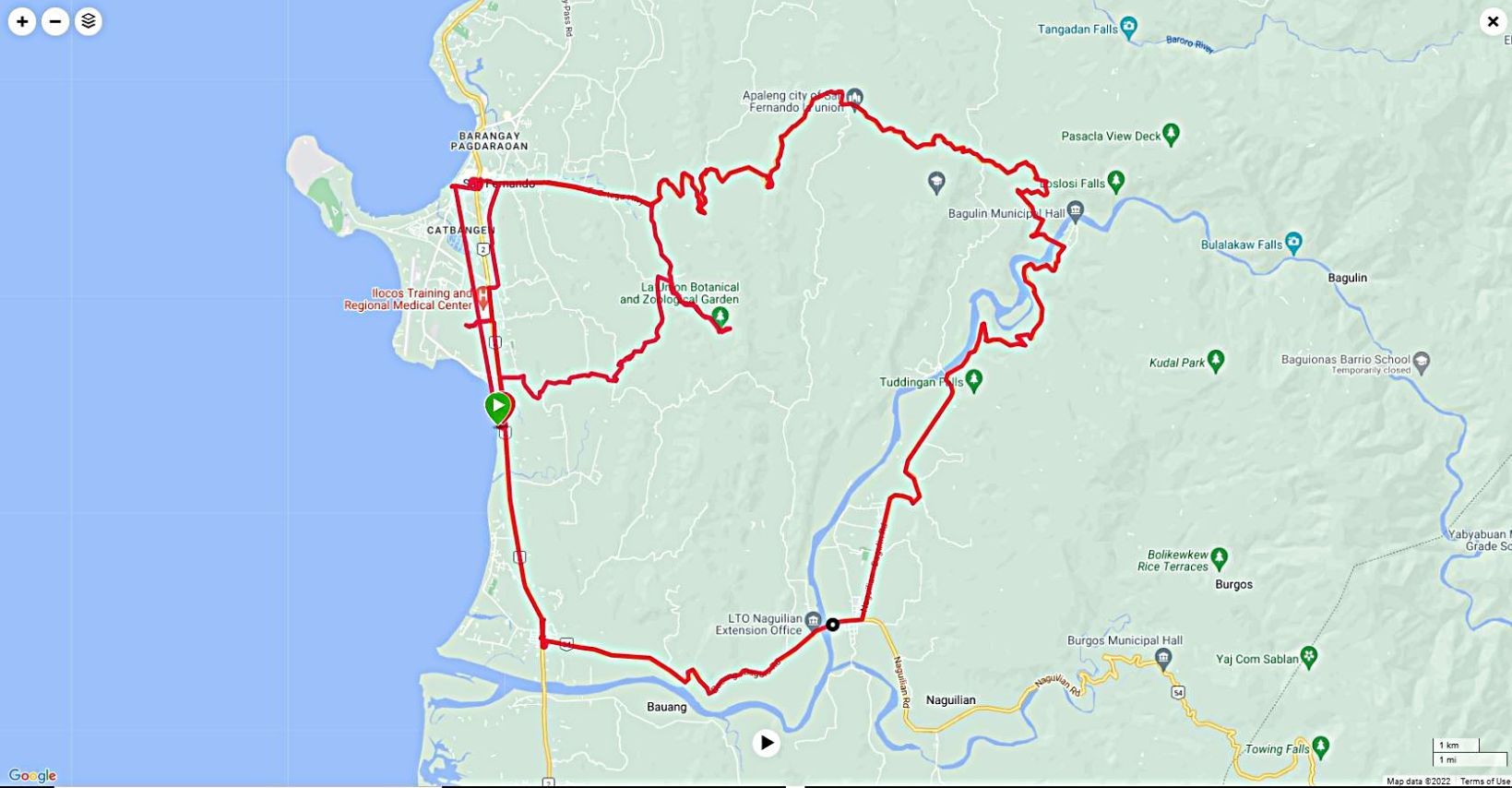 Images #00 to 04 show my GPS track to the ridge and marker and then the continuing drive to Naguilian via Bagulin. The other views are of the lowlands towards San Fernando where I started from. 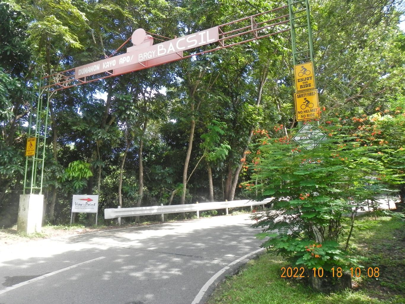 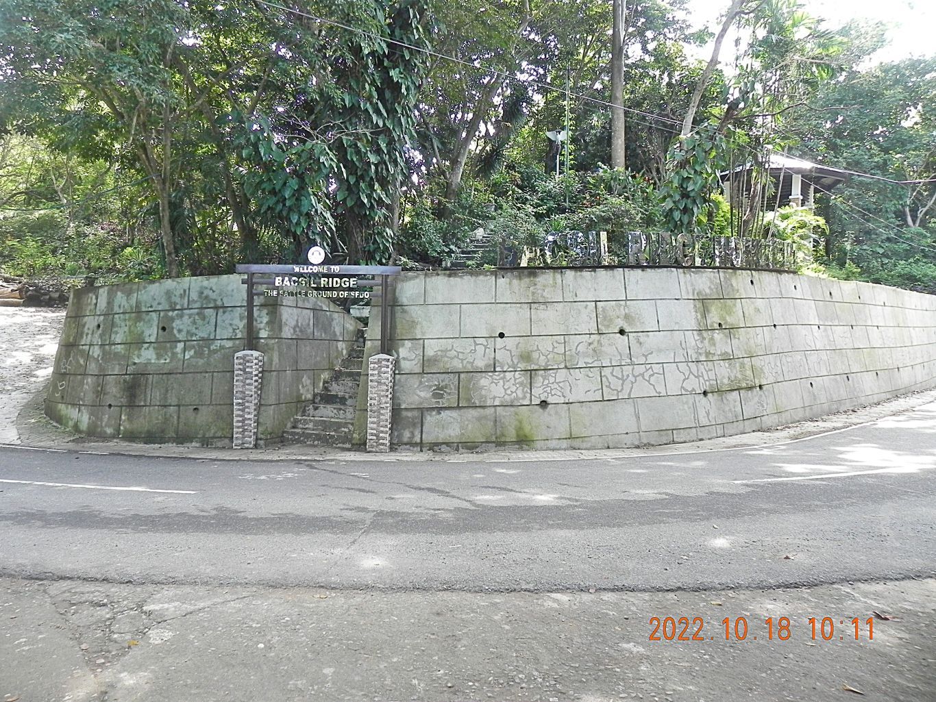 Images #05 to 14 are all images shot at the greater intersection of the highway to Bagulin with the Bacsil Ridge road. We see the entrance gate to the intersection, a look back from there, signs for establishments on the ridge road, some small structures and a couple Sari-Sari stores (where I parked), and the embankment wall to the Battle of Bacsil Historical Marker. 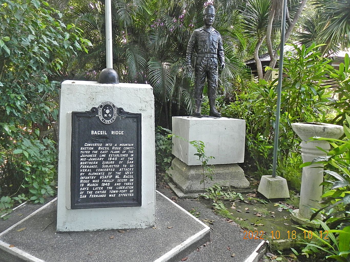 Images #15 and 16 show the Battle of Bacsil Historical Marker on top of the ridge at the intersection with the Bacsil Ridge Road. 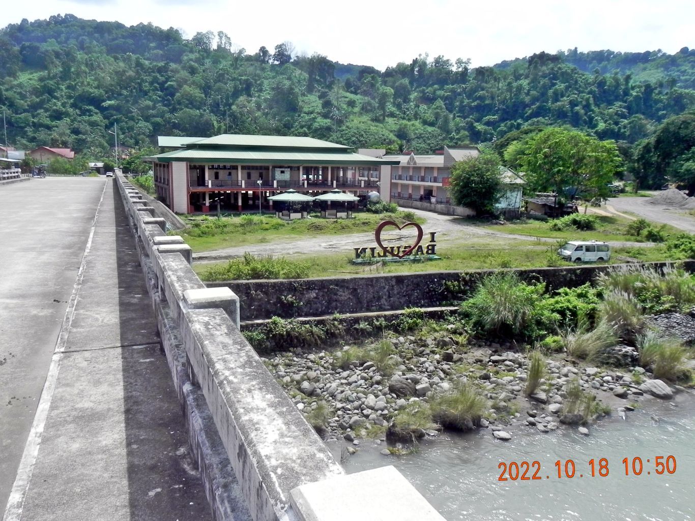 Images #17 to 25 show a round of pictures, shot clockwise, from the long bridge over the Balili River. The town of Bagulin is just on the other end of the bridge and we see some large structures there. 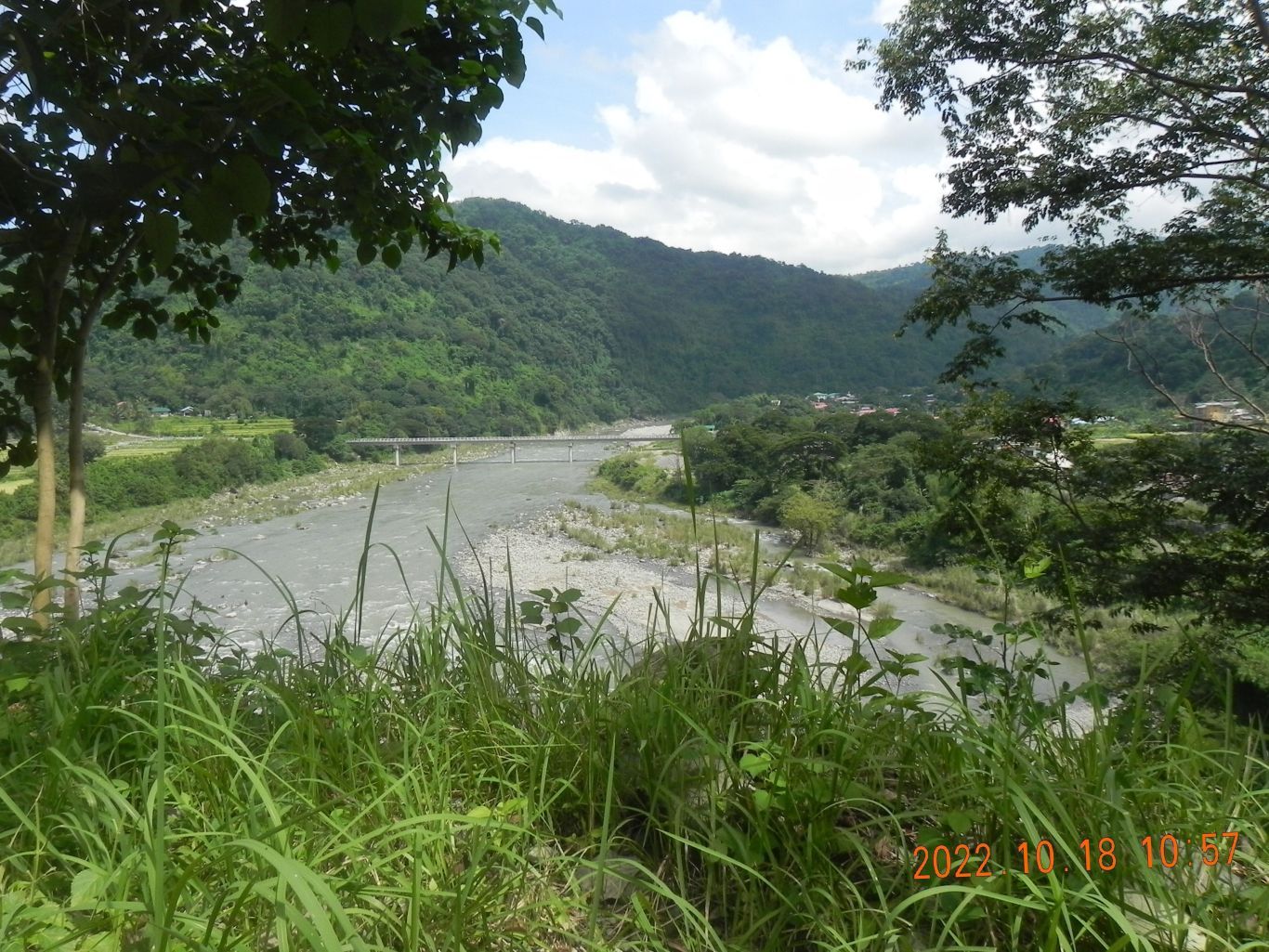 Images #26 to 29 are views of Bagulin, the bridge to Bagulin, which I just crossed and a view down river from that bridge. Images #30 to 36 are various images of the road from Bagulin to Naguilian all are nice views of this very scenic La Union Province. |
|
|
|
Post by Karl Welteke on Jan 31, 2023 17:09:08 GMT 8
Solar Project in Santa Fe Lahars 23-01-29 This is in the Mt. Pinatubo River Lahars Field of San Marcelino, Zambales about 30 km north of the former Naval Base Subic Bay. This day walked to the ex Chinese Black Sand Mine (near Dalanawan), found the valley road in good shape, the mine buildings razed, nothing left, the steel bridge across the Mapanuepe River and the trail to Sitio Dalanawan ok. A new Solar Power Plant is in the works, on the Lahar Field from the previous explosion, not the 1991 one; the project is called: Santa Cruz Solar Energy INC. Walked around Mt. Bagang and took pictures of the project. I established 3 albums if you are interested: Uploaded to Facebook with 15 images and shared with: Barretto Bars, Subic Bay Expats, SBH3, The Raging Main, click here: www.facebook.com/karlwilhelm.welteke/posts/pfbid0ng6MQfPk3nziN6N3iLwpzTPzyjzBXaaVoKWJTKAFP5YVBta7UpBRTRFmv6LMvYQxlUploaded to a Flickr album, 39 images in HR, click here: www.flickr.com/photos/44567569@N00/albums/72177720305643580Uploaded 209 images to Photobucket, Philippines including my walks, Zambales albums, Aglao Hikes, click here: app.photobucket.com/u/PI-Sailor/a/ac068fc3-2022-4287-b2fb-dfa4667f7fd2----------------------------------------------------------------------- For this forum presentation I chose these 7 images 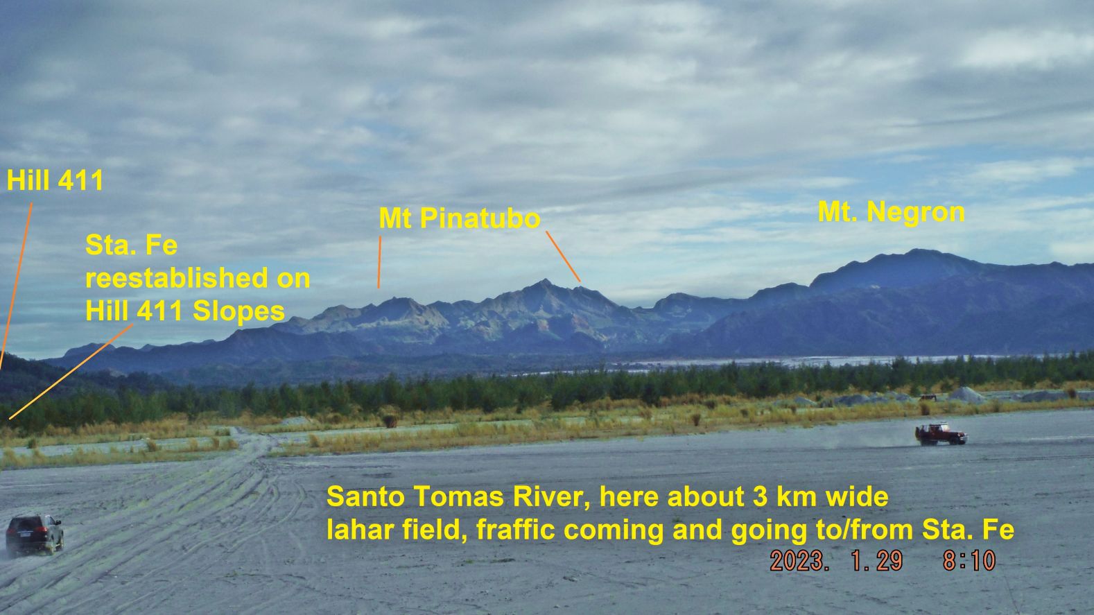 Zg105. (-002) image is a nice picture of Mt. Pinatubo, Santo Tomas River with traffic coming and going to and from Santa Fe. 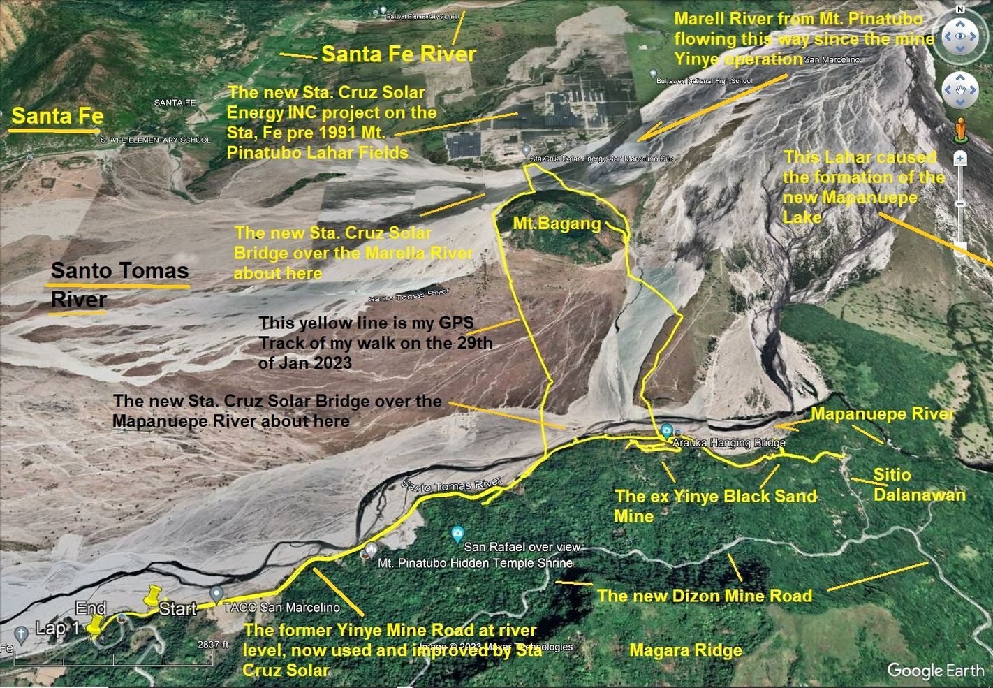 Zg106. (-004b) are data images of my GPS walk on the 29th of Jan 2023 in the San Marcelino, Mt. Pinatubo lahars fields. 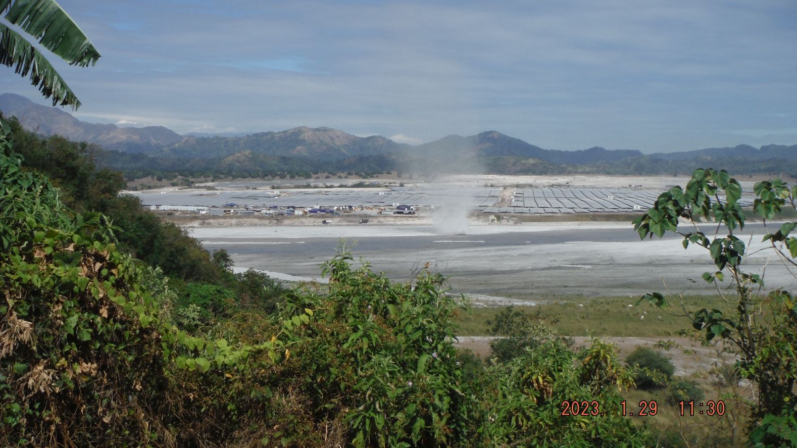 Zg107. (-107),Image is a portion of my walk when I walked to Mt. Bagang and climbed to some height to take pictures. I saw tourist traffic coming and going to the east to the pine forested area on the north shore of the new Mapanuepe Lake (not in picture); I learned a tourist spot, called “New Zealand has opened business there. Most important I got a good view of the new Santa Cruz Solar Energy INC Project. It is being set up on the Lahars fields which were created before the Mt. Pinatubo Lahars Fields. The Marella River which comes from Mt. Pinatubo runs now between that new solar project and Mt. Bagang where I took the pictures from. 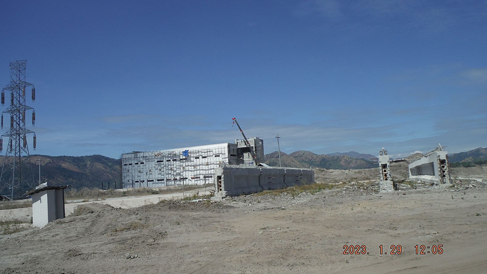 Zg108. (131.) are images of my effort going around the north side of Mt. Bagang and use the new bridge over the Marella River, see a new large building going up at the solar project, see a container truck departing, going thru the Lahars and capture another sign of the solar project. 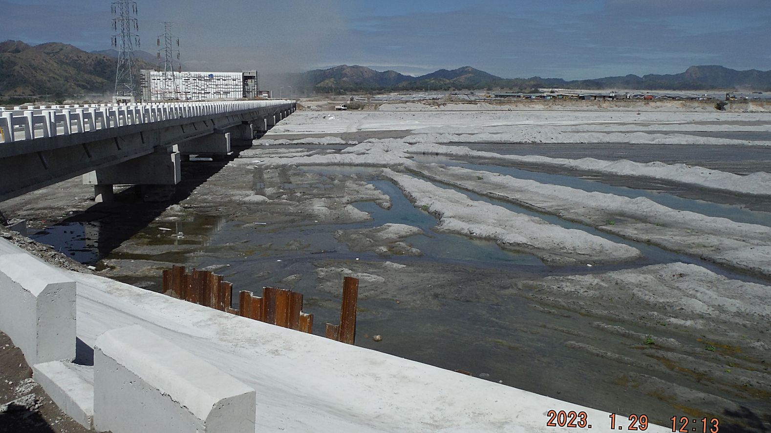 Zg109. (143), are images of my effort going around the north side of Mt. Bagang and use the new bridge over the Marella River, see a new large building going up at the solar project, see a container truck departing, going thru the Lahars and capture another sign of the solar project. 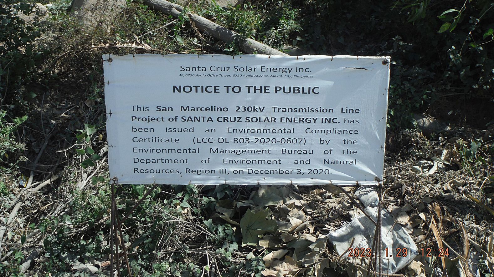 Zg110. (157). Are my parting images from this solar project and my walk. Images -162 shows the south side of Mt. Bagang and shows that several native hootches have been built by the Aeta people; that has only started with all this new commercial activity and the other three images are of some of the high voltage line work. 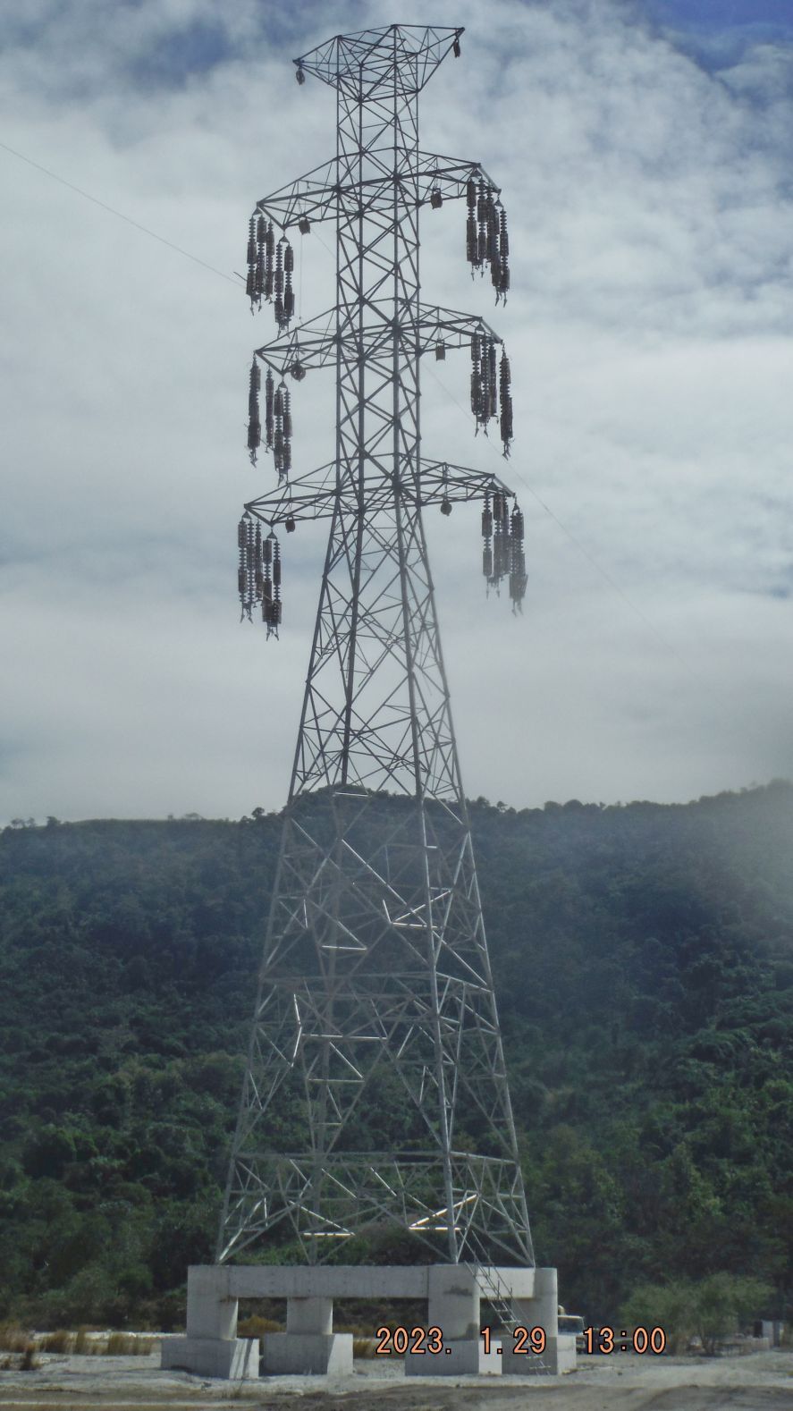 Zg111. (170). Are my parting images from this solar project and my walk. Images -162 shows the south side of Mt. Bagang and shows that several native hootches have been built by the Aeta people; that has only started with all this new commercial activity and the other three images are of some of the high voltage line work. |
|
|
|
Post by Karl Welteke on Feb 6, 2023 16:49:44 GMT 8
New Zealand & Lumibao Hike, 230201 This 1st of Feb. 2023 I wanted to check out the new tourist spot “New Zealand” (on the shores of Mapanuepe Lake) and find, explore the land way to Sitio Lumibao on the north side of Mapanuepe Lake. I succeeded and the pictures in this album are of this exploring hike. The NW shore of the new Mapanuepe Lake is now a tourist spot called New Zealand because now many pine like/type trees have grown and the place looks lovely. Many visitors come by car and one has to drive thru the Lahars and local guides are available. Then I walked to Sitio Lumibao, a small Aeta village at the north Shore of Mapanuepe Lake. Lumibao is the end or starting point of crossing the Zambales Mountains to or from the Basa Airbase area in Pampanga. The Lahars have changed much since my last visit. The picture numbers are based on the 128 images of this walk in my Photobucket album. Uploaded to PHB 128 images, Philippines including my walk, Zambales albums, Aglao Hikes, click here: app.photobucket.com/u/PI-Sailor/a/bc6f1a01-d466-442b-8aed-7f99333dd19c Uploaded 57 images to this Flickr album in high resolution, click here: www.flickr.com/photos/44567569@N00/albums/72177720305759797 Uploaded 33 images into an album in my Facebook account and shared with: I remember Subic Naval Station, I lived in Subic NavSta and Cubi, Barretto Bars, SBH3, click here: www.facebook.com/media/set/?vanity=karlwilhelm.welteke&set=a.10225419906158291 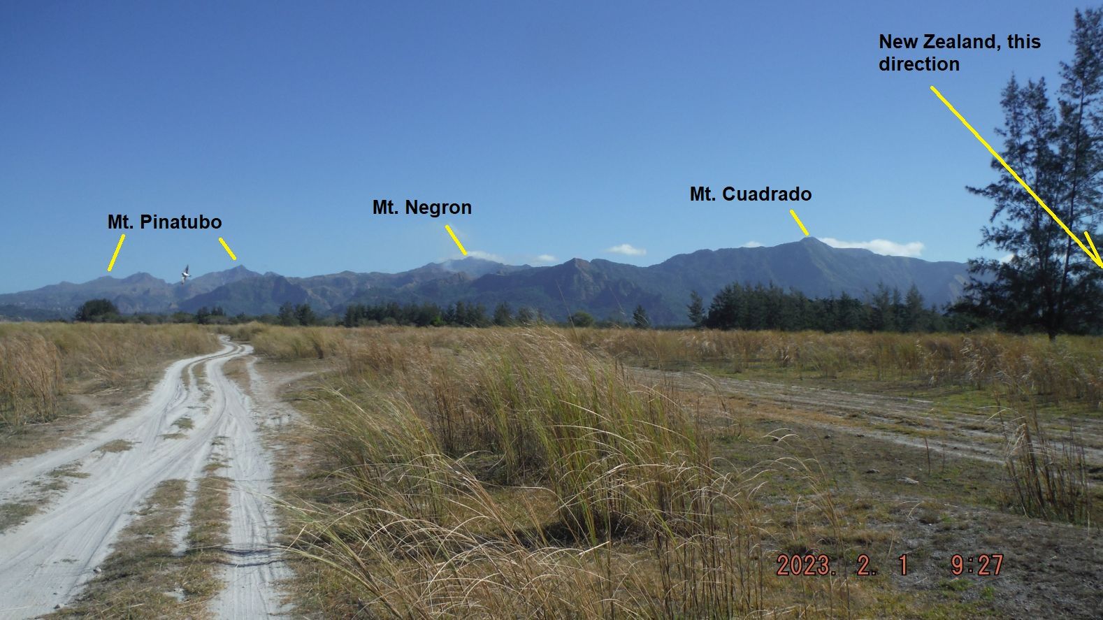 Zg112. This is picture #001 but is numbered in this album as Zg112. Pictures # 000 to 005 are pictures of where I parked and started my hike, at the ex-Chinese Yinyi Mine and show the initial stretch of the hike, crossing the Mapanuepe River on the old steel bridge of the Yinyi Mine, over Lahar and in a direction of keeping Mt. Bagang to my left. We also catch a view of the new large Solar Project on top of old Lahar field in the Barangay Santa Fe area. They also have maps and data of my hike with the GPS track and landmarks put on the maps of my New Zealand & Lumibao Hike, 230201. 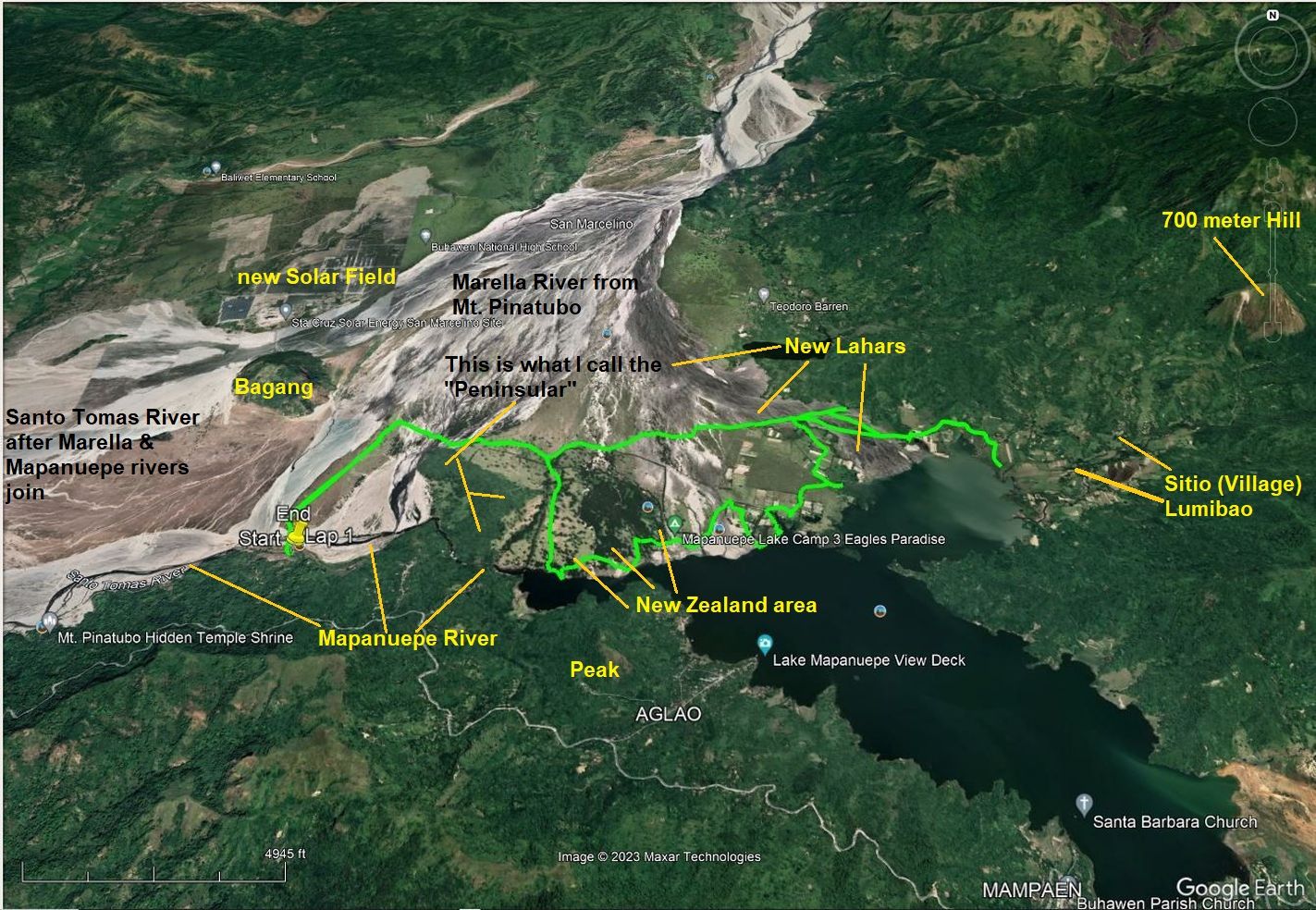 Zg113. This is picture #003 but is numbered in this album as Zg113. Pictures # 000 to 005 are pictures of where I parked and started my hike, at the ex-Chinese Yinyi Mine and show the initial stretch of the hike, crossing the Mapanuepe River on the old steel bridge of the Yinyi Mine, over Lahar and in a direction of keeping Mt. Bagang to my left. We also catch a view of the new large Solar Project on top of old Lahar field in the Barangay Santa Fe area. They also have maps and data of my hike with the GPS track and landmarks put on the maps of my New Zealand & Lumibao Hike, 230201. 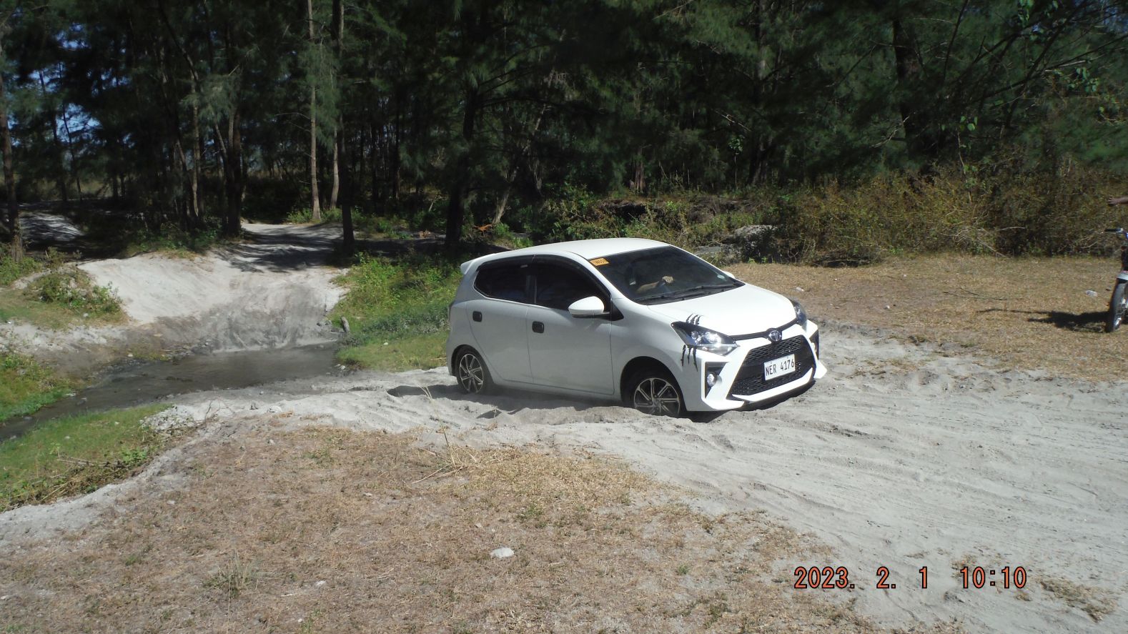 Zg114. This is picture #028 but is numbered in this album as Zg114. Pictures # 011 to 029 are of the hike, walking around a long strip of ridge which I call the Peninsular. This Peninsular sticks out into the lahars and it come from Magara Ridge. This walk starts at the ex black sand Yinyi Mine steel bridge, goes/curves around the Peninsular and enters the Lahars area that caused the blockage of the Mapanuepe River which caused the creation of the large Mapanuepe Lake. Many pine trees have grown on this Mt Pinatubo Lahars Sand and with lawn type grass under them and next to the shore of the lake make it a lovely area. A caution from me, going there, even with a guide may be risky for two wheel drive vehicle. 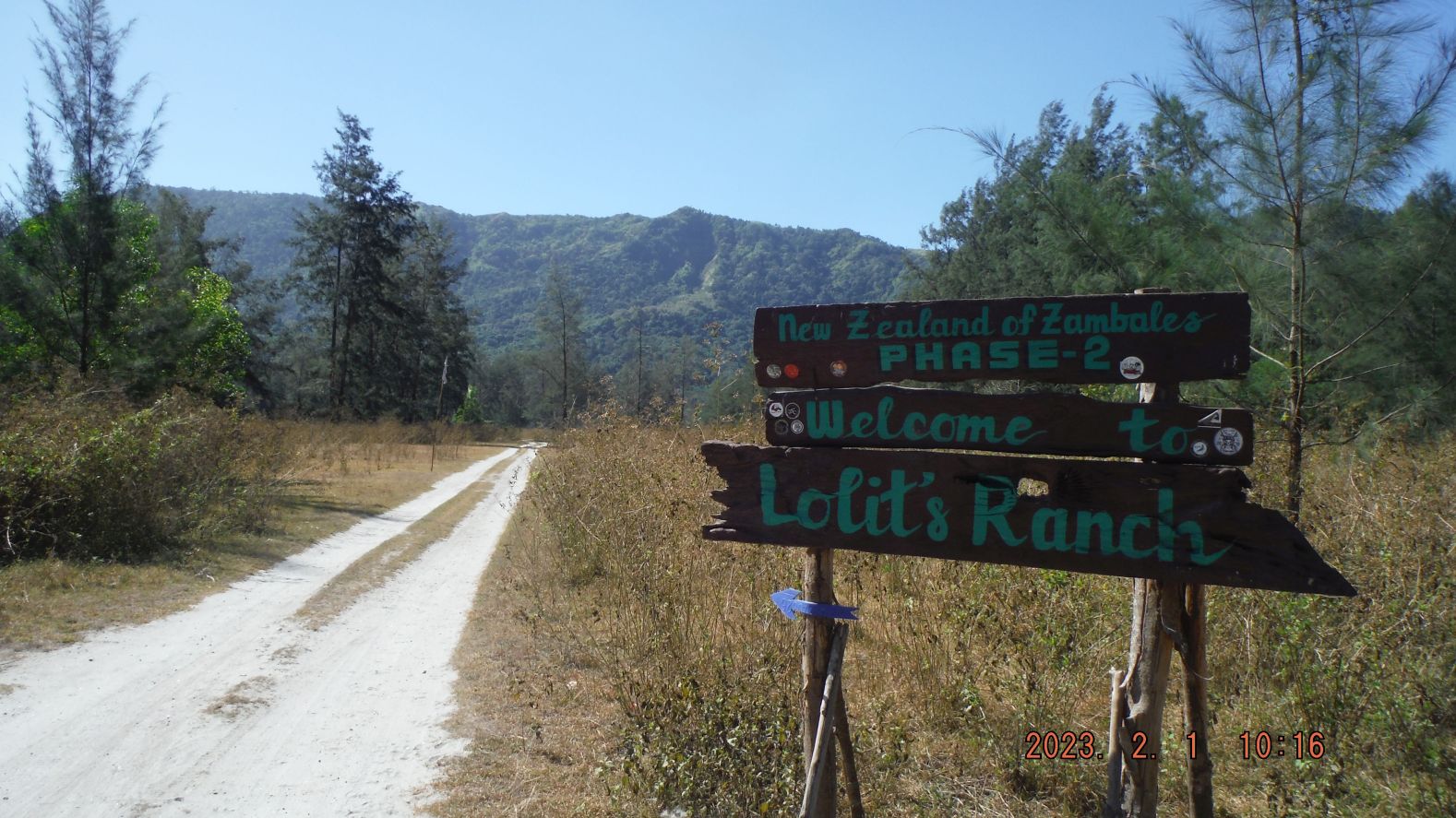 Zg115. This is picture #031 but is numbered in this album as Zg115. Pictures # 030 to 066 are of the area that people are calling and are visiting, the New Zealand tourist spot. Under those trees, in their cool shade and with the lawn type grass covering the grounds and the calm waters of the lake shores make this a lovely place. Some entrepreneurs are building toilet facilities and Sari Sari Stores, some of which can cook a limited menu. I saw a sign “No Swimming” and I speculate fishing is not recommended either; the lake most likely is contaminated from the closed Gold and Copper Dizon Mine which is upriver of this lake and the Mapanuepe River which flows into it. 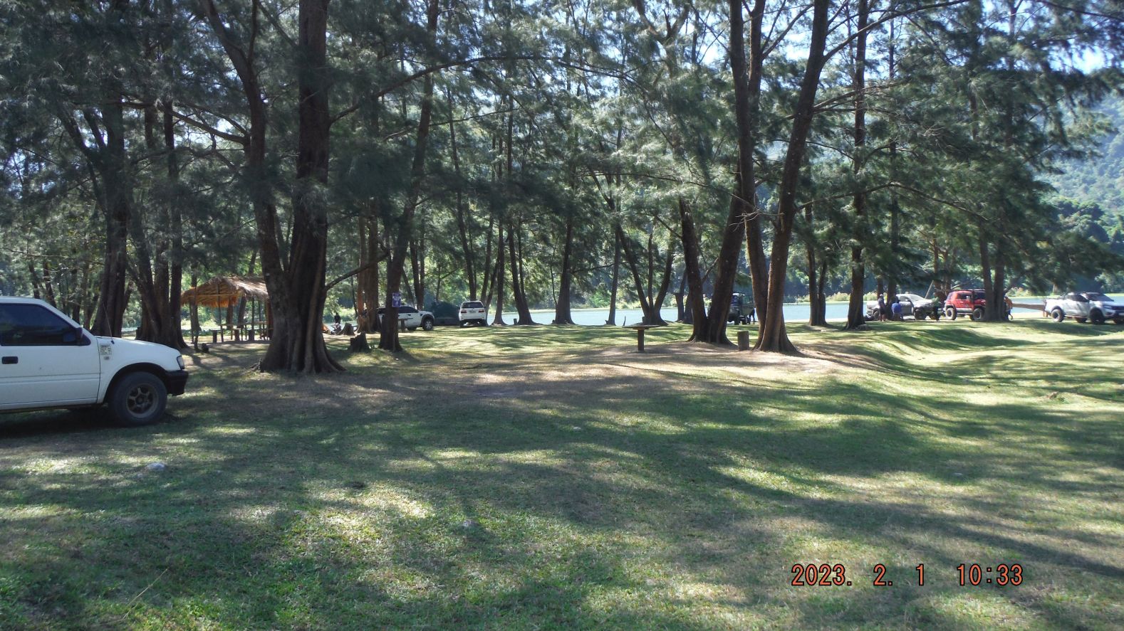 Zg116. This is picture #048 but is numbered in this album as Zg116. Pictures # 030 to 066 are of the area that people are calling and are visiting, the New Zealand tourist spot. Under those trees, in their cool shade and with the lawn type grass covering the grounds and the calm waters of the lake shores make this a lovely place. Some entrepreneurs are building toilet facilities and Sari Sari Stores, some of which can cook a limited menu. I saw a sign “No Swimming” and I speculate fishing is not recommended either; the lake most likely is contaminated from the closed Gold and Copper Dizon Mine which is upriver of this lake and the Mapanuepe River which flows into it. 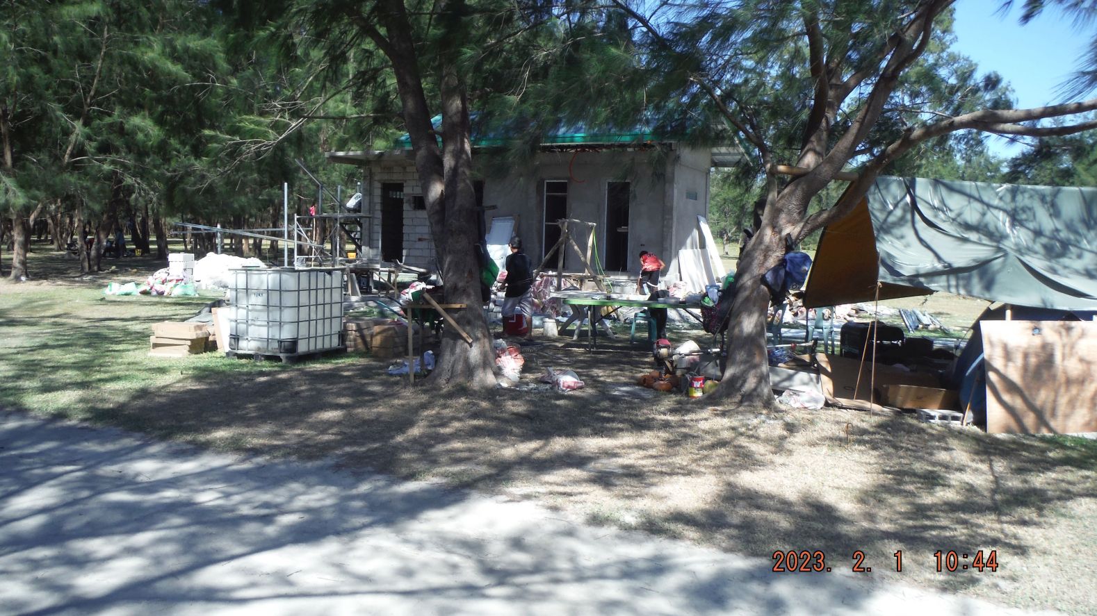 Zg117. This is picture #060 but is numbered in this album as Zg117. Pictures # 030 to 066 are of the area that people are calling and are visiting, the New Zealand tourist spot. Under those trees, in their cool shade and with the lawn type grass covering the grounds and the calm waters of the lake shores make this a lovely place. Some entrepreneurs are building toilet facilities and Sari Sari Stores, some of which can cook a limited menu. I saw a sign “No Swimming” and I speculate fishing is not recommended either; the lake most likely is contaminated from the closed Gold and Copper Dizon Mine which is upriver of this lake and the Mapanuepe River which flows into it. 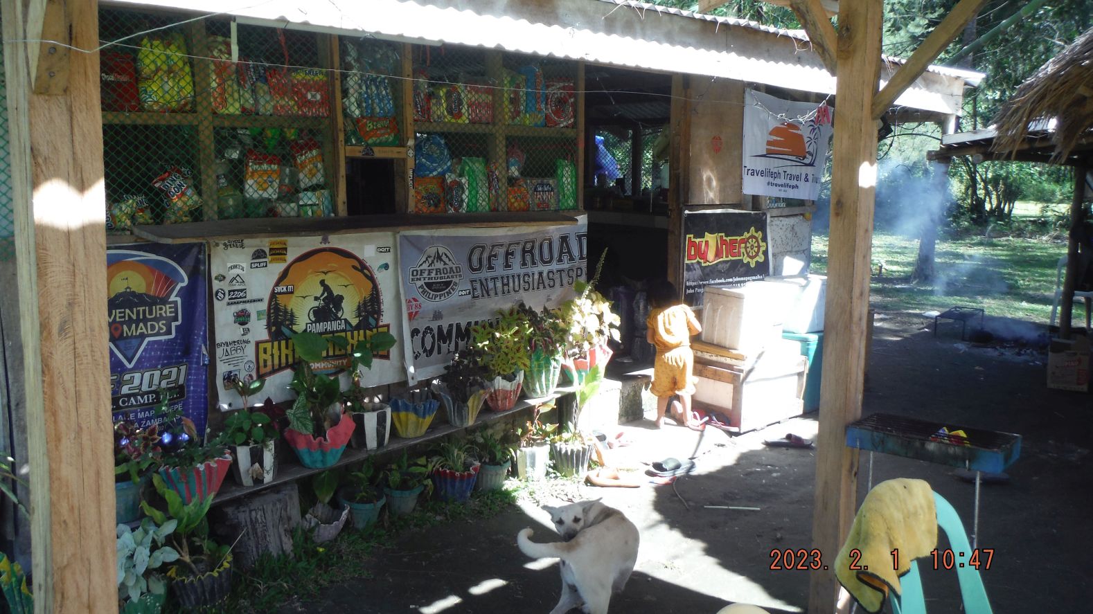 Zg118. This is picture #063 but is numbered in this album as Zg118. Pictures # 030 to 066 are of the area that people are calling and are visiting, the New Zealand tourist spot. Under those trees, in their cool shade and with the lawn type grass covering the grounds and the calm waters of the lake shores make this a lovely place. Some entrepreneurs are building toilet facilities and Sari Sari Stores, some of which can cook a limited menu. I saw a sign “No Swimming” and I speculate fishing is not recommended either; the lake most likely is contaminated from the closed Gold and Copper Dizon Mine which is upriver of this lake and the Mapanuepe River which flows into it. 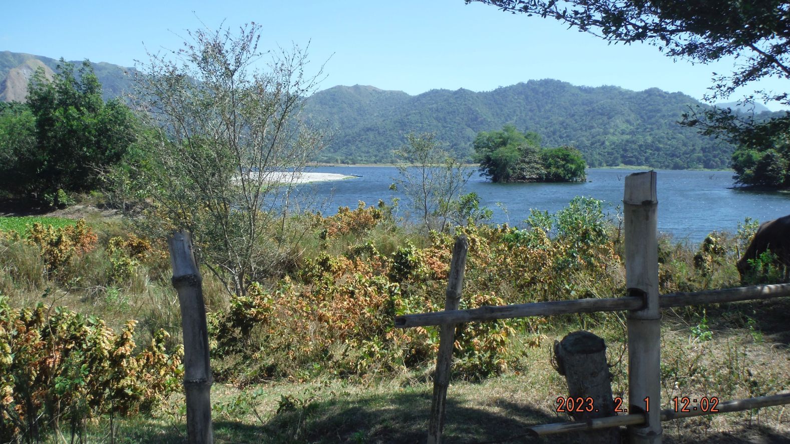 Zg119. This is picture #094 but is numbered in this album as Zg119 Pictures # 070 to 097 are images of my hike, trying to go along the shore or beach of the Mapanuepe Lake from the New Zealand tourist Spot to reach the Sitio (Small sub village) Lumibao. I was familiar with Lumibao because I had visited it before by crossing the Mapanuepe Lake by boat from Barangay (Village) Aglao. And several times Lumibao was our starting point to reach the grass plateau above which has a herd of water buffalos. Lumibao also served us hikers the goal spot, hiking across the Zambales Mountains from Pampanga. This section of hike reminded me that it was a bad idea to reach Lumibao this way. It was a zig-zag hike around water ways, fenced areas and coastal high grass places. 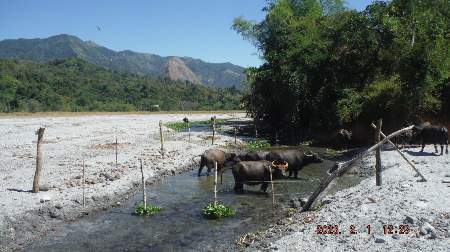 Zg120. This is picture #120 but is numbered in this album as Zg120. Pictures # 099 to 122 are images of my final stretch of hike to Lumibao. There was a drastic change in the grounds, in that new Lahar filled in a section of the Mapanuepe Lake on my track and instead of having to walk around the lake shore, there was now a straight stretch/shot of Lahar ground to Lumibao. Only one time, about 100 meter long, did I have to walk thru wet area to reach the north shore of Lake Mapanuepe, the boat landing area to reach this village from Aglao and the San Marcelino to the Dizon Mine road. Image #122 is the screen shot of my GPS device and it reads that it took me 4 hours and 23 minutes to get here and it was 14.18 km distance. Note the landmark, the 700 meter monolith Hill; it was my landmark for many of my hikes in this area. 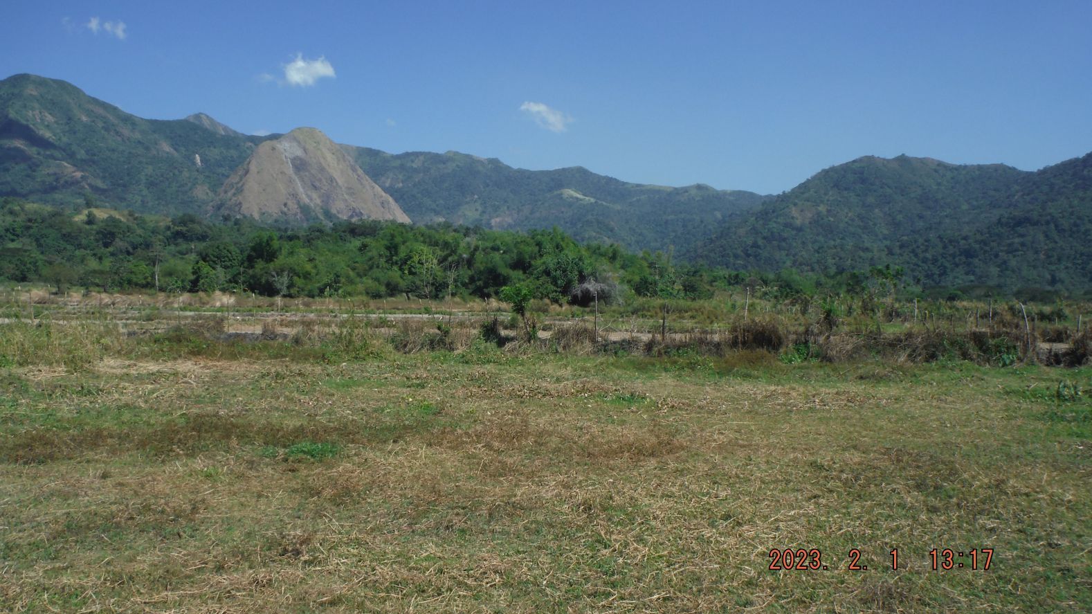 Zg121. This is picture #121 but is numbered in this album as Zg121. Pictures # 099 to 122 are images of my final stretch of hike to Lumibao. There was a drastic change in the grounds, in that new Lahar filled in a section of the Mapanuepe Lake on my track and instead of having to walk around the lake shore, there was now a straight stretch/shot of Lahar ground to Lumibao. Only one time, about 100 meter long, did I have to walk thru wet area to reach the north shore of Lake Mapanuepe, the boat landing area to reach this village from Aglao and the San Marcelino to the Dizon Mine road. Image #122 is the screen shot of my GPS device and it reads that it took me 4 hours and 23 minutes to get here and it was 14.18 km distance. Note the landmark, the 700 meter monolith Hill; it was my landmark for many of my hikes in this area. 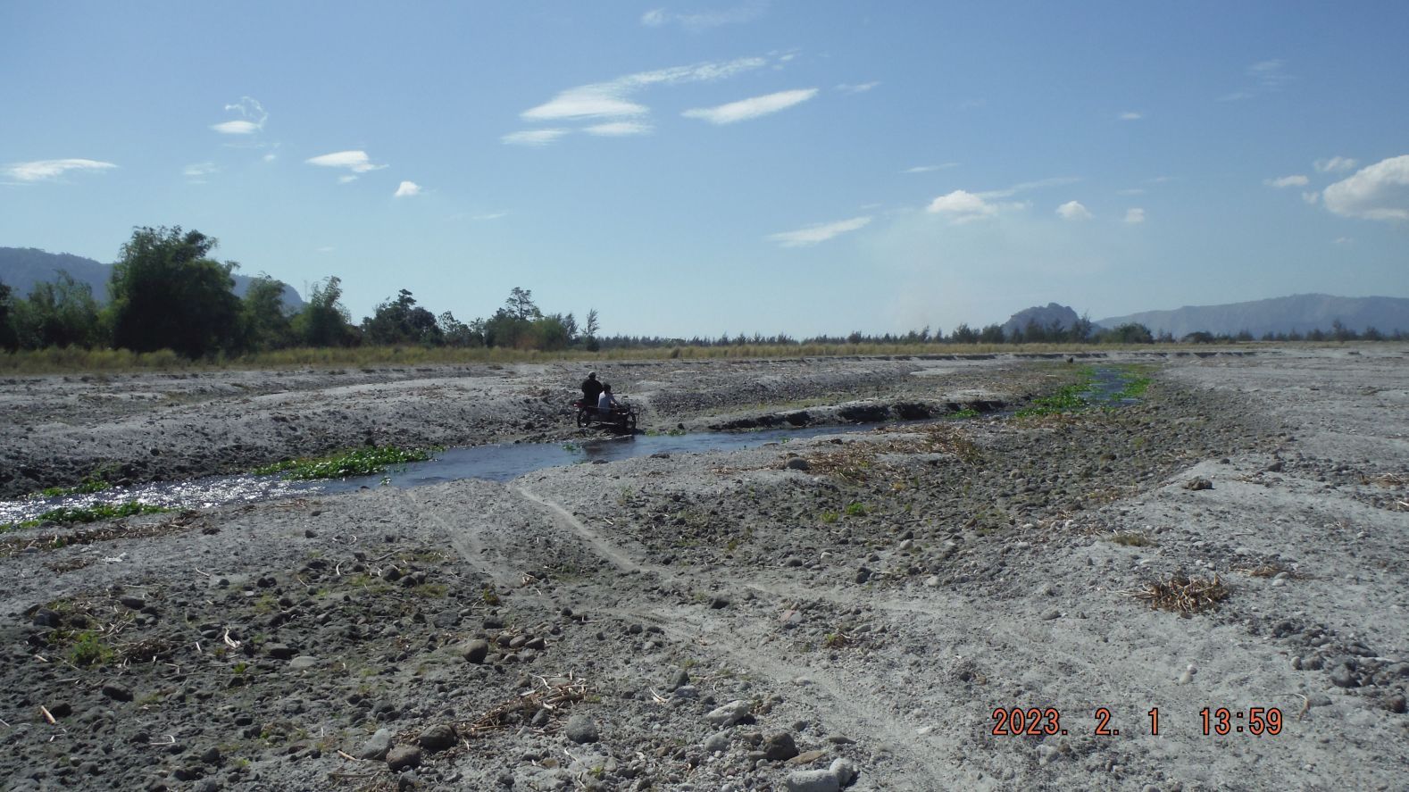 Zg122. This is picture #123 but is numbered in this album as Zg122. Pictures # 123 to 126 are only 4 images of my return march. First, I followed a tricycle, which offered me a ride but I declined, the purpose of this was walking, right! Then I cut a straight line across the Lahars, thru the pine trees and elephant grass (not difficult because cattle plow thru it all the time). Mt. Bagang was my landmark and guide. My GPS device read, that the distance was about 7 ½ km and it took me a hair under two hours This type of walk makes me feel good and I love the view of what nature did here, Mt Pinatubo and I admire how the people struggle to make living in the hard environment. Note my Stone-Age stone bridge. |
|
|
|
Post by Karl Welteke on Feb 8, 2023 11:26:14 GMT 8
The way it was!!! This is how the present New Zealand tourist spot used to look like in 1998 and 2005. I had a lot of feedback which caused me to add these 4 pictures. 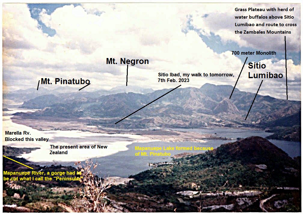 Z123. This is how the present New Zealand tourist spot used to look like in 1998, marked-up copy. 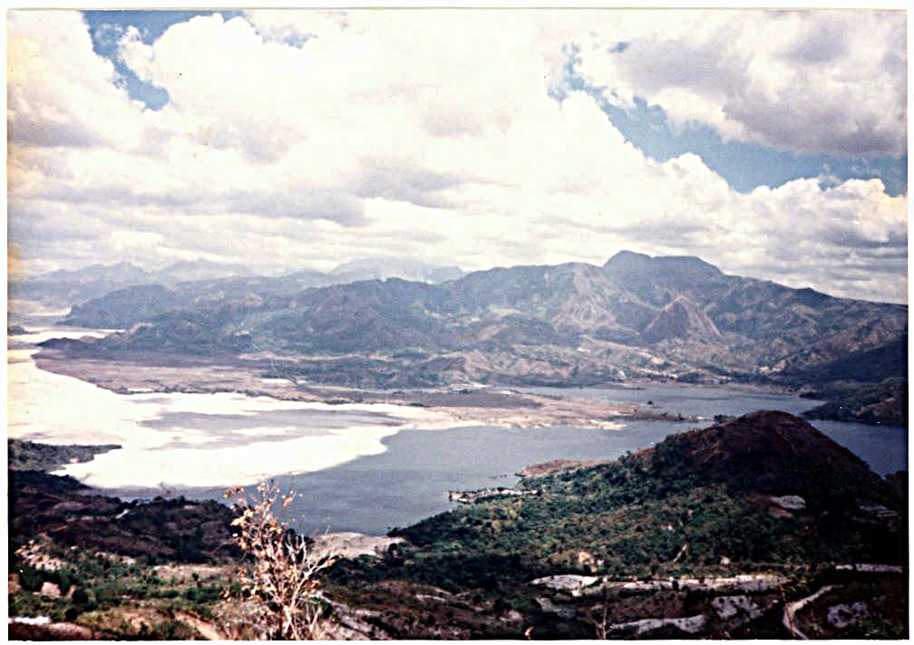 Z124. This is how the present New Zealand tourist spot used to look like in 1998. 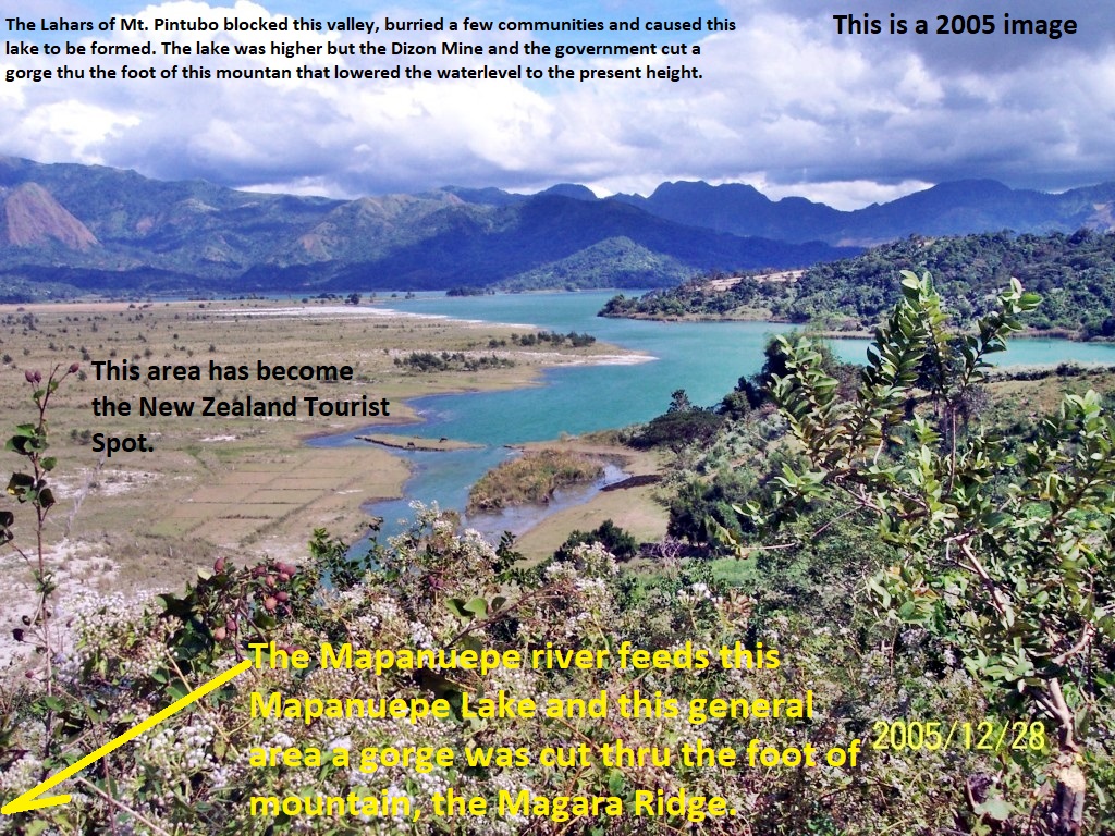 Z125. This is how the present New Zealand tourist spot used to look like in 2005, copy marked up. 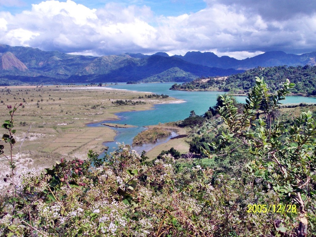 Z126. This is how the present New Zealand tourist spot used to look like in 2005. |
|
|
|
Post by Karl Welteke on Mar 5, 2023 13:22:28 GMT 8
Subic Bay Views from Matain River Valley on 3rd March 2023 These are views of Subic Bay shot from Mount Booitlao in the Matain River Valley on the 3rd of March 2023. Three maps are included to help you in your orientation. Mt. Booitlao is the sharp pointed peak inland of the Santa Monica Subdivision and it sits between the villages (Barangay) San Isidro (South) and Naugsol (North). It is a little of 200 meters high. Uploaded 56 images, in high resolution to my Flickr account as an album: www.flickr.com/photos/44567569@N00/albums/72177720306446000 For this shorter Forum presentation I chose these 12 images but they are in lower resolution. The image numbers used, referred to, are based of/on the 56 numbered images in the Flickr album. 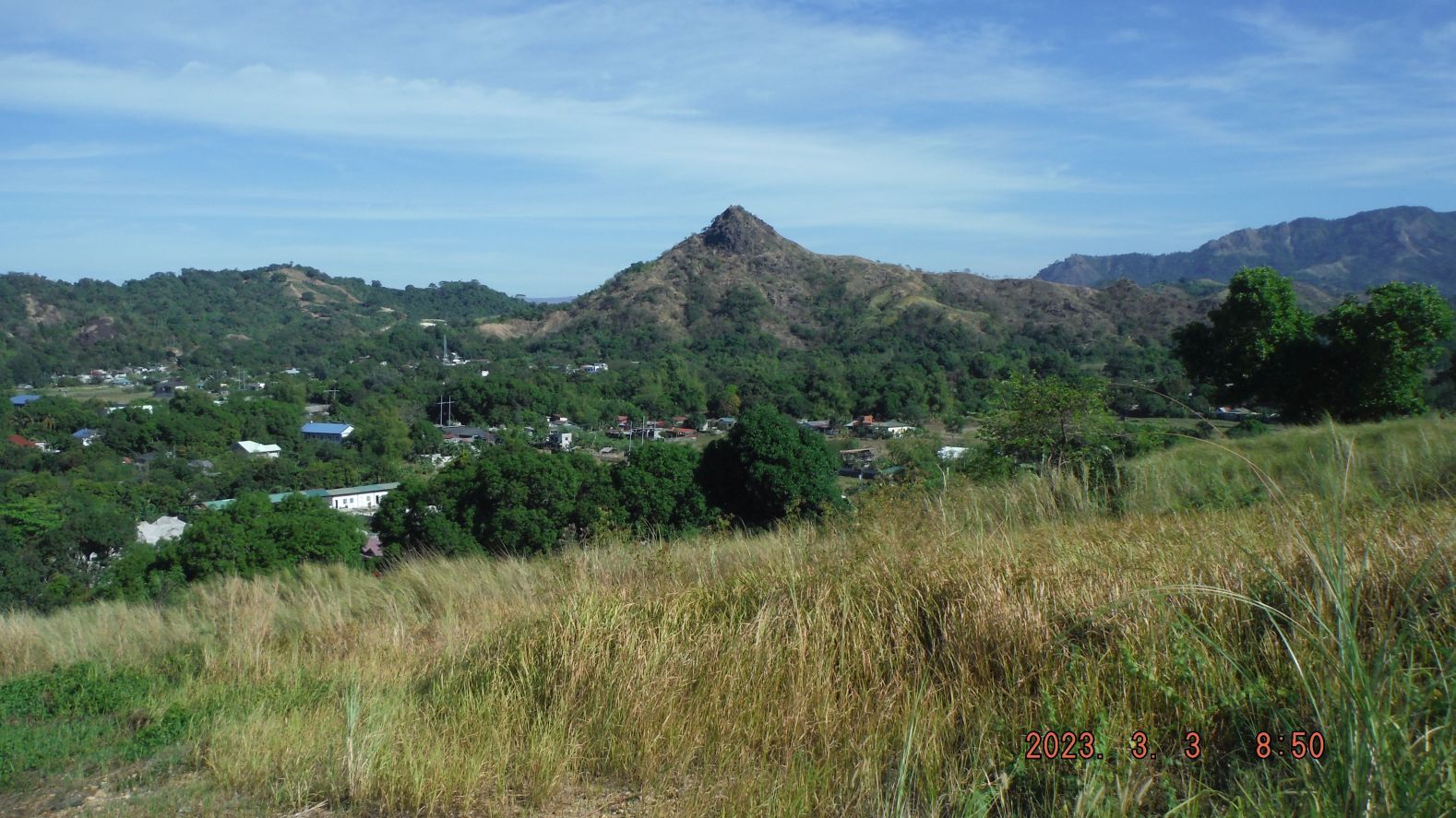 -#01. Pictures #00, 01, 02 and 05 are images of Mount Booitlao in the Matain River Valley as I approach it. 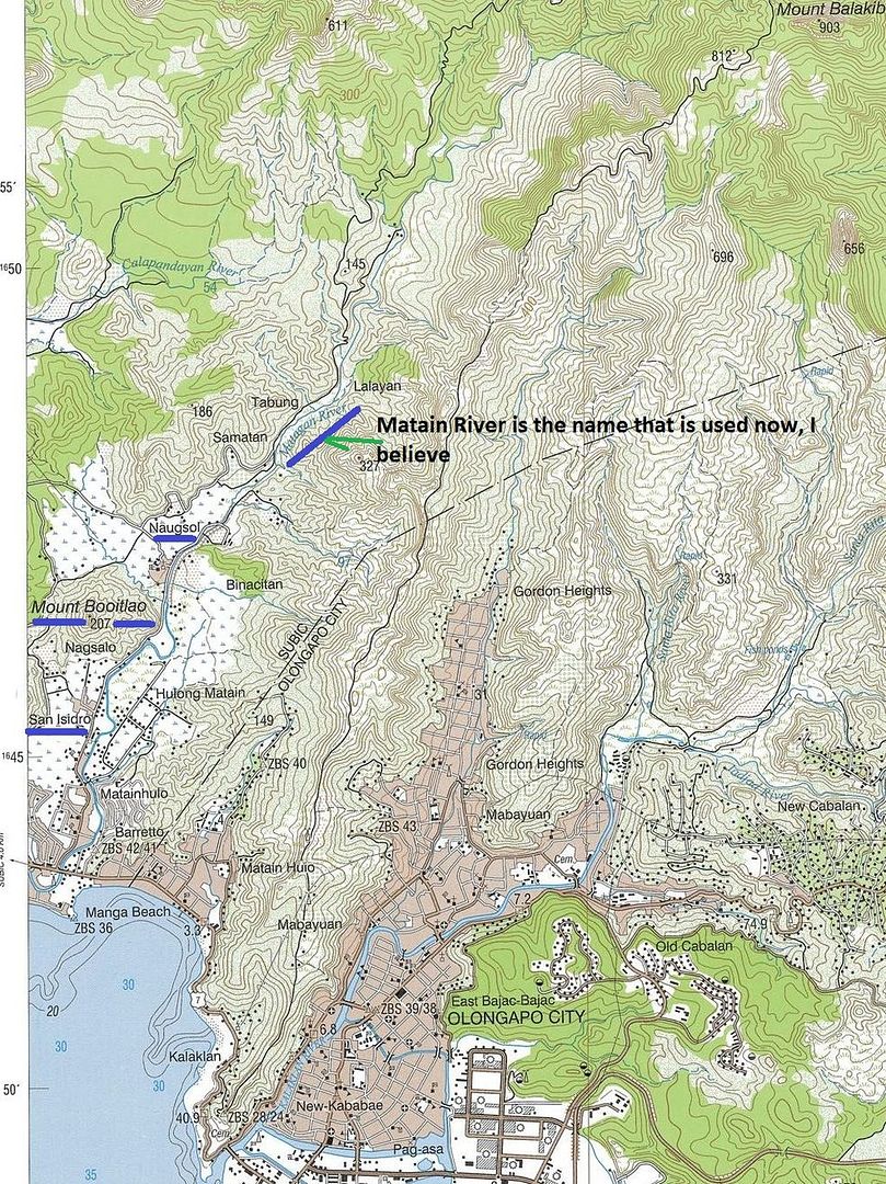 -#03a. Pictures #03, 03a and #04 are the maps that pretty much cover the area of Subic Bay that was captured in these view shots of Subic Bay. 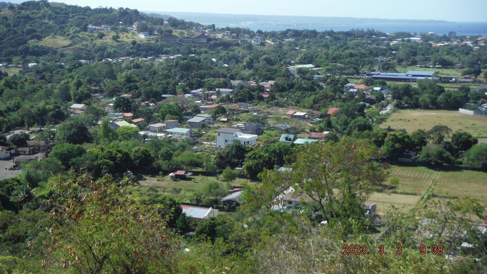 -#11. Pictures #07 to #19 are image shots of my climb to the top of Mount Booitlao, the sharp peak inland of the Santa Monica Subdivision and it sits between the villages (Barangay) San Isidro (South) and Naugsol (North). The shots are of the trail and mostly in the south direction except a few shots to Barangay Calpacuan and the newly covered Subic Municipality Landfill. 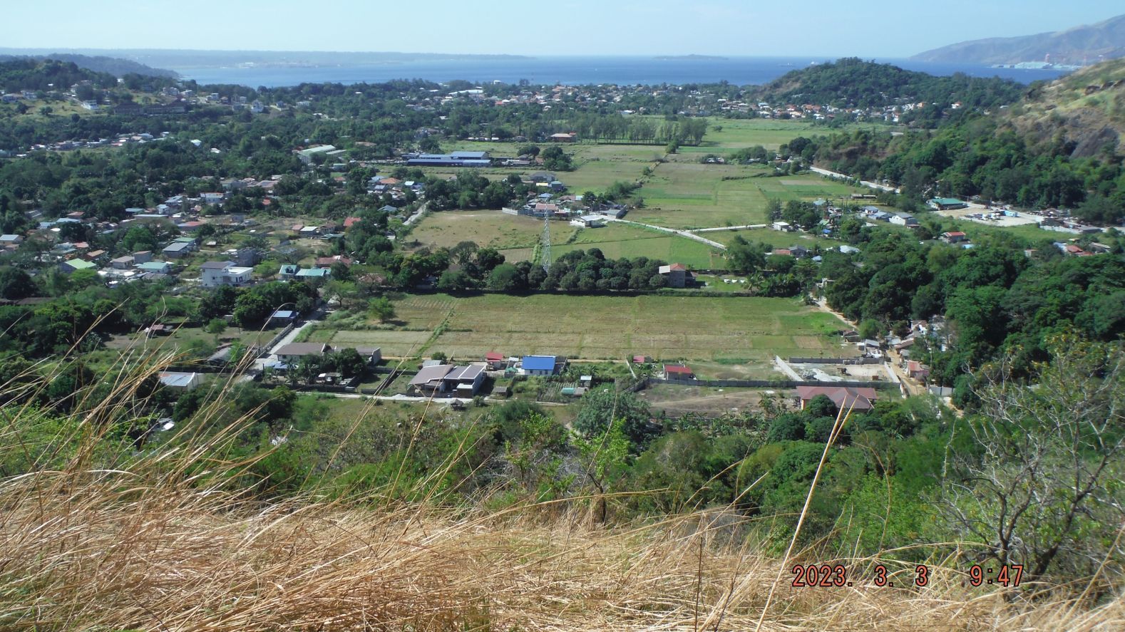 -#16. Pictures #07 to #19 are image shots of my climb to the top of Mount Booitlao, the sharp peak inland of the Santa Monica Subdivision and it sits between the villages (Barangay) San Isidro (South) and Naugsol (North). The shots are of the trail and mostly in the south direction except a few shots to Barangay Calpacuan and the newly covered Subic Municipality Landfill. 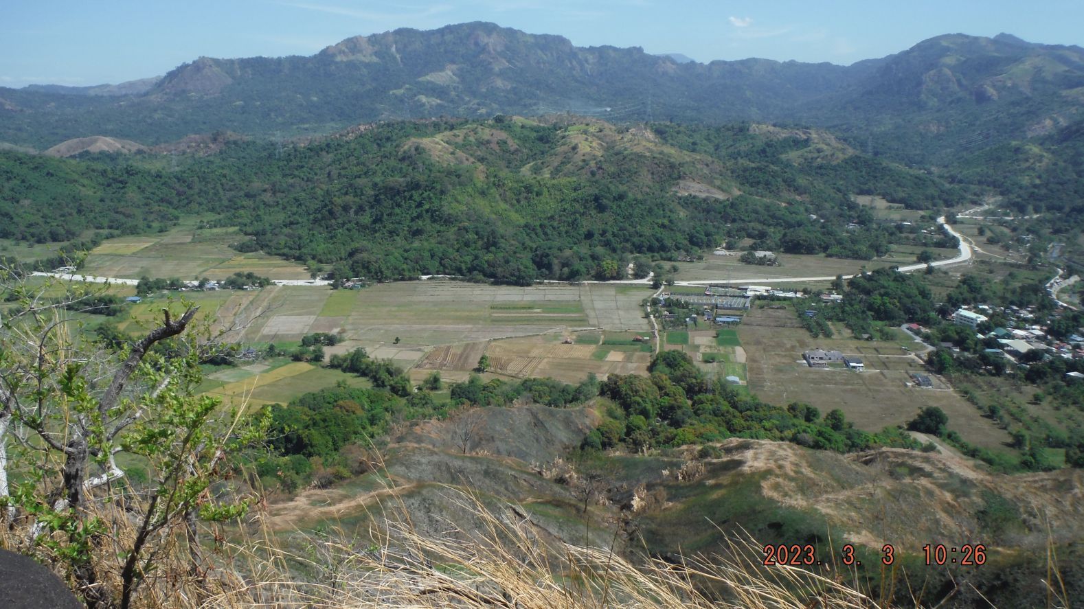 -#21. Pictures #21 to #33 are image shots in a clockwise movement of the area around Mount Booitlao and from the north top end of the mountain, all the way 360 degrees around the mountain starting with shot #21, north direction of fields of the Barangay Naugsol. 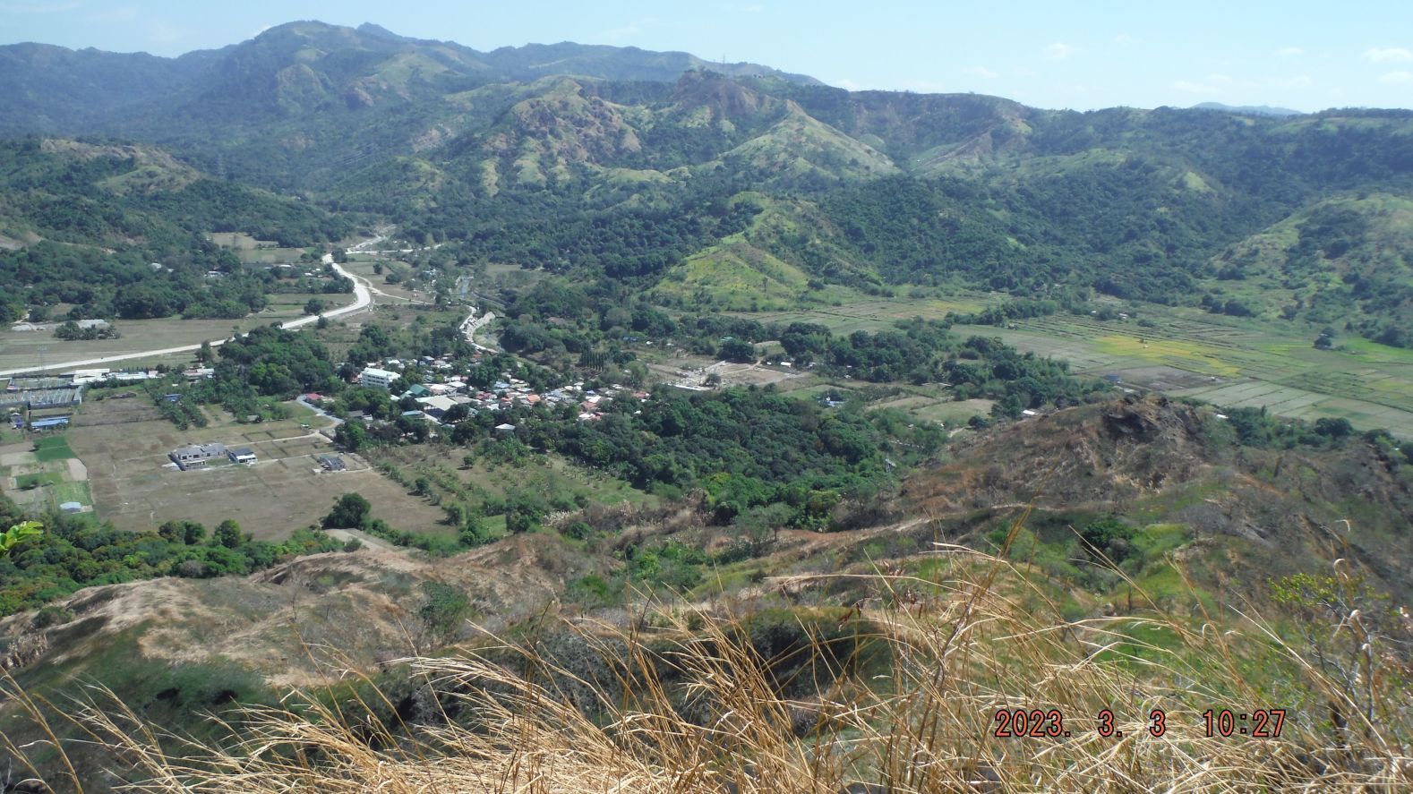 -#22. Pictures #21 to #33 are image shots in a clockwise movement of the area around Mount Booitlao and from the north top end of the mountain, all the way 360 degrees around the mountain starting with shot #21, north direction of fields of the Barangay Naugsol. 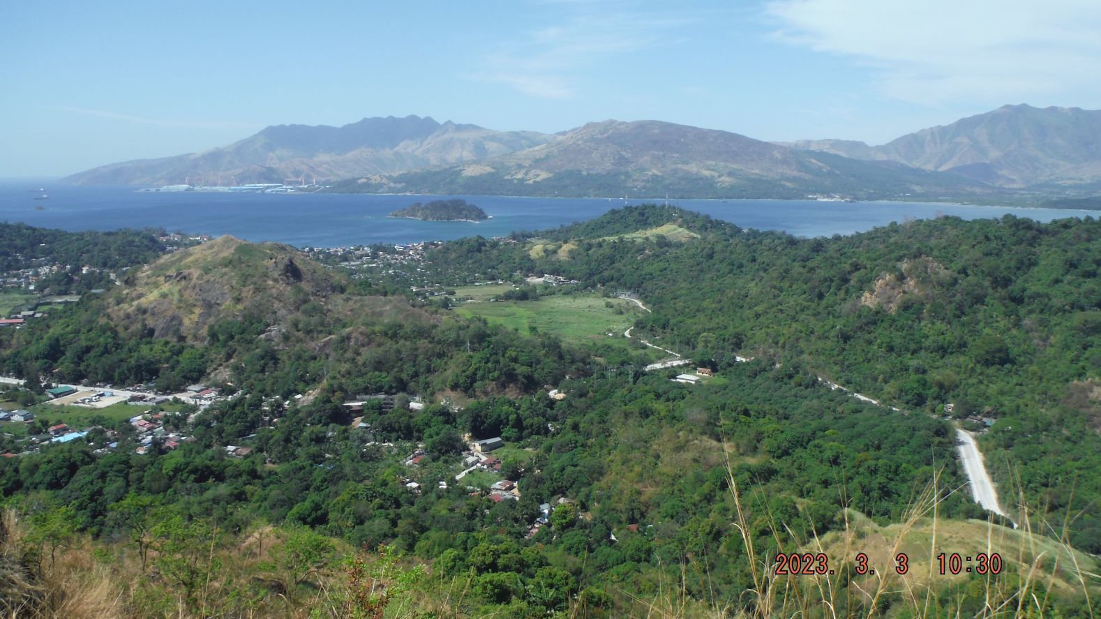 -#29. Pictures #21 to #33 are image shots in a clockwise movement of the area around Mount Booitlao and from the north top end of the mountain, all the way 360 degrees around the mountain starting with shot #21, north direction of fields of the Barangay Naugsol. 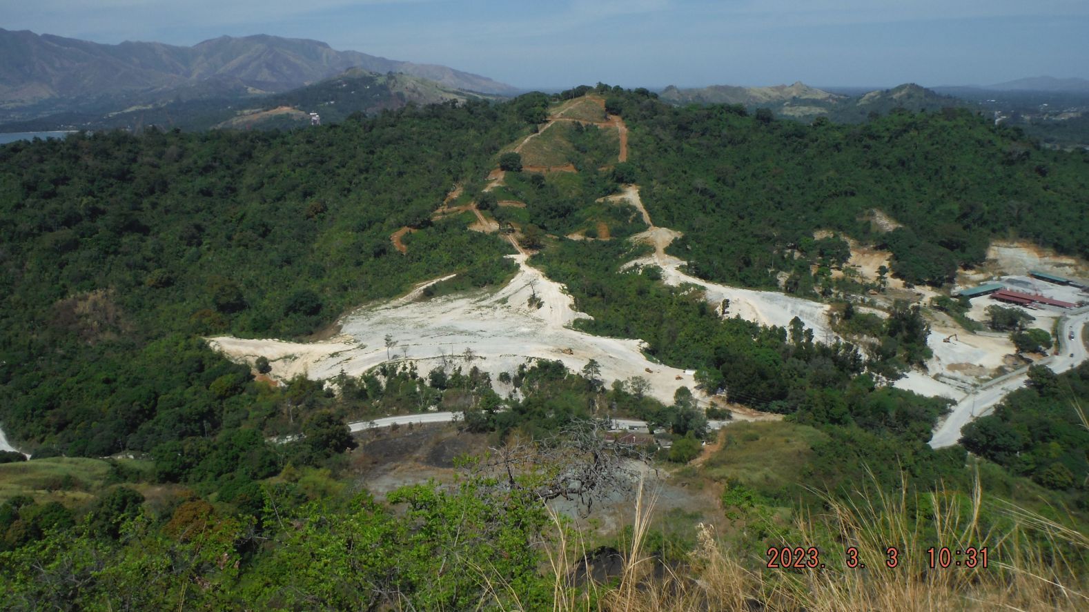 -#30. Pictures #21 to #33 are image shots in a clockwise movement of the area around Mount Booitlao and from the north top end of the mountain, all the way 360 degrees around the mountain starting with shot #21, north direction of fields of the Barangay Naugsol. 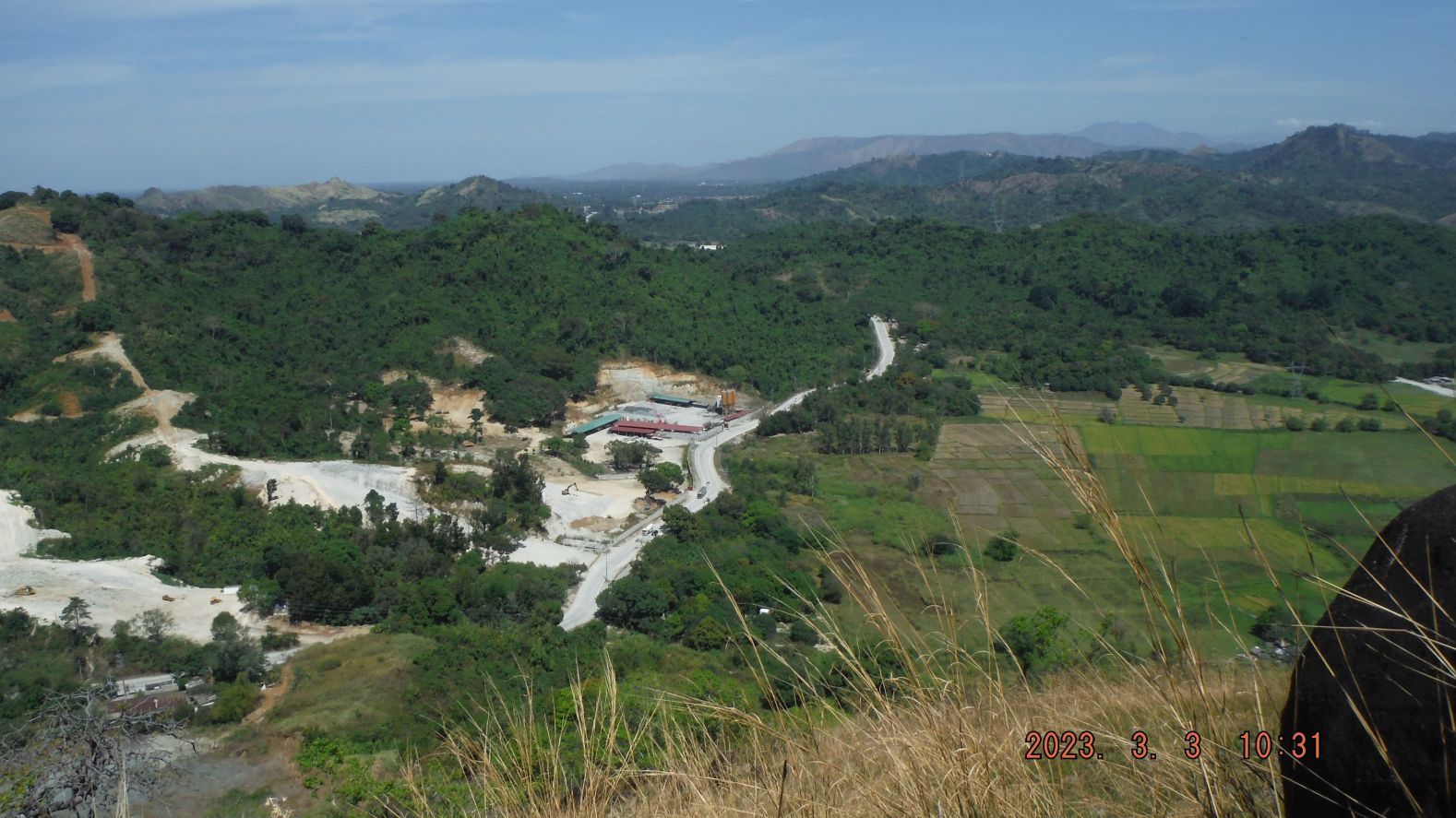 -#31. Pictures #21 to #33 are image shots in a clockwise movement of the area around Mount Booitlao and from the north top end of the mountain, all the way 360 degrees around the mountain starting with shot #21, north direction of fields of the Barangay Naugsol. 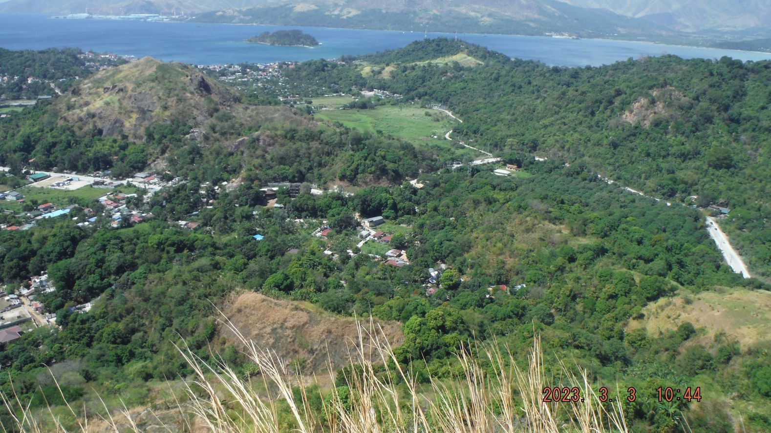 -#41. Pictures #34 to #43 are image shots in a clockwise movement of the area, south of Mount Booitlao from the south end of Mount Booitlao and first two shots are of my way getting there. The area covered is about only 270 degrees, mostly to the south. The first shot #36 is in the direction east towards the Kalaklan Ridge; on the other side of it is Gordon Heights of Olongapo City. There used to be a covered shed on this mountain hence to concrete floor but now the top large boulders are painted white and mark this mountain. 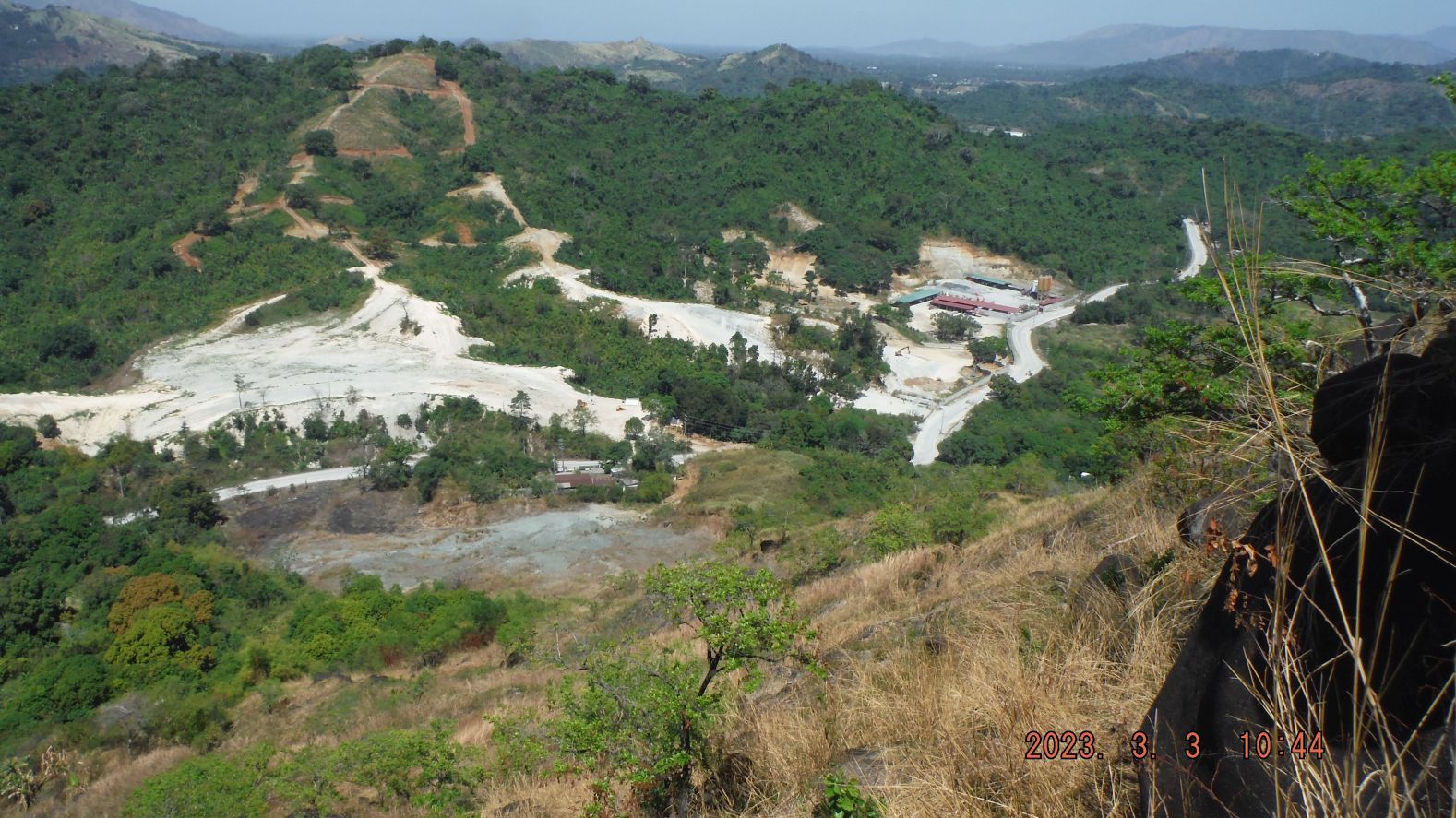 -#43. Pictures #34 to #43 are image shots in a clockwise movement of the area, south of Mount Booitlao from the south end of Mount Booitlao and first two shots are of my way getting there. The area covered is about only 270 degrees, mostly to the south. The first shot #36 is in the direction east towards the Kalaklan Ridge; on the other side of it is Gordon Heights of Olongapo City. There used to be a covered shed on this mountain hence to concrete floor but now the top large boulders are painted white and mark this mountain. 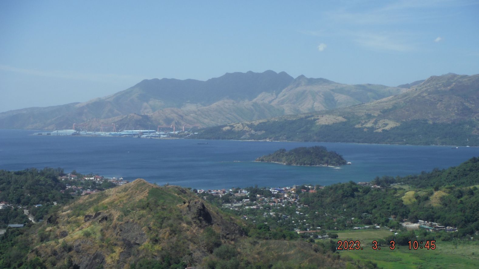 -#48. Pictures #44 to #52 are 9 long distant shots, clockwise again and are named in order, #44 PLDT Mountain with many towers, #45 Mount Natib Caldera, #46 the former Naval Magazine area, #47 Grande Island, the former Fort Wint, #48 the new Agila Subic Yard, #49 Mount Redondo, #50 The Pointed Peak (check name on map), #51 the crane of the former PHILSECO YARD, now the Keppel Subic Shipyard, #52 the San Marcelino Plains of Zambales. |
|