|
|
Post by Karl Welteke on Nov 12, 2019 4:12:05 GMT 8
USS Oklahoma BB-37 Memorial on Ford Island in Pearl Harbor. I read that the USS Oklahoma Memorial existed but I had no idea how it looked. On the 2nd Nov. 2019 I walked to Ford Island and had a look. Here are only 12 images of my visit. 26 images each, same pictures, are in these other albums, take your pick: Uploaded to Karl’s web page: philippine-sailor.net/2019/11/11/uss-oklahoma-bb-37-memorial/Uploaded to Facebook, click here or copy and paste this URL: www.facebook.com/karlwilhelm.welteke/media_set?set=a.10217526193220401&type=3Uploaded to Photobucket, click here or copy and paste this URL: s74.photobucket.com/user/PI-Sailor/library/Hawaii/Ford%20Island/USS%20Oklahoma%20BB-37%20MemorialIf you are going to watch this on Photobucket, they are drowning you with advertisements. Try to click slide view right away, then click slow and full screen. 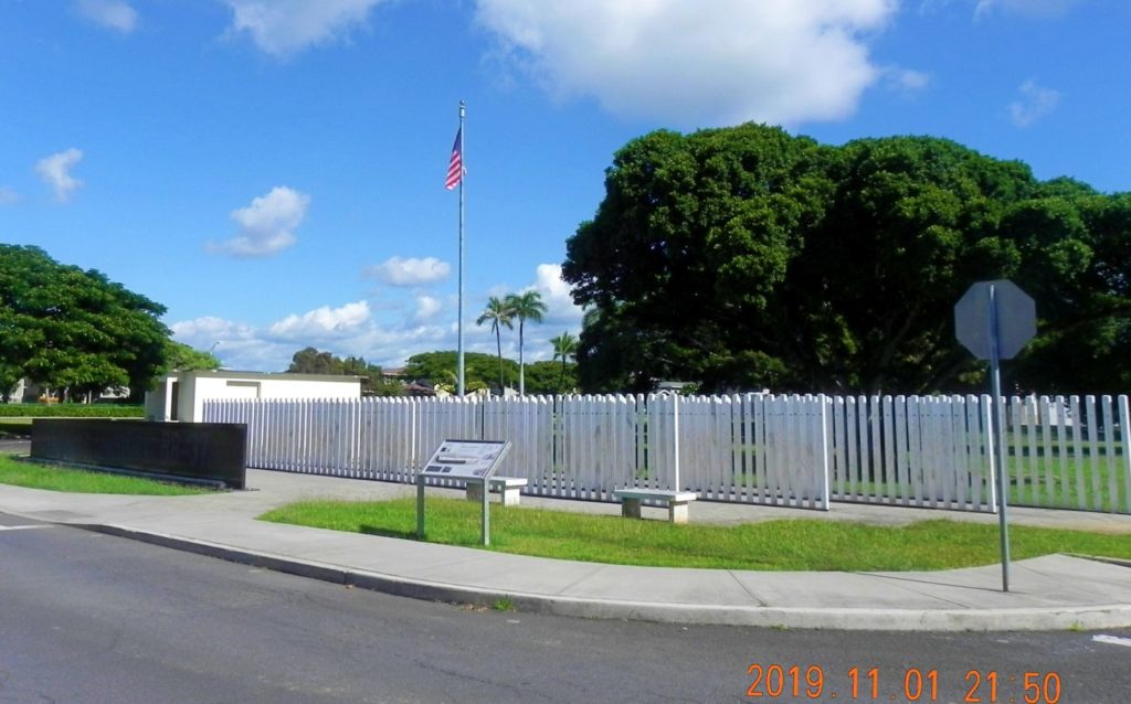 Ze650. This is the USS Oklahoma BB-37 Battle Ship Memorial on Ford Island in Pearl Harbor. When you stand at the gate of the USS Missouri Memorial you have this view of the USS Oklahoma Memorial. 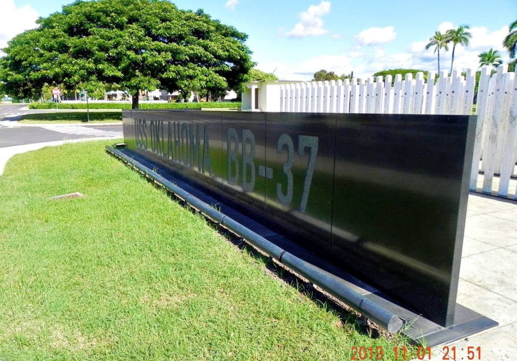 Ze651. This is the USS Oklahoma BB-37 Battle Ship Memorial on Ford Island in Pearl Harbor. It is located very near the USS Missouri Memorial which is berthed at the place where the USS Oklahoma sunk. 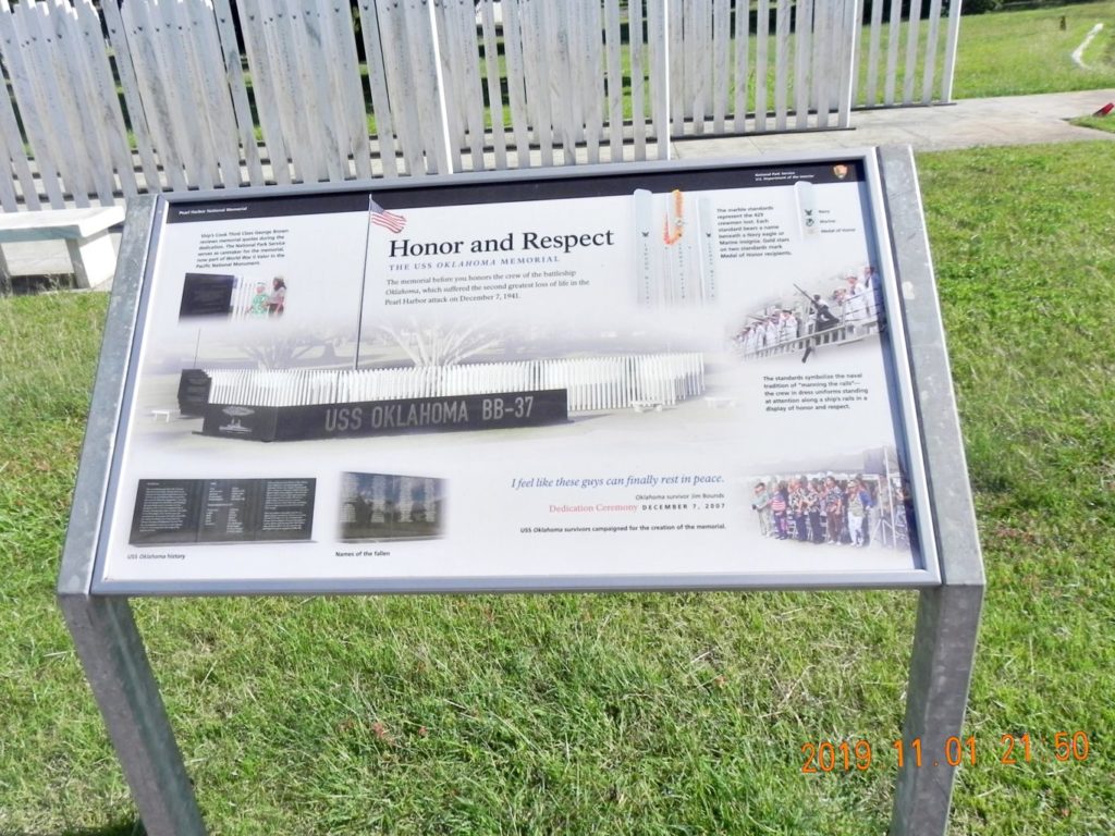 Ze652. This plaque stands by the USS Oklahoma BB-37 Battle Ship Memorial on Ford Island in Pearl Harbor. A high-resolution copy is available, click this URL: www.flickr.com/photos/44567569@N00/49041415871/in/album-72157711711575833/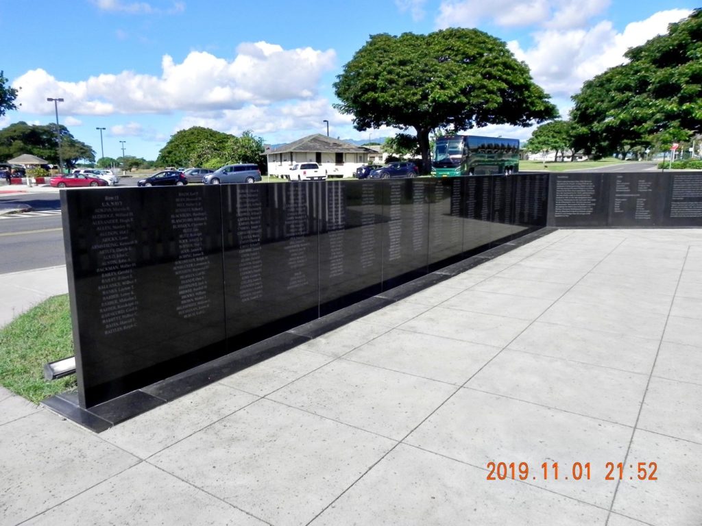 Ze653. The USS Oklahoma Memorial has a wall with the names of the Marines and Sailors that gave up their life or died later from their injuries. 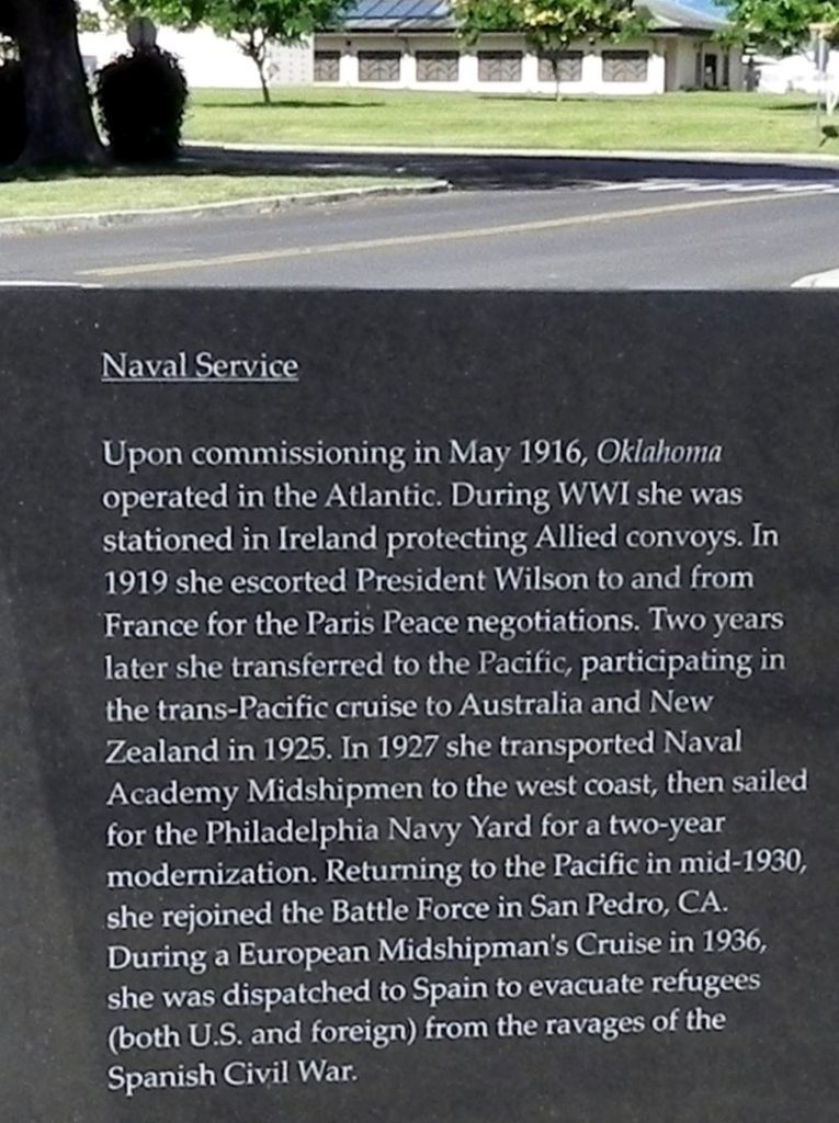 Ze654. This plaque tells us the history of the USS Oklahoma BB-37 at its BB-37 Battle Ship Memorial on Ford Island in Pearl Harbor. 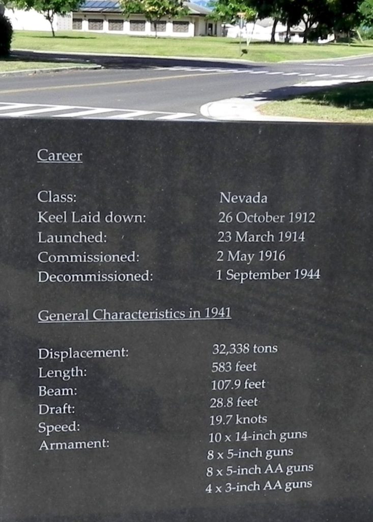 Ze655 Historic dates and technical data of the USS Oklahoma BB-37 at its BB-37 Battle Ship Memorial on Ford Island in Pearl Harbor. 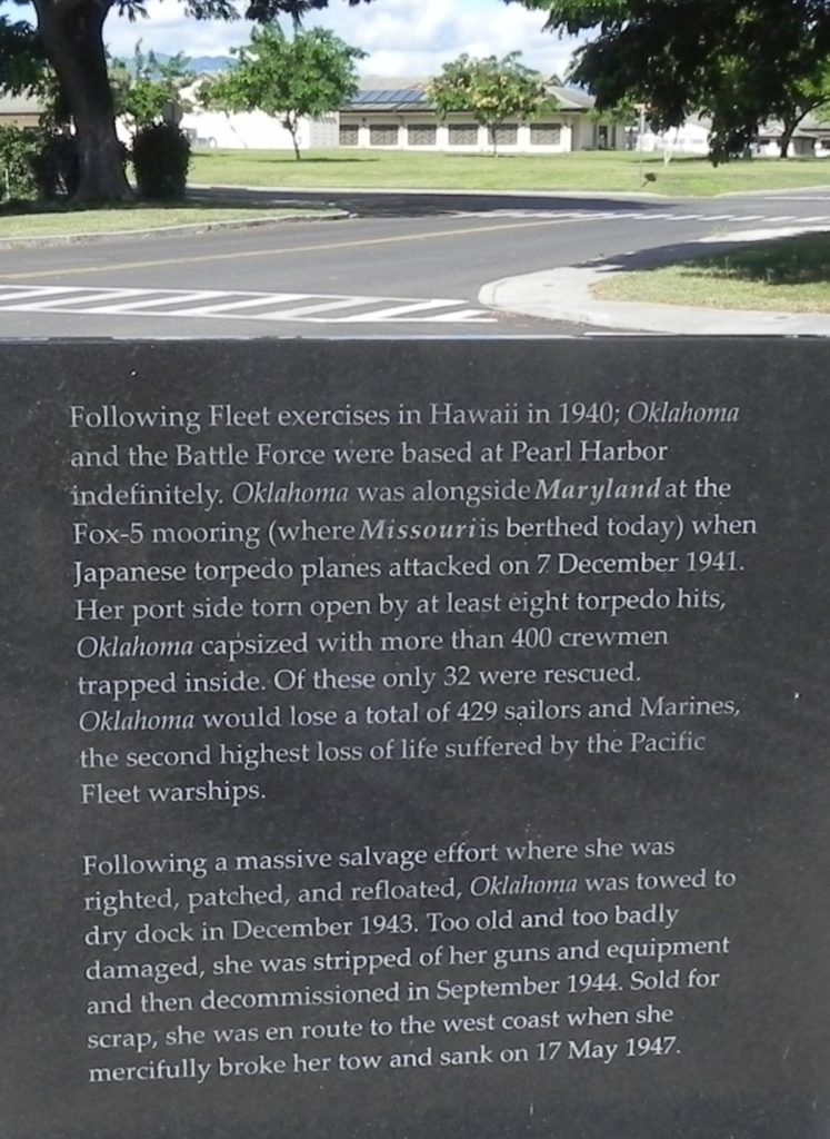 Ze656. The USS Oklahoma story on the 7th Dec. 1942 and how her life ended. 429 Sailors and Marines gave up their life then or died later. 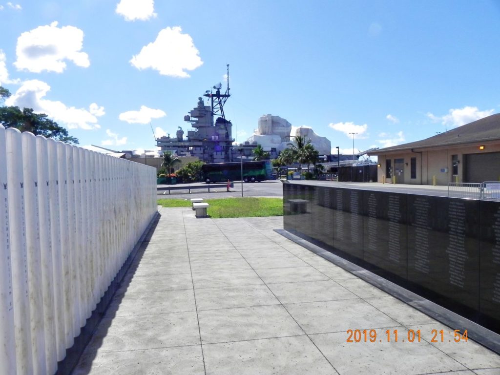 Ze657. This is a view of the USS Missouri from the USS Oklahoma Memorial; at that very spot is where the USS Oklahoma sunk and was salvaged. In front of you at that area a heck of a salvage job was executed in 1943 and 44. 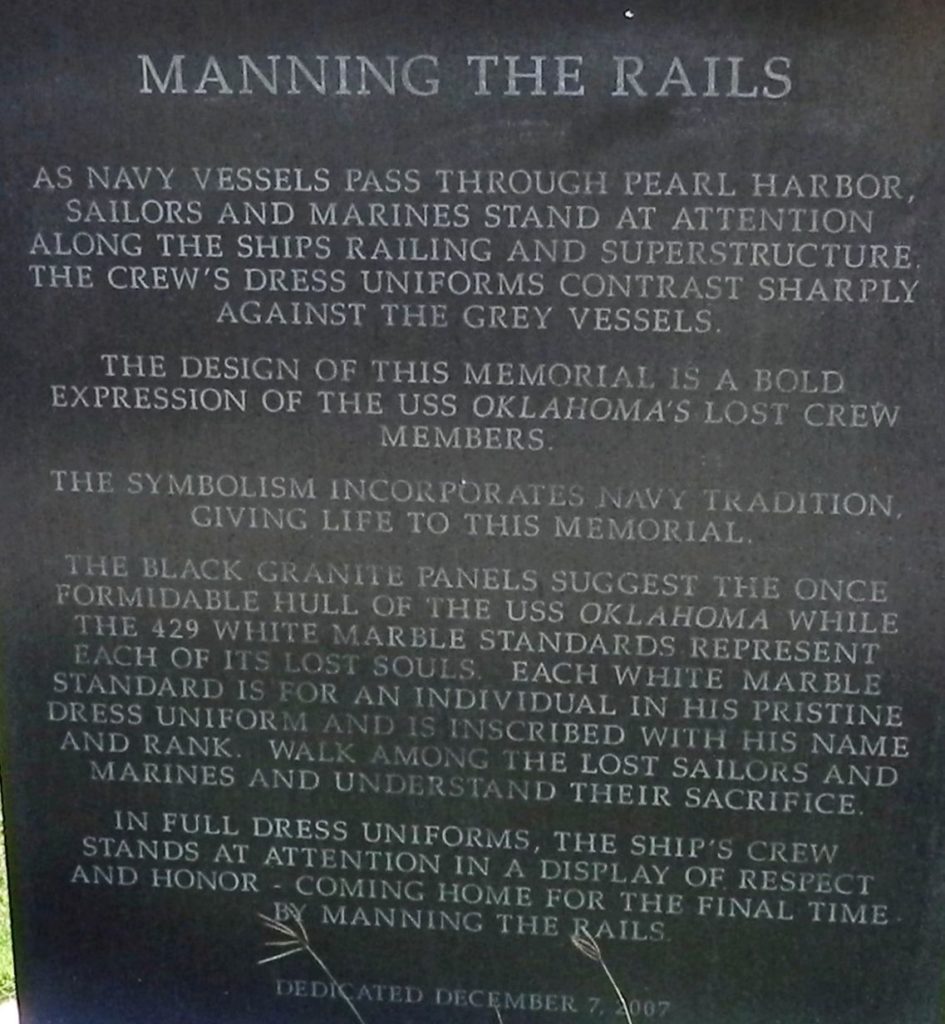 Ze658. This plaque explains the Navy Tradition of Manning the Rail and what the 429 White Marble Standards with the names of the Sailors and Marines represent, that they were torn away from our sides. 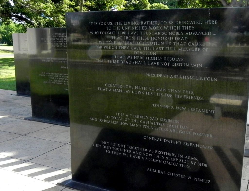 Ze659. Several black marble plates were erected with meaningful quotes from historical peoples. 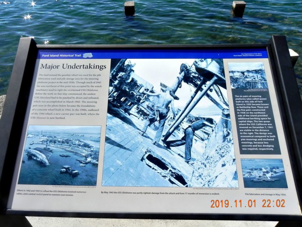 Ze660. This plaque is part of the Ford Island Historical Trail around the island with many plaques like this one. It is located nearby and shows the USS Oklahoma being salvaged; a heck of a job; divers like me and may other skills did the job. 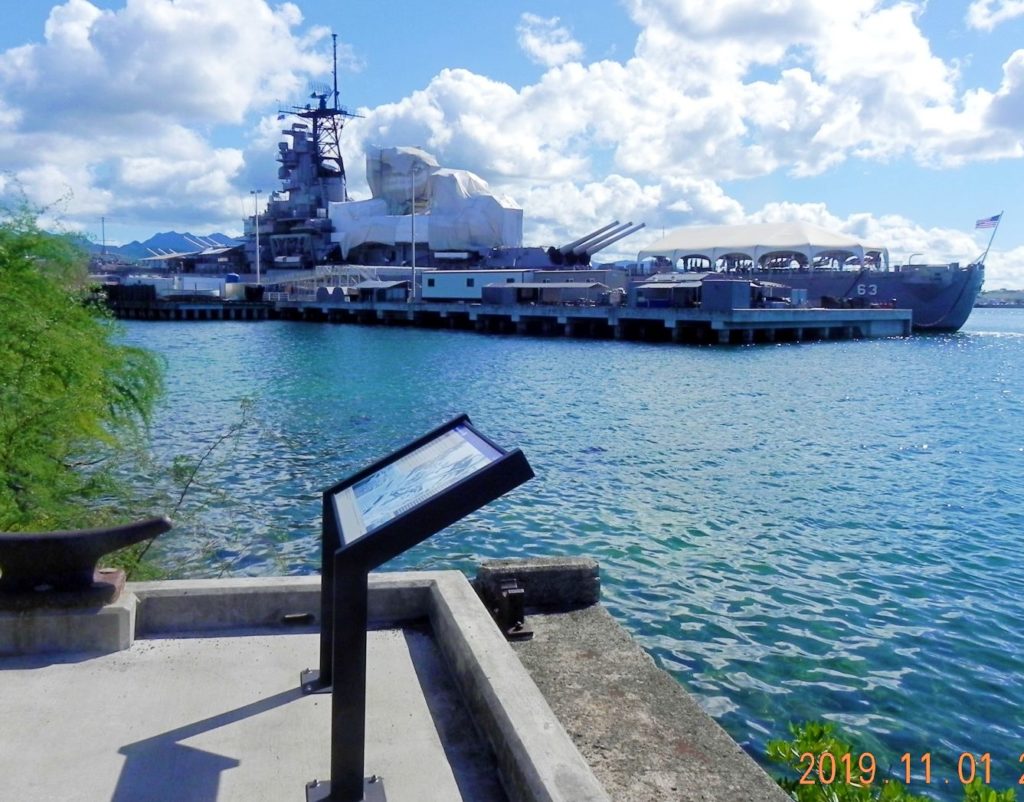 Ze661. This is where the Salvage plaque is located, that is the USS Missouri BB-63 Memorial. The USS Oklahoma Memorial is about the same distance, about 50 degrees to the left. This is also where the Ford Island Historical Trail starts with may plaques. The trail is well marked and I will present it in the future. |
|
|
|
Post by Karl Welteke on Nov 13, 2019 2:13:45 GMT 8
Karl on the USS Conserver ARS-39 1977-81  U434. This is a great picture and my daughter put it on Facebook (Veterans Day, thank you Tammy), a friend wrote me, maybe put it on our Corregidor Forum. OK EXO, I will do it, but put it on Facebook again also and I will send it to some friends that don’t use Facebook. I did have a great Ships Bos’n and friend, Martinez, a Deck Warrant Officer, who used to work for me as a BM1 DV in HCU-2 in the Atlantic. Then when we arrived in Subic a very great Petty Officer reported on board for duty, BM1 Lee Langston, who became a legendary Deck and Diving Officer. My tour on the USS Conserver started this way. We went WESTPAC, I was in charge of the Diving Locker and the deck Department and I had no Petty Officers in Deck, only me. I did have two leading Seaman, that saved the day. And we had a large tow, two drydock sections for Subic Bay. And the flooding alarm came on the first night. What happened, one tug, when we started out, tore off a ladder which ripped a hole in the hull of one of the tows. Bos’n Martinez and I went on board, patched the hole from the inside and dewatered with the emergency pumps. In this picture, the ship being undermanned, I just got out of the water and then directed the boom operator. I am giving the signal to train the boom to my left and come down 3 on the hook. A shipmate shot this picture but I forgot who. It was a great tour of duty on the USS Conserver, in 1978 I picked up as BMCM DV. I served in the Navy 1960-91 and in in 1963 I became a Navy Deep Sea Diver. Funny thing, after I retired, I never dove again, I do swim. My interest went into walking and visit historic sites. |
|
|
|
Post by Karl Welteke on Nov 15, 2019 1:19:08 GMT 8
USS Utah BB-31 (AG-16) and its Memorial The USS Utah BB-31 was ones a proud ship but is resting now at Ford Island in Pearl Harbor as a War Grave Site and WWII Memorial. On the 2nd of Nov. 2019 I walked to Ford Island, across the bridge and visited the USS Utah. These pictures are from that visit. I added several more USS Utah pictures from Wikipedia and the Naval History Heritage Command. In 1931, Utah was demilitarized and converted into a target ship and re-designated as AG-16, in accordance with the terms of the London Naval Treaty signed the previous year (Wikipedia). This USS Utah Memorial is special to me. I started my American life in Salt Lake City and became a Sailor there on the 14th July 1960. The USS Utah is sometime called the forgotten ship, it only can be visited if you have a military ID card or someone escorts you who has one, Ford Island is part of the Pearl Harbor Naval Base. I established a webpage with 33 Images: philippine-sailor.net/2019/11/14/uss-utah-bb-31-and-its-memorial/For this forum presentation I chose these 7 images! 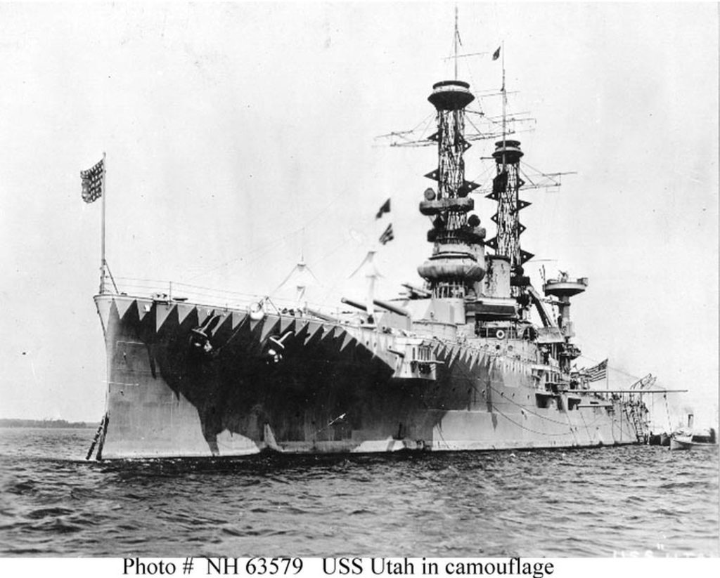 Ze662. This is a WW One picture of the USS Utah BB-31 from Wikipedia. This is the URL: en.wikipedia.org/wiki/USS_Utah_(BB-31)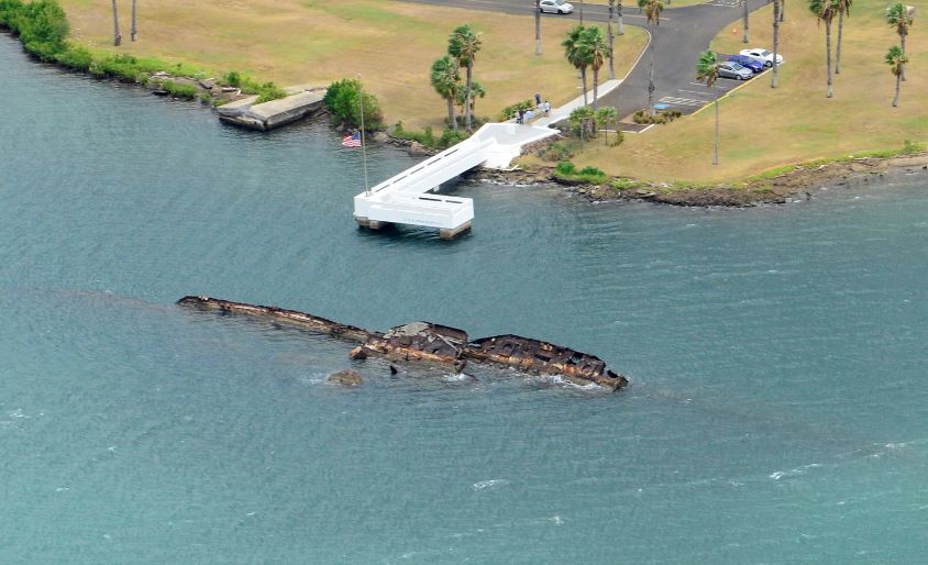 Ze663. The USS Utah BB-31 Memorial on Ford Island in Pearl Harbor from Wikipedia, this is the URL: en.wikipedia.org/wiki/USS_Utah_(BB-31) Ze664. This is one of 3 images as you approach the USS Utah BB-31 Memorial on Ford Island in Pearl Harbor, it was shot the 2nd Nov. 2019. 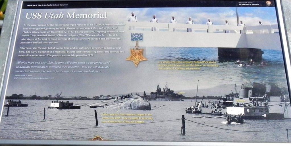 Ze671. This is one of 6 images of the information plaque about the USS Utah BB-31 Memorial and zoomed-in parts of it. It is located just before you step on the USS Utah Memorial Pier at Ford Island in Pearl Harbor. It can be downloaded in high resolution with this URL: www.flickr.com/photos/44567569@N00/49060801382/in/album-72157711711575833/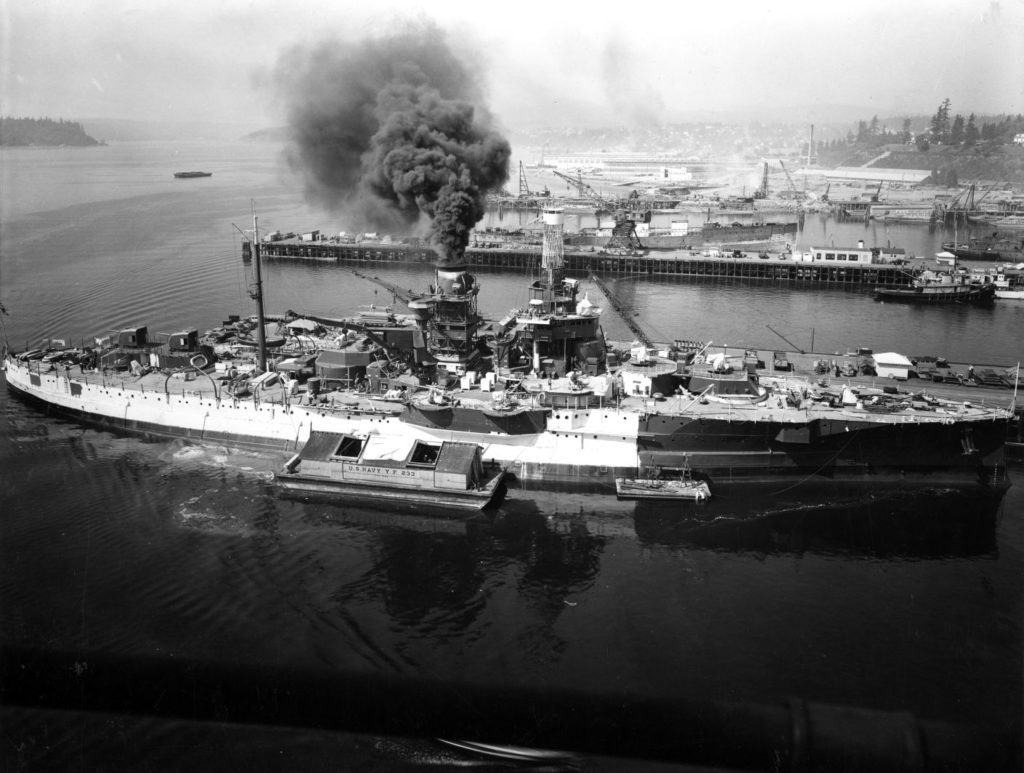 Ze688. This is one of several images from this Wikipedia web page: en.wikipedia.org/wiki/USS_Utah_(BB-31) The U.S. Navy training ship USS Utah (AG-16) at the Puget Sound Naval Shipyard, Bremerton, Washington (USA), 18 August 1941. She has been rearmed and partially repainted into Measure 1 camouflage. The U.S. Navy lighter YF-233 is alongside, and USS Aroostook (AK-44) is being disassembled in the background. I consider this a real great picture, so much detail if you download it in high resolution. 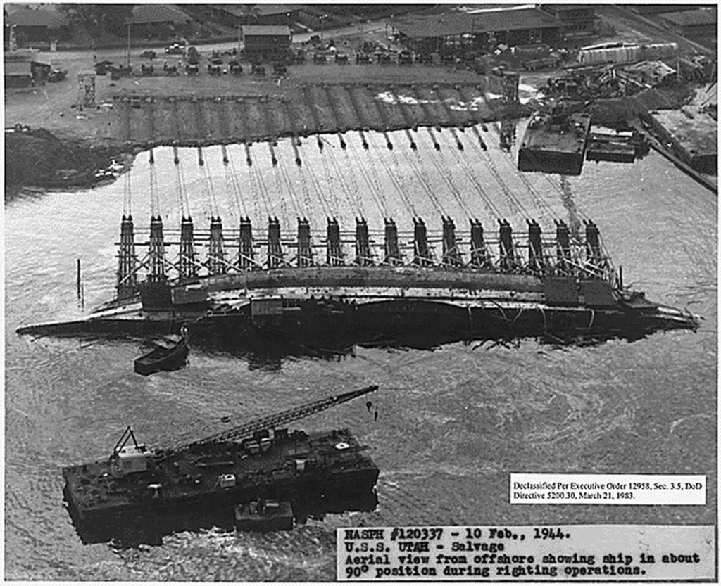 Ze690. This is one of several images from this Wikipedia web page: en.wikipedia.org/wiki/USS_Utah_(BB-31)Following the successful righting (rotation to upright) of the capsized Oklahoma, an attempt was made to right the Utah by the same parbuckling method using 17 winches. As Utah was rotated, she did not grip the harbor bottom, and slid towards Ford Island. The Utah recovery effort was abandoned, with Utah rotated 38 degrees from horizontal. 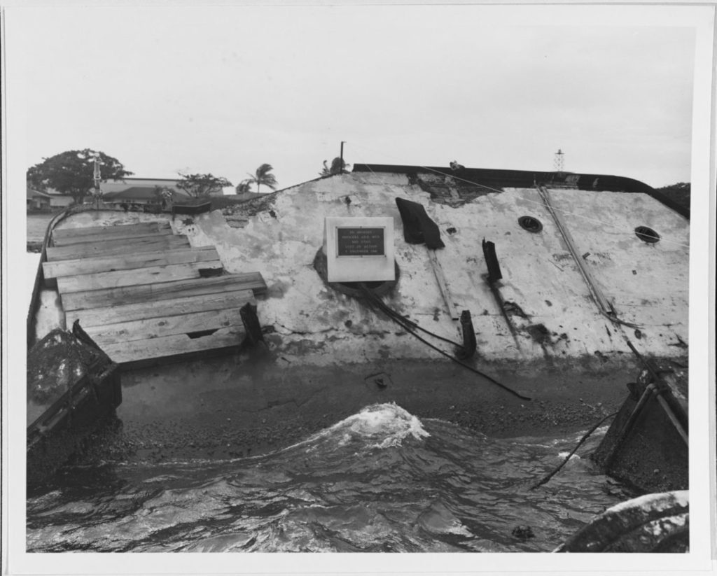 Ze692. This is one of 3 images from the Naval History and Heritage Command about the USS Utah BB-31 Memorial, here is the URL: www.history.navy.mil/our-collections/photography/wars-and-events/world-war-ii/pearl-harbor-raid/remembrance-of--a-date-which-will-live-in-infamy-/uss-utah-memorial-at-pearl-harbor.htmlMemorial plaque mounted on the ship's wreck, off the west side of Ford Island, Pearl Harbor. Photographed on 9 December 1950. The plaque's inscription reads: In Memory - Officers and Men - USS Utah - Lost in Action - 7 December 1941. Official U.S. Navy Photograph, now in the collections of the National Archives. Catalog #: 80-G-484354 |
|
|
|
Post by Karl Welteke on Nov 17, 2019 14:10:18 GMT 8
Ford Island Historic Trail, South East Side #1 On Ford Island in Pearl Harbor a Historic Trail has been established, it goes around the whole island. It is marked for people to follow the trail. Every so often a set of two historic plaques are put in place. I walked the trail on the 2nd of Nov and will present my pictures in segments. This is the first one from the south-east side. 49 pictures have been generated and I put them in these two albums, take your pick: Uploaded to Facebook: www.facebook.com/karlwilhelm.welteke/media_set?set=a.10217574749834286&type=3Uploaded to Photobucket: s74.photobucket.com/user/PI-Sailor/library/Hawaii/Ford%20Island/South%20East%201%20Ford%20Island%20Historic%20TrailIf you are going to watch this on Photobucket, they are drowning you with advertisements. Try to click slide view right away, then click slow and full screen. Eight pictures have been selected for presentation in this forum:  U435. This is a zoomed-in picture from one of the plaques, maybe the first one, on the Ford Island Historic Trail. This is the fuel pier, gasoline, for the Naval Air Station on Ford Island. Just to the right from the viewer were the USS Oklahoma and the USS Maryland. A construction job is planned, piles are made and laying there. The pier is gone now but at the foot of the pier is were the first set of plaques are located.  U436. In this picture we see the fuel pier from the previous picture. We see the salvage of the USS Oklahoma. Those winched and cables was part of my salvage diver skill. On my salvage ship we had 8 sets of gear, they are called Beach Gear. The USS Maryland was inboard of the USS Oklahoma was salvaged in served in WWII to the end. USS Maryland was hit twice by Kamikaze planes. The USS Missouri is berthed here now as an Memorial.  U437. Here is the fuel pier again and new housing for Chief Petty Officers, my family and I could have been housed here. The pier is gone now and it is indicated where the first two plaques of the Ford Island Historic Trail are located.  U438. This is a Google Earth image of the former Ford Island Naval Air Station fuel pier. The pier is gone now. This is where the first set of plaques from the Ford Island Historic Trail were placed. You can see the white marks/spots that mark the historic trail to follow from here.  U439. This picture is of the large barracks on Ford Island and is from the 2nd set of plaques which are placed between the ex-ferry landings and the dispensary. I was stationed on Ford Island between 1983-86 as an instructor in the diving school. Our students were berthed there and one of my job was to inspect their rooms sometime. One of our students was a 1st Lt. USMC with a name Crowe. Our Corpsman, looking in his health record, discovered he is an Admiral’s son. Admiral William J. Crowe was CINCPAC then, was it him, yes it was. He came down to Ford Island from Camp Smith, his HQ with a helicopter for his son’s graduation. That was great and I had a very good German family friend along and the admiral shook everybody’s hand, great experience.  U440. The dispensary on Ford Island got hit by a bomb in 1941, it hit right in the middle of the courtyard, in the middle of the structure. I knew that because if we had to go the dispensary the spot was marked. I have to go there again and see whether it is still marked, I failed to do it this time.  U441. The only way to get to Ford Island was by this ferry service or by ferry passenger boats from Merry Point Landing near Nimitz Gate of Pearl Harbor. The ferry landing was where the Arizona Memorial Landing is. The landings on Ford Island are still there, look into the albums. Notice a unit is standing in formation. In back is the Naval Station Boat Pool.  U442. The USS California settled near the ferry landings, next to the right ferry landing is a marker commemorating the USS California BB-44. Here is a paragraph from Wikipedia: California was moored in Pearl Harbor on 7 December 1941 when the Japanese attacked the port, bringing the United States into World War II. The ship was moderately damaged by a pair of torpedoes and a bomb, but a fire disabled the ship's electrical system, preventing the pumps from being used to keep the ship afloat. California slowly filled with water over the following three days and eventually sank. Her crew suffered heavy casualties in the attack and four men were awarded the Medal of Honor for their actions during the attack. She was raised in April 1942, repaired and heavily rebuilt, and returned to service in January 1944. |
|
|
|
Post by Karl Welteke on Nov 22, 2019 7:40:46 GMT 8
South-East Side, 2nd Seg., Ford Island Historic Trail This is an album about the Ford Island Historic Trail which runs all the way around the island. This is the 2nd of two segments of the South East Side of Ford Island in Pearl harbor. Many historic plaques or panes with great historic information have been put in place along the trail. I put 58 images into these two accounts, take your pick: Uploaded to Facebook: www.facebook.com/karlwilhelm.welteke/media_set?set=a.10217622525428646&type=3Uploaded to Photobucket: s74.photobucket.com/user/PI-Sailor/library/Hawaii/Ford%20Island/SE%20Side%202%20Ford%20Island%20HistoricIf you are going to watch this on Photobucket, they are drowning you with advertisements. Try to click slide view right away, then click slow and full screen. Here are 5 sample images:  U443. This is the “Down Town” of the new Naval Air Station Ford Island, this picture was shot a few days after the 7th Dec. 1941.  U444. This is a Google Earth image of the Ford Island landmarks in this album.  U445. The SW corner of Ford Island is Seaplane Country, the question was what will be in the future, carrier planes or seaplanes. By 1934 much was done for the seaplanes on Ford Island.  U446. The Pan American Clippers landed first near Ford Island.  U447. One thing has changed since my ship, USS Beaufort ATS-2, departed Hawaii in 1987 to change homeport to Japan, Pearl harbor has established barriers to isolate the inner harbor of Pearl Harbor. A patrol boat was on duty also nearby. |
|
|
|
Post by Karl Welteke on Nov 24, 2019 9:04:16 GMT 8
South-West Side of Ford Island Historic Trail This is an album about the Ford Island Historic Trail which runs all the way around the island. This 3rd segment of the Ford Island Historic Trail in Pearl harbor. Many historic plaques or panes with great historic information have been put in place along the trail. In this segment 3 sets of two Plaques/Panes are presented. On the 2nd of Nov I walked around the island following the marked trail. 62 images have been uploaded each in these two albums, take your pick: Uploaded to Facebook: www.facebook.com/karlwilhelm.welteke/media_set?set=a.10217639819660991&type=3Uploaded to Photobucket: s74.photobucket.com/user/PI-Sailor/library/Hawaii/Ford%20Island/SW%20Side%20Ford%20Island%20Historic%20TrailIf you are going to watch this on Photobucket, they are drowning you with advertisements. Try to click slide view right away, then click slow and full screen. For this forum presentation I chose these 13 images:  U448. 7th Dec. 1941 havoc on the seaplane ramps on Ford Island.  U449. A post WWII installation at the Naval Submarine Training Center Pacific where my diving school was also located, Building 39 on Ford Island.  U450. Before the Naval Air Station Ford Island was born Naval Air Activities actually started on the main side of Pearl Harbor.  U451. the Naval Air Station Ford Island in full swing with seaplane assets in 1937 at the corner of the island with Battleship Maryland steaming by.  U452. I thought this was just a neat image of my shade. Every set of historical plaques/panes has this direction and location map graph for the visitors orientation.  U453. This picture tells us that the Army Air Corps called this air field the Luke Field and the runway did not get paved until 1936.  U454. Interesting, these compass roses were needed by the aviators at that time.  U455. Emelia Earhart stopped by for a visit in 1937.  U456. It looks like in the beginning much of the Army communication went via a ferry to the Pear City Peninsular.  U457. The US Army Air Corps was here first.  U458. This is a 1914 map of Ford Island, very interesting.  U459. Two Decades of Army Aviation on Ford Island, called Luke Field.  U460. Two Decades of Army Aviation on Ford Island, called Luke Field. The information plaques or panes were uploaded in their original high-resolution format into this Flickr URL: www.flickr.com/photos/44567569@N00/albums/72157711711575833 |
|
|
|
Post by Karl Welteke on Nov 26, 2019 5:12:50 GMT 8
NW Side, Ford Island Historic Trail (1st Seg.) This is an album about the Ford Island Historic Trail which runs all the way around the island. This is the 4th segment and is the beginning, showing the trail on the NW side of Ford Island. Many historic plaques or panes with great historic information have been put in place along the trail. In this segment 2 sets of two Plaques/Panes each are presented (the 8th and the 9th). At the end of this segment I walked past other Government Organizations, such as the Naval Brig, NUWC of NAVSEA and a branch of NOAA. Also, I enjoyed view of Middle Loch with the inactive ships and the tip of Pearl City Peninsular. On the 2nd of Nov I walked around the island following the marked trail. 76 Images each were put into these two albums, take your pick: Uploaded to Facebook: www.facebook.com/karlwilhelm.welteke/media_set?set=a.10217657131853785&type=3Uploaded to Photobucket: s74.photobucket.com/user/PI-Sailor/library/Hawaii/Ford%20Island/NW%20Side%20Ford%20Island%20Historic%20TrailIf you are going to watch this on Photobucket, they are drowning you with advertisements. Try to click slide view right away, then click slow and full screen. For this forum presentation I selected these 9 images:  U461. This is a plaque on the Ford Island Historic Trail and the subject is being Stationed on Ford Island in the 1920s. Note from Karl: We are better taken care of now by Uncle Sam.  U462. This is a plaque on the Ford Island Historic Trail and the subject is: Water-Source of Life. Much of Pearl Harbor was and still is wet land.  U463. One of two pictures of the Naval Brig on Ford Island, I don’t know when it moved here. It was located next to the Pearl Harbor Marine Corps Barracks (they also are gone now and we have Navy gate guards). I picked up prisoners for work there.  U464. One of three images of the USS Curtis, she had a long career in the Navy and participated faithfully during the whole WWII. It has a marker here.  U465. One of three images of the USS Curtis, she had a long career in the Navy and participated faithfully during the whole WWII. This WWII image is from Wikipedia.  U466. This is picture on a plaque on the Ford Island Historic Trail and the subject is: Water-Source of Life. Much of Pearl Harbor was and still is wet land.  U467. The pearls of Pearl Harbor, Everybody was interested in them even King Kamehameha but they are gone now but we have the names: Pearl Ridge, Pearl City and Pearl Harbor.  U468. By 1936, the tents are gone at the Army side but still no concrete barracks like in Fort Mills on Corregidor.  U469. One of 20 images at the end of this segment as I walked past other Government Organizations, such as the Naval Brig, NUWC of NAVSEA and a branch of NOAA. Also, I enjoyed views of Middle Loch with the inactive ships and the tip of Pearl City Peninsular. |
|
|
|
Post by Karl Welteke on Nov 28, 2019 9:22:45 GMT 8
NW Side Ford Island Historic Trail (2nd Seg). This is an album about the Ford Island Historic Trail which runs all the way around the island. This is the 5th segment (around the island). In this 5th segment is one set of three Plaques/Panes and one set with 2 plaques or panes (the 10th and the 11th sets). And is the 2nd Seg. (2 of 2 at the NW side), showing the trail on the NW side of Ford Island. Many historic plaques or panes with great historic information have been put in place along the trail. On the 2nd of Nov I walked around the island following the marked trail. Two albums with 45 images have been established, take your pick: Uploaded to Facebook: www.facebook.com/karlwilhelm.welteke/media_set?set=a.10217673907193158&type=3Uploaded to Photobucket: s74.photobucket.com/user/PI-Sailor/library/Hawaii/Ford%20Island/NW%20Side%20Ford%20Island%20Historic%20Trail%202nd%20%20Seg U470. This the 10th set of plaques and the only set that has three plaques/panes. The area in back has been landscaped and maybe the area immediately to the right is also formed with the theme of the Hawaiian Culture, presented in these plaques. I failed to grasp it then and I need to come back here and have a closer look. The building at left is a huge building but I did not take the time to have a closer look.  U471. This part of Ford Island, a few years before WWII and during WWII, became the Navy Support Area for the Carrier Air Crafts.  U472. The dance of the Sandwich Island Men by an artist on a Russian Ship commanded by Otto von Kotzebue (sounds like German to me). This was done about 1817, wow 202 years ago!  U473. Right are those Luke Field Officer Houses, look at those trees and compare them when they were just planted (different image).  U474. This is one of the two plaques from the 11th set of plaques as walked around the island 2nd Nov. 2019, following the Ford Island Historic Trail.  U475. This is zoomed in picture of Luke Field Officer Houses in 1936 on Ford Island. |
|
|
|
Post by Karl Welteke on Dec 7, 2019 12:01:05 GMT 8
North Side/End of the Ford Island Historic Trail This is an album about the Ford Island Historic Trail which runs all the way around the island. This is the 6th segment (around the island). In this 6th segment are three sets of two Plaques/Panes each (the 12th, 13th and the 14th set). And this 6th Segment covers the north side or end of the Ford Island Historic Trail. The historic plaques or panes along the trail have great historic information. On the 2nd of Nov I walked around the island following the marked trail. There is a total of 15 sets of plaques/panes and I missed the first one or last one (this 15th one) located on the shore facing the Arizona Memorial; another time. Two albums with 59 images have been established, take your pick: Uploaded to Facebook: www.facebook.com/karlwilhelm.welteke/media_set?set=a.10217746736813853&type=3Uploaded to Photobucket: s74.photobucket.com/user/PI-Sailor/library/Hawaii/Ford%20Island/North%20Side%20Ford%20Island%20Historic%20TrailIf you are going to watch this on Photobucket, they are drowning you with advertisements. Try to click slide view right away, then click slow and full screen. For this forum presentation I only picked 2 images.  U490. The NW part of Ford Island became the carrier based aircraft support area.  U491. During the time of the First War the military authorities were concerned about land defense of Ford Island.I got a glimpse of one of these gun positions, but it is blocked and covered with dirt. Next time on Ford Island I have to get a closer look. |
|
|
|
Post by Karl Welteke on Dec 8, 2019 1:10:15 GMT 8
Remember WWII Today is the 7th Dec. 2019 and on the 27th Oct. 2019 I visited the Pearl Harbor Memorial Reception area. I’m sure there are many events planned today to Commemorate the Day of Infamy. But I’m immobilized, have a tube in my bladder and can’t participate. I took many pictures in Oct but have not worked them yet. But here is a sampling of 8 images plus one from the Philippines. In that country, on that day, many Filipinos started dying in the service of the United States. In Bataan 70,000 service members, US and Filipinos had to surrender, on the 5th of May 1942 Gen. Wainwright had to surrender not only Corregidor, he had to surrender all of the Philippines. This is the wall of the perished, Filipino Soldiers, 30,000 plus died in the hands of the Japanese in this Camp O’Donnell. It is now the Capas Shrine. Over 1600 American GIs died here also until they transferred to Cabanatuan and continued dying there at the same rate. But Gen. MacArthur came back like he promised.         The Submarines that never came back!  In that country, on that day, many Filipinos started dying in the service of the United States. In Bataan 70,000 service members, US and Filipinos had to surrender, on the 5th of May 1942 Gen. Wainwright had to surrender not only Corregidor, he had to surrender all of the Philippines. This is the wall of the perished, Filipino Soldiers, 30,000 plus died in the hands of the Japanese in this Camp O’Donnell. It is now the Capas Shrine. Over 1600 American GIs died here also until they transferred to Cabanatuan and continued dying there at the same rate. But Gen. MacArthur came back like he promised. |
|


