|
|
Post by Karl Welteke on Dec 11, 2017 13:43:38 GMT 8
Japanese Gun at Malico Museum on the Villa Verde Trail. This museum was advertised on a sign, along the road from Santa Fe, Nueva Viscaya to Barangay (Village) Malico Village, located between the Salacsac Passes on the Villa Verde Trail. From the 4th to the 6th Dec. 2017 I was exploring the area of the Salacsac Passes on the Villa Verde Trail again. A new road is being built between San Nicolas in Pangasinan to Santa Fe in Nueva Viscaya, and I wanted to check on the progress. This area is beautiful and as high as Baguio, but there are no tourists, traffic and other things that distract from natural beauty. It beats Baguio in many ways. This presentation deals with a Museum I discovered and a WWII Japanese artillery piece that is located outside of the Museum. 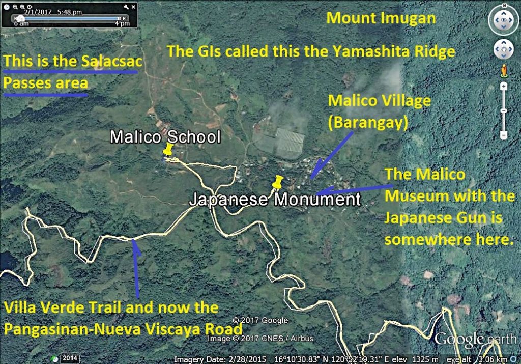 Za471. Location of the Japanese gun in Malico Village, zoomed in A Google Earth image that shows the location of the Salacsac Passes, the Barangay (Village) Malico, the Villa Verde Trail and the Malico Museum. 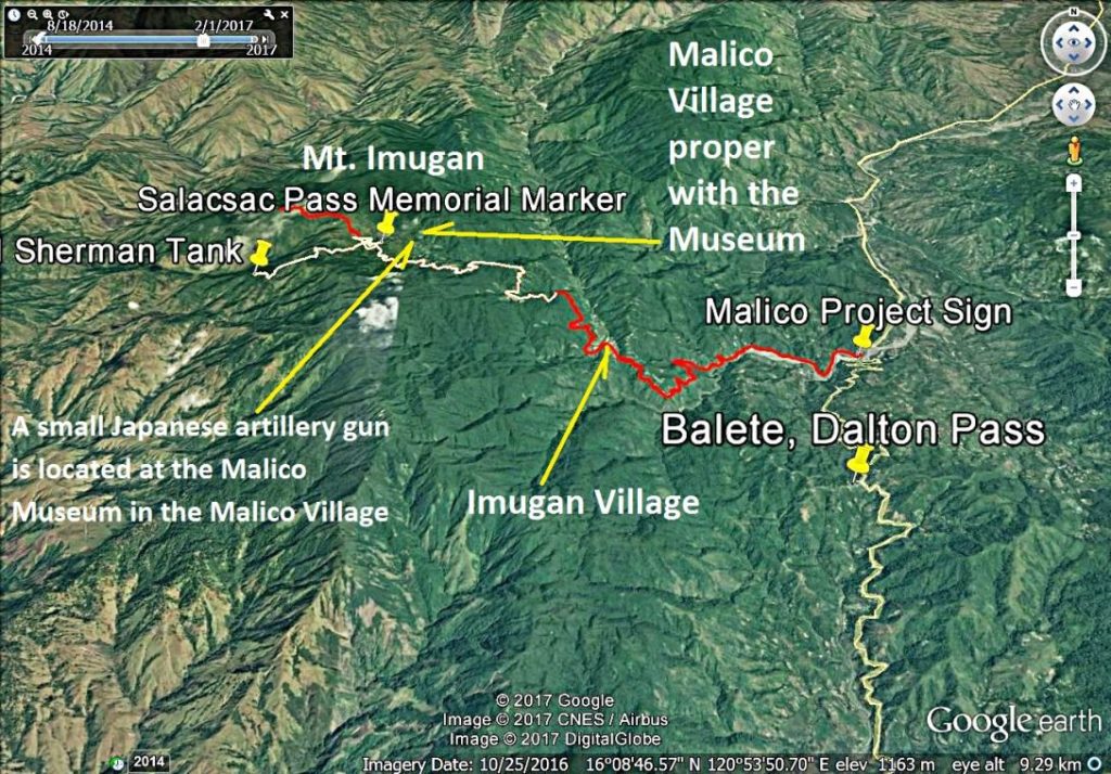 Za473. Google Earth image of the Salacsac Passes and Malico Village A Google Earth image that shows the location of the Salacsac Passes, the Barangay (Village) Malico, the Villa Verde Trail and the Malico Museum. 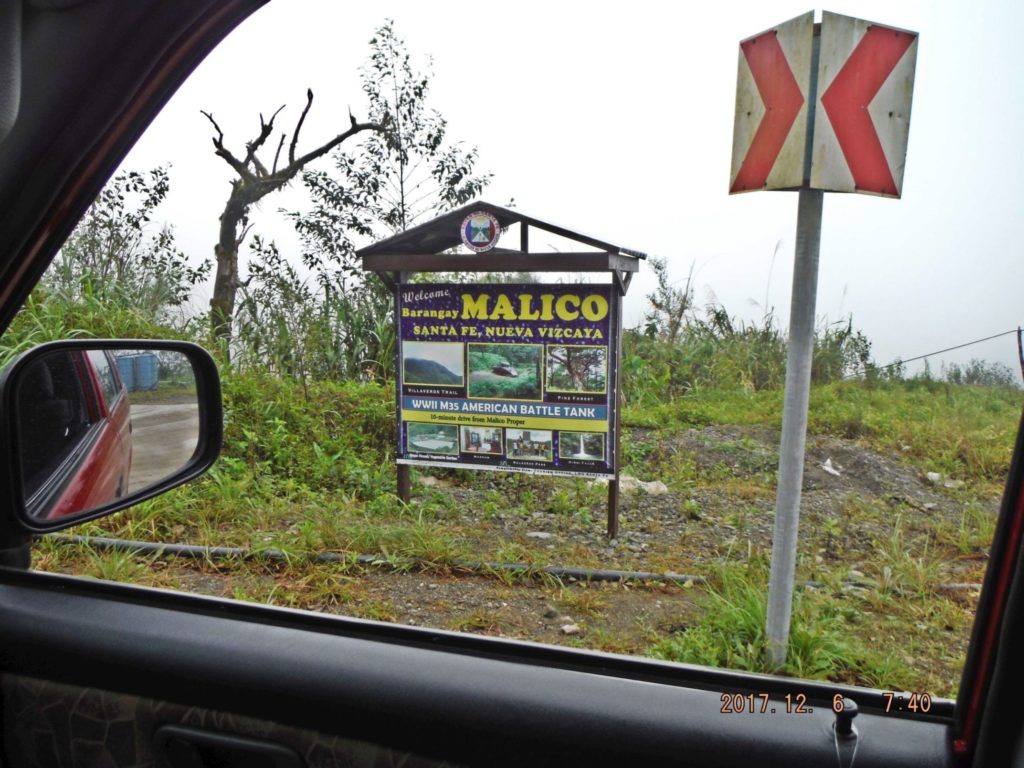 Za474. Welcome to Barangay (Village) Malico sign. -It is about 20 km from Santa Fe, Nueva Viscaya to the Malico Village at the Salacsac Passes and I noticed this sign about of the points of interest in Malico Village. The road, except for ½ km is now concrete, a two lane road. It was clouds, all the way up to Malico! 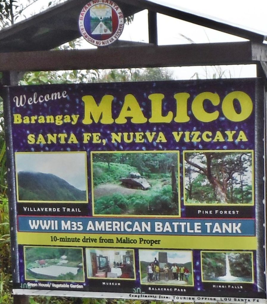 Za475. Welcome to Barangay (Village) Malico sign. -It is about 20 km from Santa Fe, Nueva Viscaya to the Malico Village at the Salacsac Passes and I noticed this sign about of the points of interest in Malico Village. The road, except for ½ km is now concrete, a two lane road. Because of this sign I looked for the Museum. 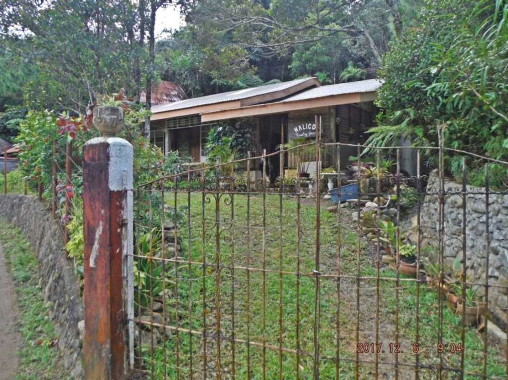 Za476. This Malico Country Inn also housed the Malico Museum in a separate structure. Not far into the village coming from the west I came across the Malico Country Inn which also houses the Malico Museum in a separate structure. 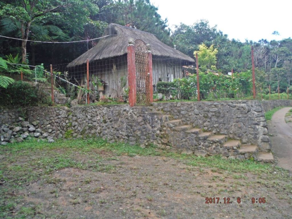 Za477. The Malico Museum structure within the Malico Country Inn compound. This is the east end of the Malico Country Inn compound and that structure had a sign: Malico Museum. 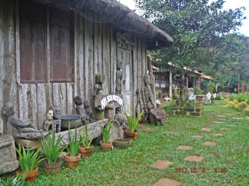 Za478. Malico Country Inn compound with the Malico Museum. This is the street side of the Malico Country Inn compound with the Malico Museum. We are looking west where I came from. 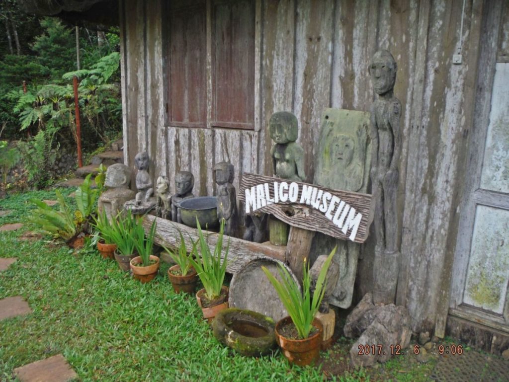 Za479. The Malico Museum structure in the Malico Country Inn compound . The owner of this privately owned Museum was out of town and the compound care taker tried many keys but none fit. But I suspect inside are mostly native art objects like at the ones on the outside. Notice the steps at left; they lead to a Japanese gun. 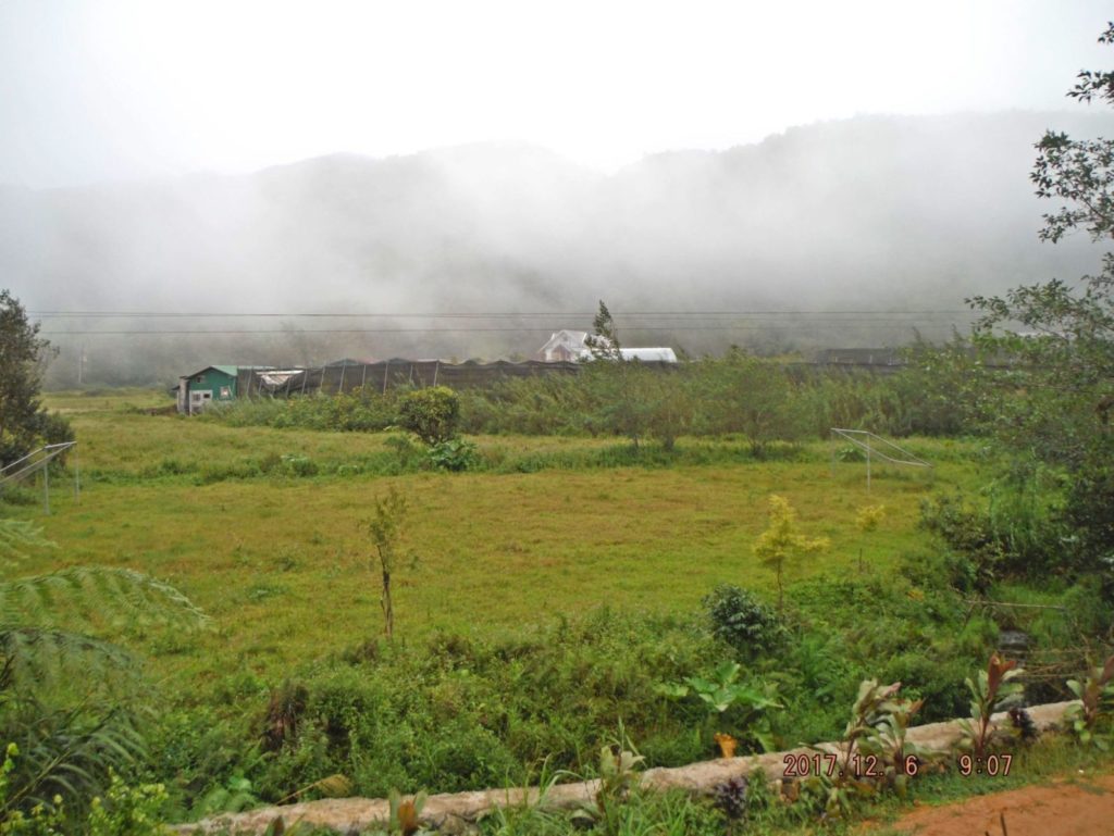 Za480. The Malico Village plains at 1300 meter height with clouds. This view is north across the Malico Village plains towards Mt. Imugan. That is a failed green house enterprise. The WWII GIs called that mountain Yamashita Ridge and the Japanese had a clear view from there on the approaching Americans coming up the Villa Verde Trail. 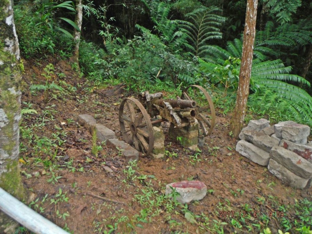 Za481. The small Japanese artillery piece at the Malico Museum. -About 3 meters up a concrete stairway, next, left of the museum, is this small Japanese artillery piece. I certainly was interested to have closer looks. 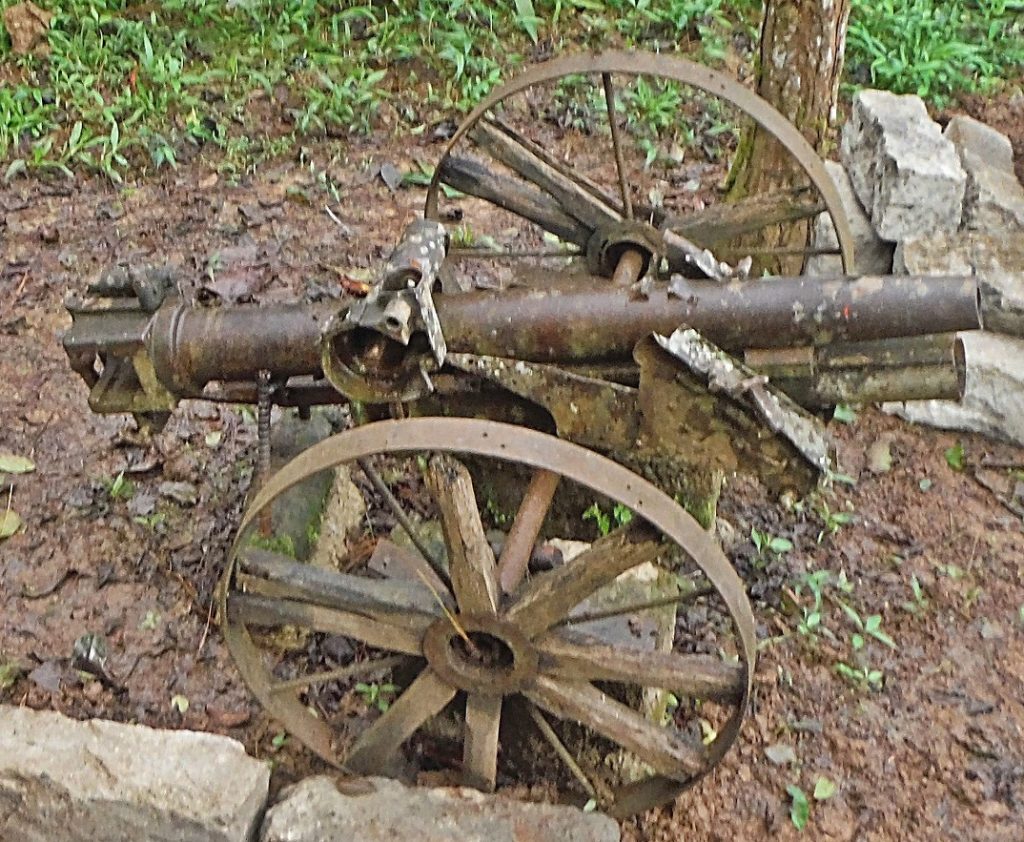 Za469. Small Japanese artillery piece in Malico Village. -Close-up of the last picture. About 3 meters up a concrete stairway, next, left of the museum, is this small Japanese artillery piece. I certainly was interested to have closer looks. 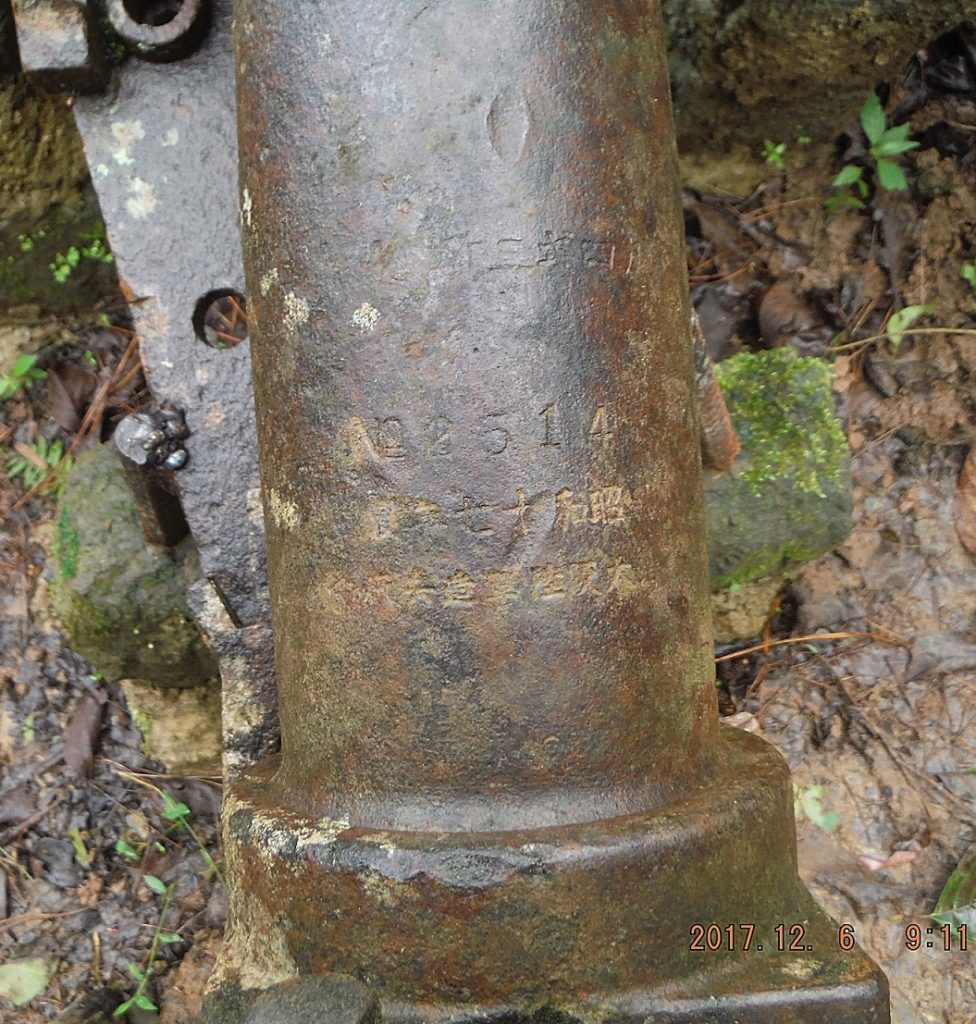 Za470. Japanese gun indentifying markings. Here is a close up of the Japanese gun indentifying markings. 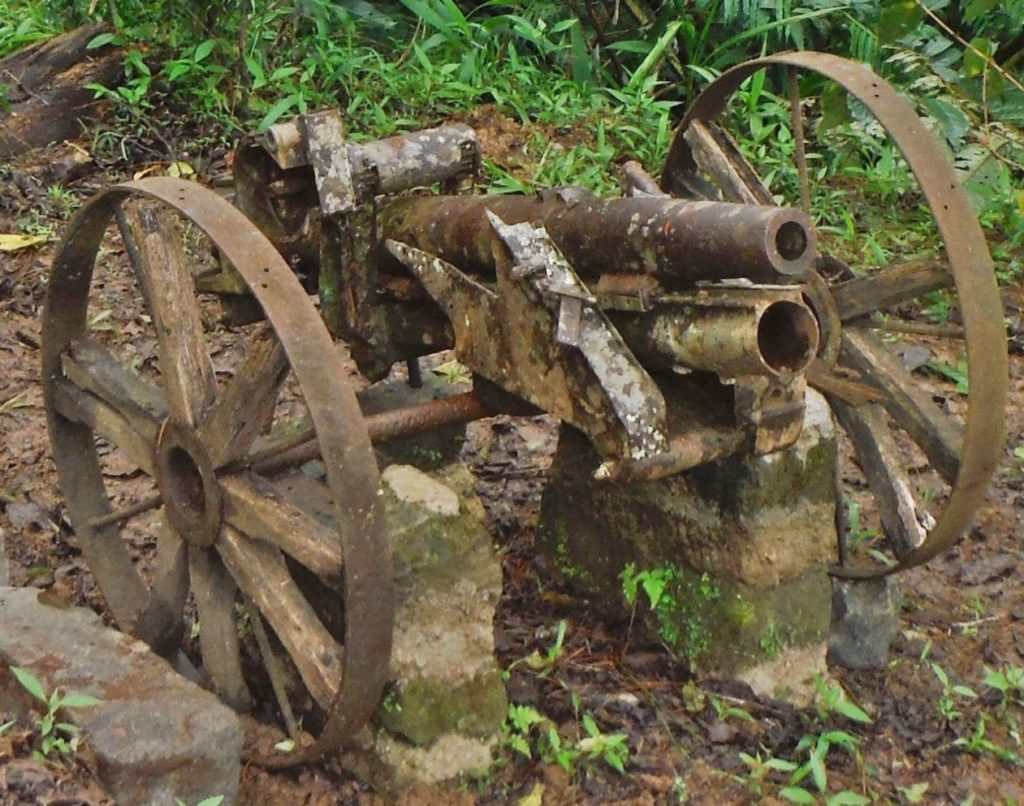 Za482. Small Japanese artillery piece in Malico Village. Close-up of this small Japanese artillery piece. I certainly was interested to have closer looks. 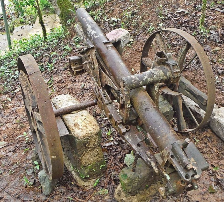 Za483. Small Japanese artillery piece in Malico Village. Another close-up of this small Japanese artillery piece. I certainly was interested to have closer looks. 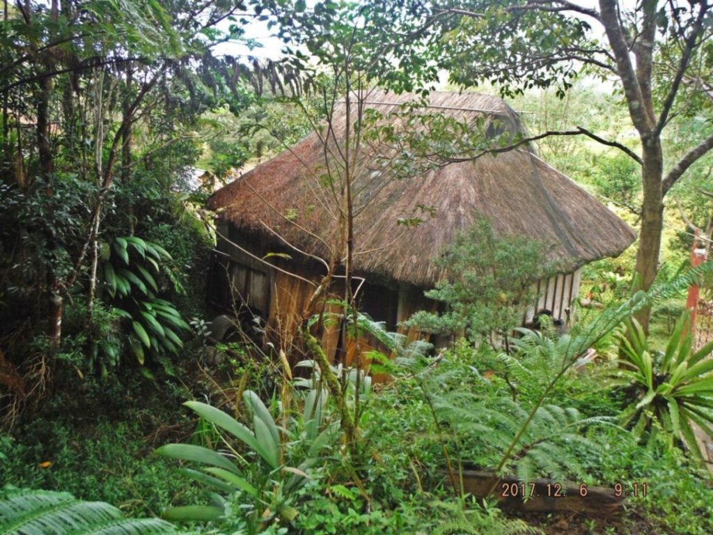 Za284. The Malico Museum view from the Japanese Gun. This view is of the Malico Museum, shot from the location of the small Japanese artillery piece. It is small. I have uploaded 12 images at the original high resolution into this Flickr album: www.flickr.com/photos/44567569@N00/albums/72157690093461134I have uploaded 28 images to this Photobucket album: s74.photobucket.com/user/PI-Sailor/library/Manila%20Bay%20Forts-Other/Balete%20Pass%20and%20Villa%20Verde%20Trail/Malico%20Museum%202017-12-06?sort=9&page=1 |
|
|
|
Post by Karl Welteke on Dec 20, 2017 12:37:05 GMT 8
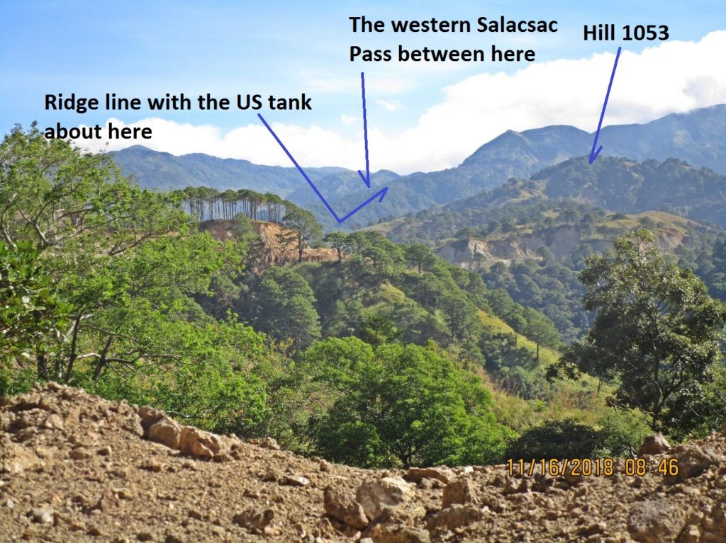
Villa Verde Trail, New Pangasinan-Nueva Viscaya Road Update, Between the 4th and the 6th Dec. 2017 I explored the Villa Verde Trail and the new Pangasinan-Nueva Viscaya Road project. The distance of the Villa Verde Trail and now the new Pangasinan – Nueva Viscaya road from San Nicolas to Santa Fe is about 45 km. It is about 20 km from Santa Fe to Malico and the road is now concreted except about ½ km. Passed the Malico Village entrance, towards San Nicolas another 2 km are concreted. Last year in this thread I reported on the progress on the San Nicolas side. The big story is that the whole road is now traced and that backhoes and bulldozers have touched every km of the remaining road that is not concreted yet. In a week or so one should be able to walk the whole road without getting your feet wet, beat your way thru grass or brush or climb steep inclines. And you get great vistas every inch of the way! The Geographic Segment! I love to explore historical geographic areas and also have a look at mankind improve or expand its infrastructure to improve the life of the people. 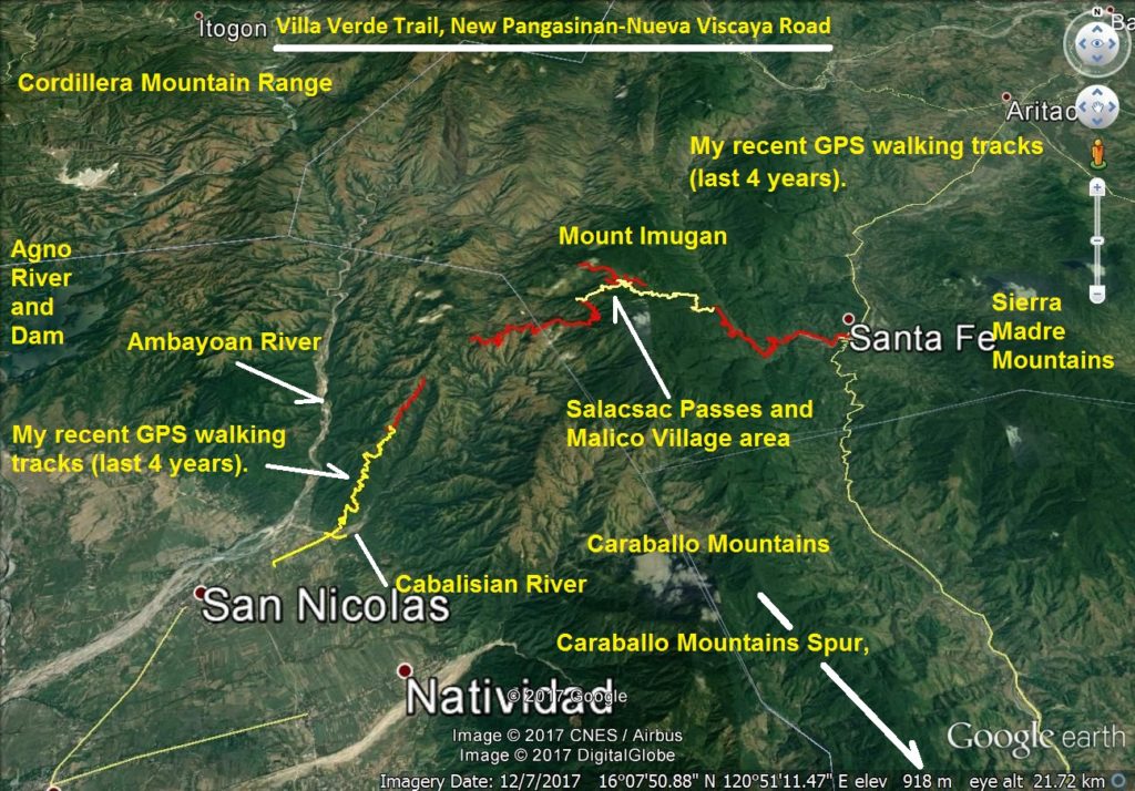 Za496. Villa Verde Trail, New Pangasinan-Nueva Viscaya Road. This is a Google Earth image of the Villa Verde Trail and the new Pangasinan-Nueva Viscaya Road project. It also has my GPS Walking tracks and I marked in important landmarks. 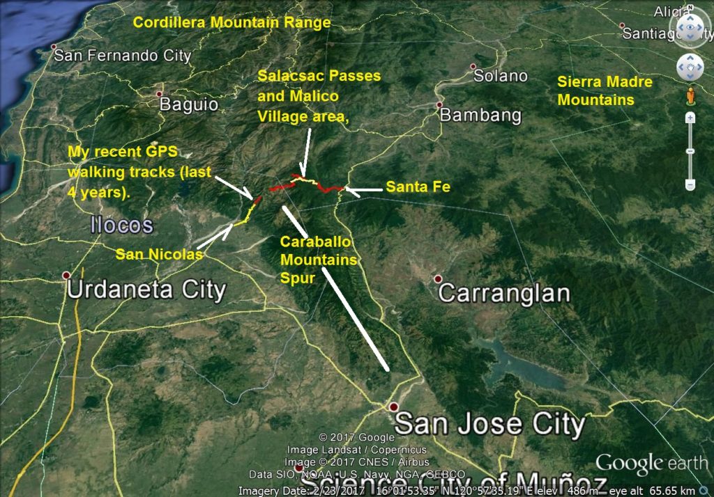 Za497. Villa Verde Trail, New Pangasinan-Nueva Viscaya Road are on Luzon Island. Where is the Villa Verde Trail and the new Pangasinan-Nueva Viscaya Road project? This image gives you the big picture how it fits into the Luzon Island landscape. 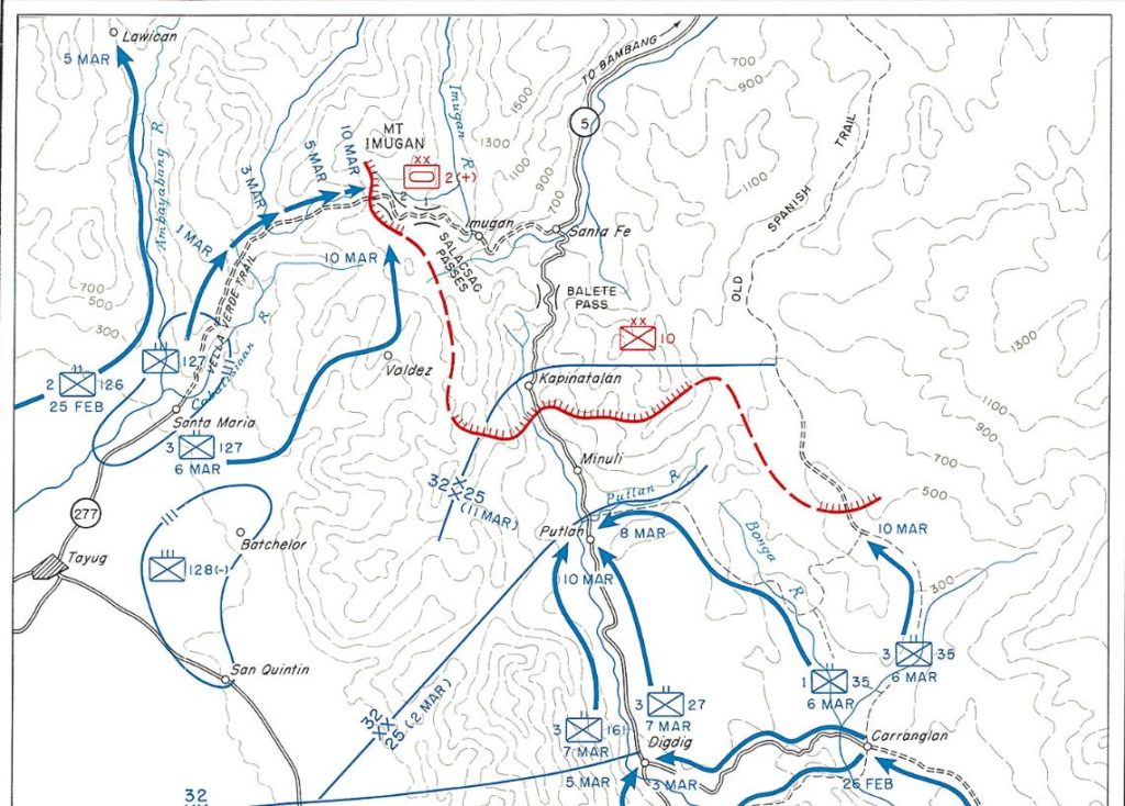 Za498. Map XI, Advance Toward Santa Fe, I Corps, 21 February-10 March 1945. This is a section of a map from the US Army publication “Triumph in the Philippines” by Robert Ross Smith. It was a terrific and very tough and very long battle. Both sides paid a heavy price. This area of the Villa Verde Trail, New Pangasinan-Nueva Viscaya Road is soaked in blood, that makes is sacred to me! That is why I am interested. This is where servicemen done their duty in the defense of Freedom! This segment of my presentation only deals with the advance of the 32nd Inf. Div. up the Villa Verde Trail. The URL for the chapter of the Villa Verde Trail Battle from the above publication is: www.ibiblio.org/hyperwar/USA/USA-P-Triumph/USA-P-Triumph-26.htmlThe URL for this map of the Villa Verde Trail Battle from the above publication is: www.ibiblio.org/hyperwar/USA/USA-P-Triumph/maps/USA-P-Triumph-XI.jpgThe Japanese Monument in Malico, in the Salacsac Passes area, says that 4600 Japanese died here and the Americans Forces suffered 3200 total casualties. The monument also says that many Filipinos died in the vicinity of the passes. 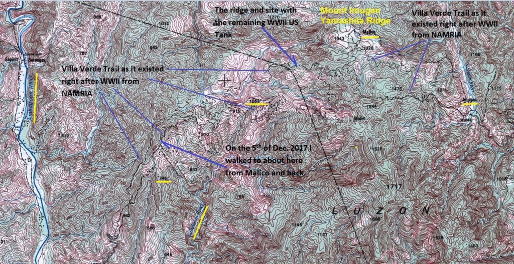 Za499. This is a map of the Villa Verde Trail from MAMRIA. This is probably is the best map of the Villa Verde Trail as it existed right after WWII. It is a section of a 1:50000 map of the National Mapping and Resource Information Authority (NAMRIA) # 7175 II (San Nicolas). I marked in or highlighted landmarks that are mentioned in the WWII battle story or from my walks. Notice Hill 1053, I will upload one picture of this hill in this segment! Also notice Ridgeline 745, that one always blocked my view towards the Salacsac Passes when I walked up the Villa Verde Trail from San Nicolas in 2014. And I will add one picture of the area where I had to turn around from my walk on the 5th Dec. 2017 from Malico. The map has this URL: www.namria.gov.ph/7175-IISanNicolas.html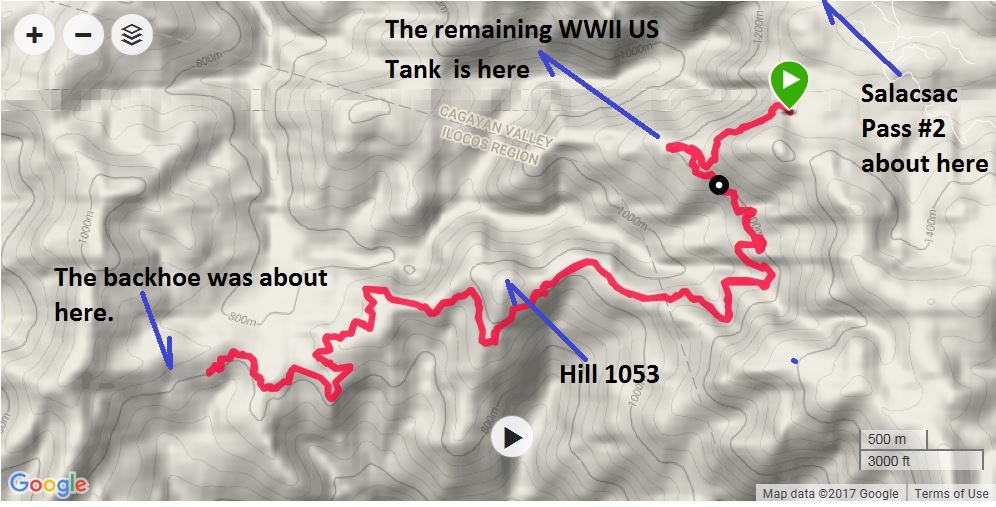 Za500. My GPS Track of the Villa Verde Trail walk on the 5th Dec. 2017. This is my 5th Dec. 2017 GPS track of my walk on the Villa Verde Trail, starting about 2 km west from Salacsac Pass #2. 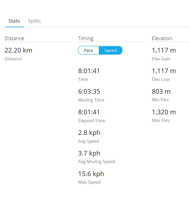 Za501. My GPS Track data of the Villa Verde Trail walk on the 5th Dec. 2017. This is my 5th Dec. 2017 GPS track data of my walk on the Villa Verde Trail, starting about 2 km west from Salacsac Pass #2. 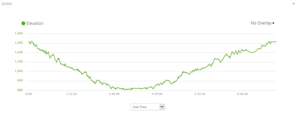 Za502. My GPS Track elevation profile of the Villa Verde Trail walk on the 5th Dec. 2017. This is my 5th Dec. 2017 GPS track elevation data of my walk on the Villa Verde Trail, starting about 2 km west from Salacsac Pass #2. It was a very windy day. I put on two shirts and only at 11am did I remove one of the shirts. Noteworthy was that it was easterly winds and all day at the east side of the Caraballo Mountains Spur, it was clouds all day (from top to bottom) and on my side it was sunshine! 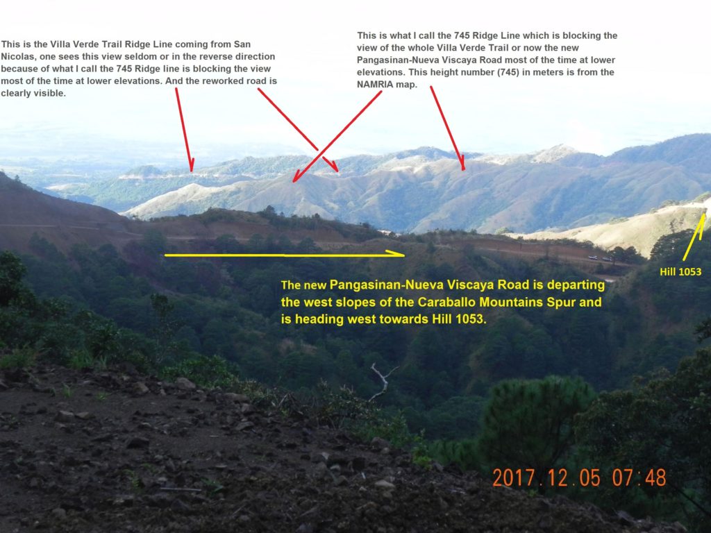 Za503. Villa Verde Trail, New Pangasinan-Nueva Viscaya Road View. This is a very unique image of the Villa Verde Trail, New Pangasinan-Nueva Viscaya Road; seldom can you see this overall view of the project. Only from this high elevation can we see across the headwater area of the Cabalisian River. We are looking from the west slopes of the Caraballo Mountains Spur across the headwaters of the Cabalisian River and the 745 Ridge line which is blocking the view most of the time from lower elevations. At the right side of the image is Hill 1053. 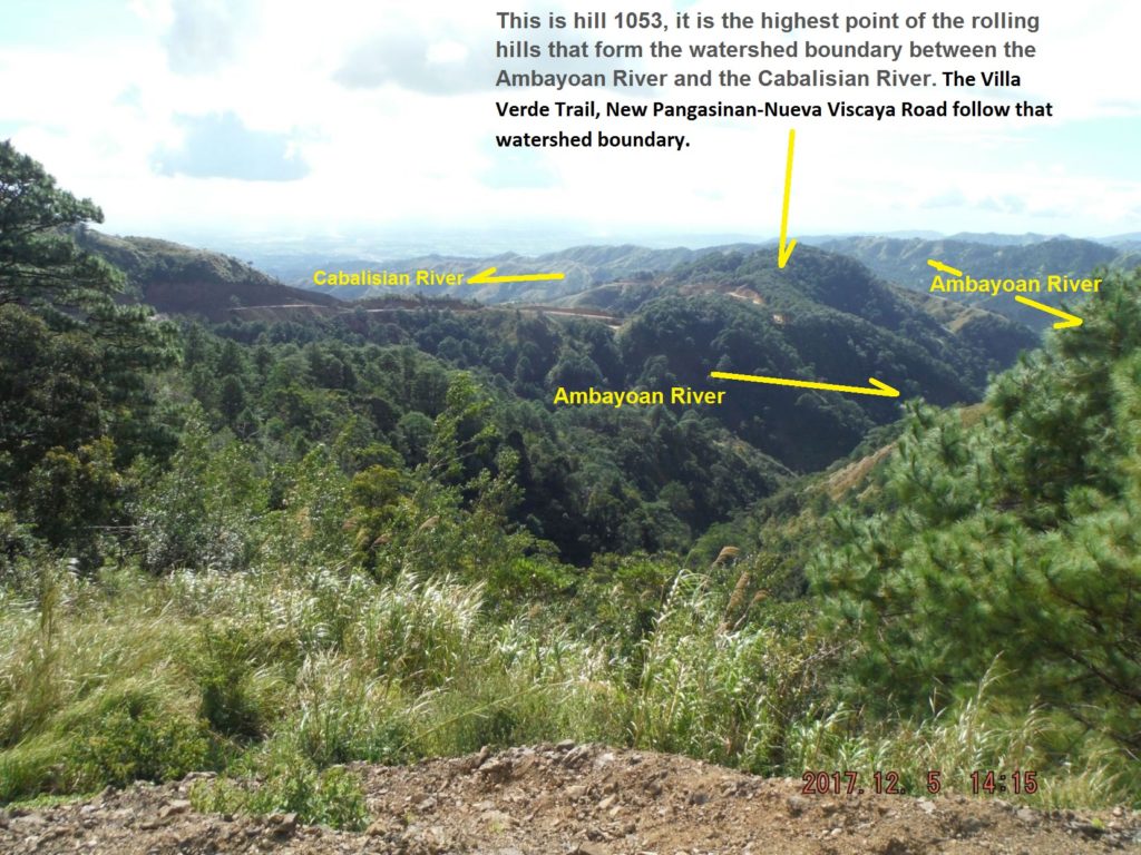 Za504. Villa Verde Trail, New Pangasinan-Nueva Viscaya Road View. In this picture the Villa Verde Trail, New Pangasinan-Nueva Viscaya Road is departing the west slopes of the Caraballo Mountains Spur and is heading west towards Hill 1053. This height number in meters is from the NAMRIA map. I indicated the river drain directions. 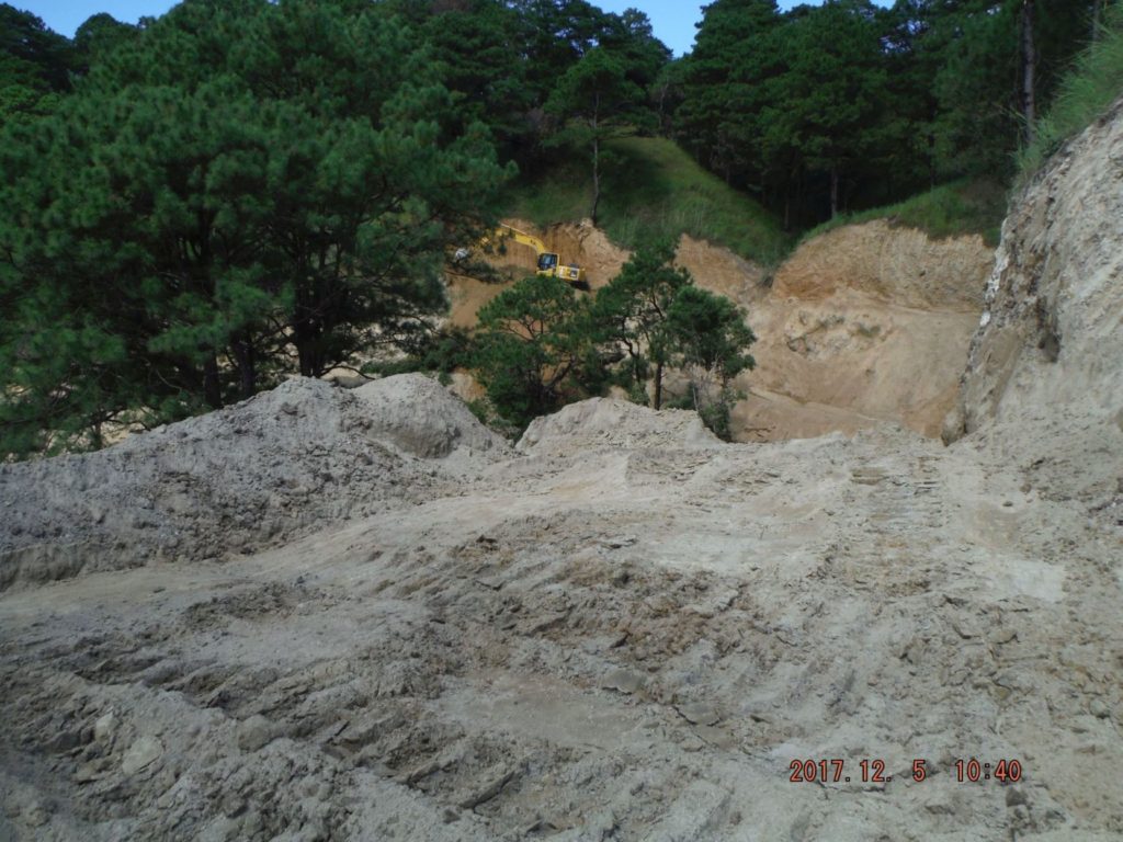 Za505. A backhoe in action on the Villa Verde Trail, New Pangasinan-Nueva Viscaya Road. This is the point where I turned around; it was about 14 km from the Salacsac Pass #2 near Malico. I estimate it was about 2 more km and we would intersect the road coming up the long ridge from San Nicolas. The road is traced already all the way but I just got past a bull dozer and now I would have to get by that back hoe. I decided to turn around, return 12 km (where I parked my car) and struggle with 500 meter elevation. 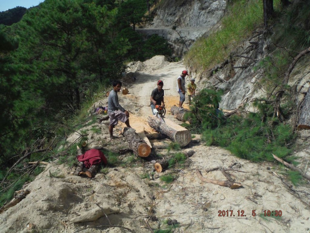 Za506. Lumber salvage on the Villa Verde Trail, New Pangasinan-Nueva Viscaya Road. All three days, I was in this area, I noticed at least 2 trucks following the new road with a lot of workers on board. I asked the people where they were from, they said –they are Malico residents. They are harvesting, or salvaging the fir trees that have to give way to this road project. I am glad to see the local people benefit from this project. |
|
Deleted
Deleted Member
Posts: 0
|
Post by Deleted on Apr 9, 2018 18:01:14 GMT 8
UPDATE:
Hi i have a friend who lives in san nicolas and according to him 2 wheeled vehicles including bicycles can already passed the villa verde trail from san nicolas pangasinan up to sta.fe nueva vizcaya the widening and construction of the road seems to delay a little bit as rebels(npa) are harrassing workers thus it needs military and police presence just to continue the development of the road.
Note from Karl: Thanks, I might try walking it this year, down from Malico to San Nicolas.
|
|
Deleted
Deleted Member
Posts: 0
|
Post by Deleted on Aug 12, 2018 11:14:04 GMT 8
hi google maps already updated with the whole villa verde trail from san nicolas up to malico  |
|
|
|
Post by Karl Welteke on Nov 18, 2018 13:02:59 GMT 8
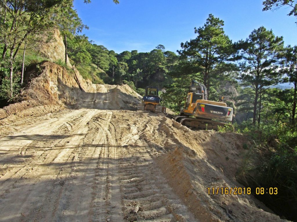
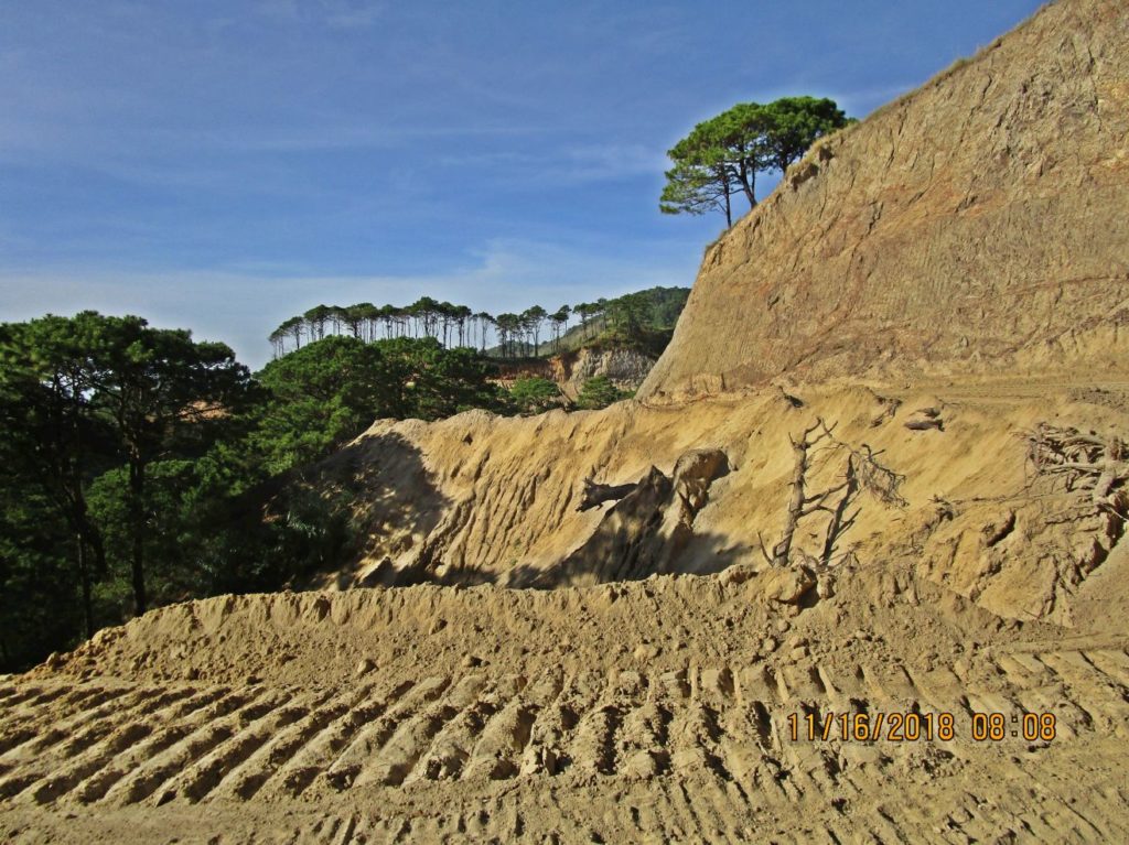
Villa Verde Trail Update 2018-11-15 & 16 The new name of road is Pangasinan-Nueva Viscaya Road. The bridge over the Cabalisian River (Pangasinan End) which flows into the Ambayabang River is complete and is called Villa Verde Bridge About 6 km (rough estimate) from that bridge up are now concreted with two lanes. A drainage ditch is incomplete or not built yet. Roughly another 3 km are concreted in patches. The road is now connected, cut, one lane opened for equipment movement between both ends (San Nicolas-Pangasinan and Santa Fe-Nueva Viscaya). The road from Santa Fe up to the Salacsac Passes, about 20 km, is now concreted except for about 100 meter. At this location is the village of Malico (Pangasinan), passed it, another 2 km are concreted. The work started from both ends and on the 16th of November I walked about 4 km in the middle to make sure that one can now walk the whole length. On both ends work is going on to stabilize the embankment at many ravines. In the middle and at the Malico end the road still needs to be widened, blasting was used that day for that purpose. It is a very difficult job at some steep rocky places or in the middle where it seems to be mostly lahars material, but the authorities and contractors keep plucking away. I don’t dare to give a completion date. Local motorcycles and bicycle riders are using this road now, stay clear of heavy equipment. I seen a few motor cars, trucks use the road, the whole way, I did drive it myself but advice others not to do it yet. Blasting is going on and some sections are too sandy, muddy, rocky or to steep. The 32nd Inf. Div. WWII 1945 Memorial is still sitting, in its damaged state, near the Villa Verde Bridge. It was damaged during the road and bridge construction. 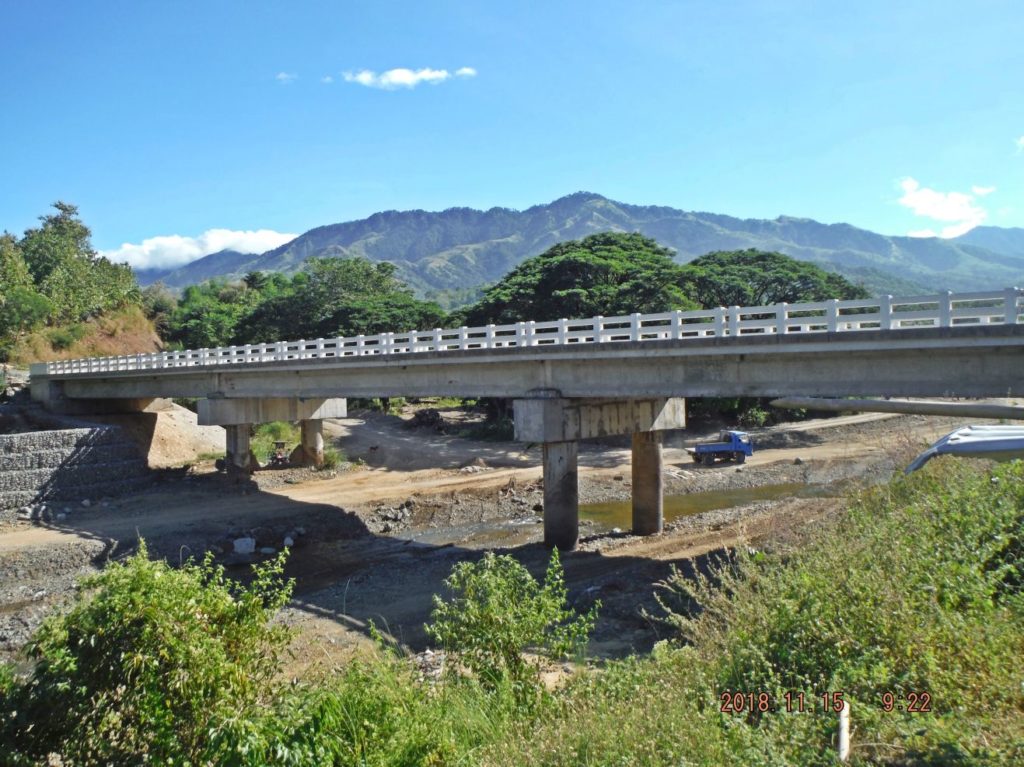 Zc889. The bridge over the Cabalisian River (Pangasinan End) which flows into the Ambayabang River is complete and is called Villa Verde Bridge 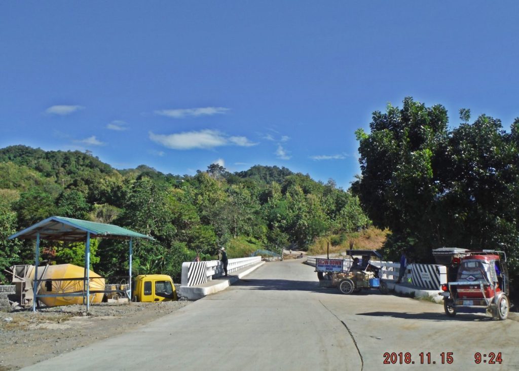 Zc890. The bridge over the Cabalisian River (Pangasinan End) which flows into the Ambayabang River is complete and is called Villa Verde Bridge 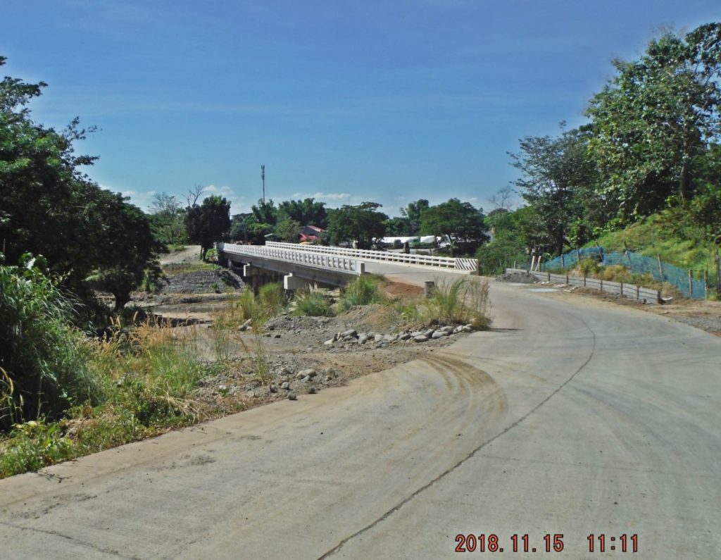 Zc891. The bridge over the Cabalisian River (Pangasinan End) which flows into the Ambayabang River is complete and is called Villa Verde Bridge 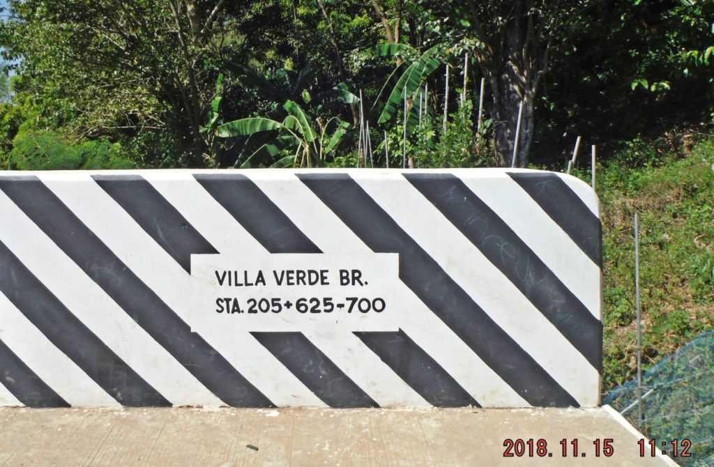 Zc892. The bridge over the Cabalisian River (Pangasinan End) which flows into the Ambayabang River is complete and is called Villa Verde Bridge 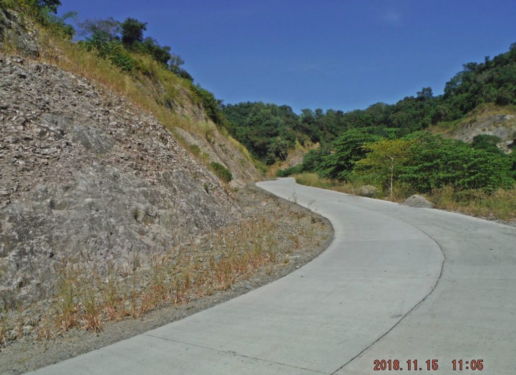 Zc893. About 6 km (rough estimate) on the Villa Verde Road from that bridge up are now concreted with two lanes. A drainage ditch is incomplete or not built yet. 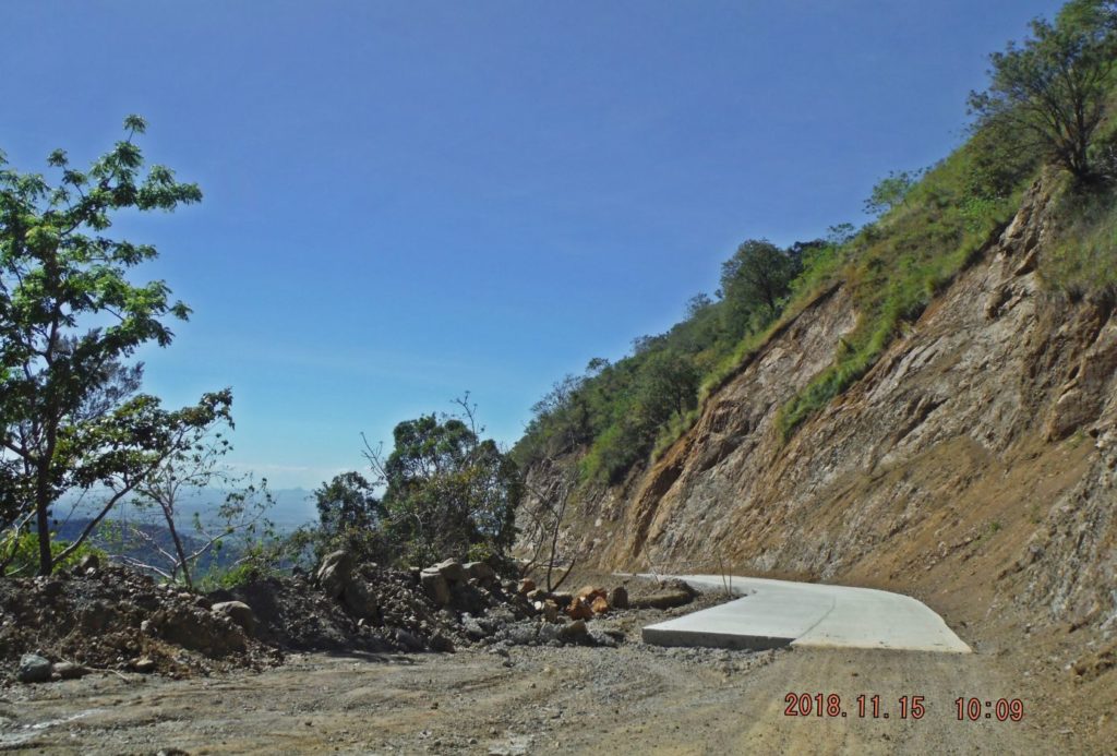 Zc894. About 6 km (rough estimate) on the Villa Verde Trail (Pangasinan End) from that bridge up are now concreted with two lanes. A drainage ditch is incomplete or not built yet. Roughly another 3 km are concreted in patches. 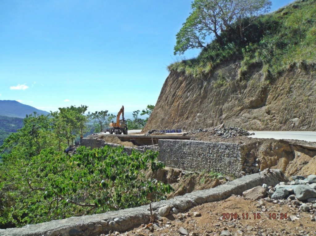 Zc895. On both ends of the Villa Verde Trail/Road work is going on to stabilize the embankment at many ravines. The new name of road is Pangasinan-Nueva Viscaya Road. |
|
|
|
Post by Karl Welteke on Nov 18, 2018 17:22:18 GMT 8
------------------------------------- The 32nd Inf. Div., the Red Arrow Division, built this monument in 1945 to honor the horrendous sacrifices made by its Soldiers and attached Philippine Luzon Guerrillas Army Forces (LGAF) and civilians in conquering the Villa Verde Trail and the Salacsac Passes. It was located very near to this new bridge and sadly it was damaged during the construction of this bridge. Later another 32nd Inf. Div. Red Arrow Symbol Monument was erected in the San Nicolas Plaza. The people of San Nicolas named their High School “Red Arrow” in appreciation of their liberation by the U.S. Army, from the Japanese Invaders. What could be done now? A suggestion I expressed several times in our Corregidor Proboard is, to establish a Villa Verde Memorial Park or marker similar as the Balete Pass Memorial Park. Put up this Villa Verde Trail Memorial in Malico, the actual Salacsac Pass; this is where most of the fighting occurred. This is still Pangasinan; the Japanese already have a marker there. Use the old Red Arrow Marker, fix it after the Pangasinan-Nueva Viscaya Highway construction damaged it, and move it near the Japanese one. Then move the tank which is about 3 km from that location also to this place. And then does whatever else might seem appropriate and make it a nice park where travelers between the two provinces and regions stop and reflect about history and country. Here are 4 recent pictures: 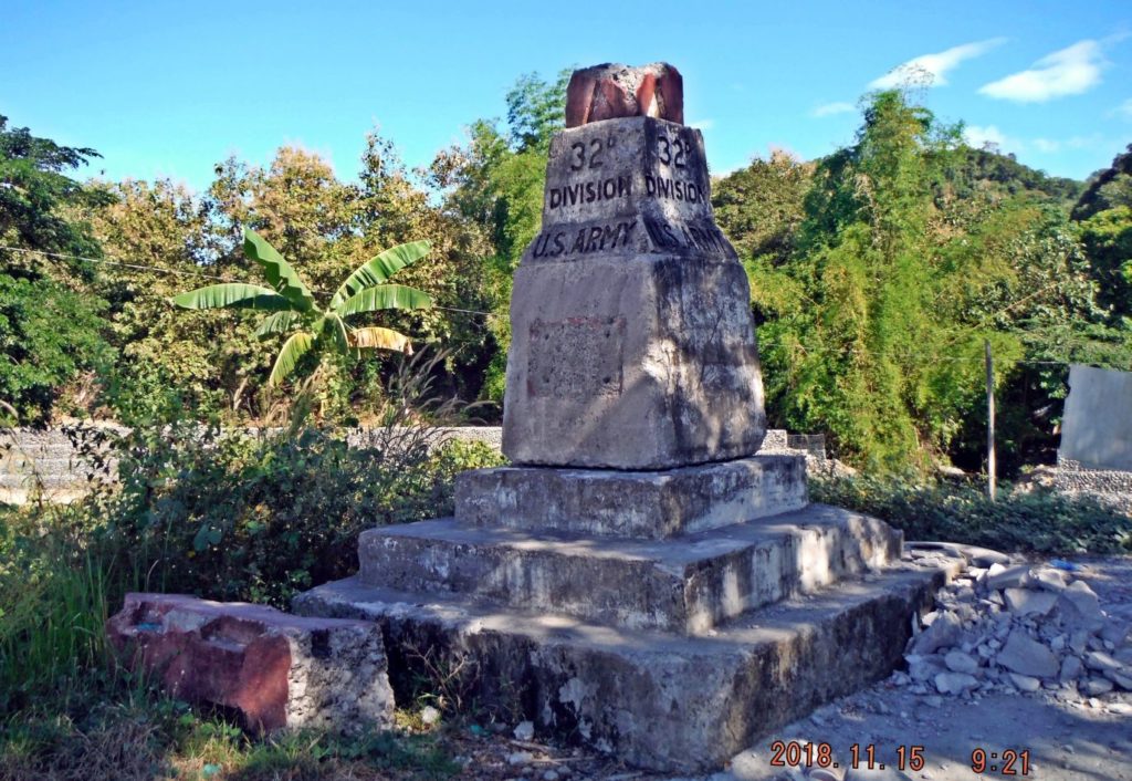 Zc896. This is the damaged 1945 Red Arrow Division Monument of the 32nd Infantry Division, temporarily standing near the new Villa Verde Bridge, the starting point of the Villa Verde Trail and now the starting point of the new Pangasinan-Nueva Viscaya Road. 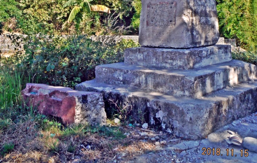 Zc897. This is the damaged 1945 Red Arrow Division Monument of the 32nd Infantry Division, temporarily standing near the new Villa Verde Bridge, the starting point of the Villa Verde Trail and now the starting point of the new Pangasinan-Nueva Viscaya Road. 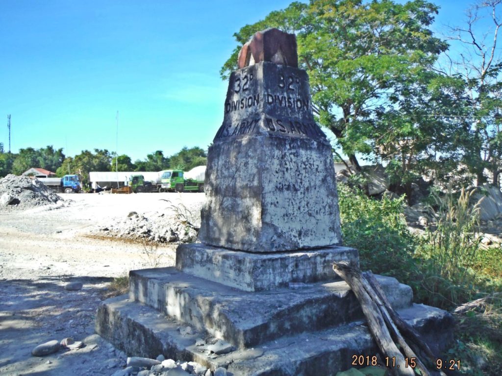 Zc898. This is the damaged 1945 Red Arrow Division Monument of the 32nd Infantry Division, temporarily standing near the new Villa Verde Bridge, the starting point of the Villa Verde Trail and now the starting point of the new Pangasinan-Nueva Viscaya Road. 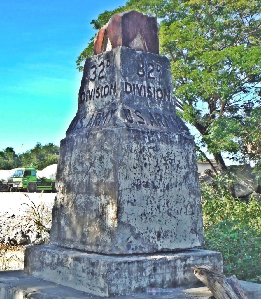 Zc899. This is the damaged 1945 Red Arrow Division Monument of the 32nd Infantry Division, temporarily standing near the new Villa Verde Bridge, the starting point of the Villa Verde Trail and now the starting point of the new Pangasinan-Nueva Viscaya Road. |
|
|
|
Post by Karl Welteke on Nov 19, 2018 14:18:42 GMT 8
----------------------------------------- Villa Verde Trail Drive 2018-11-16 When I walked a section of the trail today I met two cars and some motorbikes, I stopped them and asked them whether the trail can be driven. My Tagalog is not very good but I got the impression that it was possible. After my walk I decided to try it. I did drive the trail but it was risky and I don’t recommend it. Watch these 21 images: 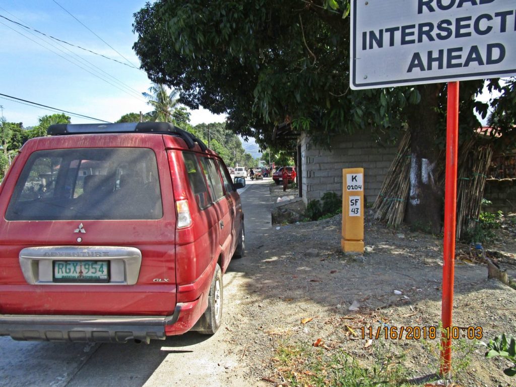 Zc900. I started out at Santa Maria East, barrio of San Nicolas; the km stone says 43 km to Santa Fe in Nueva Viscaya. 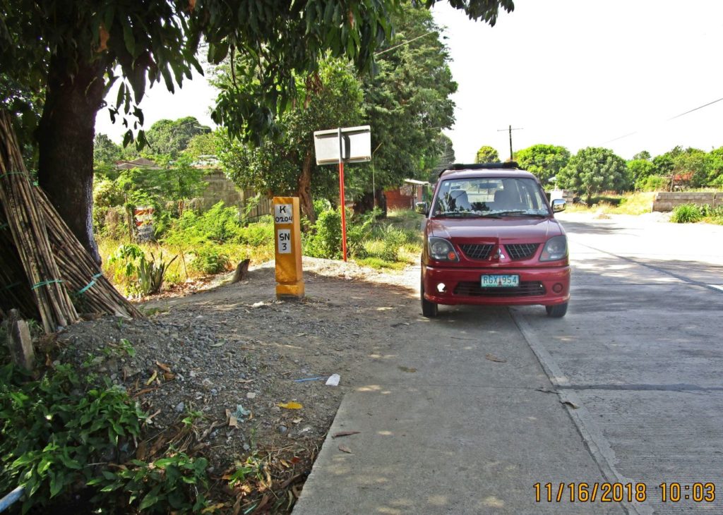 Zc901. I started out at Santa Maria East, barrio of San Nicolas; this is a view back. 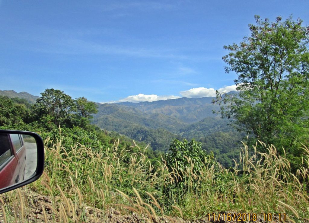 Zc902. About 8 minutes later I got a view of the mountains where I am headed to and I can see the Villa Verde Trail/Road Cut ahead, the next picture will show it clearer. 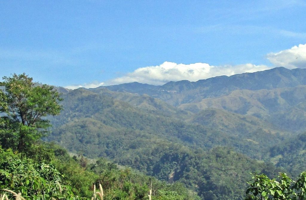 Zc903. About 8 minutes later I got a view of the mountains where I am headed to and I can see the Villa Verde Trail/Road Cut ahead, it is a long way to go. 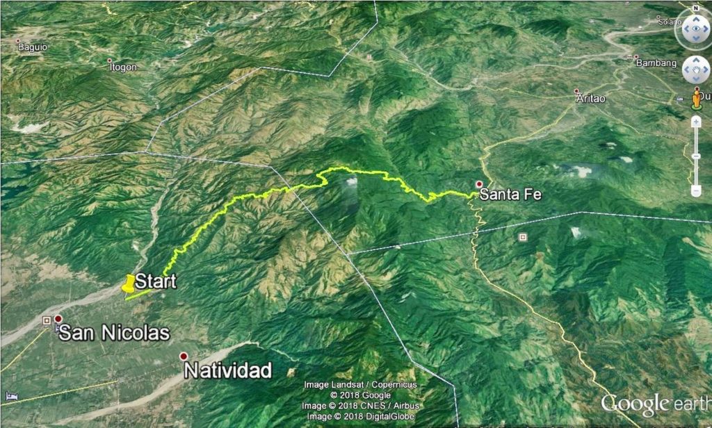 Zc904. This is my actual GPS track of my drive on the Villa Verde Trail on the 16th of Nov. 2018. This is a new road being constructed between Pangasinan and Nueva Viscaya. 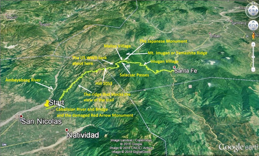 Zc905. This is my actual GPS track of my drive on the Villa Verde Trail on the 16th of Nov. 2018. This is a new road being constructed between Pangasinan and Nueva Viscaya. On this Google Earth image I marked in the landmarks. 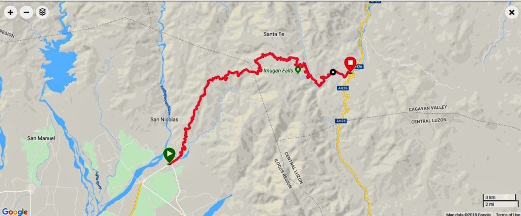 Zc906. This is my actual GPS track of my drive on the Villa Verde Trail on the 16th of Nov. 2018. This is a terrain map from my Garmin account. 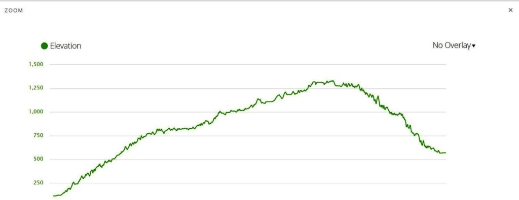 Zc907. This is my actual elevation profile of my drive on the Villa Verde Trail on the 16th of Nov. 2018. 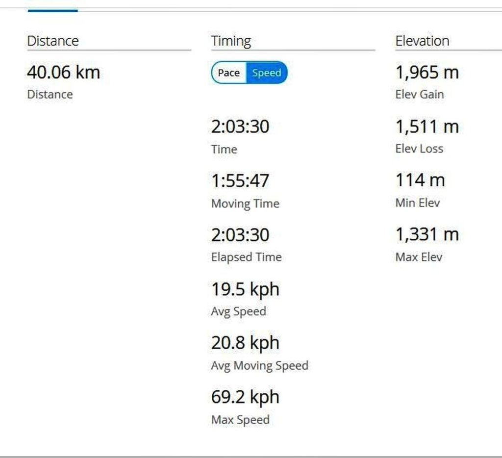 Zc908. This is my GPS data of my drive on the Villa Verde Trail on the 16th of Nov. 2018. The distance does not jive, my GPS device cut corner, ha, ha. 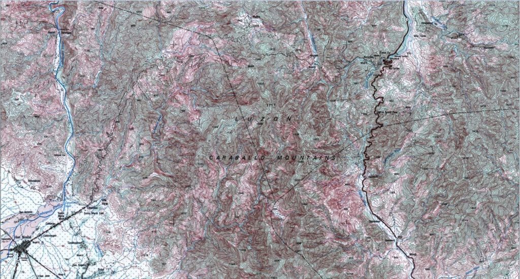 Zc909. This is only a section of an old 1:50000 map of the Villa Verde Trail area connecting, San Nicolas-Pangasinan with Santa Fe –Nueva Viscaya. If you study it closely there used to be at least two ways traveling this trail. Here is a link to the whole map in HIGH RESOLUTION: www.flickr.com/photos/44567569@N00/45896717212/in/album-72157674621084888/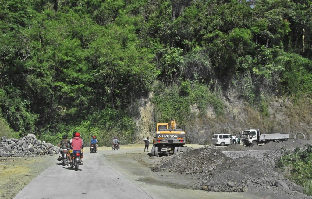 Zc910. There was traffic on this Villa Verde Road, now called the Pangasinan and Nueva Viscaya, I asked them whether one could drive all the way to Malico and I got the impression one could! 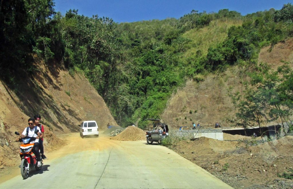 Zc911. I followed that vehicle, I had met it earlier during my walk and it was now returning to Malico. Notice the embankment at the ravine ahead, it is being repaired. 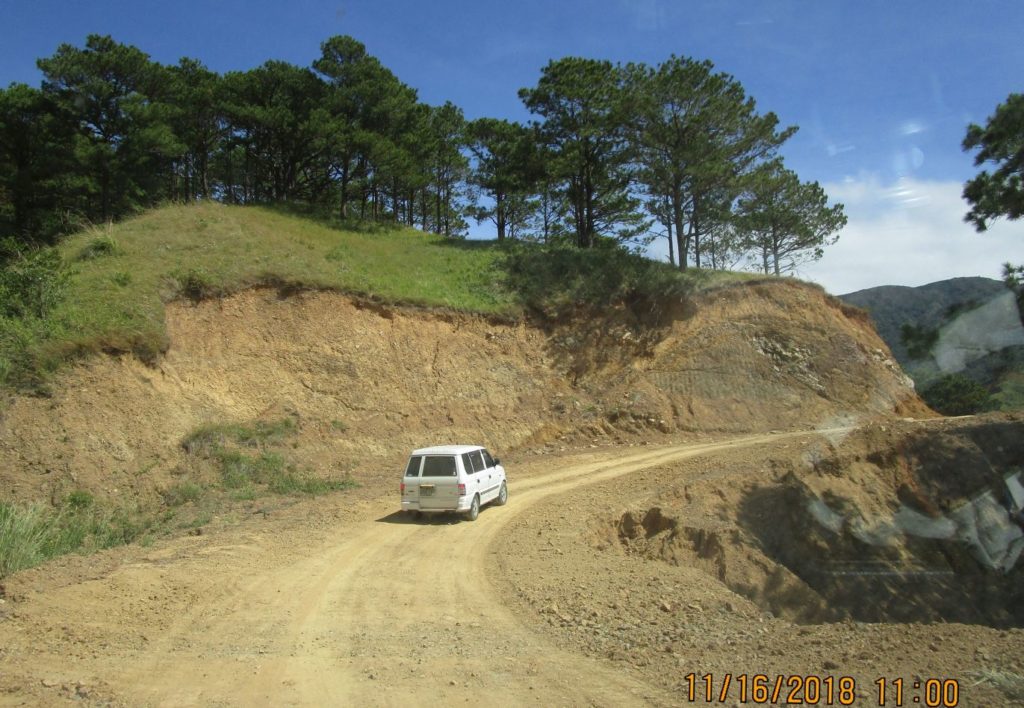 Zc912. I followed that vehicle, I had met it earlier during my walk and it was now returning to Malico. This is part of the middle section of the trail between San Nicolas and Malico. 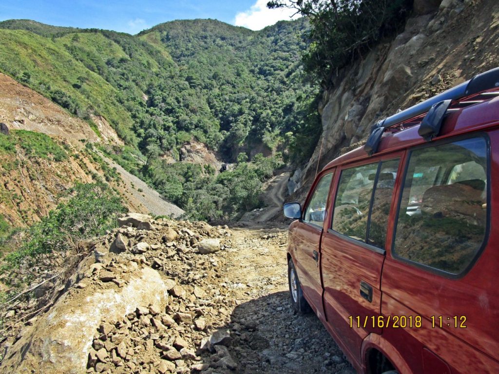 Zc913. I crossed the middle section which runs along the watershed line between the two rivers and I am approaching the Caraballo Spur Mountains and it got difficult here; very narrow and they just finished blasting. 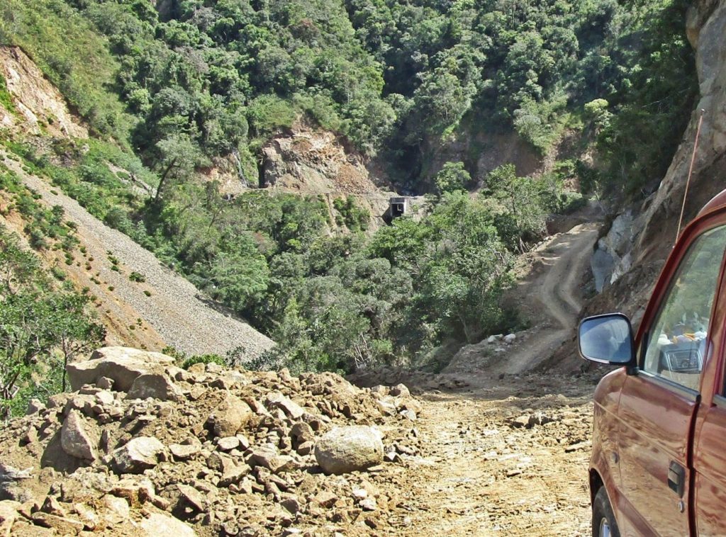 Zc914. This is the last picture zoomed in. I crossed the middle section which runs along the watershed line between the two rivers and I am approaching the Caraballo Spur Mountains and it got difficult here; very narrow and they just finished blasting. 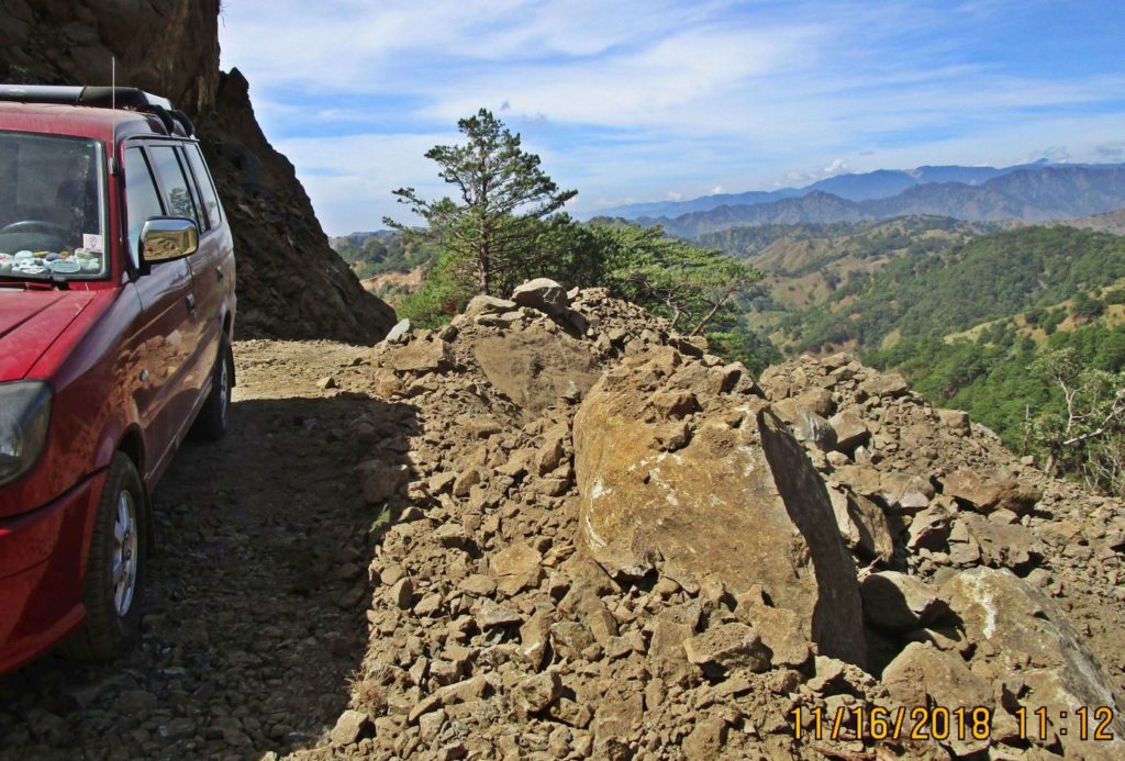 Zc915. This is at the same place at the last two pictures, but I am looking back. I have reached the cliffs of the Caraballo Mountains. Today there was some blasting here and I am standing on a pile that was blasted before though. 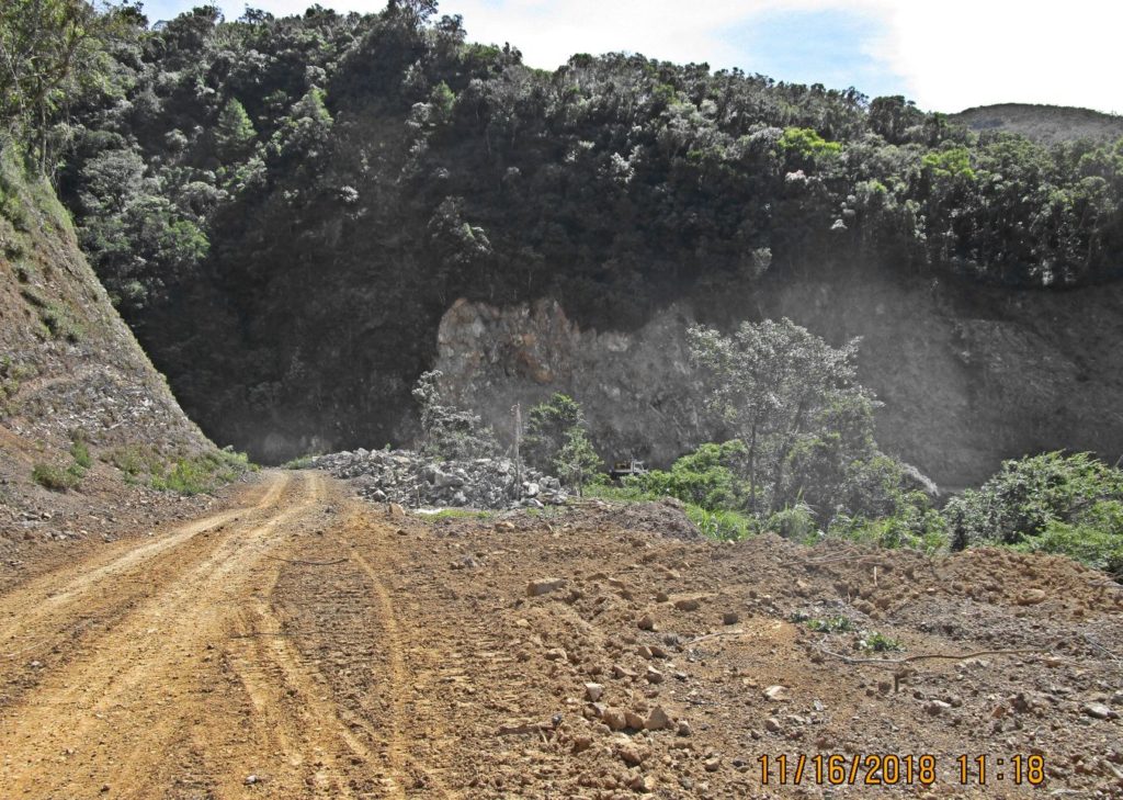 Zc916. I am passed the blasting area and in back one can see the area of recent blasting. 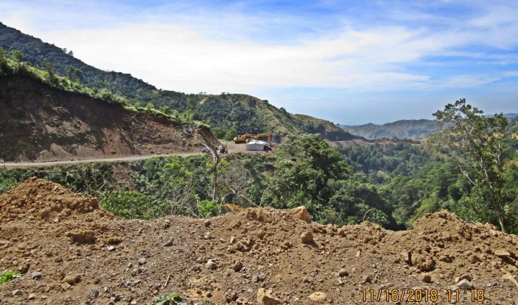 Zc917. This is another look back; I am passed several ravines, passed the blasting area and more important we can see where the Villa Verde trail reaches the Caraballo Mountain Cliffs after it crossed the expanse from that ridge in the background. 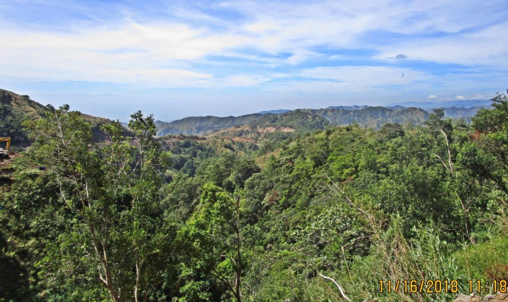 Zc918. This is a similar look back, as in the last picture, from the Caraballo Cliffs towards the ridge in the background. In between we see Hill 1053 which is used by the Villa Verde Trail/Road to connect these two mountain ridges. The Villa Verde Trail runs along the watershed line between the two rivers, left is the head water of the Cabalisian River which drains to the left and south and remember the new bridge was built to cross it at the start of the Villa Verde Trail, Pangasinan End. To the right is headwaters of the Ambayabang River, it starts in part at Malico, hooks to the north, then makes another large curve to the left and flows south into the Agno River. 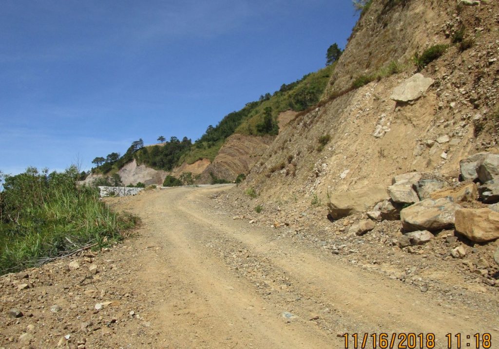 Zc919. That ridgeline ahead, down from the road, houses the WWII tank, which makes me believe that the Villa Verde had several tracks reaching the Salacsac Passes at Malico Village. 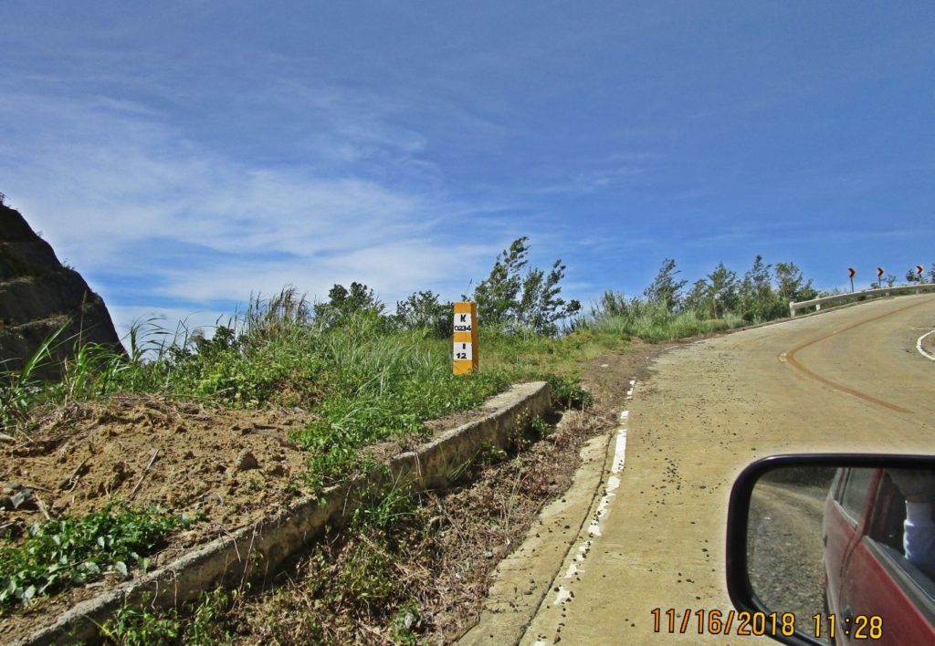 Zc920. These km stones have been recently replaced; it says 12 km to Imugan Town. From there to Santa Fe it is about another 8 km, so from here to Santa Fe, about 20 km, the Villa Verde Trail/Road or the new Pangasinan-Nueva Viscaya Road is concreted except about 100 meters. Don’t ask me why, I am sure there is some bureaucratic reason. The entrance to Malico Village is about 1 km from here, I consider this the western Salacsac Pass. If you like to read up on the terrific war action up the Villa Verde Trail, read this, Chapter XXVI, the Villa Verde Trail: www.ibiblio.org/hyperwar/USA/USA-P-Triumph/USA-P-Triumph-26.htmlor this: The 32nd Red Arrow Veteran Association: www.32nd-division.org/ |
|
|
|
Post by Karl Welteke on Nov 22, 2018 12:27:59 GMT 8
2018-11-16 Villa Verde Trail Hike, Middle Section
Sections of the Villa Verde Trail are now being used to build a new Pangasinan to Nueva Viscaya Road. I started walking the trail before the construction started. But now, I have finished walking the whole trail, although in sections, with this walk.
Finally I walked the last section of the Villa Verde Trail. Last Dec. 2017 I walked from Malico towards San Nicolas about 9 km and before that I started up from San Nicolas. One could not walk it all the way before because it was un-penetrate-able and later not cut yet for the new road construction. So today I drove up about 8km from San Nicolas and walked to and back about a 4 km stretch between Malico and San Nicolas. The pictures are in sequence, going up in the direction to Malico.
A total of 88 images were generated from this walk and I put them all into this Photobucket album, click here:
s74.photobucket.com/user/PI-Sailor/library/Manila%20Bay%20Forts-Other/Balete%20Pass%20and%20Villa%20Verde%20Trail/2018-11-16%20Villa%20Verde%20Hike%20Middle%20Section?sort=9&page=1
And I made a web page with 29 images here:
philippine-sailor.net/2018/11/21/2018-11-16-villa-verde-hike-middle-section/
For this forum presentation I used these 9 imagers:
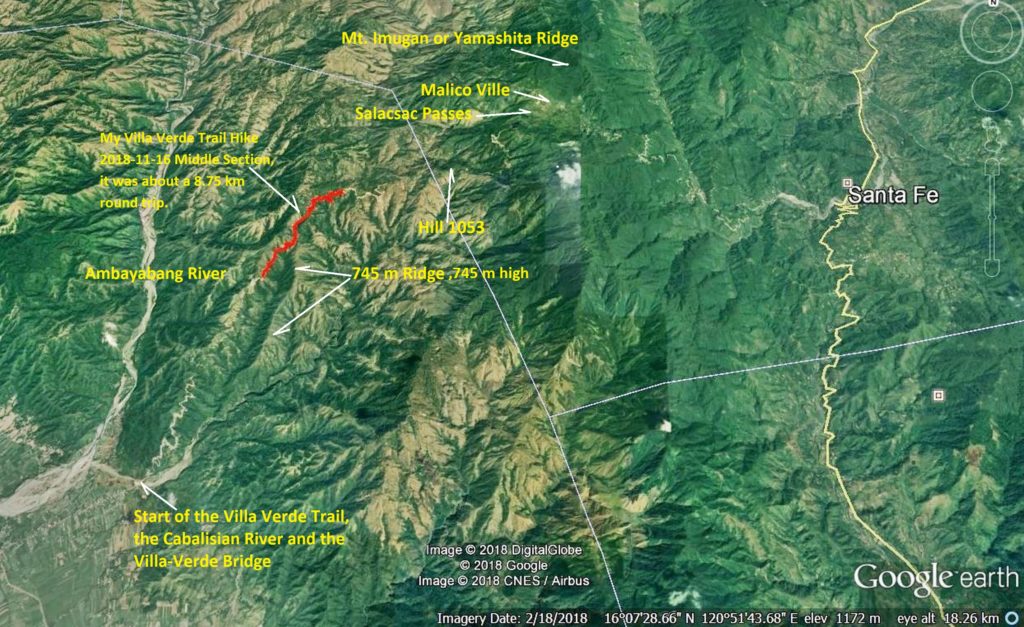
Zc921. 181116 Villa Verde hike, middle section 001. This is my GPS track of the walk and also gives you a bigger picture of the Villa Verde Trail area.
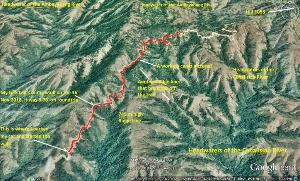
Zc922. 181116 Villa Verde hike, middle section 002. This is my GPS track of the walk, zoomed in with some landmarks.
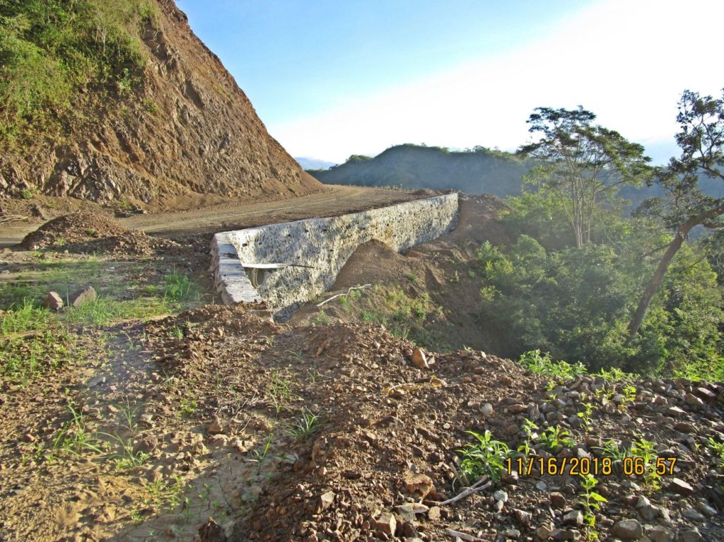
Zc929. 181116 Villa Verde hike, middle section 012. At many bends or ravines the embankment of the trail or now the new road needs to be enforced like this.
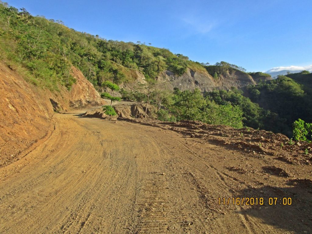
Zc930. 181116 Villa Verde hike, middle section 013. This a long view up and ahead, at the distance is where the 745 meter high ridge, branches off from this main one.
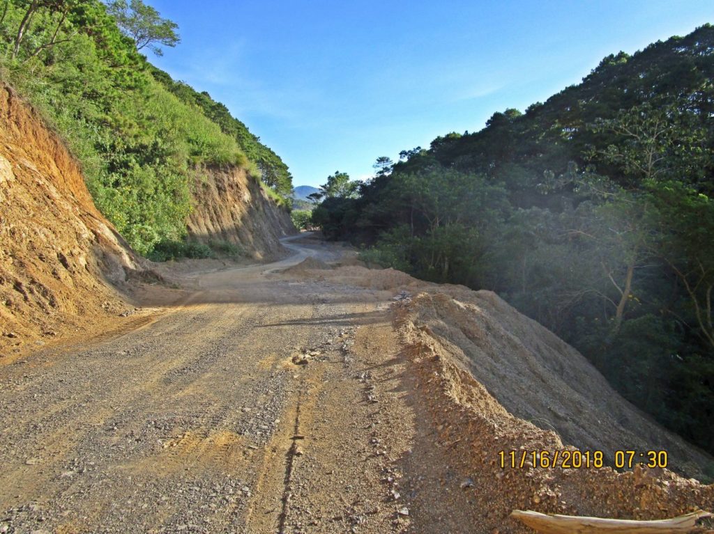
Zc935. 181116 Villa Verde hike, middle section 030. This is where a much smaller ridge branches off and the road pretty much runs level now.
.
--------------------------------------------
If you like to read up on the terrific war action up the Villa Verde Trail, read this, Chapter XXVI, the Villa Verde Trail:
www.ibiblio.org/hyperwar/USA/USA-P-Triumph/USA-P-Triumph-26.html
or this: The 32nd Red Arrow Veteran Association:
www.32nd-division.org/
-------------------------------------------
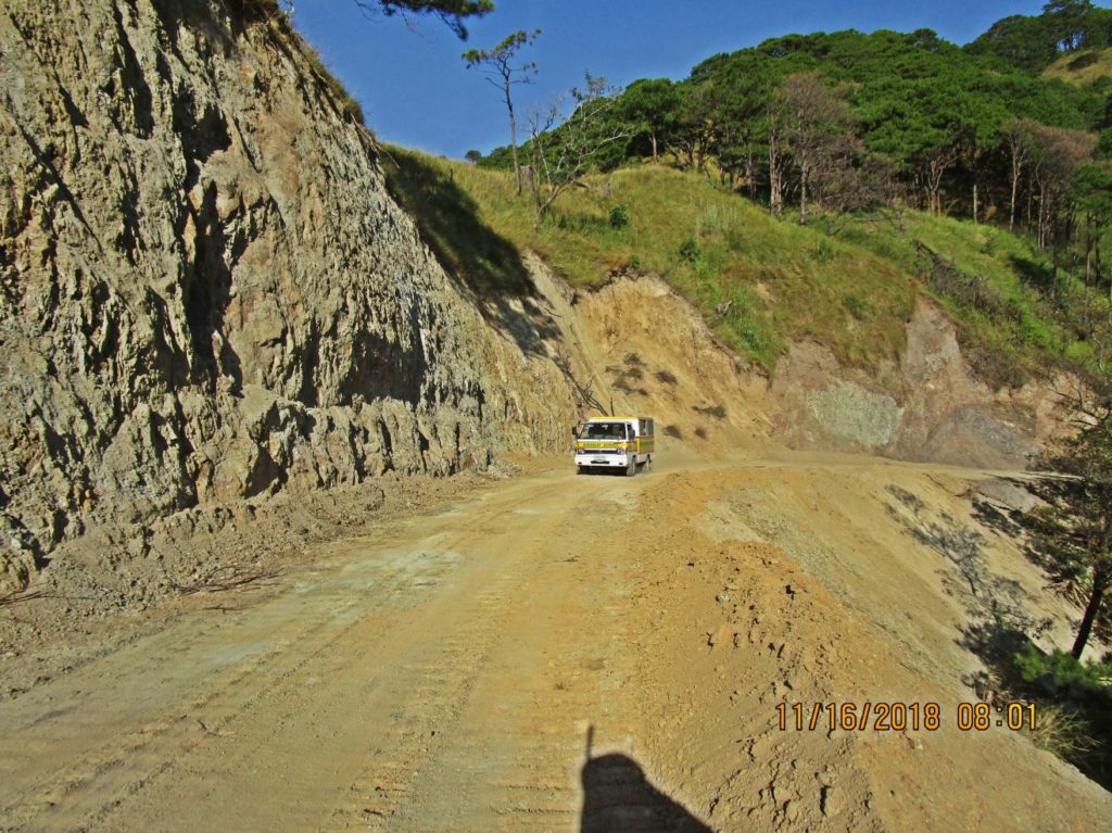
Zc943. 181116 Villa Verde hike, middle section 063. I met another vehicle; this one is actually a barangay Malico vehicle on a government mission to San Nicias, its parent Municipality. This is the first time in several decades they could drive directly to Town Hall. Before the Villa Verde Trail was opened again, they had to drive south to San Jose, Nueva Ecija thru the Balete Pass and then back up to San Nicolas, on this side of the Caraballo Mountain Spur.
Zc944. 181116 Villa Verde hike, middle section 064. I’m advancing along the Villa Verde Trail/Road along a ridge that runs towards or connects to Hill 1053; it is now mostly Lahar material. The Villa Verde Trail follows the watershed boundary between two rivers. Right and south is the head water of the Cabalisian River which drains to the right and south and remember the new bridge was built to cross it at the start of the Villa Verde Trail, Pangasinan End. To the left and north is the headwaters of the Ambayabang River, it starts in part at Malico, hooks to the north, then makes another large curve to the left and flows south into the Agno River. In this picture I am looking forward, to the east.
Zc945. 181116 Villa Verde hike, middle section 069. I’m advancing along the Villa Verde Trail/Road along a ridge that runs towards or connects to Hill 1053; it is now mostly Lahar material. The Villa Verde Trail follows the watershed boundary between two rivers. In Dec 2017 I walked the Villa Verde Trail, starting at Malico, walking down to this direction and had to stop about here. The new Villa Verde Trail, Road was not finished cut here yet and I had to turn around and go back. This is a look back to the west by south west.
Zc949. 181116 Villa Verde hike, middle section 083. Hill 1053 is in sight, the mountains in back are the Caraballo Mountains Spur that runs down to San Jose, Nueva Ecija. On the east side of the spur is Highway 5 going north thru Balete/Dalton Pass to Santa Fe, Nueva Viscaya and Cagayan Valley Region. Now this road project, the new Pangasinan – Nueva Viscaya Road along the old Villa Verde Trail will be a shortcut to the Cagayan Region from the Central Luzon Plains.
|
|
|
|
Post by Karl Welteke on Nov 25, 2018 12:38:57 GMT 8
Villa Verde Trail, first 8km, Pangasinan side, 15th N0v. 2018 On the 15th Nov. 2018 I drove to San Nicolas, the last Municipality before entering the Villa Verde Trail from Pangasinan. I found the bridge over the Cabalisian River complete and about 6km 2 lanes completed with concrete and perhaps 2 more Km concreted in sections. I drove up to the 8km mark (approximate) and explored it by driving down. I established this Photobucket album with 60 pictures: s74.photobucket.com/user/PI-Sailor/library/Manila%20Bay%20Forts-Other/Balete%20Pass%20and%20Villa%20Verde%20Trail/181115%20Villa%20Verde%20first%208km-Pangasinan%20side?sort=9&page=1The first 4 pictures were shot driving up and all the other pictures are in sequence driving down the trail from about the 8km mark. These are my general observations about the progress of the new Pangasinan-Nueva Viscaya Road which uses much of the old Villa Verde Trail tracks. The new name of road is Pangasinan-Nueva Viscaya Road. The bridge over the Cabalisian River (Pangasinan End) which flows into the Ambayabang River is complete and is called Villa Verde Bridge About 6 km (rough estimate) from that bridge up are now concreted with two lanes. A drainage ditch is incomplete or not built yet. Roughly another 2 km are concreted in patches. The road is now connected, cut, one lane opened for equipment movement between both ends (San Nicolas-Pangasinan and Santa Fe-Nueva Viscaya). The road from Santa Fe up to the Salacsac Passes, about 20 km, is now concreted except for about 100 meter. At this location is the village of Malico (Pangasinan); passed it another 2 km are concreted. The work started from both ends and on the 16th of November I walked about 4 km in the middle to make sure that one can now walk the whole length. On both ends work is going on to stabilize the embankment at many ravines and bends. In the middle and at the Malico end the road still needs to be widened, blasting was used that day for that purpose. It is a very difficult job at some steep rocky places or in the middle where it seems to be mostly lahars material, but the authorities and contractors keep plucking away. I don’t dare to give a completion date though! Local motorcycles and bicycle riders are using this road now, stay clear of heavy equipment. I seen a few motor cars, trucks use the road, the whole way, I did drive it myself but advice others not to do it yet. Blasting is going on and some sections are too sandy, muddy, rocky or to steep. The 32nd Inf. Div. WWII 1945 Memorial is still sitting, in its damaged state, near the Villa Verde Bridge. It was damaged during the road and bridge construction. For this forum presentation I use these 9 pictures, they are uploaded to my Photobucket account, as the server. Because of Photobucket’s quality of service not all pictures may open. 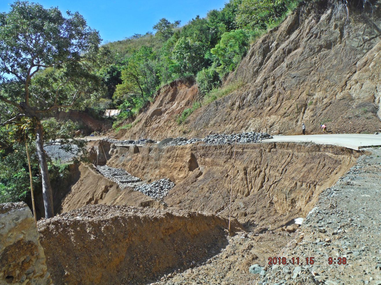 [/p]
Photobucket doesn't let this picture open, at least not on my PC; here is the alternative, click on this IMG Thumb:
Z229. At the4 Villa Verde Trail/Road many bends or ravines the embankment of the trail or now the new road needs to be enforced like this.
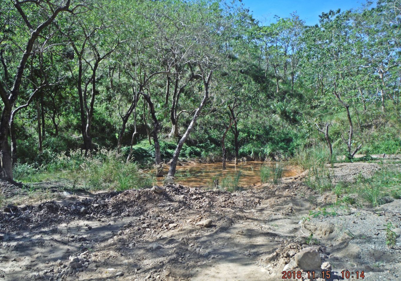
Z230. This small pond is about at the 6 km mark up on the Ville Verde Trail/Road. Here is the only place where one can look on the other side, the west direction, on this ridge; the Villa Verde Trail is following. This is exactly the spot I walked to on my first walk on the 18th of Aug. 2014. Thus was way before the construction work started.
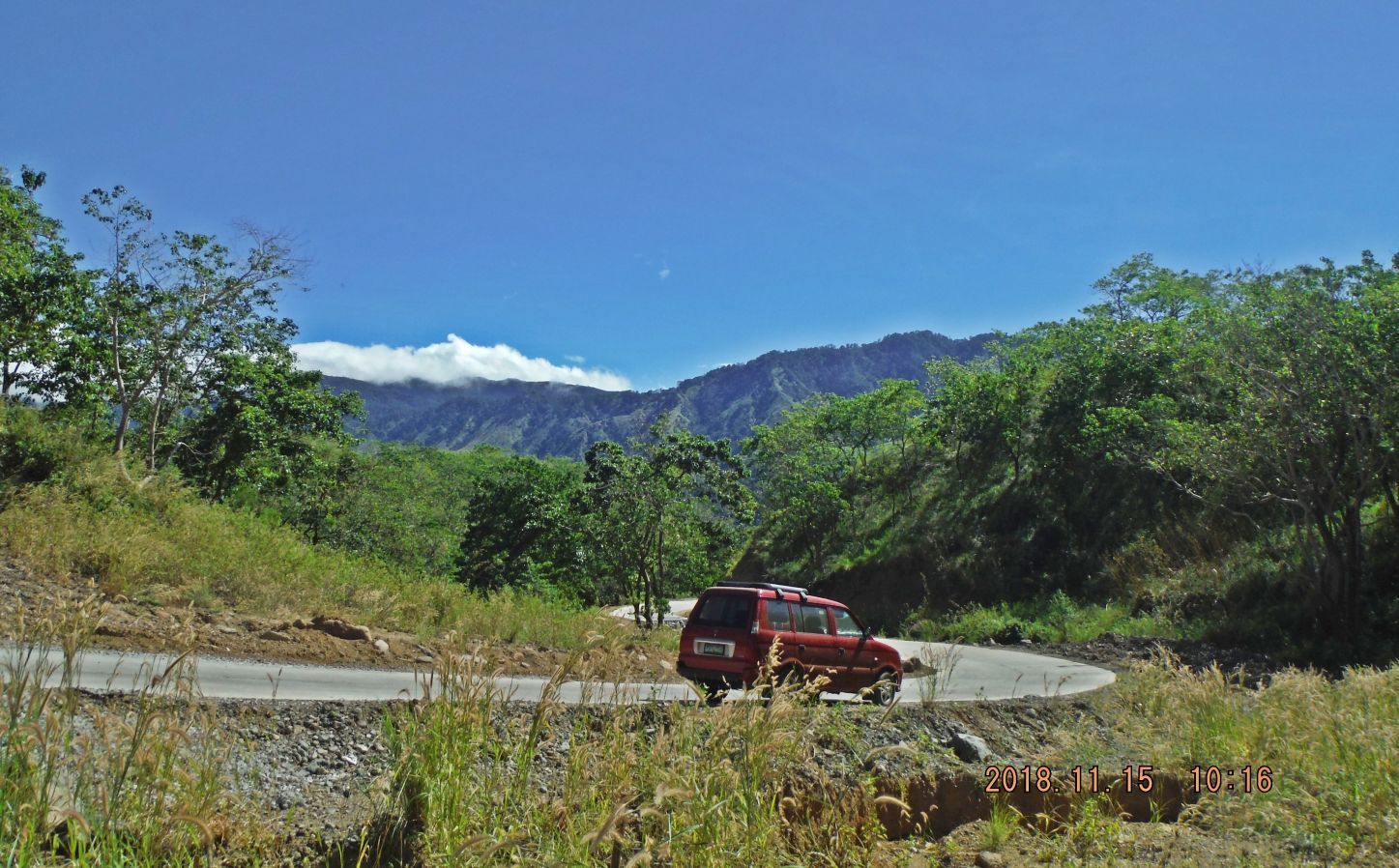
Z231. This is where I parked the car, next to the pond. The 2 lane road is concreted but the drainage ditch has not been started yet. The mountains in back are the mountain spur of the Caraballo Mountains, running to the right, south to San Jose in Nueva Ecija.
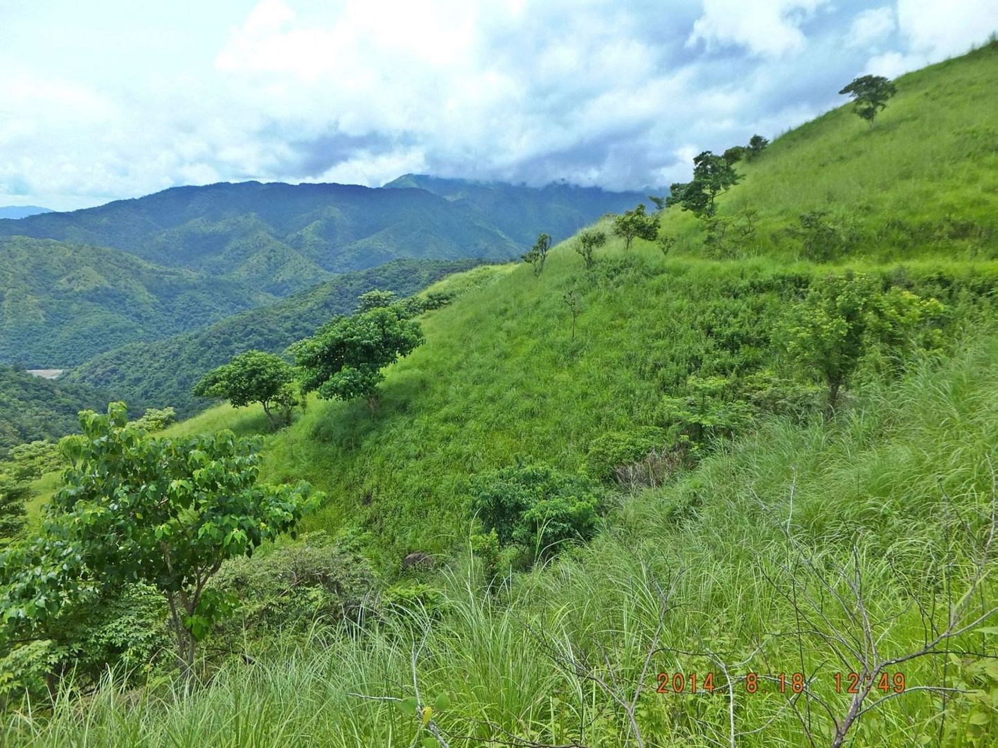
Z231a. This is a 18th Aug. 2014 picture of a spot just above the pond in picture #Z230. This is exactly the spot I walked to on my first walk on the 18th of Aug. 2014. Thus was way before the construction work started. What you see in this picture is that the Villa Verde Trail split up here and followed up this ridge on both sides, east and west. Here we see the road was going around a bend and up on the west side of this ridge. We also see just a tiny spot of the Ambayabang River. If you look at the 1:50000 map in the you will see the Villa Verde Trail spit up here.
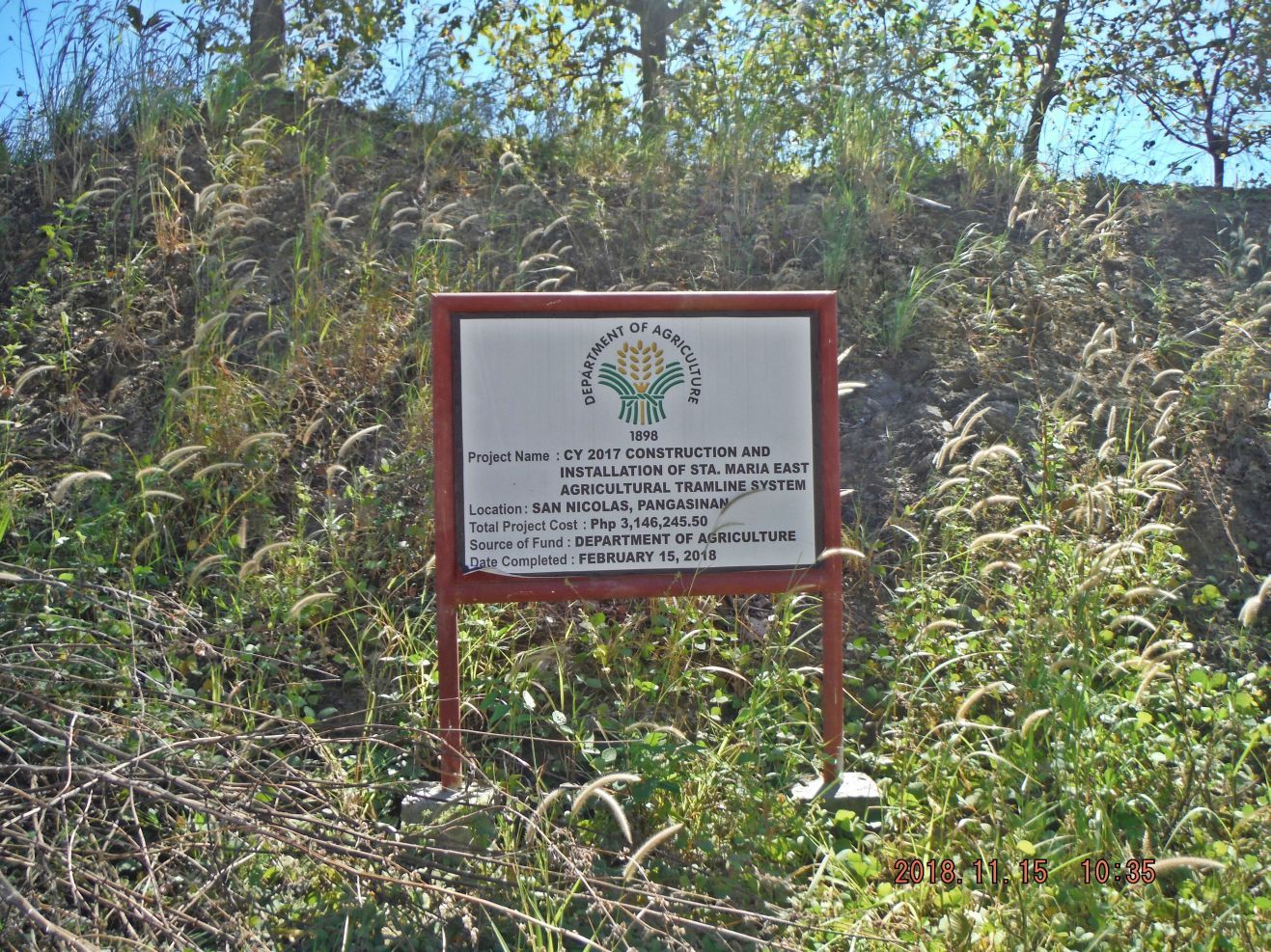
Z232. Here at the new Villa Verde Trail, the Dept. of Agriculture did not waste any time, probably at the request of the people here, and built a high wire transfer station over the valley of the Cabalisian River.
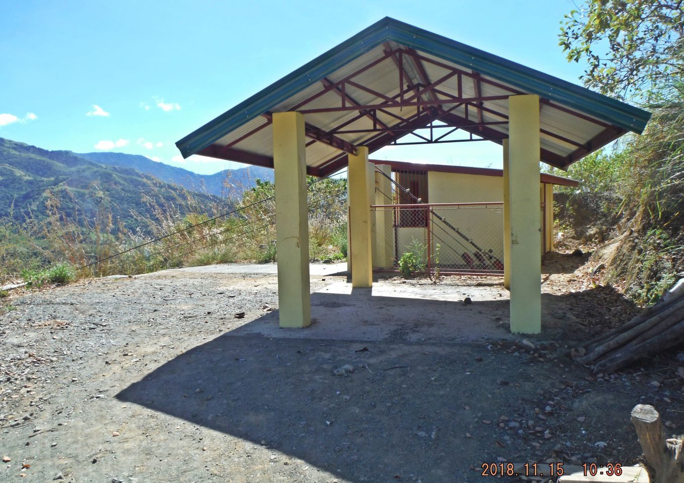
Z233. Here at the new Villa Verde Trail, the Dept. of Agriculture did not waste any time, probably at the request of the people here, and built a high wire transfer station over the valley of the Cabalisian River. This rig has a special appeal to this sailor because we use this system between two ships while we are steaming next to each other.
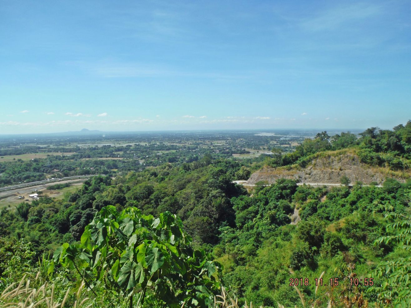
Z234. Looking at the Central Luzon Plains from the Villa Verde Trail/Road, right we see the Ambayabang River streaming into Pangasinan Plain and it will join the Agno River. The hill at left is most likely Mount Balungoa, which is an extinct volcano.
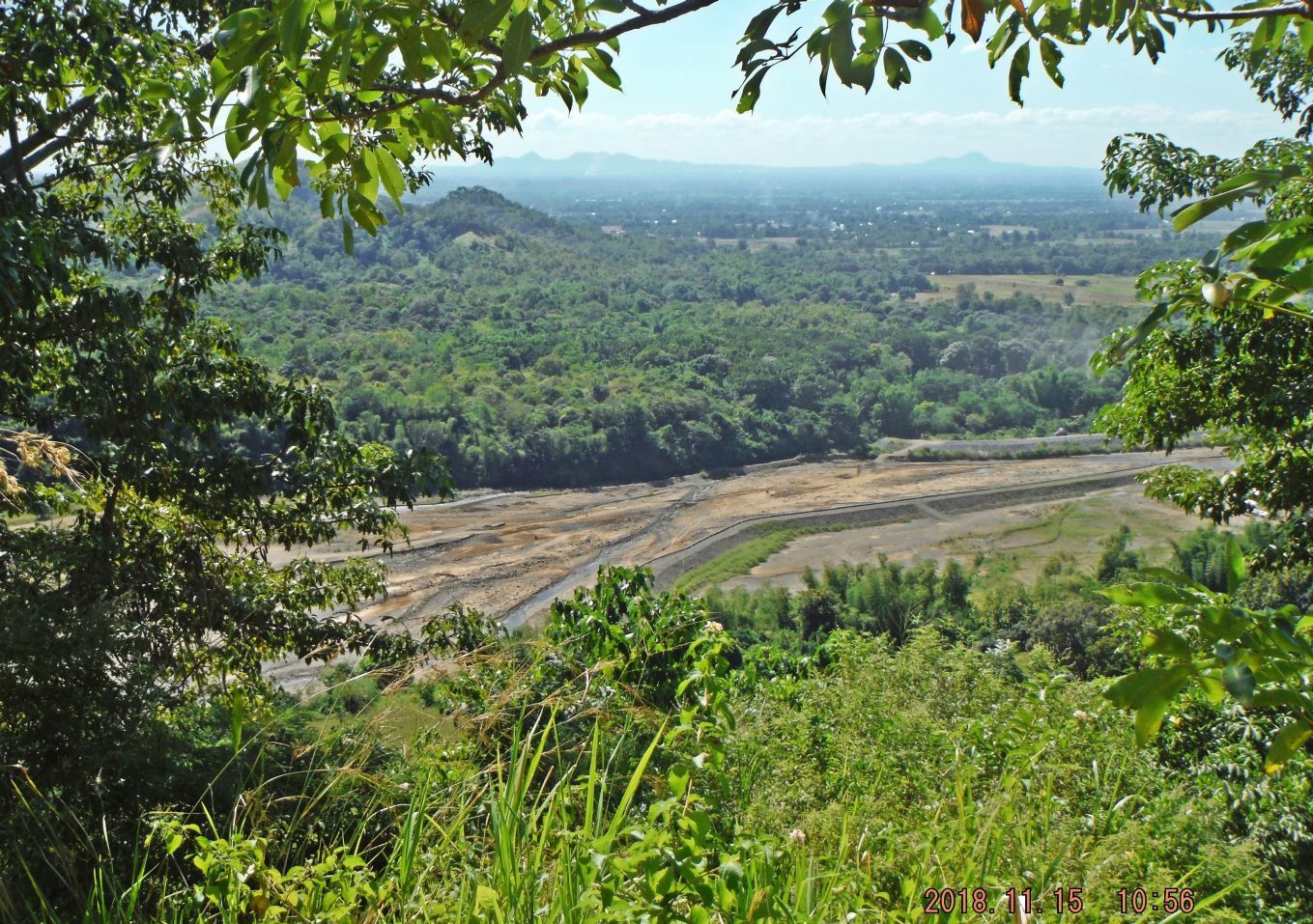
Z235. Looking down onto the Cabalisian River from the Villa Verde Trail/Road, it is coming from the Caraballo Mountain Spur at left. In the distance we see several relative small peaks, which I suspect are all extinct volcanoes like Mt. Balingao in the last picture.
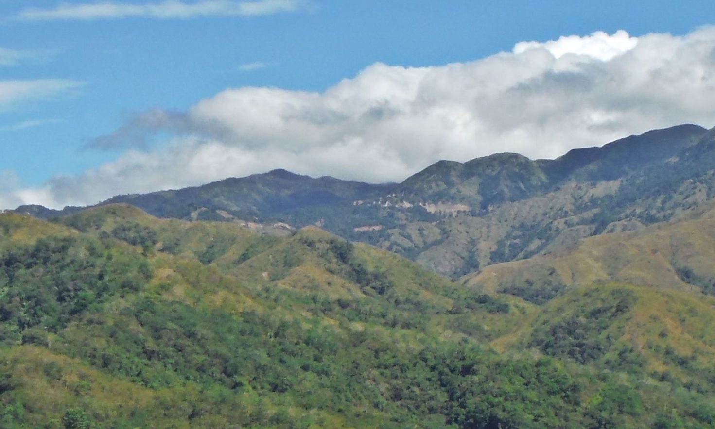
Z236. This is a rare view of the upper portion of the Villa Verde Trail/Road as it approaches the Salacsac Passes; the ridge line in front, ridge 745 meters high, blocks this view most of the time.
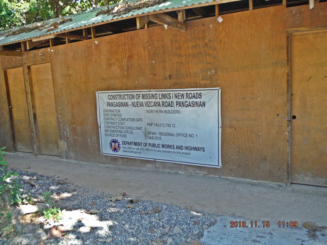
Z237. The Department of Public Works and Highways at on the job, building the new Villa Verde Road, I prefer that name. This hooch in a small camp is a little distance up the new road.
NOTE:
If you like to read up on the terrific war action up the Villa Verde Trail, read this, Chapter XXVI, the Villa Verde Trail:
www.ibiblio.org/hyperwar/USA/USA-P-Triumph/USA-P-Triumph-26.html
or this: The 32nd Red Arrow Veteran Association:
www.32nd-division.org/
|
|
|
|
Post by Karl Welteke on Jan 20, 2019 17:36:24 GMT 8
The Villa Verde Trail from afar. I’m just working on pictures of the Luzon Guerrilla Army Forces (LGAF) at the East Pangasinan area and I got a couple of shots of the Villa Verde Trail (now being rebuilt as the Pangasinan-Nueva Viscaya Two Lane Highway). I like to share them here. 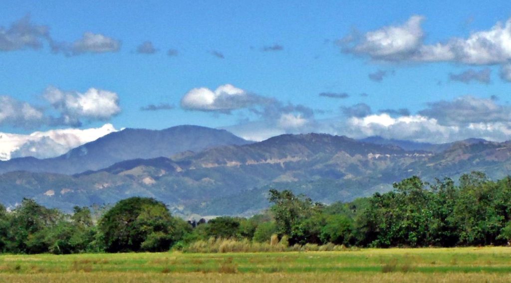 Zc995. The Villa Verde trail runs up this ridge line on its east side starting at San Nicolas. This ridge line is the watershed boundary between the Ambayabang River (on west side of ridge) and the Cabalisian River (on the east side of the ridge); it will flow into the Ambayabang River. 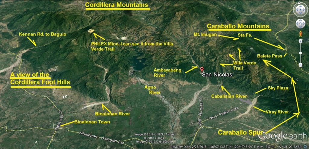 Zc996. A view of the Cordillera Foot Hills and the Caraballo Mountains and the Villa Verde Trail 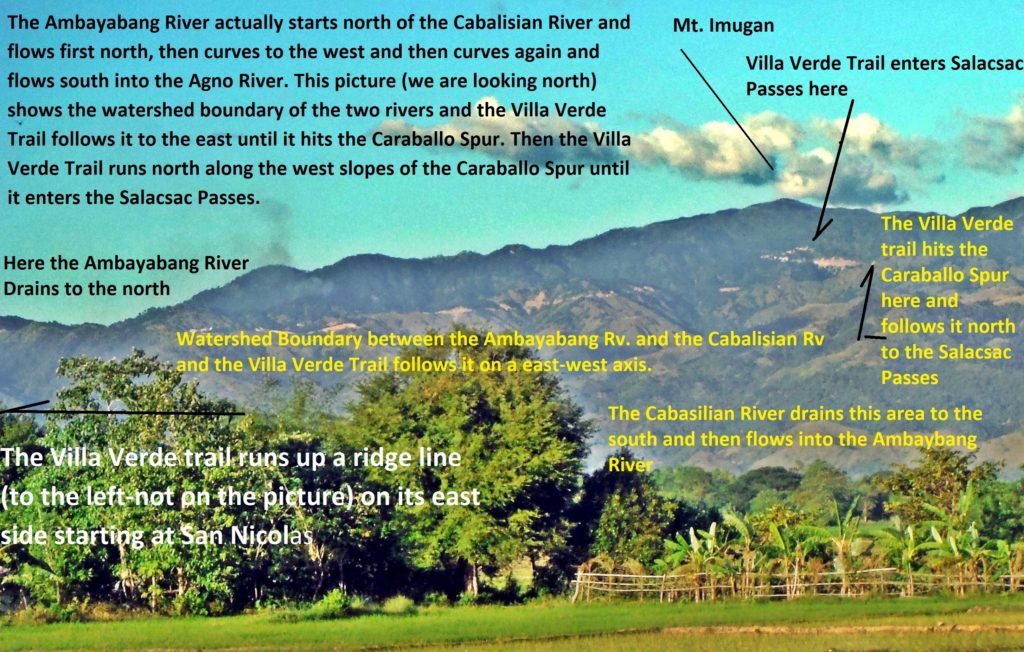 Zc997. Villa Verde Trail. The Ambayabang River actually starts north of the Cabalisian River and flows first north, then curves to the west and then curves again and flows south into the Agno River. This picture (we are looking north) shows the watershed boundary of the two rivers and the Villa Verde Trail follows it to the east until it hits the Caraballo Spur. Then the Villa Verde Trail runs north along the west slopes of the Caraballo Spur until it enters the Salacsac Passes. 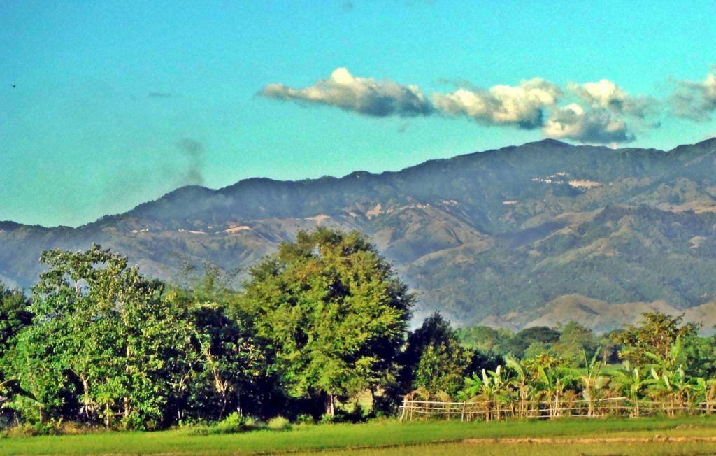 Zc998. Villa Verde Trail unmarked copy. The Ambayabang River actually starts north of the Cabalisian River and flows first north, then curves to the west and then curves again and flows south into the Agno River. This picture (we are looking north) shows the watershed boundary of the two rivers and the Villa Verde Trail follows it to the east until it hits the Caraballo Spur. Then the Villa Verde Trail runs north along the west slopes of the Caraballo Spur until it enters the Salacsac Passes. |
|


 [/p]
[/p]


