Post by Karl Welteke on Mar 8, 2015 13:21:57 GMT 8
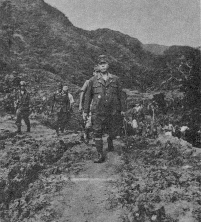
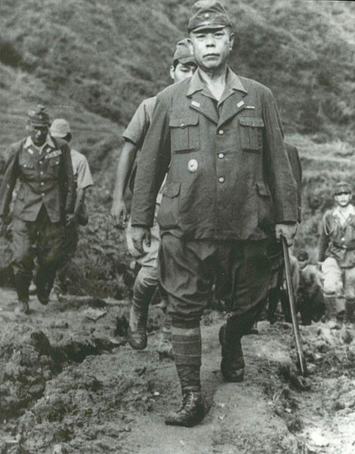
This new thread is about the General because he was an important enemy soldier in the history of WWII in the Philippines and SE Asia. I hope many others will contribute to this thread.
KIANGAN WAR MEMORIAL SHRINE, SURRENDER SITE OF GEN. YAMASHITA
This segment is about the shrine which I was able to visit on the 20th of Feb. 2015.
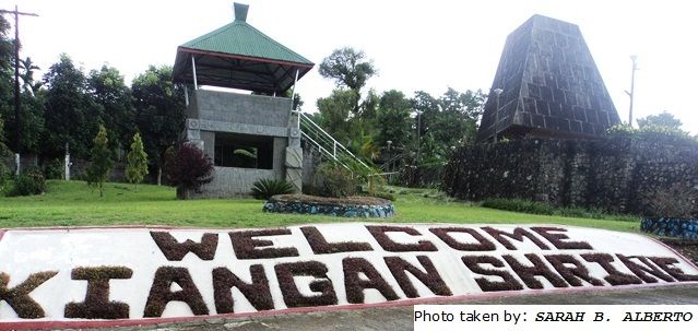
A gigantic steel-and-concrete structure stands commandingly at Linda, Kiangan overlooking the town proper and the capital town of Lagawe to the east. Officially called the Kiangan War Memorial Shrine, it was erected in 1974 to commemorate the end of World War II in the Philippines, and fittingly in the place where the last battles of the war were fought.
The Shrine is located in Linda, Poblacion, 300 meters from the municipal hall. It can be reached by taking a short ride or by walking.
The above description is from the Municipality of Kiangan webpage and its Cultural Heritage section, this is the URL:
kiangan.gov.ph/tourist-spots/cultural-heritage/
It describes the shrine better than I can, that is why I copied much in here. Some of the pictures are also better than mine and I will post them at the end.
From my visit I established this album with 20 images:
app.photobucket.com/u/PI-Sailor/a/2c6284f5-673f-48b9-850a-69bd7f6d901f
Here are seven sample pictures from me:
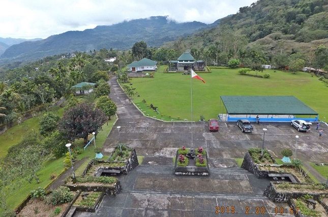
X143. At the head of the Kiangan Shrine is a high concrete structure which can be accessed and one gets this view of the shrine.
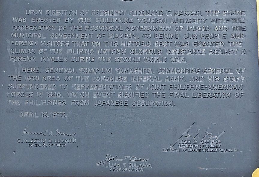
X144. This plaque at the Kiangan Shrine gives you the purpose and history of this shrine.
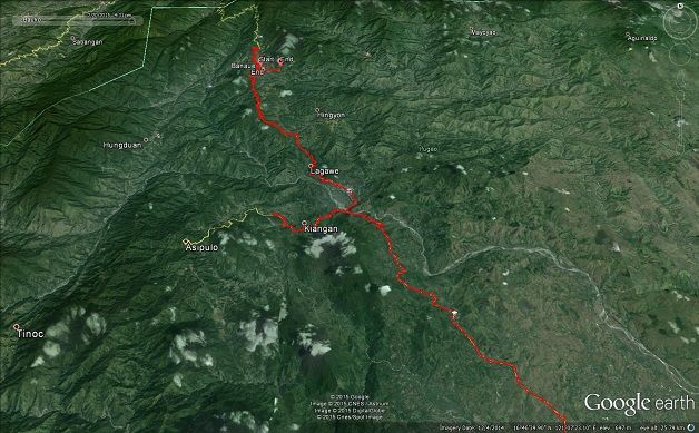
X145. This Google Earth image gives you the big picture as to where the Kiangan War Memorial Shrine is located. It actually shows our track of travel including two walks at Banaue.
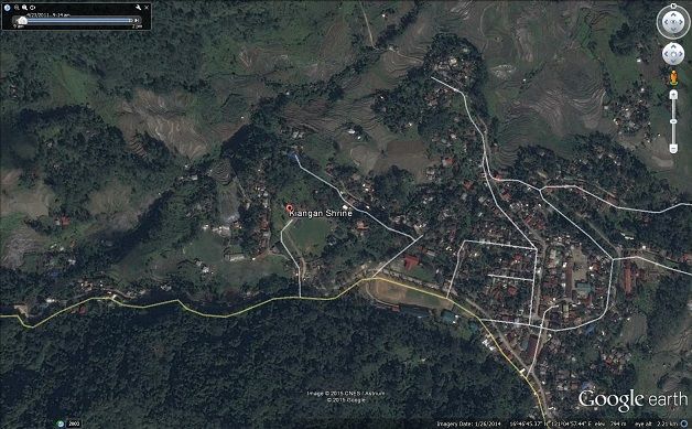
X146. This Google Earth image, zoomed in, gives you a closer view as to where the Kiangan War Memorial Shrine is located. This important town is part of the Ifugao Province.
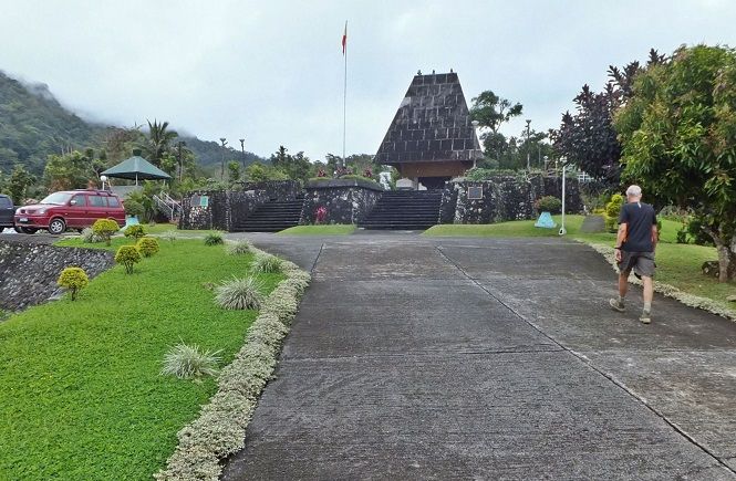
X147. This is a closer look at the concrete structure at the head of the Kiangan War Memorial Shrine. Three information plaques are in view.
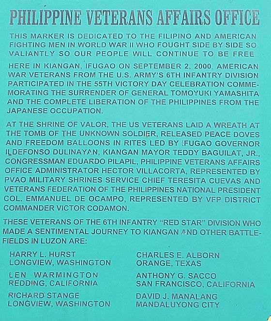
X148. This plaque at the Kiangan War Memorial Shrine commemorates the anniversary of the surrender Gen. Yamashita with soldiers of the 6th Inf. Div. present on the 2nd Sep. 2000.
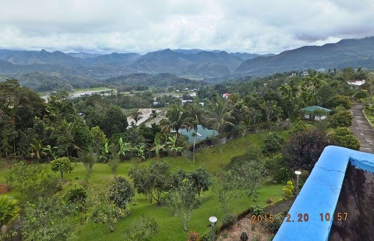
X149. This is the 3rd of 6 shots (in my album) from left to right of the area around the Kiangan War Memorial Shrine. On this image we are looking to the NE, in the distance, Lagawe is in view.
The following are information and images from the Municipality of Kiangan web page, the URL
is above
When my friend and I visited Kiangan we failed to visit the actual surrender site. And here are 4
pictures and the text from the above Kiangan Municipality URL:
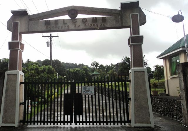
X150. The gate to the Kiangan War Memorial Shrine, I failed to take a picture and this picture is from the Municipality of Kiangan web page, the URL is above.
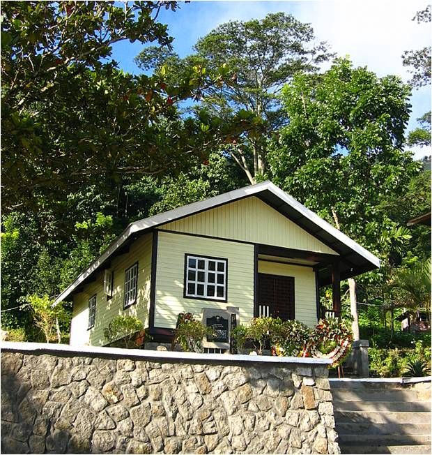
X151. I failed to take a picture of this structure at the Kiangan War Memorial Shrine also. This picture is from the Municipality of Kiangan web page, the URL is above.
X152. Peace Museum/Yamashita Surrender Site
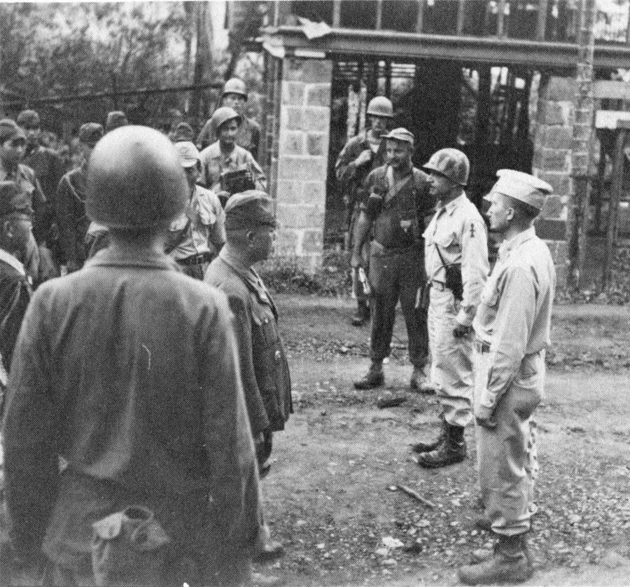
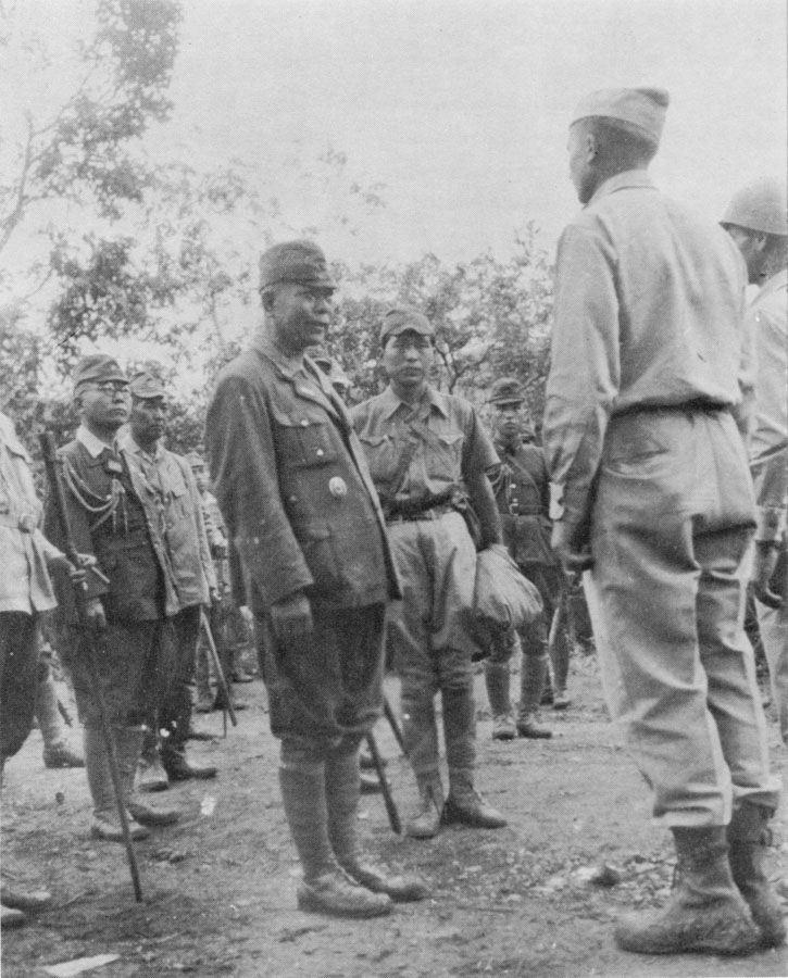
It consists of a wooden building situated at the Kiangan Central School at Poblacion, Kiangan, Ifugao where the so-called “Tiger of Malaya” General Tumoyuki Yamashita, Supreme Commander of the Japanese Imperial Army, during the Second World War, signed his unconditional surrender to the Allied Forces.
On September 2, 1945 Yamashita, with his command staff, actually and physically surrendered to the Americans at the Home Economics building of the Kiangan Central School. He was taken to Bagabag, Nueva Vizcaya, and from there he was flown to La Union and then to Baguio City where on September 3, 1945 at Camp John Hay, he signed the surrender of the Japanese Imperial Forces in the Philippines.
The event is commemorated every year as Victory Day. During the 60th Anniversary of Victory Day, PGMA graced the occasion and it became known as the Anniversary of the End of World War II in the Philippines.
The site is located 200 meters from the municipal hall and can be reached by walking or taking a short tricycle ride.
This picture is from the Municipality of Kiangan web page, the URL is above.
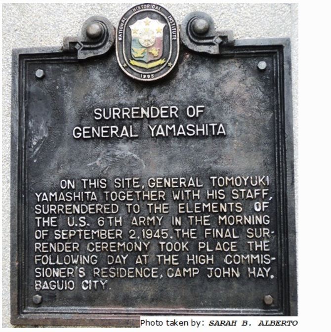
X153. The plaque at the Peace Museum/Yamashita Surrender Site In Kiangan.
This picture is from the Municipality of Kiangan web page, the URL is above.
KIANGAN WAR MEMORIAL SHRINE, SURRENDER SITE OF GEN. YAMASHITA
This segment is about the shrine which I was able to visit on the 20th of Feb. 2015.
A gigantic steel-and-concrete structure stands commandingly at Linda, Kiangan overlooking the town proper and the capital town of Lagawe to the east. Officially called the Kiangan War Memorial Shrine, it was erected in 1974 to commemorate the end of World War II in the Philippines, and fittingly in the place where the last battles of the war were fought.
The Shrine is located in Linda, Poblacion, 300 meters from the municipal hall. It can be reached by taking a short ride or by walking.
The above description is from the Municipality of Kiangan webpage and its Cultural Heritage section, this is the URL:
kiangan.gov.ph/tourist-spots/cultural-heritage/
It describes the shrine better than I can, that is why I copied much in here. Some of the pictures are also better than mine and I will post them at the end.
From my visit I established this album with 20 images:
app.photobucket.com/u/PI-Sailor/a/2c6284f5-673f-48b9-850a-69bd7f6d901f
Here are seven sample pictures from me:

X143. At the head of the Kiangan Shrine is a high concrete structure which can be accessed and one gets this view of the shrine.

X144. This plaque at the Kiangan Shrine gives you the purpose and history of this shrine.

X145. This Google Earth image gives you the big picture as to where the Kiangan War Memorial Shrine is located. It actually shows our track of travel including two walks at Banaue.

X146. This Google Earth image, zoomed in, gives you a closer view as to where the Kiangan War Memorial Shrine is located. This important town is part of the Ifugao Province.

X147. This is a closer look at the concrete structure at the head of the Kiangan War Memorial Shrine. Three information plaques are in view.

X148. This plaque at the Kiangan War Memorial Shrine commemorates the anniversary of the surrender Gen. Yamashita with soldiers of the 6th Inf. Div. present on the 2nd Sep. 2000.

X149. This is the 3rd of 6 shots (in my album) from left to right of the area around the Kiangan War Memorial Shrine. On this image we are looking to the NE, in the distance, Lagawe is in view.
The following are information and images from the Municipality of Kiangan web page, the URL
is above
When my friend and I visited Kiangan we failed to visit the actual surrender site. And here are 4
pictures and the text from the above Kiangan Municipality URL:

X150. The gate to the Kiangan War Memorial Shrine, I failed to take a picture and this picture is from the Municipality of Kiangan web page, the URL is above.

X151. I failed to take a picture of this structure at the Kiangan War Memorial Shrine also. This picture is from the Municipality of Kiangan web page, the URL is above.

X152. Peace Museum/Yamashita Surrender Site
It consists of a wooden building situated at the Kiangan Central School at Poblacion, Kiangan, Ifugao where the so-called “Tiger of Malaya” General Tumoyuki Yamashita, Supreme Commander of the Japanese Imperial Army, during the Second World War, signed his unconditional surrender to the Allied Forces.
On September 2, 1945 Yamashita, with his command staff, actually and physically surrendered to the Americans at the Home Economics building of the Kiangan Central School. He was taken to Bagabag, Nueva Vizcaya, and from there he was flown to La Union and then to Baguio City where on September 3, 1945 at Camp John Hay, he signed the surrender of the Japanese Imperial Forces in the Philippines.
The event is commemorated every year as Victory Day. During the 60th Anniversary of Victory Day, PGMA graced the occasion and it became known as the Anniversary of the End of World War II in the Philippines.
The site is located 200 meters from the municipal hall and can be reached by walking or taking a short tricycle ride.
This picture is from the Municipality of Kiangan web page, the URL is above.

X153. The plaque at the Peace Museum/Yamashita Surrender Site In Kiangan.
This picture is from the Municipality of Kiangan web page, the URL is above.


