|
|
Post by Karl Welteke on May 13, 2017 11:33:16 GMT 8
Magdalena Leones, Filipina Heroine, Silver Star This lady has been in the news since last year; she passed away, RIP. How many females do you know that received the Silver Star? She was recommended for it by no less than Col. Volkmann the legendary leader of the USAFIP, NL 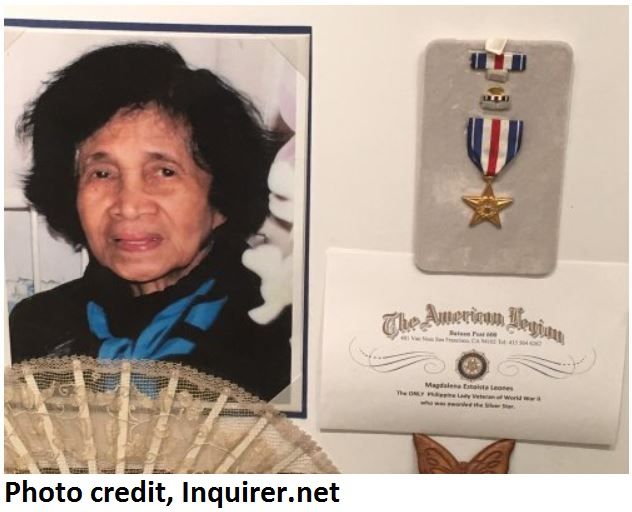 V896. This is Magdalena Leones, Filipina Heroine, Photo credit: is Inquirer.net. This picture and the write-up below is from the Philippine Consulate General in San Francisco; this is the URL: www.philippinessanfrancisco.org/news/5118/591/San-Francisco-s-Board-of-Supervisors-paid-tribute-and-issued-a-Certificate-of-Honor-in-memory-of-the-late-Corporal-Magdalena-Estoista-Leones/d,phildet/ This is the write-up from the above URL: San Francisco’s Board of Supervisors paid tribute and issued a Certificate of Honor in memory of the late Corporal Magdalena Estoista Leones, a Filipina American war veteran and unsung heroine of WWII, who passed away last June 16, 2016. Supervisor Jane Kim stated “We are diminished by the passing of Corporal Magdalena Leones, Silver Star Filipina World War II veteran-- the only Asian to receive this honor. Corporal Leones has paved the way for many women that are breaking barriers in every arena. I look forward to her story and the story of the 250,000 Filipino World War II veterans being told for all to remember”. Cpl. Leones’ Silver Star citation states that she was an intelligence operative in the Philippines who, on Feb. 25 to 26, 1944 “repeatedly risked her life to carry important intelligence data, vital radio parts and medical supplies through heavily garrisoned enemy-held territory.” Before she turned 25, Magdalena had already been arrested by Japanese soldiers three times, and escaped all three times harm-free. She was eventually enlisted in the Philippine army and became an official member of the USAFIP. On July 18 1945, Colonel Volckmann, the man who offered her a position as a special agent, recommended that Cpl. Leones be awarded the US Silver Star, the third- highest military decoration. Cpl. Leones is the fifth woman to receive the honor, and the only Asian. Later in her life, she was also awarded the Philippine Liberation Medal, the Resistance Movement Medal, the World War II Medal, and the Philippine Independence Ribbon. Cpl. Leones moved to California from the Philippines in 1969. She worked as a clerk at Pacific Bell, owned homes in Richmond and in San Jose and did not talk much about her war exploits, according to her children. She is survived by sons Guillermo Tabor, Gildon Tabor and Gregorio Tabor; daughter Alijadra Maytas of West Virginia; husband Pedro Tabor of Richmond; and an adopted son, Leonard Yates. She had 13 grandchildren and three great-grandchildren. Corporal Magdalena Estoista Leones was one of the 250,000 Filipino soldiers who fought valiantly in World War II on behalf of the United States. Photo Credit: Inquirer.net 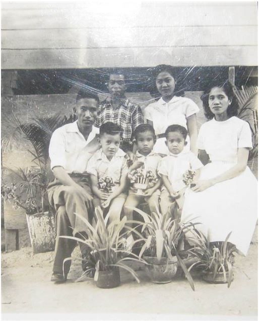 V897. This is a family picture of Magdalena Leones fm the Pacific Paratrooper website, in it; it says also that she will be buried in the Philippine Hero Cemetery, the Libingan ng mga Bayani. This is the URL and it has some more information about this exceptional Filipina Guerrilla: pacificparatrooper.wordpress.com/2017/05/11/filipina-heroine/ |
|
|
|
Post by Karl Welteke on Jul 29, 2017 20:40:04 GMT 8
Florence Ebersole Smith Finch A very special lady! She was active in the resistance in Manila during the war, was arrested by the Japanese, tortured and was liberated early 1945 by US Forces. Being a Filipino-American she was transported to the US and joined the US Coast Guard. She recently died and so was remembered. 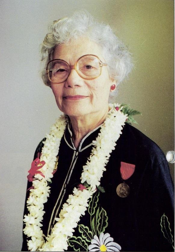  Za027. Florence Ebersole Smith Finch in recent years. This picture is from this web page: pacificparatrooper.wordpress.com/2017/07/24/intermission-story-9-a-special-woman/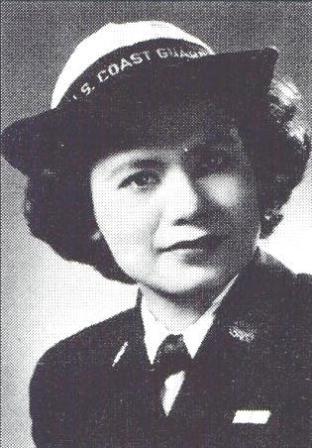 Za028, This picture and story of Florence Ebersole Smith Finch came from this US Coast Guard web page: www.uscg.mil/history/people/FlorenceFinchBio.aspCoast Guard SPAR decorated for combat operations during World War II By William H. Thiesen, Ph.D. U.S. Coast Guard Atlantic Area Historian Of the thousands of women who have served with honor in the United States Coast Guard, one stands out for her bravery and devotion to duty. Florence Smith Finch, the daughter of a U.S. Army veteran and Filipino mother, was born on the island of Luzon, north of Manila, in Santiago City. She married navy PT boat crewman Charles E. Smith while working for an army intelligence unit located in Manila. In 1942, after the Japanese invaded the Philippines, her young husband died trying to re-supply American and Filipino troops trapped by the enemy on Corregidor Island and the Bataan Peninsula. After the Japanese occupied Manila, Finch avoided internment by claiming her Philippine citizenship. She received a note from her imprisoned army intelligence boss regarding shortages of food and medicine in the POW camps. Finch began assisting with locating and providing smuggled supplies to American POWs and helping provide fuel to Filipino guerrillas. In October 1944, the Japanese arrested Finch, beating, torturing and interrogating her during her initial confinement. Through it all, she never revealed information regarding her underground operations or fellow resisters. When American forces liberated her prison camp in February 1945, Finch weighed only eighty pounds. She boarded a Coast Guard-manned transport returning to the United States and moved to her late father’s hometown of Buffalo, New York. In July 1945, she enlisted in the U.S. Coast Guard, eager to continue the struggle against an enemy that had killed her husband. Finch served through the end of the war and was among the first Pacific-Island American women to don a Coast Guard uniform. After the war, she met U.S. Army veteran Robert Finch. They married and moved to Ithaca, New York, where she lived the remainder of her life. Of the thousands of SPARs serving in World War II, she was the first to be honored with the Asiatic-Pacific Campaign Ribbon. In November 1947, she received the U.S. Medal of Freedom, the highest civilian medal awarded to Americans who aided in the war effort. In 1995, the Coast Guard honored her service by naming a facility for her at Coast Guard Base Honolulu. Ms. Finch crossed the bar on 8 December 2016. |
|
|
|
Post by Karl Welteke on Jul 30, 2017 11:17:00 GMT 8
Florence Ebersole Smith Finch Was imprisoned and liberated together with Claire Philips In the previous presentation is a link of the US Coast Guard about her. On that web page is this link, a PDF file, with written questions and her answers. This is the URL: www.uscg.mil/history/weboralhistory/FlorenceFinchHistory.pdfIn that PDF file I was able to paint and copy the questions regarding her early life and the Philippines: Segment 2: Early Years & Philippines 1. Can you tell us about your parents and your childhood in the Philippines? 2. What was your educational background and how did you come to work for the army? How old were you when you did? 3. How did you first hear of the attack on Pearl Harbor? What did you do? 4. What are your memories of the Japanese assault on the Philippines, and Manila in particular? 5. Did you receive intelligence training before working for the U.S. Army’s chief of intelligence? 6. Where was your office located? Did you work in Manila proper or somewhere else? 7. Given that your boss, LTC Englehart was General MacArthur’s chief of intelligence, what role did you play in securing Army intelligence files and codes from the Japanese as Manila was captured? 8. What was Englehart’s first name? Did he work for Major General Charles A. Willoughby? 9. Were you aware of any Coast Guard personnel working alongside the Army personnel in intelligence or in any other way? 10. Do you remember how you decided to stay in Manila? What did your husband, Charles, think? 11. When did Engelhart leave and what do you remember of that? 12. When you smuggled items to the American POWs, did you work with a larger group or was it just the former office employees? How did you begin the work? How long did it continue? 13. When you were employed at the fuel distribution center, how did you know which Filipinos to issue vouchers to? Did you help sabotage Japanese fuel deliveries and, if so, how? 14. How else did you aid the resistance? 15. In October 1944, on what political grounds were you taken into custody? Do you remember any questions the Japanese police asked you? Why were you imprisoned? Were you interrogated again in Bilibid prison? In your trial what were you charged with and why were you convicted? 16. Do you remember your liberation from the women’s prison? What happened? Were you still in contact with Claire Phillips at the time? 17. For what actions did your husband receive his awards? Do you know how he was killed? 18. What are your 3 most vivid memories of the war? I was unable to do that with the answers. So the answers are presented here as two images   Za029. Florence Ebersole Smith Finch answers, 1 of 2.   Za030. Florence Ebersole Smith Finch answers, 2 of 2. |
|
|
|
Post by Karl Welteke on Sept 13, 2017 17:45:51 GMT 8
Battle of Abatan or KP90 Veterans Memorial Park This area is an important cross road in the Cordilleras. It is Kilometer Post 90 (KP90) in Abatan. The allies had to get this intersection and to put a bigger squeeze on the Imperial Japanese Invaders. They succeeded and rightful are very proud of it. In Nov. 1995 this Park was inaugurated and in March 2017 my friend and I visited it. We took pictures and established an album in Photobucket with 25 images. For the forum presentation 10 images are uploaded but are much smaller than in the album: ![]()  Za172. Veterans Memorial Park in Abatan -When we were driving around Abatan we came across this Battle of Abatan Memorial Park, so we stopped and took some pictures. It is also called the Veterans Memorial Park. It is located on the Baguio to Bontoc Hwy., called Halsema Hwy., in the municipality of Buguias, Benguet Province.  Za173. Veterans Memorial Park in Abatan -This is the view from the north of the Battle of Abatan Veterans Memorial Park, it is about 1 km south from the Halsema Hwy. intersection with the Cervantes and Buguias Road. To the right of it a recycle collection place (junkshop). 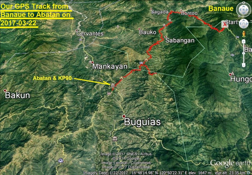 Za174 Battle of Abatan or KP90 map. -This is the big picture of where the Battle of Abatan or KP90 was carried out, thank you Google Earth. 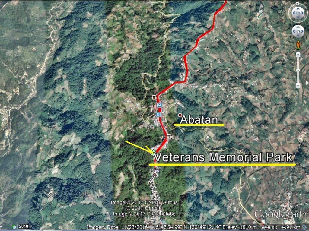 Za175 Battle of Abatan or KP90 map. -This Google Earth image of the Abatan and KO90 is zoomed in and shows a closer view of the Battle of Abatan and KP90 area. 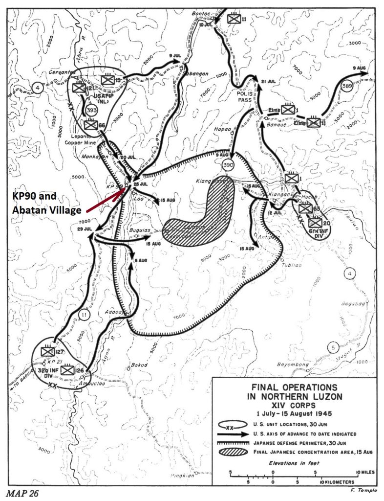 Za176 Battle of Abatan or KP90 map. -WWII history is always of great interest to me, it changed the world, it changed my life. A major battle occurred here and this map is from the publication: Triumph in the Philippines. 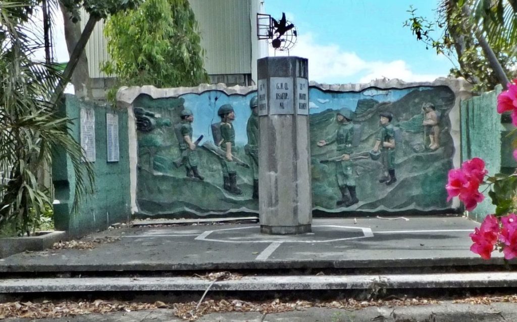 Za177. Veterans Memorial Park in Abatan -The Veteran Memorial Marker marks the liberation of Abatan and Buguias on July 27, 1945, that was fought between the Japanese Imperial Army and the combined Filipino and American ground troops. Through municipal council resolution No. 19, July 27, 1945 was declared as the Liberation Day and local holiday in the municipality. Festivals during this date include parades, programs and wreath-laying. The above was copied from Wikipedia: en.wikipedia.org/wiki/Buguias,_Benguet 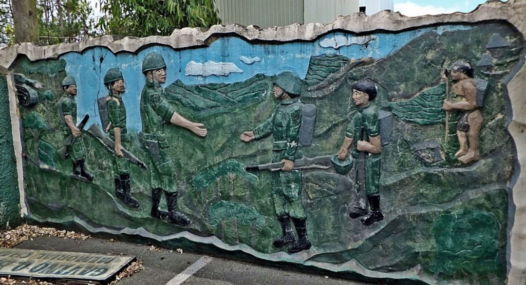 Za178. Veterans Memorial Park in Abatan -The Veteran Memorial Marker marks the liberation of Abatan and Buguias on July 27, 1945, that was fought between the Japanese Imperial Army and the combined Filipino and American ground troops, zoomed in. If you look close, the two main units are indicated on the shoulder patches, the 32nd Inf. Div. and the 66th Reg. The two forces meet at Abatan, KP90 left is the US Army 32nd Inf. Div. and right is the 66th Regiment of the USAFIP-NL and all the way at right are the local people represented who were very important in sustaining the 66th Reg. 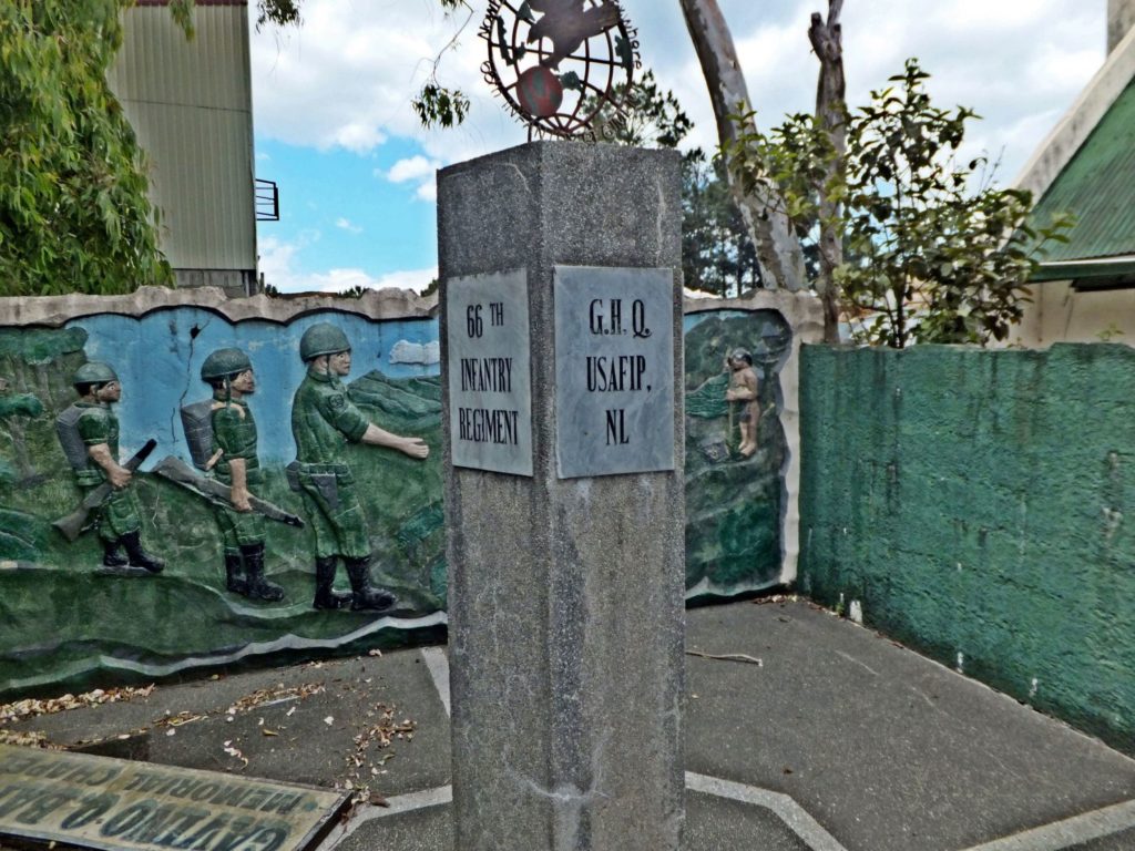 Za179. Veterans Memorial Park in Abatan hexagon memorial stand. -This hexagon memorial stand shows all five regiments of the U.S. Army Forces in the Philippines-North Luzon (USAFIP-NL) and the General Head Quarter (G.H.Q.). The 11th, 14th, 15th, 66th and the 121st are posted. 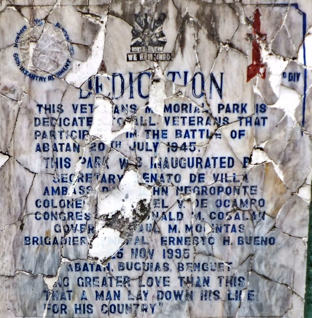 Za180. Veterans Memorial Park in Abatan Inauguration Plaque. -The inauguration plaque of the Battle of Abatan Veteran Memorial Marker, if I read it right it was inaugurated on the 25th Nov 1995. Notice the Red Arrow icon of the 32nd U.S. Inf. Div. which conquered the Villa Verde Trail. I recognize at least 3 VIPs: Secretary of Defense Renato de Villa, Ambassador John Negroponte and Col. de Ocampo who is a Filipino Hero. 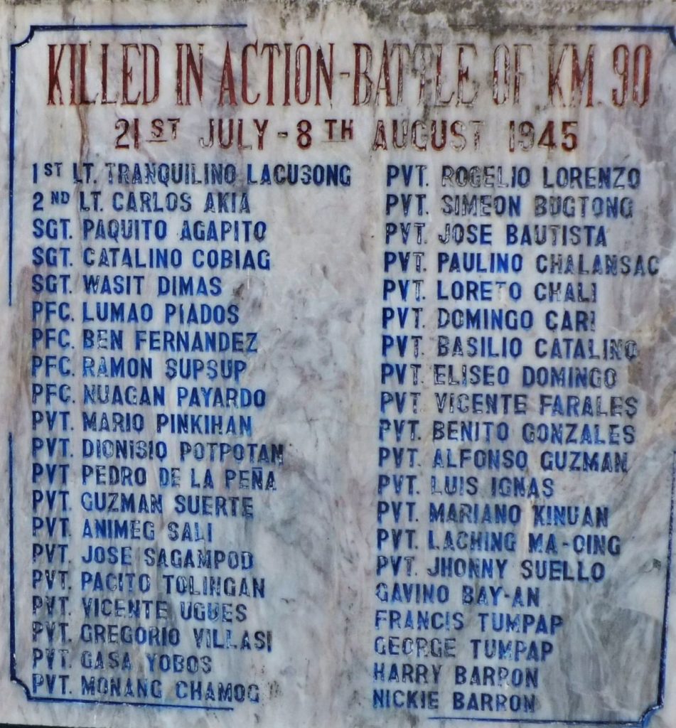 Za181. Veterans Memorial Park in Abatan Plaque with the names of the Fallen. -The plaque with the names of the fallen Heroes in the victorious Battle of Abatan and Kilometer Post #90 (KP90) from the 21st July to the 8th of Aug. 1945. We salute them! I wished, I take the time or someone else and we write these names in the forum so that they may show up at internet searches for their names. - |
|
|
|
Post by Karl Welteke on May 31, 2018 5:40:49 GMT 8
Revisit of Camp Spencer, Darigayos Cove, the USAFIP-NL HQ, 2018-01-26 In this thread are several entries about Camp Spencer, Darigayos Cove and the USAFIP-NL HQ. My friend and I put it on our itinerary to visit it again on our grand tour of North Luzon. Last time I was here I failed to take pictures of the gate area. Here are three images of the gate and once more the list of heroes who gave up their life in the hands of the Japanese. 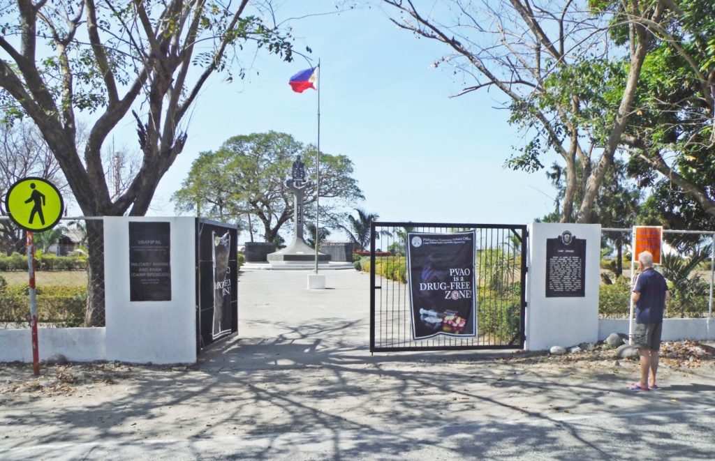 Zc110. The gate to Camp Spencer, Darigayos Cove and the USAFIP-NL HQ, 2018-01-26 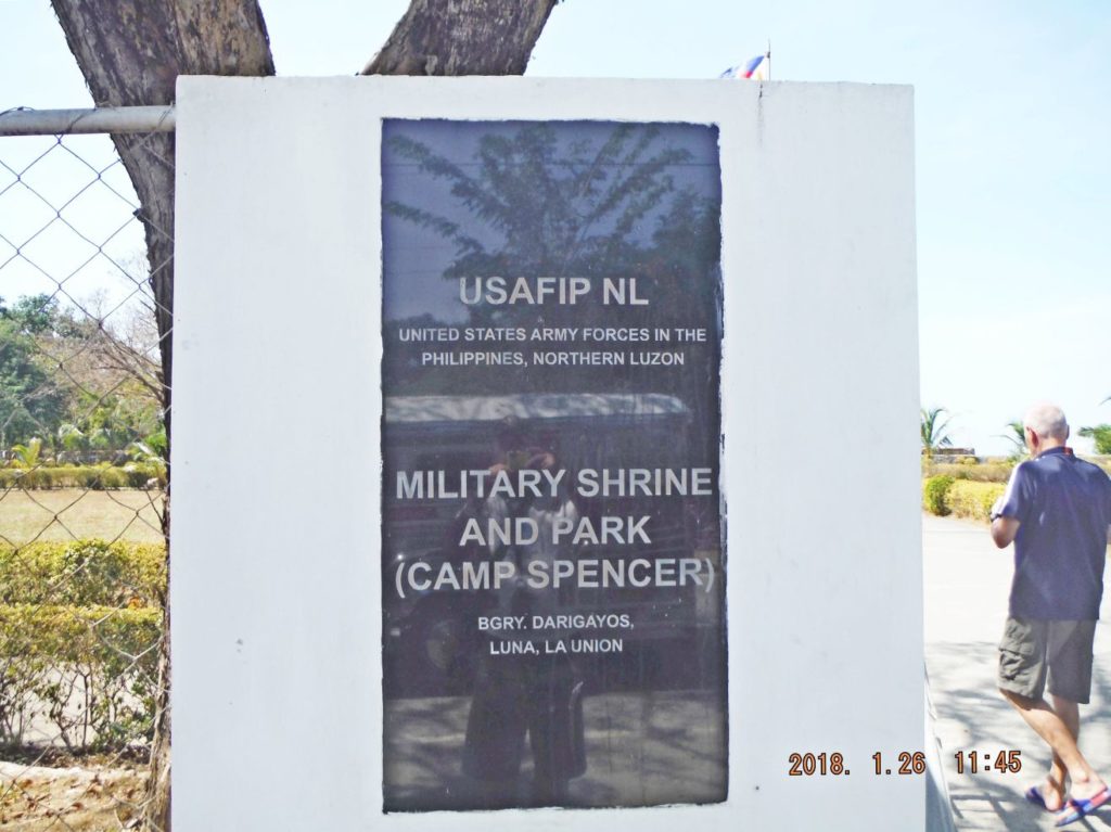 Zc111. USAFIP-NL stands for United States Army Forces in the Philippines-Northern Luzon and Camp Spencer became National Shrine and Park; it is located in Luna, La Union. 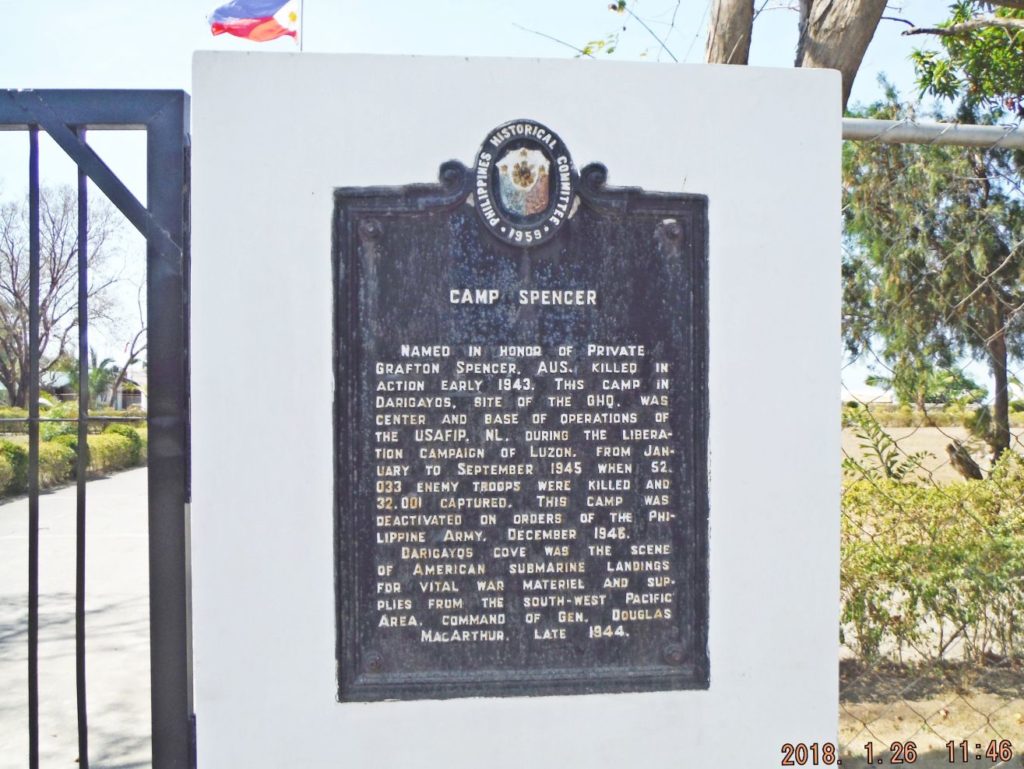 Zc112. The history of Camp Spenser and United States Army Forces in the Philippines-Northern Luzon, The Navy arrived here before Gen. MacArthur’s landing by submarine and by surface vessels after Gen. Mac’s landing. 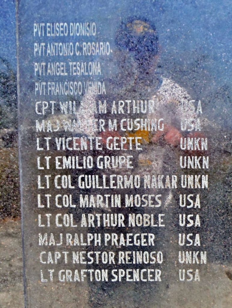 Zc113. The list of heroes, I believe all of them lost their lives in the hands of the Japanese after they were captured or caught as guerrillas. |
|
|
|
Post by Karl Welteke on Mar 24, 2022 19:30:38 GMT 8
This picture and paragraphs are copied from page 1 of this thread to remind our visitors that 2 links were corrected and brought back to life on page 1, this thread, that deals with the San Bernardino Strait and relatives of members of the forum helped set up coast watcher stations on the San Bernardino Strait. 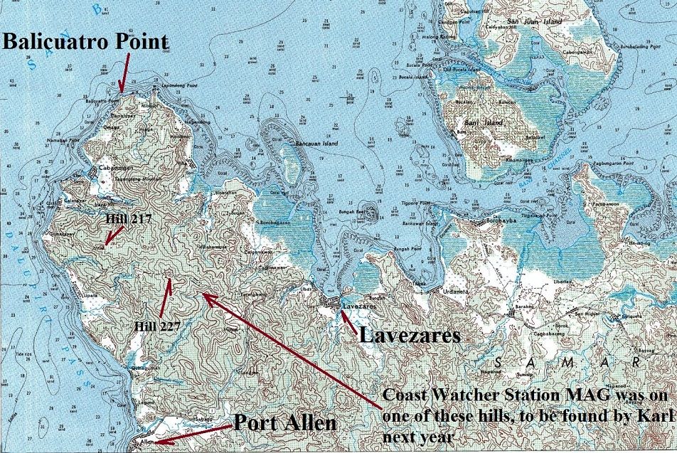 X633 is a section of an 1:50000 map of North Samar and shows Balicuatro Point, the Balicuatro Peninsular, its two main communities, Port Allen and Lavezares Town and Hills 217, 227 the highest elevations on the peninsula. Here is a personal angle A friend of ours, Louis Jurika, is the son of the well known guerrilla Tom Jurika. This year he gave a presentation at the General MacArthur Museum in Norfolk about the experience of his father and uncle as guerrillas in the Philippines during WWII. He made the transcription of his presentation available to this forum and it is posted here at this URL: corregidor.proboards.com/thread/1831/crossroads-history-crosshairs-enemyIt is titled: A Guerrilla Odyssey - Tom Jurika & Chick Parsons “At the Crossroads of History and in the Crosshairs of the Enemy.” Here is the main paragraph germane to the NW Samar Coast Watcher Station. It is located about half way down in that URL and is followed by a few more paragraphs about setting up this Coast Watcher Station MAG on NW Samar: In 1943 Tom Jurika was busy setting up coast watcher stations and many a rendezvous with incoming submarines, devising an efficient and easily-recognized signal system from guerrillas on shore that submarine skippers appreciated. After Tom had brought Cap and Charlotte Martin out of hiding and put them aboard the submarine Narwhal in November, 1943, at Butuan, Mindanao, he took on the mission of leading a guerrilla team from Mindanao all the way to the tip of northern Samar and strategic San Bernardino Straits. Here he would install a coast watcher named Gerald Chapman to monitor any Japanese merchant shipping or naval movements in this important passage through the Philippines between the Pacific Ocean and the South China Sea. It was Chapman who eventually reported the Japanese navy moving through the straits on their way to annihilation in what became known as “the Marianas Turkey Shoot”. On the previous map you can see that I call a small place nearby, home, some of the time. And indeed I have been in the neighborhood of both locations belonging to Coast Watcher Station MAG. I visited or passed thru Port Allen twice but it was before I know that this area played a role in WWII. The next time I go here, should be next year I will search for the footsteps of this WWII story. I like to share a few photos and maps of the area of the Balicuatro Point Peninsular. The higher resolution copies are in this album (5 images numbered D1 to D5): app.photobucket.com/u/PI-Sailor/a/31978bd1-7ac0-45ae-a849-60737ead879c Note from Karl: This link is active again as 24th March 2022! |
|
|
|
Post by Karl Welteke on Mar 28, 2022 13:03:48 GMT 8
Josefina “Joey” Guerrero: The Leper Spy of the Philippines There is so much to learn about the people who experienced WWII. It is a passion of mine to learn more. I never heard about this spy, this person, until a good friend of mine, a Filipino Flag Officer and graduate of the AMA West Point, sent me an email about her and said this: Hi Karl You might find this World War II story interesting. I did a copy-and-paste of a subscription article. Imagine -- the first FOREIGN LEPER allowed entering the USA! Ray And I learned a lot in the www about this Filipina Lady. The best coverage about this WWII story and person, I believe, is this WWII National WWII Museum at New Orleans story by Lea Schram von Haupt. I copied 4 pictures along with the texts. This is the URL of her article, click here: www.nationalww2museum.org/war/articles/philippines-spy-joey-guerreroSix images are provided! --------------------------------------------------------  Zf620. Josefina “Joey” Guerrero: The Leper Spy of the Philippines. A book has been written about her and it is available on Amazon and perhaps at other venues.  Zf621. Josefina “Joey” Guerrero, from Outcast to Spy to Outcast: The War Hero with Hansen’s Disease. This is a National WWII Museum at New Orleans image. Diagnosed with Hansen’s disease and unable to access medication in Japanese-occupied Philippines, Josefina Guerrero decided to join the guerrilla movement and become a spy. Her disease allowed her to move untouched by the Japanese, providing critical Intel to American forces as they moved towards the Battle of Manila. 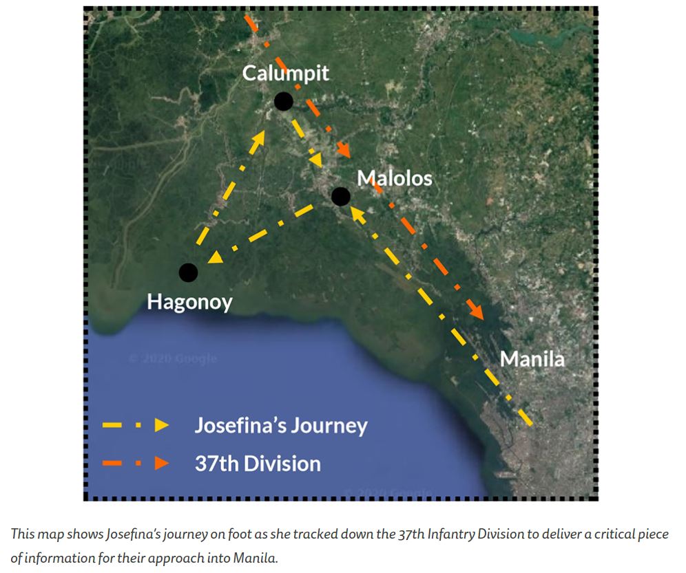 Zf622. Josefina “Joey” Guerrero, one of her outstanding feats as a guerrilla. This is a National WWII Museum at New Orleans image. Despite her paralyzing headaches and fatigue, she taped the map to her back and set off on foot. She walked 25 miles to the town of Malolos. Here, she took a boat around an active combat zone through the town of Hagonoy, outrunning river pirates. Back on land, she walked the remaining eight miles to her destination: Calumpit. Guerrero arrived only to discover that just three hours earlier, the American troops had already advanced to Malolos. She began walking once again, back to Malolos and eventually placed the map in the hands of Captain Blair of the 37th Infantry Division. 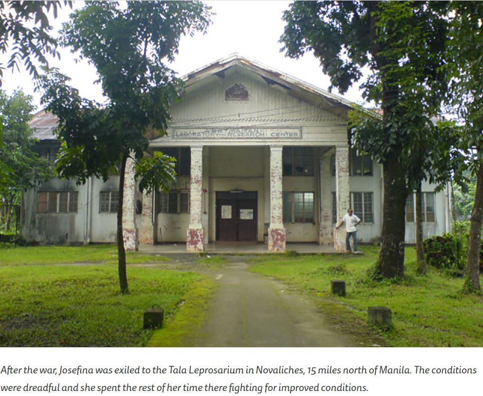 Zf623. The Tala Leprosarium in Novaliches, 15 miles north of Manila, where Josefina “Joey” Guerrero was admitted to. This is a National WWII Museum at New Orleans image. After the war ended, Guerrero’s disease made her an outcast once again. She was exiled to a leprosarium 15 miles northeast of Manila. The conditions were deplorable. Only four nurses tended to 650 patients. There were only 10 buildings on the grounds with a maximum capacity of 300 patients, and there was no running water or electricity. Most of the patients slept on the ground in unclean conditions. Every year, dozens of patients died from malnutrition. Guerrero set about cleaning the camp as much as she could, and became a teacher at the colony and built coffins for the deceased. She wrote a letter to a friend of a friend in San Francisco, describing the conditions of the leprosarium. Her letter found its way to the Catholic Chaplain at the National Leprosarium of the United States in Carville, Louisiana. As her letter was passed around, it caught the attention of the Manila Times. An above-the-fold exposé was written on the conditions at the colony. Other news sources caught on to the story and wrote their own pieces. Finally, the government sent investigators to the leprosarium and confirmed the conditions. New dormitories were built and the leprosarium received beds for both the dormitories and hospitals, so that all patients had somewhere to sleep. Food rations were improved, telephone service was installed for emergencies, and water stations were built. The campus was cleaned up and medical staff added. 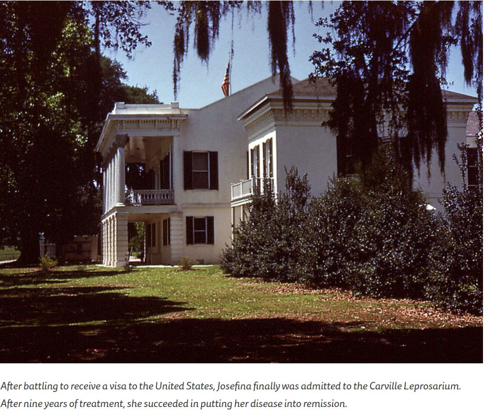 Zf624. The Carville Leprosarium, where Josefina “Joey” Guerrero was admitted to and healed. This is a National WWII Museum at New Orleans image. After hearing about the community at Carville, Louisiana and the medical breakthroughs being made in the United States, Guerrero felt hope about her condition for the first time. She fought to obtain the first American visa for a foreign national with Hansen’s disease. In 1948, Guerrero arrived in Carville. She was diagnosed with an “advanced” case and it took nine years of treatment to put her disease into arrest. She continued to fight publicly against the maltreatment and discrimination of people with Hansen’s disease. Over the years, she prepared herself for freedom from the walls of the leprosarium. Finally, in April of 1957, she was discharged from Carville. |
|
|
|
Post by Karl Welteke on Mar 20, 2023 19:06:12 GMT 8
Bessang Pass Battle Monument, 2023, Mar. 13th I’m attracted to history and geography and visited the monument now the 3rd time and generated these pictures. Wikipedia says this about this monument: The Bessang Pass Natural Monument is a protected area and memorial that commemorates the victory on June 14, 1945, by Filipino soldiers serving the U.S. Army Forces in the Philippines Northern Luzon (USAFIP-NL) over the Imperial Japanese Army in the Battle of Bessang Pass which led to Japan's eventual surrender and end to World War II in the Philippines. The best description of this part of the WWII is found in this URL: www.ibiblio.org/hyperwar/USA/USA-P-PI/USA-P-PI-28.htmlIf you are interested, I uploaded 23 images to Photobucket, Bessang Pass, Philippine Historical Places No 1, app.photobucket.com/u/PI-Sailor/a/1870e52a-8a37-41dc-8a36-e04359b15fb0?field=TITLE&desc=ascFor this Forum presentation I chose these 12 images, the picture numbers refer to all 23 images in the Photobucket album. ------------------------------------- -# 00 pic. Is an overall view of the Bessang Pass Battle Monument. 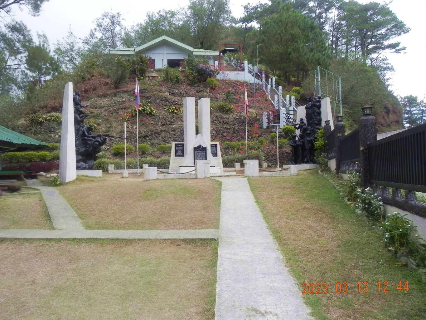 ------------------------------------------------------------ -# 01 & # 02 pics are maps of the Bessang Pass Battle area. 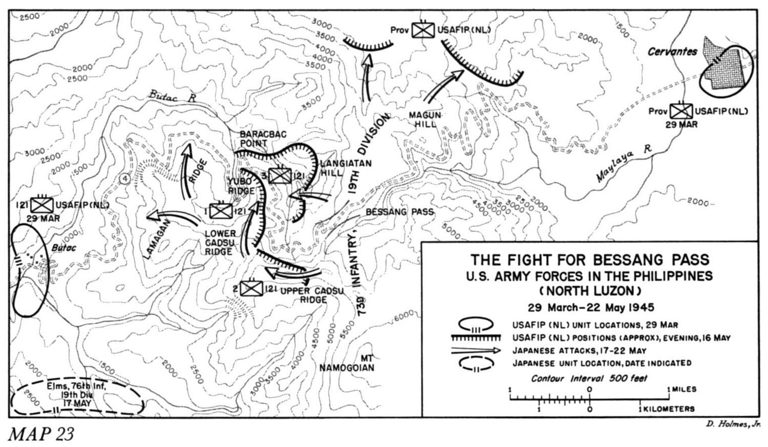 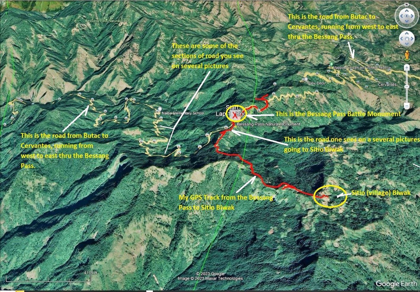 -------------------------------------------------------- -# 05 to # 08 pics are over-views of the general area around the Bessang Pass Battle Monument and of highway # 205 going passed it and thru the Bessang Pass. 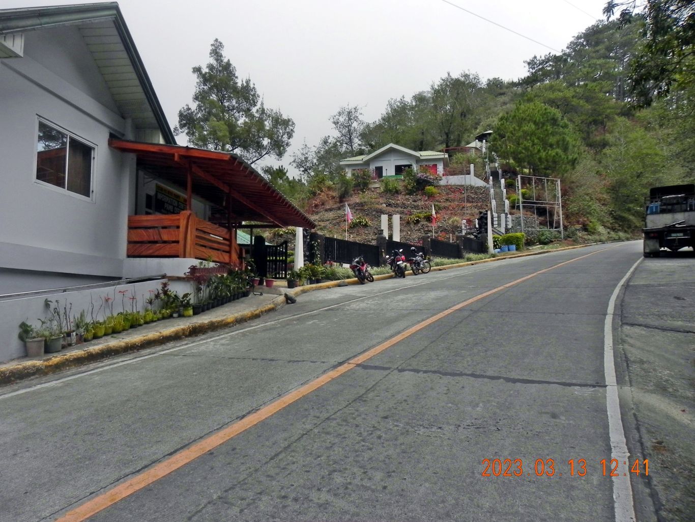 ----------------------------------------------- -# 09 to # 14 are pictures of the actual Bessang Pass Battle Monument. 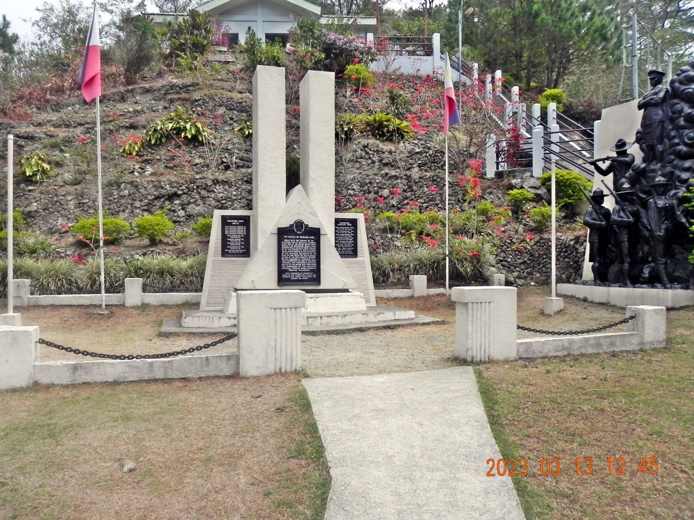 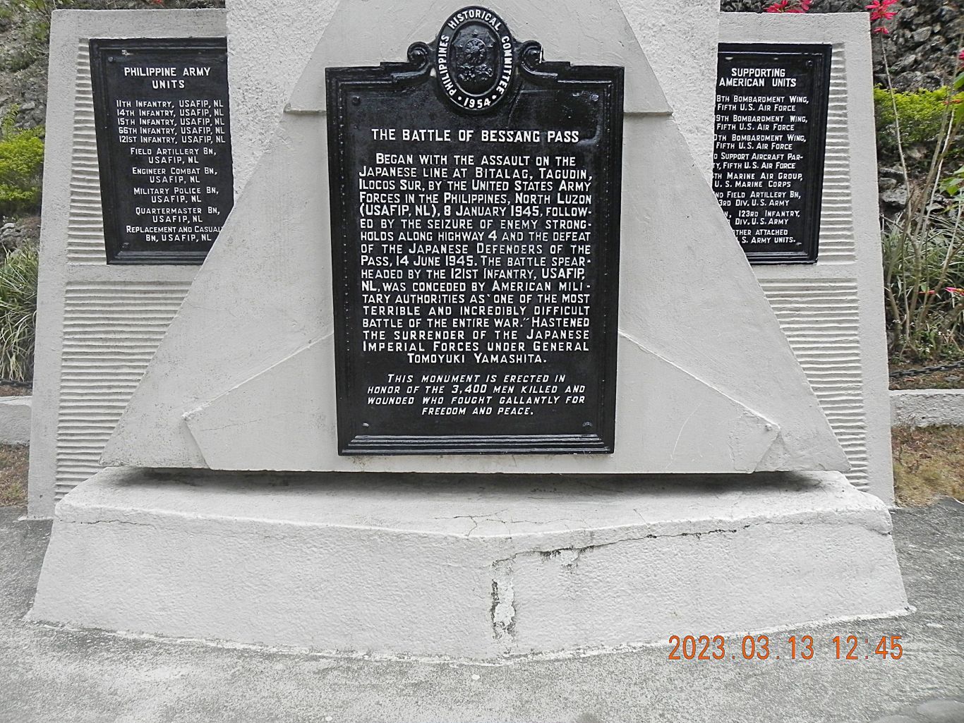 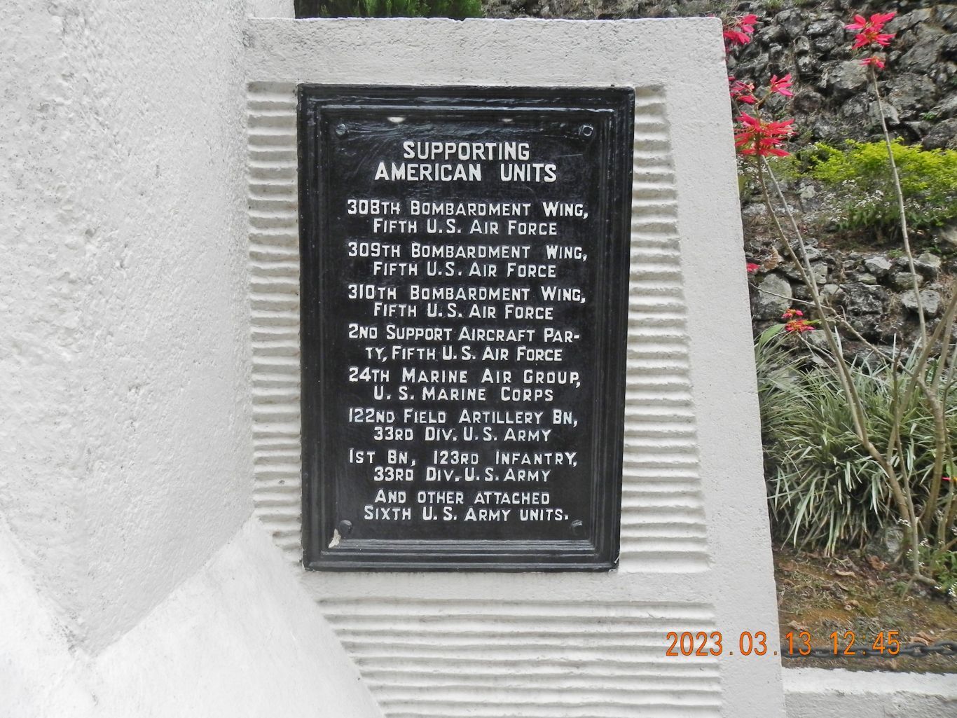 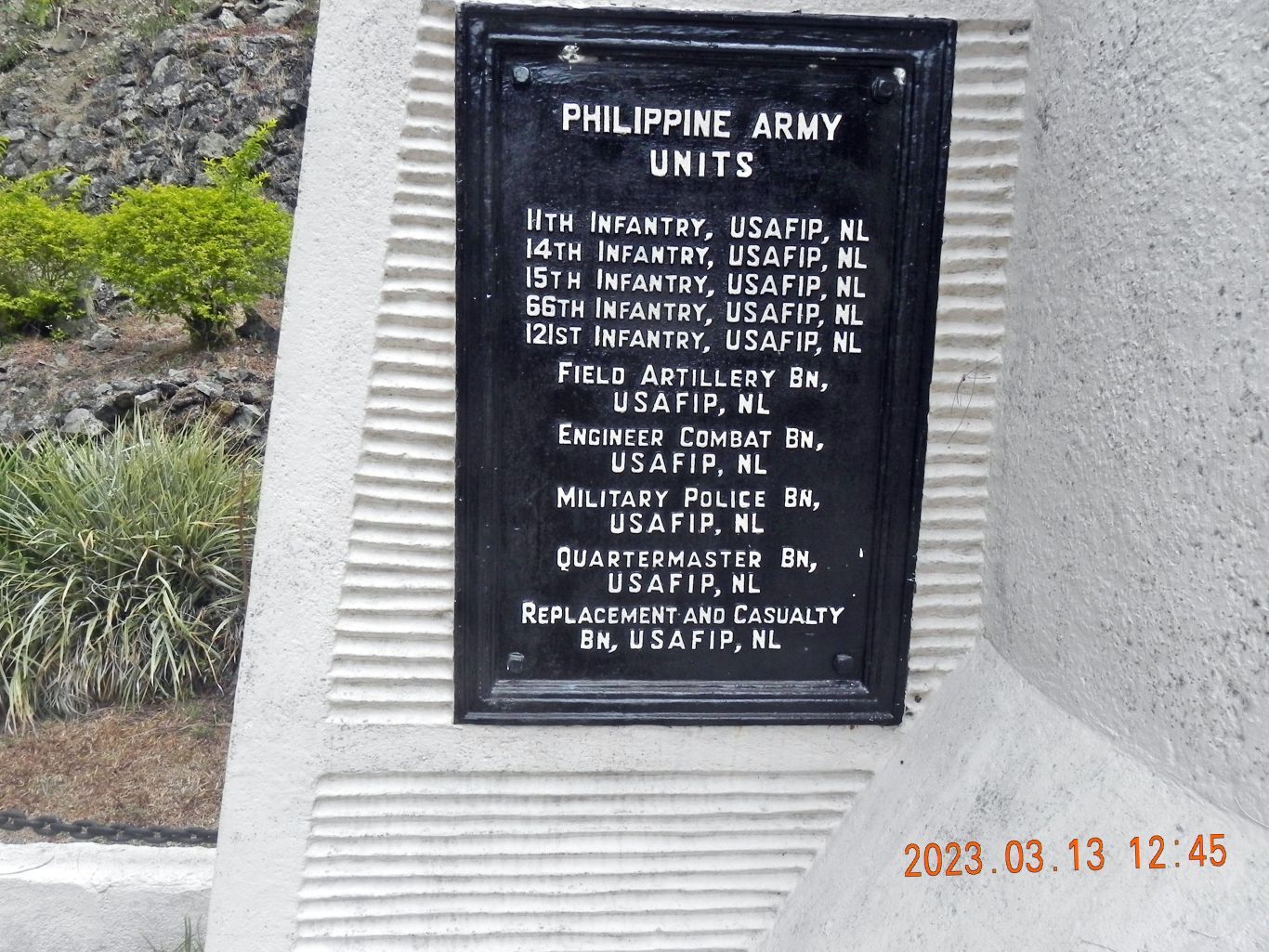 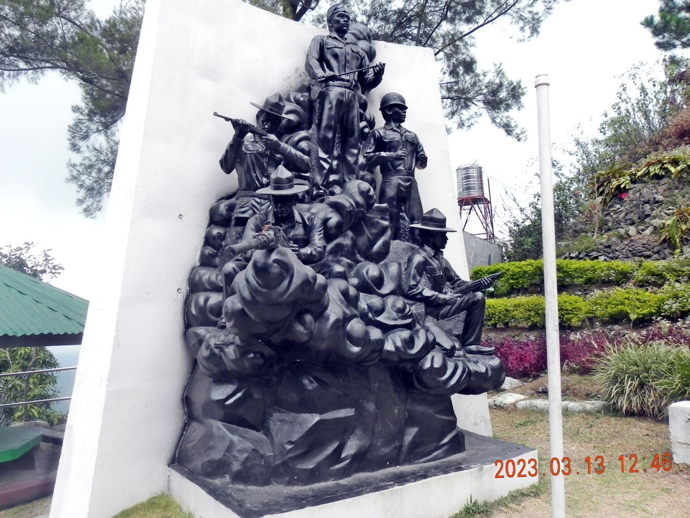 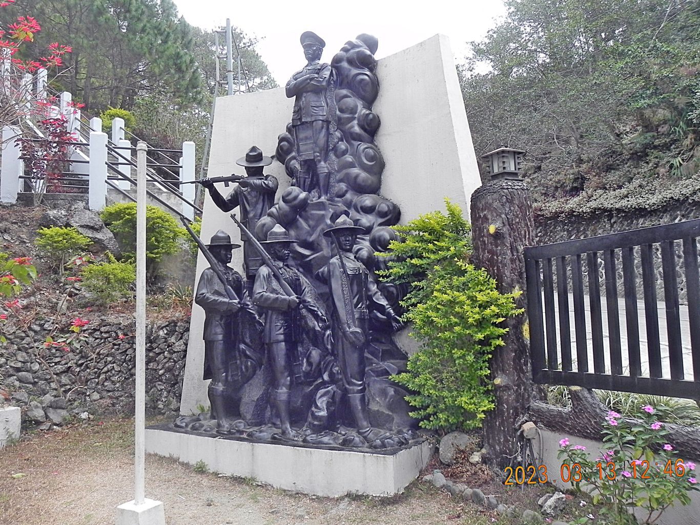 ------------------------------------------------- -# 15 & # 16 are pics of Highway #205 as it approaches the Bessang Pass Battle Monument from the west; note the clouds, the Filipino Soldiers had to fight often in this condition, wet and cold and in very steep mountain ridges and ravines. 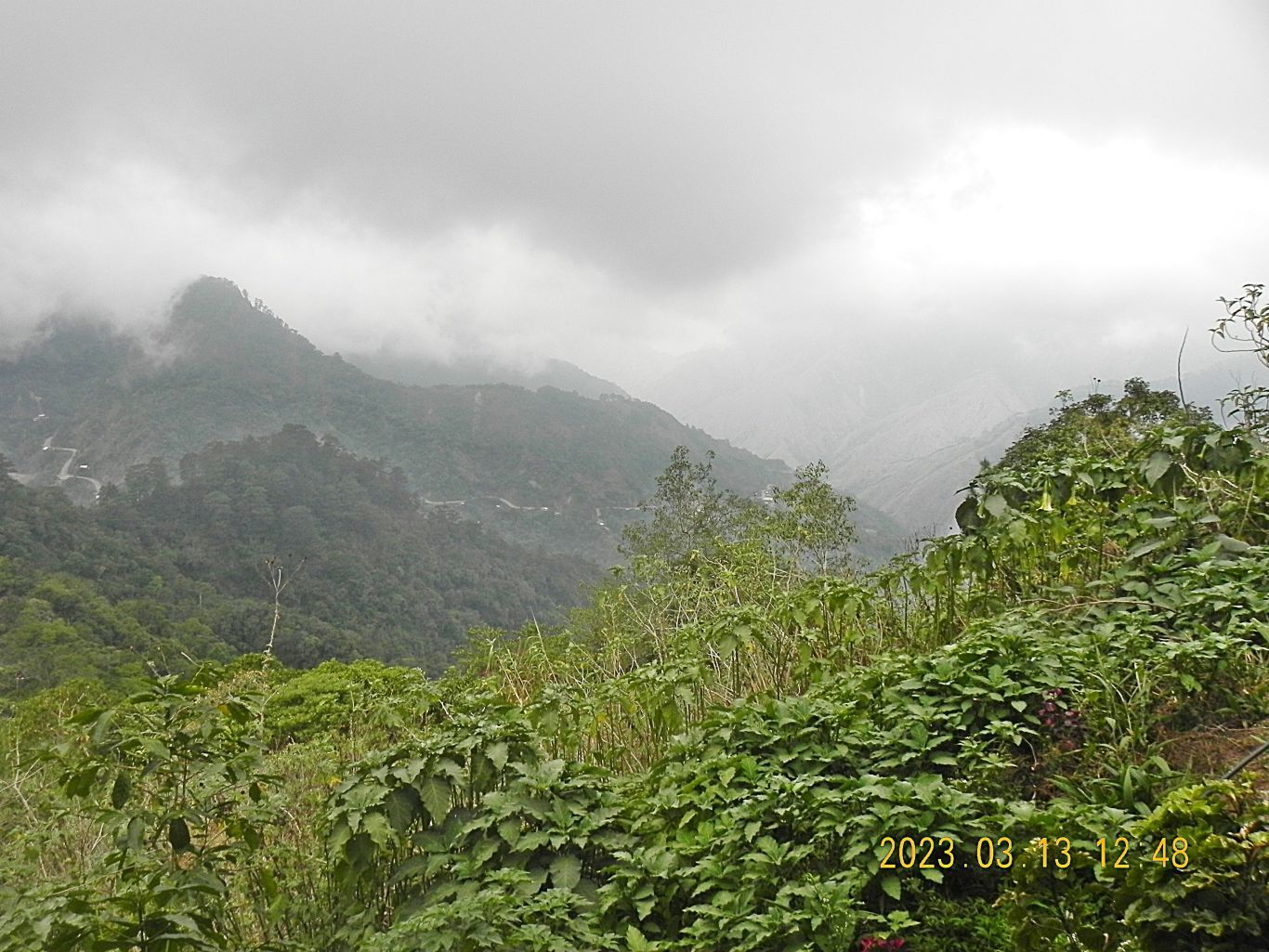 ----------------------------------------- -# 17 to # 22 are pictures of various views of the Bessang Pass Battle Monument or views from it. 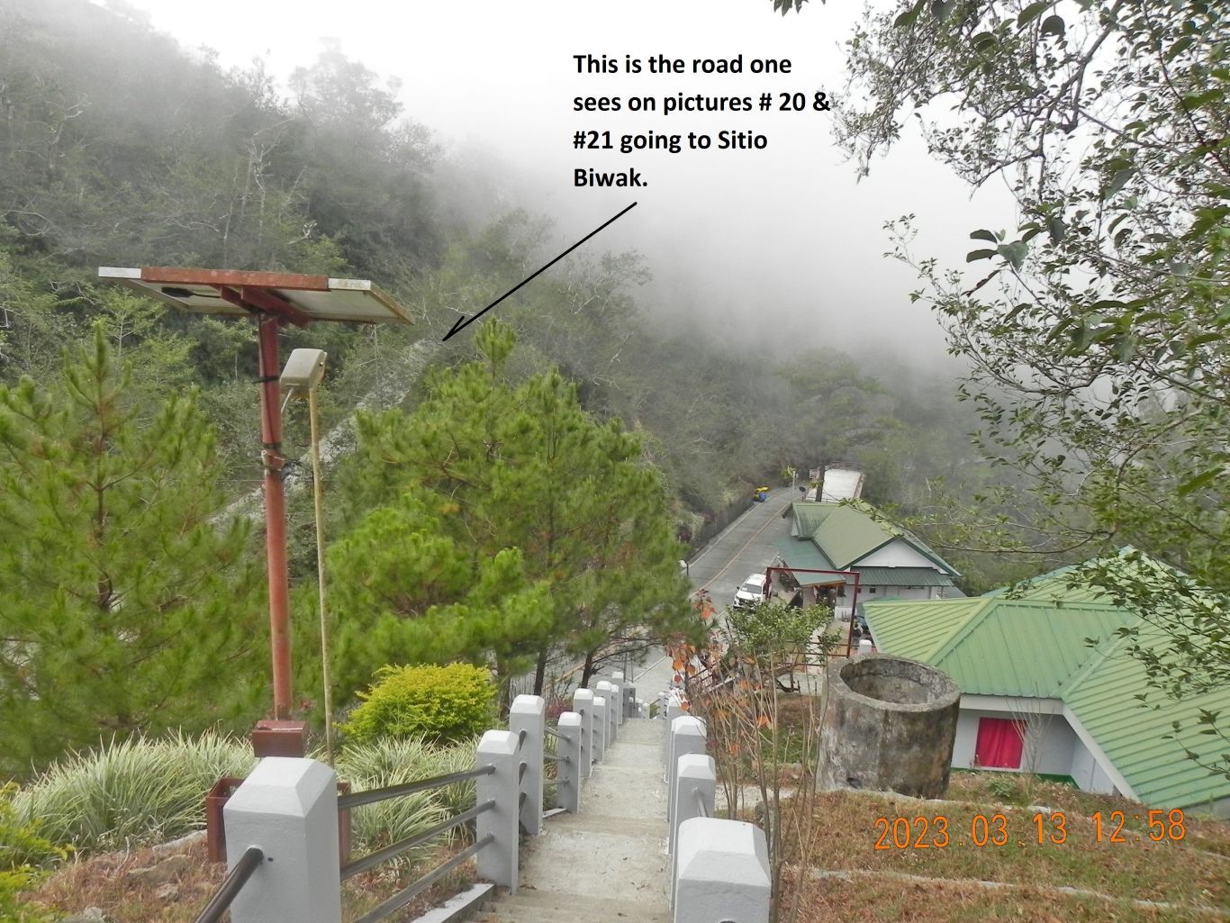 |
|
|
|
Post by Karl Welteke on Mar 21, 2023 18:31:07 GMT 8
Bitalag Road Junction Historical Marker, 12th March 2023 As I made my plans to visit the Bessang Pass Battle Fields area I became aware of the Bitalag Historical Marker. nhcphistoricsites.blogspot.com/2021/09/the-bitalag-road-junction.html I visited it and took these pictures. THIS ROAD JUNCTION WHICH SERVED AS VITAL JAPANESE OUTPOST, WAS ASSAULTED BY ELEMENTS OF THE 121ST INFANTRY, USAFIP NL, ON 8 JANUARY 1945 AND WAS CAPTURED FOUR DAYS LATER. THE SIEGE OF BITALAG WAS THE INITIAL ACTION IN THE GREAT BATTLE FOR BESSANG PASS, FARTHER TO THE EAST, WHOSE CAPTURE ON 14 JUNE 1945 HASTENED THE SURRENDER OF THE JAPANESE IMPERIAL FORCES IN THE PHILIPPINES. All the WWII Guerrilla Forces in the Philippines fascinate me; they are part of the Philippine and American History. Wikipedia says this about the USAFIP-NL: en.wikipedia.org/wiki/United_States_Army_Forces_in_the_Philippines_%E2%80%93_Northern_LuzonThe United States Army Forces in the Philippines – Northern Luzon or United States Armed Forces in the Philippines – Northern Luzon (USAFIP-NL) (Tagalog: Sandatahang Lakas ng Estados Unidos sa Pilipinas - Hilagang Luzon (SLEUP-HL)/Hukbong Sandatahan ng Estados Unidos sa Pilipinas - Hilagang Luzon (HSEUP-HL) Ilocano: Fuerza Armada ti Estados Unidos iti Filipinas - Amianan ti Luzon (FAEUF-AL)) was the military and guerrilla organization active in the Philippines after the Japanese occupation. It was made up of United States Army and Philippine Army soldiers, reservists and civilian volunteers. It was active from January 1, 1942 to June 30, 1946 and commanded by Col. Moses, followed by Russell W. Volckmann.[2]: 119–121 Following the Japanese occupation of the Philippines through the campaign to liberate the country, the military and guerrilla operations from the units of USAFIP-NL operated in Northern Luzon, including the some provinces in Ilocos Norte, Ilocos Sur, La Union, Abra, Mountain Province, Cagayan, Isabela and Nueva Vizcaya. ------------------------------- 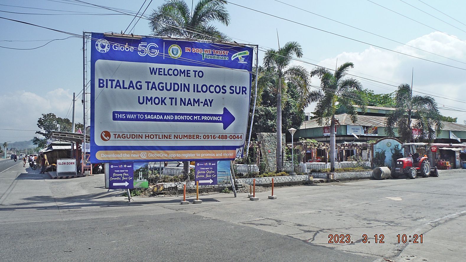 -#00 is the Bitalag Road Junction. ----------------------------- 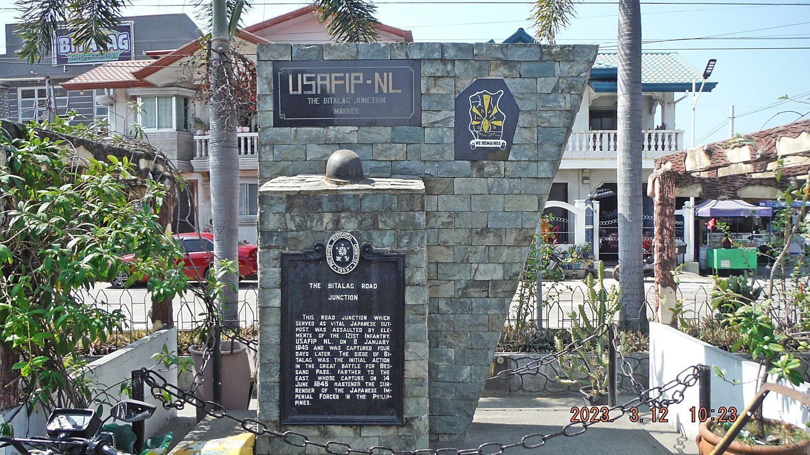 -#01 is the USAFIP-NL Bitalag Road Junction Marker. ------------------------------- 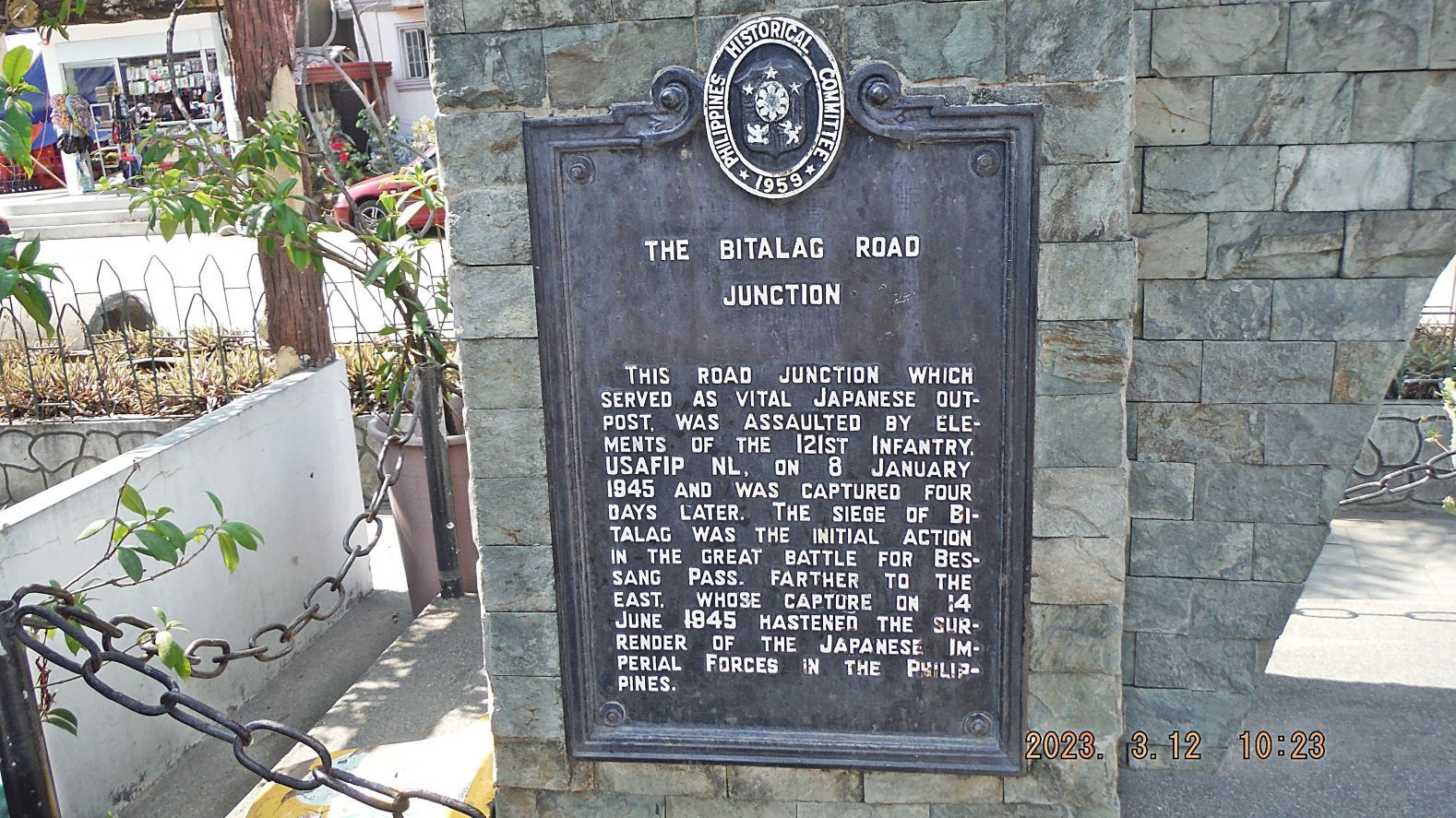 -#02 is the USAFIP-NL Bitalag Road Junction Marker, zoomed in! 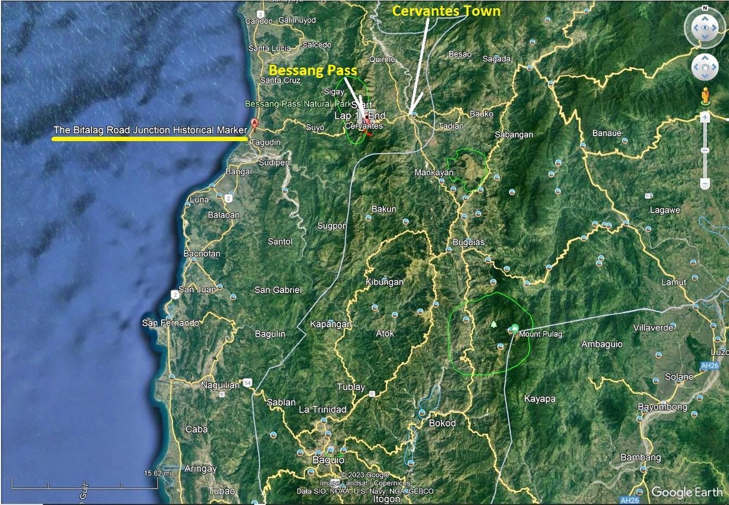 -#03 is the Google Earth image showing the location of the USAFIP-NL Bitalag Road Junction Marker. ------------------------------------------- 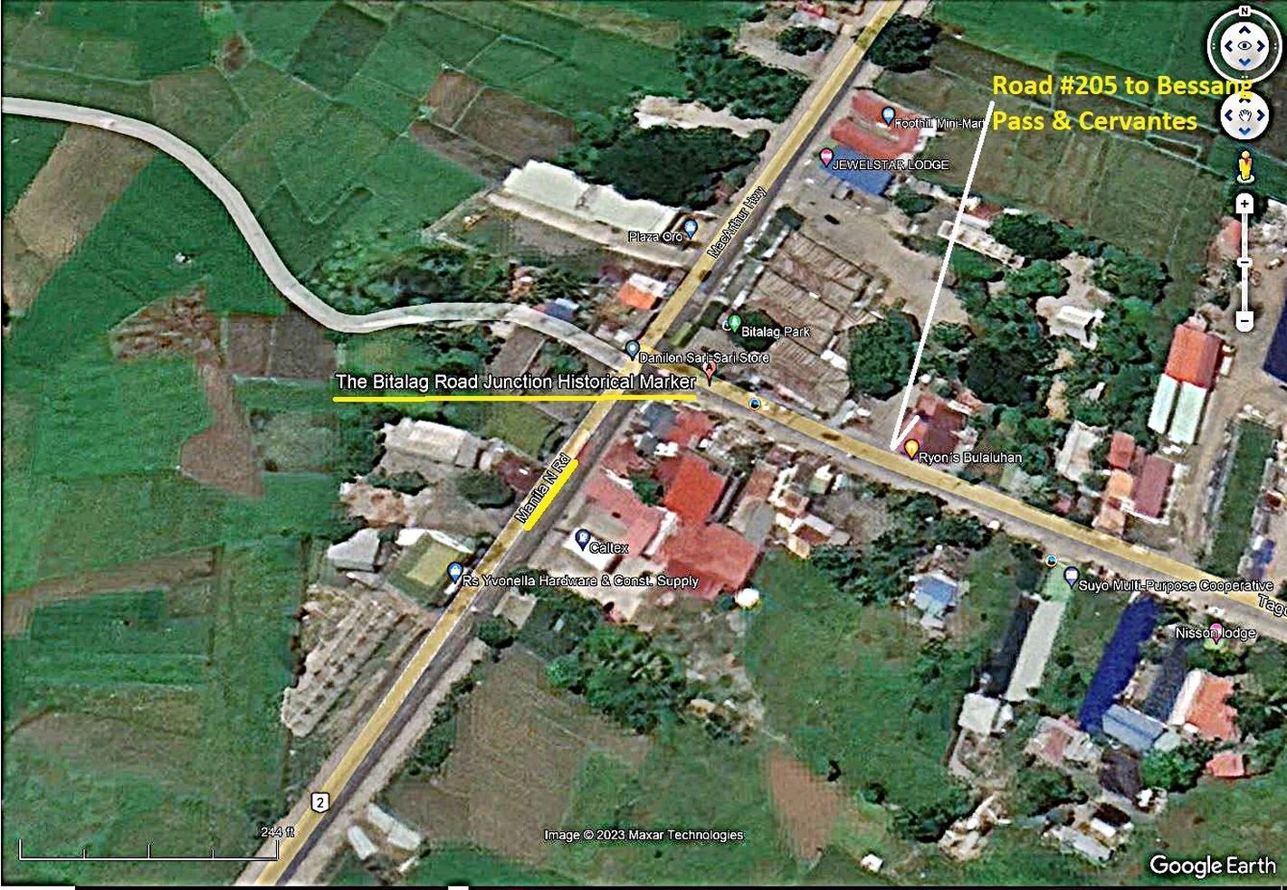 -#04 is the Google Earth image showing the location of the USAFIP-NL Bitalag Road Junction Marker, zoomed in! ---------------------------------------------- 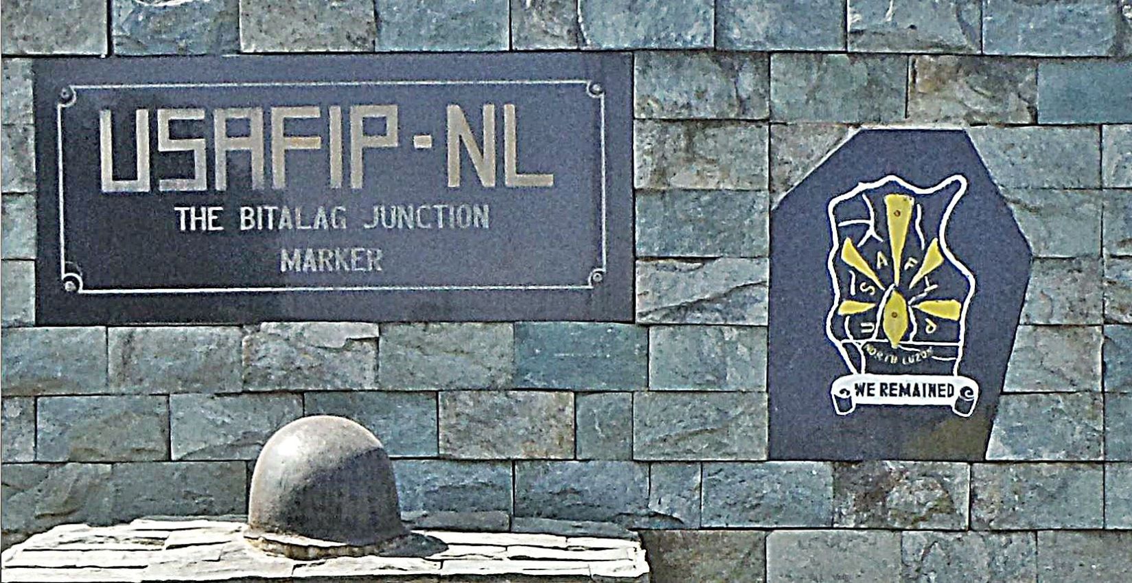 -#05 is the USAFIP-NL Bitalag Road Junction Marker, zoomed in! -------------------------------------------- 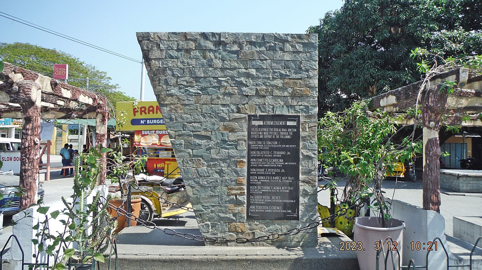 -#06 is the USAFIP-NL Bitalag Road Junction Marker from the road side. Apparently it was relocated in recent years. -------------------------------------------- 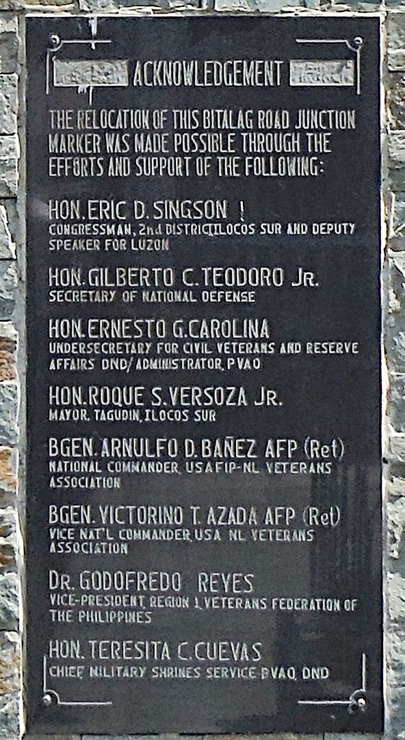 -#07 is the USAFIP-NL Bitalag Road Junction Marker from the road side. Apparently it was relocated in recent years zoomed in! ----------------------------------------------------- 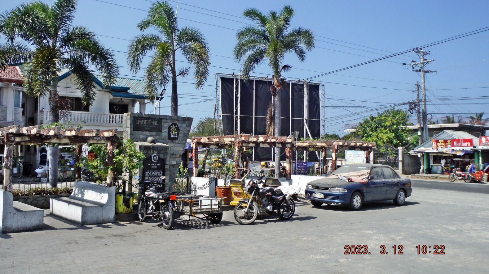 -#08 is the USAFIP-NL Bitalag Road Junction Marker from the park or open seat plaza type area. This would be in the NE corner of the road junction. -------------------------------------------------- If you are interested, they are also posted in this Flickr album in high resolution: www.flickr.com/photos/44567569@N00/albums/72177720306893128 |
|
|
|
Post by Karl Welteke on Mar 23, 2023 13:48:14 GMT 8
Bessang Pass Tunnels exploration 13th March 2023 On this date I parked my car at the Bessang Pass Monument and walked to the tunnels nearby. I thought this is an important WWII battle site, took these pictures and post them here. If interested, I posted all 56 images in my Photobucket account: app.photobucket.com/u/PI-Sailor/a/40addfc9-369b-4282-a977-17f1a9822461?field=TITLE&desc=ascWhen the album opens, click on the first picture or the one you would like to view, then click the icon “i” and that will open the title and description of the image or images. For this Forum presentation I chose these 25 pics; the numbers of the images refer to the 56 images in the Photobucket album. -------------------------------------------------- -#00 image is a 2016 image of this sign of tunnels near the Bessang Pass Monument. I did not explore the tunnels then but this sign motivated me to return. This sign was gone in 2023. 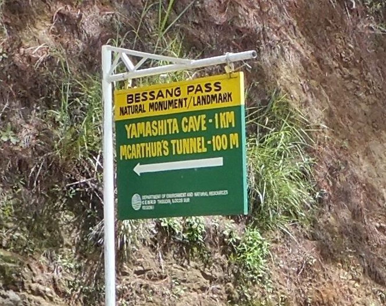
------------------------------------------------------ -#01 to #03 images are Google Earth images to show you the location of the Bessang Pass Monument and the locations of the tunnels. I also had walked to the sitio (village) Biwak. But this presentation is only about the walk to the tunnel area. 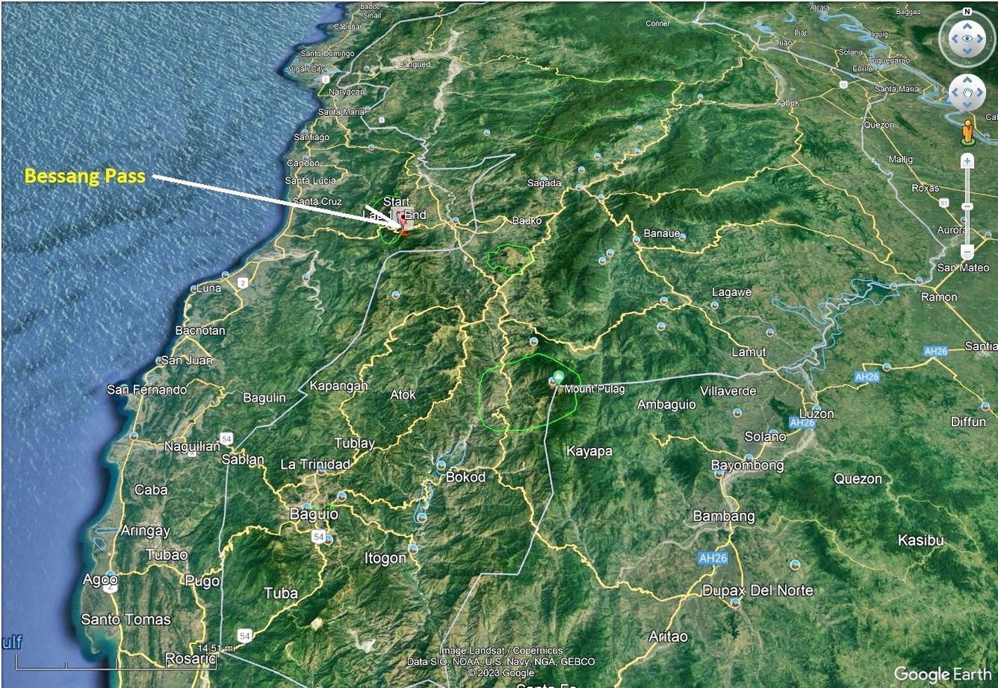 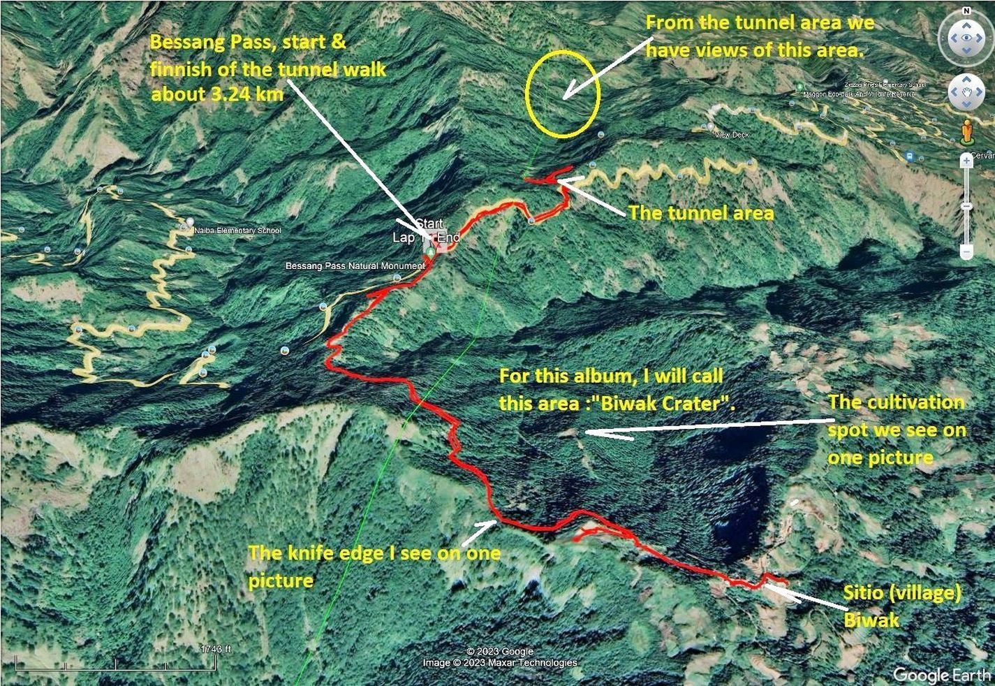 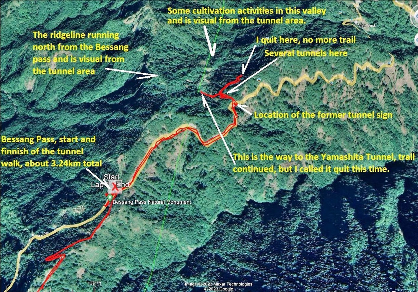 ------------------------------------------------------- -#04 to #22 are images of my walk from the Bessang Pass Monument down and east for about 1.6 km to the trail to the tunnels and where the 2016 sign for the tunnels used to be, only the post remains now. The images include, views of the former highway #4 (WWII name then) now the National Road #205. There are many pine trees on either side of the road. We also have glimpses of leaving the pass, of rims of what I call the Sitio Biwak Crater, the crater itself and views towards the Abra River Valley around the Cervantes Town. 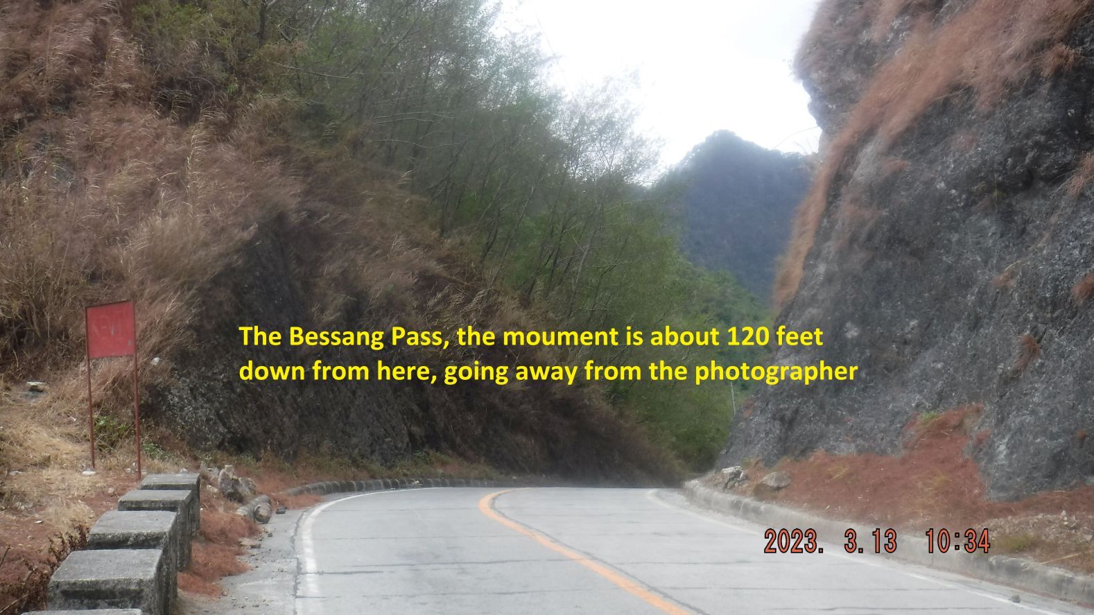 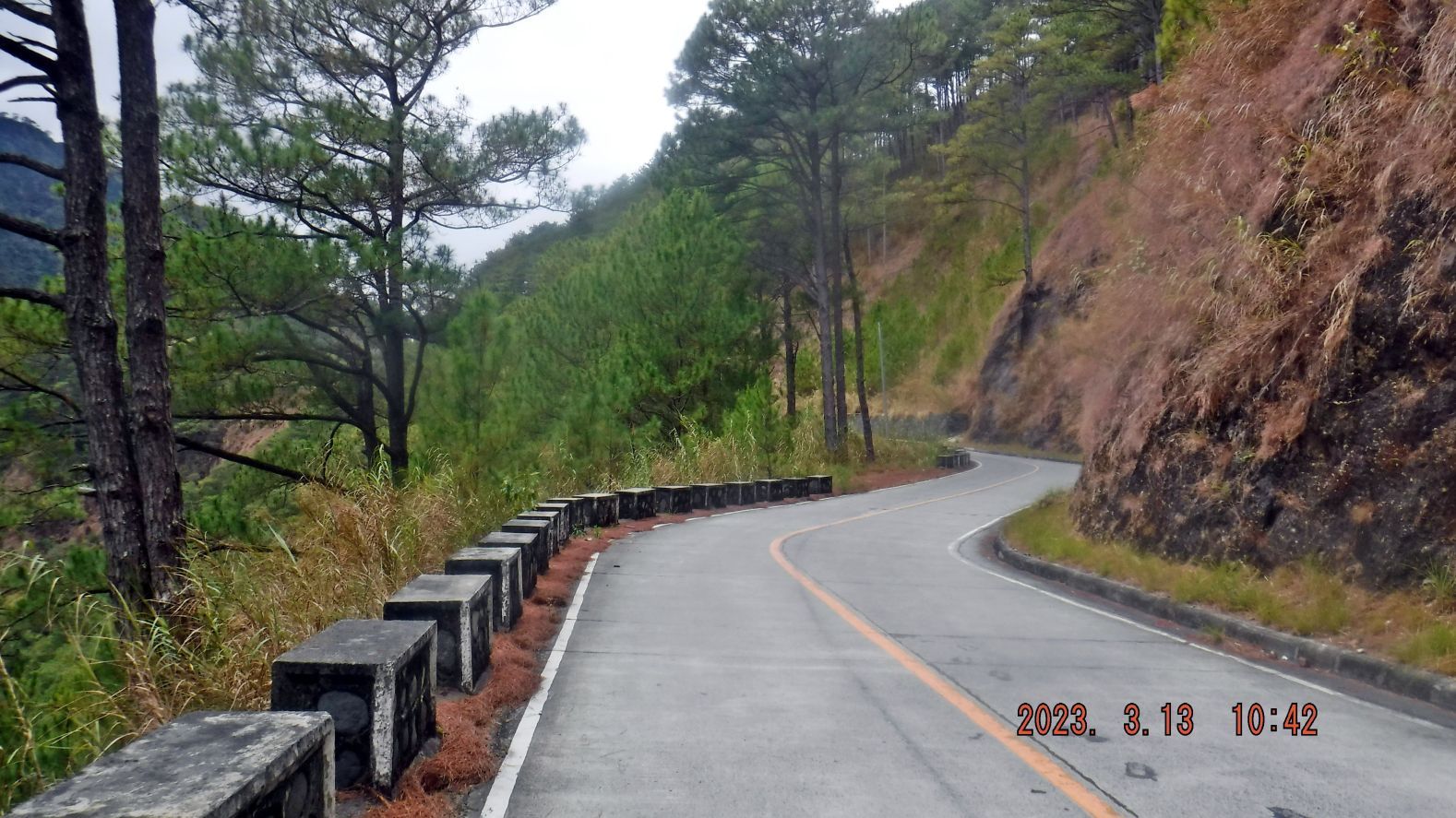 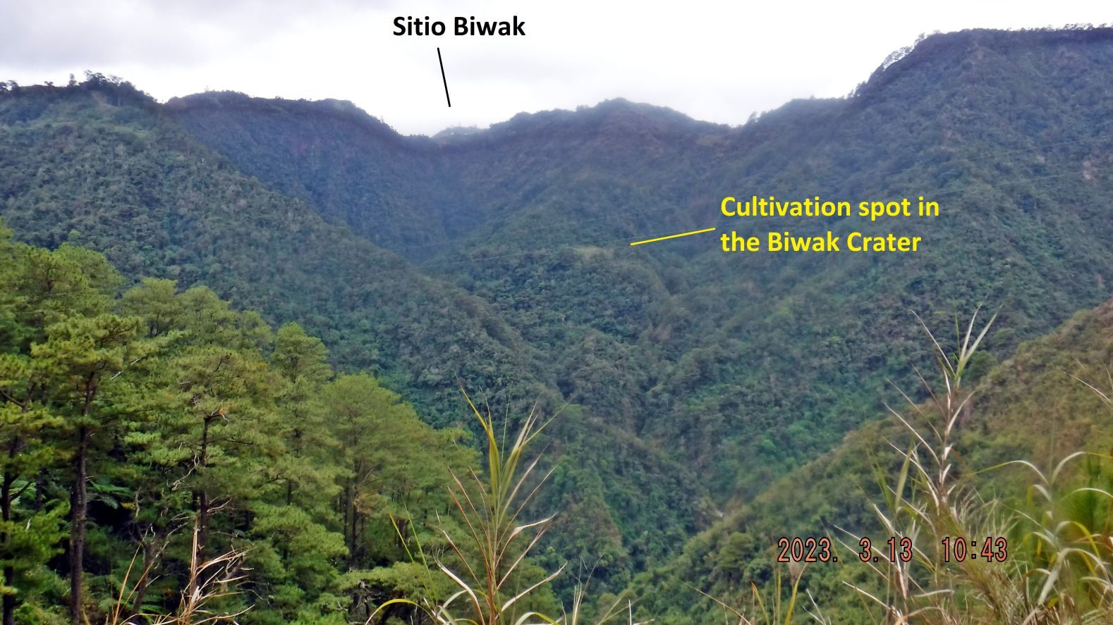 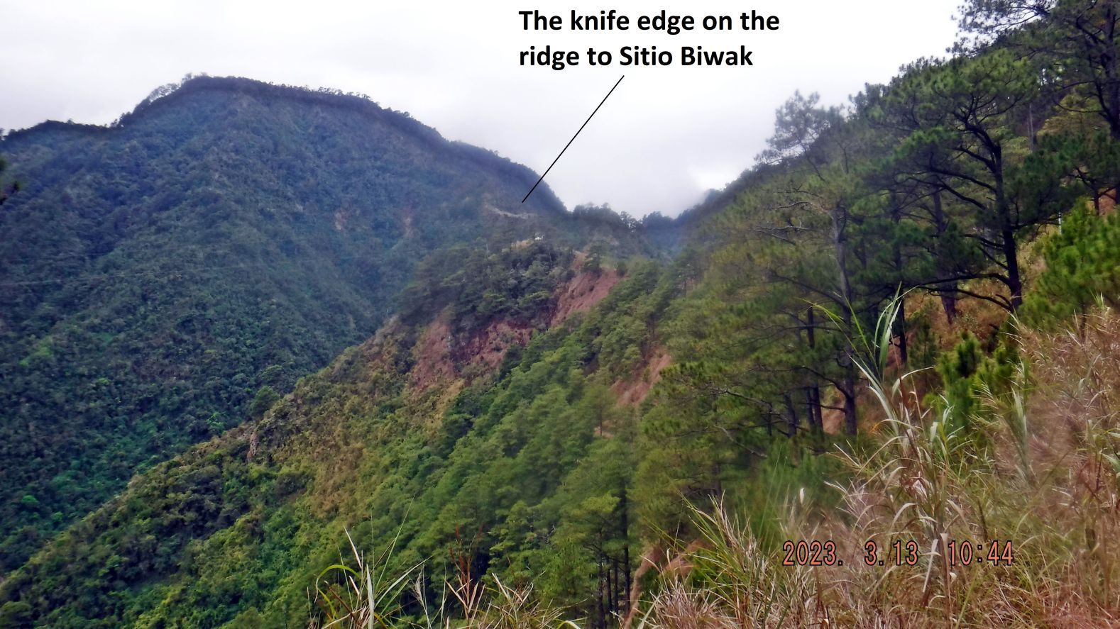 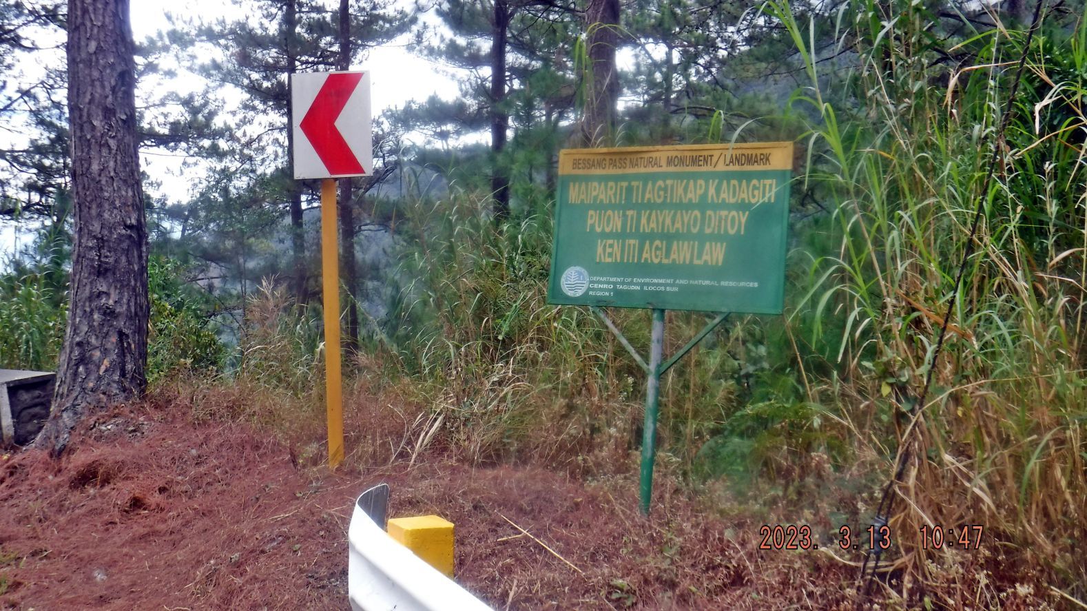 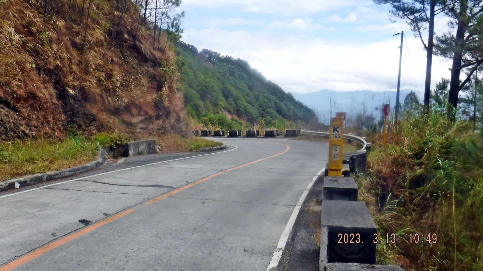 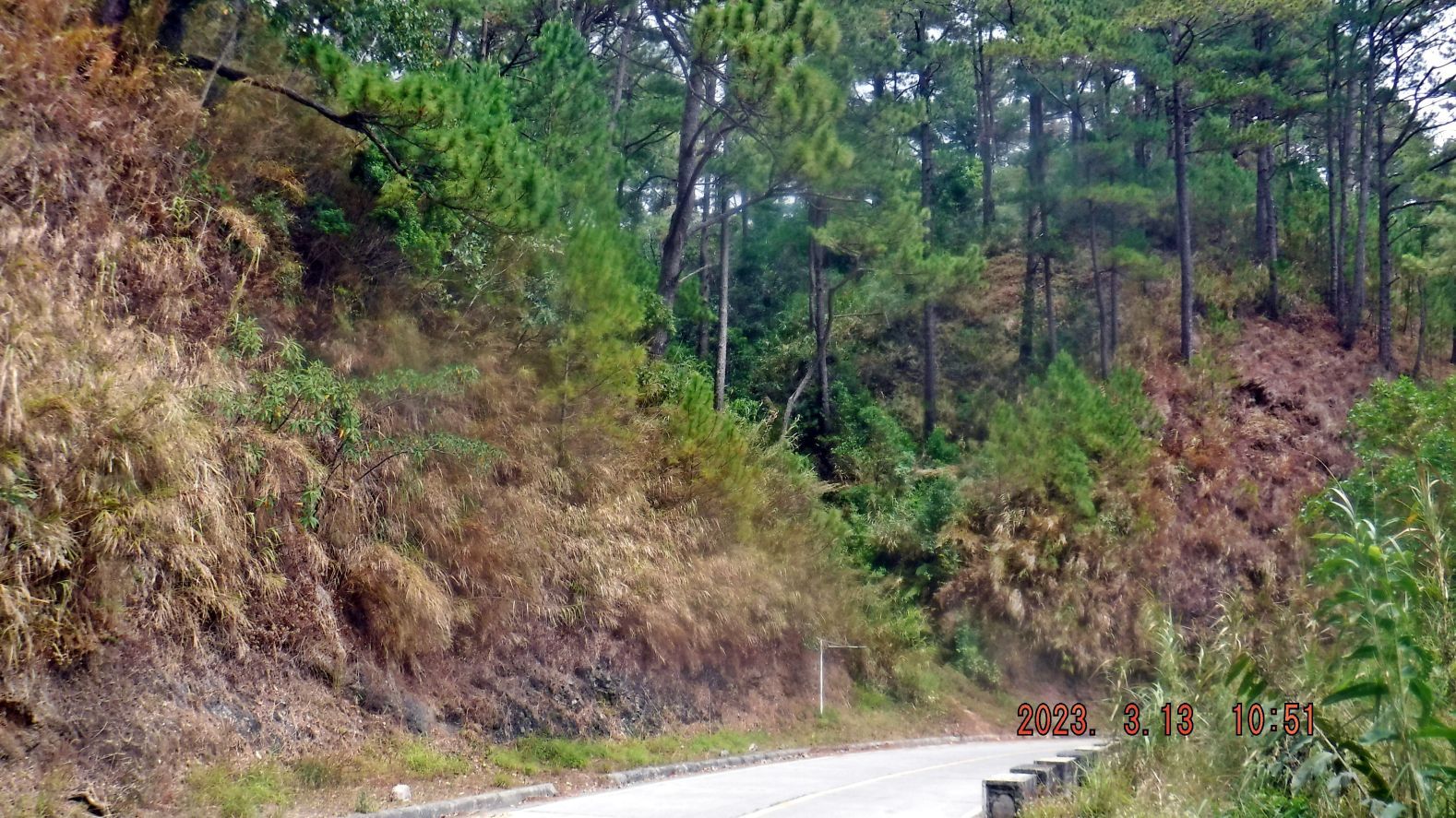 ---------------------------------------------------------------------- 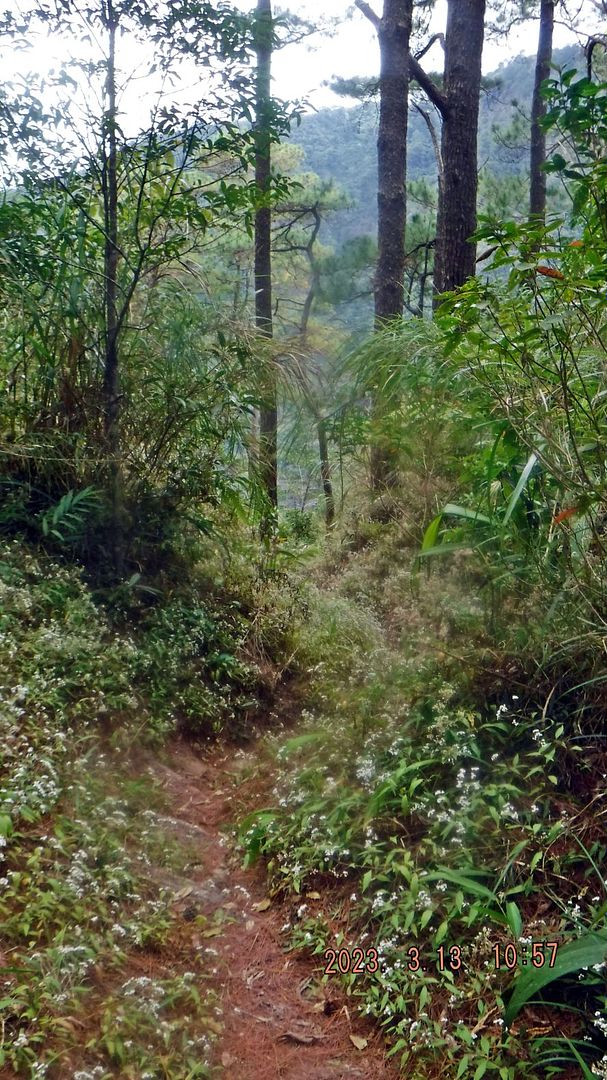 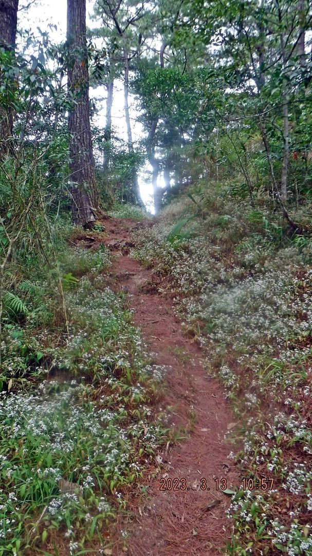 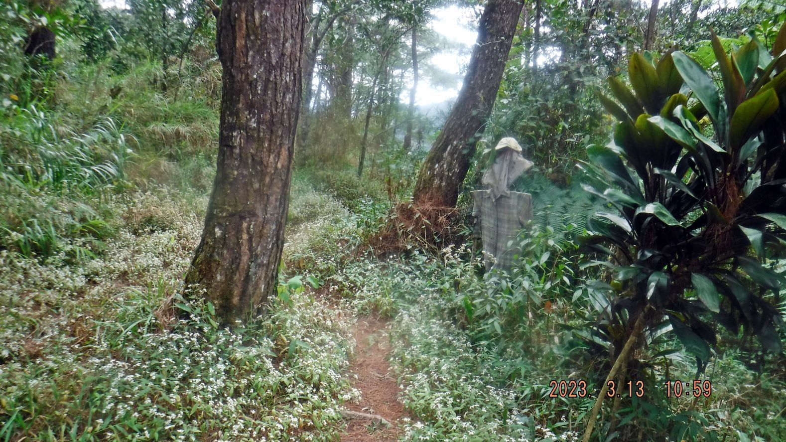  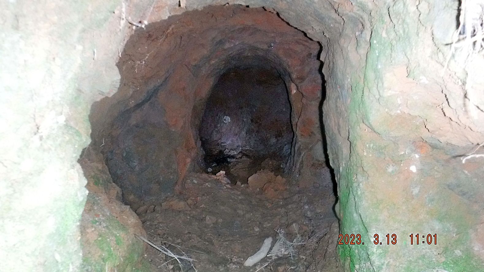 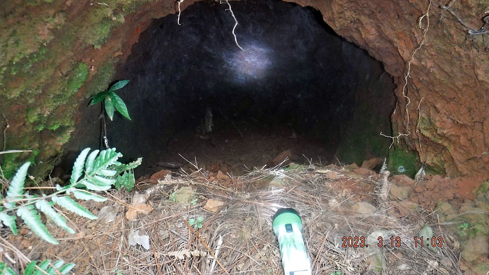 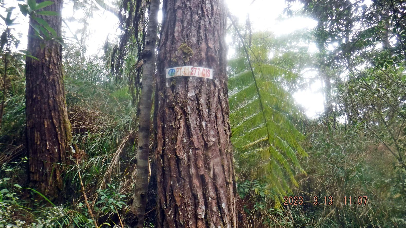 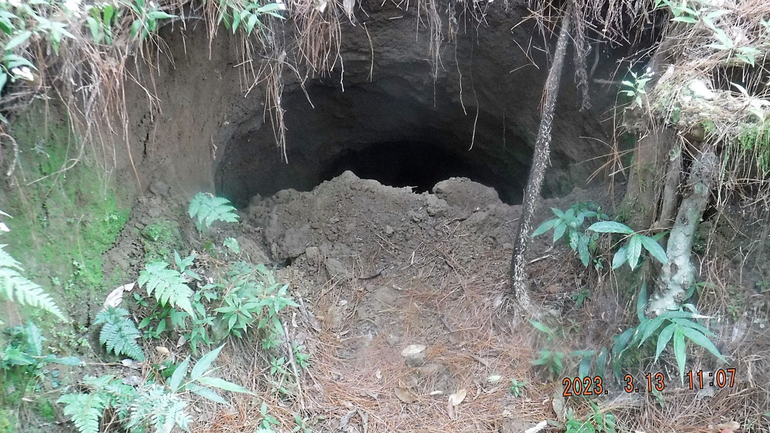 ----------------------------------------------------------------------- -#36 to #45 are images of the tunnel area in the saddle, there is a sign to the Yamashita Tunnel but these pictures are of my walk in the north direction. I didn’t find anymore tunnels; the trail faded and forced me to turn back. Down, thru the bushes, west, down to the valley I saw signs of cultivation. #45 image is of a square hole in the ground, about 4 feet by 4 feet and 5 feet deep, not too far from the Yamashita sign in the saddle area. 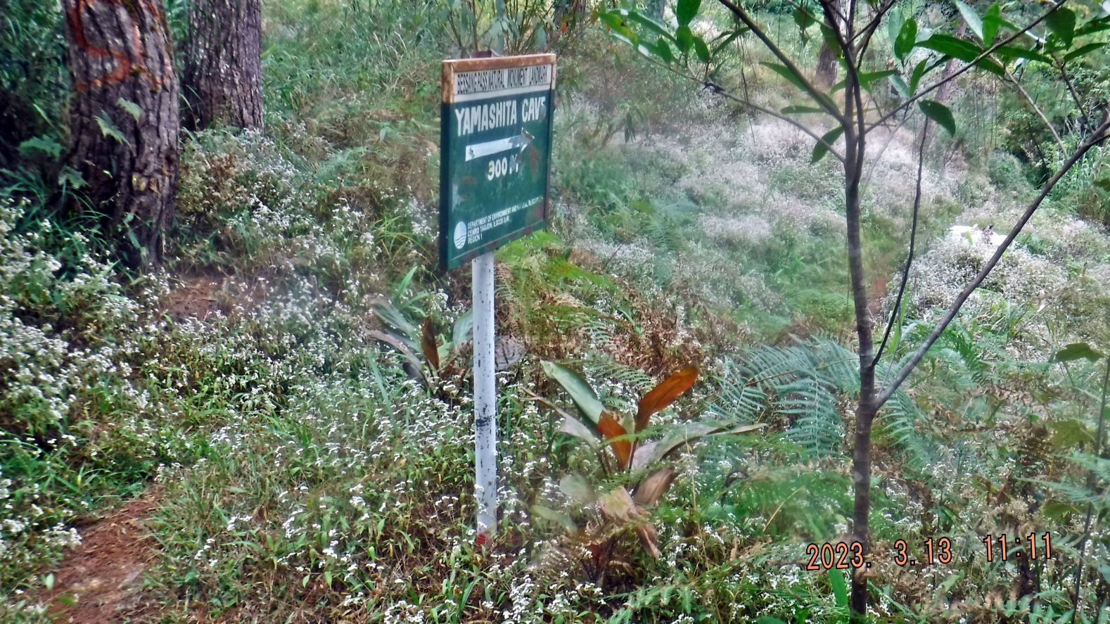 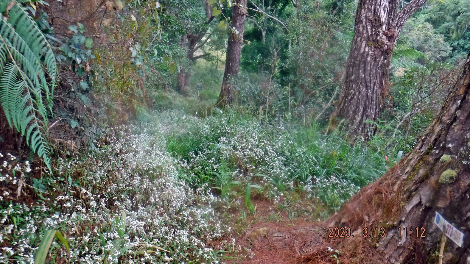 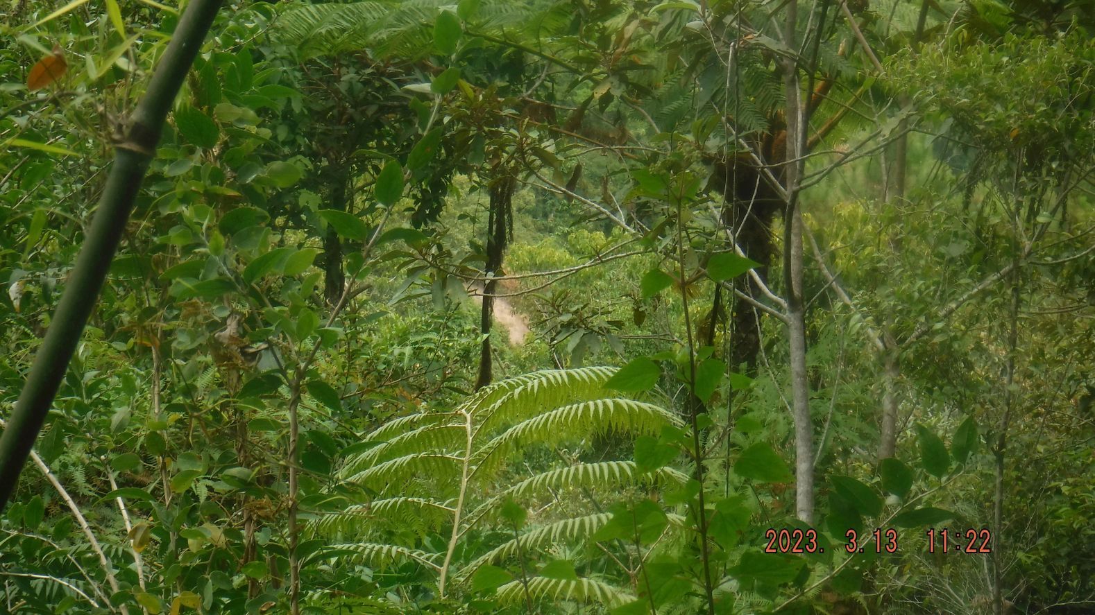 -------------------------------------------------------- -#46 to #54 are images of my walk in the direction of the Yamashita sign, which is in a west direction towards the ridge that runs north from the Bessang Pass, it is a used trail not only for the Yamashita tunnel but also this area is being cultivated. I decided not to go all the way to the Yamashita tunnel; I had walked enough and still have to walk back to the pass. From this trail I had views towards the north into the west side of the Abra River Valley. 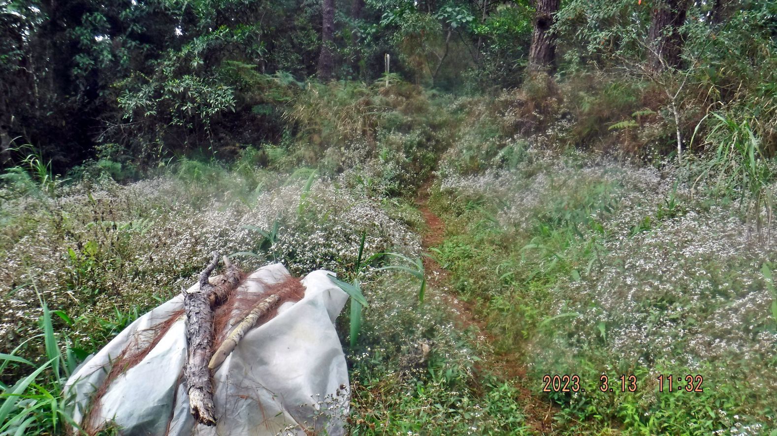 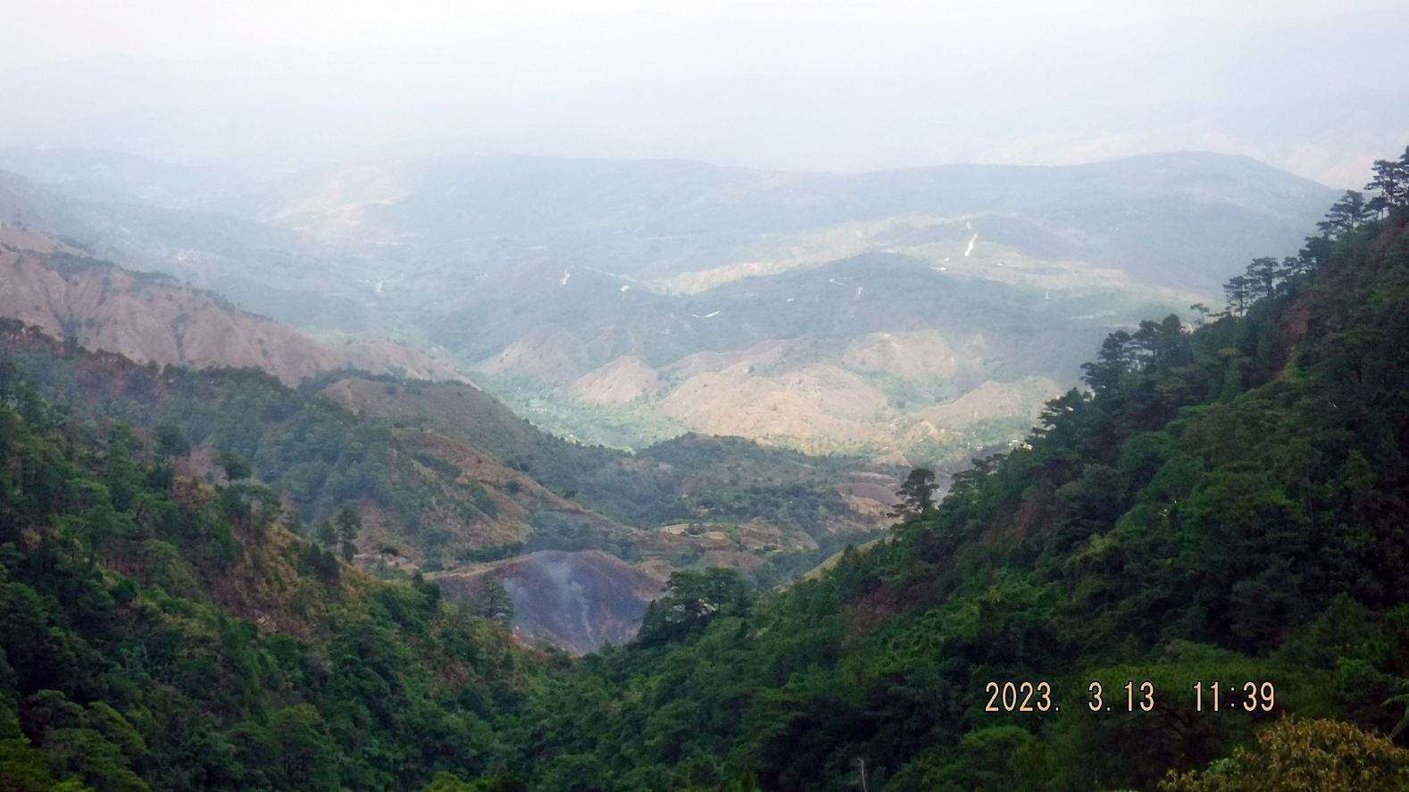 ------------------------------------------------------- -#55 image is the last picture and it shows the start of the trail to the tunnels at and near the Bessang Pass Monument. This was in the WWII battle area of the pass. The sign is now gone! 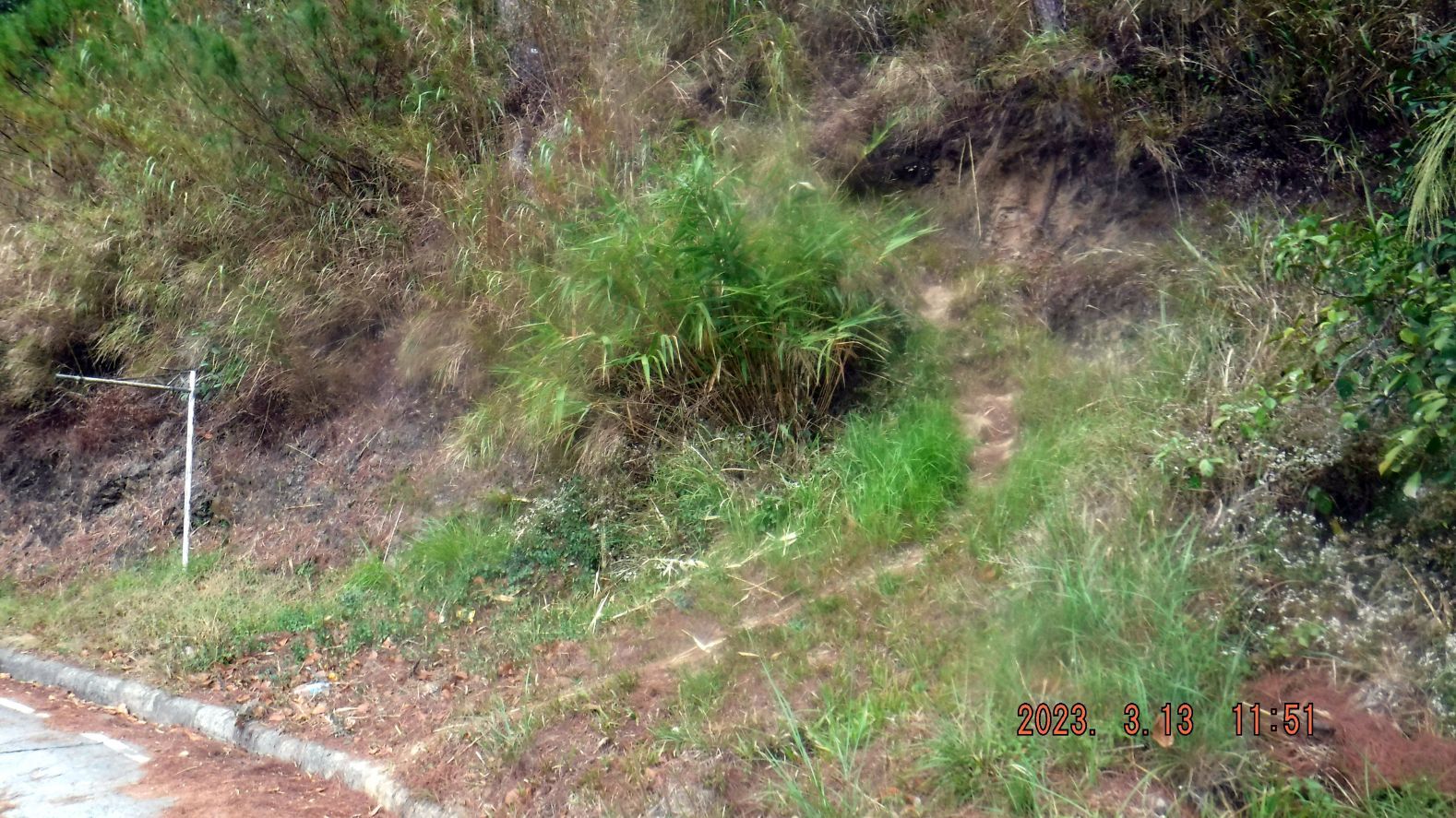 |
|


