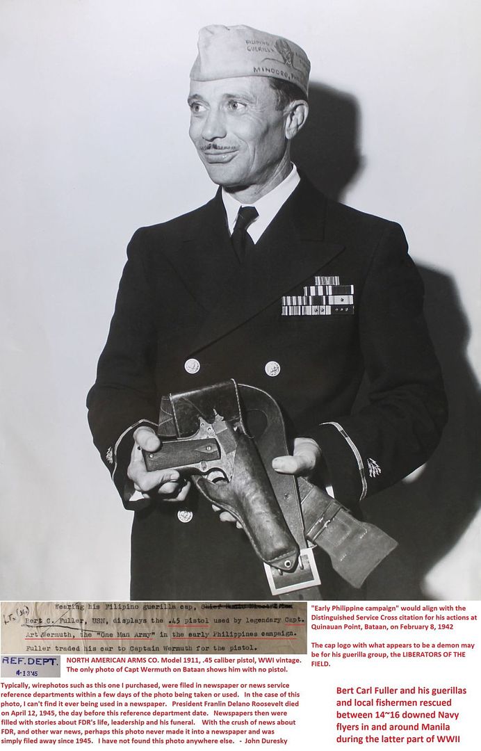
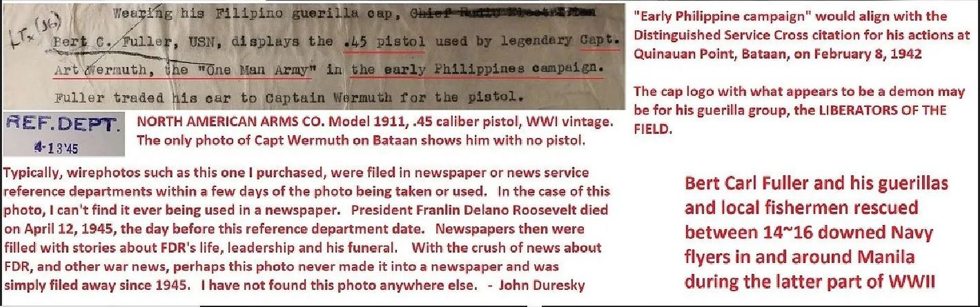
Post by Karl Welteke on Mar 27, 2023 19:16:00 GMT 8
Bessang Pass to Biwak Rd. 13th Mar. 2023
I had noticed this road before, going up a ridge from the Bessang Pass to the sitio (village) Biwak. It really was my main purpose for this visit, to walk this road, path or trail. I would get a feel of this battle field where so many endured, fought on and many died to liberate the Philippines from the Japanese invader. I took these pictures so I can revisit this hike in the future on the PC. But I will come back and try to walk a little further up towards Mt Namandiraan.
If you are interested 112 images have been uploaded into this Photobucket album:
app.photobucket.com/u/PI-Sailor/a/f0a3195d-2be8-445c-a527-4a692e0e9fe1?field=TITLE&desc=asc
When the album opens, click on the first picture or the one you would like to view, then click the icon “i” and that will open the title and description of the image or images.
A short version of 38 images has been established in my Facebook as an album:
Uploaded 38 images to a Facebook album and shared with Where Americans fought, RUMP, Advocates of Heritage Preservation, WWII in the PI,
www.facebook.com/media/set/?vanity=karlwilhelm.welteke&set=a.10225719722293507
For this much shorter forum presentation 12 images are chosen but the references to picture numbers are referring to the 112 images in the Photobucket album!
-----------------------------------------------------------
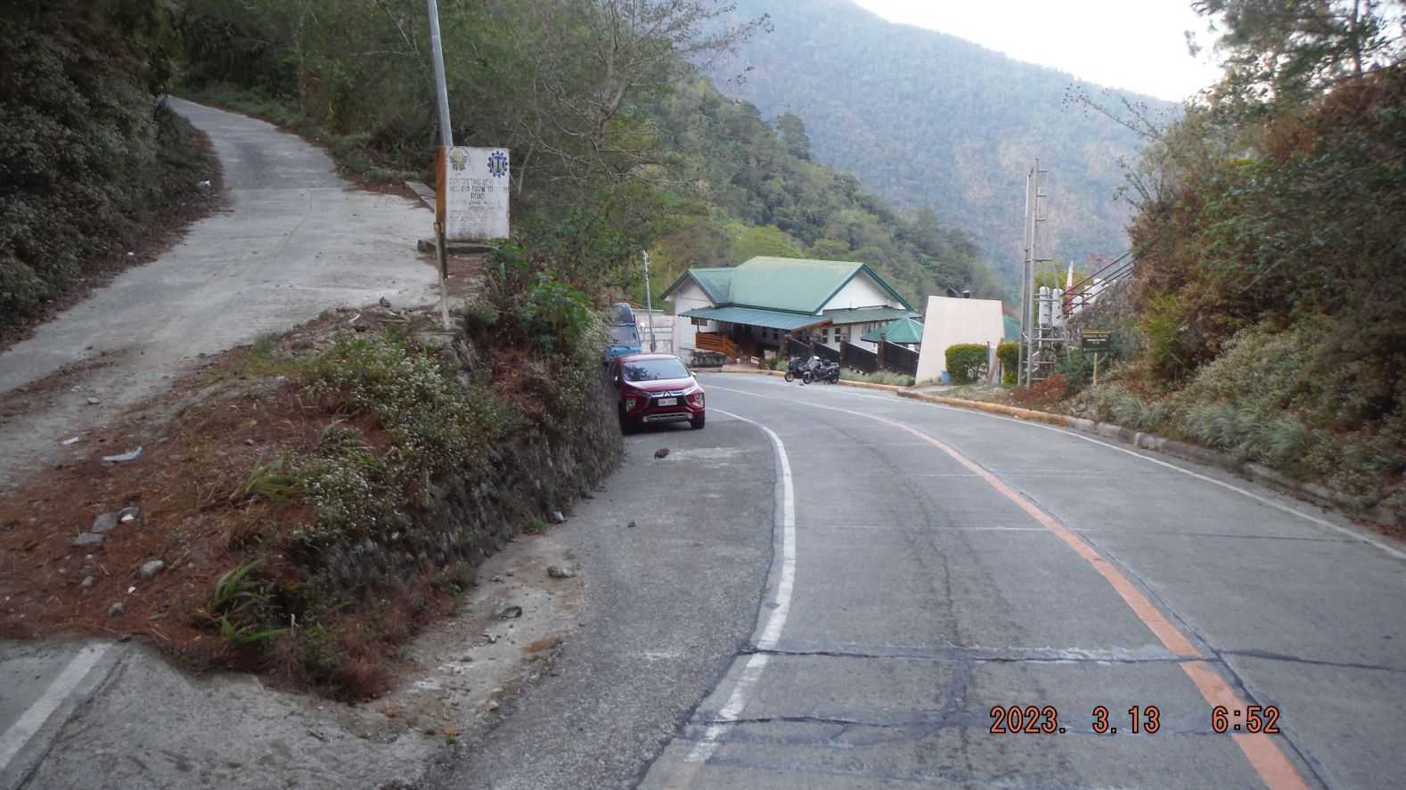
-#000 & #001 images show the Bessang Pass Monument, the pass road coming from the west and the side road to sitio Biwak going up the ridge at left.
---------------------------------------------------------------------------
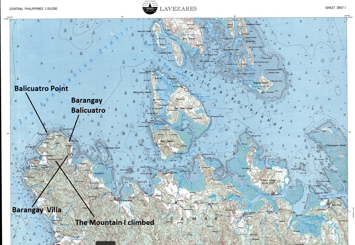
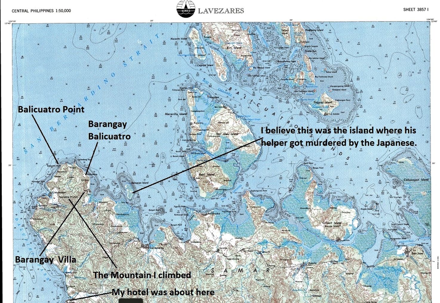
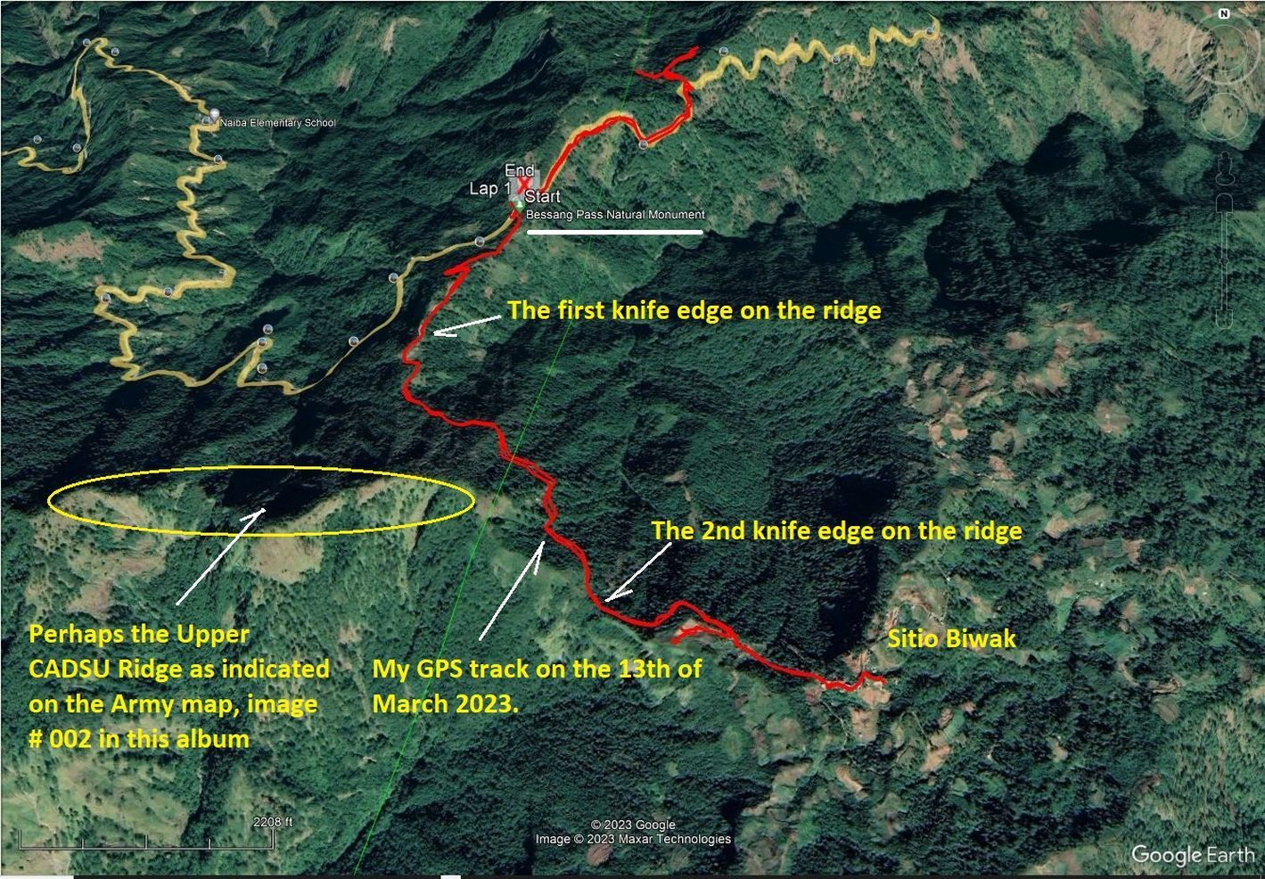
-#002 to @008 images are maps from books or Google Earth of the Battle of Bessang Pass or the Bessang Pass Monument with marking from me to indicate landmarks presented or shown in the picture.
----------------------------------------------------------------------
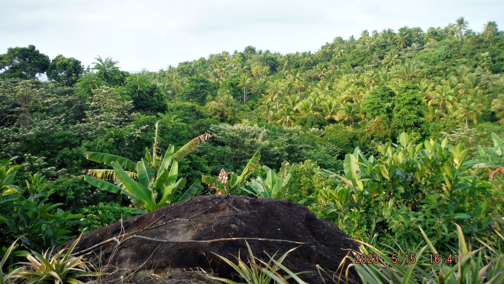
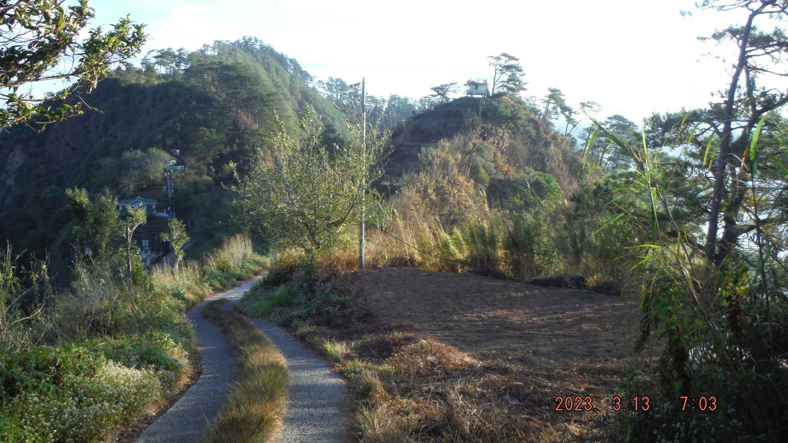
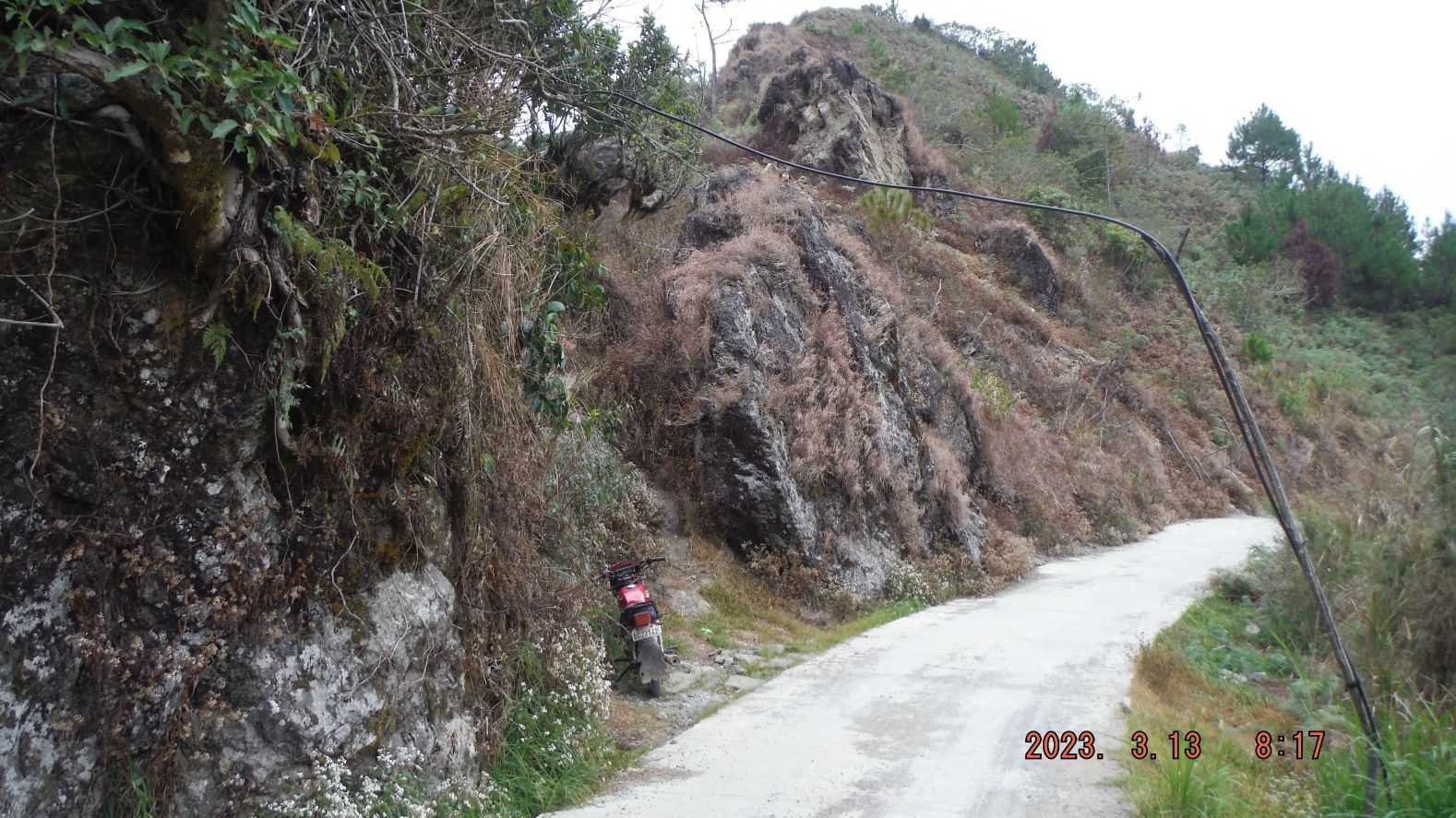
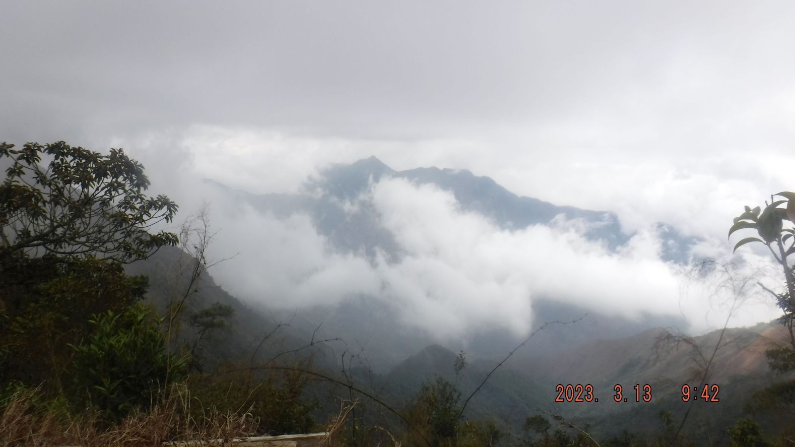
-009 to #017 images show the start of my walk up a first short section up the road to Sitio Biwak on the west foot of perhaps the Upper CADSU Ridge as shown in the Army book map image# 002. We have glimpses back to the Bessang Pass Monument and the Butac Valley, the Bessang Pass road coming up the Butac Valley. We have also views of the Malaya (Ilocos) Range, north of the Butac River Valley and the Bessang Pass.
Leaving Bessang Pass.
-------------------------------------------------------------------------
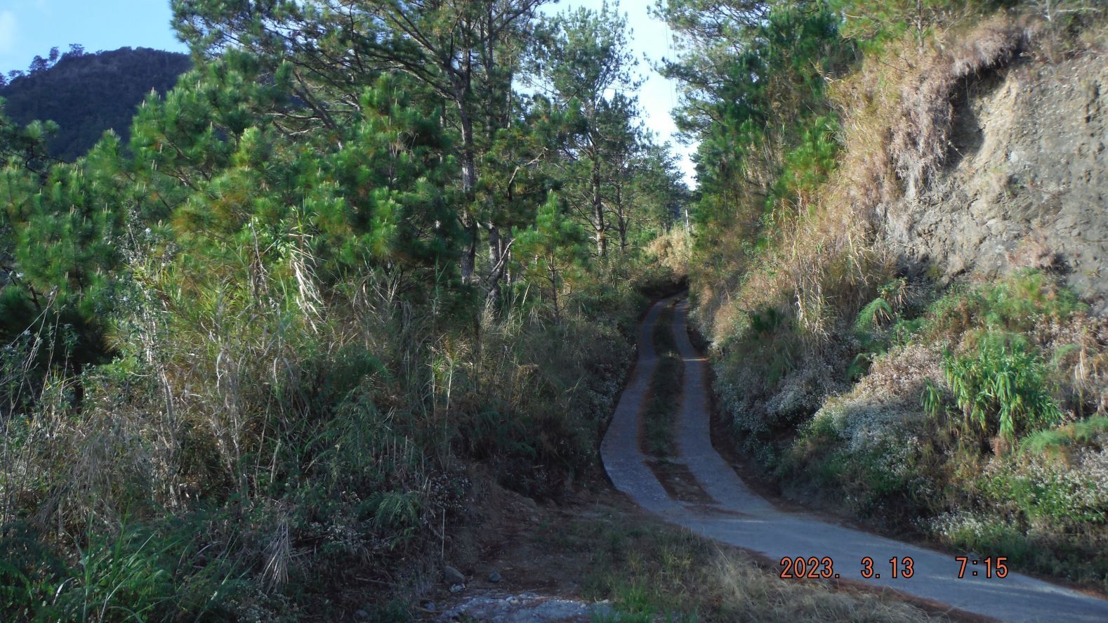
-#018 to#025 images are taking us to the 1st knife edge of this ridge walk and we have views to both sides. There are views down the river and valley going east to Abra River valley at the Cervantes Town area but it is starting right under us, the Bessang Pass and Sitio Biwak. The view west is glimpses of the Bessang Pass Road coming up the Butac River valley to the pass.
----------------------------------------------------------------------
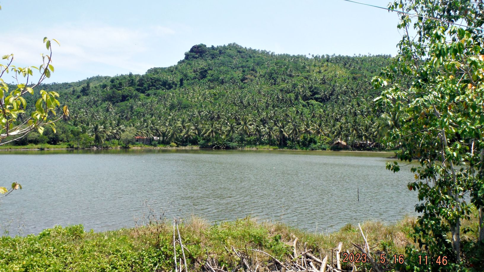
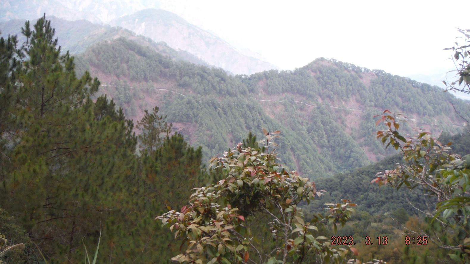
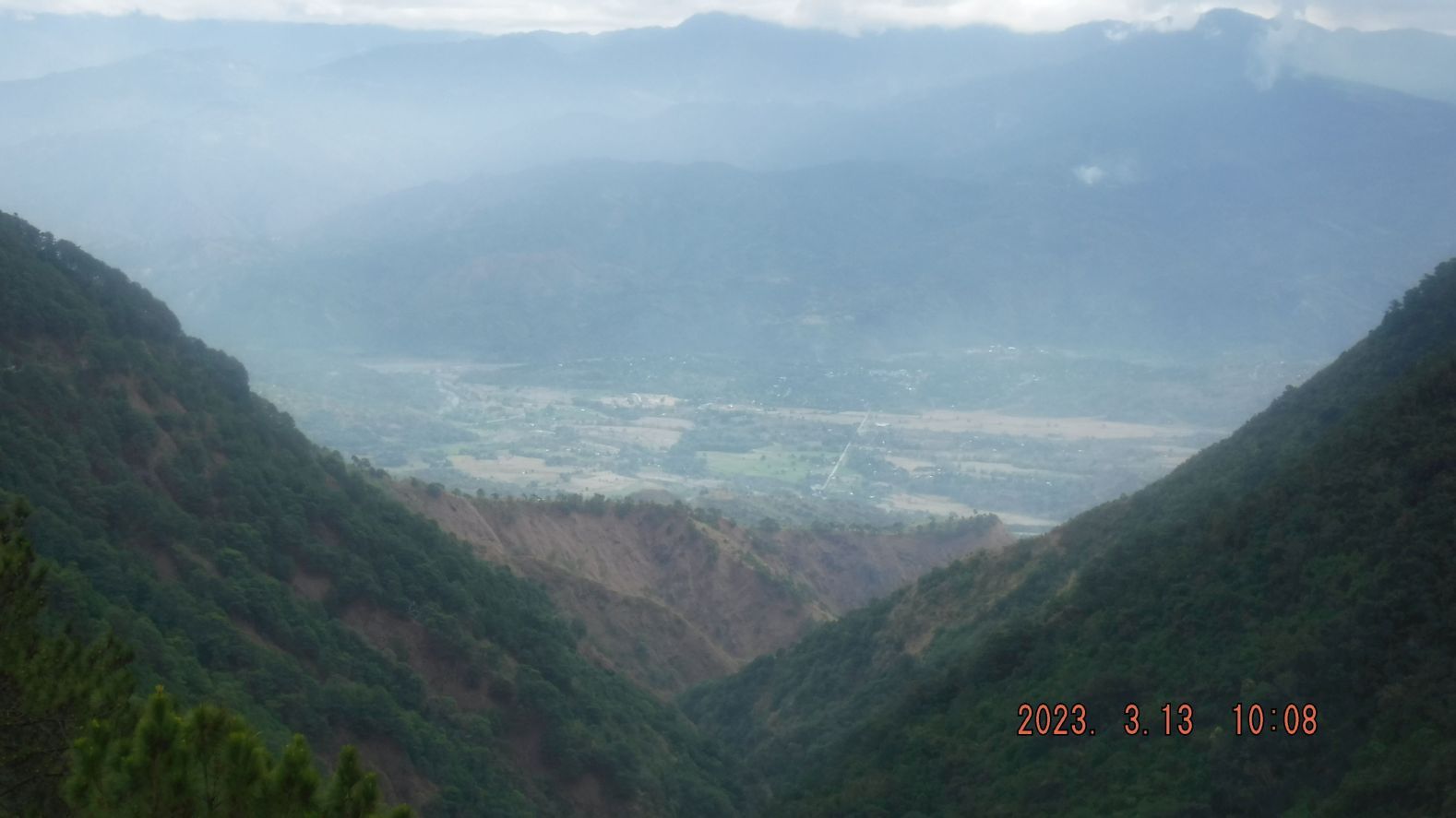
-#026 to #036 images are views of the Bessang Pass to Sitio Biwak Road, from the first knife edge to the 2nd knife edge, how the road looks like, a place being cultivated and views back to the pass and we see the road going east to Cervantes town. We also have glimpses down the deep canyon east of us and we can see all the way to the Abra River Valley, at the Cervantes Town area.
---------------------------------------------------------------------------------
-#044 to #49 images are views of the Bessang Pass to Biwak Rd. 13th Mar. 2023 from the 2nd knife edge to the beginning of Sitio Biwak.
--------------------------------------------------------------------------
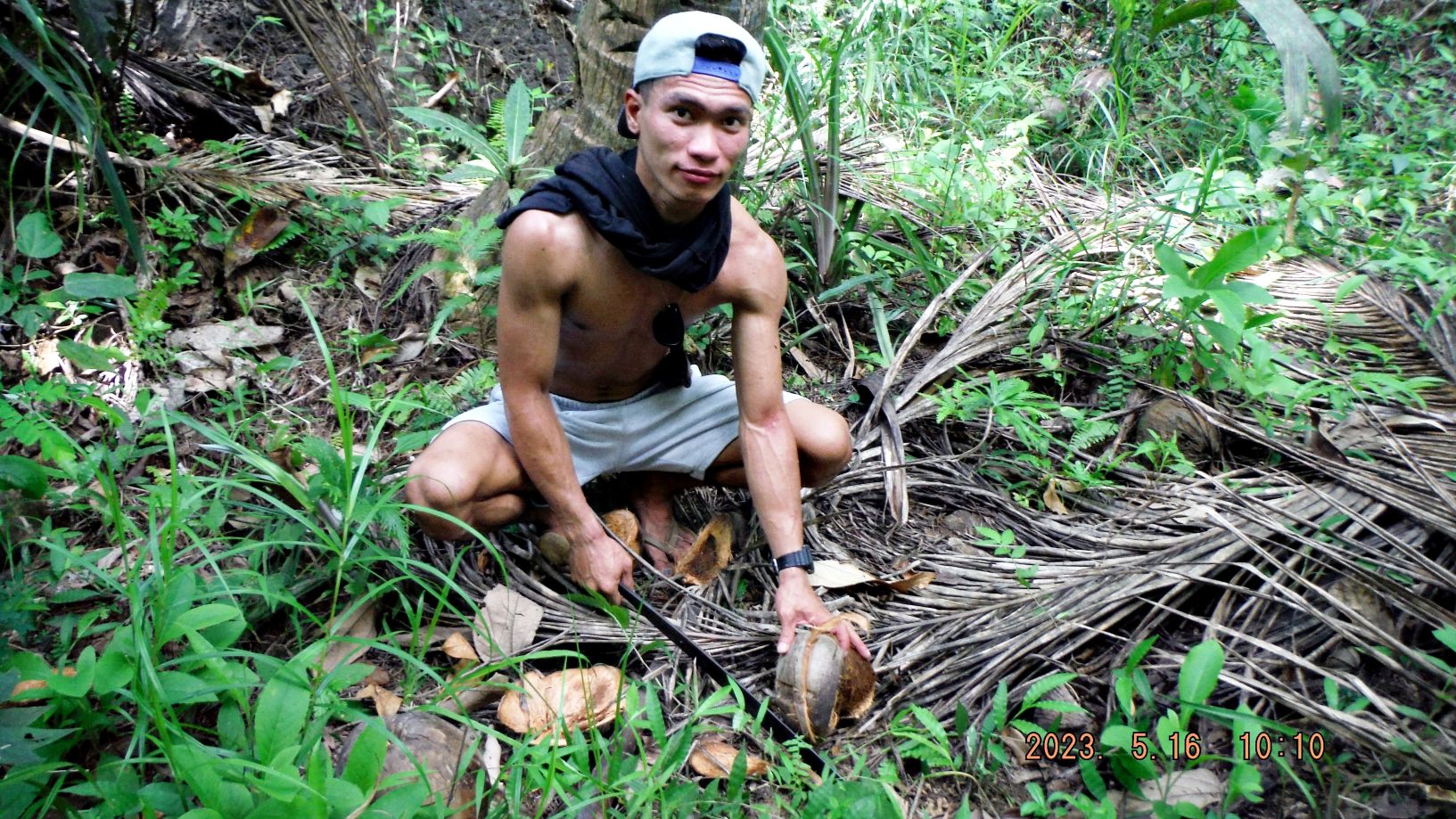
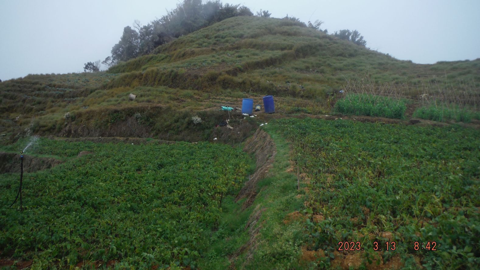
-#055 to #064 images are of my little excursion off to the right, following a substantial trail and I enter potato fields and some other vegetable crops plots. But I’m also in the clouds so the pictures are not the best. Some of the potato plants seem to suffer from a sickness or a bug.
----------------------------------------------------------------------------
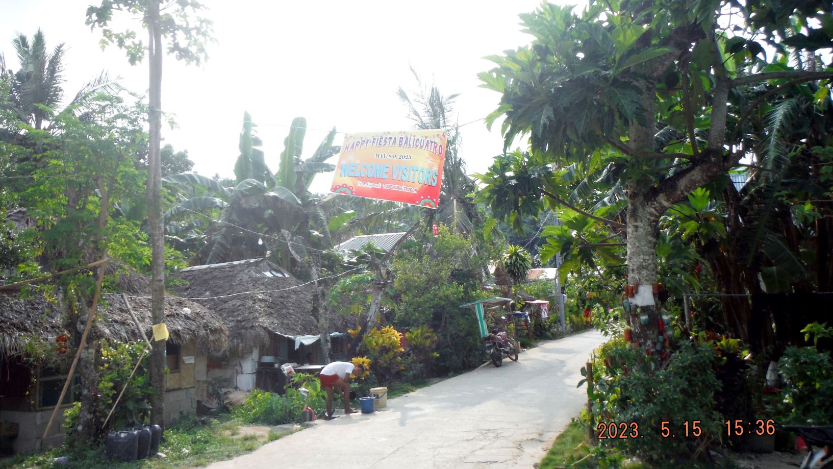
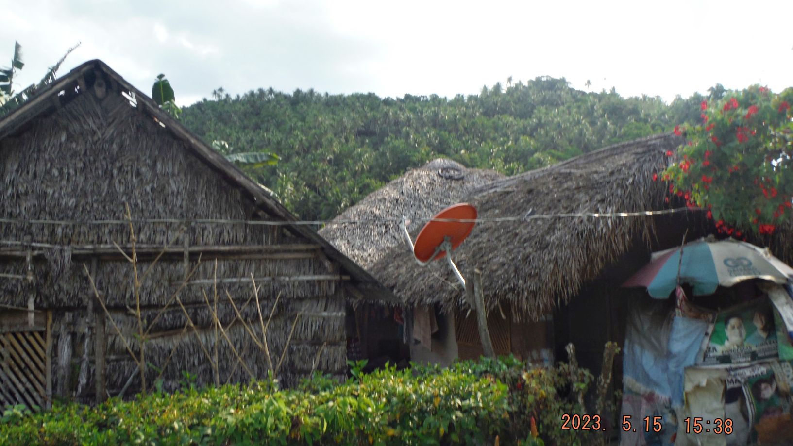
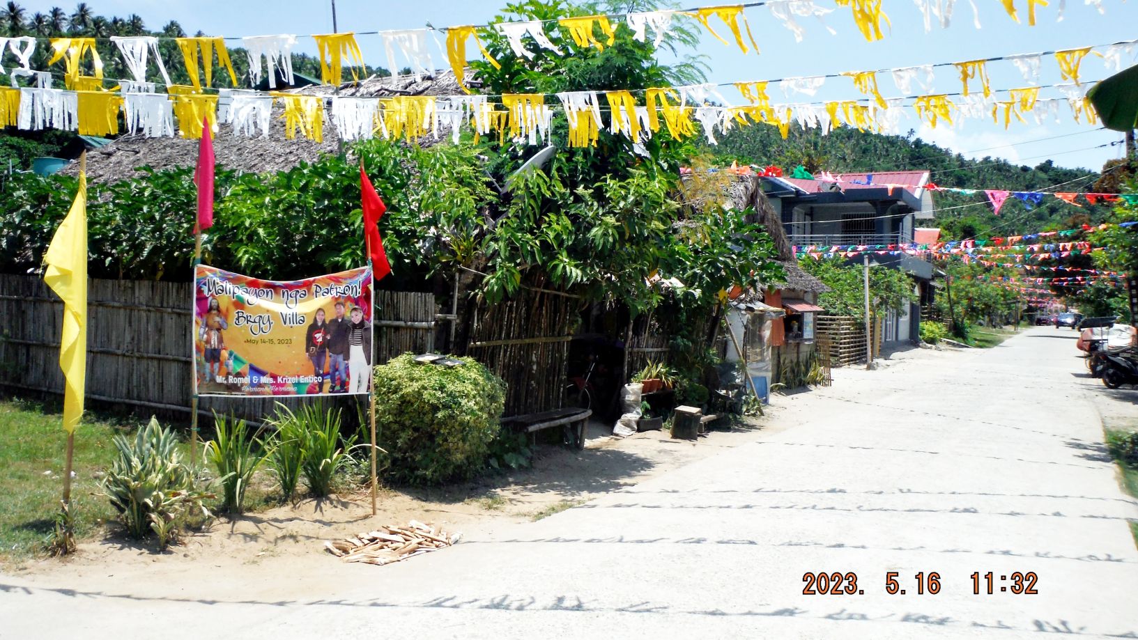
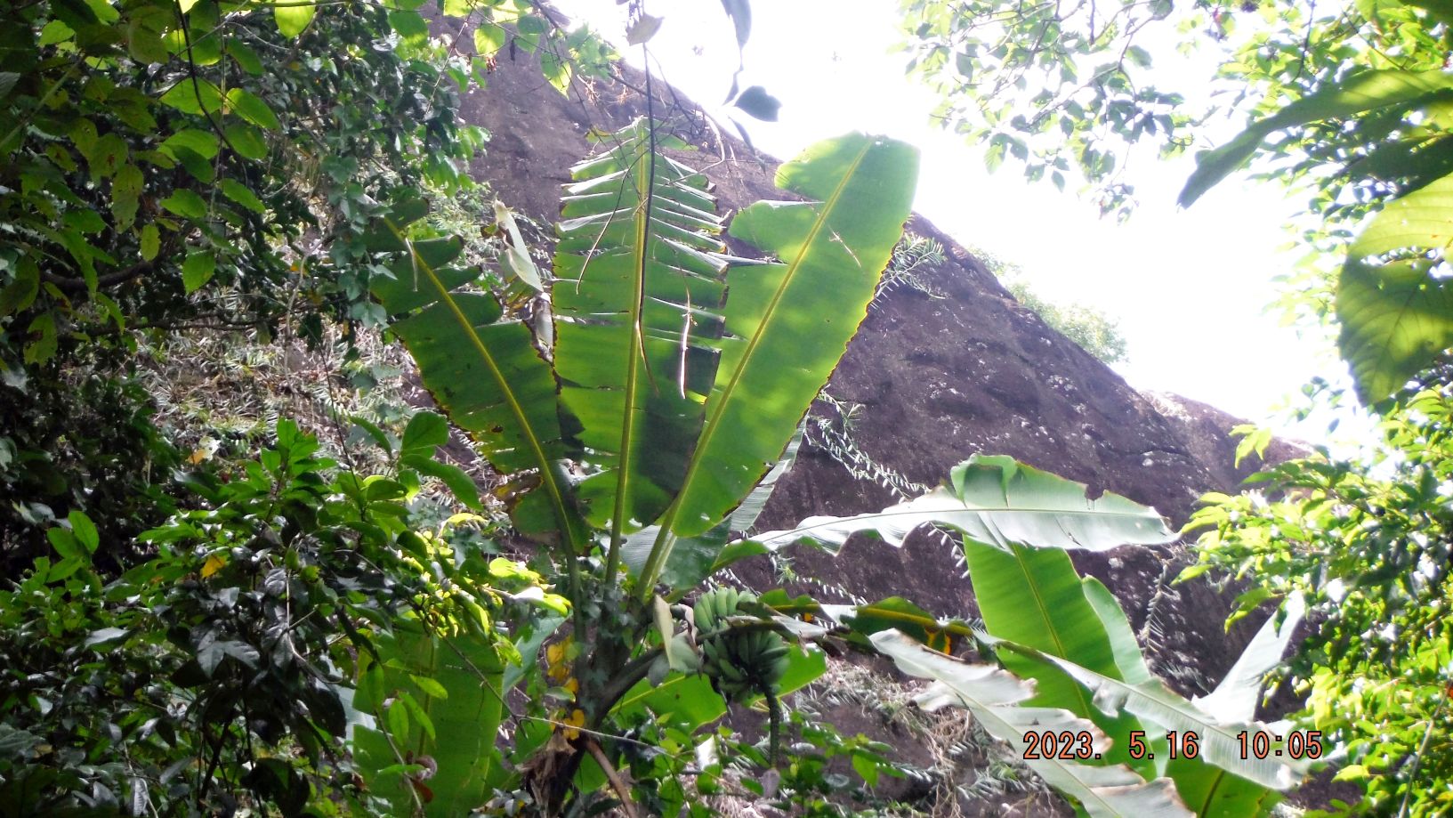
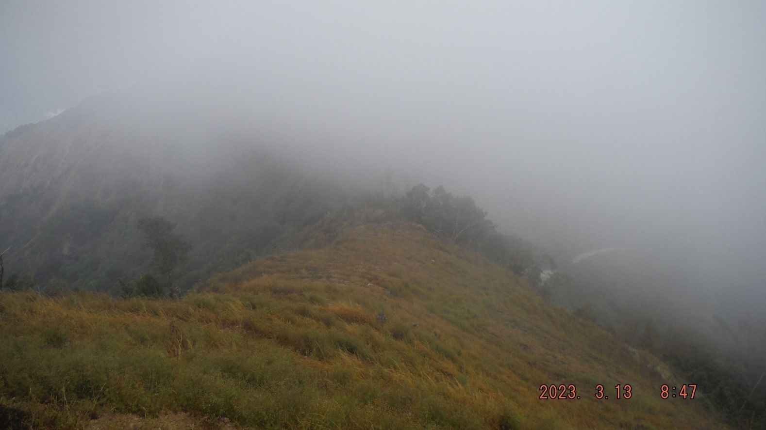
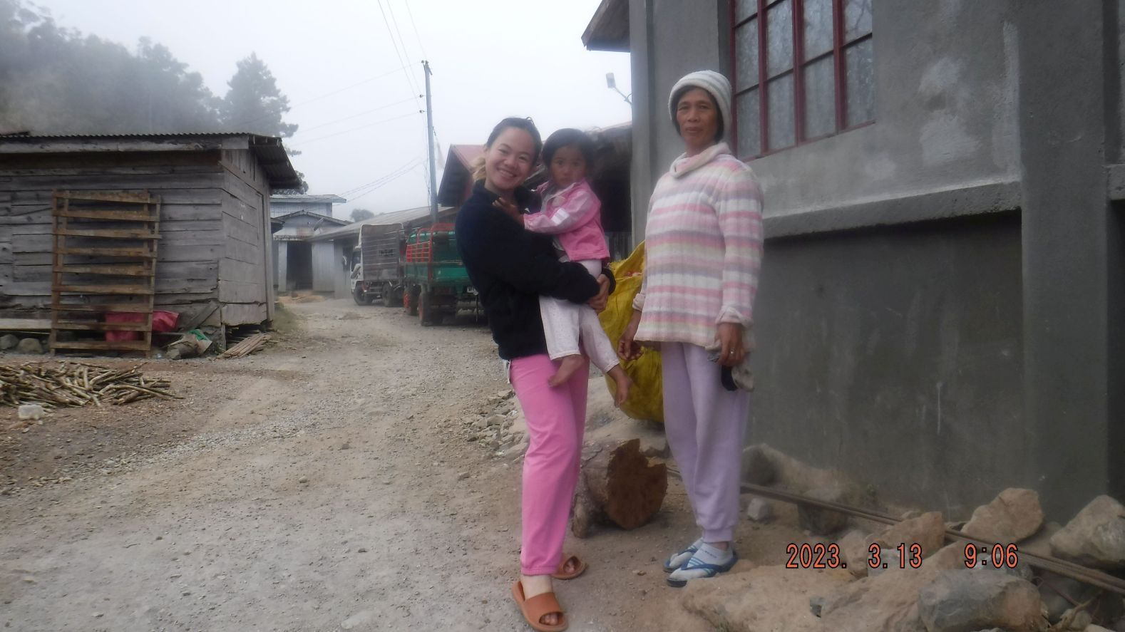
-#065 to -094 images are of Sitio (village) Biwak on top of this height, next to the Bessang Pass Battle Field, the UPPER CADSU Ridge. The images are of some of the friendly people, the houses, and the views back to the Bessang Pass, the east road from it going down to Cervantes, the village area and the direction towards Mt. Namandiraan.
-----------------------------------------------------------------------------
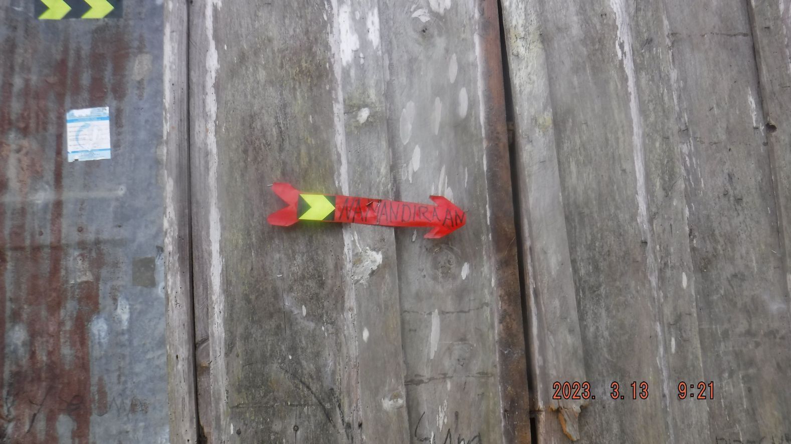
-#073 to #076 images got my attention, here, thru that sign on that house and the people told me, is news, information of a way and trail to a mountain I had not heard about. But dedicated hikers in this country know about it and have written about their hikes to this mountain. I read it and it is not for me. One has to descend several hundred meters before the final climb.
----------------------------------------------------------------------------------------
-#095 to #111 images are various shots of my return march from Sitio Biwak to the Bessang Pass.
Abra River Valley near Cervantes.
I had noticed this road before, going up a ridge from the Bessang Pass to the sitio (village) Biwak. It really was my main purpose for this visit, to walk this road, path or trail. I would get a feel of this battle field where so many endured, fought on and many died to liberate the Philippines from the Japanese invader. I took these pictures so I can revisit this hike in the future on the PC. But I will come back and try to walk a little further up towards Mt Namandiraan.
If you are interested 112 images have been uploaded into this Photobucket album:
app.photobucket.com/u/PI-Sailor/a/f0a3195d-2be8-445c-a527-4a692e0e9fe1?field=TITLE&desc=asc
When the album opens, click on the first picture or the one you would like to view, then click the icon “i” and that will open the title and description of the image or images.
A short version of 38 images has been established in my Facebook as an album:
Uploaded 38 images to a Facebook album and shared with Where Americans fought, RUMP, Advocates of Heritage Preservation, WWII in the PI,
www.facebook.com/media/set/?vanity=karlwilhelm.welteke&set=a.10225719722293507
For this much shorter forum presentation 12 images are chosen but the references to picture numbers are referring to the 112 images in the Photobucket album!
-----------------------------------------------------------
-#000 & #001 images show the Bessang Pass Monument, the pass road coming from the west and the side road to sitio Biwak going up the ridge at left.
---------------------------------------------------------------------------
-#002 to @008 images are maps from books or Google Earth of the Battle of Bessang Pass or the Bessang Pass Monument with marking from me to indicate landmarks presented or shown in the picture.
----------------------------------------------------------------------
-009 to #017 images show the start of my walk up a first short section up the road to Sitio Biwak on the west foot of perhaps the Upper CADSU Ridge as shown in the Army book map image# 002. We have glimpses back to the Bessang Pass Monument and the Butac Valley, the Bessang Pass road coming up the Butac Valley. We have also views of the Malaya (Ilocos) Range, north of the Butac River Valley and the Bessang Pass.
Leaving Bessang Pass.
-------------------------------------------------------------------------
-#018 to#025 images are taking us to the 1st knife edge of this ridge walk and we have views to both sides. There are views down the river and valley going east to Abra River valley at the Cervantes Town area but it is starting right under us, the Bessang Pass and Sitio Biwak. The view west is glimpses of the Bessang Pass Road coming up the Butac River valley to the pass.
----------------------------------------------------------------------
-#026 to #036 images are views of the Bessang Pass to Sitio Biwak Road, from the first knife edge to the 2nd knife edge, how the road looks like, a place being cultivated and views back to the pass and we see the road going east to Cervantes town. We also have glimpses down the deep canyon east of us and we can see all the way to the Abra River Valley, at the Cervantes Town area.
---------------------------------------------------------------------------------
-#044 to #49 images are views of the Bessang Pass to Biwak Rd. 13th Mar. 2023 from the 2nd knife edge to the beginning of Sitio Biwak.
--------------------------------------------------------------------------
-#055 to #064 images are of my little excursion off to the right, following a substantial trail and I enter potato fields and some other vegetable crops plots. But I’m also in the clouds so the pictures are not the best. Some of the potato plants seem to suffer from a sickness or a bug.
----------------------------------------------------------------------------
-#065 to -094 images are of Sitio (village) Biwak on top of this height, next to the Bessang Pass Battle Field, the UPPER CADSU Ridge. The images are of some of the friendly people, the houses, and the views back to the Bessang Pass, the east road from it going down to Cervantes, the village area and the direction towards Mt. Namandiraan.
-----------------------------------------------------------------------------
-#073 to #076 images got my attention, here, thru that sign on that house and the people told me, is news, information of a way and trail to a mountain I had not heard about. But dedicated hikers in this country know about it and have written about their hikes to this mountain. I read it and it is not for me. One has to descend several hundred meters before the final climb.
----------------------------------------------------------------------------------------
-#095 to #111 images are various shots of my return march from Sitio Biwak to the Bessang Pass.
Abra River Valley near Cervantes.