|
|
Post by okla on Aug 13, 2012 7:13:05 GMT 8
Hey Buster....Many thanks for the update.
|
|
|
|
Post by chadhill on Aug 13, 2012 7:59:59 GMT 8
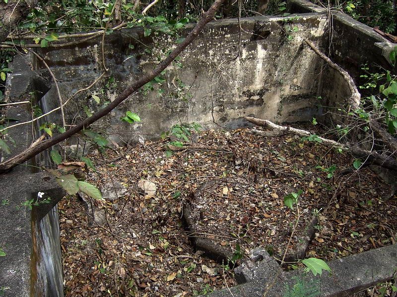
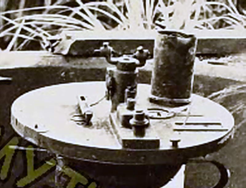
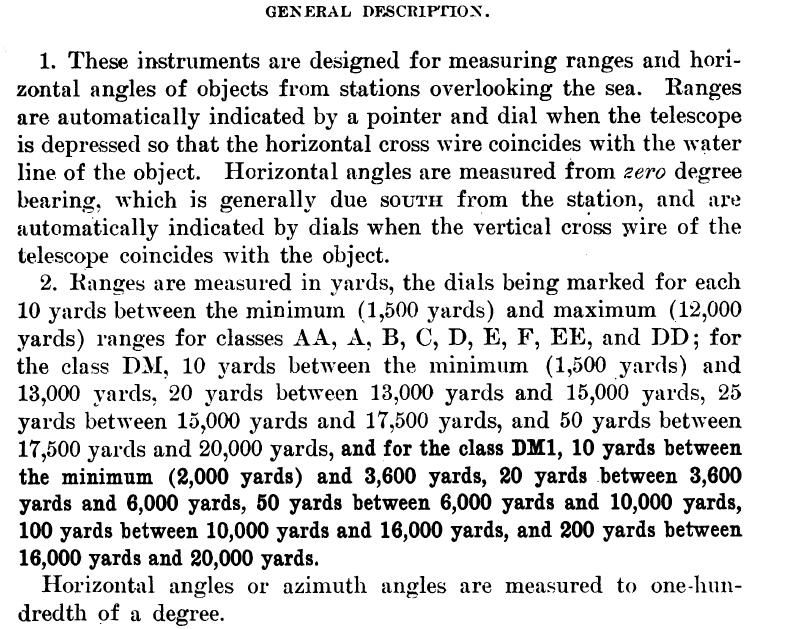
Let me open by wishing the best for all our friends in the PI after the massive flooding they have had to endure. I hope things turn out as well as they possible can. Fots, thank you for posting those additional photos of EG-IV-3 and the nearby stairs to SL #8. Yes, I would like very much to see a video of that area when it is convenient for you to make one! That photo you posted from armyjunk's wonderful collection sure looks like EG-IV-3 to me. I think it might possibly be the one I saw on another website some time ago, even though it is obviously not pre-war and there are no optical instruments shown as I seemed to remember. I was gone for a while today and in my absence a most capable assistant named pdh54 (AKA Patty  ) noted that the wide mounting pedestal shown in armyjunk's pic was missing something on top. Fots, your suggestion prompted her to research photos and articles of WW2 observation instruments and she found a very probable match for the missing part:  "A depression position finder (DPF) is an observation instrument that was used in the fire control system of the U.S. Coast Artillery to locate targets in range and/or azimuth as part of the process of directing the fire of a battery of coast defense guns or mortars. These instruments, which contained telescopes on massive, finely geared mountings, were located variously in base end stations, DPF bunkers or pillboxes, or built-in to concrete gun emplacements. To measure range correctly, a DPF instrument had to be configured for the specific site at which it was emplaced, and had to be adjusted during the day for the level of the tide at that site. DPF instruments were used beginning in the 1890s and continuing through WW2".  |
|
|
|
Post by pdh54 on Aug 13, 2012 8:24:16 GMT 8
It also looks like the rheostat that is on the ceiling in the diagram has been mounted on the table top and that the scope has had an extender added to its mounting apparatus so the scope could clear the rheostat as it swiveled.
|
|
|
|
Post by sherwino on Aug 13, 2012 12:51:56 GMT 8
There were no Japanese ships from S. China sea that entered through Manila bay during the battle of Bataan and Corregidor. I'm wondering if that scope was used on targets on Bataan and Cavite. Or it didn't saw a very active duty because it probably might take a lot of calculations and adjustments due to the different elevations of the Bataan peninsula. Was there a similar emplacement on the topside? I was thinking that topside could obstruct view of the approach on S. China sea.
|
|
|
|
Post by fots2 on Aug 13, 2012 13:47:40 GMT 8
Hi Patty and Chad,
Thank-you for the information and photos. I probably have some details hidden away somewhere of how these things work but am not really interested enough to spend time on it. They look to be very precise instruments though.
I would say the old photo is indeed EG-IV-3.
P.S. Another storm is in the area today. I just got home from buying some groceries. When I went into the market it was not raining but a few minutes later it sounded like a freight train was passing by the roof. Ten minutes later when I left, the water in the street was over my ankles. Fortunately I live on a hillside.
|
|
|
|
Post by fots2 on Aug 13, 2012 13:51:31 GMT 8
Hi Sherwino, I hope you are high and dry over in Mariveles these days. Corregidor had numerous large and small stations/command posts. Even Cochinos Point near you has one. I expect only some of them were ever equipped with such instruments but all seem to have had the concrete mounting pedestal on the floor in preparation for use. Imagine a few such stations providing triangulation data of the same target for increased accuracy. Such a high location would be ideal for viewing Cavite and Bataan. The bathtub we are talking about (EG-IV-3) was an emergency backup station for the main station (G-IV-3) which is situated further south on the top of Malinta Hill. It has two concrete pedestals still remaining. Here is a look at them:   |
|
|
|
Post by sherwino on Aug 13, 2012 14:33:27 GMT 8
Thanks. High and dry on the hill at the end of the old Mariveles airstrip, Fots. Though it's imperative to pass through the flooded old airfield everytime it rains hard, a tall vehicle does the job. But I'm worrying right now, I have brought to work my small car.
It could be that all stations have that equipment. It might be troublesome to move them from time to time. The scopes probably have all been destroyed prior to the surrender. The lack of them(and some of the big guns) deprived the Japanese the best of what Corregidor could had give. Imagine how easily the allied ships entered the bay during the liberation.
The one at the Cochinos point sure provided a good view for spotting fire.
|
|
|
|
Post by fots2 on Aug 15, 2012 17:17:54 GMT 8
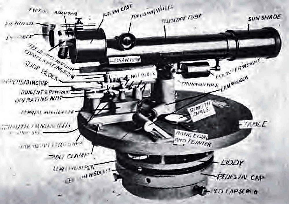
Thanks to information from a friend, here is a look at the instrument that was mounted on the circular table in EG-IV-3. It was called a “Lewis Depression Position Finder”, Model 1907.  EG-IV-3 photo taken in 1945. (courtesy of armyjunk)  Lewis Depression Position Finder  |
|
|
|
Post by pdh54 on Aug 15, 2012 18:37:01 GMT 8
Great site specific diagram Fots.
You come up with the darndest things.
Patty
|
|
|
|
Post by fots2 on Aug 15, 2012 22:15:47 GMT 8
Hi Patty,
I had some help with this one. It is great the way these forums allow us to share information.
|
|