|
|
Post by fots2 on Aug 16, 2012 0:10:48 GMT 8
Lately we have been talking about such structures as the EG-IV-3 station and the Searchlight #8 tunnel that are both located on top of Malinta Hill. If you stand in front of them today you see nothing but old grey concrete. I expect very few people take a moment to contemplate the men who manned these positions or any of their experiences. After a little lead in, here are two minor anecdotes about them that you will not find in any history book. On February 16th 1945, 1st LT. Paul Cain landed in the second wave of the amphibious landings on Corregidor's Black Beach. He was the CO of 'I' Company, 34th Infantry Regiment. His orders were to get his company across Bottomside to the North Dock area while clearing out any enemy along the way. The first night 'K' Company on top of Malinta Hill took heavy casualties during Japanese attacks, 'I' Company was ordered to relieve them the following day. LT. Cain found the daytime busy with patrols, logistics and preparations for the night time attacks that were sure to come. He had little sleep for days. One night after the Japanese attacks had subsided, exhausted, LT. Cain rolled into a little concrete observation station with low walls (EG-IV-3) which was located on top of the searchlight tunnel. He quickly fell asleep. Being on top of the hill, the eastern sunrise woke him up. He looked down and saw an unexploded Japanese grenade between his legs! The searchlight tunnel has its own 'dark' little story...actually 'dark brown' might be a better description. With two companies of men on Malinta Hill, the rocky terrain meant there were not many places suitable for digging. You may have guessed it, the searchlight tunnel became their latrine. After a few days, Lt. Cain says it became pretty 'ripe' in there! You are probably asking "How do I know this?" Well, Paul Cain is alive and well in Illinois, USA. I have spoken to him several times and he is definitely one of the "Greatest Generation".  1945 ‘Latrine’ |
|
|
|
Post by wwalker on Aug 16, 2012 9:45:13 GMT 8
Very interesting stuff Fots. I know that I've always posted about the fall of "The Rock", but lately have been reading about the re-taking. It is another amazing story. I'm thinking about doing some work on this part of the Corregidor story as well. Keep up the great work.
WW
|
|
|
|
Post by armyjunk on Aug 26, 2012 0:37:28 GMT 8
I found this the other day the Magazine being used for power for S/L 8 at the top of the drawing  |
|
|
|
Post by Karl Welteke on Aug 26, 2012 21:35:35 GMT 8
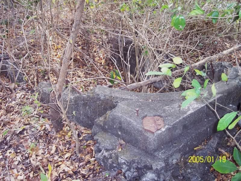
About EG-IV-3, I like to state that this bathtub (Emergency Station w/o Roof) is unique in another point and nobody seems to have raised it so far. I have not seen this at any other of the many bathtubs on the island. At the rounded end at each corner a concrete base has been placed (maybe added later) to hold an iron support to support (a roof ?) and at the same time to make it easy to take an azimuth (as a Navy man I like to say to take bearings). I don’t know the proper description of this arrangement that all concrete covered gun control stations have. I added the image of this arrangement from C1,to demonstrate what I’m trying to point out. Any opinions? The C1 irons to facilities bearing taking and support the concrete cover above.  This image is from fots2 and shows the two concrete bases on the rounded end, the one at right is damaged.  To me this looks like the irons that were used at the covered gun controls. It was not holding a concrete roof but another type and these irons facilitated taking bearings around roof supports.  |
|
|
|
Post by okla on Aug 26, 2012 23:43:31 GMT 8
Hey Karl....Very reasonable assumption until a better one comes along.
|
|
|
|
Post by oozlefinch on Aug 27, 2012 13:06:44 GMT 8
As an addendum to ArmyJunk's drawing, I believe this is where Lt. Friedline and his men were killed by an artillery strike, not in the back of the SL#8 tunnel, as popularily believed. This is where the SL (and probably other local positions) got it's local power and thus, where the gasoline would have been stored.
|
|
|
|
Post by chadhill on Aug 28, 2012 2:07:33 GMT 8
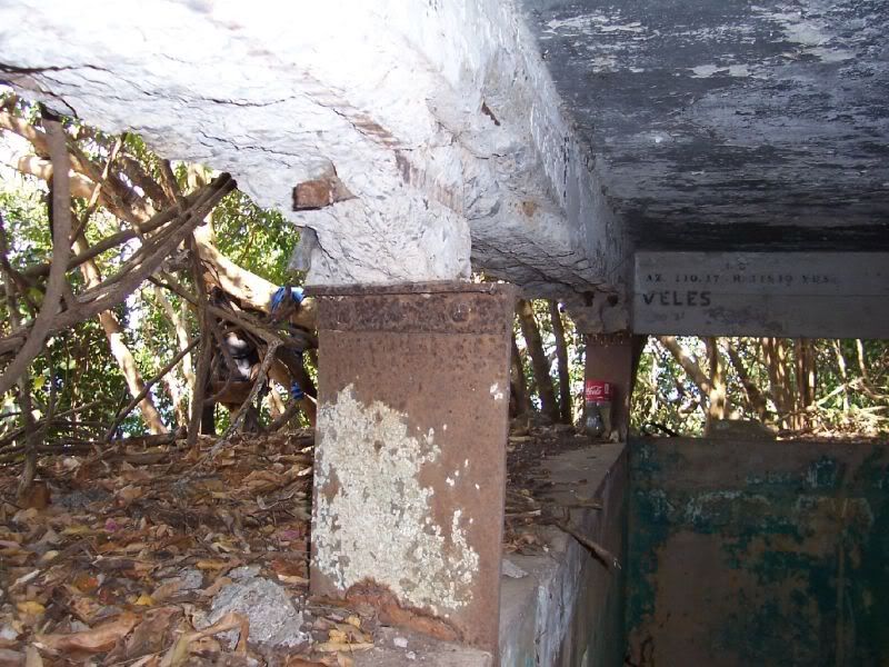
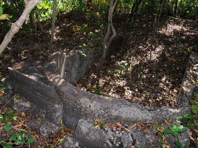
Armyjunk's diagram made me dust off my thinking cap again; it has been 25 years since I was on top of Malinta Hill. Back at the very beginning of this thread fots posted a photo of one of the two entrances to the small bunker that is located between the air shaft and the 75mm gun shelter. The other entrance is collapsed: (photo courtesy fots2)  Here is a sharpened view from the Japanese newsreel looking from the 75mm shelter up the small hill to the overturned pom-pom gun:  If you look directly over the wheels of the 75mm gun, a wall of sandbags can been seen just beyond. Is this where one of the entrances to the small bunker would be? The pom-pom gun arrived with 25,000 rounds of ammunition. The bunker may have been used as a magazine for this ammo as well as 75mm rounds. Is the small bunker the "OLD LAND DEFENSE MAGAZINE" noted at the bottom of armyjunk's diagram? Fots' photo inside the bunker shows a collapsed entrance to the right, which agrees with the diagram: (photo courtesy fots2)  |
|
|
|
Post by okla on Aug 28, 2012 3:09:51 GMT 8
Hey Chad....Makes all the sense in the world, even to one, such as I, who has never set foot there. What is that junk in the last photo's foreground. The cover of a air vent, maybe.  ?Something off the "fan" denoted in Army Junks's diagram?  |
|
|
|
Post by chadhill on Aug 28, 2012 6:41:32 GMT 8
That sounds like a good SWAG to me, okla. Any other SWAGs out there?
I forgot to mention that at the start of this thread fots said the small bunker was about 30 feet from the 75mm gun shelter. That made me take another look at the Japanese newsreel, and I began to wonder about those sandbags seen above the gun wheels.
|
|
|
|
Post by chadhill on Aug 28, 2012 10:23:13 GMT 8
pdh54 (Patty) was studying the following section of the 1936 map and made an observation that I had missed:  Notice the map position of the northernmost 75mm Gun Emplacement. It is immediately southwest of the bathtub EG-IV-3, north of the 25 K.W. power supply (see armyjunk's diagram) and almost due west of Searchlight 8. The 75mm is much further north than it is seen in the 1942 Japanese photos or in armyjunk's late war aerial photo of the ridge: (photo courtesy armyjunk, notations by fots2)  Note that the 1936 map shows a second 75mm south of the 25 K.W. power supply. I suspect this really may be the 75mm shelter that is shown in armyjunk's photo above, and in the Japanese newsreel photo with the pom-pom gun on the small hill to the north. I checked the 1941 Emergency Defense Map. It has much less detail but seems to show two 75mm positions on the northern ridge also. I have a SWAG about this northernmost 75mm position shown on the 1936 map. I think that the shelter was relocated south on the ridge in early 1942 to make room for the pom-pom gun. It's also possible that the 25 K.W. power supply was then relocated to the rear of the SL #8 tunnel in order to let the "small bunker" become the magazine for the 25,000 rounds of ammo that came from the Navy with the pom-pom. This would explain armyjunk's diagram as well as the reports stating that LT Friedline and his crew were in the SL #8 tunnel when the fateful 240mm shell penetrated the air shaft and exploded the generator's fuel tank. Just another SWAG... |
|


 ?Something off the "fan" denoted in Army Junks's diagram?
