|
|
Post by fots2 on Aug 15, 2014 21:07:10 GMT 8
Hi Oozlefinch,
The newspaper story could still be accurate however I doubt the POWs left Corregidor before the war was over. There must have been a cross-over period between when the war ended and when the Japanese POWs were repatriated. If the story that the holdouts were in contact with the POWs is true then the holdouts could have found out that way. We may never know for sure.
|
|
|
|
Post by The Phantom on Feb 11, 2015 17:11:56 GMT 8
I recently spent 10 days on Corregidor, here is a basic report.
Kudzu, beautiful flowering vines, is very much out of CONTROL!
Several areas on the island are now off limits to travelers, Battery Martin, gone under the vines, the entire west side of Malinta Hill mostly gone now.
Malinta Point gone.......
Found another live phosphorus shell on Enlisted mans beach.
That's one a year for 5 years of late.
South shore road around Malinta is gone, rock slides, not cut at all anymore.
Same road not cut on the east side of Malinta.
Road to top of Malinta hill not cut.
The south shore road below the Spanish fort not cut, Spanish fort gone under grass and small trees.
Road to Battery Wheeler not cut.
Road from James to Engineer's Ravine is cut as there was a bike race on Corregidor recently and that was part of the route.
The race took the bikers DOWN the north shore road around Malinta Hill, past the Hospital entrance, saw no busted bikes on Enlisted mans beach.........
The Tail at the end of Kindley Field, has grasses shoulder high on the old roads, it appears no one goes there any more.
Grasses closing in on the Parade ground from the edges.
It is much too green this year to do much exploring off the roads, it rained hard and all day for the Popes visit to Ermita, so it's raining late this year.
The food at the Hotel is good still.
Mac Arthur's is closed and its sign is down, too bad. Find your own reasons............Edith was there for a few days but left the island while i was there.She told me she couldn't serve me food, the Karaoke was gone also.
What a disappointment that was!
P300.00 for a drop off and P500.00 for a drop off and interesting pick up.
Seems to be more people working on the island in various endeavors.
More guards, the same motorcycle guard traveling the entire island all the time.
Full ferry's on my trips, some days 2 boats.
Many tent campers in Barrio San Jose bringing it's population up substantially...........
Lots of Banka traffic from Bataan also.
The Spanish old stone water reservoir by the lighthouses area has been cleaned out and seems huge now, great to see it open finally, capstone interesting.
A few of the buildings at the Lighthouse area are gone giving it a cleaner look, half the shops are also gone.
Restroom up there gone also it appears, so I used the Museum one.
All for now.
|
|
|
|
Post by okla on Feb 12, 2015 9:34:13 GMT 8
Hey Phantom....Sounds as if things are getting a bit "shaky" on the Rock these days. I say, again, it's too bad that when the US granted Independence, some kind of deal wasn't arranged where Corregidor was turned over to the US National Park Service for administration, upkeep, etc, but with the new Republic of the Philippines retaining complete Sovereignty. I would rest easy, knowing that the folks who oversee Gettysburg, Shiloh and Vicksburg were in charge. Alas, not to be. Just sayin'.
|
|
|
|
Post by Registrar on Feb 12, 2015 9:50:17 GMT 8
I have just digested The Phantom's run-down of what he found on his ten days on Corregidor. As the Ghost Who Walks, he visits annually, with an odd skip here and there, but my point is that when he visits Corregidor, he notices things that people who see it more regularly tend not to notice all that much. Most people, like the proverbial frogs in slowly heated water, do not notice that things are starting to boil until it is too late. It is disturbing that the set of information that most of us have to benchmark against, is not really a complete picture. We do have the Corregidor of the last decade, when our holiday images and happy snaps began to appear and to be shared - and compared - across the internet. Those years held such promise. Clearly I was wrong that 1 January 2015 may have seen a reinvention of CFI. What did happen on 1 January 2015 was not the demise of CFI, but that Corregidor lost two of its resident friends. Essentially, they were two people who had accumulated a huge positive bank of Corregidor friends overseas, and a few local enemies. They were working full time on getting Corregidor lodged into the hearts and minds of new markets - visiting VIPs, military buffs, bird watchers, ecologists, naturalists and the like. When sales figures are down, its conventional wisdom has it that many companies reduce their sales force. This is, in truth, the opposite of what's needed. When sales are down, you need more people out there selling, beating the bushes, not fewer. Laying off sales people is the beginning of a loss of business spiral. What happens here a lot is that when there is a "secret plan" for sale or redevelopment of an asset, those in control run down the asset to such a state that they can announce, as rescuers, the new development plans with the flourish "Well, the old asset was falling into disrepair. We had to do something." This statement comes, usually, after years and years of nothing being done. " I follow "Manila Nostalgia" on Facebook, and time and again we see the pattern. It is a system of programmed decrepitude which eventually bleeds the red corpuscles from the bloodstream of the country's cultural heritage. Here's but one example: www.facebook.com/groups/492789477466714/?fref=nfA crisis is no less a crisis just because it happens slowly. Corregidor has suffered from severe and repetitive cyclone damage, and the failure of some of its income streams. Something there is not working. It deserves better. War and Remembrance deserves better. |
|
|
|
Post by The Phantom on Feb 12, 2015 14:45:43 GMT 8
Another item of concern are the number of huge trees teetering on the edge of the various cliffs exposed to the extrema winds recently seen during the last typhoon.
All along the tops of the cliffs visible from the road into Engineers Ravine or going up the north road around Malinta hill past the Hospital entrance, you see trees that have been shaken loose by the winds, some even already having tumbled down the hill.
It appears to me that the wind action loosed the lahar, loose pumice base, under the tree roots.
You can see the lahar pumice sliding down the hills in many places, with piles on the bottom of the hills, many large roots exposed.
The trees grew to big for their precipitous environment it appears.
My visit was a pleasant one all in all, with chilly temperatures, and after all I was on Corregidor!
The former small power plant in Engineers ravine still contains the bell shaped mines, 4 ft. tall,some with brass fittings,found near the cable tanks recently.
Next to them were some very rusted but existing mine cables......
Saw all 3 of Mac's old houses.......General Moore's.
Played through on the golf course.......
Oh, Monkey's everywhere!
In the morning one big guy was in the tree 6 ft. from the veranda, a tourist shot a picture, the monkey scampered down the tree, then we heard what appeared to be a gun shot, no more monkey.
Watched the noon buffet for any meat additions.....
A few rode the Zip line and a few raced around the go cart path flat uot at 10 mph, top speed!
But you are on Corregidor just hampered by the thick vegetation this early in the year, go in late March or early April to see the maximum as the green jungle is gone.
But then it is HOT!
|
|
|
|
Post by beirutvet on Apr 27, 2015 4:34:50 GMT 8
Hello Fots2
In case I missed it, I apologize but did you ever get an answer as to those "tiles" you found that were marked CFC?
|
|
|
|
Post by fots2 on Apr 30, 2015 7:56:58 GMT 8
beirutvet,
I have been on vacation so late reply for you. No, I never found out what CFC on the tiles meant. A company name I asume but no definitive answer yet.
|
|
|
|
Post by cbuehler on Apr 30, 2015 22:52:06 GMT 8
Very sorry to hear of overgrowth problem. It comes and goes I guess, depending upon when or if they do some clearing. Is the south road around Malinta really totally gone? I remember hiking it with few problems, but that was around 12 years ago now.
CB
|
|
|
|
Post by EXO on Jan 9, 2016 19:14:42 GMT 8
|
|
|
|
Post by fots2 on Jul 3, 2016 22:01:31 GMT 8
This mini report has little to do with history. It is more about a brief look at Corregidor’s terrain under that beautiful green canopy we see today. If I can generalize, almost of all the island’s edges, excluding Bottomside, are made up of many large or small eroding cliffs down to the shoreline. The result is that something not far away can take hours to get to depending on its location. I often scout out new ways to get to a destination if earlier treks there proved to be difficult. Here is a sample of one such trip. The south side of the island, since it gets the majority of direct sunlight, can be very thick and overgrown when compared to the north side. Vegetation is made up of big trees and bamboo plus numerous types of leafy bushes/vines; often thorny. Another hurdle is that the majority of the island has not been cleared since the war so we see fallen branches and trees due to age or typhoons. Throw in the heat and humidity and some areas can be a real challenge. I won’t even mention snakes! Since I am too cheap to rent an expensive boat for the day, my goal was to determine if there was an easier way to get down Crockett Ravine to the ocean when starting from Topside. Karl and I have made it down there in the past but it got more difficult near the end. We followed Crockett Trail to the C1 tunnel and went down the ravine from there. It was not too bad but got thick before reaching the coast. We even had to crawl under bushes at one spot where it would take too much time and effort to cut. The map shows old roads here and I know some parts of them exist but some do not. I would start down the west side of the ravine much earlier than before. At the bottom of the ravine, I had two choices for continuing on to the coast. Either follow the stream down or go via an old road if it still remained. I was also interested what the eastern side of Crockett Ravine looked like as I have had no reason to go there in the past. In summary, I made it down the ravine to the stream. The stream itself was a series of mini water falls but would be passable. Slippery moss on big rocks was a concern though. Up the east side of the ravine, the old road was completely gone due to multiple landslides. Even going parallel to the stream along there was impossible in places. Since I had nothing pressing to do at the coast that day, I decided to see if I could get up the east side of the ravine and back to Topside. Due to the heat, I was not carrying enough water to spend the whole day down there anyway. It took a few tries but I found a route which worked. Vegetation up the steep part was the only real obstacle. I headed up to an old Fire Control Station called B'''14 and then along a pre-war road to the paved road used today. My trek was only 1.6km but took me almost half a day. 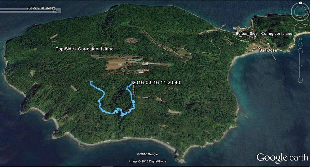 Google Earth view of Corregidor with an overlay of my GPS trek that day. 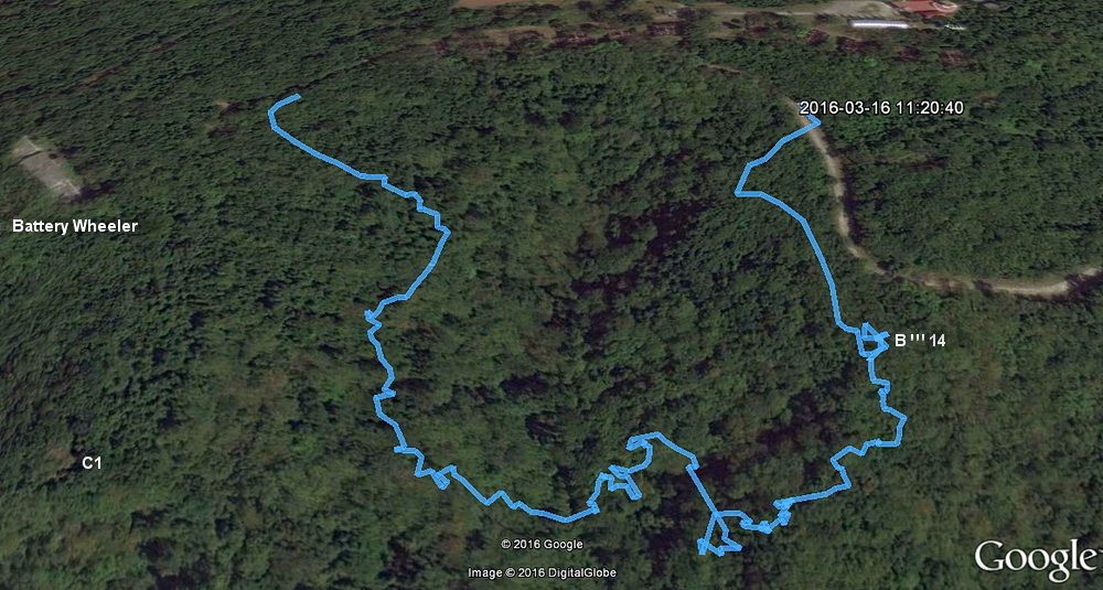 A closer view of Crockett Ravine. It looks quite easy in this view. 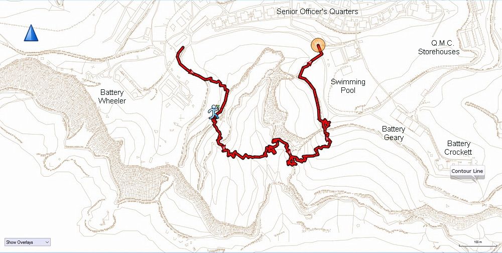 Here is the same area in the 1936 map. You can see the actual terrain including cliffs and roads. 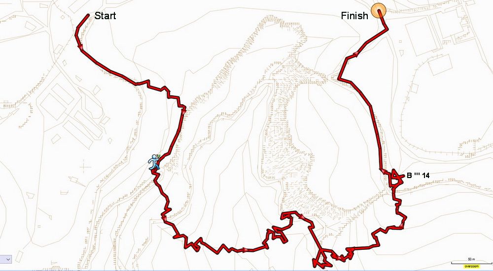 A closer view of the upper part of Crockett Ravine. 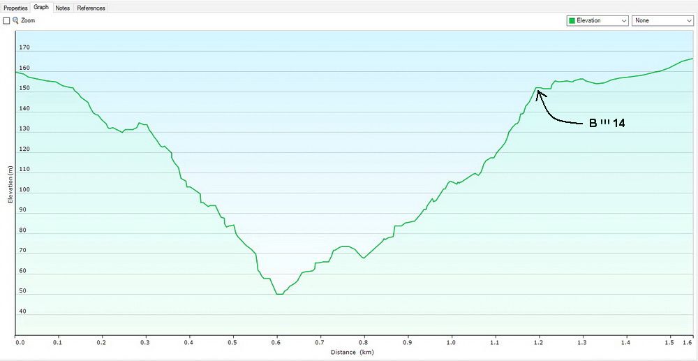 Here is the GPS elevation graph of my trek down and back up the other side of the ravine. 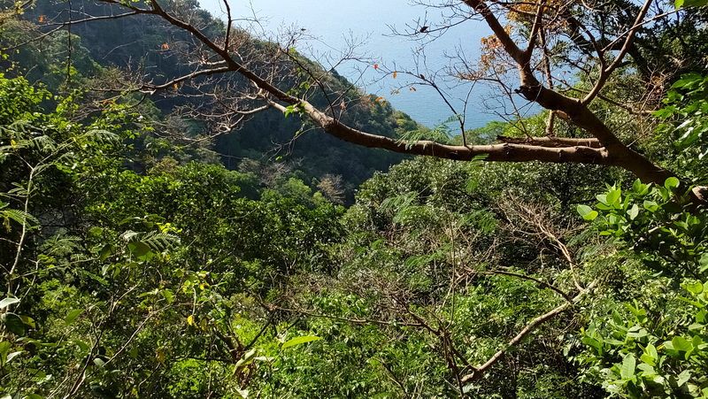 After fifteen minutes or so, a little cliff was in front of me so I could look out over the tree tops. This is a view down Crockett Ravine towards the coast. 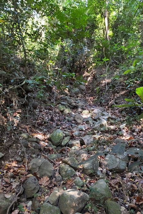 The cliff was presenting a problem until I found a dry stream bed heading straight down the hill. The loose rocks were not difficult to walk over. 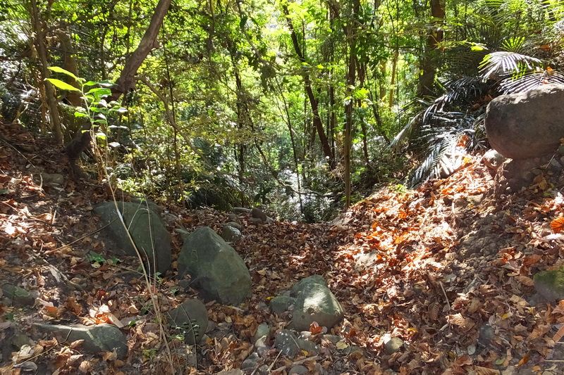 Awhile later the stream bed led to this view. Another cliff was in front of me. 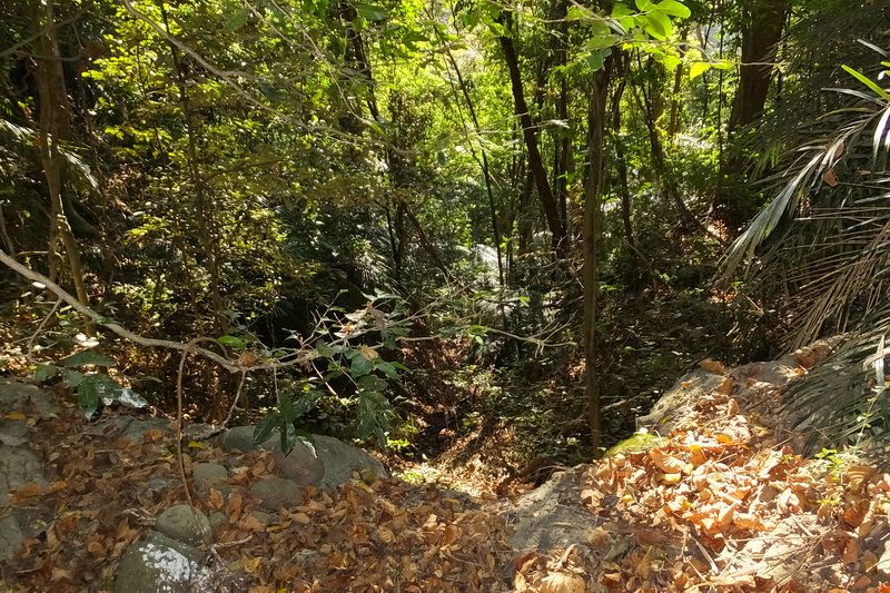 Looking over that cliff further down the ravine. This would be an impressive waterfall during a heavy rain. After a detour around it to the right I was back in the stream bed again. 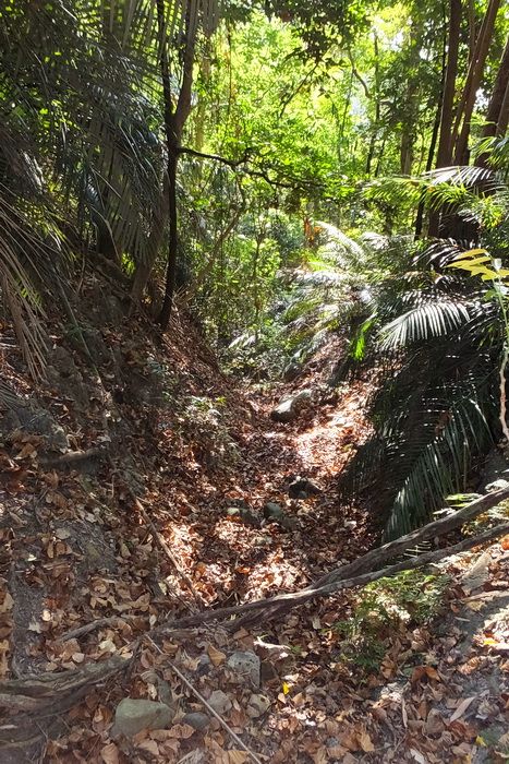 The slope had leveled out somewhat when I saw this view of another cliff ahead and I could hear running water. This cliff turned out to be just above the stream going down to the coast and was only a few feet high. 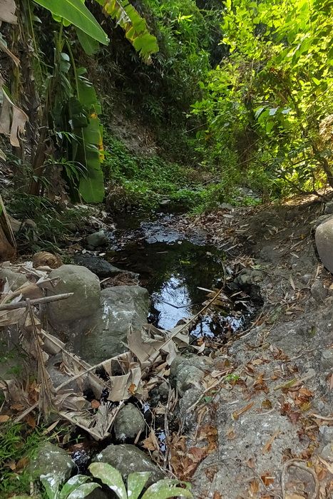 Looking down the stream going to the coast. Corregidor is very dry at this time of the year but I have always seen water here. 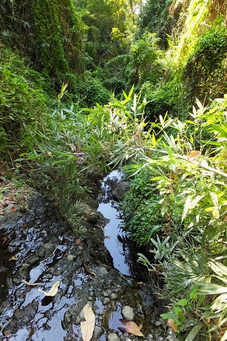 Another view of this stream. 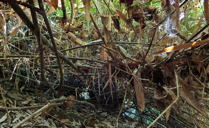 Heading back up the other side of the ravine was a challenge for a while. Here is a sample view of bamboo and bushes intertwined making the going difficult. Some places you go over it, other places you go under it. 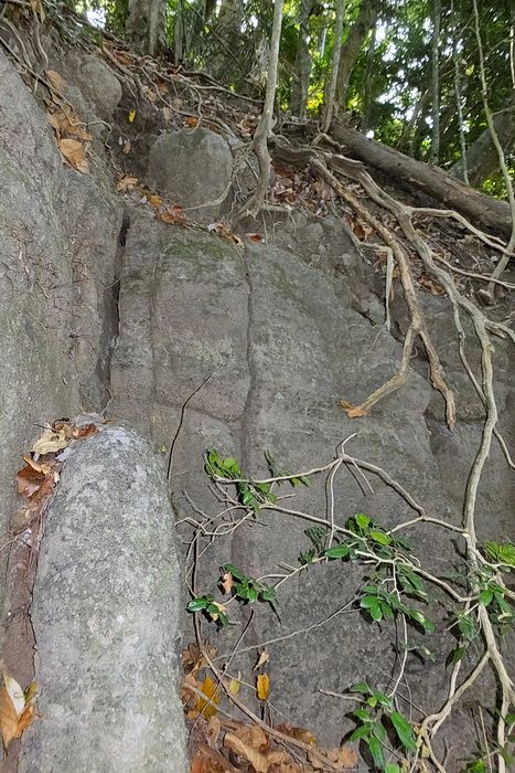 Two thirds of the way up was this final cliff. It may look difficult from this angle but there was lots to hold onto and it was very easy. The rest of the climb up had quite a slope but plenty of trees all the way. 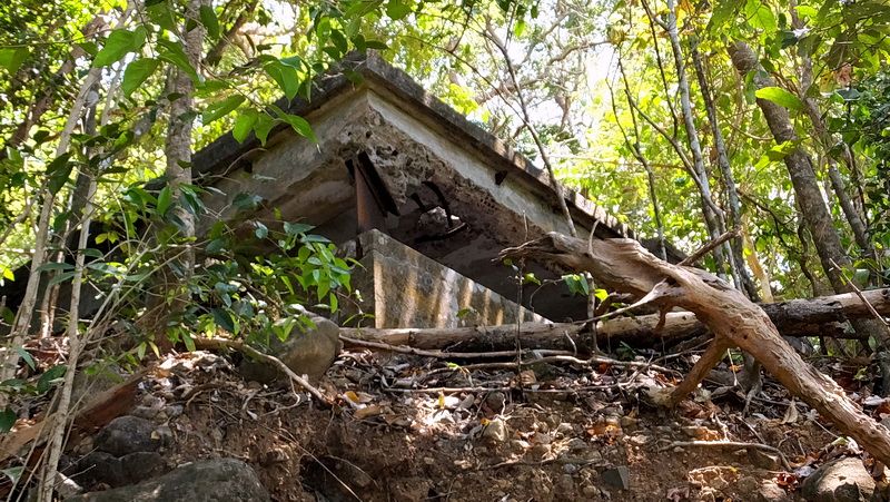 My trusty GPS guided me exactly to the B'''14 Fire Control Station. It was for Battery Crofton on Fort Frank. 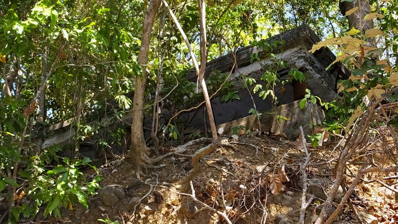 Another view from below the station. 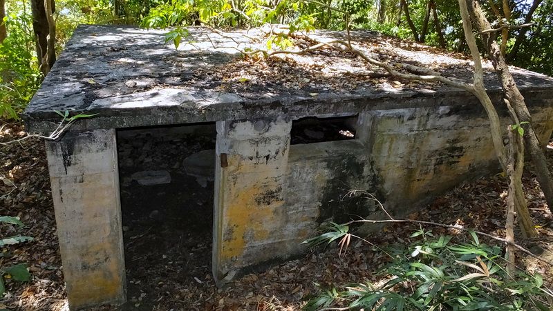 Looking down at B'''14 from above. Ten minutes later I was back out on the road and on my way to the Lighthouse area for a cold drink. After a break there, I had all afternoon to do something else. (easier this time!) Another good day on The Rock. |
|