Post by fots2 on Mar 1, 2011 9:35:00 GMT 8
In the past Karl and I have talked about the Navy Tunnels that were located in Mariveles, Bataan. Last year he got the ball rolling with the result that two tunnels can now be entered. You can also visit the locations of three more inaccessible tunnels.
By early January it was time for a trip to meet up with Karl and go exploring. After the tunnels we planned to see other war related areas and go find a fire control station on nearby Cochinos Point. We would even go off to the 'Points' if we had time.

Map of southern Bataan showing the location of Mariveles. The circled areas will be seen in this report.

Mariveles Harbour area with some 'Points of Interest' labeled. (Google Earth photo)

A chart of Mariveles Harbour.
This trip report is too large to post all at once so I will break it into sections.
PART 1: The Mariveles Navy Tunnels
I was a bit disappointed in that absolutely nothing remains to give a visitor any indication of these tunnels being military in origin. On the other hand, they are part of Bataan's WWII history. To explore inside them was interesting and well worth the effort. Some books mention many more tunnels than we know of today plus there were even two more at the Mariveles airfield. Just walking the area was great for getting a realistic feeling of locations I had only been reading about.

Google Earth satellite view of the Mariveles Navy Tunnels. (My GPS software program has a feature where waypoints can be placed in their exact positions on a Google Earth photo).
Tunnel #1B (collapsed) is most likely a second entrance to Tunnel #1A. Tunnel #2 has not been located.

Similar view, different orientation. The tunnels are in the hillside at the top of this aerial photo taken in December 2007.
In December 2010, Karl arranged for the entrance of Tunnel #1 to be dug out. It had been open years ago but later landslides had completely sealed it.

Sketch of Tunnel #1A. I'll call this entrance 1A as a nearby sealed entrance only 68 meters away may be a second entrance to this tunnel. At the moment, this cannot be confirmed 100%. (Sketch courtesy of Karl Welteke)

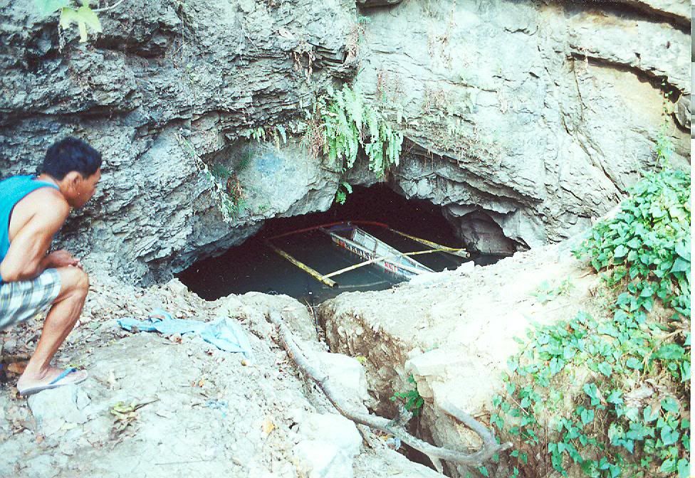
On the outside looking towards the entrance to Tunnel #1A.

Looking back towards the entrance we just came in.
You can easily stand up in most of this tunnel. Humidity is quite high and no concrete is visible anywhere. Near the entrance to the first lateral on the left are bags of sifted soil. The owner said people had been working in the tunnel years ago 'looking' for things. I saw no air vents anywhere in this tunnel.

The entrance to the first lateral on the left.
Near the end of this lateral, we see a water-filled hole in the floor that is the width of the tunnel. You can easily see the bottom through the clear water. I did not measure it but I will estimate it at 5 to 6 feet at the deepest. If you look closely you can see a little wall of neatly stacked rocks which prevents anyone from going any further. Walls are for either keeping something in or keeping something out. Not sure which scenario fits here. (Mystery #1)

Approaching the water-filled hole and rock wall.

Note the stacked rock wall. The tunnel appears to continue past this point.
Back at the main tunnel, continue inside and have a look at the next lateral which is on the right. This one is interesting in that it is low in places and a bit up and down. When you reach as far as you can go you are definitely not at the end. Bats are flying in and out of a 10 inch high gap between the rock ceiling and the soil floor. Crawling forward and sticking my light in here, I am reasonably sure that see a tunnel on both sides of me that is parallel to the main tunnel #1A. This is why we feel that Tunnel entrance #1B may be a second entrance to #1A. A bit of digging would get us past here. (Mystery #2)

Proceeding down the second lateral.

Proceeding down the second lateral.

Getting narrow ahead. Look at that grey pile of soil. Has someone been digging here?

As far as I can go but open ahead. Bats are coming in and out of here.
Back at the main tunnel, we continue on again. There is an area where you slide over some rocks that have fallen from the ceiling. Another short lateral appears on the right. After traveling quite a ways we come to the end or more correctly, to as far as we can go today.

Nearing the end of the main tunnel.
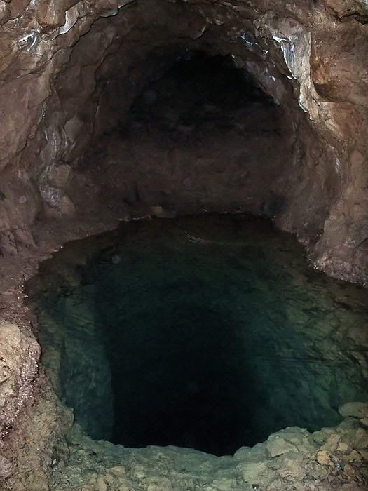
This is the farthest point we could go in this long tunnel.
A pool of water is in front of me and the tunnel may or may not be fully collapsed past that. The rectangular hole is full of clear water. It looks like a very professional construction job and I wonder why someone would go to so much bother digging it. The tunnel floor is muddy, sloped, wet and slippery. Venturing too close to the edge does not seem wise.
I would like to know how deep the hole is so I come up with this 'bright' idea of using a chemical light stick that I always carry. I snapped the stick and it glowed bright yellow. After tying a rock to it, I dropped it in the middle of the hole. In 3 seconds it went out of sight and I saw nothing. I turned off my flashlight and gave my eyes a couple minutes to adjust to total darkness. The water is crystal clear so I expected at least a faint yellow glow from down there. Nothing!!! Why dig such a hole and how deep is it? (Mystery #3)
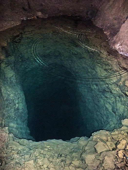
Close-up view down the rectangular hole.
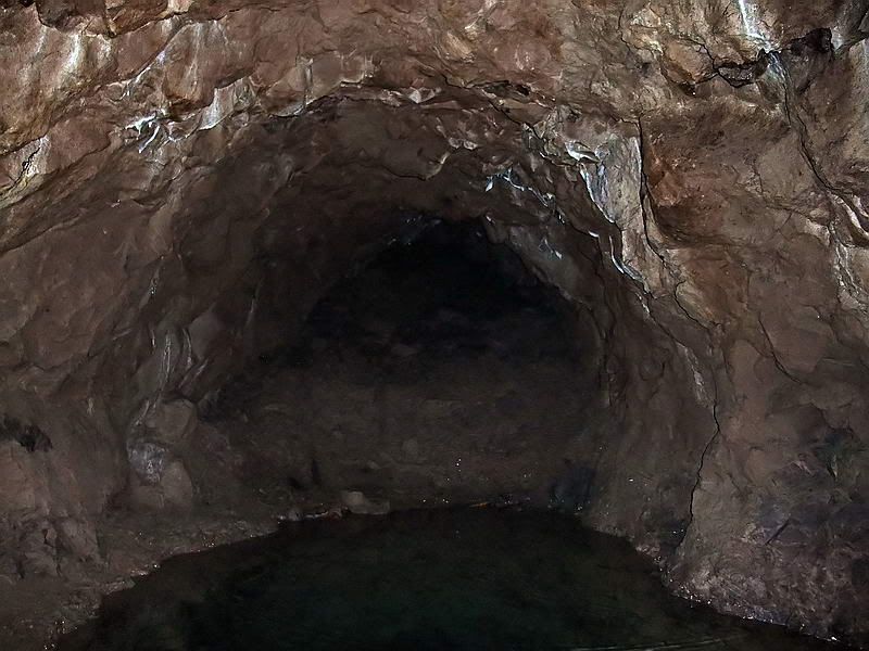
Closer view of as far as I could see past the hole. The tunnel appears to continue further on.
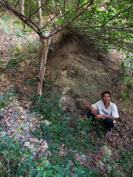
Tunnel entrance #1B. It doesn't look like much in this photo but the owner says this is a collapsed entrance and we tend to agree with him.
Tunnel #3 is the only other Navy tunnel that is accessible today. A pile of soil and rocks outside the entrance keeps nearly half of the tunnel flooded. Lots of garbage and miscellaneous junk at the entrance makes sliding in a bit messy but it is not a problem. No concrete lining is visible but as Karl's sketch says, the floor may be concrete under the muddy water. Walking through the water is easy and you only have to be careful of a few submerged objects (truck tire, electrical cable etc). There is one air vent on the right as you enter. Almost everywhere you can walk upright. I noted that the flooded section of the tunnel (which is at a level lower than the rest of the tunnel) is narrower than the un-flooded section.
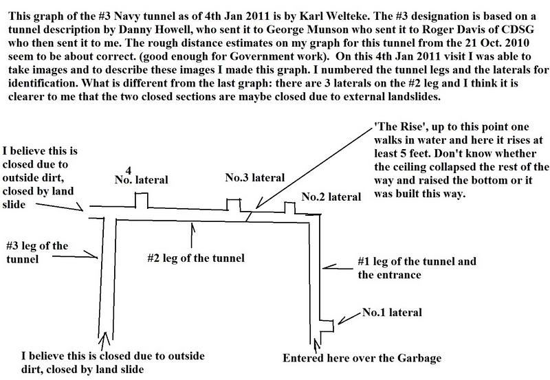
Sketch of Tunnel #3. (Sketch courtesy of Karl Welteke)
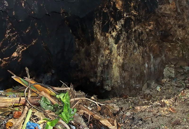
Standing on a pile of garbage looking at the entrance of Tunnel #3.
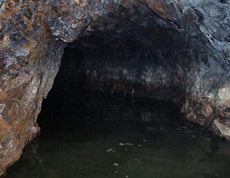
The view walking along the flooded tunnel.
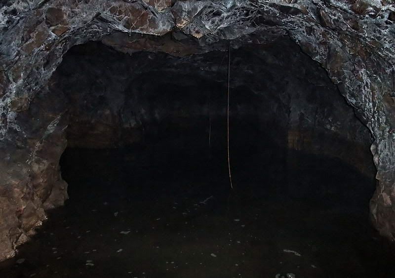
The main tunnel makes a left hand turn here. That is electrical cable hanging from the ceiling.
After seeing a short lateral on the right, you will soon come to the end of flooded tunnel. A slope of about 5 feet or more in elevation takes you up to the rest of the tunnel.
On viewing the photos on both sides of the 5 foot high tunnel transition, I have a theory on what caused the difference. It can be summed up in the term 'SNAFU'. The lower flooded section is narrow and the upper dry section is wider. A short sloping section that roughly connects the two tunnels seems to be an afterthought. Perhaps two separate tunnels were not originally designed to connect but that decision was made later. Whether it was an error or a later decision, I see two separate tunnels meeting at this point. Have a look and decide for yourselves.

The flooded tunnel ends and Karl is ascending the short passageway between the two tunnels. Note two things: (1) see how much smaller the passageway is than the flooded tunnel and (2) the flooded tunnel has a low ceiling.
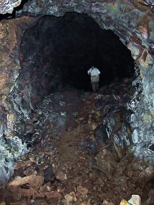
I am standing in the passageway looking up at Karl who is now at the upper tunnel level. Note how small he looks in that tunnel that has a high ceiling.
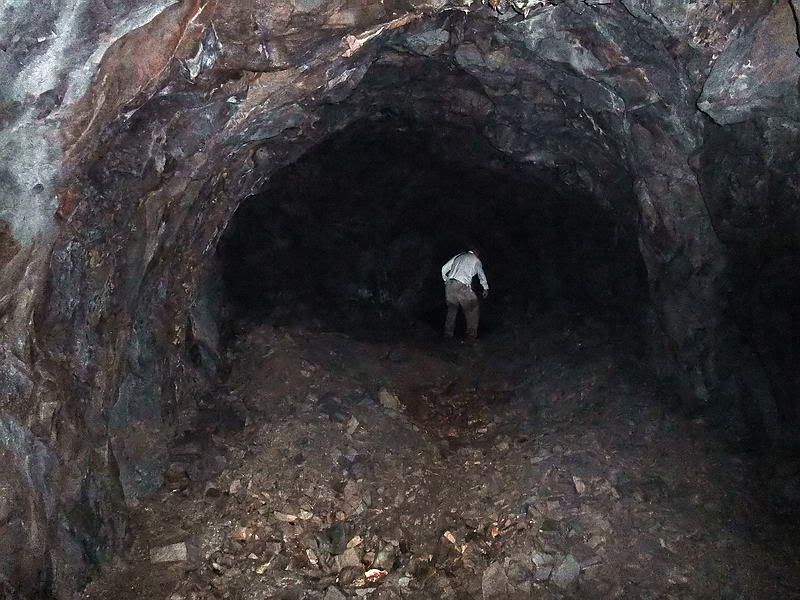
This photo was taken on the way out so now I am standing in the upper tunnel looking towards the passageway. This tunnel (wide and high) seems to come to an abrupt end straight ahead. Note the small dark area in front of Karl. This is the start of the narrow passageway down to the flooded tunnel.
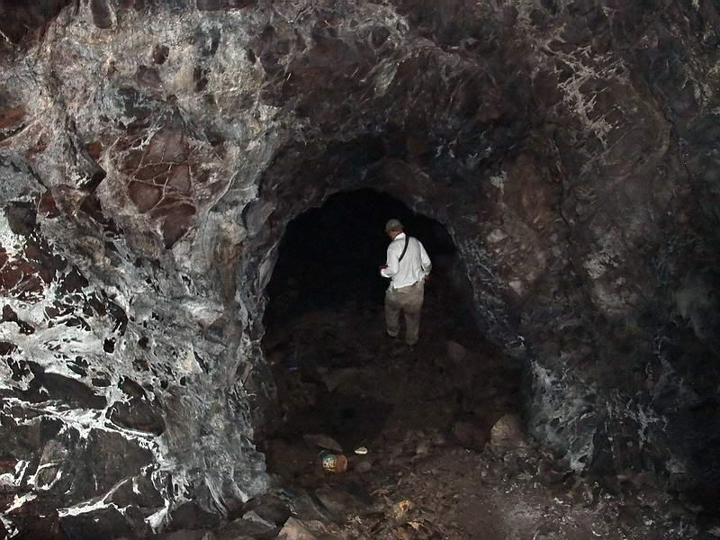
Standing at the top of the narrow passageway looking down at Karl who is about to step into the water.
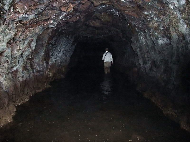
From the bottom of the passageway (at the start of the water) we see Karl walking along the narrower flooded tunnel. You can see from his wet pant legs how deep the water was that day. Stain marks on the walls indicate it is deeper at times.
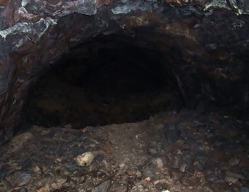
Moving further into the upper tunnel one area has piles of gravel and rocks to walk over.
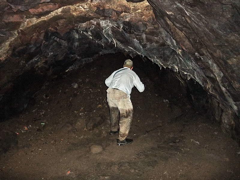
Karl inspecting the end of the main tunnel. It is completely collapsed now but used to continue past here.
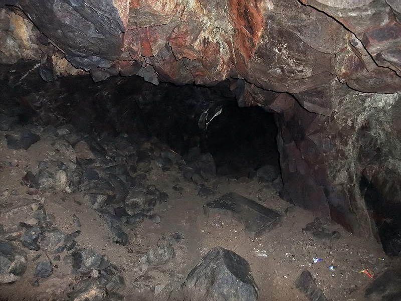
On the left a side tunnel intersects perpendicular to the big tunnel. On the ground is the only piece of concrete we have seen in any tunnel so far.

Karl cuts a path through the bats.

The tunnel is a bit wet.

This is as far as we can go in Tunnel #3. Again it is not a dead end but a collapsed tunnel. I thought it was a complete collapse until I viewed this photo. If you look close you can see a bat flying from the right side out of a crack in the wall. It is definitely open past this little collapse.

On the way back out, here is a look at the short lateral in the flooded tunnel.

A right turn will put us onto the last straight leg out of here.

The entrance is in view. The tunnel sea monsters have let us pass in peace.

Karl standing at the entrance to Tunnel #4. It is flooded and the water is being used to supply the nearby houses along the road. The tunnel ceiling is close to the water level so we did not attempt to enter here. I am sure no one would approve of us messing up their water either.

Tunnel #5 entrance. The water in this tunnel gravity feeds even more houses and the entrance is too small to get into anyway. It has been fun but our tunnel explorations are finished for today.

By early January it was time for a trip to meet up with Karl and go exploring. After the tunnels we planned to see other war related areas and go find a fire control station on nearby Cochinos Point. We would even go off to the 'Points' if we had time.

Map of southern Bataan showing the location of Mariveles. The circled areas will be seen in this report.

Mariveles Harbour area with some 'Points of Interest' labeled. (Google Earth photo)

A chart of Mariveles Harbour.
This trip report is too large to post all at once so I will break it into sections.
PART 1: The Mariveles Navy Tunnels
I was a bit disappointed in that absolutely nothing remains to give a visitor any indication of these tunnels being military in origin. On the other hand, they are part of Bataan's WWII history. To explore inside them was interesting and well worth the effort. Some books mention many more tunnels than we know of today plus there were even two more at the Mariveles airfield. Just walking the area was great for getting a realistic feeling of locations I had only been reading about.

Google Earth satellite view of the Mariveles Navy Tunnels. (My GPS software program has a feature where waypoints can be placed in their exact positions on a Google Earth photo).
Tunnel #1B (collapsed) is most likely a second entrance to Tunnel #1A. Tunnel #2 has not been located.

Similar view, different orientation. The tunnels are in the hillside at the top of this aerial photo taken in December 2007.
In December 2010, Karl arranged for the entrance of Tunnel #1 to be dug out. It had been open years ago but later landslides had completely sealed it.

Sketch of Tunnel #1A. I'll call this entrance 1A as a nearby sealed entrance only 68 meters away may be a second entrance to this tunnel. At the moment, this cannot be confirmed 100%. (Sketch courtesy of Karl Welteke)

On the outside looking towards the entrance to Tunnel #1A.

Looking back towards the entrance we just came in.
You can easily stand up in most of this tunnel. Humidity is quite high and no concrete is visible anywhere. Near the entrance to the first lateral on the left are bags of sifted soil. The owner said people had been working in the tunnel years ago 'looking' for things. I saw no air vents anywhere in this tunnel.

The entrance to the first lateral on the left.
Near the end of this lateral, we see a water-filled hole in the floor that is the width of the tunnel. You can easily see the bottom through the clear water. I did not measure it but I will estimate it at 5 to 6 feet at the deepest. If you look closely you can see a little wall of neatly stacked rocks which prevents anyone from going any further. Walls are for either keeping something in or keeping something out. Not sure which scenario fits here. (Mystery #1)

Approaching the water-filled hole and rock wall.

Note the stacked rock wall. The tunnel appears to continue past this point.
Back at the main tunnel, continue inside and have a look at the next lateral which is on the right. This one is interesting in that it is low in places and a bit up and down. When you reach as far as you can go you are definitely not at the end. Bats are flying in and out of a 10 inch high gap between the rock ceiling and the soil floor. Crawling forward and sticking my light in here, I am reasonably sure that see a tunnel on both sides of me that is parallel to the main tunnel #1A. This is why we feel that Tunnel entrance #1B may be a second entrance to #1A. A bit of digging would get us past here. (Mystery #2)

Proceeding down the second lateral.

Proceeding down the second lateral.

Getting narrow ahead. Look at that grey pile of soil. Has someone been digging here?

As far as I can go but open ahead. Bats are coming in and out of here.
Back at the main tunnel, we continue on again. There is an area where you slide over some rocks that have fallen from the ceiling. Another short lateral appears on the right. After traveling quite a ways we come to the end or more correctly, to as far as we can go today.

Nearing the end of the main tunnel.

This is the farthest point we could go in this long tunnel.
A pool of water is in front of me and the tunnel may or may not be fully collapsed past that. The rectangular hole is full of clear water. It looks like a very professional construction job and I wonder why someone would go to so much bother digging it. The tunnel floor is muddy, sloped, wet and slippery. Venturing too close to the edge does not seem wise.
I would like to know how deep the hole is so I come up with this 'bright' idea of using a chemical light stick that I always carry. I snapped the stick and it glowed bright yellow. After tying a rock to it, I dropped it in the middle of the hole. In 3 seconds it went out of sight and I saw nothing. I turned off my flashlight and gave my eyes a couple minutes to adjust to total darkness. The water is crystal clear so I expected at least a faint yellow glow from down there. Nothing!!! Why dig such a hole and how deep is it? (Mystery #3)

Close-up view down the rectangular hole.

Closer view of as far as I could see past the hole. The tunnel appears to continue further on.

Tunnel entrance #1B. It doesn't look like much in this photo but the owner says this is a collapsed entrance and we tend to agree with him.
Tunnel #3 is the only other Navy tunnel that is accessible today. A pile of soil and rocks outside the entrance keeps nearly half of the tunnel flooded. Lots of garbage and miscellaneous junk at the entrance makes sliding in a bit messy but it is not a problem. No concrete lining is visible but as Karl's sketch says, the floor may be concrete under the muddy water. Walking through the water is easy and you only have to be careful of a few submerged objects (truck tire, electrical cable etc). There is one air vent on the right as you enter. Almost everywhere you can walk upright. I noted that the flooded section of the tunnel (which is at a level lower than the rest of the tunnel) is narrower than the un-flooded section.

Sketch of Tunnel #3. (Sketch courtesy of Karl Welteke)

Standing on a pile of garbage looking at the entrance of Tunnel #3.

The view walking along the flooded tunnel.

The main tunnel makes a left hand turn here. That is electrical cable hanging from the ceiling.
After seeing a short lateral on the right, you will soon come to the end of flooded tunnel. A slope of about 5 feet or more in elevation takes you up to the rest of the tunnel.
On viewing the photos on both sides of the 5 foot high tunnel transition, I have a theory on what caused the difference. It can be summed up in the term 'SNAFU'. The lower flooded section is narrow and the upper dry section is wider. A short sloping section that roughly connects the two tunnels seems to be an afterthought. Perhaps two separate tunnels were not originally designed to connect but that decision was made later. Whether it was an error or a later decision, I see two separate tunnels meeting at this point. Have a look and decide for yourselves.

The flooded tunnel ends and Karl is ascending the short passageway between the two tunnels. Note two things: (1) see how much smaller the passageway is than the flooded tunnel and (2) the flooded tunnel has a low ceiling.

I am standing in the passageway looking up at Karl who is now at the upper tunnel level. Note how small he looks in that tunnel that has a high ceiling.

This photo was taken on the way out so now I am standing in the upper tunnel looking towards the passageway. This tunnel (wide and high) seems to come to an abrupt end straight ahead. Note the small dark area in front of Karl. This is the start of the narrow passageway down to the flooded tunnel.

Standing at the top of the narrow passageway looking down at Karl who is about to step into the water.

From the bottom of the passageway (at the start of the water) we see Karl walking along the narrower flooded tunnel. You can see from his wet pant legs how deep the water was that day. Stain marks on the walls indicate it is deeper at times.

Moving further into the upper tunnel one area has piles of gravel and rocks to walk over.

Karl inspecting the end of the main tunnel. It is completely collapsed now but used to continue past here.

On the left a side tunnel intersects perpendicular to the big tunnel. On the ground is the only piece of concrete we have seen in any tunnel so far.

Karl cuts a path through the bats.

The tunnel is a bit wet.

This is as far as we can go in Tunnel #3. Again it is not a dead end but a collapsed tunnel. I thought it was a complete collapse until I viewed this photo. If you look close you can see a bat flying from the right side out of a crack in the wall. It is definitely open past this little collapse.

On the way back out, here is a look at the short lateral in the flooded tunnel.

A right turn will put us onto the last straight leg out of here.

The entrance is in view. The tunnel sea monsters have let us pass in peace.

Karl standing at the entrance to Tunnel #4. It is flooded and the water is being used to supply the nearby houses along the road. The tunnel ceiling is close to the water level so we did not attempt to enter here. I am sure no one would approve of us messing up their water either.

Tunnel #5 entrance. The water in this tunnel gravity feeds even more houses and the entrance is too small to get into anyway. It has been fun but our tunnel explorations are finished for today.


 One does wonder if it was left by Navy construction people back in 1942 or a relic from postwar digging. Anyhow, enjoyed your latest effort big time. Looking forward to my next "fix". Cheers. Postscript....The aerial views and charts are excellent. Lays everything right in my lap, way back here in the badlands.

 Thanks for pictures and trip report. The maps and labels are especially helpful.
