Post by Karl Welteke on Mar 3, 2013 17:09:37 GMT 8
Upper Pocket, Battle of the Pockets. 23rd Feb. 2013.
Conrad Buehler and I finally made it to the Battle of the Pockets and with the help of Mr. Alehandre, a resident near by, we are certain that we identified the Upper Pocket of the battle. We found bullets and other material just sticking out of the ground of the fields Mr. Alehandre pointed out to us. Then on top of it all he gave a treasure cove of WWII artifacts to Conrad. Thank you very much, Mr. Alehandre!
THIS LINK WITH MULTIPLY IMAGE SHARING ACCOUNT IS DEAD FOR EVER. I have been having bad luck in choosing the right image sharing accounts. Multiply just dropped this service even though I had 2 year paid pro account with them.
Other personal activities will prevent me to tackle this problem for the next 4 month and today is 2013-03-24.
Also had problems with the Kodak sharing account in the past and now my Photobucket account is making things difficult also. DON’T RECOMMEND NEITHER ONE TO ANYONE!!!!!!!!!!!
77 images have been uploaded here including 3 maps.
pisailor.multiply.com/photos/album/163/Upper-Pocket-Battle-of-the-Pockets.-23rd-Feb.-2013.
A good reference for reading up on this battle is here:
United States Army in World War II
The War in the Pacific
The Fall of the Philippines
Louis Morton
www.ibiblio.org/hyperwar/USA/USA-P-PI/USA-P-PI-18.html
Here are some sample pictures:
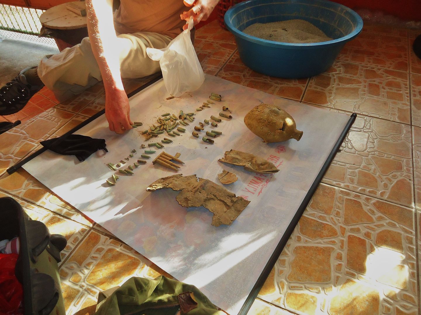
These are mostly artifacts that Mr.Alejandre gave to Conrad and a few items he found himself. The few items I found I have not photographed yet. We tried to show our appreciation but MR Alejandre refused and said he was glad to give it to us because we were interested in history.
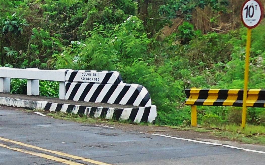
The bridge over the Culvo River which seems to be the boundary between the Municipalities of Pilar and Bagac. Here is the welcome gate to Bagac located and the Battle of the Pockets Marker.
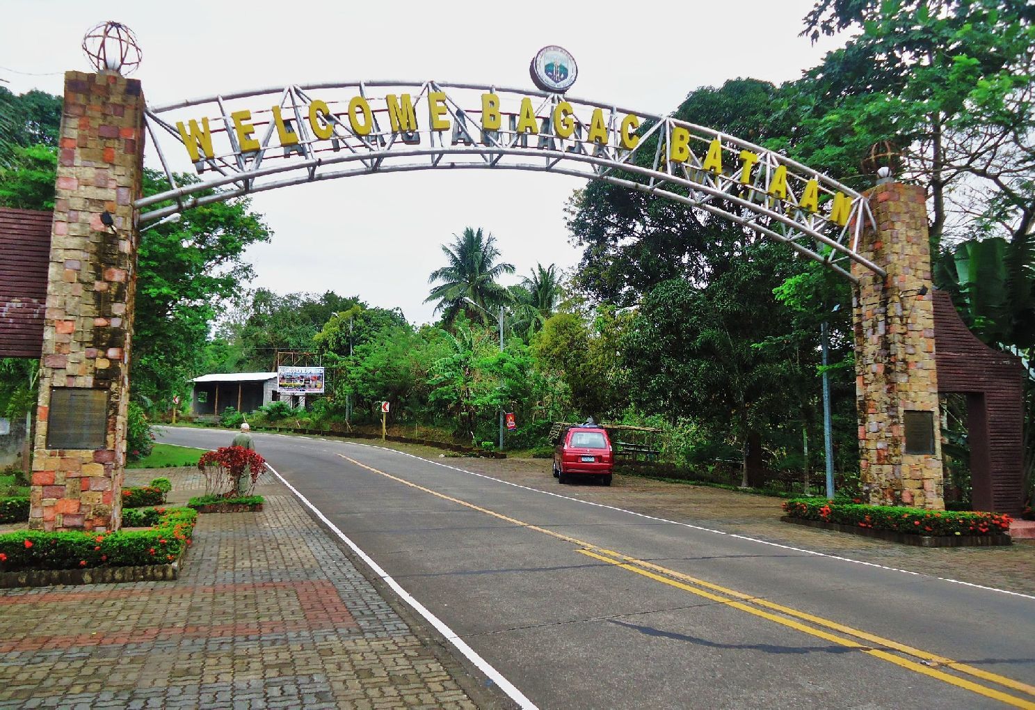
The Bagac Welcome Gate, the Battle of the Pockets Marker is hidden by my car. This location is about 2 km or so east from the start of trail #7.
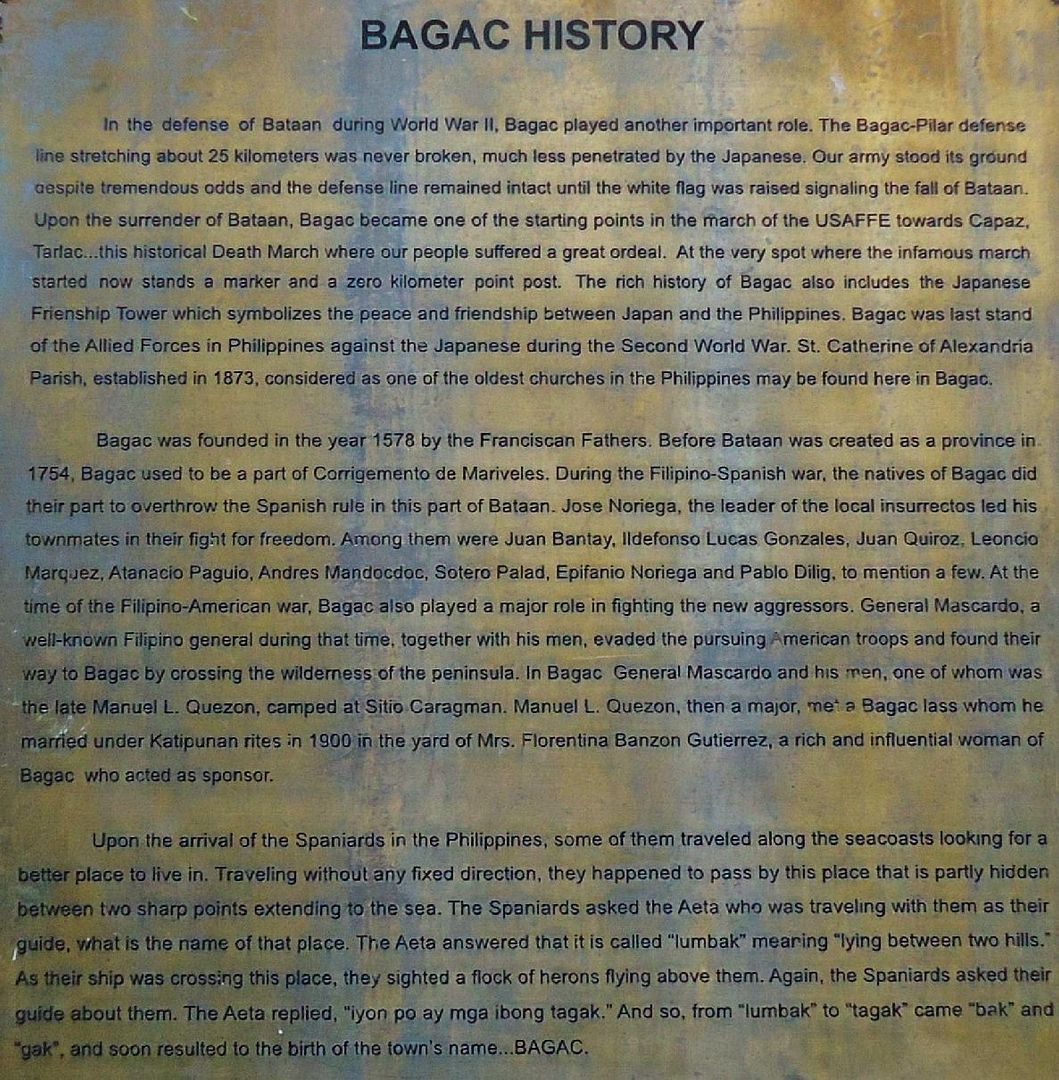
This history plaque on the left post of the Bagac Welcome gate post had an interesting tidbit that President Quezon found his bride in Bagac here when he was an freedom fighter against the Americans during the Philippine American War in 1900.
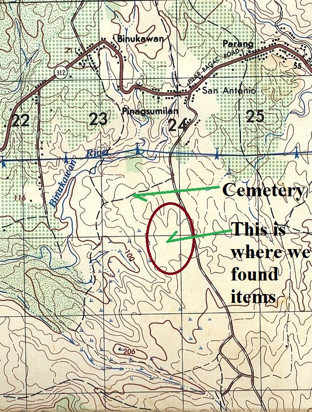
On this map the Gogo River has the name Binukawan, this name was also on the bridge upriver where it went under the Pilar-Bagac Road in Barangay (village or barrio) San Antonio.
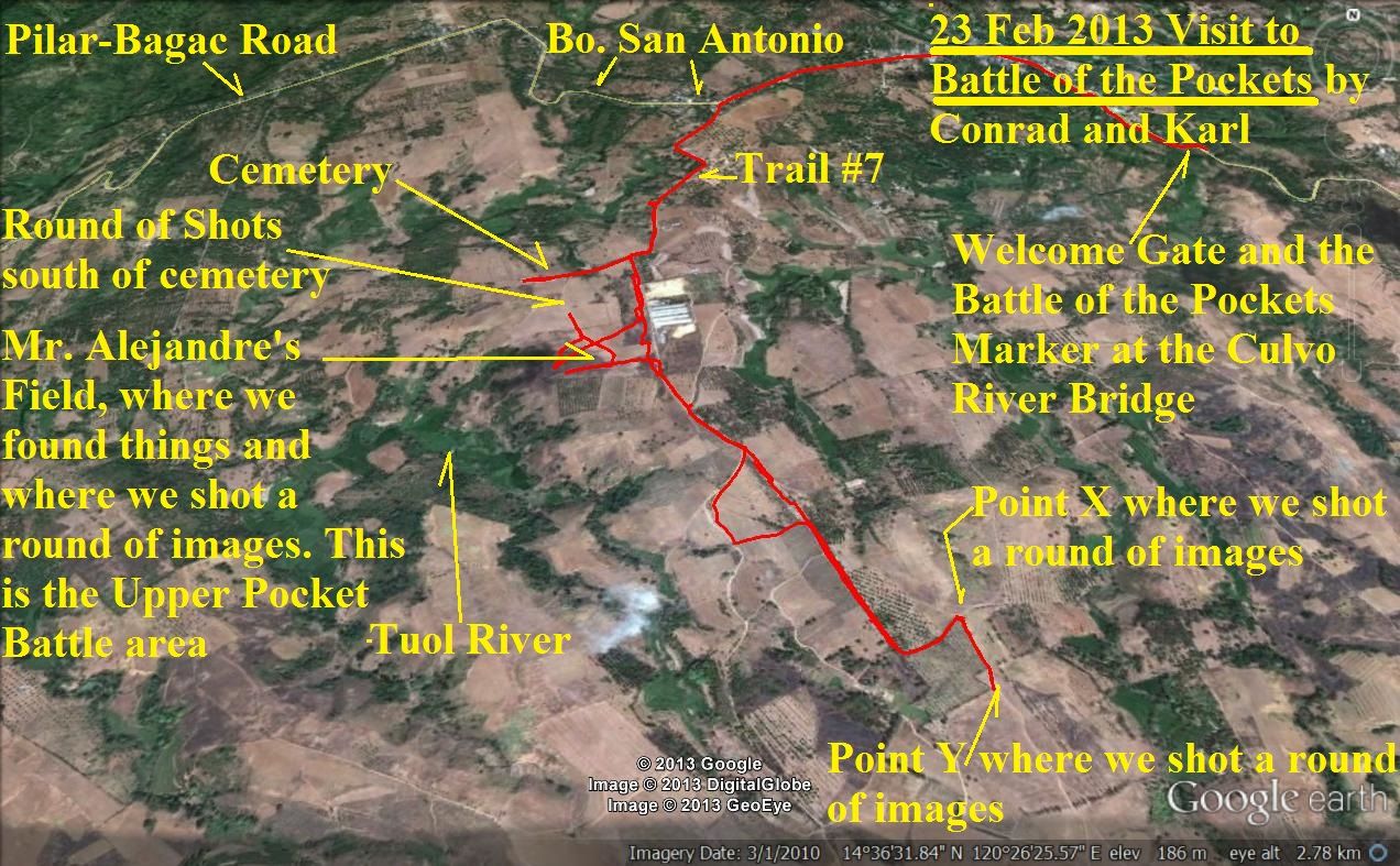
This Google Earth map gives you all the landmarks that help you identify where the pictures where shot and you can figure out in what direction. This map also shows our GPS track.
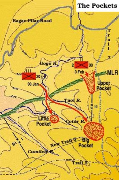
This map from the Fall of the Philippines is most important really, in identifying where we were and helps you understand where one is in reality and on the more modern map.
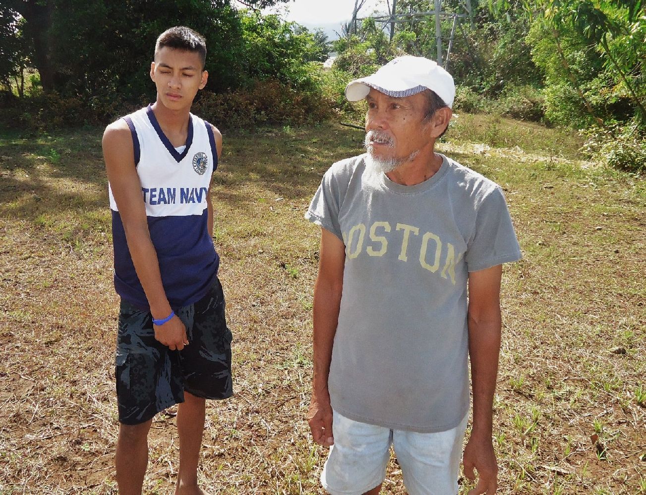
At right is Mr. Alejandre who took us right under his arm and took us to his field where he said he found WWII things all the time.
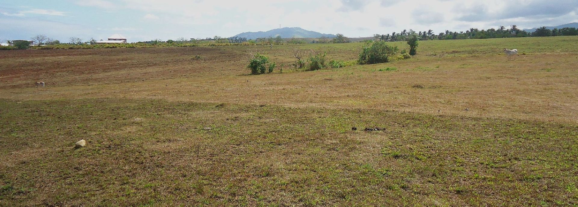
Obviously we are looking east and across a field where we found most of the things and they were just laying on the ground.
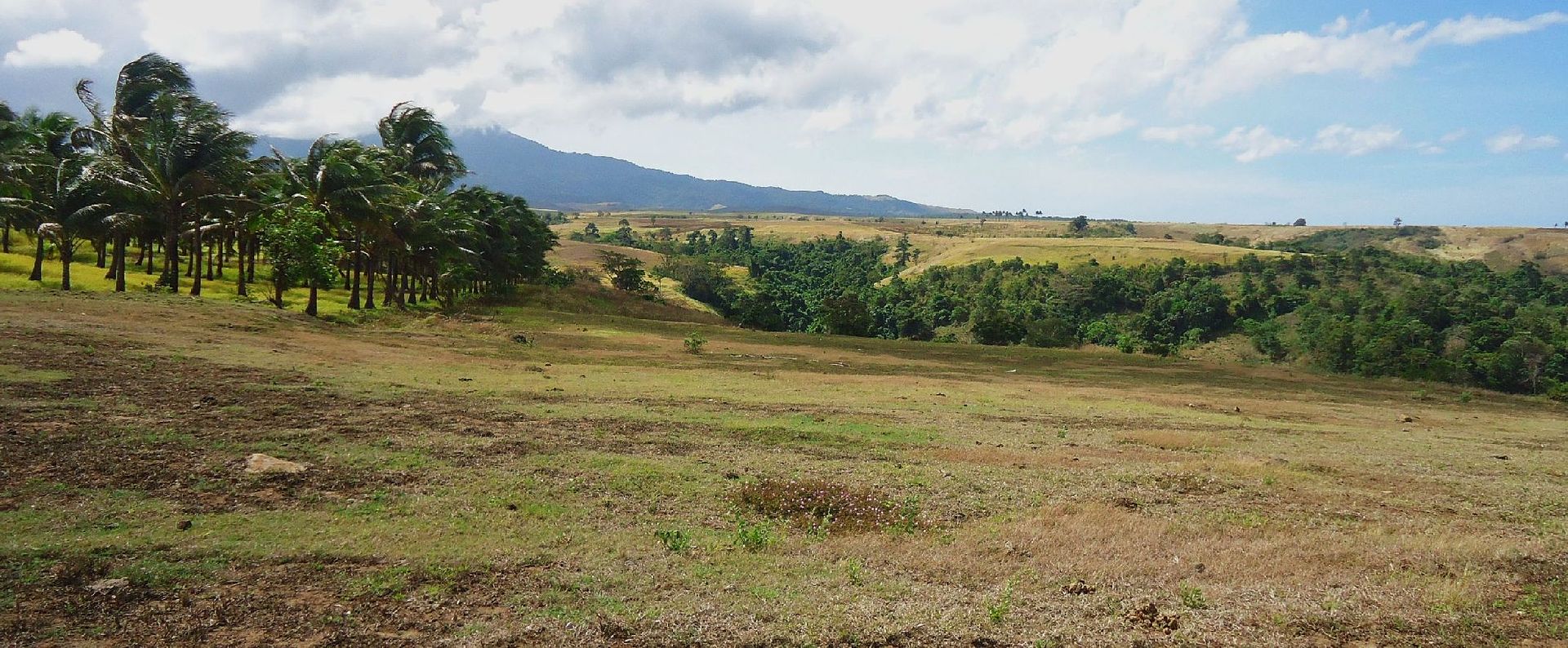
I’m looking S to SW across the Tuol River.
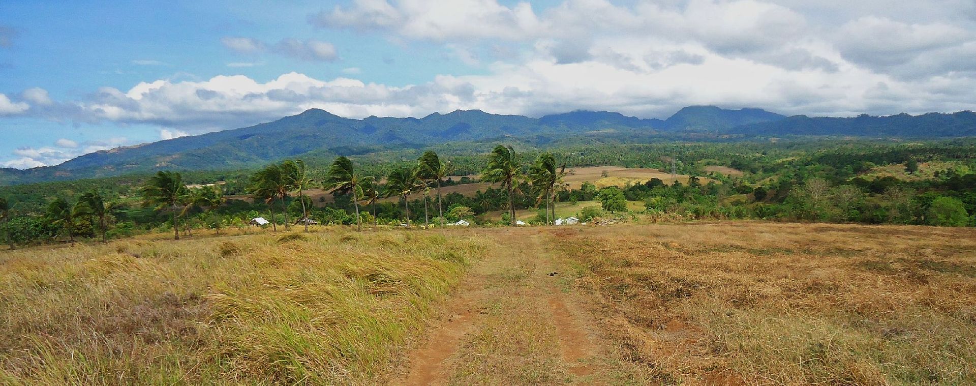
I’m just south of the cemetery and I’m looking north. In the depression below is the Gogo River, flowing from east to west. On the modern map the river is now called Binukawan but the people here were familiar with the Gogo name.
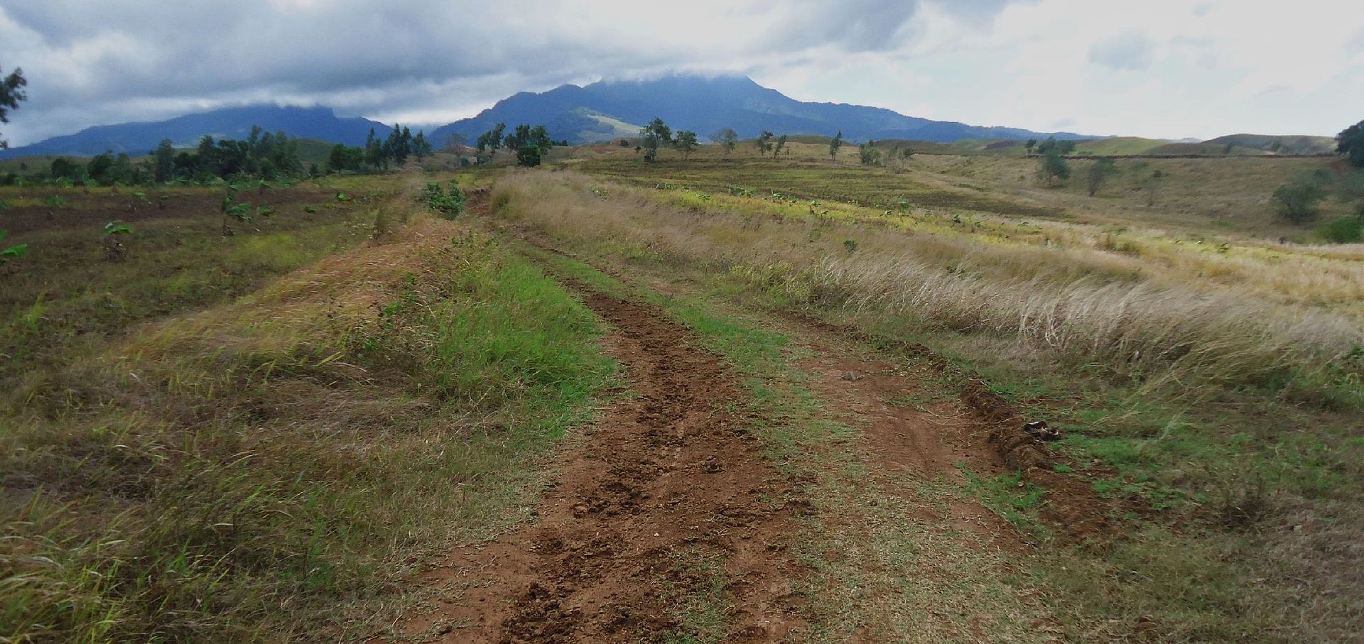
Using the Fall of the Philippine map, there is no doubt in my mind that this is the ex Trail # 7 and it is heading south towards the west flank of Mt. Mariveles. Because of this map we had no trouble finding this place at all. This image was shot from Point “Y” on the marked up Google map.
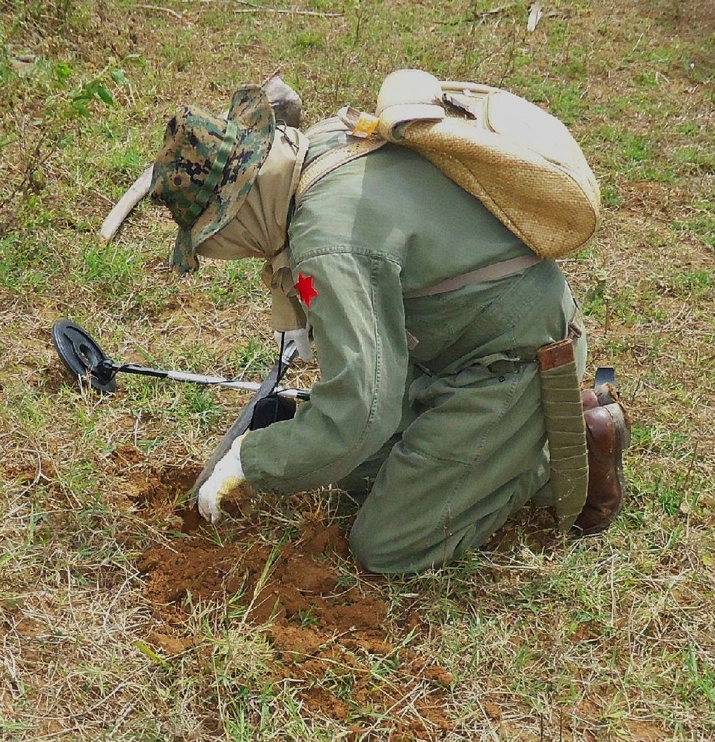
Conrad Buehler at work. But the metal detector was beeping all the time and all he found was very small rusty iron chips. On the 2nd day he gave up using the device and we found things with our naked eyes.
Conrad Buehler and I finally made it to the Battle of the Pockets and with the help of Mr. Alehandre, a resident near by, we are certain that we identified the Upper Pocket of the battle. We found bullets and other material just sticking out of the ground of the fields Mr. Alehandre pointed out to us. Then on top of it all he gave a treasure cove of WWII artifacts to Conrad. Thank you very much, Mr. Alehandre!
THIS LINK WITH MULTIPLY IMAGE SHARING ACCOUNT IS DEAD FOR EVER. I have been having bad luck in choosing the right image sharing accounts. Multiply just dropped this service even though I had 2 year paid pro account with them.
Other personal activities will prevent me to tackle this problem for the next 4 month and today is 2013-03-24.
Also had problems with the Kodak sharing account in the past and now my Photobucket account is making things difficult also. DON’T RECOMMEND NEITHER ONE TO ANYONE!!!!!!!!!!!
77 images have been uploaded here including 3 maps.
pisailor.multiply.com/photos/album/163/Upper-Pocket-Battle-of-the-Pockets.-23rd-Feb.-2013.
A good reference for reading up on this battle is here:
United States Army in World War II
The War in the Pacific
The Fall of the Philippines
Louis Morton
www.ibiblio.org/hyperwar/USA/USA-P-PI/USA-P-PI-18.html
Here are some sample pictures:

These are mostly artifacts that Mr.Alejandre gave to Conrad and a few items he found himself. The few items I found I have not photographed yet. We tried to show our appreciation but MR Alejandre refused and said he was glad to give it to us because we were interested in history.

The bridge over the Culvo River which seems to be the boundary between the Municipalities of Pilar and Bagac. Here is the welcome gate to Bagac located and the Battle of the Pockets Marker.

The Bagac Welcome Gate, the Battle of the Pockets Marker is hidden by my car. This location is about 2 km or so east from the start of trail #7.

This history plaque on the left post of the Bagac Welcome gate post had an interesting tidbit that President Quezon found his bride in Bagac here when he was an freedom fighter against the Americans during the Philippine American War in 1900.

On this map the Gogo River has the name Binukawan, this name was also on the bridge upriver where it went under the Pilar-Bagac Road in Barangay (village or barrio) San Antonio.

This Google Earth map gives you all the landmarks that help you identify where the pictures where shot and you can figure out in what direction. This map also shows our GPS track.

This map from the Fall of the Philippines is most important really, in identifying where we were and helps you understand where one is in reality and on the more modern map.

At right is Mr. Alejandre who took us right under his arm and took us to his field where he said he found WWII things all the time.

Obviously we are looking east and across a field where we found most of the things and they were just laying on the ground.

I’m looking S to SW across the Tuol River.

I’m just south of the cemetery and I’m looking north. In the depression below is the Gogo River, flowing from east to west. On the modern map the river is now called Binukawan but the people here were familiar with the Gogo name.

Using the Fall of the Philippine map, there is no doubt in my mind that this is the ex Trail # 7 and it is heading south towards the west flank of Mt. Mariveles. Because of this map we had no trouble finding this place at all. This image was shot from Point “Y” on the marked up Google map.

Conrad Buehler at work. But the metal detector was beeping all the time and all he found was very small rusty iron chips. On the 2nd day he gave up using the device and we found things with our naked eyes.


