|
|
Post by Karl Welteke on Aug 28, 2023 10:00:27 GMT 8
Why Do Foreigners Want To Move To Subic Bay Philippines 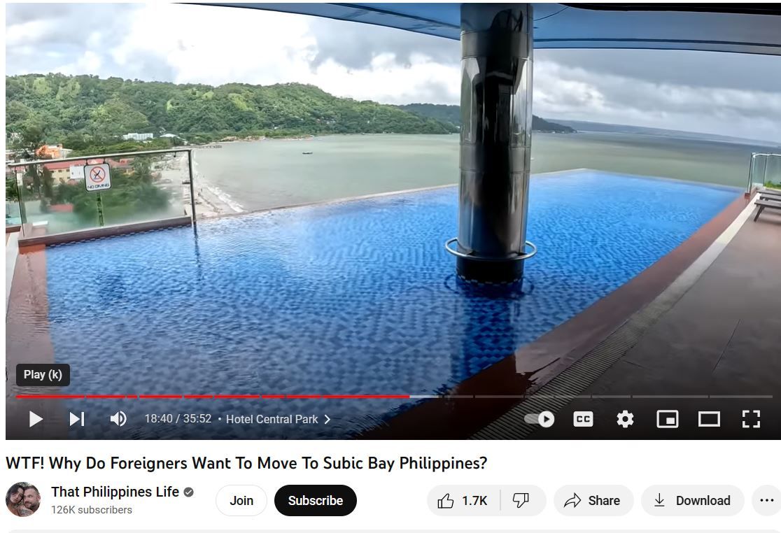 This video is strictly only for people who are interested in Barrio Barretto, Olongapo City and SBFZ, the former Naval Base Subic Bay This is about a 30 min. video about mostly Barretto but also a little bit of Olongapo and the former Base. Although the Canadian couple, who made the video, were here for the first time but they caught nice glimpses of this Subic Bay area, the way it is now. |
|
|
|
Post by Karl Welteke on Sept 7, 2023 18:52:33 GMT 8
Barretto Beach Walk, 2023-09-06 Barretto Beach Walk with new camera and after big rain the night and other days before. I posted 55 images in this Photobucket album. If you are going to look at it, click the icon “ i ” to open the photo descriptions, click here: app.photobucket.com/u/PI-Sailor/a/cb8f6beb-53a1-4065-87d0-de5a7e39dbe8?field=TITLE&desc=ascHere are 5 sample images: 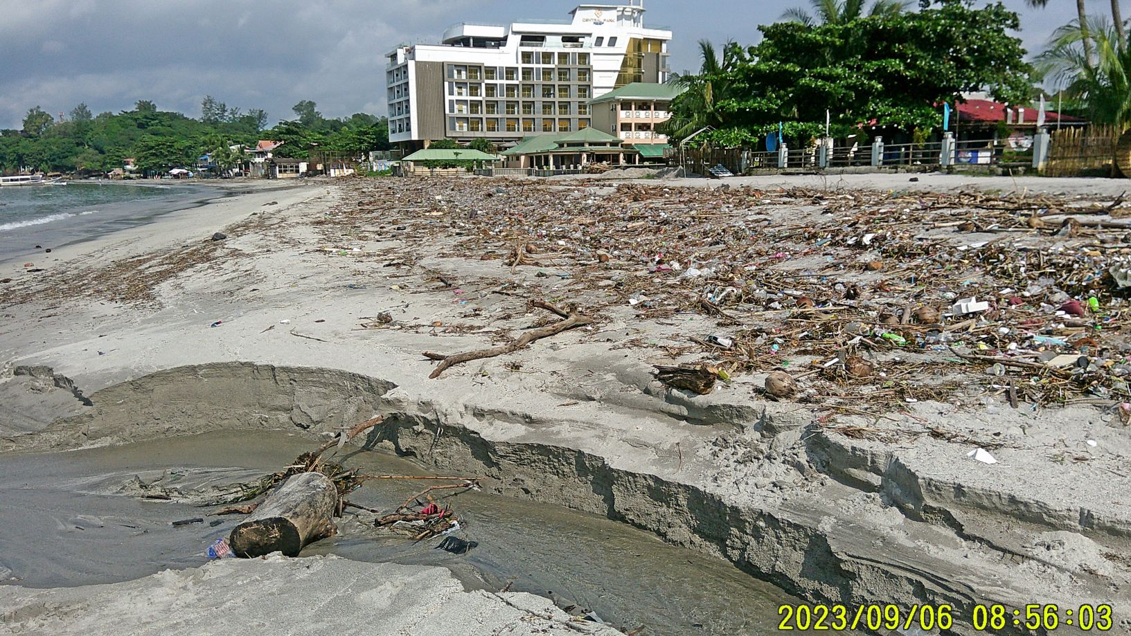 Zg470. (-#05). Pictures #05 to 09 were shot in front of or just inside the By The Sea Hotel area at the Barrio Barretto Beach. 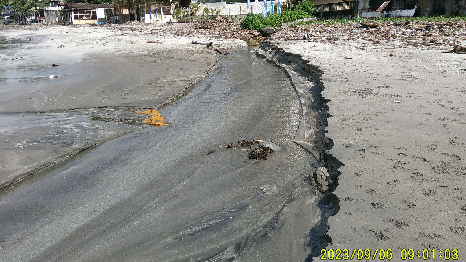 Zg471. (#10). Picture #10 is the Barrio Barretto rain flood drainage discharge next to the new High Rise Hotel. 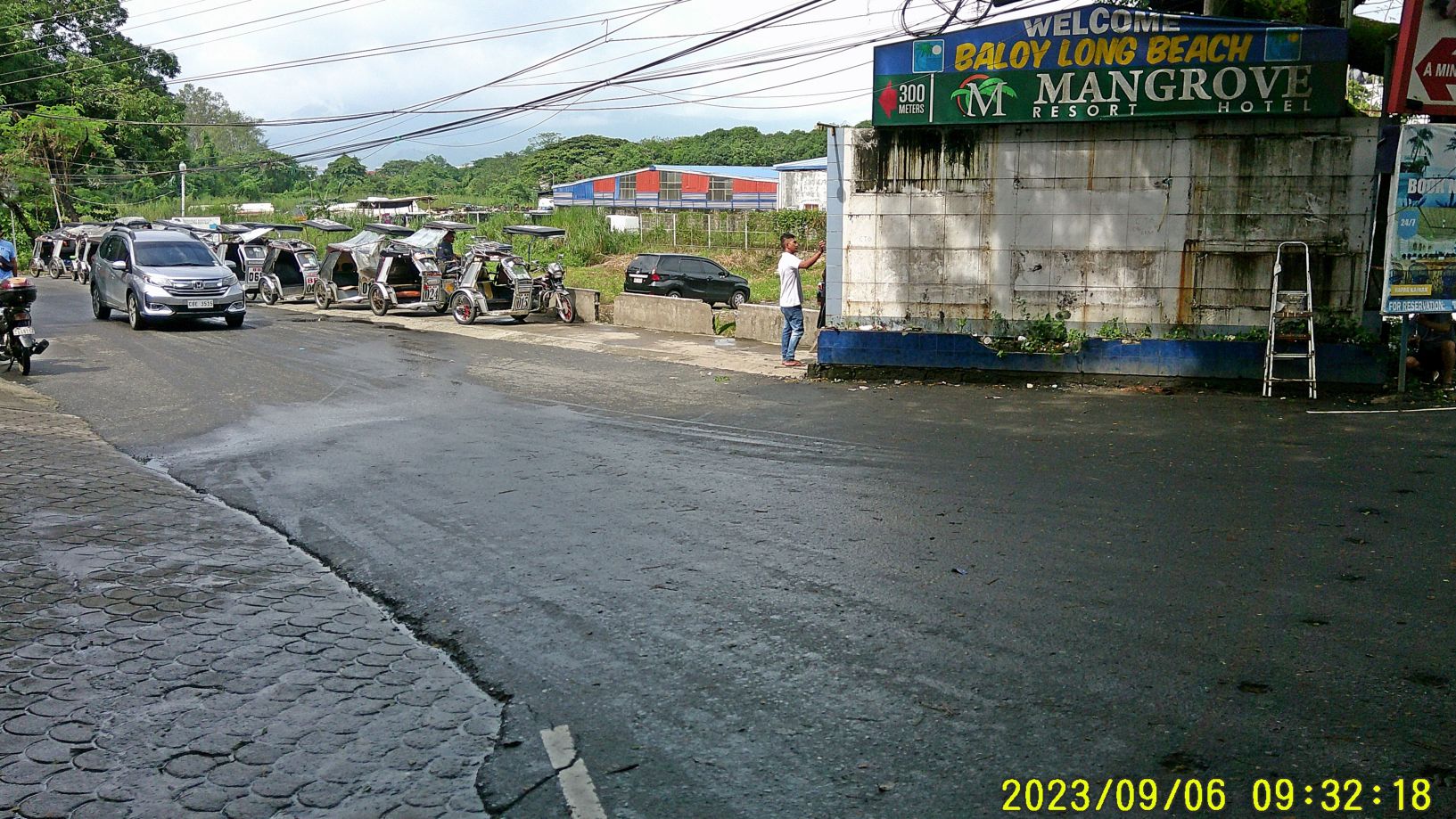 Zg472. (-#14). 14Pictures #12 to 15 are from the short walk from the Barrio Barretto Beach to the entrance of Baloy Long Beach. Noteworthy is embankment construction thru the ridge running to Baloy Beach. And even more noteworthy is the new fact that the Baloy Beach Tricycle waiting area was moved just now, further into the Baloy Access road. The rumor has it that the construction of a new MacDonald’s is about to begin. 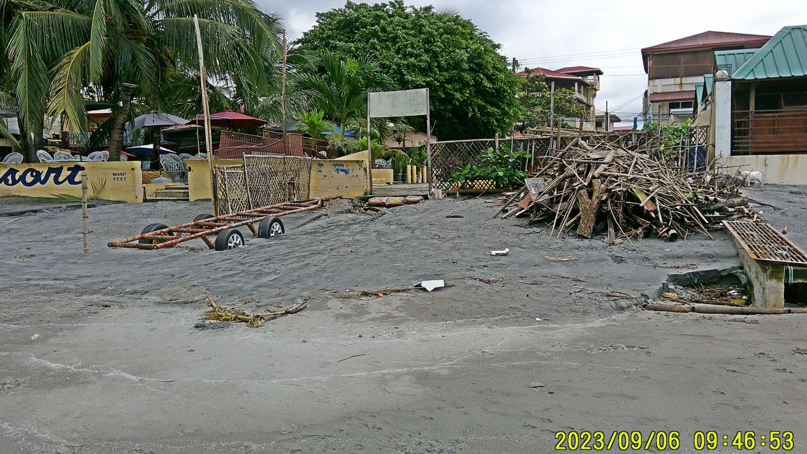 Zg473. Pictures #16 to 43 are along the Baloy Long Beach with some of the more well known beach bars & hotels shown. Notice that the Baloy Beach got very little trash after the big rain compared to the Barrio Barretto Beach. Picture #43 is the last picture, just before, east, of the Baloy Beach End which was demolished and cleared for a new development. 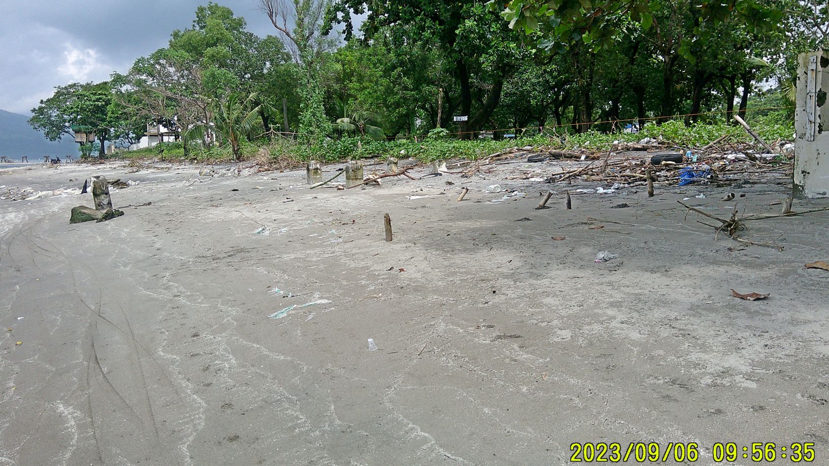 Zg474. -#44. Pictures #44 to 48 are from the North West End of Baloy Beach. It was low tide at the moment and this is the mouth of the Matain River. I walked to the development area, walls on three sides and one or more guard towers are built. But today I didn’t see even one guard. I asked the people nearby but they assured me that there are guards on duty. |
|
|
|
Post by Karl Welteke on Sept 9, 2023 14:55:17 GMT 8
A Day in Subic Bay w. a Friend, 23-09-08 A day with Bill Loudermilk in Subic Bay, 2023-09-08. We go back to Viet Nam in 1966 at Da Nang. Bill is back in Town, about 2 ½ month, we had a look around. Uploaded 13 images into this Photobucket album, My Navy Days, My Ships-Units and Stations, click here, app.photobucket.com/u/PI-Sailor/a/f6b87a82-9dba-4524-8818-f5246b2e7eef?field=TITLE&desc=ascWhen the album opens, click on the first picture or the one you would like to view, then click the icon “i” and that will open the title and description of the image or images. This Forum presentation has 5 images 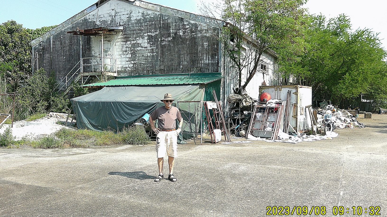 Zg475. (Images #00). Pictures #00 to #10 are of the former Subic Bay Naval Base SRF Diving Locker, we had decided to have a look. The Chamber was used for diving accident treatments to about 2004 and then no more. The Diving Locker has not been used since then. This area, around the Diving Locker has different security than the former SRF proper and the guard waved us thru. 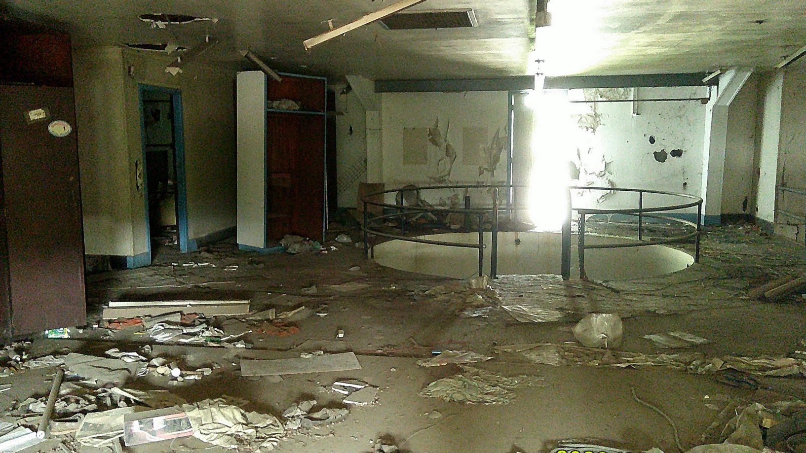 Zg476. (Images #07). This is the open water tank training area. Pictures #00 to #10 are of the former Subic Bay Naval Base SRF Diving Locker, we had decided to have a look. The Chamber was used to about 2004 and then no more. The Diving Locker has not been used since then. This area, around the Diving Locker has different security then the former SRF proper and the guard waved us thru. 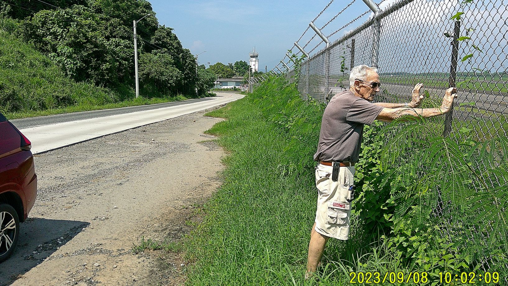 Zg477. (Picture #11) is of the former Cubi Point Air Station which is now the Subic Bay International Airport. It has no scheduled traffic and is occasional used by the US Military and other entities. 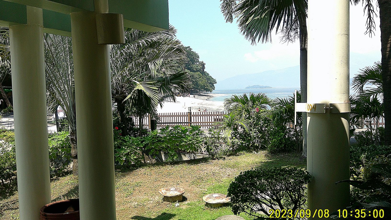 Zg478. (Picture #12) is the beach of the Camayan Beach Resort, just up from the former Camayan Munitions Wharf which is now the popular Ocean Adventure, a marine ocean park. At the Camayan Point we always did our explosive qualification activities. In back we see the historical island Grande Island, the former Fort Wint. 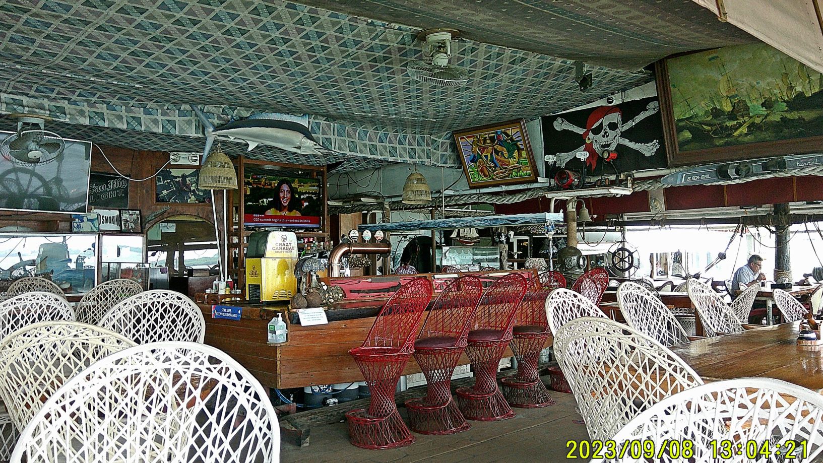 Zg479. (Image #13). Pictures #13 to #16 are from the very popular Maritime History Resort “Vasco”. It sits exactly on the site and pier of the early 1900 Coaling Station of the Subic Bay Naval Base. The views are towards ex Naval Station, SRF, Lower MAU and the former Cubi Point US Naval Air Station Subic Bay. In one image we see a WWII era type vessel with a very low line of porthole with an Aussie Flag, I believe. |
|
|
|
Post by Karl Welteke on Nov 23, 2023 15:32:04 GMT 8
Barrio Barretto Bypass Road In our larger Subic Bay and Olongapo City area a road construction has been started which is called “Barretto Bypass”. Many of people that live here are interested in such a project because the traffic on the National Road from Olongapo to Zambales is bad at times. ------------------------------------ Bo. Barretto Bypass Rd. 23-11-22 Second Segment On my walk today, the 22nd Nov. 2023, to Naugsol, I saw work going on at the Barretto Bypass road, so I changed my direction to that project and took pictures. I will call these pictures Barretto Bypass 2nd Segment. For this forum presentation I chose 13 images and the numbering system I used, refer to 62 images I posted in these 2 two venues if you are interested: ----Uploaded 62 pics into this FB album URL, click here: www.facebook.com/media/set/?set=a.10227197483836622&type=3Or the FB posting URL, click here: www.facebook.com/karlwilhelm.welteke/posts/pfbid0JmKzySkMtbeKSXLdVZuPHnpnb6AFQVGxBoeNh169YVbxU5UJmjEyeurWCsnoCHQ8l\----Uploaded 62 images to this Photobucket album at 2023 OC, BB, SB, SBFZ,Zam album group, No 2 Phil Events by year, Philippines incl. my walking: app.photobucket.com/u/PI-Sailor/a/20b85116-e63b-4fb8-9f71-3bf97a181162?field=TITLE&desc=asc--------------------------------------- #00 to #05 images are maps or data information of the Barrio Barretto Bypass Road Project. 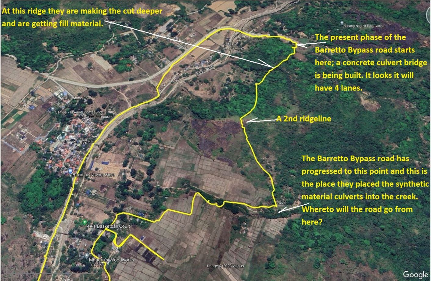 Zg610. (02) Barretto Bypass. ------------------------------ #06 to #19 images are starting with my glimpse of the Barretto Bypass project is continuing over the 2nd ridge, the culverts put in place for the creek in this valley which gives you an idea where the road is heading. The remaining pictures show the work going on from the culverts to the 2nd ridge and area views I shot for your orientation. 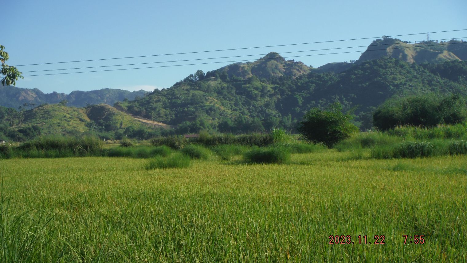 Zg611. (06) Barretto Bypass. 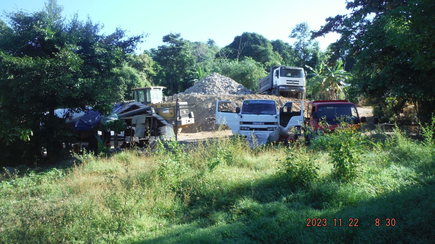 Zg612. (10) Barretto Bypass. 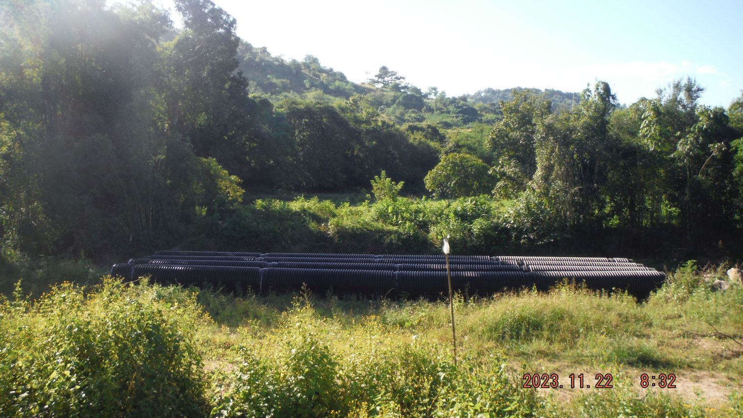 Zg613. (11) Barretto Bypass. 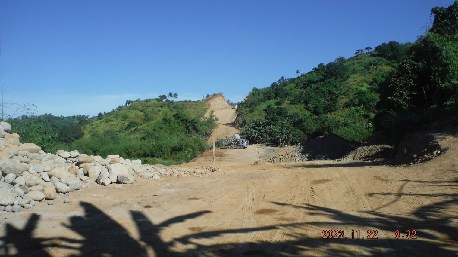 Zg614. (14) Barretto Bypass. 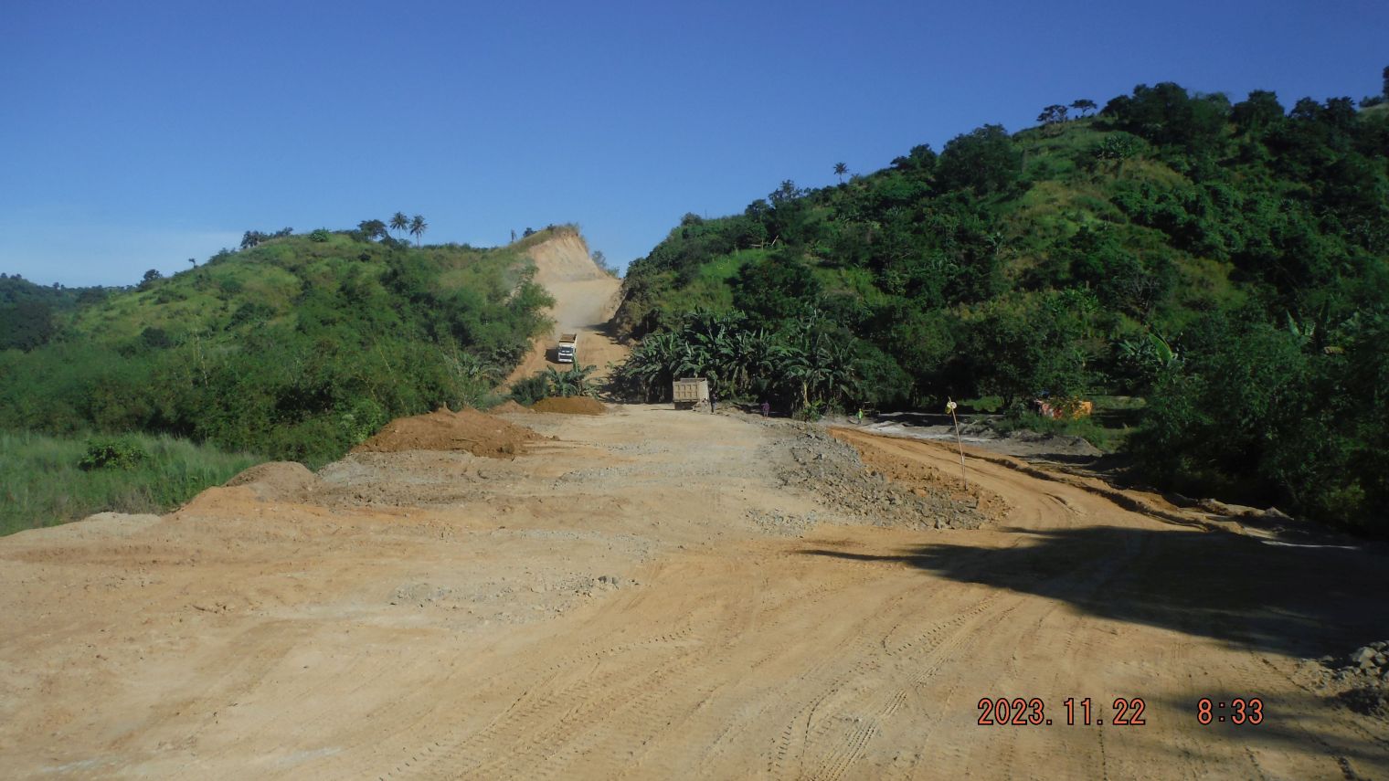 Zg615. (15) Barretto Bypass. ---------------------------------------- #20 to #35 images are of many shots as I reach the ridge I labeled “A 2nd Ridgeline”, views and the road going up and thru the ridge. The other images are of the area between the “2nd Ridgeline” and the ridge which is used right now to get fill. 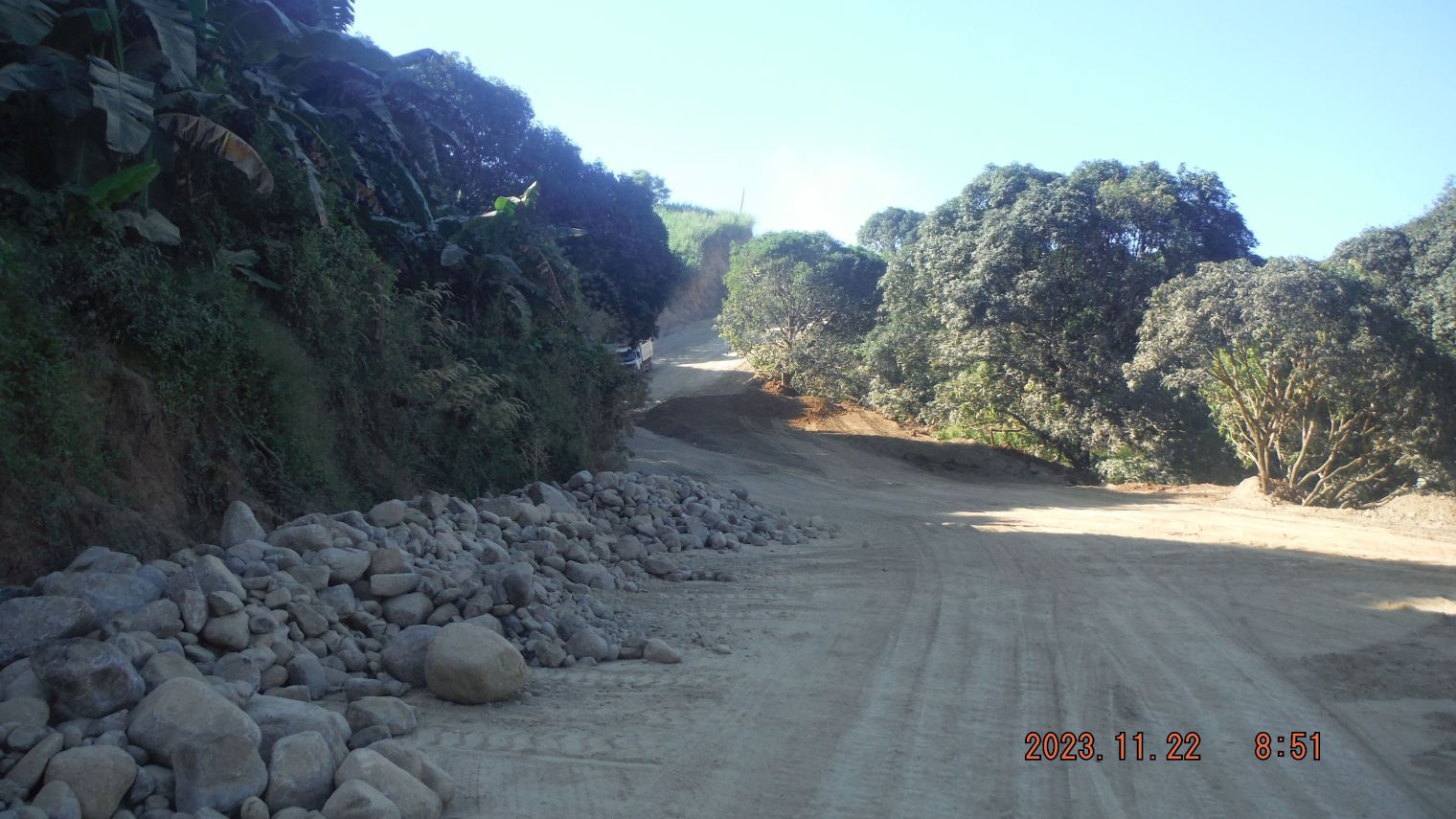 Zg616. (33) Barretto Bypass. 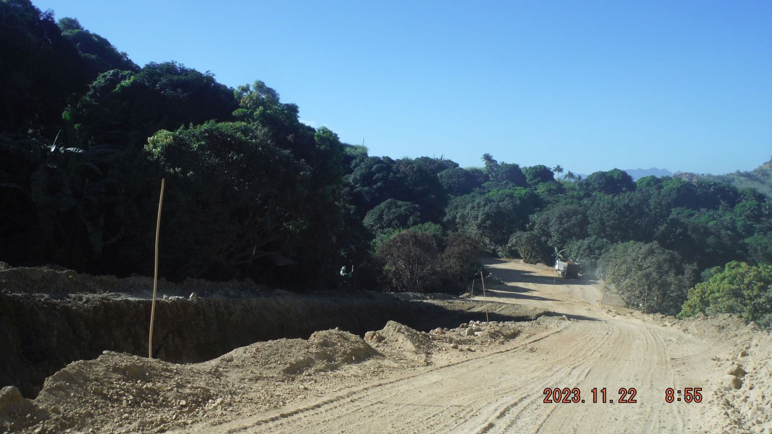 Zg617. (35) Barretto Bypass. --------------------------------------- #36 to #43 images are of the ridgeline where the road cut is made deeper and the material is used for fill to build the road further up. 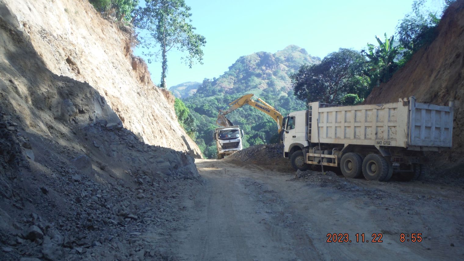 Zg618. (37) Barretto Bypass. 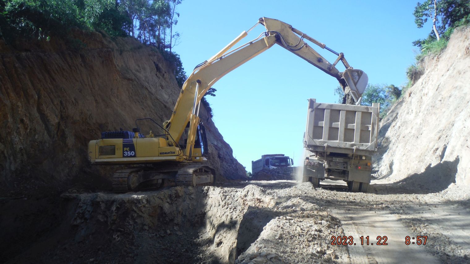 Zg619. (41) Barretto Bypass. -------------------------------------------- #44 to #47 images are of the place where the present phase of the Barretto Bypass road starts; a concrete culvert bridge is being built. It looks like that it will have 4 lanes. The engineers are hanging out here and said the road will go up to Kalaklan Ridge. 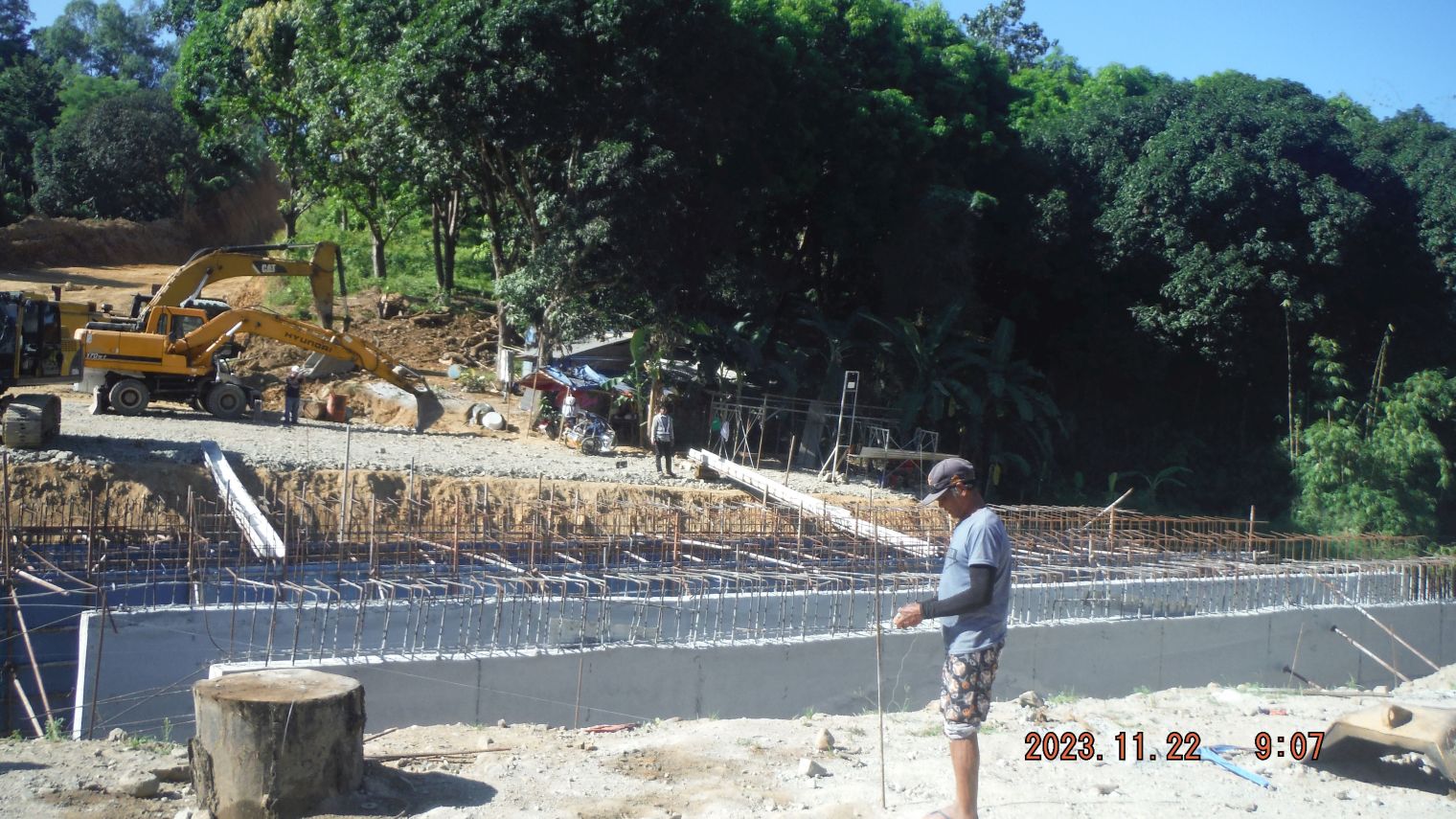 Zg620. (46) Barretto Bypass. --------------------------------------------- #48 to #55 images are of the stretch of road from the 4 lane culvert job back to the solid bridge over the Matain River. No pictures chosen. ------------------------------------- #56 to #61 images of the bridge over the Matain River, the river and a section of road which receives a better embankment and we have a parting shot of the Barretto Bypass road going thru the woods and the ridgelines 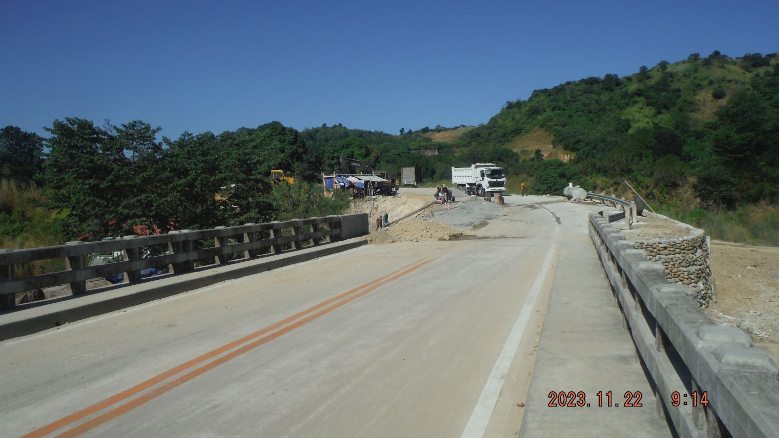 Zg621. (56) Barretto Bypass. 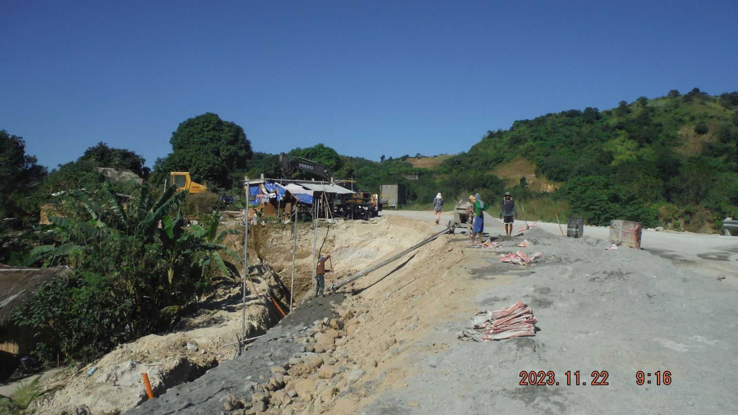 Zg622. (59) Barretto Bypass. ------------------------------------------------------ My 1st Segment of the Barretto Bypass Rd. presentation in Facebook is this URL: www.facebook.com/karlwilhelm.welteke/posts/pfbid02A6krdDT2SoTYqYNoPKoydfsKeXZCWbZVci6zMyUQYYTuj11bk5QXuSAyrkwPbMUil |
|
|
|
Post by Karl Welteke on Feb 6, 2024 17:47:55 GMT 8
Subic Bay Views from Kalaklan Ridge 2024 Subic Bay Views from Kalaklan Ridge 28th Jan. It was a beautiful day and did not even sweat and the visibility was good, so, I had to take these pictures. This is short version with only 10 images but more detailed descriptions All of the 82 images and all in high resolution are available here: www.flickr.com/photos/44567569@N00/albums/72177720314530657Two short versions with 31 images are here, take your pick: Uploaded 31 pics to PhB: Philippines including my walks, No 2 Phil Events by Year, 2024 OC, BB, SB, Zam Group: app.photobucket.com/u/PI-Sailor/a/20af4da2-599c-4b41-8428-dd12eb1a4950?field=TITLE&desc=asc31 images, in low resolution have been uploaded to a FB posting: www.facebook.com/karlwilhelm.welteke/posts/pfbid0ouchatPS4gsfSV7asTC8mNNuoNyf9RrVm62YuzWdCgHWtfAWZ7GuSqHDTYvXea3El #001, in this picture we see Mt. Sinco Picos, the ex Hanjin Shipyard, now a Phil. Navy Base, and a ship is pulling into Subic Bay.  #014 image shows the Columban College in Barrio Barretto, my daughter is a student there right now. We see the Pointed Peak inland of Santa Monica and next to it the former Subic Town Landfill is being developed. 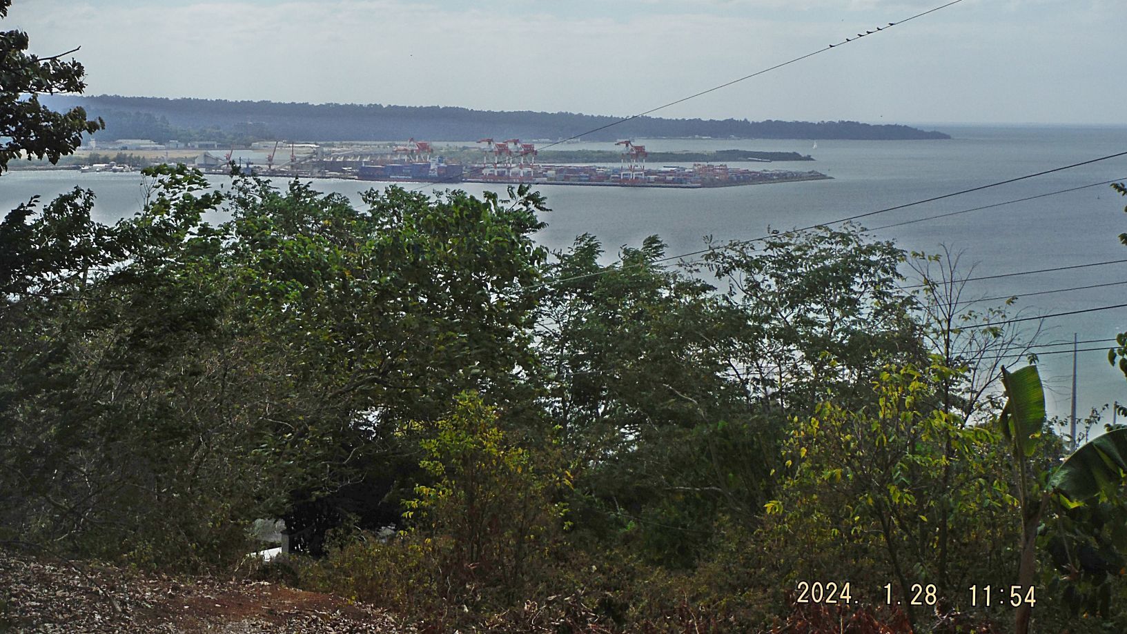 #046 picture, we are looking at the former geographic Cubi Point which was the location of the Naval Base Officer Beach. This area has become the new Container Port. In back we see the former Naval Magazine and its two wharfs. The right one is a very popular Ocean Adventure Park. 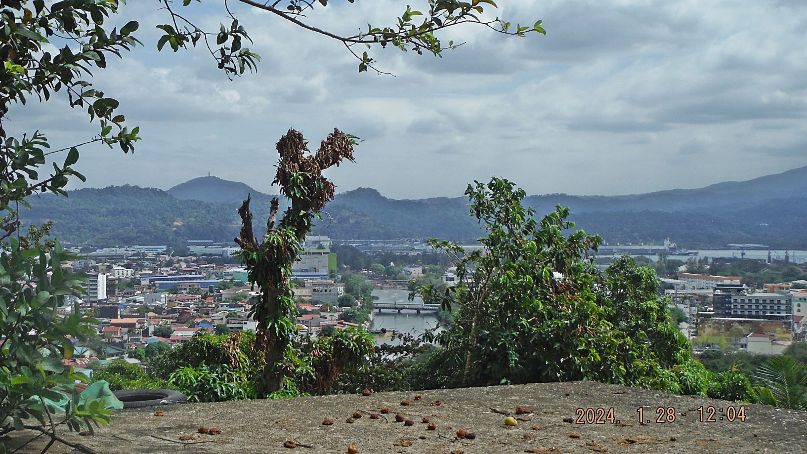 #053 picture shows the two bridges to SBFZ, the close one is Rizal Bridge, in 1958 it was a wooden bridge going to Manila Avenue, now Rizal Avenue in Olongapo. When I arrived in 1962 that bridge did not exist anymore but we had the Main Gate Bridge, (2nd one in the picture), which is being rebuild now. The Rizal Bridge was reestablished by the new management, SBFZ after our departure. 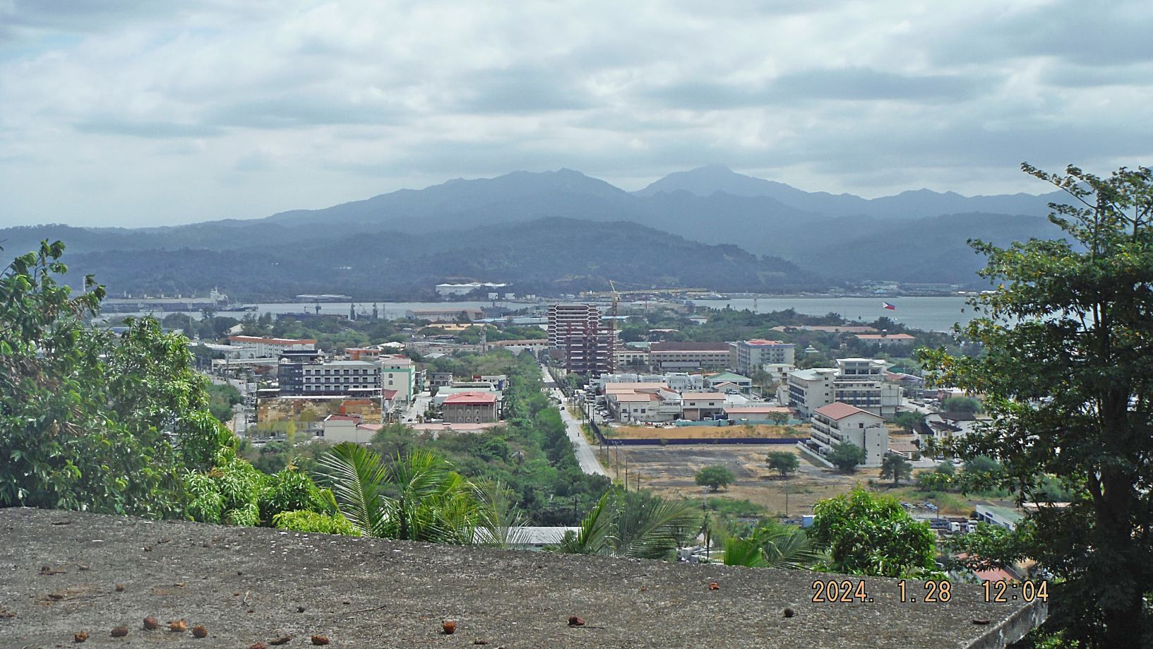 #054 picture is a view down the Olongapo Cemetery onto the Kalaklan Gate area of the SBFZ, we see the Canal Road going by the two high rises. Across the Olongapo Harbor we see a number of large fuel tanks; they were built by the new management, SBFZ after our departure. They also built a 2nd fuel pier there. Next to it used to be the Navy Coal Wharf which is now a famous Hotel, Restaurant and Museum called Vascos and Magelans. 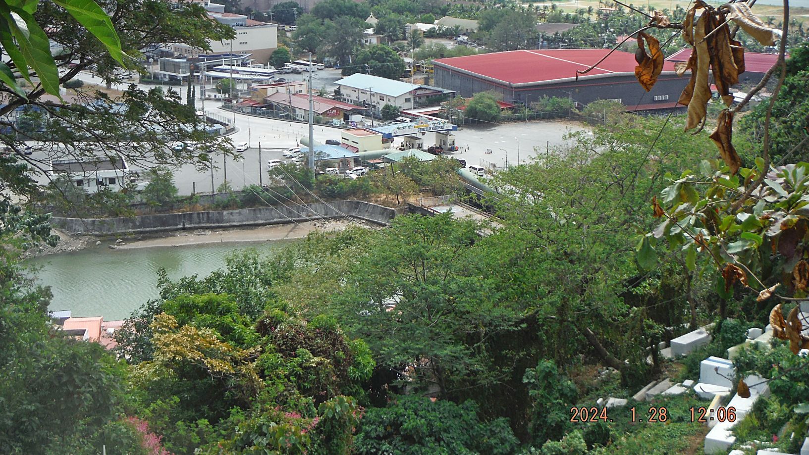 #056 picture shows the SBFZ Kalaklan Gate are, the old and new bridge over the Kalaklan River. 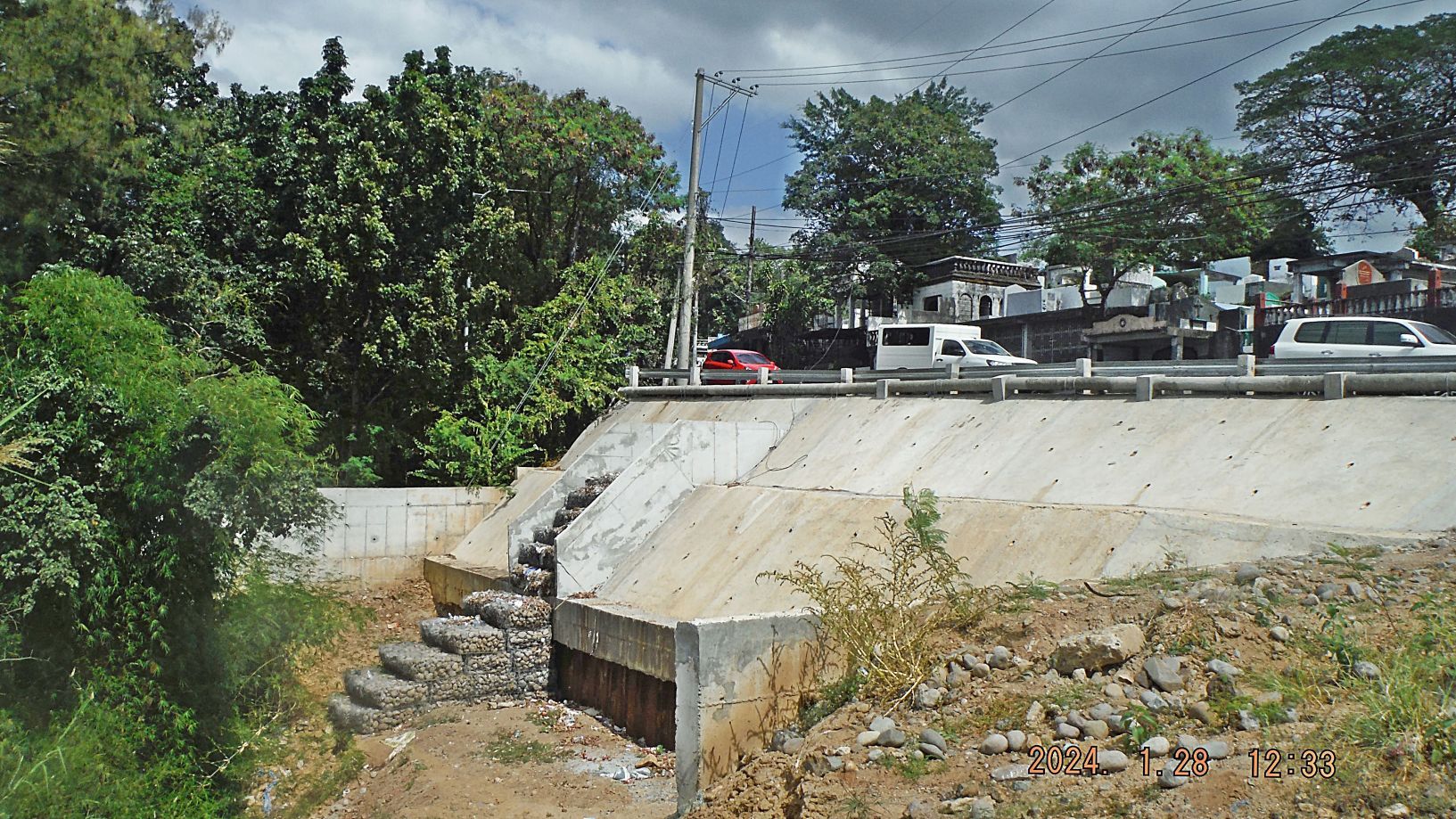 #070 picture, this is recent repair work by the DPWH of the Zambales Highway, at the Kalaklan Point, the curve had to be better stabilized. 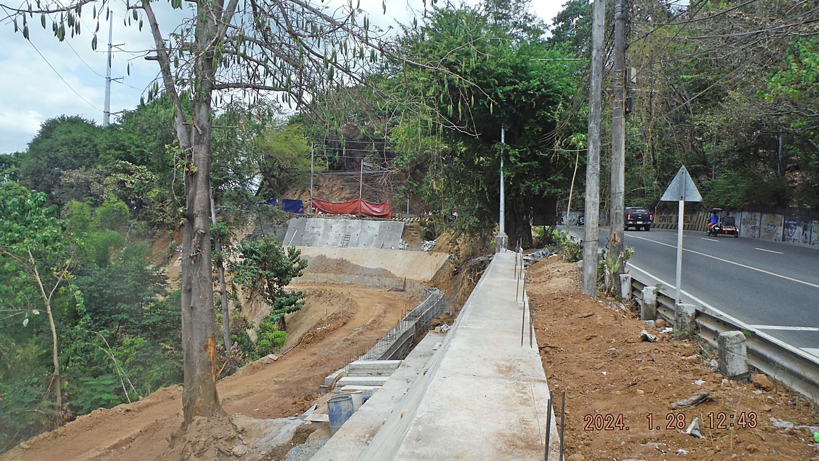 #074 picture, this is recent repair work by the DPWH of the Zambales Highway, just where the Olongapo Cemetery starts when you come from the North. This is stabilizing the curves and embankments projects of the Zambales Highway. 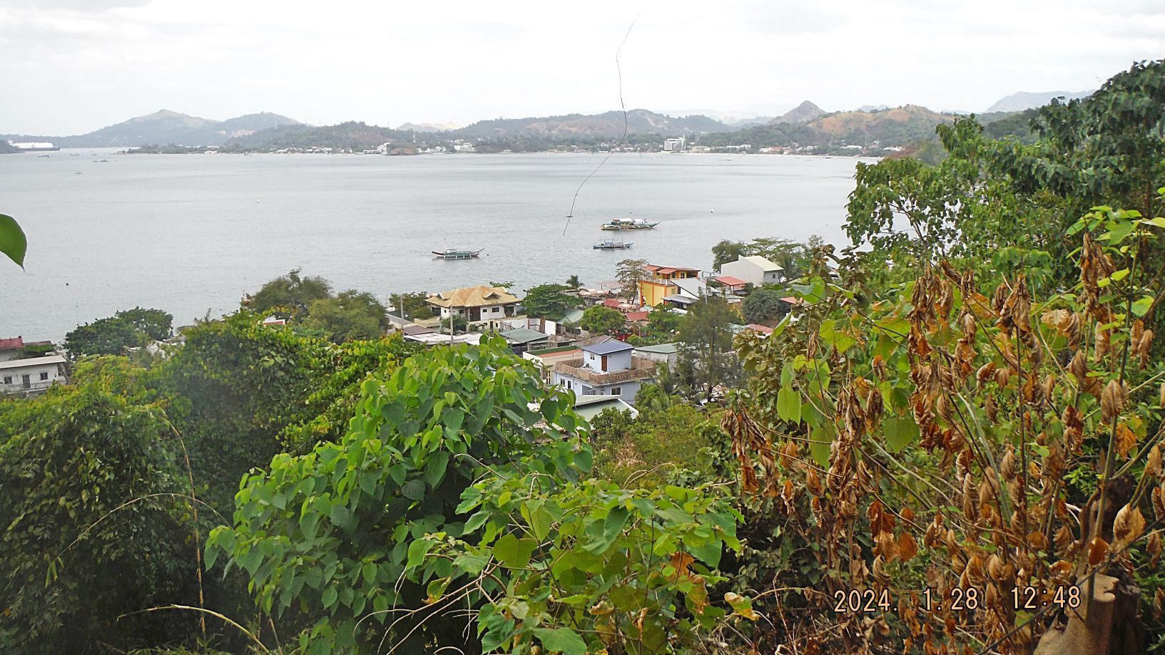 #076 picture is of a new community that has established down the beach from the Ocean View Resort, all part of the Kalaklan Ridge. 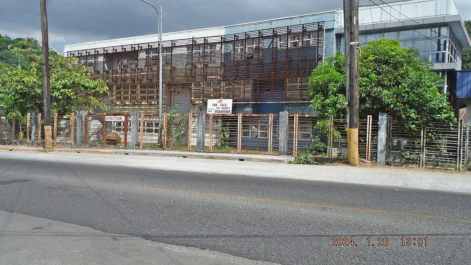 #080 picture, this used to be the Halfmoon Hotel or was it Nipa Hut, I don’t remember. It was popular during our Navy times but died after we left. |
|
|
|
Post by lf62 on Mar 14, 2024 15:16:17 GMT 8
LARGE MAPS OF NAVSTA SUBIC BAY (1985) AND OLONGAPO (1984) AVAILABLE FROM KARL. I had these drawings since my active duty days and I finally got off my butt and found a place to scan them and digitalize them. In the process I learned the difference of a JPG and a PDF file, see the details below”.  Y433. Look at size of a different file formats of the same material! In view of above I only make the PDF file available, should you be interested send me a message on the forum with your email and I will send you the PDF file copy. Here is how they look on a small JPG file, small and unreadable: 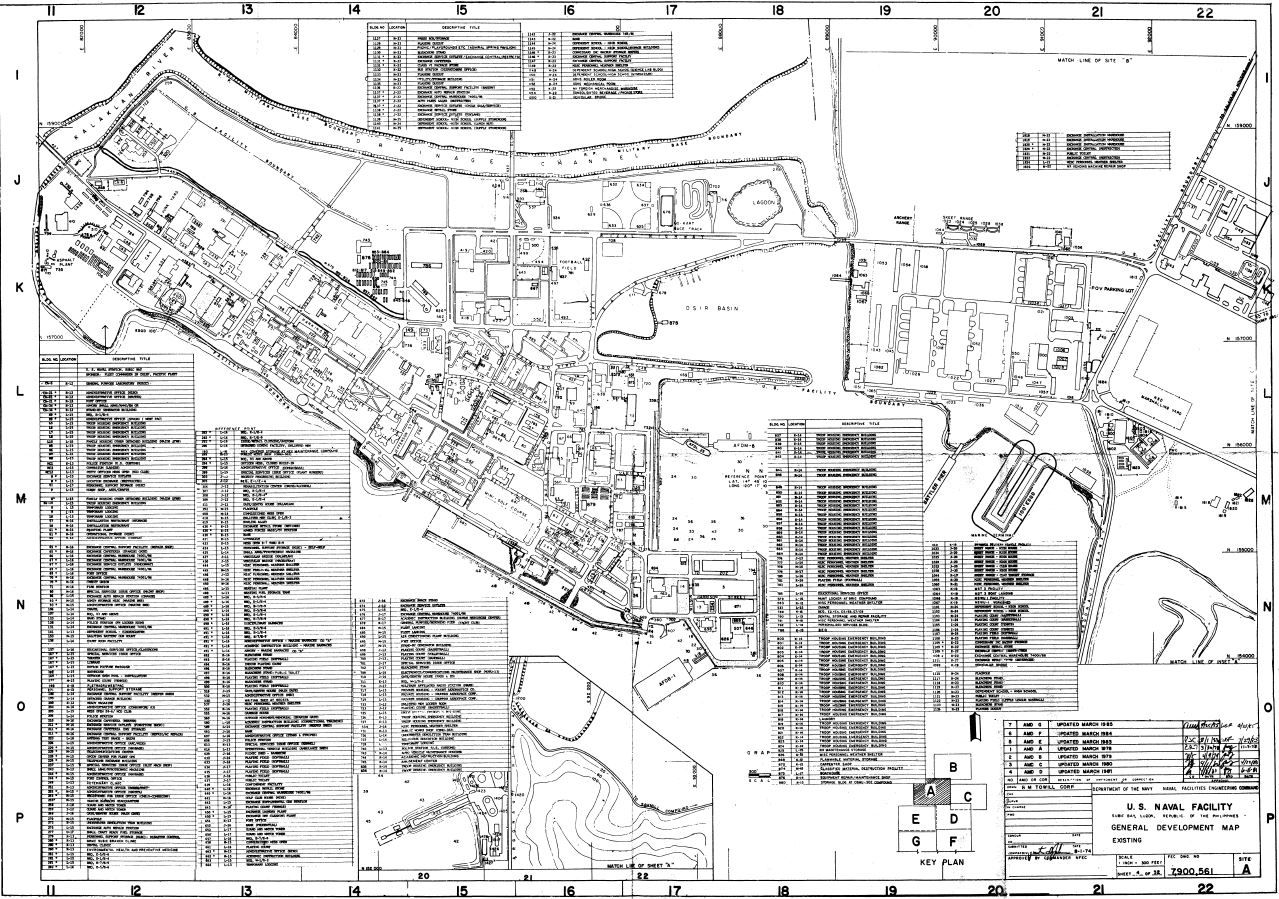 Y434. US Naval Station (NAVSTA) Subic Bay 1985 map or drawing. 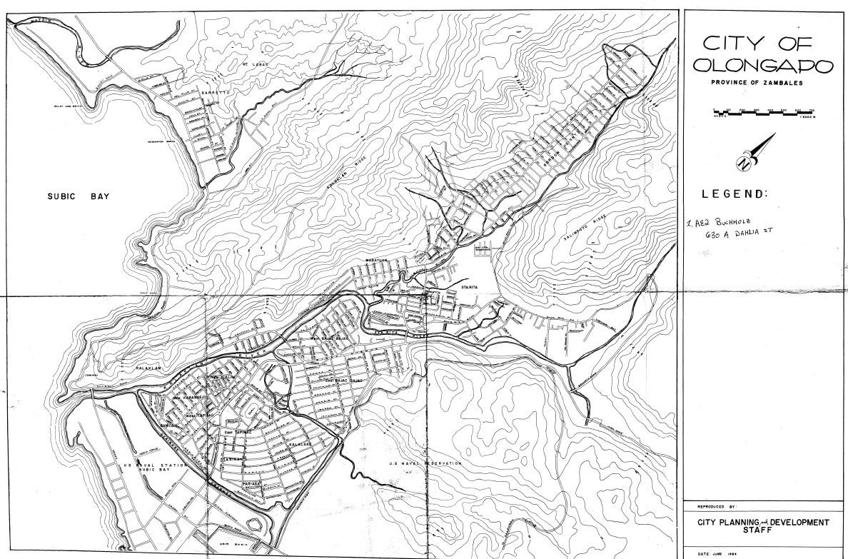 Y435. Olongapo City 1984 map or drawing. |
|
|
|
Post by beirutvet on Mar 16, 2024 23:53:59 GMT 8
Hi Karl
A few posts back you had a picture of Vasco's. Was that the place that you and I had a beer on our tour of Subic, the one with the museum attached?
From Karl: Yes, indeed that was the place!
|
|
|
|
Post by Karl Welteke on Apr 1, 2024 9:50:54 GMT 8
Pictures are of Barrio Barretto and Subic Bay The 5 pictures are of Barrio Barretto and Subic Bay, shot from right to left and they are uploaded here in high resolution: Various pictures of Subic Bay album No 1. | Flickr The same Picture Description for all 5 images! This is one of 5 images I shot on the 31st of March 2024 (Easter Sunday) from the ridge behind my house which I like to call the Hotel Marmont Ridge. The pictures are of Barrio Barretto and Subic Bay, shot from right to left. 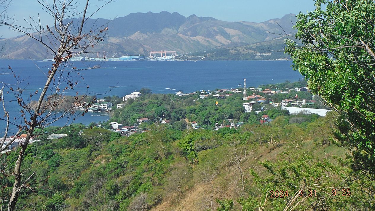 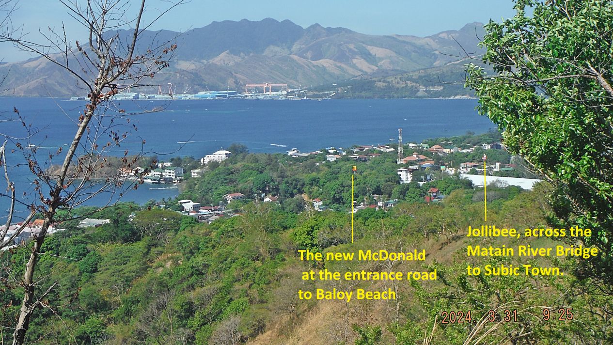 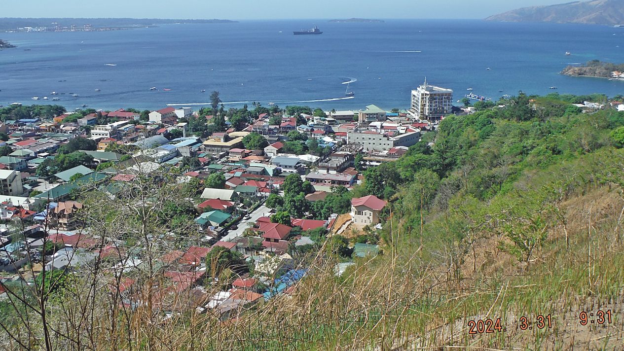 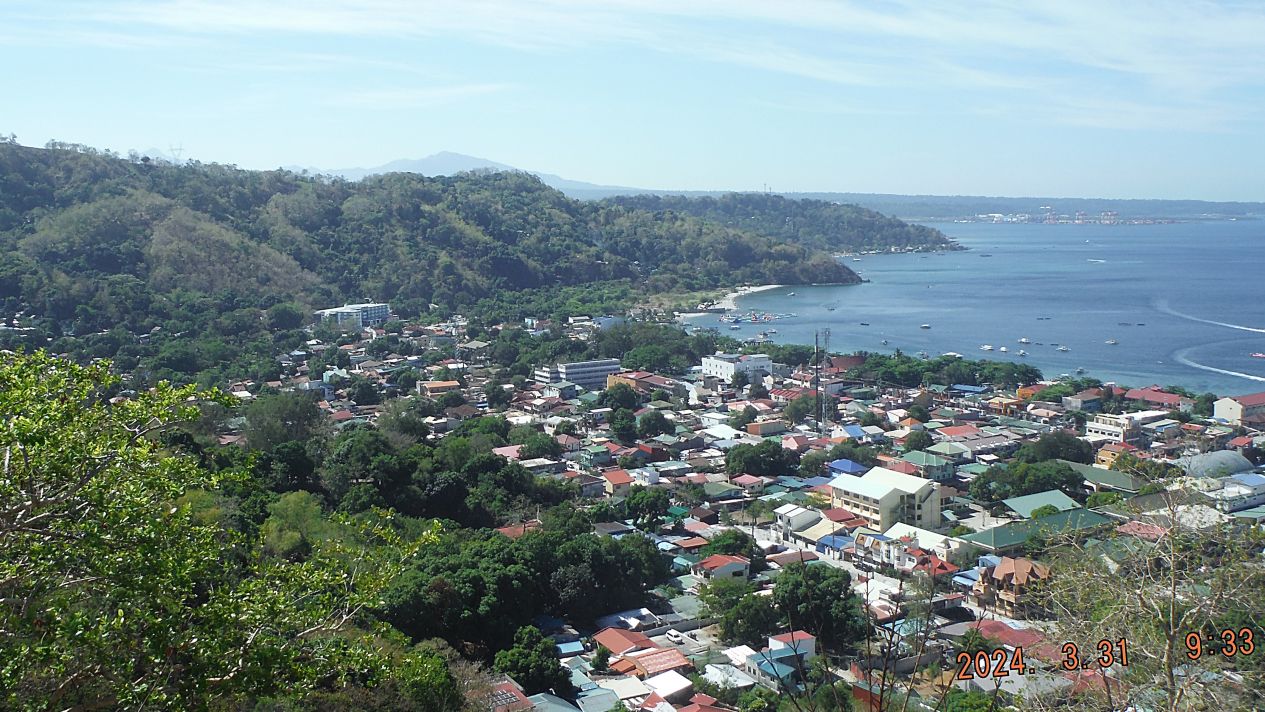 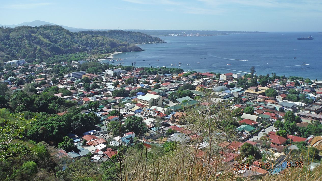 |
|
|
|
Post by Karl Welteke on Apr 6, 2024 18:20:24 GMT 8
3rd Apr. 2024 News Items from Subic Bay The replacement of the former Naval Base Main Gate Bridge is finally making progress. This picture is shot from the 5th Floor of the SM City Mall, Down Town Olongapo, just across the Main Gate Bridge. Interestingly, this E Vehicle Charging Station exists here now on the 5th Floor, parking floor, for about a month, according a guard there. 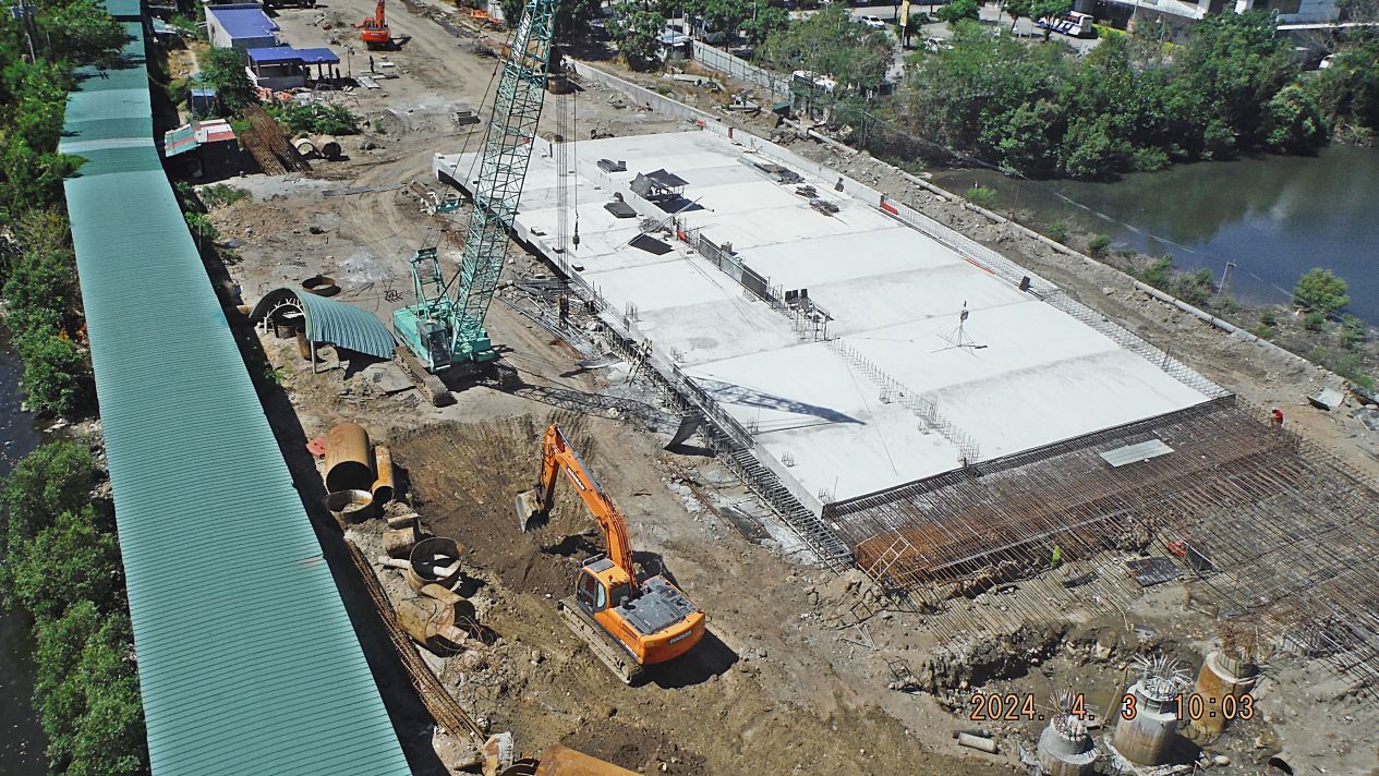 Zg770. The former Naval Base Main Gate Bridge is finally making progress 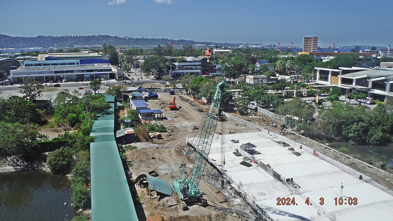 Zg771. The former Naval Base Main Gate Bridge is finally making progress 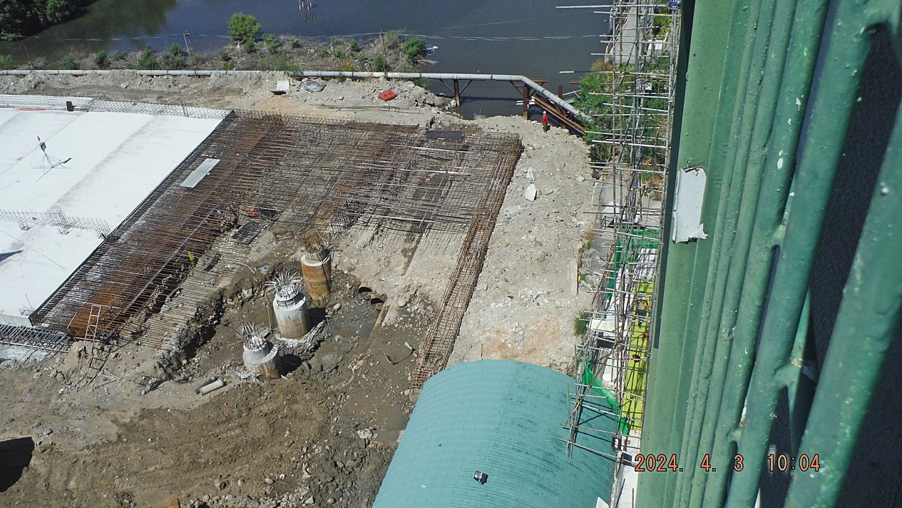 Zg772. The former Naval Base Main Gate Bridge is finally making progress 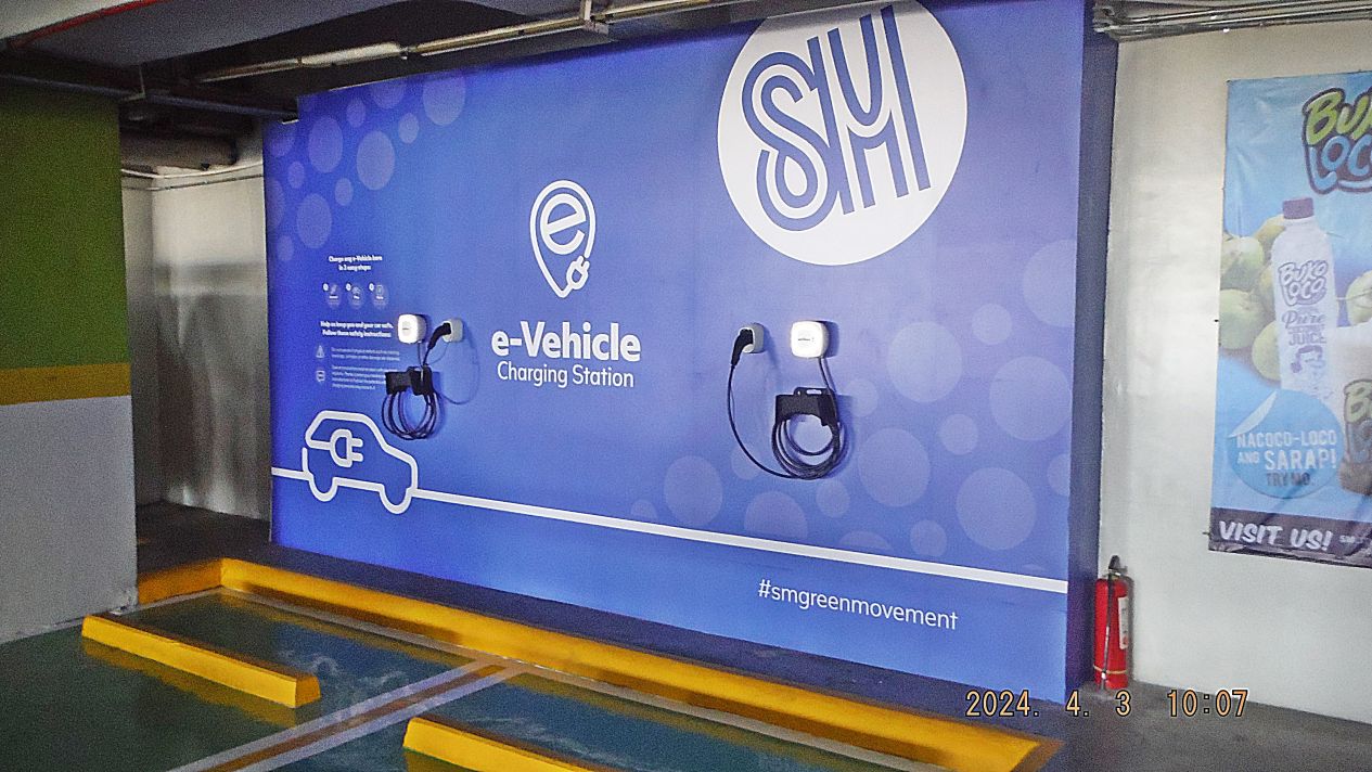 Zg773. E Vehicle Charging Station, SM City Mall, Down Town Olongapo This E Vehicle Charging Station exists here now on the 5th Floor, parking floor, at the SM City Mall, Down Town Olongapo, for about a month, according a guard there. |
|
|
|
Post by Karl Welteke on Jun 13, 2024 11:08:24 GMT 8
Ulticare Medical Center, Bo. Barretto, Olongapo City is open now! It is located in Barrio Barretto, Olongapo City and it is renovated, under new ownership and management. I had to see a doctor because I had pain in my left ear on the 10th of June 2024. The pictures were shot on the 12th of June, Philippine Independence Day, and the outpatient clinic was closed. I got to see a doctor maybe in 45 minutes, an examination, and a prescription and paid 500 pesos. The hours of the clinic are 8am to 5pm, closed on Sundays and holidays. I may add more pictures in the future. The new hospital in Barretto is open, has an outpatient clinic and I was good taken care of. I thought, I share this. We didn’t have this in Barretto or anything north from here after the old hospital closed. So, now we have again a big clinic, minutes away, with parking, efficient and at reasonable cost. I posted 10 images at these venues, take your pick: Established an album with 10 pics<, put in Philippines-including my walks group, No2 Phil. Events by year group, 2024 OC. BB.ZAM. SB Group: app.photobucket.com/u/PI-Sailor/a/efb2d521-8c6c-42a7-8f1f-1ebbe4e974f2?field=TITLE&desc=ascPosted 10 images on Facebook and shared with: Ulticare, SBH3, SB Expats, SB Bars, Raging Main, BB Resid. Assoc., www.facebook.com/karlwilhelm.welteke/posts/pfbid02FntZHMf2qhX8e5uCkJqbpTP5gdCiJ182KNzxw1a1n3B74LCv85JmggCkdaSJ1WW2lUploaded 10 images in high resolution to this new Flickr album, and put it in album collection Subic Bay from m2021 up: www.flickr.com/photos/44567569@N00/albums/72177720317841853/Note: Try to copy these URLs and place into another browser! I don’t know what is happening! It seems these links only work if you copy them and paste into another browser. Two sample images are attached:   |
|