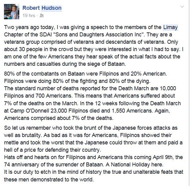
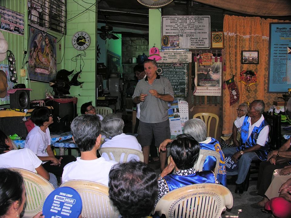
Post by Karl Welteke on Aug 13, 2014 13:44:44 GMT 8
BATTLE OF MT. SAMAT AND TRAIL TWO, THE COMMUNITY ON TRAIL TWO, THE VILLAGE CAMOT REMEMBERS.
Much of the 1942 defense here was directed by Gen. Vicente P. LIM, the Commanding General of the Philippine Army 41st Div. The Battle of Trail Two was fought here and was won. Gen. Lim was the first Filipino graduate of West Point, class 1914.
He was ordered to join Gen. MacArthur in Australia, was captured by the Japanese, reportedly tortured and was executed. In Wikipedia is a lengthy article available about him:
en.wikipedia.org/wiki/Vicente_Lim
The village of Camot, straddling the Trail-Two has been renamed General Lim.
The road from Gen. Lim village (ex Camot) to Orani Town has been reamed Gen. Lim. Road.
Just before the Gen. Lim Road crosses the post war Bataan Express-Way a Battle of Mt. Samat Gate has been built over this road. This gate has unit icons imbedded and has commemorating plaques on either side of the two gate posts.
The Barangay (village) Hall has a commemorating plaque honoring, Lt. Francisco Millena, Company A, 51st Engineer Battalion, Philippine Army.
The Great Grandson of the General, Vincente Lim IV, his friend and I teamed up and visited these places on the 16th Sep 2012. It was a rainy day but we managed to meet our goal to visit this area and others. I made an album and 30 pictures with descriptions have been put into this album:
tinyurl.com/kqn399o
On the 9th of July 2014 Bob Hudson took me there again and showed me that he retraced the writing on the right gate post, the plaque facing east, on the north gate post. I got to admit his work looked real good. Good Job Bob!
Here are sample images of that album and the efforts of the local people of Gen. Lim (ex Camot) village to remember the Battle of Mt. Samat and the sacrifices of their soldiers. The pictures in the album are much bigger:
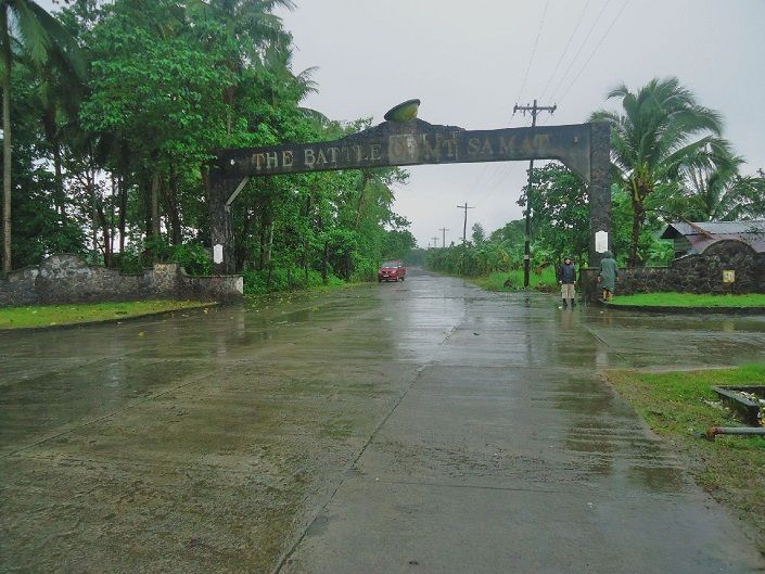
Z717---a big surprise, this gate, located east of Gen. Lim Village on the Gen. Lim Road I never had seen before. It is only a few hundred feet from the Bataan Express way towards the Mt. Samat direction.
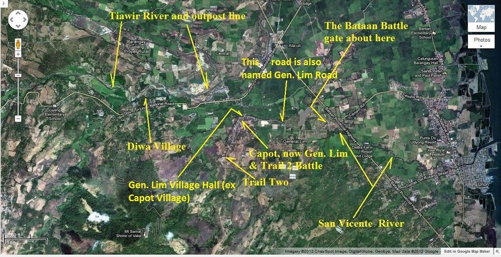
Z718---this is a Google Earth image of most of the areas we covered on this visit but most importantly it shows the locations of The Battle of Mt. Samat Gate, the Gen. Lim Village Hall,- Road and the San Vicente River which are the subjects of this segment/reply.
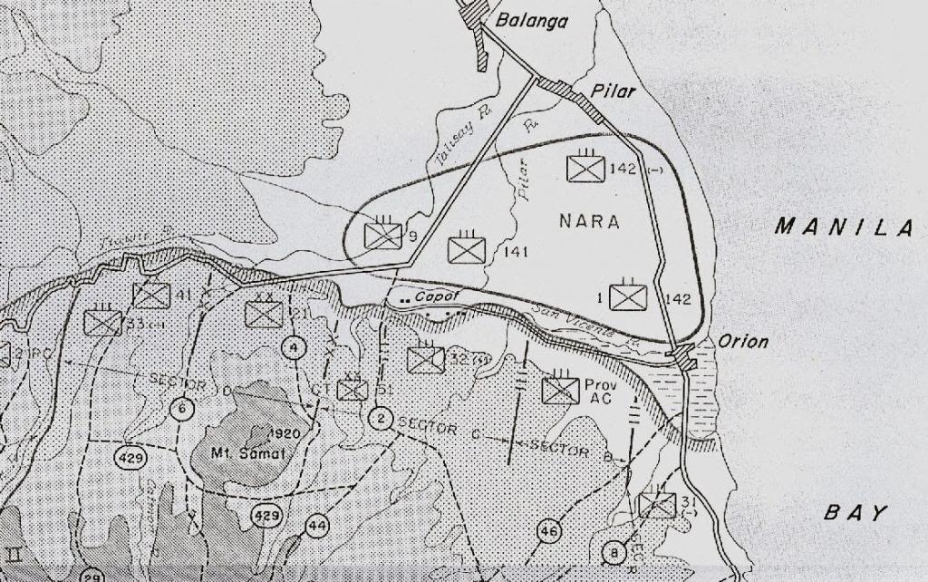
Z719--- and here is a map section from the -Fall of the Philippines- of the Main Line of Resistance (MLR) of the area we are going to look at today.
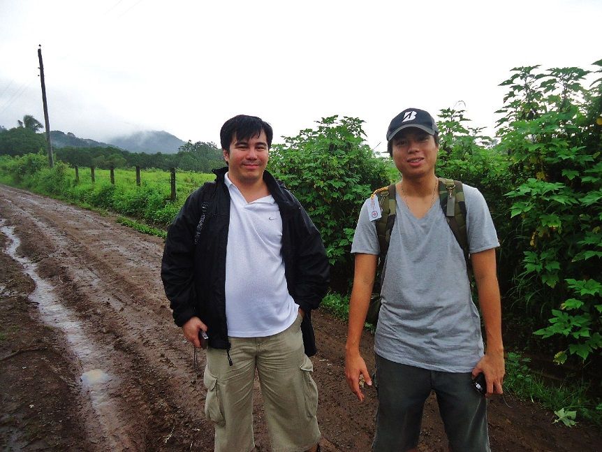
Z720--- Vicente Lim IV and his friend Kevin, a college educator in Manila, were my partners today. We are walking between the Abucay Hacienda area, south of us and the Batantay River which is right and below us. This river was part of the MLR.
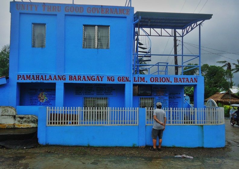
Z721---the Barangay (village) Hall of Barangay Gen. Lim (ex Brgy. Capot) and the Great Grandson of the General is standing there and I’m sure he is contemplating that the residents of this village changed the name of the village to the name of his Great Grandfather. I believe that was the first time that Vicente Lim IV visited this village and location.
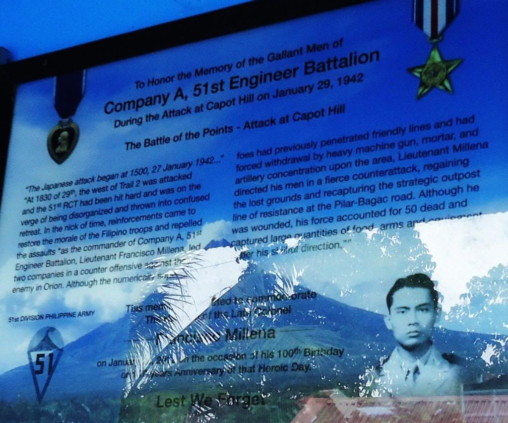
Z722--- on the Gen. Lim Barangay Hall wall is a plaque mounted honoring another Philippine Hero, Lt. Francisco Millena, Company A 51st Engineer Battalion. You should be able to read the information in this image.
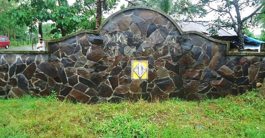
Z723---right and left of the Battle of Mt. Samat Gate are walls with military unit symbols embedded and this is the only symbol icon left and I don’t know which unit this symbol represents.
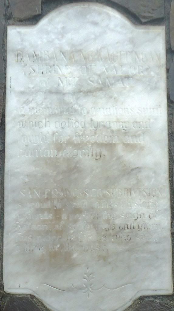
Z724--- the Battle of Mt. Samat displays 4 commemorating plaques, one on either side of the two gate posts. This one is on the north gate post and faces towards east. On this 16th Sep. 2012 image the writing is very hard to read. The other three plaques are equally hard to read.
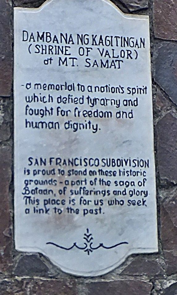
Z725---this is the same plaque as in the last image but now we can read it; what has happened? As I said, on the 9th July 2014 Bob Hudson took me here to show me the change. He told me that he retraced the writing with only a permanent black marker a few months ago and it was a difficult job. He wanted to see how his work was holding up; I think it is looking good.
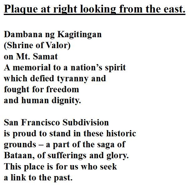
After Vicente Lim IV and I visited this gate we decided to try to make out the writing of all 4 plaques and with a little back and forth by email, I believe we done it.
Z726--- looking from the east this is on the right post, plaque facing east, -The Shrine of Valor-.
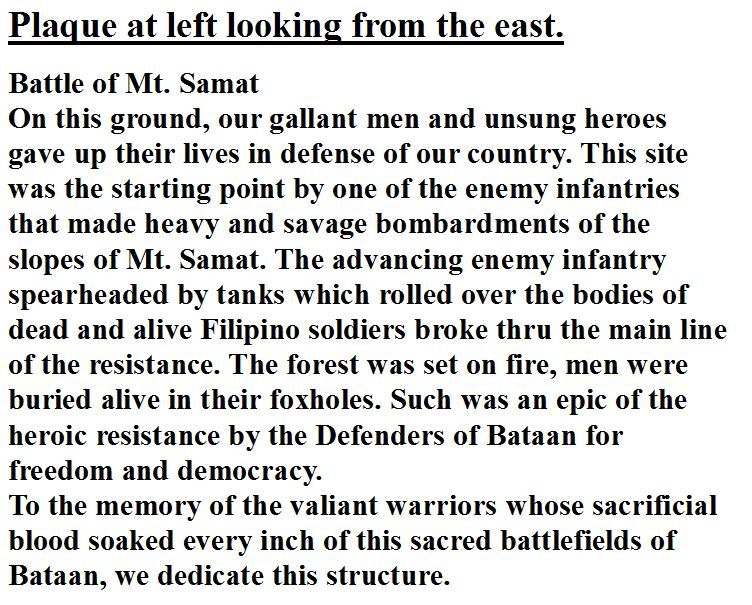
Z727--- looking from the east, this is on the left post, plaque facing east, -The Battle of Samat-.
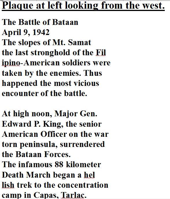
Z728--- looking from the west this is on the left post, plaque facing west, -The Battle of Bataan-.
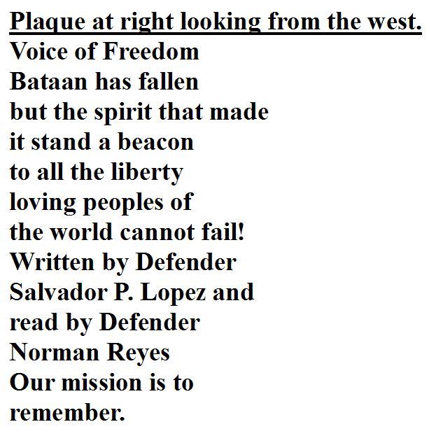
Z729--- looking from the west this is on the right post, plaque facing west, -The Voice of Freedom-.
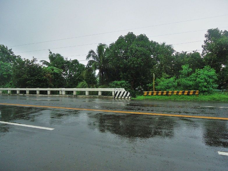
Z730---Another important landmark I was looking for was the San Vicente River because you can see on the map from the Fall of the Philippines the Main Line of Resistance and a road run parallel to it on the south side. I cannot explain but on the Google Earth map, no road shows there and rather the road is on the north side and I can confirm that by our visual exploration.
Much of the 1942 defense here was directed by Gen. Vicente P. LIM, the Commanding General of the Philippine Army 41st Div. The Battle of Trail Two was fought here and was won. Gen. Lim was the first Filipino graduate of West Point, class 1914.
He was ordered to join Gen. MacArthur in Australia, was captured by the Japanese, reportedly tortured and was executed. In Wikipedia is a lengthy article available about him:
en.wikipedia.org/wiki/Vicente_Lim
The village of Camot, straddling the Trail-Two has been renamed General Lim.
The road from Gen. Lim village (ex Camot) to Orani Town has been reamed Gen. Lim. Road.
Just before the Gen. Lim Road crosses the post war Bataan Express-Way a Battle of Mt. Samat Gate has been built over this road. This gate has unit icons imbedded and has commemorating plaques on either side of the two gate posts.
The Barangay (village) Hall has a commemorating plaque honoring, Lt. Francisco Millena, Company A, 51st Engineer Battalion, Philippine Army.
The Great Grandson of the General, Vincente Lim IV, his friend and I teamed up and visited these places on the 16th Sep 2012. It was a rainy day but we managed to meet our goal to visit this area and others. I made an album and 30 pictures with descriptions have been put into this album:
tinyurl.com/kqn399o
On the 9th of July 2014 Bob Hudson took me there again and showed me that he retraced the writing on the right gate post, the plaque facing east, on the north gate post. I got to admit his work looked real good. Good Job Bob!
Here are sample images of that album and the efforts of the local people of Gen. Lim (ex Camot) village to remember the Battle of Mt. Samat and the sacrifices of their soldiers. The pictures in the album are much bigger:

Z717---a big surprise, this gate, located east of Gen. Lim Village on the Gen. Lim Road I never had seen before. It is only a few hundred feet from the Bataan Express way towards the Mt. Samat direction.

Z718---this is a Google Earth image of most of the areas we covered on this visit but most importantly it shows the locations of The Battle of Mt. Samat Gate, the Gen. Lim Village Hall,- Road and the San Vicente River which are the subjects of this segment/reply.

Z719--- and here is a map section from the -Fall of the Philippines- of the Main Line of Resistance (MLR) of the area we are going to look at today.

Z720--- Vicente Lim IV and his friend Kevin, a college educator in Manila, were my partners today. We are walking between the Abucay Hacienda area, south of us and the Batantay River which is right and below us. This river was part of the MLR.

Z721---the Barangay (village) Hall of Barangay Gen. Lim (ex Brgy. Capot) and the Great Grandson of the General is standing there and I’m sure he is contemplating that the residents of this village changed the name of the village to the name of his Great Grandfather. I believe that was the first time that Vicente Lim IV visited this village and location.

Z722--- on the Gen. Lim Barangay Hall wall is a plaque mounted honoring another Philippine Hero, Lt. Francisco Millena, Company A 51st Engineer Battalion. You should be able to read the information in this image.

Z723---right and left of the Battle of Mt. Samat Gate are walls with military unit symbols embedded and this is the only symbol icon left and I don’t know which unit this symbol represents.

Z724--- the Battle of Mt. Samat displays 4 commemorating plaques, one on either side of the two gate posts. This one is on the north gate post and faces towards east. On this 16th Sep. 2012 image the writing is very hard to read. The other three plaques are equally hard to read.

Z725---this is the same plaque as in the last image but now we can read it; what has happened? As I said, on the 9th July 2014 Bob Hudson took me here to show me the change. He told me that he retraced the writing with only a permanent black marker a few months ago and it was a difficult job. He wanted to see how his work was holding up; I think it is looking good.

After Vicente Lim IV and I visited this gate we decided to try to make out the writing of all 4 plaques and with a little back and forth by email, I believe we done it.
Z726--- looking from the east this is on the right post, plaque facing east, -The Shrine of Valor-.

Z727--- looking from the east, this is on the left post, plaque facing east, -The Battle of Samat-.

Z728--- looking from the west this is on the left post, plaque facing west, -The Battle of Bataan-.

Z729--- looking from the west this is on the right post, plaque facing west, -The Voice of Freedom-.

Z730---Another important landmark I was looking for was the San Vicente River because you can see on the map from the Fall of the Philippines the Main Line of Resistance and a road run parallel to it on the south side. I cannot explain but on the Google Earth map, no road shows there and rather the road is on the north side and I can confirm that by our visual exploration.


