Deleted
Deleted Member
Posts: 0
|
Post by Deleted on Jun 5, 2009 12:34:14 GMT 8
How does one get to Fort Hughes, Caballo Island?
|
|
|
|
Post by Karl Welteke on Jun 21, 2009 8:33:37 GMT 8
Hello ‘amarcianae’ and ‘bikbok’ To amarcianae: sorry it took this long to respond but I see that my friend Tony took up the matter and he is certainly more qualified that I on Ft. Hughes. May I ask how you got onto the island and that would help also answer ‘bikbok’s ‘question. As to the question how to visit Caballo Island, one has to get permission from the Philippine Navy which uses the island as an munitions storage. Then one would have to provide one’s transportation. The Coastal Defense Study Group (CDSG) association has organized visits to that island before with formal letters to the Philippine Navy. I was lucky to know about it and they gave me permission to join them on their visit. Just in case you have not seen Tony’s contribution “the visit to another island”, here is the URL for that page: www.corregidor.org/chs_feredo/feredo_report_1.htmKarl |
|
Deleted
Deleted Member
Posts: 0
|
Post by Deleted on Jul 17, 2009 2:10:32 GMT 8
Karl:
I was able to get onto Caballo via a circuitous route. I contacted Valor Tours who put me in contact with Col. Art Matibag. I travelled to Corregidor with Valor Tours and then hired a banca and with Col. Matibag we went across the Bay to Caballo. It was far shorter visit than I would have liked but it is so difficult to get to you have to take what opportunity you have. Valor Tours (Bob Reynolds and Steve Kwiecinski) were great to work and travel with and Col. Matibag used his extensive connections to help make it happen. I concentrated on the flat end of the island because I was interested in the "Parade Ground" where a diary says my uncle was killed and buried on April 17 1942. I walked as much of it as our military escort felt comfortable and I am sure I stepped over my unlce's grave. At any rate, it is not an easy location to get to and of the few that I know that have been there each seems to have done so by a different method.
|
|
|
|
Post by The Phantom on Jul 18, 2009 4:22:18 GMT 8
Some help in your research can be found in the 503rd PRCT. section of this Web Site on Matthew D. Musolino's and our quest to get his Dog tags back to his Family.
Lots of people helped in tracking down all the pertinent information.
here is a section of the research that may help you........
Re: Dog Tags of a KIA found on Corregidor
« Reply #10 on May 21, 2008, 6:15pm »
|
|
|
|
Post by Karl Welteke on Aug 15, 2011 19:02:47 GMT 8
I thought I rekindle some interest in this fascinating Island since fots2 gave me some hands on training posting images. Here are some sample pictures: Allied planes over Caballo Island in 1963. The picture came from a VP-40 web page. 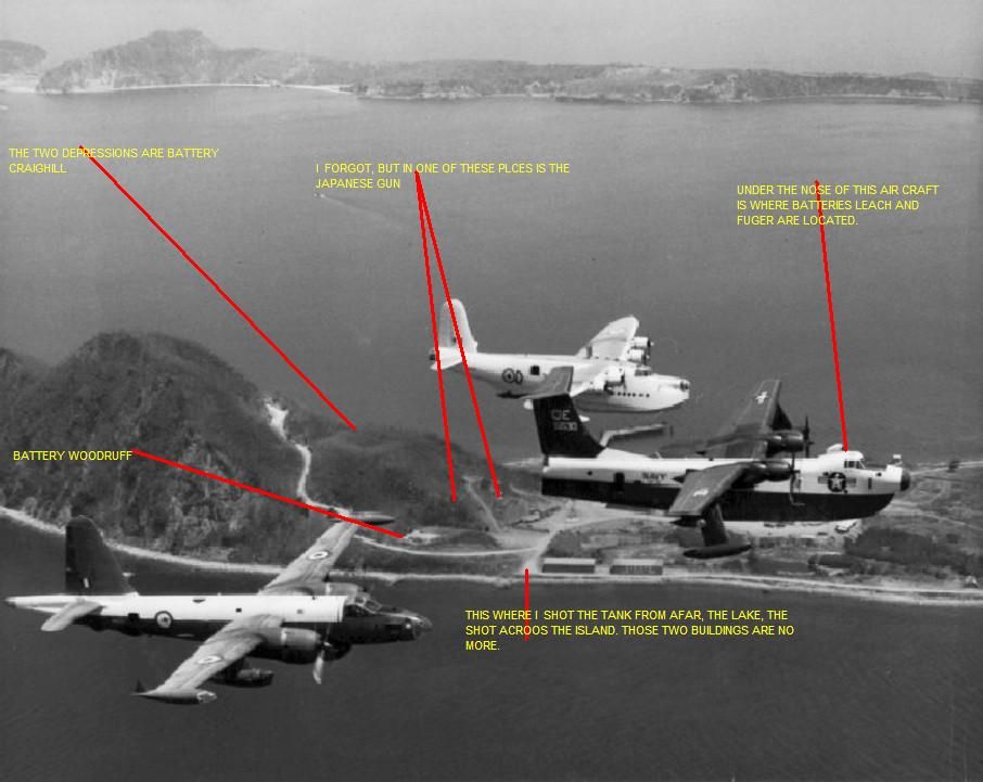 Our outrigger boat along a Philippine Navy Vessel 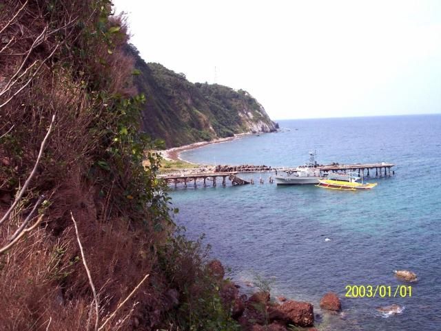 Battery Woodruff 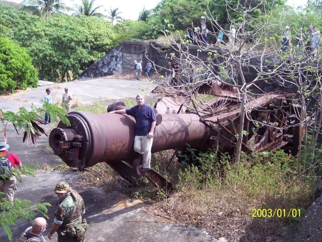 A Japanese Gun 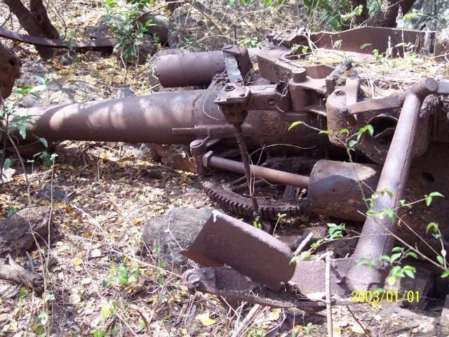 Battery Craighill, West Pit 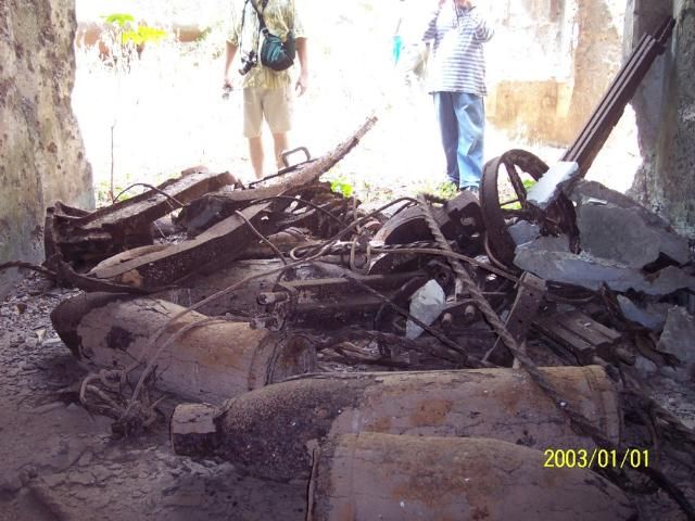 The Searchlight swivel base inside its tunnel 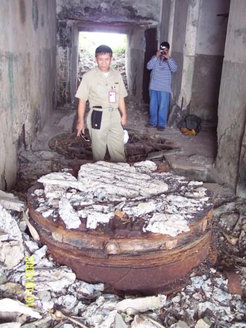 |
|
|
|
Post by chadhill on Dec 2, 2011 12:29:20 GMT 8
|
|
|
|
Post by EXO on Dec 2, 2011 21:40:01 GMT 8
Great Pics, Chad!
I hate to say this, but the quality of the photos on those WWII Japanese books far surpassed the normal printing of the US news sheets of the same era. The latter were printed like half-tones (hundred of dots) whereas the Japanese photos were, well, something else entirely. It only goes to make me appreciate the images all the more.
I first noticed this when I tried scanning some US printed images, and got an awful result. I spent hours researching stuff like moire patterns, and only got myself thoroughly confused.
I will now allow you guys to get back to normal programming.
|
|
|
|
Post by batteryboy on Dec 2, 2011 23:23:20 GMT 8
PEF Photos:
1) Battery Gillespie
2) Battery Craighill
3) Incline rail from Battery Craighill Pit B exit. Now the wall of the exist has collapsed. Possible photo shot coming from the cable winch house.
4) One of the storehouse in front of the fresh water lake.
|
|
|
|
Post by chadhill on Dec 3, 2011 7:22:30 GMT 8
Thanks EXO, I've had similar experiences with US pics. For some reason photo # 3 was "dim" in the book. Appreciate the IDing, batteryboy. I know little about Caballo and the photo captions said nothing except the island's name.
|
|
|
|
Post by Karl Welteke on Oct 5, 2015 14:41:59 GMT 8
AERIAL VIEW OF FORT HUGHES ON CABALLO ISLAND PRIOR 1932 & 1946 Manila & Subic Bay Forts! These pictures were given to me by Karl Schmidt; a leader in the Coastal Defense Study Group (cdsg.org) who got this image from the National Archives and Records Administration (NARA). The album below contains aerial images of the Manila and Subic Bay Harbor Defense Forts. Because I cannot or don’t like to upload a large size images I captured them to make them smaller and then cropped them several times, which is like zooming in on the original picture. These 8 new pictures are numbered D1 to D8 in this album: www.flickr.com/photos/44567569@N00/albums/72157658661455655I present all 8 images here in the forum and they are smaller than in the above album: 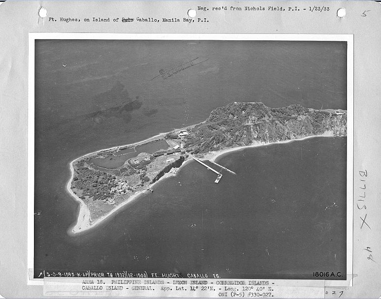 W152 (D1) Fort Hughes, Caballo Island, Manila Bay, prior 1932; (Photo credit: NARA and Karl Schmidt, CDSG). 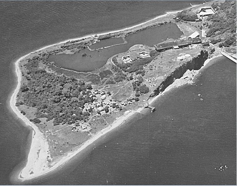 W153 (D2) Fort Hughes, Caballo Island, Manila Bay, prior 1932; (Photo credit: NARA and Karl Schmidt, CDSG). 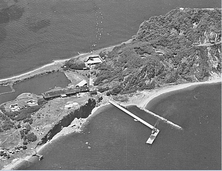 W154 (D3) Fort Hughes, Caballo Island, Manila Bay, prior 1932; (Photo credit: NARA and Karl Schmidt, CDSG). 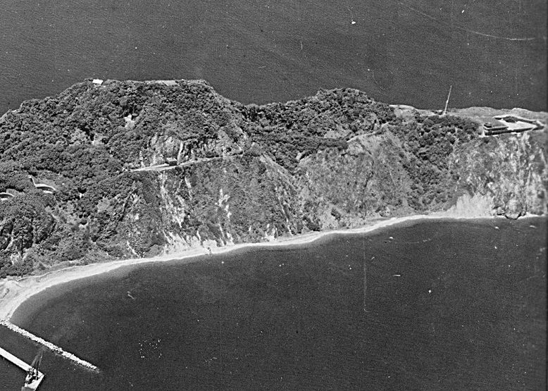 W155 (D4) Fort Hughes, Caballo Island, Manila Bay, prior 1932; (Photo credit: NARA and Karl Schmidt, CDSG). 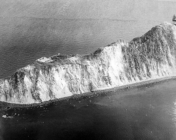 W156 (D5) Fort Hughes, Caballo Island, Manila Bay, 1946; (Photo credit: NARA and Karl Schmidt, CDSG). 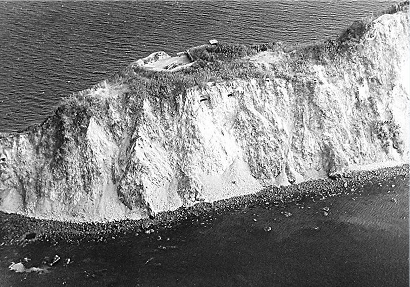 W157 (D6) Fort Hughes, Caballo Island, Manila Bay, 1946; (Photo credit: NARA and Karl Schmidt, CDSG). 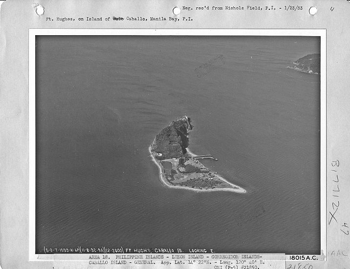 W158 (D7) Fort Hughes, Caballo Island, Manila Bay, 1932; (Photo credit: NARA and Karl Schmidt, CDSG). 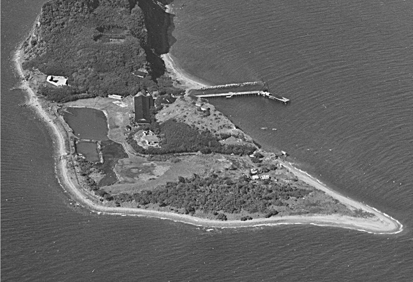 W159 (D8) Fort Hughes, Caballo Island, Manila Bay, 1932; (Photo credit: NARA and Karl Schmidt, CDSG). |
|