|
|
Post by fortman on Oct 5, 2015 21:38:01 GMT 8
Hi K-W,
Many thanks for the fascinating pre-war photos of Caballo Island (and also the previous ones of Carabao and Grande islands).
In photo number W157(D6)there are two slit-like features in the rock face slightly below the battery that look man-made. Could they be observation stations?
fortman
|
|
|
|
Post by armyjunk on Oct 6, 2015 5:11:10 GMT 8
on photo W157,notice the slots in the cliff in front of Battery Gillespie, I was told by a Filipino sailor that those are connected by a tunnel to this opening on the backside of the cliff. I saw the opening on the backside, but as usual we were in a big hurry, so I didn't get into the opening. Might be an interesting place to explore if anyone ever gets back there. opening on backside of cliff  |
|
|
|
Post by fortman on Oct 6, 2015 11:14:55 GMT 8
The photo in question was taken in 1946 and the effects of the naval bombardment of Caballo in 1945 are still very evident-a large part of the cliff face was shot away. That makes me wonder whether the "slots" were actually tunnels exposed by the removal of the rock.
fortman
|
|
|
|
Post by batteryboy on Oct 6, 2015 11:29:32 GMT 8
Said to be extensions of a Japanese dug tunnels or previous work that the Japanes extended. Never really had time to explore the area in detail due to time constraints on the island. We focused on the SL positions which can be seen at the leftmost part of the photo that also had an extension dug up but was buried. The extension tunnel entrance was suppose to be on the other side.
|
|
|
|
Post by fortman on Oct 7, 2015 1:52:09 GMT 8
Karl,
I don't want to appear greedy, but do you have similar pre-war aerial photos of Corregidor that you can share? That will really be great!
Regards,
fortman
|
|
|
|
Post by oozlefinch on Oct 8, 2015 5:52:56 GMT 8
The picture with the purported slits is really interesting. Over 25 years ago George Munson had a picture (same one?) that showed some tunnel opeinings on the face of the cliff, and he asked me to look for them as he knew that Al McGrew and I were going to the island in 1987. We had viewed Gillespie and the SL and our escort informed us that there was a Japanese AA gun up on the ridge, and did we want to see it. Al begged off, but being the stupid I am, I said "yes". We took off from Gillespie and I thought I would look for the tunnels as we walked along the ridge. WRONG! Most of the ridge line is only 2-3 yards wide and the dropoff on the south side is near vertical. As we hiked along the ridge we did see most of the BES situated there. We finally got to the end of the ridge above Woodruff and found the mounting for what, I expect, was a twin 25mm gun, but not the gun. It had been taken to one of the warehouses. When we circled the island we attempted to see the openings, but were unsuccessful. Has anyone else had any better luck.
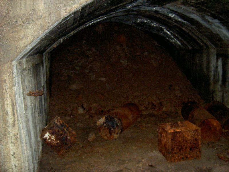
The extension to the SL tunnel through the SL recess mentioned by BatteryBoy is interesting as it contains several 50gal size barrels. It's a good 100ft long and turns to the backside of the island. At the end appears to be a concrete tunnel opening. Again, looking at the area from the water fails to show anything including any road or trail on the backside. I would estimate that the SL elevation is about 45-50ft below Gillespie, and the backside of Gillespie is a 15ft+/- retaining wall, so I don't know what where the tunnel opening would have gone to unless it went all the way back down to the wharf area. Has anyone seen anything like a trail on the backside leading away from the wharf area?
As to the slits, themselves, if you look at their width, compared to the size of Gillespie's emplacement, they are quite wide, maybe 25-30ft. To my eye their elevation would put them about level with the lower level of Gillespie. Maybe an opening was made from that level through the front wall? ArmyJunki, where did you find the tunnel opening? Was it along the stairway down to the SL?
And last, but not least, why go to all of the trouble to dig any tunnels out to that point? The only suitable landing point on Hughes is at the west end of the island. We'll probably never know, but it's fun to SWAG.
|
|
|
|
Post by batteryboy on Oct 8, 2015 6:25:56 GMT 8
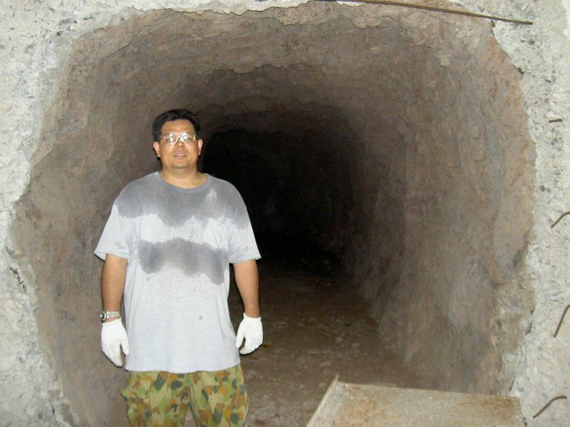
Here is the entrance to the extension of the tunnel and as mentioned by oozlefinch  The blocked entrance:  |
|
|
|
Post by Karl Welteke on Oct 8, 2015 13:54:43 GMT 8
Hello fortman. Yes, Karl Schmidt also gave me good aerial images of Fort Mills, all in due time. Re the openings under Gillespie, there must have been tunnels, but we never have enough times to check everything out.
|
|
|
|
Post by fortman on Oct 8, 2015 18:11:46 GMT 8
Thanks Karl, I'm really looking forward to this.
fortman
|
|
|
|
Post by armyjunk on Oct 9, 2015 4:17:32 GMT 8
Hello everyone, maybe this will give everyone a slightly better idea of the layout of searchlight 11, the photo number coincides with the number on the very professional looking drawing . Mr oozlefinch, The opening you asked about was on the road between Craighill and Gillespie, it looked as if it went to the “Slots” but someone will have to explore that…………………  Photograph 1  Photograph 2  Photograph 3  Photograph 4  Photograph 5  Photograph 6  Photograph 7  Photograph 8  |
|