|
|
Post by fots2 on Dec 19, 2009 0:04:19 GMT 8
Hi okla,
Yes the eastern end was a pleasant surprise when I first started exploring it. There certainly is a lot of history there. A counter attack may have made a difference that day especially since the Japanese were low on ammunition. Surrender would have been prolonged for better or worse, who knows.
In January I would like to take a detailed look at the Monkey Point area and north of Kindley Field. You never know what you will stumble onto until you do it.
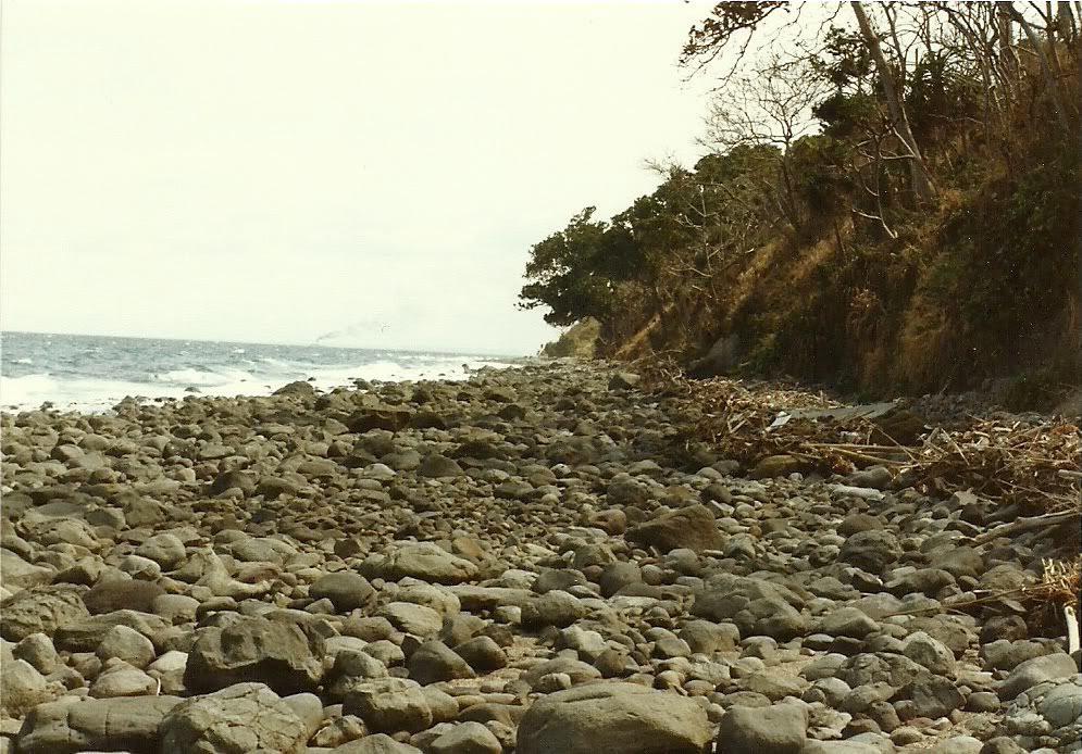
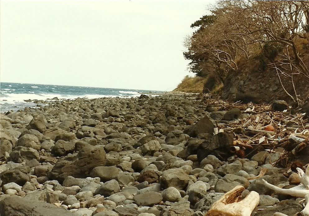
That is Manila garbage you see. At times it is much worse and sometimes nothing at all depending on the prevailing winds and currents.
I like that photo you mentioned too. It was early morning and one of the first photos taken that day.
The next batch of photos for me to sort through is from the tunnel called “Bombproof Infantry Quarters” in James Ravine. That will take a week or so. Its time to go underground again…
|
|
|
|
Post by okla on Dec 19, 2009 6:58:43 GMT 8
Hey Fots....One last thing. I can't help but wonder if that possibly "hand dug" gulley/mini-ravine was where those three Japanese tanks exited the invasion beach. I realize there were other, more easily traversed points to get off the beach, but maybe the defenders had those spots more heavily defended, forcing the interlopers to improvise with picks and shovels in order to get away from those .75s, etc. Conjecture's head rises once again. Lordy, how I enjoy it. Thanks again for the tour. Anxiously awaiting the next outing.
|
|
|
|
Post by fots2 on Dec 19, 2009 9:11:23 GMT 8
okla, that is exactly what I was thinking as I was standing there. It is the only spot like that along the beach. The rocks are like big marbles there so perhaps the three small tanks could not get to a better location to get up off the beach. Just speculation of course.
|
|
|
|
Post by fots2 on Mar 10, 2010 17:07:06 GMT 8
Here are a few more recent coastal views.  Bottomside south  Overlooking the 92nd Garage area. Part of Caballo Island is at the left and Cavite is in the distance.  View of the beach at the 92nd Garage area looking east taken from the old Casino building.  View of the beach at the 92nd Garage area looking west taken from the old Casino building. The cut in the cliff face is the South Shore Road winding around Malinta Hill.  View of Infantry Point with one of the Shinyo suicide boat caves to the right.  Partial view of Tailside taken from Battery Crockett’s parapet. From left to right you can see the south side of Malinta Hill, the 92nd Garage area and the Japanese Memorial Garden on top of the cliff. |
|
|
|
Post by okla on Mar 11, 2010 2:16:01 GMT 8
Hey Fots....Just in the nick of time. The first, faint pangs of "withdrawal" were beginning to announce their presence and, low and behold, a new Fantastic Fots Foto Tour appears on the Corregidor website. Excellent job as per usual. The shot of the, now defunct, casino peering down on the 92nd Garage area, of course, got my bile to boiling. I, for one, am most happy that this abomination went kaput for whatever reason. Whether it failed financially or maybe the powers that be pressured them to close (probably the former, but I would hope it was the latter) because it was viewed as being highly inappropriate, suits me just fine. Captives were suffering from lack of food, water and medicine. Many were wounded. This is hallowed ground and to allow a Casino to be built overlooking this area is insanity in my view. Why not turn Malinta into a brothel?  All those laterals would make fine "cubicles" for the ladies to ply their trade. Branch out over all of Luzon. Chorus lines, ala the Radio City Rocketts, appearing nightly at ODonnell and Cabanatuan could be considered. I had best slow up. Please forgive me, but this is and will remain a very sensitive issue with me. Corregidor/Bataan is sacred territory and should be treated as such. I want to emphasize that I am not ranting on the Hotel,etc. There obviously has to be facilities for the tours that come out from Manila,etc. I am ranting about the "rides", ex-casinos and even some of the monuments (you and I have touched on some of these in prior hissy fits). Thanks for listening and thanks for the latest tour. |
|
|
|
Post by okla on Mar 11, 2010 2:44:07 GMT 8
Hey Fots...I have another stupid question. In viewing the second photo in this tour it think I see Fort Drum in the hazy distance. Correct me if I am in error (which seems to be the norm these days), but just below the gap or low spot in the mountain range in Cavite in the right center portion of the pic, I think I see an object that could well be the defunct "concrete battleship". Whatcha think?  ? Believe it or not, I used to work, at times, in photo interpretation while serving in the USAF. WIth the shape my eyes are in these days, it is diffucult for me to believe that this was once so. Old age, it's the pits, methinks. |
|
|
|
Post by fots2 on Mar 11, 2010 12:03:56 GMT 8
You will get no argument from me on those points okla. There is nothing wrong with your eyes if you see that faint island. It has not rained for a long time to clear up the air so distant views are hazy these days. You can see Fort Drum and even Fort Frank below the hills of Cavite. Fort Frank (Carabao Island) also has a rectangular profile similar to Drum. Here is a darkened crop of the same photo showing some fishing boats and the two forts.  |
|
|
|
Post by okla on Mar 12, 2010 0:02:11 GMT 8
Hey Fots...Thanks for the close up pic. What I thought was Fort Drum is, in reality, Fort Frank, I missed the actual "Concrete Battleship". The close up certainly shows that the profiles of both installations are very similar. Do you happen to know if the troops who manned these small, restrictive in area (especially Drum) posts, were rotated from Fort Mills every 30, 60,etc days or some such thing? I am under the impression that there was always a skeleton crew present, but am wondering if they weren't relieved after a certain period of time. If not, they should put in for "sea pay". There wasn't enough room on Drum for a guy to have a "running fit". Fort Frank is a bit different as far as area is concerned, so maybe rotating between Mills and their station would be a different situation. This might be a project for Battery Boy. These little, important tidbits continue to plague me, but it is kinda interesting. Kinda, hell, its bordering on some kind of mental disorder, methinks. Cheers.
|
|
|
|
Post by fots2 on Mar 12, 2010 13:29:43 GMT 8
I have not read anything about life on those forts so sorry I can't help you with that.
Perhaps batteryboy or someone else would know.
|
|
|
|
Post by chadhill on Aug 16, 2010 10:19:56 GMT 8
Fots2, here's my comparison "Then" (1986) to one of your beautiful pics "Now" in post # 9...  The above photo was captioned "looking east from North Point", and the next one is "looking east from Cavalry Point to North Point".  (reposted with enlarged photo, and with an additional photo) Attachments:
|
|