|
|
Post by okla on Jun 19, 2010 22:18:20 GMT 8
Hey Fots....That link you posted is tops for the "what if" bunch, of which I am one. As soon as I get my grass mowed I will plunge into it up to my ear lobes. Thanks again for posting it. Wife will really be on my case this weekend. I will blame you for my shortcomings as pertains to my undone "honeydos". Cheers.
|
|
Deleted
Deleted Member
Posts: 0
|
Post by Deleted on Jun 19, 2010 23:58:39 GMT 8
Victor, That was a good link you posted on the background of the battle. If anyone is interested in “what if” discussions, you will love this thread about MacArthur and the defense of Bataan. It seems to go on forever. A lot of information with facts and figures is presented however the sources are rarely quoted. Take that for what its worth I guess. If you back up a forum level or two you will find discussions on all aspects of WWII. www.ww2f.com/what-if-pacific-cbi/28198-what-if-macarthur-goes-offensive-pi.html#post360139Yeah, guilty as charged. That's me writing on another forum, using my real name. |
|
Deleted
Deleted Member
Posts: 0
|
Post by Deleted on Jun 20, 2010 1:15:50 GMT 8
When General Selleck sent in two companies of the 31st Infantry on a counterattack at Layac Junction, to regain lost ground, imagine how much more effective the attack would have been had a dozen M-3 tanks, along with some 75mm armed half tracks been in a line, offering some protection to the following infantry, as well as blasting targets of opportunity in front of them with their 37mm and 30 caliber machineguns. Like I wrote. "such an attack could have busted the whole Japanese line wide open."
|
|
|
|
Post by Nowhere Man on Jun 20, 2010 6:00:37 GMT 8
False name?
In the words of Captain Renault, "I'm shocked, shocked to find that gambling is going on in here!"
It is a damn good article you did, enjoyed it thoroughly!
|
|
|
|
Post by victor on Jun 20, 2010 9:44:01 GMT 8
Thanks Fots. I haven't been back to that thread in a long time. I didn't know that's still going on. I'm the one with a Anywhere-Anytime username.
|
|
|
|
Post by Karl Welteke on Jun 23, 2010 19:36:48 GMT 8
Second Walk in Layac! On the 19th of June 2010 I did my 2nd walk in the Layac Battle area. My Army Buddy Chris was my partner again. This walk was in the area where the Tama River flows into the Culo River and I believe we were at or right behind the front line which the two Battalions of the 31st Inf. manned. We came across some spots that made us wonder whether they were Artillery impact holes. In the album above I recommend that you look close at the hill I labeled CP Hill. I think it was important for observation and placing artillery behind it. 59 picture are uploaded into this album of the 2nd walk near the Colo River: s74.photobucket.com/user/PI-Sailor/library/Walk%20in%20the%20Philippines/No%202%20Walk%20PI%20Group/Layac%20Project/to%20Colu%20Rv%202010-06-19?sort=9&page=1or tinyurl.com/o574c4yThis link/URL has been dead, don’t know why but as of today, the 15th Nov. 2015 it is active again and this time I also upload these 10 sample pictures of this walk. 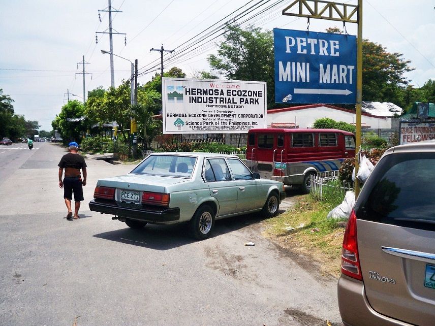 Z180- The Hermosa Ecozone Industrial Park (HEIM) is being developed behind the 1942 Layac First Line of Defense and they are building a wall around the complex. So perhaps in the future it will be a little harder to explore this area. This entrance is located 200m from the Dinalupihan Exit of the new SUBIC-Clark-Tarlac Express way (SCTEX) or ½ km from the Layac intersection. 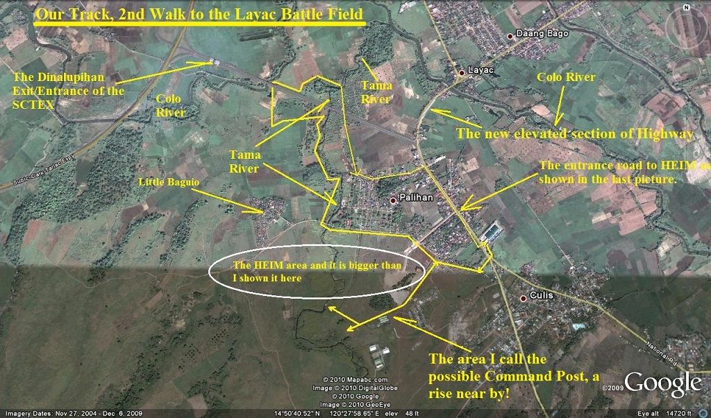 Z181- The track and landmarks of our 2nd walk in the Layac Battle Field area. 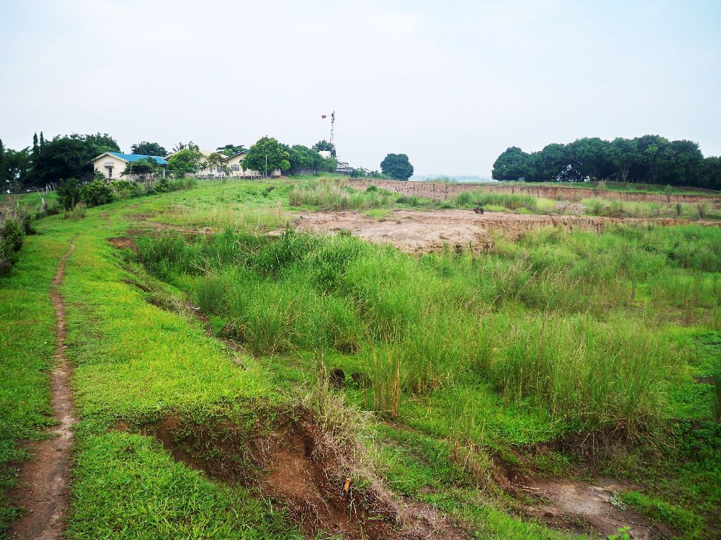 Z182- We are walking from near the HEIM gate to the area I call the Possible Command Post. 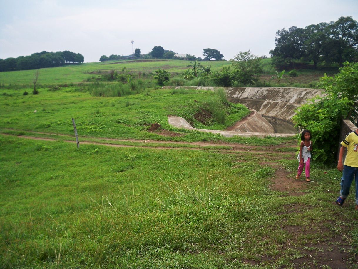 Z183- We walked now passed and or over the possible Command Post towards the Tama River with it’s irrigation dam. This irrigation dam is providing water to the village Palihan. 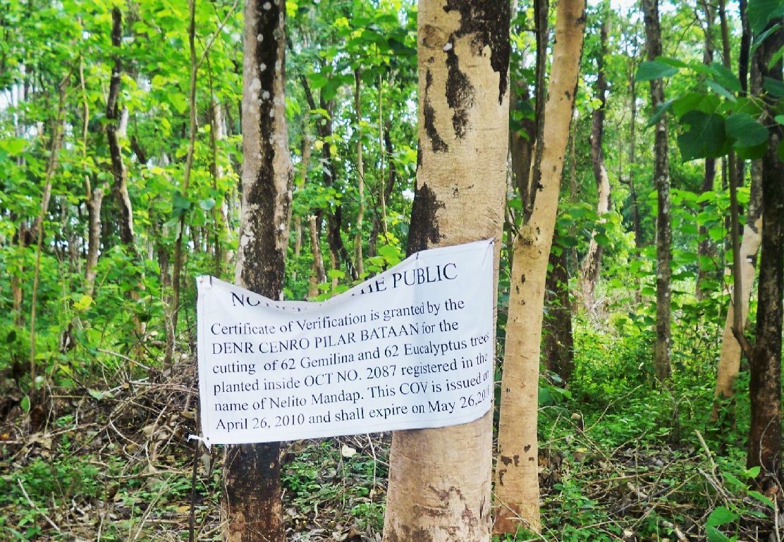 Z184- Then we walked along the HEIM parameter wall, down the left side of the Tama River to the area between the Culo River and the Tama River, all around the new Dinalupihan exit/entrance way to the SCTEX. We walked thru a batch of trees and I thought it interesting that a sign had to be posted that permission had been attained. 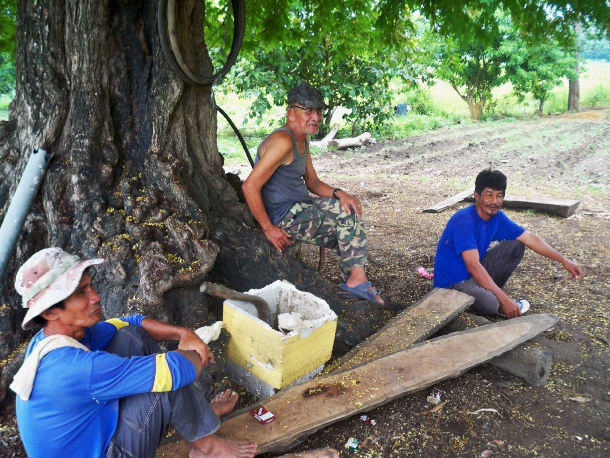 Z185- We came by a group of farmers and asked them whether they knew anything about the battle that was fought here. Even so one person was old the answer was negative. 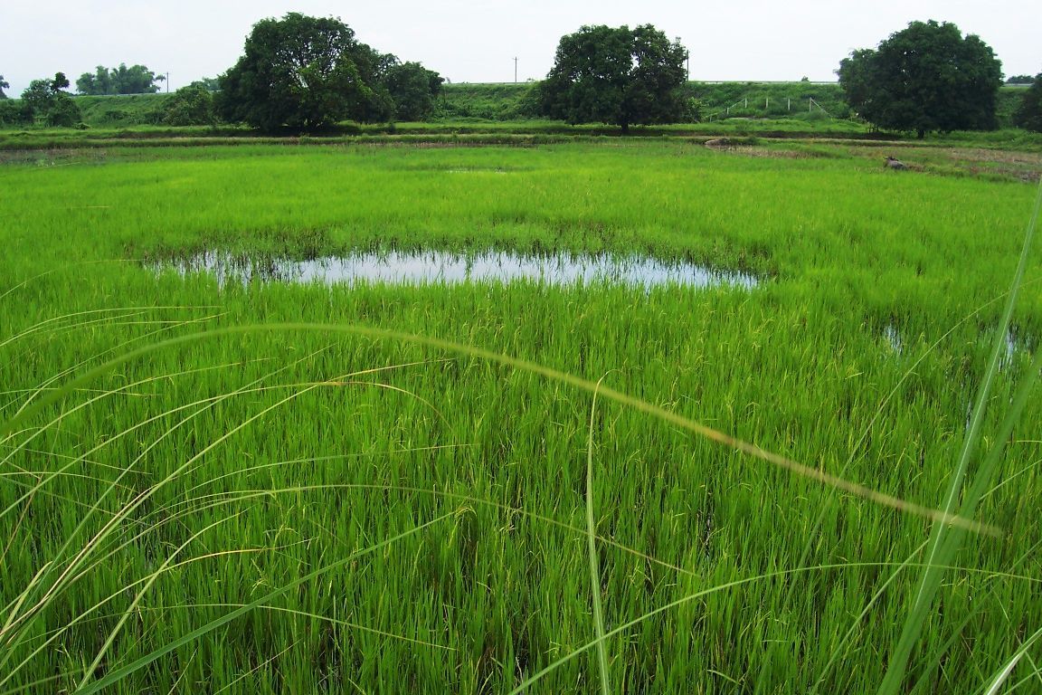 Z186- That hole, the bare spot of no rice growing made us wonder why? They were numerous and we wondered could they have been artillery impact holes? There in back of the image is the Dinalupihan exit/entrance way of the SCTEX and we are on the west side. 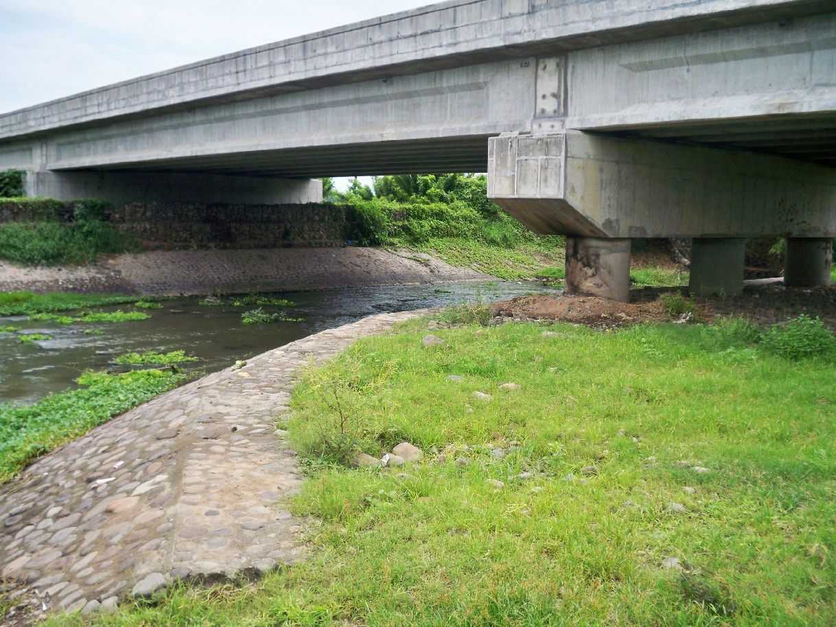 Z187- We left the Tama River and are now at the bridge of the Dinalupihan SCTEX exit/entrance road over the Culo River. The Culo River was the MLR the Bataan defenders tried to defend. 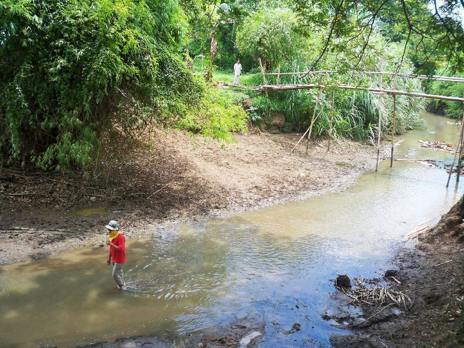 Z188- We are on our way back and had to cross to Tama River again in Palihan, We were lucky a bamboo bridge existed and we didn’t have to take off our shoes. 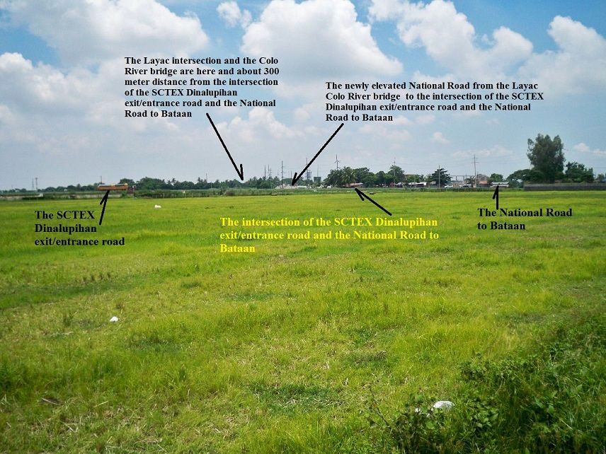 Z189- This is rice land just west of the Culo River, this is the area the 31st Inf. Guarded. |
|
|
|
Post by Karl Welteke on Jun 24, 2010 20:25:02 GMT 8
Fourth Walk in Layac, 2013-06-22 My friend John and I decided to scout out and get a picture of the area the Philippine 71st Div. defended. Basically this area was between the national Highway and the Culo River. We walked a circle around the area where the 71st Division of the Philippine Army had their positions 38 images have been uploaded into this album: s74.photobucket.com/user/PI-Sailor/library/Walk%20in%20the%20Philippines/No%202%20Walk%20PI%20Group/Layac%20Project/71st%20PA%20Div%20area%202010-06-22?sort=9&page=1or tinyurl.com/ncoed2yThe above link has been dead, NOT ANYMORE! As of the 15th Nov. 2015 the above link is active again! Now that I learned to upload images I also uploaded some sample images: 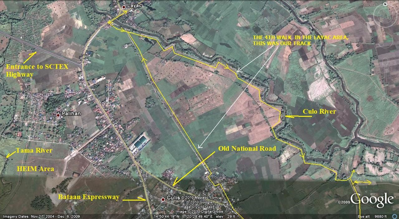 Z190- The northern half of our track, scouting the defense area of the 71st Philippine Division. 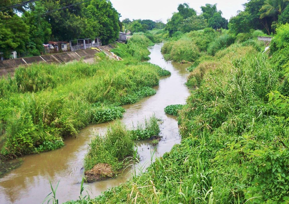 Z191- The Culo River, looking down river from near the Layac bridge. 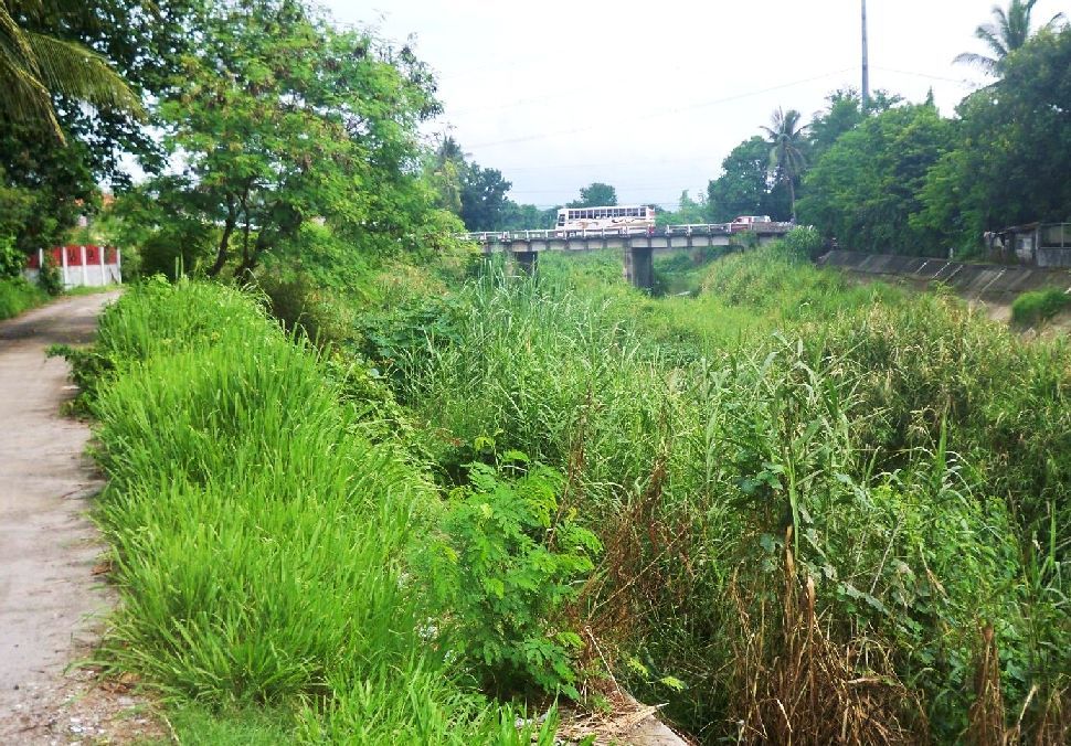 Z192-The Layac bridge over the Culo River, looking up-stream. 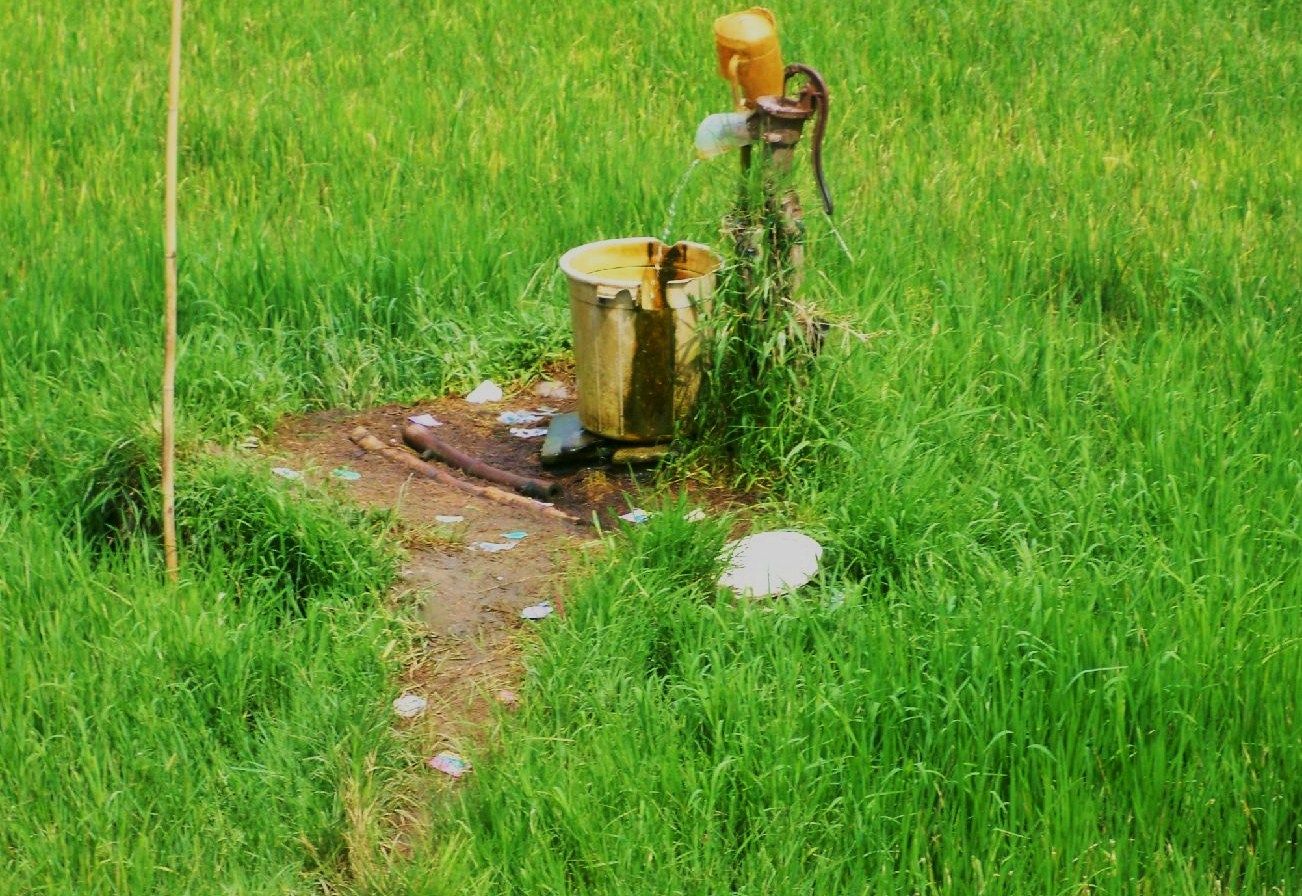 Z193- I had to show this picture, it is really unique. I seen this fairly often in my walks, the water is continuously running out off the pump without pumping. It is the pressure of the ground water causing it to run. 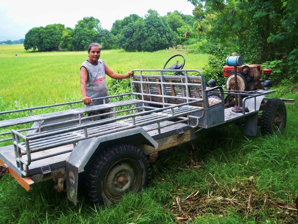 Z194- This is also very unique, this farmer built himself a very neat utility vehicle and was very friendly to boot. 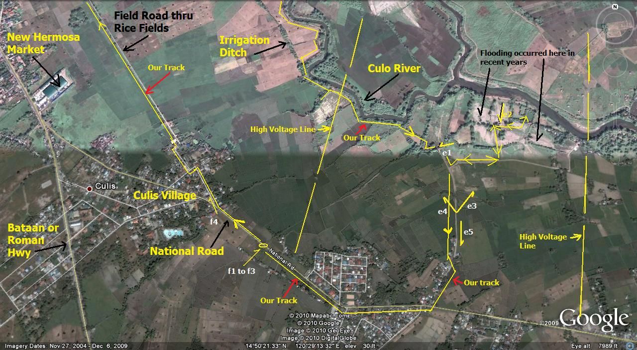 Z195- The southern half of our track, scouting the defense area of the 71st Philippine Division. 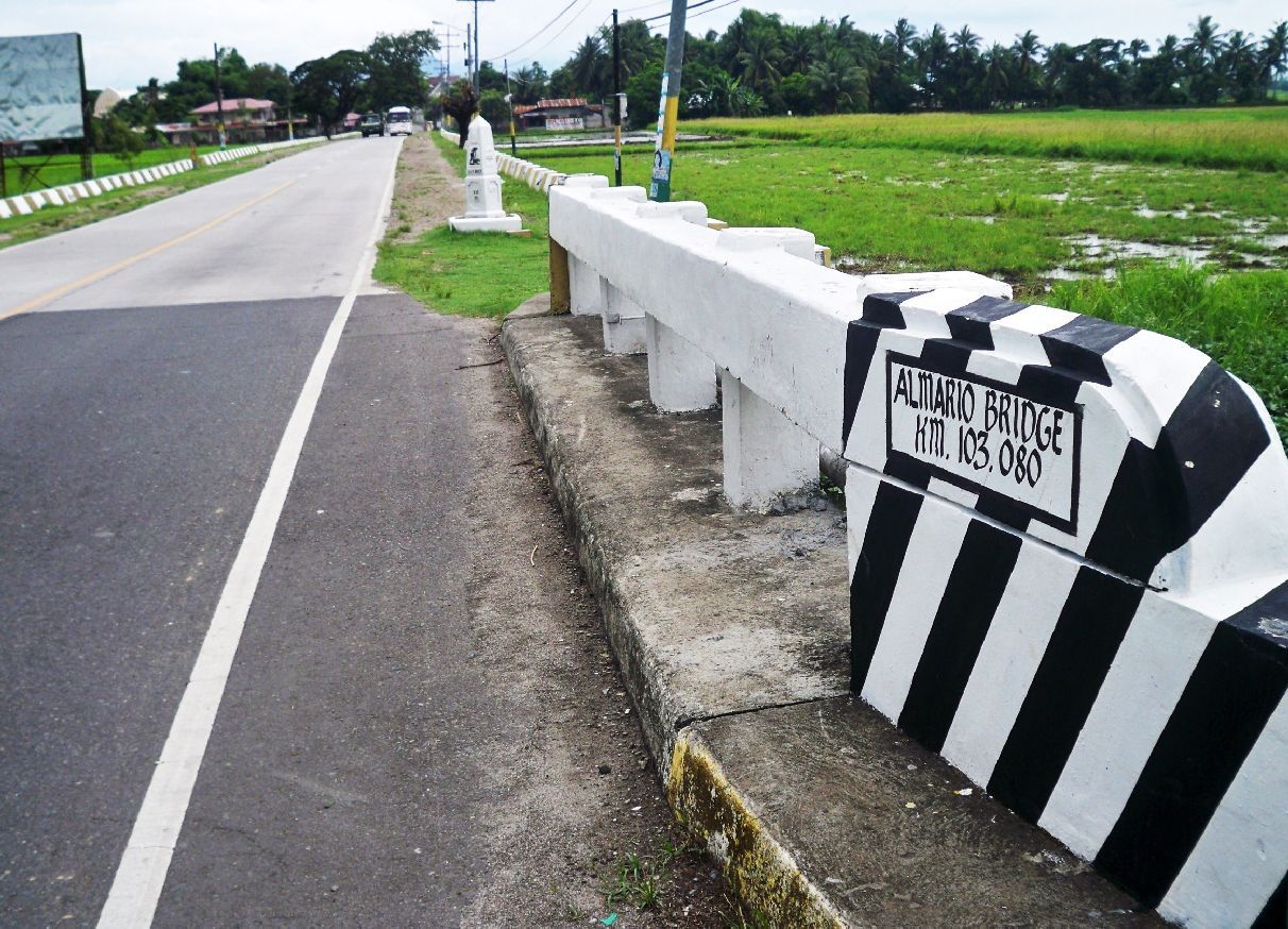 Z196- We are back on the old National Highway and are heading north, that is Death March Marker #66 and it is sponsored by the Philippine Geothermal Inc. 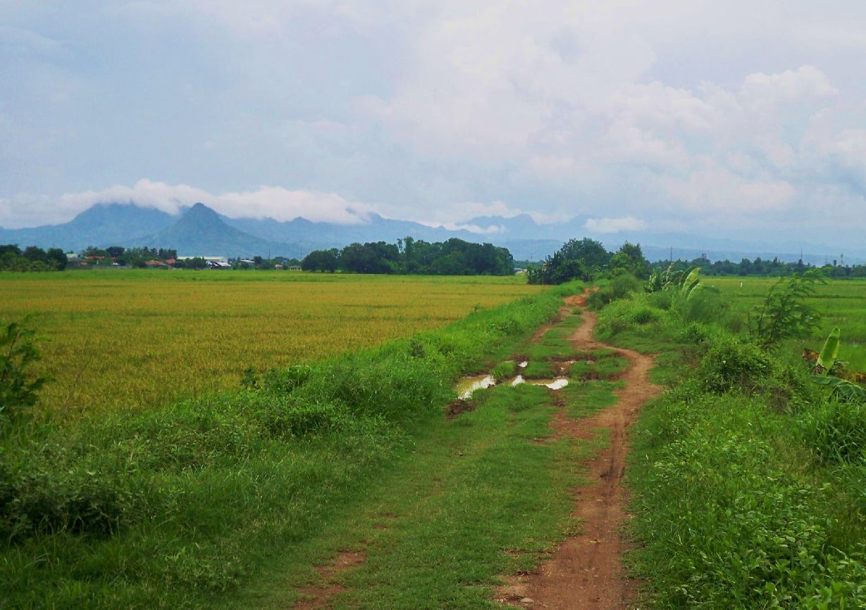 Z197- We left the old National Highway again and are walking on a dirt track that runs parallel between the highway and the Culo River. 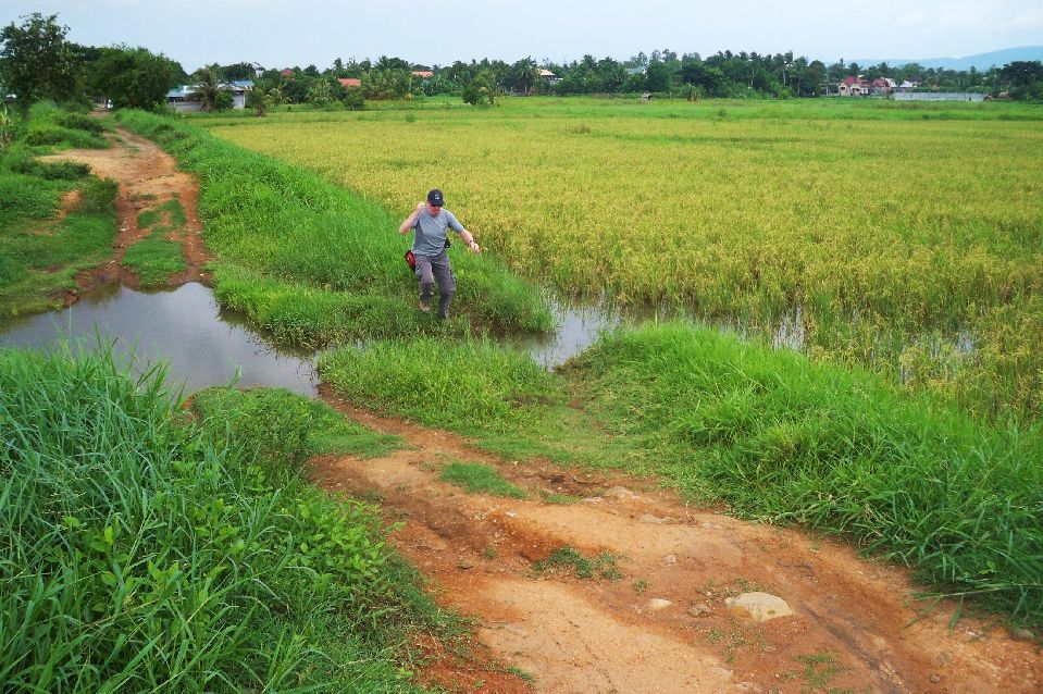 Z198- The walk on this dirt track was not all this smooth but my Canadian friend John was able to fly over some water barriers. 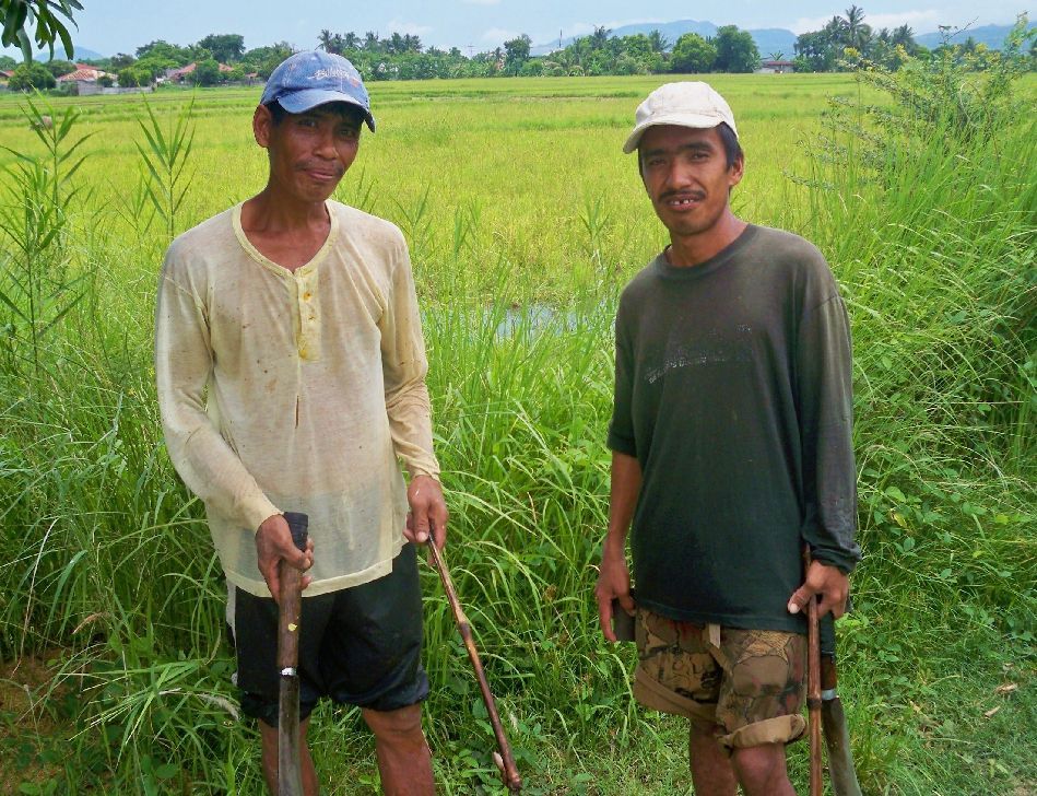 Z199- On the dirt track we met these two fellows. I added this picture because they had sticks with hooks to help to what ever they were cutting, I never had seen that before. 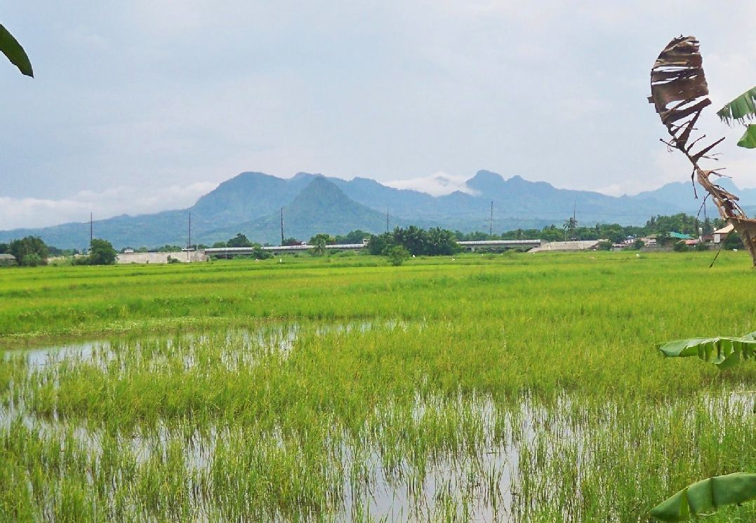 Z200- We are making progress, the new elevated National Highway spanning very low rice fields, just west of the Culo River bridge at Layac is in sight. We are almost back where we started. 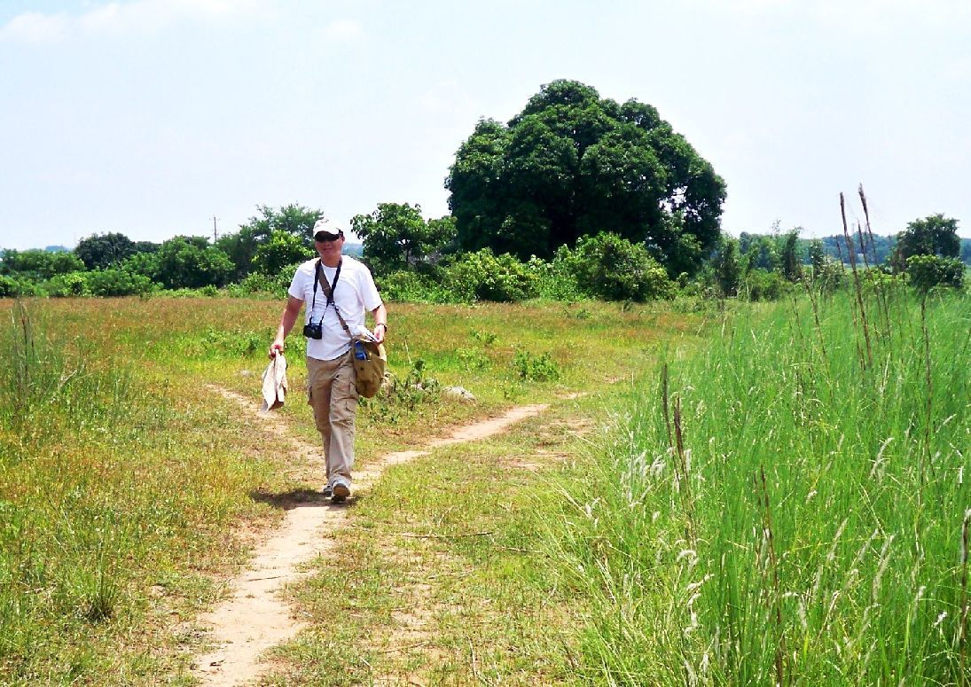 Z201- This is a surprise picture and it was shot on the 5th July 2010. Do you guys recognize this fellow? It is Vic from that day when we teamed up looking at the Layac battle area. Note: We looked but did not expect to see any kind artifacts or any kind of leftovers from the WWII battle here and we did not. But we got a good picture of how the defense line must have run in 1942. |
|
|
|
Post by victor on Jun 24, 2010 20:57:53 GMT 8
Those holes in the rice fields could be shell holes. I can't imagine why 60+ years later and nobody has filled them in. Unless the farmers find them useful as carabao wallows.  Thanks for the all the pictures. |
|
|
|
Post by Karl Welteke on Jun 26, 2010 19:44:52 GMT 8
Third Walk in Layac, 21st June 2010 This walk had the purpose to look deeper into the rear for the possible Artillery Positions and to have a closer look at holes in the ground near the Culo River at Layac. Where they Carabao wallows or WWII artillery impact holes? John, fots2, had come to join in this effort. We had a good walk and considered several location where the artillery positions might have been. 44 images were uploaded into this album: s74.photobucket.com/user/PI-Sailor/library/Walk%20in%20the%20Philippines/No%202%20Walk%20PI%20Group/Layac%20Project/Around%20rear%20of%20Arty-Positions%202010-06-21?sort=9&page=1or tinyurl.com/o7ybm8gThe above link had become a dead link but since today the 15th Nov 2015 it is active again. Besides correcting the dead link I also took the opportunity to post these 8 sample pictures:  Z202-Our track for this 3rd Walk on the Layac Battle Field. 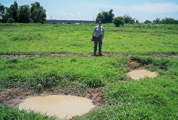 Z203-Two sample holes, Carabao wallows most likely but there were maybe a 100 hole like this. 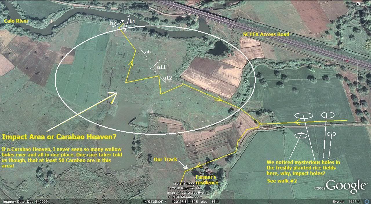 Z204-On this Google Earth image you actually can see the many holes or wallow holes. 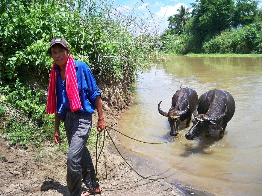 Z205-We seen many Carabaos in the Culo River, this fellow said there were 50+ Carabao in the immediate area. 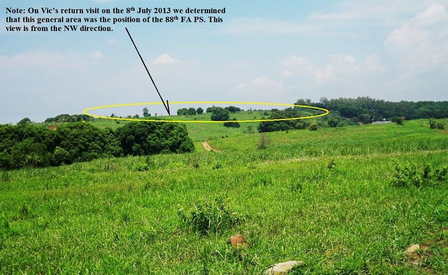 Z206-We walked about 2km from the Culo River where the carabaos were to this point and gained this view. Remember I’m not writing this in 2010 when this picture was shot but today the 25th July 2013 as I correct the dead links. That ridge and that spot is where Vic and I determined on the 8th July 2013 must be the position of the 88th FA PS in 1942. Then we approached that spot from the east but this view is from the NW where John and I came from. 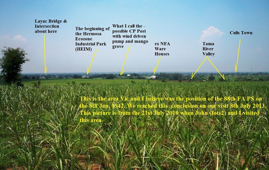 Z207-Now we are standing in the area of the position belonging to the 88th FA PS in 1942 and have the commanding view of the Layac area. 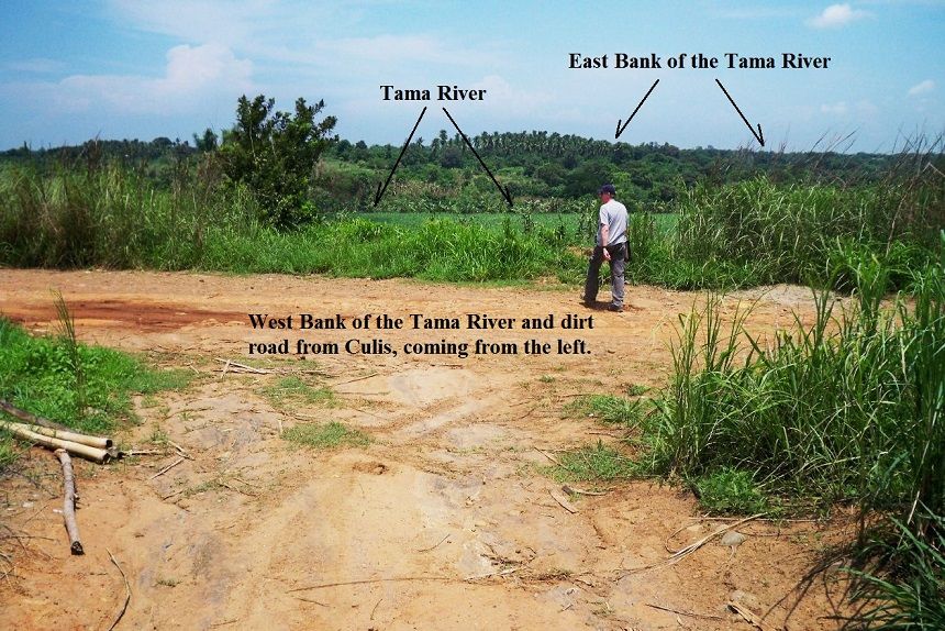 Z208-Then John and I reached the same dirt road which Vic and I visited and used on the 8th July 2013. 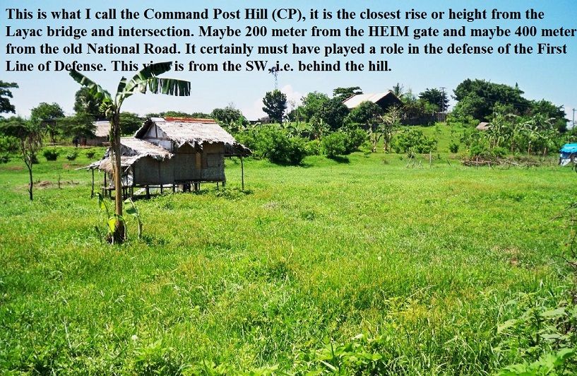 Z209-John and I walked about another km and are in the rear (NW side) of a rise which I have been calling the Command Post Hill (CP Hill). I wrote my opinion about the possible importance of this rise onto this picture. |
|
|
|
Post by okla on Jun 26, 2010 23:24:26 GMT 8
Hey Karl....Sitting here in the Zone of Interior I, of course, have no way of knowing if those suspicious holes in the ground are shell holes or "wallows", but couldn't they be both?  ? Shell holes from way back in 1942 that the local Carabao "improved" upon over the years thus preserving them for you all to view in 2010. This is just another one of my highly uneducated guesses resulting from my over active imagination. Thanks again for some more of your "good stuff". |
|