|
|
Post by Karl Welteke on Aug 22, 2015 20:58:24 GMT 8
1969/71 PEACE CORPS VOLUNTEER (PCV) BOOK; FINALE DELIVERY A 1969-71 Peace Corps member had his assignment in the village of Villar, about 27 km from Botolan into the Lahars field via the Bucao & Balin-Buguero River. He wrote a book about his experience and would like the people of the Philippines to know about it and he would like to present copies to the residents of Villar and other people in authority and in the community.  Y703. This is the book and below is an URL for it: www.webpages-charter.net/philippinesjournal/index.htmlHe is handicapped now and asked a fellow Peace Corps friend (Phantom in our forum,who is a friend of mine also) to deliver the books. And that is how I got involved. Richard Schneider sent three packages with books, one never arrived. I went to Phil Postal Center on the Domestic Road near the airport to inquire on the 19th of Aug. 2015. The personnel there were helpful but the package was not found. We did not have a tracking number. We had two books left and we thought it would be a good idea to give the books to the High School Libraries in the Mt. Pinatubo Resettlement villages in Botolan. This thread has several entries about the project to deliver the books, this is the final one. The following day after the futile trip to Manila I went to Botolan by car and made the final delivery. As I often do another album has been established with 24 pictures. Almost all pictures in my albums have descriptions and that is how I tell the story. This is the URL: s74.photobucket.com/user/PI-Sailor/library/Walk%20in%20the%20Philippines/No%202%20Walk%20PI%20Group/Botolan%20area/Books%20to%20school%202015-08-20?sort=9&page=1or tinyurl.com/o4agbhvHere are 10 sample images but they are much smaller than in the album: 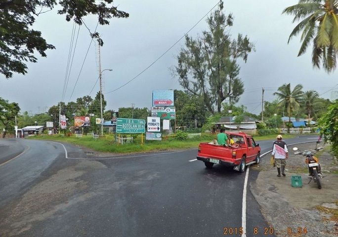 X986 View 1, Rich this view should be still the same as in your time; the Tarlac-Botolan intersection, right to Tarlac and your village Villar via Baquilan. I turned on my GPS device here. 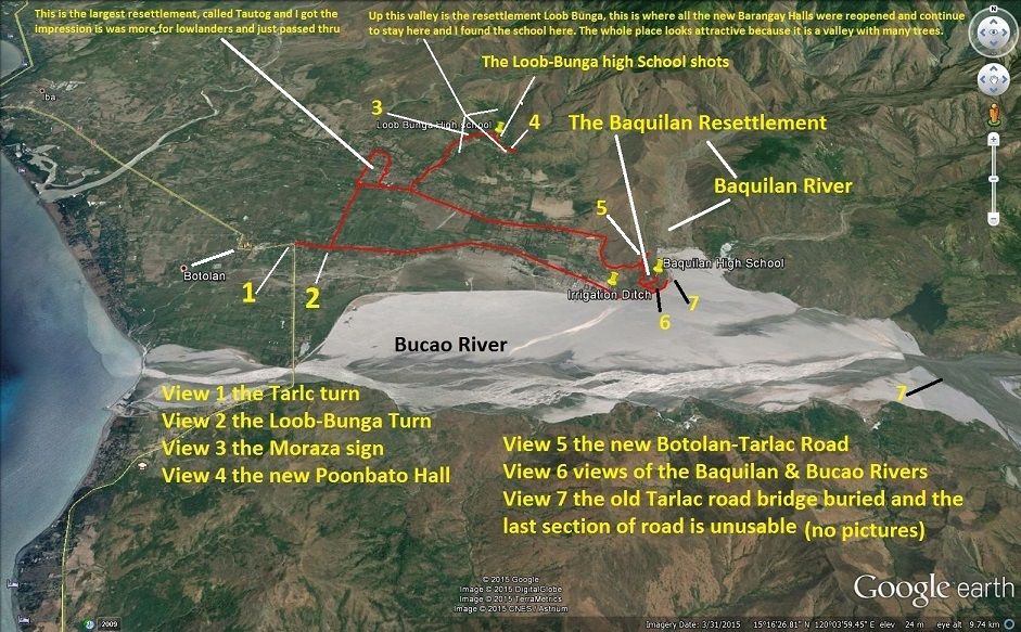 X987 The Google Earth map with my GPS track and pertinent way points in this album. 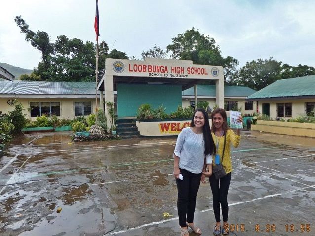 X988 at the Loob-Bunga an event was going on the school grounds outside but these two teachers took care of me. The Principle was not in and they took charge of me. I stated my business to pass out books for Richard Schneider who was a Peace Corps Volunteer here in the village of Villar about 45 years ago and wrote the book the right lady is holding. This shot is after the school event was over and I was departing. 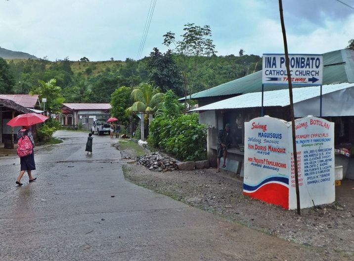 X989 after the book delivery I went deeper into the Loob-Bunga Resettlement and I find it attractive. It is inside valleys, I crossed 3 bridges. It has many trees. That Ina Stature was rescued from the Mt. Pinatubo Lahar and found a new home here. 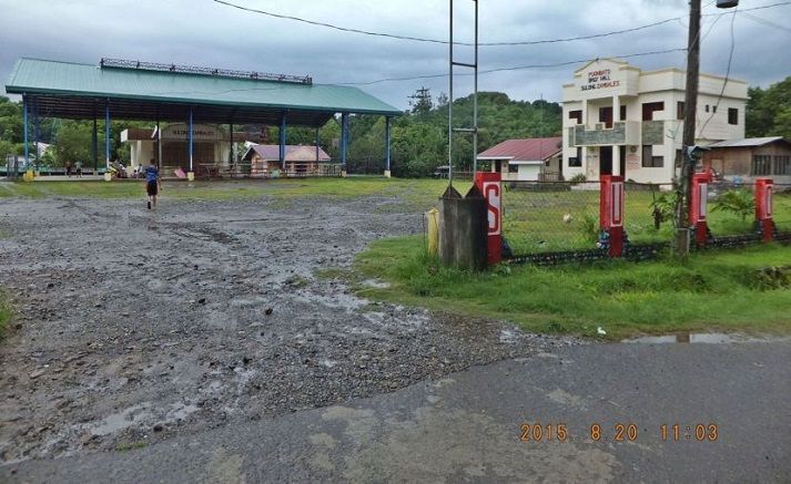 X990 I seen the Poonbato new Barangay Hall and complex; it looks big, spacey and attractive. As I said all the village barangay halls have been reestablished in this Loob-Bunga Resettlement camp. It is now permanent! 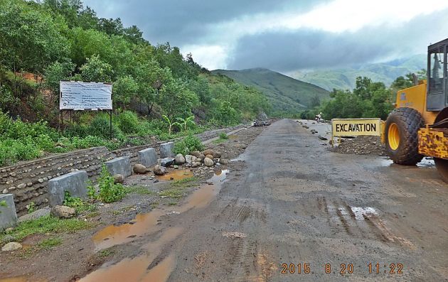 X991 View 5a, Mt. Pinatubo has wiped out the Botolan road and track; about 10 years ago or so they started building a new road, the sign said to Capas, Tarlac but it only got to this first ridge, the Baquilan Ridge but it looks like they resumed work. 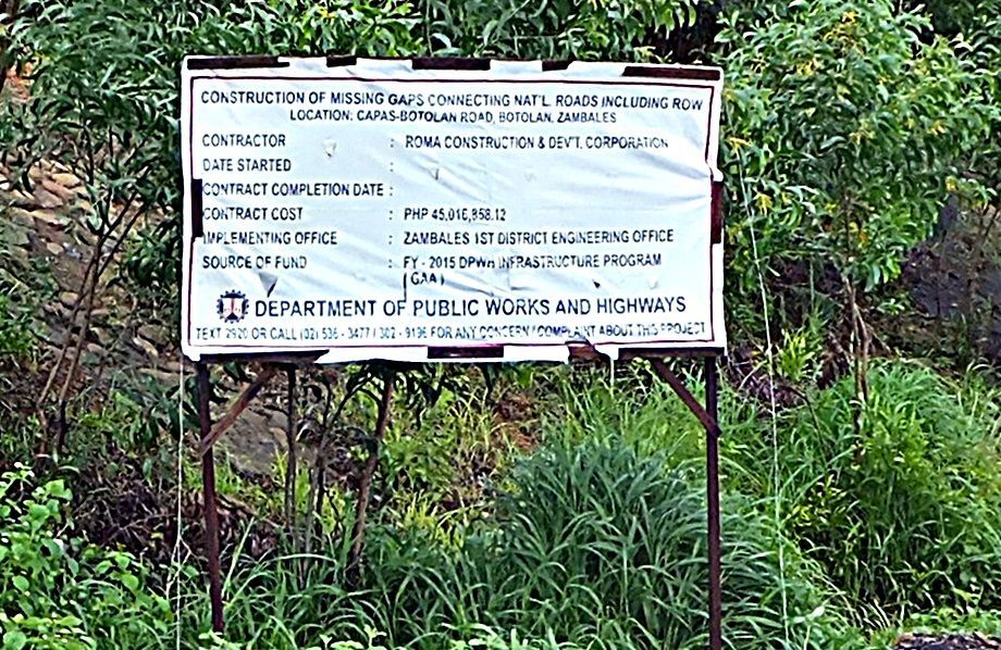 X992 close-up of the last view, the sign of the Botolan-Capas Road project. 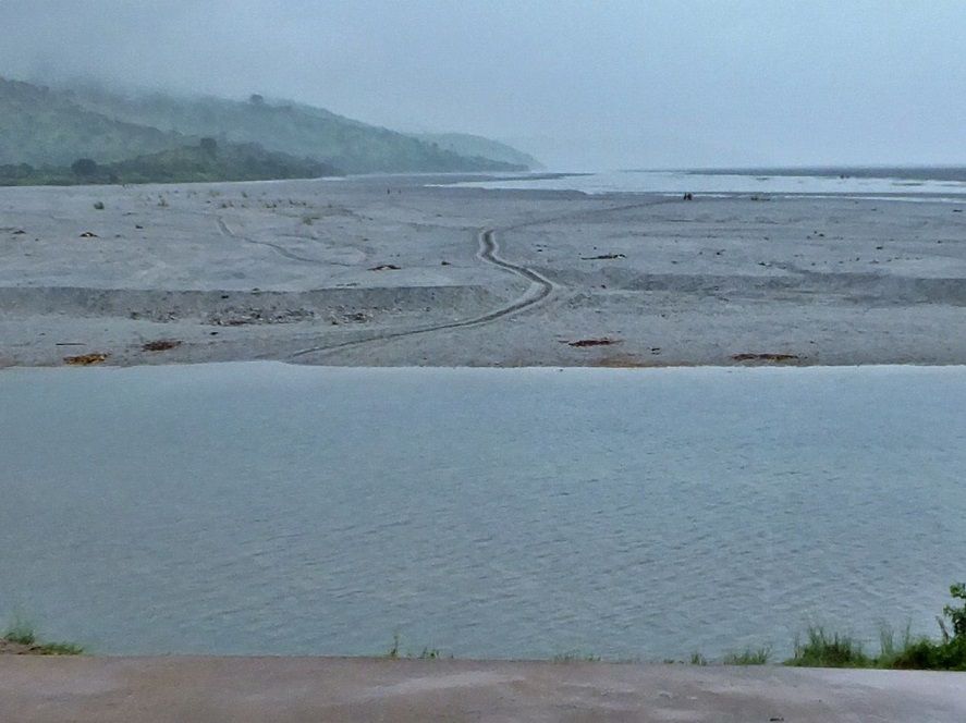 X993 View 6a to me this is a most fascinating spot. I am looking towards Mt. Pinatubo, it is about 31 km distance by air, I really started some long walks from here like to Capas in Tarlac or San Marcelino near Subic Bay, and to me it is an adventure! I was interested to see whether any traffic exist in this rainy season between this point the start of solid roads and the huge Mt. Pinatubo Lahar field where many residents have returned to continue their lively hood after the volcano destroyed it; see the track and if you look close two people are also walking to the left of the Carabao cart track. 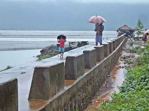 X994 View 6d this is the vast expanse of the Bucao River moving towards the South China Sea. The people apparently also are planning to cross the water and Lahar to walk to their home somewhere in the hills along the Lahar field. 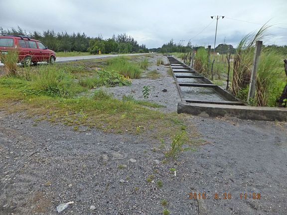 X995 this irrigation ditch is always of interest to me as to whether it still works. It is coming from under the Bucao River dike and is buried under the Bucao River bed and it amazes me that it still works, Under the river bed the irrigation ditch is built enclosed with concrete and the water is getting thru the man hole covers and it is plenty of water, the water is running swiftly in the irrigation ditch. Praise the Lord. This spot is about 200 yards from the dike. |
|
|
|
Post by Karl Welteke on Sept 28, 2015 16:49:04 GMT 8
MT. PINATUBO PREWAR AERIAL VIEW Mt. Pinatubo has played a significant part in the history of the US Military in Luzon. It provided the Aeta people, who we called the Negritos. They helped train us Soldiers, Marines and Sailors, survival skills. Around the mountain in 1945 we had hunt down the Japanese soldiers who were timed about giving up. The Mt. Pinatubo explosion caused the US to give up Clark Air Base before its time. Now a days it impresses us when we see how catastrophic the explosion altered nature, killed hundreds and ruined the live of many. It is spectacular to walk in its Lahar Fields and walk into the crater via the O’Donnell River. This picture, numbered C1 in the below Flickr album, came from this document: Terrain Handbook 42, Bataan Zambales, of 1944, from the Allied Geographic Section, Southwest Pacific Area. This document was provided to me by courtesy of Bob Hudson. www.flickr.com/photos/44567569@N00/albums/72157658661455655Here is the same picture but just a little smaller: 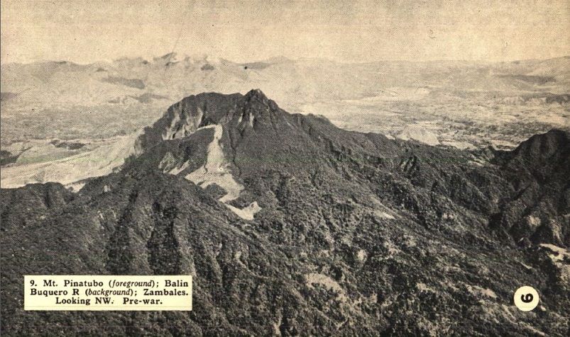 W133 (C1) Mt. Pinatubo (foreground); Balin Buquero Rv. (background); Zambales. Looking NW. Pre-war. Photo credit US Gov by courtesy of Bob Hudson. |
|
|
|
Post by victor on Sept 28, 2015 21:14:41 GMT 8
Karl, I just want to thank you again for all your hiking and exploration pictures (the same to everyone else who share these "windows" to times and places). I live vicariously through them.
|
|
|
|
Post by Karl Welteke on Mar 27, 2016 14:22:41 GMT 8
CRUCIFIXION RE-ENACTMENT DURING HOLY WEEK Finally Karl, the PI Sailor, went to it in San Pedro Cutud, San Fernando in Pampanga and had a look. I have heard of this event for decades on the news. I established this album with 42 mages, they have descriptions: s74.photobucket.com/user/PI-Sailor/library/Philippines/Other%20Phil-Areas%20No%201/Central%20Luzon/Crucifixion%202016?sort=9&page=1or tinyurl.com/j3tzuseWikipedia says this: The San Pedro Cutud Lenten Rites is a Holy Week re-enactment of Christ’s Passion and Death which takes place in Barangay San Pedro Cutud, City of San Fernando, Pampanga in the Philippines. This is the Wikipedia URL: en.wikipedia.org/wiki/San_Pedro_Cutud_Lenten_RitesThe city of San Fernando offers this webpage: cityofsanfernando.gov.ph/forvisitors/maleldoHere are a few sampling images but they are much smaller than in the above album: 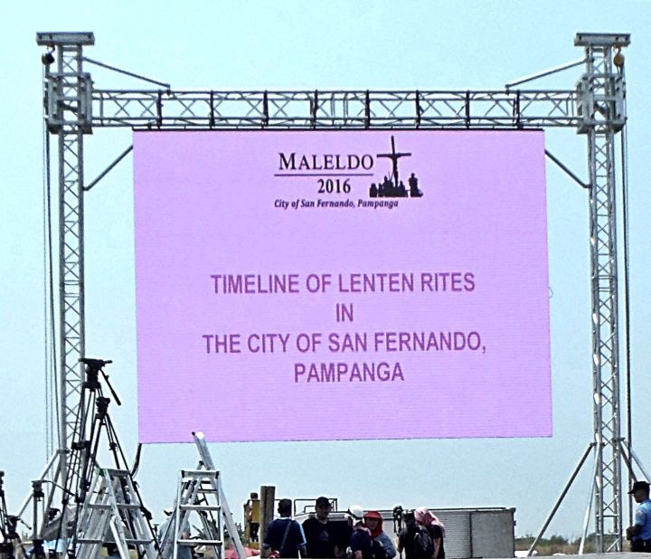 W730 -The 2016 Pampanga Malmeldo Lenten organizers had this large electronic monitor screen and offered a historic timeline of this famous Easter Holy Week event. 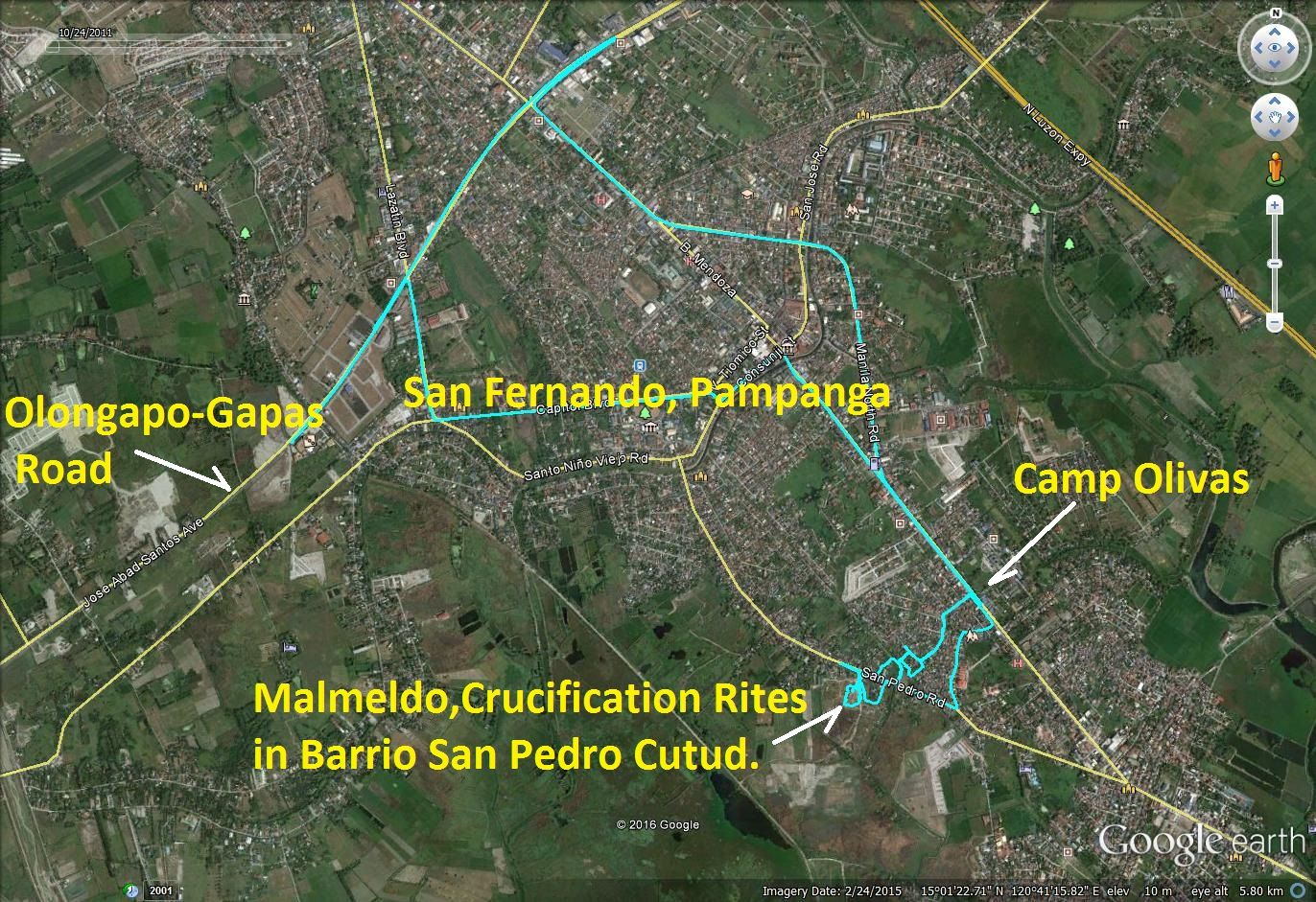 W731 -My GPS track to find the Pampanga Malmeldo Lenten and Crucifixion re-enactment site in San Fernando, Pampanga. 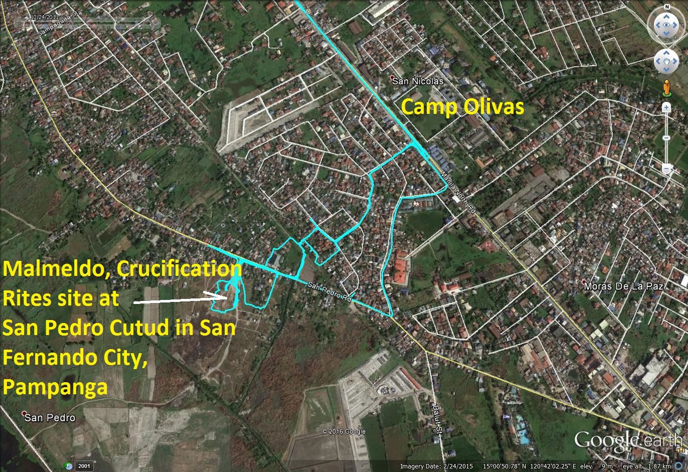 W732 -Our walking GPA track to the Pampanga Malmeldo Lenten and Crucifixion re-enactment site in Barrio San Pedro Cutud. We had to park at the highway, they would not let us drive in, and the village is way too small for that. The walk was not far! 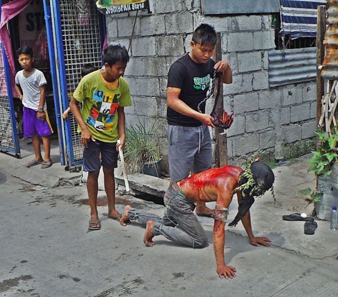 W733 -on our walk to find the Malmeldo Lenten and Crucifixion re-enactment site in Barrio San Pedro Cutud, San Fernando Pampanga we seen several flogging scenes like this one. 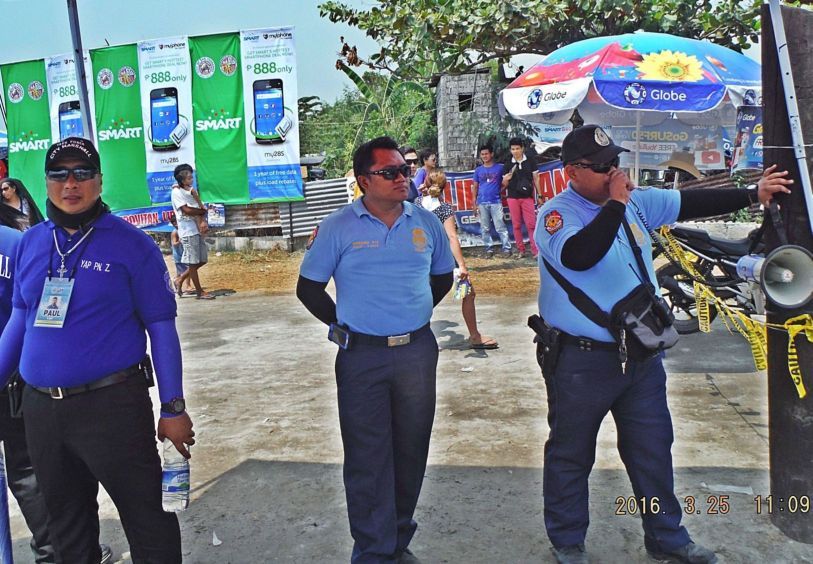 W734 -I thought this was nice, these police officers warned visitors with a megaphone to be aware of thieves. With the Region III Police HQ, Camp Olivas being near by there was no shortage of police protection. 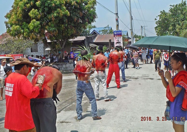 W735 -This is near the entrance of the Malmeldo Lenten and Crucifixion re-enactment site in Barrio San Pedro Cutud, San Fernando, Pampanga. Flogging is a common sight in the Philippines during the Lenten time. 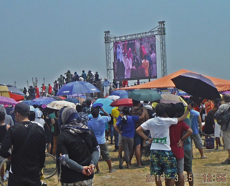 W736 -The large electronic monitor screen offered life video screening of the event. We are on the grounds of the Malmeldo Lenten and Crucifixion re-enactment rites in Barrio San Pedro Cutud, San Fernando, Pampanga. 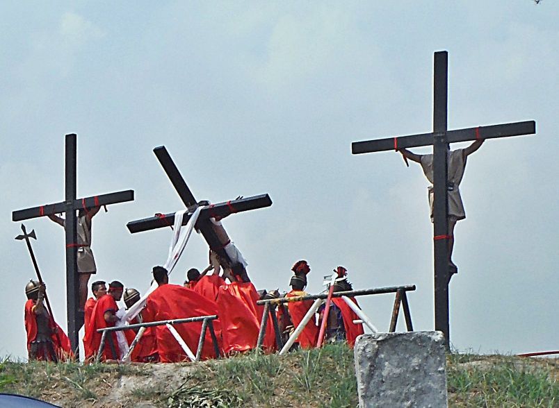 W737 -The Malmeldo Lenten and Crucifixion re-enactment rites in Barrio San Pedro Cutud, San Fernando, Pampanga have started; the last cross with Jesus is being raised. The crosses are hinged at the bottom. 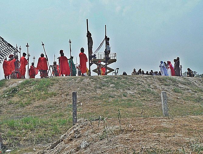 W738 -The Malmeldo Lenten and Crucifixion re-enactment rites in Barrio San Pedro Cutud, San Fernando, Pampanga have started; the crosses are raised and Maria, Magdalena and others are playing their part. The event used sound for effect, the women did their wailing. |
|
|
|
Post by Karl Welteke on May 11, 2016 15:58:40 GMT 8
BAUANG AND ITS CHURCH Bauang is well known to many of us GIs. It had become the beach recreation area for us U.S. Military personnel who were stationed or were visiting Wallace Air Base or Baguio. Because of it I have visited the VFW Post in Bauang several times and took these pictures. As you can see the church has attracted me in 2010. In view that the church was in the news with the US Military returning a war trophy, the church bell, it is the right reason to upload these pictures into an album. Here is a Stars and Stripes news article: www.stripes.com/news/pacific/west-point-returns-bell-taken-from-philippines-church-100-years-ago-1.407085 I uploaded 19 images of the church and Bauang into this Flickr album: www.flickr.com/photos/44567569@N00/albums/72157667965804752Here are 7 sample images but they are smaller than in the album except for the two maps, they can be zoomed in: 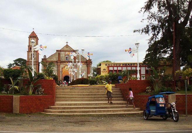 W770 (1i) the Saints Peter and Paul Church in Bauang, La-Union, just south of San Fernando City, La-Union. The church bell, taken as a war trophy during the Philippine-American War, will be returned to its home soon. This picture was shot on the 27th Nov. 2010. 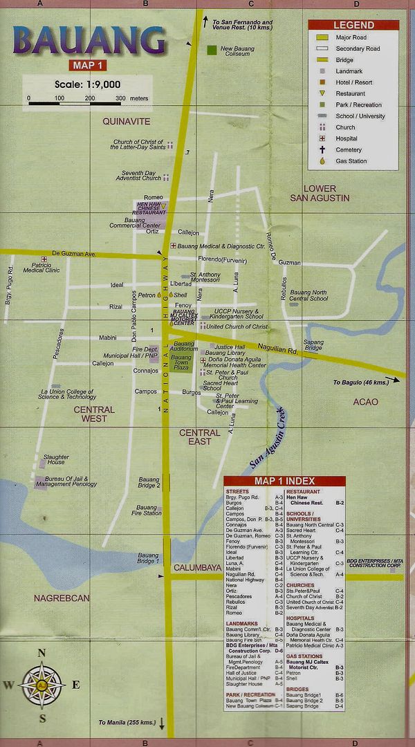 W771 (1b) this is a section of an EZ map about Bauang and it shows the Saints Peter and Paul Church and other points of interests. This map can be zoomed in. 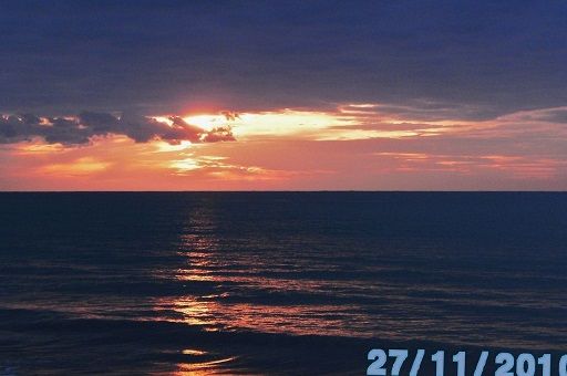 W772 (1a) one of the more enjoyable activities in Bauang is to sit at a Bauang beach resort and enjoy sunset with a cold beer in one’s hand. This picture was shot on the 27th Nov. 2010. 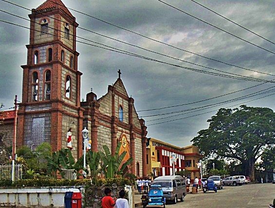 W773 (1u) this is a view of the front and the plaza of the Saints Peter and Paul Church in Bauang. This picture was shot on the 27th Nov. 2010. 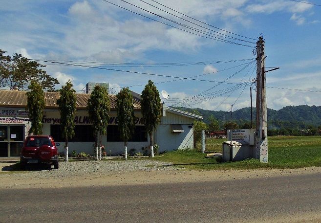 W774 (1d) VFW Post 9892 was a very popular hangout for us U.S. Military visiting Bauang, San Fernando in La-Union or the Wallace Air Base. This picture was shot on the 27th Nov. 2010. 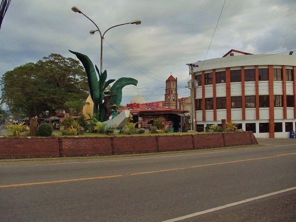 W775 (1g) this is the intersection of the National Road heading North to Ilocano Country and the Naguillian Road leading to Baguio. Most buses use this road to go to Baguio. The tower of the Saints Peter and Paul Church is in view 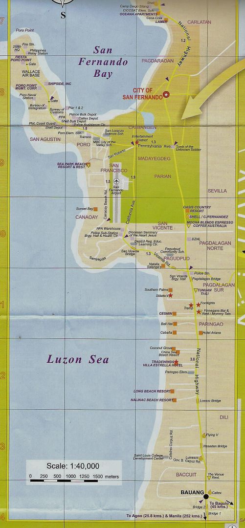 W776 (1v) this is part of an EZ Map of San Fernando, La-Union, Bauang Municipality and Poro Point. |
|
|
|
Post by Karl Welteke on Jul 11, 2016 20:03:25 GMT 8
VIGAN CITY, SPANISH HERITAGE VILLAGE Vigan-City played a role in the attempt to capture General and President Aguinaldo and also it was the base of departure to liberate the US Sailors who were captured on Baler and other US Soldiers who were all captured during the Philippine-American War. That alone motivated me to get interested in Vigan. Old Vigan City This album is about the Spanish Heritage Village in the Vigan City, Ilocos Sur. My family visited there on the 26th May 2016 and had a good look at the city. It is certainly an interesting city, certainly worth a visit or two. I basically walked up one street and returned on another going thru this old former Spanish Town. I uploaded 45 image including 3 maps of Vigan into the below album, the images average about 700KB. This is the URL: www.flickr.com/photos/44567569@N00/albums/72157670825168866Eight sample images are presented here but they are very, very much smaller that the images in the above album. The map is the original high resolution and you can zoom in: 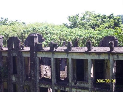 W919 this Vigan City map was hanging on a structure at one of the Vigan Plazas.  W919a I uploaded the original in high resolution and it will open big for you! 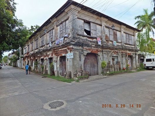 W920 this is an impressive Spanish Building and it is not where the tourists go but one really can see the excellent Spanish type construction at that early colonial time. 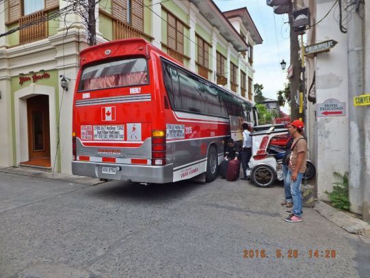 W921 hotels are plentiful spread out throughout the old city but manoeuvring with your car and finding one can be initially difficult. Once you know your way around it become easy. 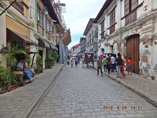 W922 this is already where the tourists walk around, we see tourists, shops and some construction is going on. 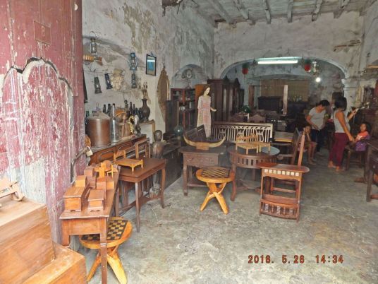 W923a I looked into one little tourist shop. 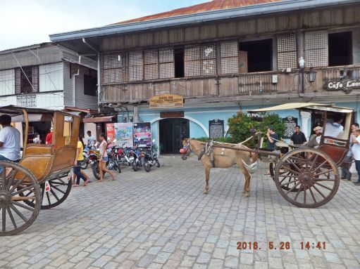 W924a this is the tourist office and those horse and buggy vehicles are available for about 200 peso, for 1 hour, and they take you all the main points of interest. 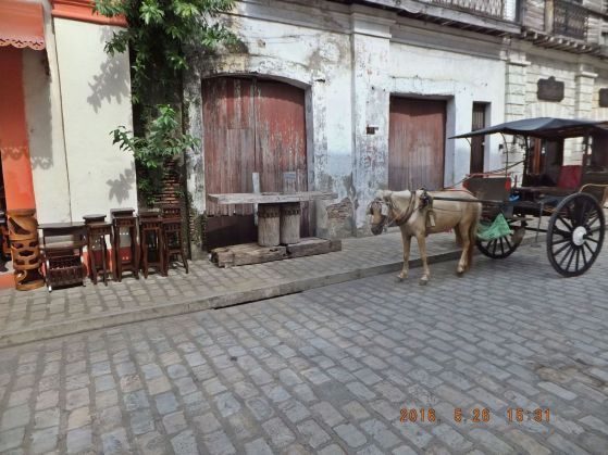 W925a I am on way back to the hotel using another street thru this old Vigan City Spanish Heritage Village and that old sugarcane press caught my eye. 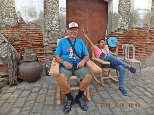 W926a some young men talked me into getting my picture taken in this old Vigan City Spanish Heritage Village . |
|
|
|
Post by Karl Welteke on Oct 27, 2016 9:58:21 GMT 8
Mt. Bulusan steam explosion Oct 23, 2016; it could be seen from our house 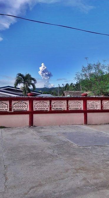 V320. On the 23rd Oct. 2016 Mt. Bulusan had several steam explosions. The explosion could be seen from in front of our house. It is 25 km from our house to Mt. Bulusan and a 250 meter high mountain ridgeline is blocking the view. This is the first time that I got aware that activities of Mt. Bulusan can be seen from Bon-Ot Big. In this picture that is the front wall of our compound and the cement area in front is ours also and it is used by all for drying rice. I read that Mt. Bulusan is the 4th most active volcano in the Philippines. Photo credit Mrs. Cyrel Generalo, a friend of my wife. 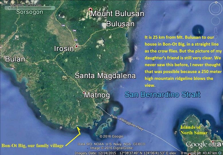 V321. This Google Earth image shows the geography of Mt. Bulusan as it relates to the location of our family house. It is 25 km from Mt. Bulusan to our house in Bon-Ot Big, in a straight line as the crow flies. But the picture of my wife’s friend is still very clear. We never saw this before; I never thought that was possible because a 250 meter high mountain ridgeline blocks the view. 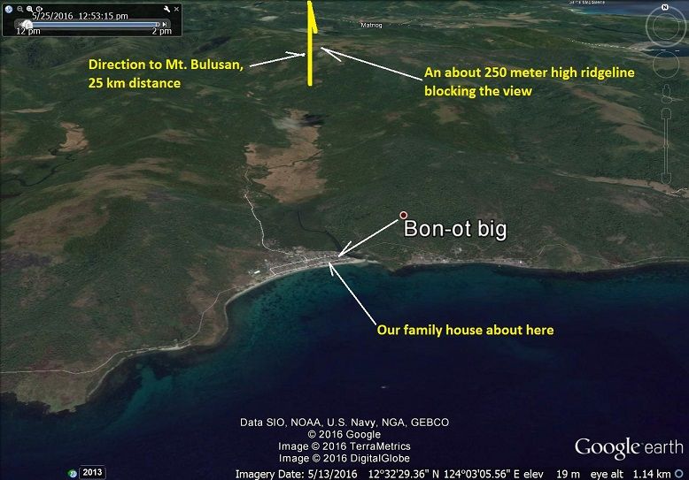 V322. A close-up Google Earth image of Bon-Ot Big, which shows the location of our house and the 250 meter high ridgeline blocking the view towards Mt. Bulusan. Imagine this view is from directly above the San Bernardino Strait, a lot of history passed by here: The Spanish Galleons went thru here on their way to Acapulco. One of the islands at the NW corner of Samar is called Capul because the galleon made one final stop on their way to Acapulco. In June 1944 a Japanese carrier group went thru here, got detected by the guerrilla coast watchers and sailed thru their doom in the Mariana Turkey Shoot. In Oct. 1944 a Japanese Battle group went thru here and almost upset General MacArthur’s landing in Leyte. They got stopped by heroic resistance by the Americans and beat their retreat back thru these straits. In 1978 my ship came thru here with a large tow going to Subic and I remember looking thru the big glasses at this very beach and was thinking to myself, I sure would like to visit that lovely beach. Well in 1996 it came true and I even have a home and family at that very beach now. |
|
|
|
Post by Karl Welteke on Jan 15, 2017 13:00:08 GMT 8
Battle of the Zig-Zag Pass and Mabel's Tit This entry is about my walking in the Luzon Mountains, and particular this entry is about Subic Bay. Joe Sherrill was a Sailor (3rd Class Petty Officer, Radio Man) on the famous LSM-51 that took the Army to Fort Drum, the Concrete Battleship, in Manila Bay in 1945. We communicate with each other. Here is an answer from him about Mabel’s Tit. For your information, Mabel’s Tit is what the GIs called a peak in Subic Bay which on the map is called Suso ng Dalaga (Maiden’s Tit). To: Karl-Welteke Welteke Subject: Re: One of my note-worthy hikes Hi Karl, Great pictures and I really enjoy them. I wonder if you are familiar with a peak that the GI's referred to as Mabel's Tit? From out in the bay it certainly had a resemblance of that. I was surprised at the number of soldiers who made mention of it when we had them in that area. We operated in the area on several occasions during 1945. Thanks again for sending the pictures. Joe I answered Joe with the below email and this picture: 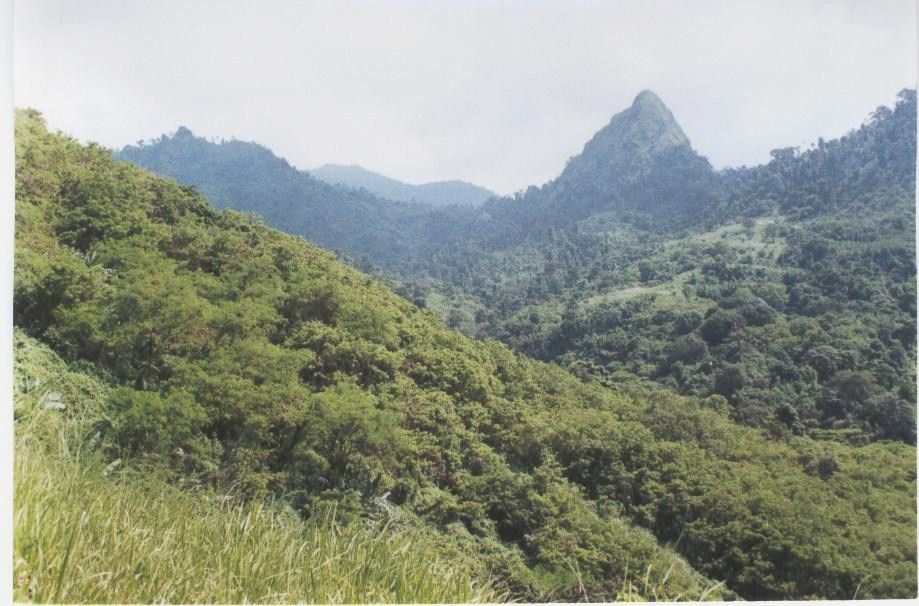 V537. Mabel’s Tit, Maiden Tit, Suso ng Dalaga. This picture of Suso ng Dalaga is from our walk 2002-08-24 and is provide by Jos, my Belgian Lady walking partner in Subic Bay. From: Karl-Welteke Welteke Sent: Tuesday, March 30, 2010 3:09 PM To: 'Joe Sherrill' Subject: RE: One of my note-worthy hikes Joe You only could be talking about the one on the attachment. That peak has the name Suso ng Dalaga on the map and knowledgably locals call it that also. Suso ng Dalaga means “Maiden’s Tit”. That picture is from hiking friend Jos. Yes, you can see it also from the bay in front of the Subic Base and Olongapo. That is a nice piece of news from the war, from Subic Bay in 1945; thanks Joe Karl 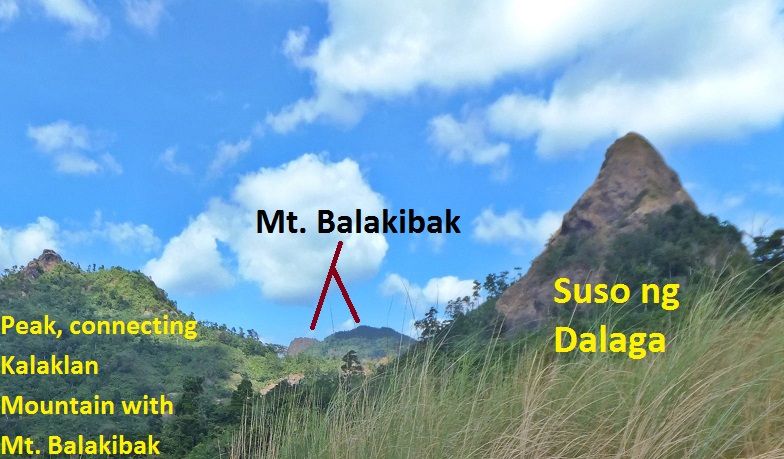 V538. Here is a closer picture of Suso ng Dalaga. It is from our walk 2017-01-06. During the Battle of the Zig-Zag Pass, 1945, one whole regiment, the 149th of the 38th Div marched thru these mountains. THAT IS AN AMAZING ACCOMPLISHMENT and hardly anyone mention it. I know the route and I have to express my greatest Bravo Zulu for these GIs who done it. I am sure they not only carried their full combat equipment and most likely had to carry more. See the map and order from the 38th Inf. Div. Report, the Avengers of Bataan. 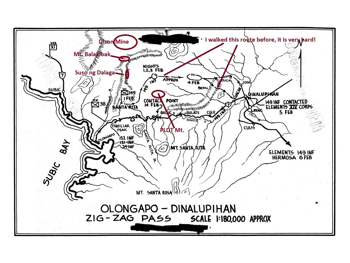 V539. The Plan of Attack, 38th Inf. Div. to advance two regiments parallel with each other to Dinalupihan. 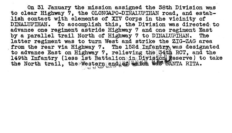 V.540.The paragraph ordering the two regiments to advance parallel with each other to Dinalupihan. If you are interested in our walk to the peak of Suso ng Dalaga we present 37 images in this album: s74.photobucket.com/user/PI-Sailor/library/Walk%20in%20the%20Philippines/No%201%20Walk%20PI%20Group/PLDT%20Mt%20-%20Sta%20Rita%20Mt/Susu%20Dalaga%202017-01-06?sort=9&page=1From the above album of our walk to Mt. Suso ng Dalaga I present 3 images here but they are much smaller: 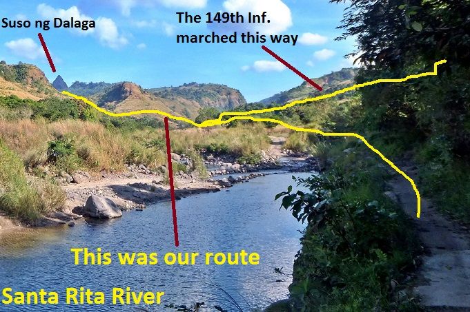 V541. We have started our walk, Suso ng Dalaga is in sight. 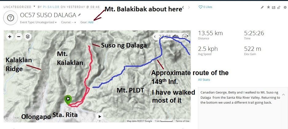 V542. The terrain and data of our walk to Suso ng Dalaga on the 6th of Jan 2017. 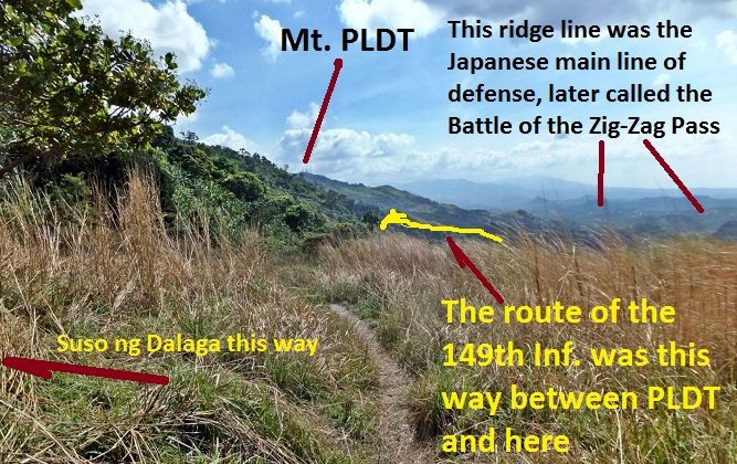 V543. A look back from our walk to the peak of Suso ng Dalaga, we are near it. From this vantage point we can see the route of the 149th Inf. around PLDT Mt. and we can see much of the Japanese Main Line of Defense. It stretches further to the east. 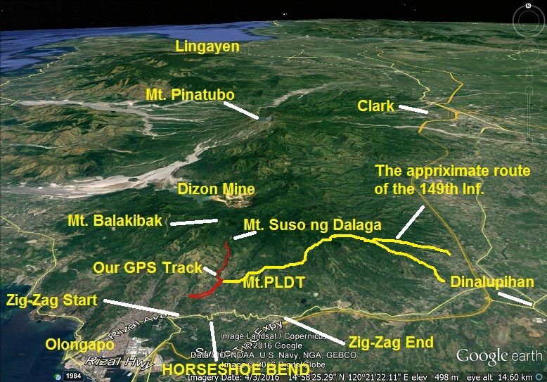 V544. Here is a bigger Google Earth picture for your orientation. 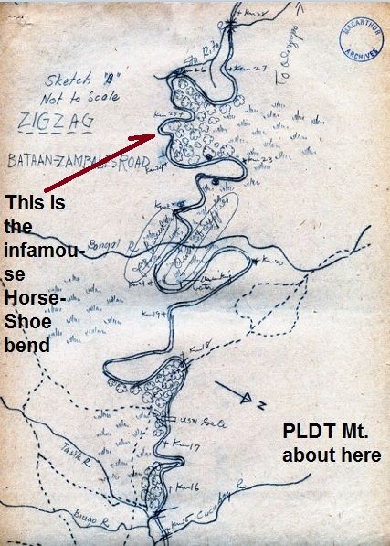 V545a. This is a story of many unsung heroes, this is a story of Corporal John Boone, a soldier of the famous 31st Inf. Regiment. He did not surrender and helped in establishing a guerrilla unit, right in our back yard, at Dinalupihan Town. Near Dinalupihan is a monolith peak, called Mt. Malasimbo, nearby there was his Head Quarter. He provided this map and much more to Gen. MacArthur’s Intelligence Service. This map, reduced in size here, was send to me by the Gen. MacArthur Memorial Archivist James Zobel. I bet you any kind of money that the 149th Inf. would not been able to walk thru these mountains without the troops of John Boone’s Guerrillas to guide them. This was John Boone’s backyard. Uploaded to forum, WWII-Then and Now, Zig Zag Pass: corregidor.proboards.com/thread/319/zig-zag-pass |
|
|
|
Post by Karl Welteke on Apr 20, 2017 11:53:25 GMT 8
South Bataan trip with my friend Klaus-2017-03-14 In March 2017 I showed my German school friend a little of the Philippines. In this album we were on our way to Corregidor but I showed him first some points of South Bataan. We looked at these spots: The Death March Memorial Shrine, Mariveles Smokey Mountain, Longos Kawayan Point, Bataan West Road above Agloloma River, Villa Carmen boats to Corregidor. I made an album of this trip with 33 images and this is the URL: s74.photobucket.com/user/PI-Sailor/library/Walk%20in%20the%20Philippines/No%201%20Walk%20PI%20Group/Bataan%20Other/South%20Bataan-Klaus-2017-03-14?sort=9&page=113 sample images are presented here but they are smaller than in the album: 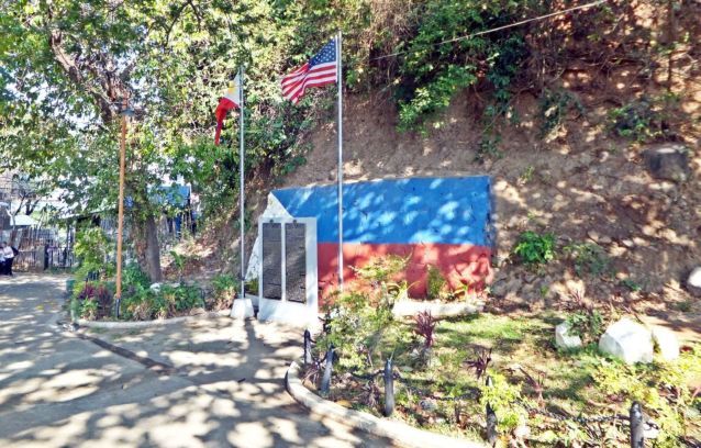 V774. (-1). This is a view of the Death March Memorial Shrine or also called the Death March Marker No. Zero. It is located at the entrance of Mariveles Town proper. 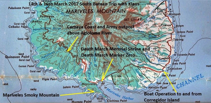 V775.(-3). A section of an old 1:250000 map of south Bataan, the places we looked at are marked up on the map. 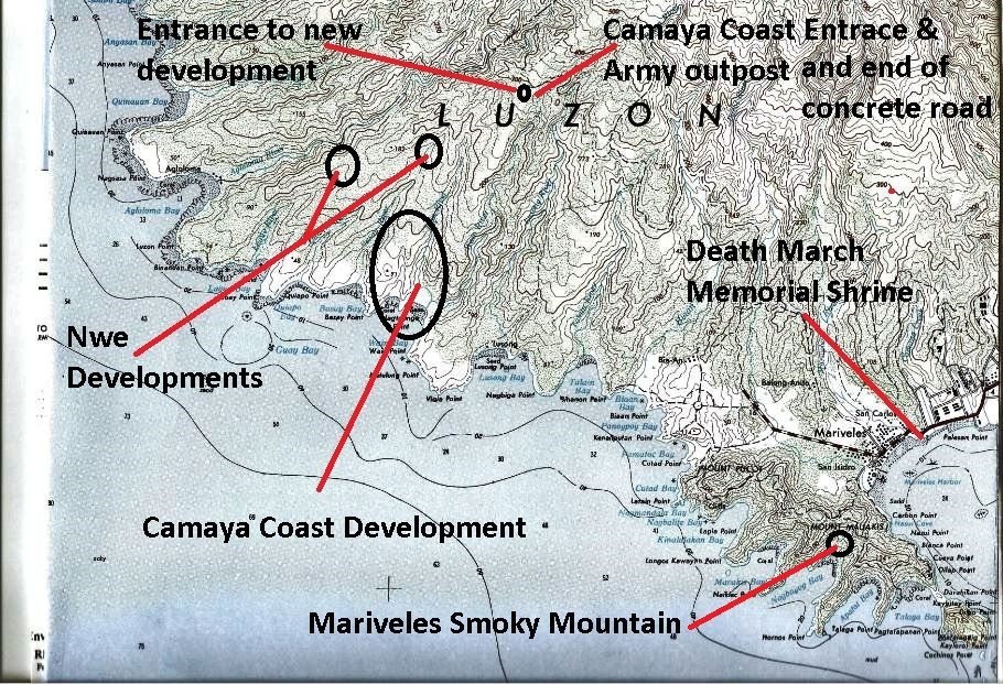 V776. (-4). A section of an old 1:50000 map of south Bataan, the one has more details. 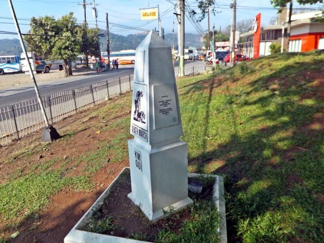 V777. (-5). This is a view of the Death March Memorial Shrine; this is the Death March Marker No. Zero. Jollibee is located right next to the shrine, good to know for parking, have a bite there. 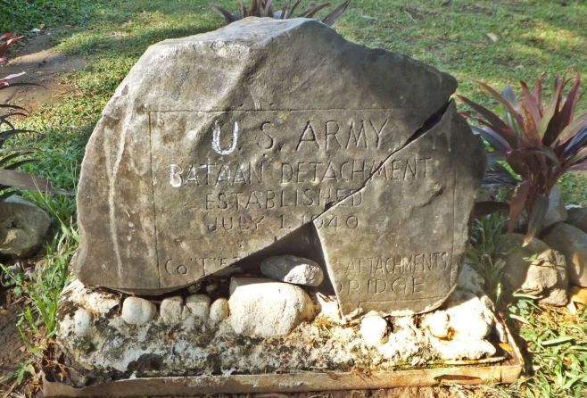 V778.(-9). This is a rock with an US Army description about a US Army unit. It is dated 1940, it does not say where it was found but it is appropriately placed here, Bravo-Zulu! 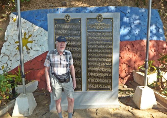 V779.(-8). This is a view of the Death March Memorial Shrine or also called the Death March Marker No. Zero. It is located at the entrance of Mariveles Town proper. My German school friend Klaus 1952-56, 5th to 8th grade. 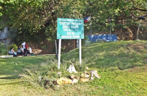 V780. (-12). This is a view of the Death March Memorial Shrine or also called the Death March Marker No. Zero. Students hang out here in the shade of the trees; I hope they think about the history of this place sometime at least. 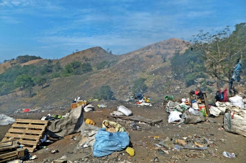 V781. (-15). One of 4 images about the Mariveles Smoky Mountain, it is located at the head of Naiklec Point and Nagbayog Bay, look at the map. We walked to a point where we could see Longos Kawayan Point, one of the Japanese landing points. 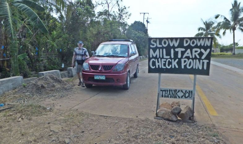 V782. (19). Next we drove along the Bataan West Road to a point where a trail goes down to the Agloloma Bay. Since the start of the Camaya Coast Development there has been an Army outpost here. The road is all concrete now to this point. 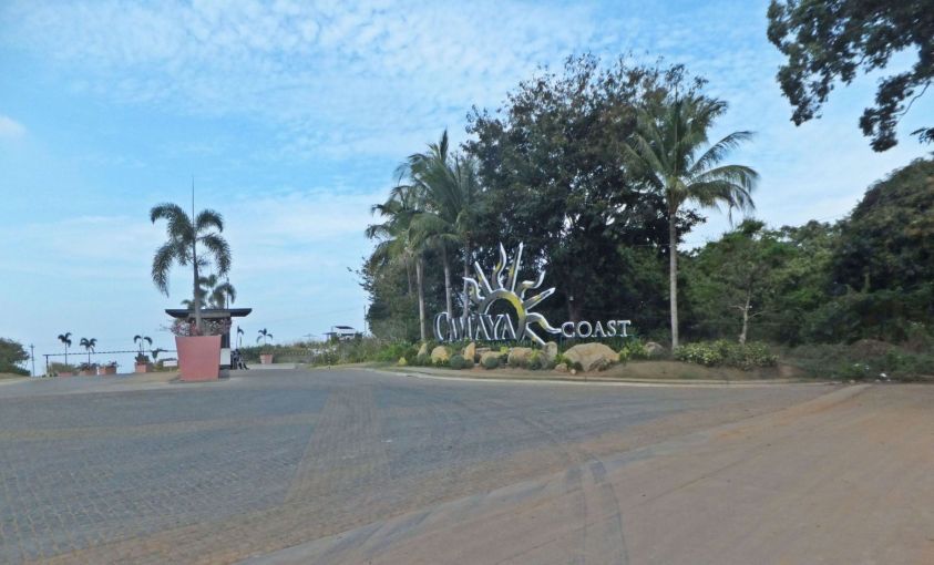 V783. (-21). Next we drove along the Bataan West Road to a point where a trail goes down to the Agloloma Bay. Since the start of the Camaya Coast Development this Army outpost existed here. The entrance to Camaya Coast is also located here. 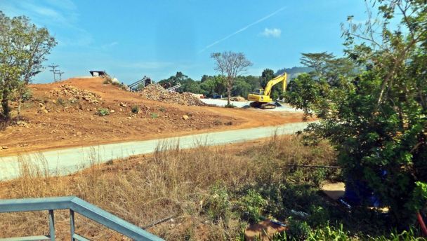 V784.(-24). Immediately to the right was the original trail down to Agloloma Bay but now it is becoming a new road down to a new development. I would have liked to go down about 100 meters more for a better shot but the guards forbade it. Agloloma Bay was one of the places where the Japanese landed in 1942. 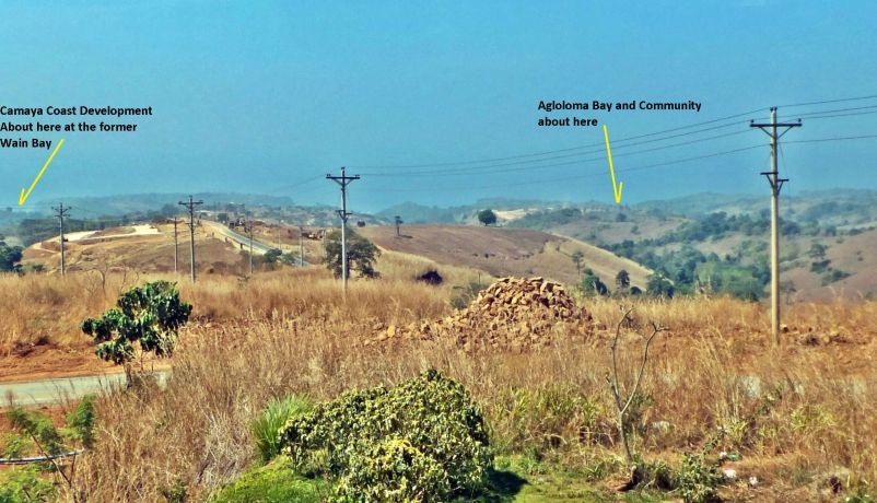 V785. (-25). We are looking at the direction of Agloloma Bay but that is a s close I can get now, in previous years I could roam around everywhere, walk from Bagac to Mariveles but no more because of developments. The ridge at right goes down to Agloloma Bay, there is a community but access for people like me is now blocked because a new development in progress on the ridge down to Agloloma Bay. 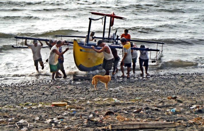 V786. -28. This is one of 4 images of the Villa Carmen boat handlers retrieving the boat that returned my friend and me from Corregidor to Cabcaben on Bataan. It was choppy and it took more men than usual |
|
|
|
Post by Karl Welteke on May 27, 2017 13:51:06 GMT 8
Karl and family in the province! If you like to know more about Karl’s life you may enjoy this album of 72 images. It is idyllic, but I did not show pictures of all my walks, my reading, watching satellite TV news and sit on a computer, uploading pictures and stories. That is how I spend most of my time. My wife Rowena is from a small village, Bon Ot Big, Matnog Town, in the Sorsogon Province. It is directly located on the Luzon side of the San Bernardino Straits. We go there every year in April or May because of the rice harvest and fiesta time. It is also the Philippine school break. I made this album to show you how we live. Our lifestyle in Olongapo City is not much different. This is the album: s74.photobucket.com/user/PI-Sailor/library/Family/Family%20in%20PI%20Sub%20Album%201/2017-2019%20Family%20Albums/2017%20May%20Province%20family%20visit?sort=9&page=1Here are two sample images: 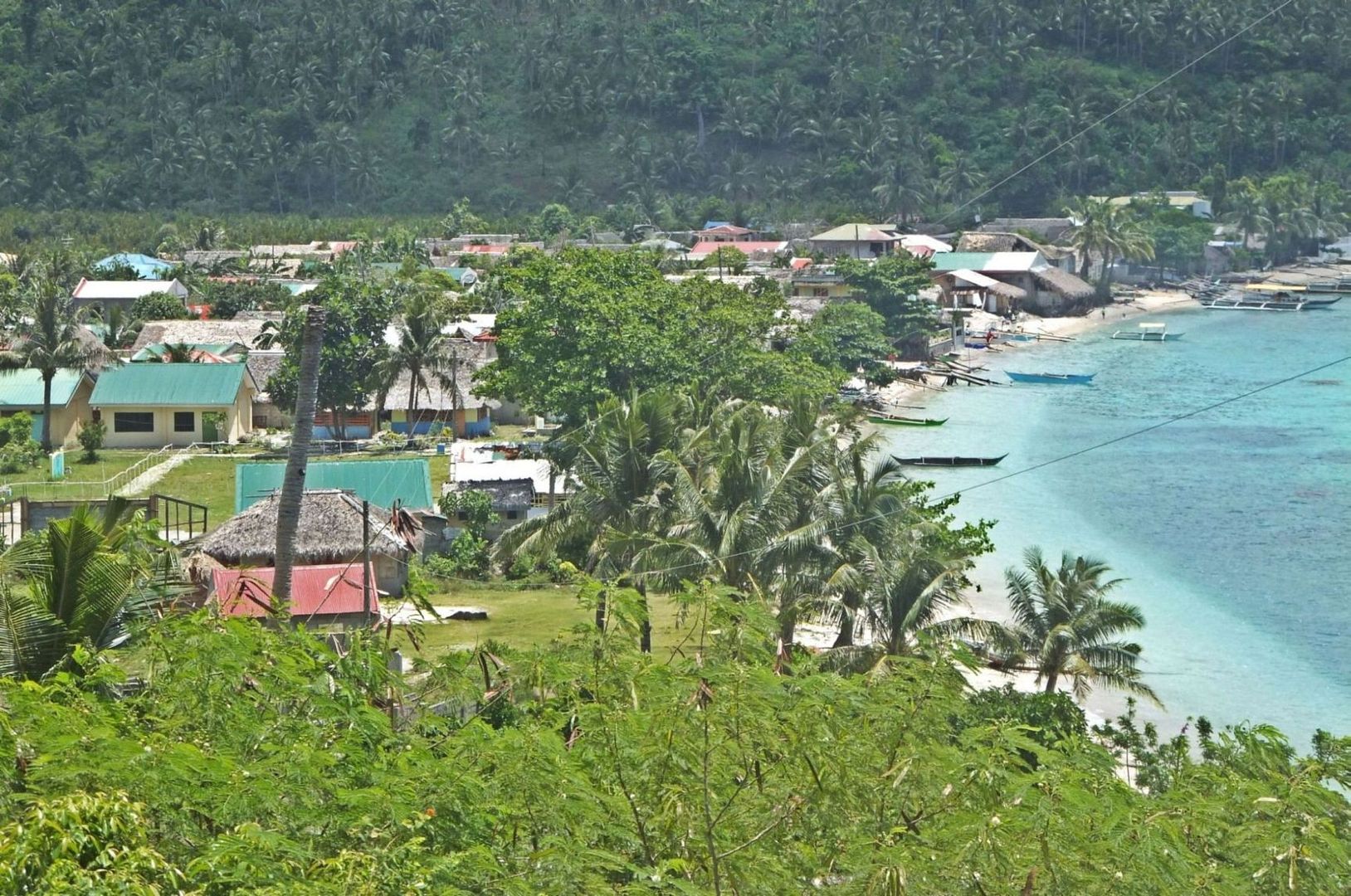 V965. This is Bon Ot Big, right is the San Bernardino Straits. This is the south end of Luzon Island. Our house is about in the 2nd row of houses in and more to the far end in this picture. 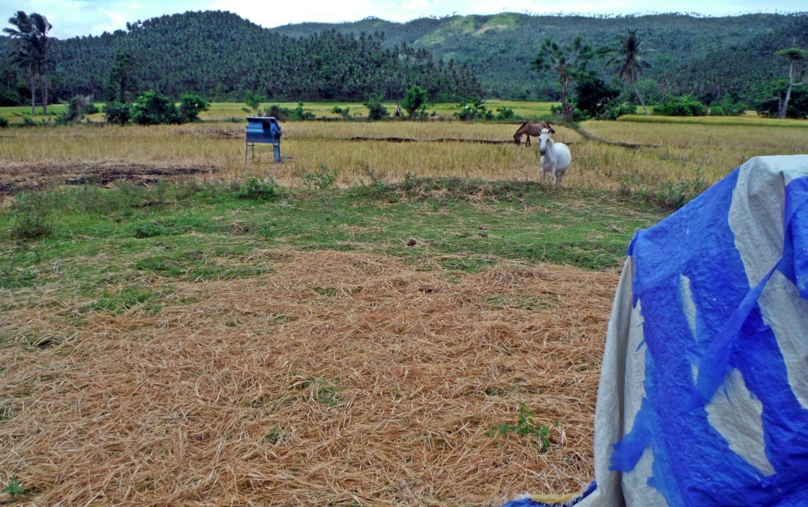 V966. This is the Bon Ot Big River Valley and rice land, it runs pretty much on a north-south axis and there is a mountain ridge line on either side of the valley. |
|


