Post by fots2 on Sept 21, 2009 16:04:30 GMT 8
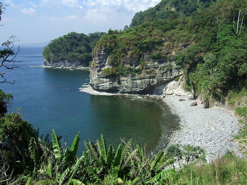
Its time for a boat ride and a walk on the beaches. I thought some of you may be interested in a break from only the remnants of war and give you some scenic views of the coastline of Corregidor Island. If you ignore the history for a moment you will see a beautiful island there today.

Corregidor Island looking north west.
I will break up the photos into east and west sections starting with the west. Bottomside will be the start and end points. We will depart from the North Dock and return via the South Dock.

View of Bottomside looking north west.

Departing the North Dock. (Ignore the floating garbage; it is a gift from Manila)
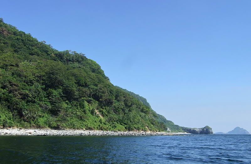
Heading west, the coast line is fairly straight with a couple turns to the left. These turns are actually Battery Point and Morrison Point but rather than distinctive points, they are more like just changes in course.
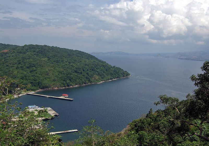
From the North Dock straight to Battery Point then turn left. Note the Sun Cruises day tour boat at the North Dock. Bataan province is in the distance.

Approaching Morrison Point.
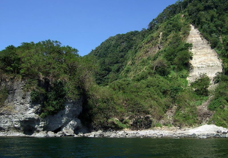
The first sort of landmark you see is James Ravine. This area is littered with caves and tunnels, a concrete water tank, concrete foundations, a road bridge and defensive positions etc. Fierce fighting took place here in 1945.

Early morning view of James Ravine. It looks like there is nothing to see here but the vegetation is deceiving.

Photo from James Ravine looking further along the coast. Small islands are quite scenic as you pass around the cliffs at the western tip of the island. Here you can see Rock Point with La Monja Island in the distance.

Approaching Rock Point with Conchita Island in the distance.

Approaching Rock Point with Conchita Island in the distance.
Next we come to Conchita Island. This island is actually just a large chunk of rock protruding from the ocean.

Sea level view of Conchita Island.
From sea level it looks like there is nothing of interest there but on it is one of Corregidor's defensive positions constructed between 1917 and 1919. This one was named X-M-3. (Sector 10, Machine guns, Emplacement #3). Sectors counted from east to west. Thanks to batteryboy and mapmaster for clarifying those designations. FYI, Rock Point had the X-M-2 position but I have never seen it.

Looking down to Conchita Island at the two machine gun positions.
Conchita Island is just offshore from the western cliffs of Corregidor Island. This area is called Cape Corregidor. Of interest here is the view of what we call the 'veranda'. This is actually part of a 3 inch gun block that due to erosion now sits partially hanging over the cliff. The old designation of the positions up there was X-F-1 and X-F-2 (Sector 10, Field guns, Emplacement #1 and #2). X-F-2 later became known as Battery Hanna.

View up the cliffs with the veranda at the top (x3 zoom)

View of the 3 inch gun block (the veranda).
Now look over the edge!!!

View straight down from the veranda.

Before reaching Cheney Ravine, here is a view looking back towards Conchita Island. Mount Mariveles (extinct volcano) on the province of Bataan is in the distance.
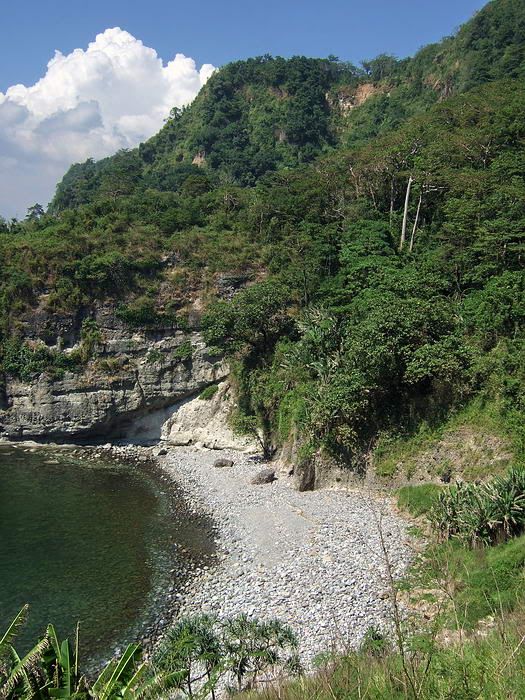
Now we arrive at Cheney Ravine. Of interest here is SMSH #8 (Strategic Material Store House #8), Searchlight #3 and remnants of defensive positions.

Looking into Cheney Ravine.

View from the SMSH #8 cliff-side tunnel entrance across the beach at Cheney Ravine towards Bataan.

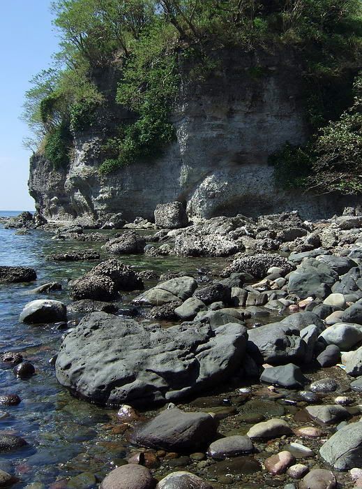
In the opposite direction, a view of the cliffs south of Cheney Ravine.
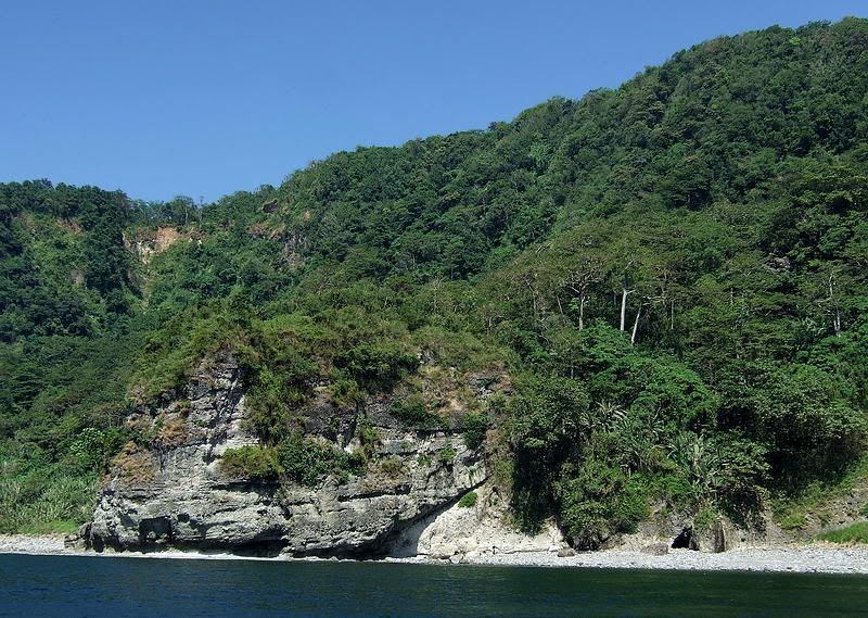
Continuing on, Wheeler Point is next. This section of Corregidor's coastline is continuous steep cliffs with narrow rocky beaches at the bottom.

View showing the steep cliffs in this area. Battery Cheney is to the left and Wheeler Point is bottom right.
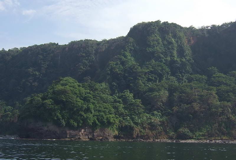
Early morning view of Wheeler Point. Battery Monja's casemate for the 155mm gun and associated tunnel/magazine are totally obscured by the vegetation. It is located roughly where the horizontal part meets the steeply sloped part.

Next you come to Unknown Point (bottom) and Searchlight Point (top). This view is taken from the top of the cliffs close to Battery Cheney. Cavite province is in the distance. Note the two Japanese caves dug into the side of Unknown Point. They do not go in very far.

These three points are very close together so I will show them all on one photo. To the left is Wheeler Point. To the right is Searchlight Point. The one in the middle is un-named on most maps. One map shows it labeled 'Unknown Point'. Battery Cheney can be seen at the top left.
Past these three points, the coastline takes an 'S' shaped turn to reach Geary Point.

Geary Point is at the far right.
Quite a ways past Geary Point is a little bump in the coastline called Breakwater Point. Lots of old defenses and structures are here and also at Government Ravine just beside it. A little further is Ramsay Ravine. Government and Ramsay Ravines are hardly visible from a boat and only a dip in the tree tops give you an indication of the hidden ravines.

View of the Government and Ramsay Ravine coastline looking back at them from Bottomside south. The South Dock is in the foreground.
The tour is over. Report to MacArthur's Cafe for cold San Miguels.

Corregidor Island looking north west.
I will break up the photos into east and west sections starting with the west. Bottomside will be the start and end points. We will depart from the North Dock and return via the South Dock.

View of Bottomside looking north west.

Departing the North Dock. (Ignore the floating garbage; it is a gift from Manila)
Heading west, the coast line is fairly straight with a couple turns to the left. These turns are actually Battery Point and Morrison Point but rather than distinctive points, they are more like just changes in course.

From the North Dock straight to Battery Point then turn left. Note the Sun Cruises day tour boat at the North Dock. Bataan province is in the distance.

Approaching Morrison Point.
The first sort of landmark you see is James Ravine. This area is littered with caves and tunnels, a concrete water tank, concrete foundations, a road bridge and defensive positions etc. Fierce fighting took place here in 1945.

Early morning view of James Ravine. It looks like there is nothing to see here but the vegetation is deceiving.

Photo from James Ravine looking further along the coast. Small islands are quite scenic as you pass around the cliffs at the western tip of the island. Here you can see Rock Point with La Monja Island in the distance.

Approaching Rock Point with Conchita Island in the distance.

Approaching Rock Point with Conchita Island in the distance.
Next we come to Conchita Island. This island is actually just a large chunk of rock protruding from the ocean.

Sea level view of Conchita Island.
From sea level it looks like there is nothing of interest there but on it is one of Corregidor's defensive positions constructed between 1917 and 1919. This one was named X-M-3. (Sector 10, Machine guns, Emplacement #3). Sectors counted from east to west. Thanks to batteryboy and mapmaster for clarifying those designations. FYI, Rock Point had the X-M-2 position but I have never seen it.

Looking down to Conchita Island at the two machine gun positions.
Conchita Island is just offshore from the western cliffs of Corregidor Island. This area is called Cape Corregidor. Of interest here is the view of what we call the 'veranda'. This is actually part of a 3 inch gun block that due to erosion now sits partially hanging over the cliff. The old designation of the positions up there was X-F-1 and X-F-2 (Sector 10, Field guns, Emplacement #1 and #2). X-F-2 later became known as Battery Hanna.

View up the cliffs with the veranda at the top (x3 zoom)

View of the 3 inch gun block (the veranda).
Now look over the edge!!!


View straight down from the veranda.

Before reaching Cheney Ravine, here is a view looking back towards Conchita Island. Mount Mariveles (extinct volcano) on the province of Bataan is in the distance.
Now we arrive at Cheney Ravine. Of interest here is SMSH #8 (Strategic Material Store House #8), Searchlight #3 and remnants of defensive positions.

Looking into Cheney Ravine.

View from the SMSH #8 cliff-side tunnel entrance across the beach at Cheney Ravine towards Bataan.

In the opposite direction, a view of the cliffs south of Cheney Ravine.
Continuing on, Wheeler Point is next. This section of Corregidor's coastline is continuous steep cliffs with narrow rocky beaches at the bottom.

View showing the steep cliffs in this area. Battery Cheney is to the left and Wheeler Point is bottom right.

Early morning view of Wheeler Point. Battery Monja's casemate for the 155mm gun and associated tunnel/magazine are totally obscured by the vegetation. It is located roughly where the horizontal part meets the steeply sloped part.

Next you come to Unknown Point (bottom) and Searchlight Point (top). This view is taken from the top of the cliffs close to Battery Cheney. Cavite province is in the distance. Note the two Japanese caves dug into the side of Unknown Point. They do not go in very far.

These three points are very close together so I will show them all on one photo. To the left is Wheeler Point. To the right is Searchlight Point. The one in the middle is un-named on most maps. One map shows it labeled 'Unknown Point'. Battery Cheney can be seen at the top left.
Past these three points, the coastline takes an 'S' shaped turn to reach Geary Point.

Geary Point is at the far right.
Quite a ways past Geary Point is a little bump in the coastline called Breakwater Point. Lots of old defenses and structures are here and also at Government Ravine just beside it. A little further is Ramsay Ravine. Government and Ramsay Ravines are hardly visible from a boat and only a dip in the tree tops give you an indication of the hidden ravines.

View of the Government and Ramsay Ravine coastline looking back at them from Bottomside south. The South Dock is in the foreground.
The tour is over. Report to MacArthur's Cafe for cold San Miguels.


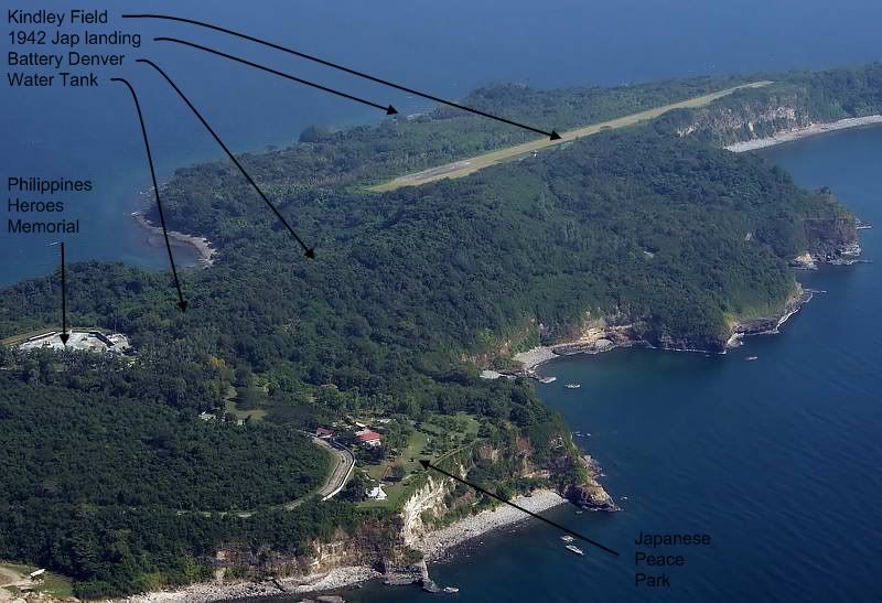
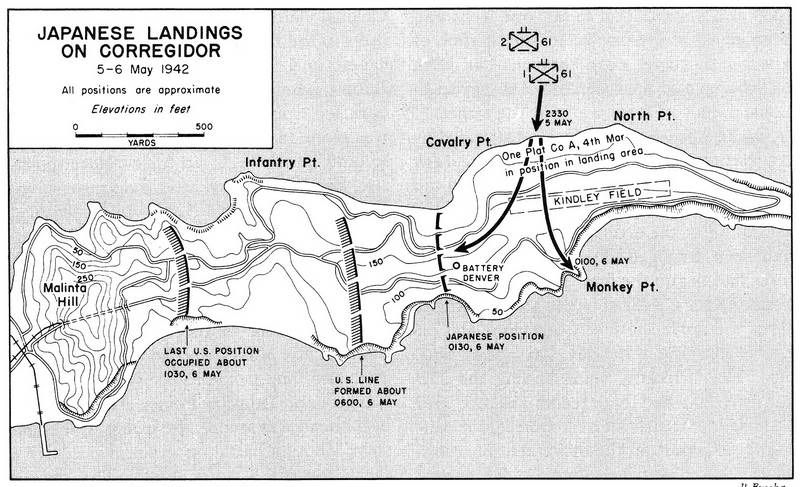
 ). i read somewhere that during the 1942 fighting two "old salt marine NCOs held forth atop the water tank, throwing hand grenades at the japanese as they fought their way toward malinta. of course, both were KIA and the bodies found a couple of days after the surrender. also, when the enemy pierced the shore defense line and came out on kindley they turned their attention toward the american/filipino defenders to the west and left their rearends totally exposed to the corregidor troops defending the eastern portion of the island. it was said that these troops, if better led and equipped, could have played havoc with a counter attack on the rear flank of the westward attacking nips. kinda similar to the situation on wake island. the marines on the wilkes portion of the wake island group had totally whipped the invaders and were moving eastward toward wake island proper when here comes colonel devereaux with a white flag. the wilkes group couldnt believe their eyes and ears when told to drop their weapons. it would seem that both surrenders were somewhat premature although the final result would have been the same. genl wainwright and colonel devereaux both probably did the correct thing as far as saving american (and filipinos on the rock) lives. aint hindsight great?