|
|
Post by okla on Nov 26, 2009 23:32:48 GMT 8
Hey Fots....Thanks a bunch for another Fantastic Fots Foto Tour. Just in time for Thanksgiving back here in Oklahoma. I will digest these latest pics whilst I digest my Turkey. Postscript....Do they do Thanksgiving or something like it over in the PI?  ?? Just wondering if the custom might have hung on with some folks even though the Americans are long gone, at least officially. |
|
|
|
Post by fots2 on Nov 27, 2009 0:37:02 GMT 8
Hi okla, Some hotels have Thanksgiving dinners for their foreign guests. A few places in Angeles and Subic usually have something also. Maybe other places but I have not heard about it. None of my neighbors have ever heard of this holiday. Where I come from Thanksgiving is a month earlier and I sure miss the food. Since I don’t have cable TV to remind me and the Christmas season starts in September, I actually forgot all about it. P.S. I made the mistake of buying a Christmas songs CD in September when they were first on display at the mall. I didn't think the family would start playing it then...  |
|
|
|
Post by fots2 on Mar 12, 2010 15:42:34 GMT 8
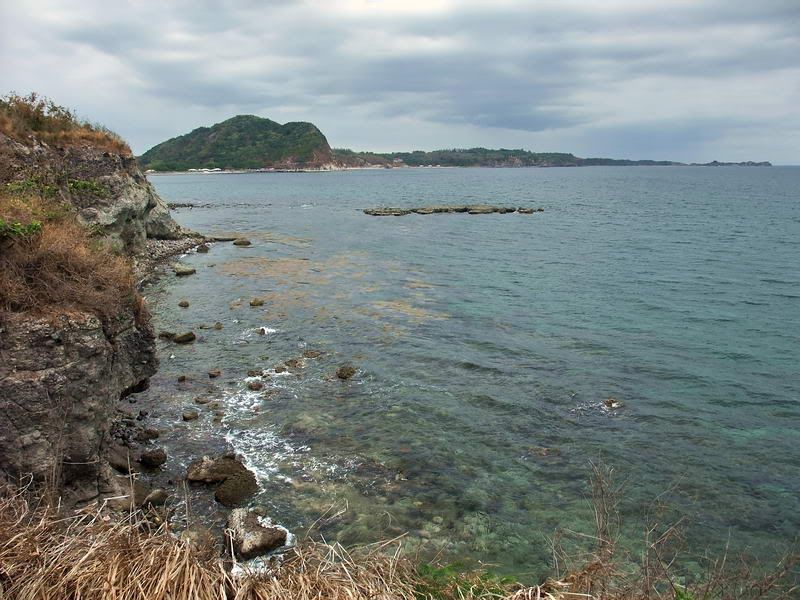
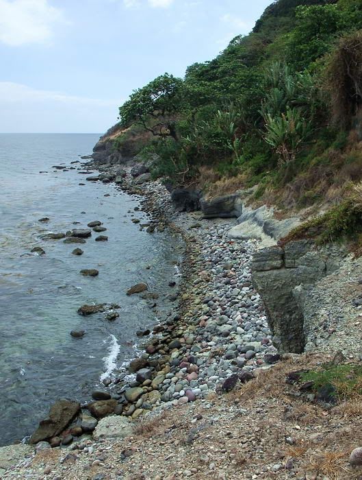
Here are a few recent photos taken along the coast of the western half of Corregidor Island. I made a trip to Searchlight #1 above Battery Point. The afternoon skies became cloudy and dark with some rain.  Down on the beach, here is the view from the point looking east back towards Bottomside. Malinta Hill is the higher land seen up ahead.  The view of the coastline at James Ravine looking west. Rock Point is in the distance.  Looking down at Conchita Island just offshore of Battery Hanna. The two machine gun positions of X-M-3 are visible. Another day I decided to go to Searchlight #3 and explore around the area where Cheney Ravine meets the southern coast.  On the Cheney Ravine beach, here is the view along the cliff looking east. The hills of Cavite are in the distance.  Just east of Cheney Ravine this is the view looking back towards Bataan. The chunk of rock off shore is Conchita Island which you saw in photo #3.  The same view after walking a few more minutes.  I walked east along the coast until I could see Wheeler Point in the distance. It is along hike back to the Corregidor Inn so I started back from here.  the cliff between Batteries Cheney and Wheeler, I stopped for a photo of two caves at Unknown (or No Name) Point that housed Shinyo suicide boats. |
|
|
|
Post by fots2 on Apr 18, 2010 15:27:04 GMT 8
The coastline between James Ravine and Cape Corregidor From James Ravine, here is the view as you look towards Rock Point.  Getting closer, Rock Point is just ahead.  At Rock Point you can look directly across this part of Manila Bay to Mount Mariveles, Bataan.  Evidence of the recent large rockslide  Looking back towards James Ravine in the distance.  The new cliff face at Rock Point.  Looking past Rock Point toward Bataan.  Further along the coast you can see Conchita Island not far away.  Cape Corregidor in the distance.  A small cliff-side tunnel. The bamboo poles probably helped someone up to have a look inside but they are rotten and broke when I tested them. I can see that the tunnel was dug farther into the rock than just near the entrance.  This is a view of where Grubbs Ravine hits the coast. Up here was my return path as walking the coast all the way back to James Ravine and then up that that hill did not seem like the easiest way home. Even this remote area has concrete infrastructure okla. A pump station(?) and a 66 step staircase is just above this little beach cliff.  Approaching Cape Corregidor.  Looking back towards Rock Point.  The cliff at the western edge of Corregidor Island. Two field gun positions including Battery Hanna are located at the top.  A closer view of the “veranda” of Battery Hanna. The veranda is the gun #1 position which now sticks out over the eroded cliff-face. This can be seen in the previous photo towards the right.  An afternoon back lit view of Conchita Island.
|
|
|
|
Post by okla on Apr 19, 2010 21:56:56 GMT 8
Hey Fots...How better way could I start my week than with another Fots Fantastic Foto Tour?  I wasn't sure whether I was detecting the initial pangs of "withdrawal" or not, but am sure that the onset was near. Yes, it would seem that the pourers of concrete, the carpenters building and placing forms, and the chugging of the mixers on Corregidor never slept. What a monumental, ongoing task that was. The fact that much, if not most, of it is still there for interested folks to still view says much. Mount Mariveles certainly isnt't as impressive and beautiful in broad daylight as it is/was in your outstanding pic taken at sundown, is it?  That view, in my humble, will never be duplicated or is it available each and every evening?  I gotta think that split second in time will never happen again. Maybe I am mistaken, but by golly I have a copy of it to enjoy each and every day, just in case. |
|
|
|
Post by fots2 on Apr 21, 2010 14:42:19 GMT 8
Hi okla,
From water level, Mount Mariveles is certainly not as impressive as from other angles, especially around sunset.
Me and my little pocket camera will stand ready to get you more views if I am lucky enough to be in the correct position at the time.
|
|
|
|
Post by fots2 on Jun 11, 2010 21:14:45 GMT 8
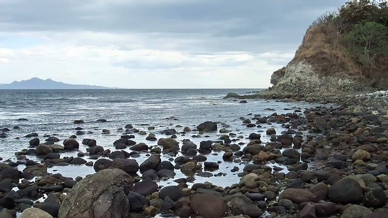
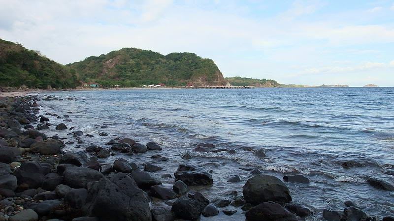
Here are a few more views of the south side of Corregidor not seen in the original report.  The view from Breakwater Point looking NE towards Bottomside and the eastern part of the island. Malinta Hill is straight ahead.  The view in the opposite direction from Breakwater Point looking SW along the coast.  Down at water level looking towards Breakwater Point. Cavite and the South China Sea are in the distance.  Standing half way between Government Ravine and Ramsay Ravine, here is the view looking towards Bottomside. The whole eastern tail of Corregidor is also visible. |
|
|
|
Post by okla on Jun 12, 2010 0:17:55 GMT 8
Hey Fots....Thanks much for the latest pics. I will never tire of viewing the results of your little pocket camera and the fruits of its' labors. Cheers.
|
|
|
|
Post by fots2 on Jun 12, 2010 16:05:00 GMT 8
You are welcome okla. Another trip report will be coming your way in a couple days.
|
|
|
|
Post by chadhill on Aug 6, 2010 8:09:14 GMT 8
Hello fots2,
The water tank in your photos is the one USMC Sgts. Sweeney and Haskin tossed grenades from the night of 5-6 May '42. I climbed it in 1986. There were several small roundish metal wire objects trapped in rubbish on what remained of the roof, over next to the wall. I have always wondered if they were safety pull-rings from those grenades. I read that Sweeney's remains were not recovered from the top of the tank until 1946.
There was another water tank near by that was taller than this one. I tried to climb it also in '86, but found it too unsafe. At that time some thought that the taller tank was the one Sweeney and Haskin fought and died on. However, in 1997 the Marine Corps Historical Center published a booklet by J. Michael Miller titled "From Shanghai to Corregidor: Marines in the Defense of the Philippines". It had an excellent account of the battle for Water Tank Hill. Both tanks were shown in a photo courtesy of the Japanese 61st Infantry Association. The shorter tank was identified as the one the Sgts. fought on.
I hope this isn't old business for you folks here. I made six trips to Corregidor between 1985-88, while stationed at NAS Cubi Point outside of Olongapo in Subic Bay. I am new to this forum.
Chad Hill
|
|