|
|
Post by chadhill on Aug 9, 2010 10:56:01 GMT 8
1986, between North and East Points. I thought I had found Lt. Lawrence's 75mm positions. This was in pre-GPS days, so not sure. Anybody have a guess at what the ordnance is? P.S.--I would never pick up old and possibly unstable ordnance these days! Attachments:
|
|
|
|
Post by fots2 on Aug 9, 2010 16:15:23 GMT 8
Hi chadhill, That made my day. Thanks for posting those photos. I have never seen any photos of the tall water tank before.  Here is a partial view of the Filipino Heroes Memorial looking east. The short water tank is hidden by the trees about half way between the left side of the photo and the flagstaff. The tall tank is gone now. That view of the 92nd Garage area pre casino/resort era is great. It still amazes me that the Japs crowded thousands of POWs here. As we can see, part of the area was taken up by the buildings so this would make even less space available for them. Here are “Then and Now” photos of the 92nd Garage area.  Your original photo taken in 1986.  A similar perspective taken in 2010. Even the beach has changed.  Wider angle view of the 92nd Garage area. In your photo, what is the fenced area to the bottom left? Looks like livestock fencing plus the grass is shorter inside. Did you see any animals there? At the far end past the second destroyed building is a two entrance tunnel. It is just out of sight at the tree line.  Looking out one of the tunnel entrances. The fortifications in the Denver/Water Tank Hill area are still there. The barrels have certainly deteriorated since your visit. The road east of North Point is still recognizable as a road but is more grown up now. Sorry, I can’t help you with the type of shell you were holding. Others here can for sure. Thanks again. |
|
|
|
Post by okla on Aug 9, 2010 22:21:59 GMT 8
Hey Fots and Chad...Thanks to you two guys and the 100 plus degree Oklahoma heat I won't get a damned thing done today in the field of "honey doos". I am indebted to you both. Chad...I was particularly drawn to your pic standing at Lt Ray Lawrence's defensive position. Fots and I both have agreed that this portion of Corregidor's tail is often under appreciated and overlooked by most folks interested in "the Rock" and its history. The area ain't very pretty, but it sure as heck was the center of the Pacific universe for several crucial hours way back in May 1942. I am convinced, if I had ever been fortunate enough to have visited this hallowed place, that I could have heard Lawrence's 75s playing hell with those Japanese landing barges. I have often stated on this forum that my imagination is rather hyper when it comes to old battlefields,etc. Cheers and thanks to you both for the good stuff you have posted. There is never too much of it in my humble. My Corregidor "habit" has been fed for another few days.
|
|
|
|
Post by okla on Aug 10, 2010 3:34:14 GMT 8
Hey Fots....I have been viewing the 92nd Garage Area pics (as I said in previous message, I ain't getting any chores done today since Chad and you have put up this new stuff)again and I can't help but think what poor taste the Casino,etc being built was on ground that witnessed the scene of such suffering back after the surrender. That great number of POWs being crammed into such a small, restricted area with little or no thought about water, food, medical,etc problems that would surface almost immediately. Then in more recent times to construct a gambling facility and cabanas,etc on the site is callous as hell in my humble. I am somewhat surprised that these same people didn't divide the Malinta Hospital Laterals into Cribs and install a "house of ill repute" where wounded and sick troops were once suffering. Some things I will never comprehend.
One last thing. If I didn't know better I would think you might be an ex-aerial photo interpreter. I say this because you spotted that fence that might have been a stock pen,etc in the earlier photo of the 92nd Garage Area. You even picked up on the height of the grass inside the pen. Heck, maybe you were a PI in the RCAF. 'Fess up, if you were. Cheers.
|
|
|
|
Post by chadhill on Aug 10, 2010 6:36:06 GMT 8
Hello, fots2-Wow, what photos you take! I hope you are considering writing a book that will include all the great pics you have posted throughout this forum. I especially like the "Here and Now" comparisons that you do.
The Filipino Heoes Memorial is very fitting and well done, but I can't help but wish they could have found another location on the island that would have been less costly to history. The same goes for what happened to the 92nd Garage area.
As far as that fence in my 92nd Garage photo goes, I don't remember any livestock kept there at that time. I do remember noticing an occassional stray goat on Topside and Middleside.
Okla, I guess I'm like you in that I always felt most of the history was east of Malinta Hill, although much of it was not easy to see or even find.
|
|
|
|
Post by chadhill on Aug 10, 2010 7:16:24 GMT 8
I'm still trying to learn how to enlarge photos without exceeding the maximum allowable size. They seem to turn out small, with a "click to enlarge" prompt. Please bear with me... I found this helmet in '86 or '87 near the Navy Radio Intercept Tunnel. Attachments:
|
|
|
|
Post by chadhill on Aug 10, 2010 7:19:00 GMT 8
On the back of this photo it says "southwest of the west end of Kindley Field". 1986 or 87. Attachments:
|
|
|
|
Post by chadhill on Aug 10, 2010 8:03:19 GMT 8
A close up view of the round I was holding while standing at what I believed was one of Lt. Lawrence's 75mm positions, between North Point and East Point, 1986. Lawrence commanded two British 1917 75mm guns. I am certainly no ordnance expert, but have been browsing thru Ian Hogg's book "The American Arsenal" this afternoon. There is a skematic for the US 75mm M48 round for usage in Model M1917 guns. The projectile portion of that round, without its cartridge case, seems to be about the size of this round when compared to the size of my forearm. I have read that British 75mm guns on Bataan were rebored to use US rounds, but I have no idea if Lawrence's guns were. And I can't suggest how a projectile can become detached from its cartridge case without being fired, although I have seen small rounds on Guam that it looked like that happened to. Anybody have any ideas? Attachments:
|
|
|
|
Post by fots2 on Aug 10, 2010 19:50:08 GMT 8
I agree with your comments regarding the 92nd Garage area okla. I don’t know how many years the Casino has been closed but the good news is that the Casino building itself will never open again.
As a school kid I lived and breathed airplanes. I had two uncles in Europe with the RCAF during WWII. Anything I know about being an “aerial photo interpreter” came from listening to you.
Great photos there again Chad. Thanks. Seems like you had some very interesting trips to Corregidor.
|
|
|
|
Post by fots2 on Apr 10, 2012 0:18:37 GMT 8
Here are a few western coastline photos taken recently. A few have not been posted in this thread before while others are updates. Some of them will give you a good idea why Corregidor is called "The Rock". 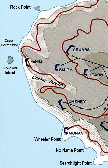 Map of the south western to western coastline of Corregidor Island. 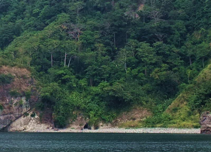 Here is a view of the beach between No Name Point (to the left) and Searchlight Point (to the right). 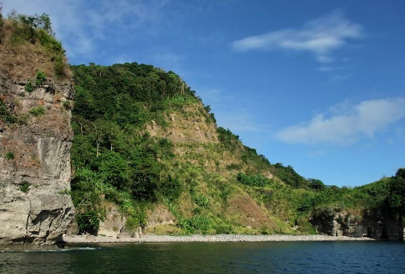 Another view of the same beach. 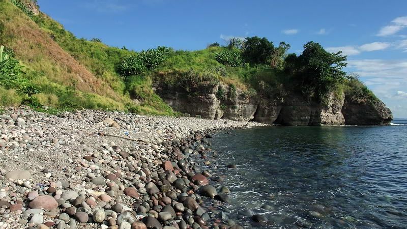 On this beach we are looking east to Searchlight Point. 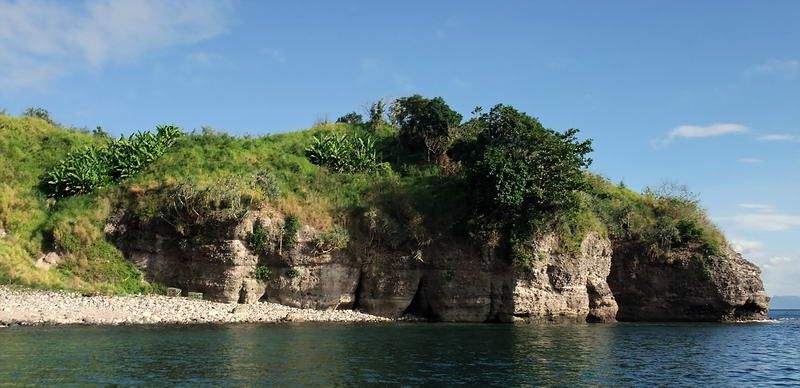 An offshore view of the west side of Searchlight Point. 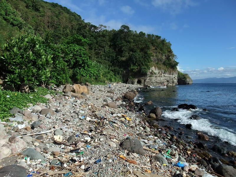 Standing on the beach close to Wheeler Point, I am facing east towards No Name Point. 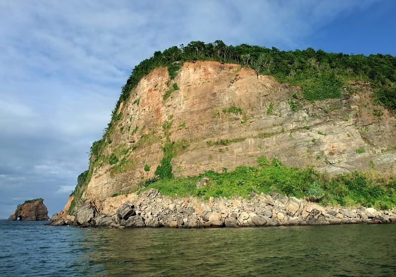 A view of Cape Corregidor with the big chunk of rock off of Rock Point in the distance. 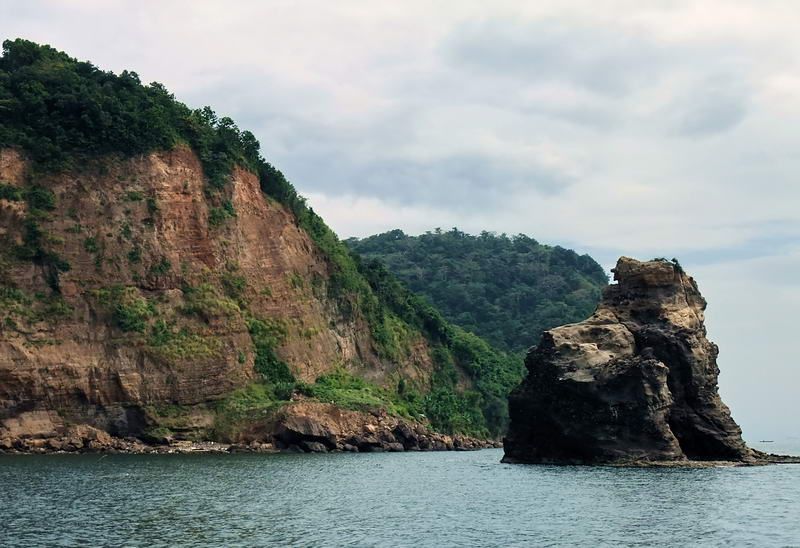 Just past Cape Corregidor I am looking back towards Cheney Ravine. The big rock is called Conchita Island. 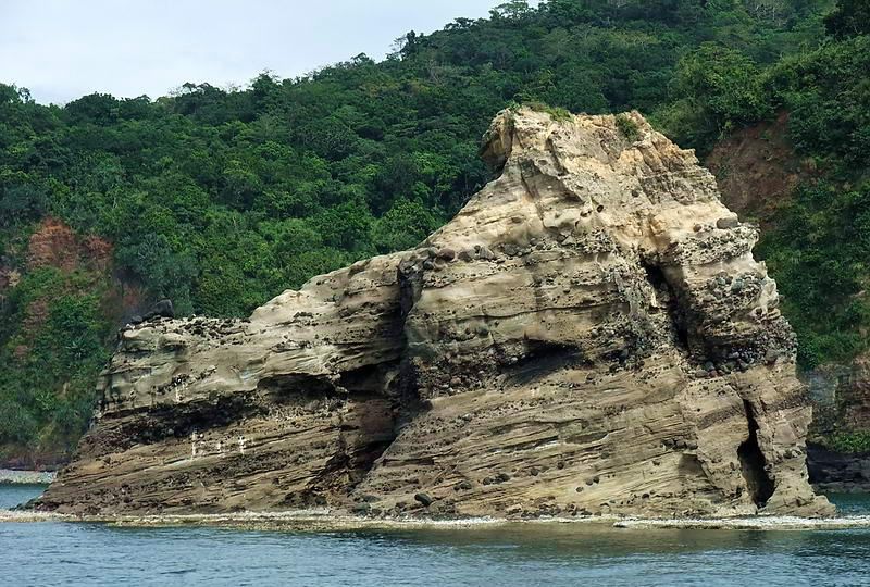 Side view of Conchita Island. The other side has an old machine gun position (X-M-3) cut into the rock facing Corregidor. 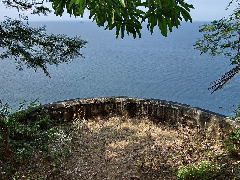 At Cape Corregidor on top of the cliff was Battery Monja. This is a look at the Gun #1 position which now partially sticks out over the cliff. 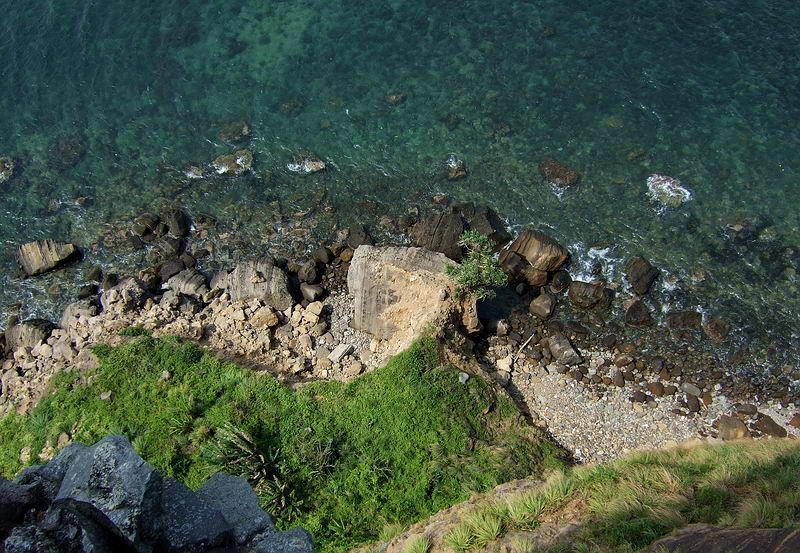 Walking up and sticking your head over the edge tends to cause a certain ‘tightening’ in ones groin area. 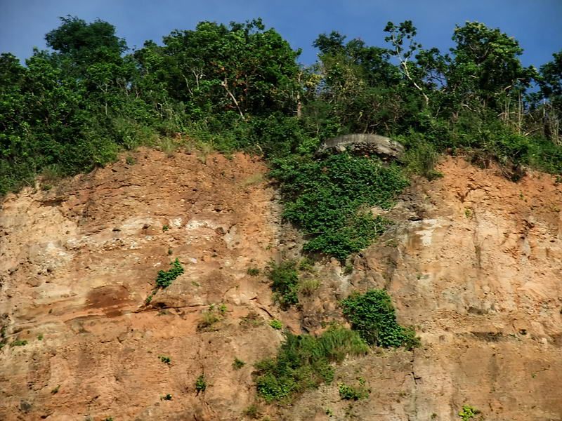 A zoomed in view of the gun position as seen from a boat offshore.  View of the cliff face from the gun position to the water.  At Rock Point, the two year old rockslide still looks very recent.  A closer view of the rubble at the base of the point. Another interesting day on The Rock. |
|