Mt. Pucot, Longos Kawayan Point, Lapiay Point (or Lapia Pt.) Trip and Finds 2013-02-25
A friend, Conrad Buehler and I visited these two points and Mt. Pucot on this date. I have been there a few times before. This was the best time because there were considerable grass burns and it was easy to get around and find things and we did. And we went on top of Mt. Pucot and possibly found the defense positions of the Naval Battalion. We are even able to communicate with the owner of Longos Kawayan Point via Victor Verano per Facebook
Longos Kawayan Point has caretakers and a gate. We entered and requested to visit the point. The immediate area around the gate is home for about 70 goats and they keep the vegetation very short. The caretaker had to help us go thru the fence because we were afraid to damage it. Most of the point is burned, free of the grass right now but he had to navigate thru a short section of tall grass.
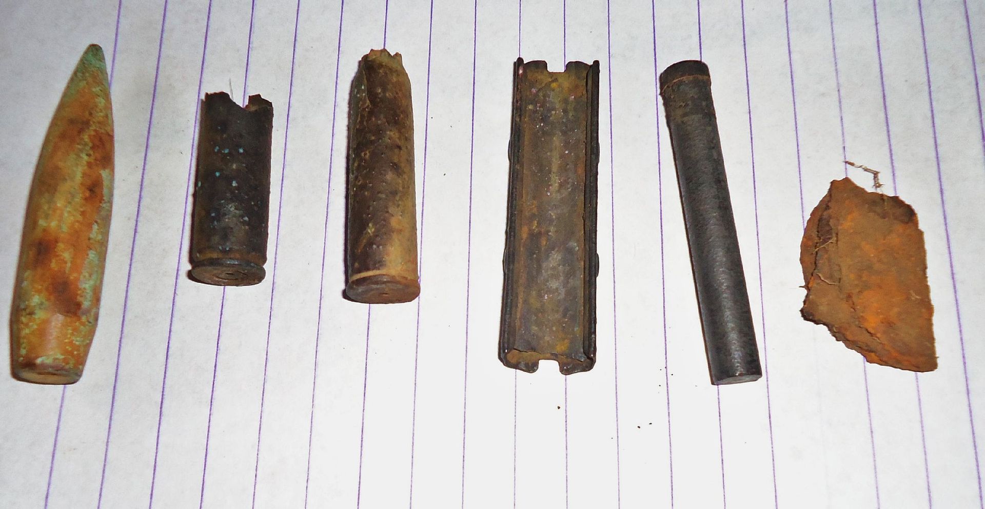
We went down to the beach between Longos Kawayan and Lapia Point, I think squatters live down there. Then our walk took us back up to the Mt. Mauakis to Mt. Pucot road which also goes around Mt. Pucot. We followed the road to Lapia Point and I descended there. Conrad stayed behind and searched that area and found WWII artifacts. On this day he had given up using his metal detector and spotted the items with his naked eye.
Then we decided to go up to Mt. Pucot and we are relative certain that we found the defense position of the Naval Battallion on top of there. Great views are available from the top of this hill. We done about 10 km and went up hill about 440 meters, that was enough and we went home.
Here are the walk stats:
Longos Kawayan and Lapia Points
Mon, 2013 Feb 25 8:33
Activity Type: Casual Walking
Event Type: Special Event
With Conrad Buehler checked out these points. Burned grass area made the walk easier and we were able to find WWII artifacts.
Summary
Distance: 10.55 km
Time: 5:42:27
Avg Pace: 32:28 min/km
Avg Speed: 1.8 km/h
Elevation Gain: 441 m
Timing
Time: 5:42:27
Moving Time: 3:19:45
Elevation
Elevation Gain: 441 m
Elevation Loss: 441 m
Min Elevation: 11 m
Max Elevation: 161 m
THIS LINK WITH MULTIPLY IMAGE SHARING ACCOUNT IS DEAD FOR EVER. I have been having bad luck in choosing the right image sharing accounts. Multiply just dropped this service even though I had 2 year paid pro account with them.
Other personal activities will prevent me to tackle this problem for the next 4 month and today is 2013-03-24.
Also had problems with the Kodak sharing account in the past and now my Photobucket account is making things difficult also. DON’T RECOMMEND NEITHER ONE TO ANYONE!!!!!!!!!!!
175 images of this walk have been uploaded into this account. The images have short titles but can be downloaded at an about 500 KB size:
pisailor.multiply.com/photos/album/164/Mt.-Pucot-Longos-Kawayan-Point-Lapiay-Point-Trip-and-Finds-2013-02-25One of the best reference reading material is here from. United States Army in World War II, The War in the Pacific, The Fall of the Philippines, Chapter XVII: The Battle of the Points by Louis Morton:
www.ibiblio.org/hyperwar/USA/USA-P-PI/USA-P-PI-17.htmlHere are some sample Images: (the numbers are only to help me find the image in my upload album)

220 A GE image with our GPS track and marked with the pertaining landmarks. NOTE: I marked the landfill in the wrong place, I tried to edit but failed. The landfill is located just under the word -END- one rigde over to the right.

221 A section from a 1:50000 map showing the Longos Kawayan area.

223 A map from the Fall of the Philippine publication, reminding us of the dates and area.

224 View of Lapia Pt. at right and Longos Kawayan Pt. at left.

225 Looking back at Mt. Mauakis, I would say it consists at least of 4 peaks.

226 The Longos Kawayan care taker who graciously helped us go thru the property and over the fence.

227 The trail thru the property towards the end of the Longos Kawayan Point.

228 Left of the fence, the about 70 goats keep the grass short, the caretaker helped us get thru this fence.

229 Thu the fence the tall grass swallowed us up but after a while we got onto the burned area.

230 The actual Longos Kawayan Point.

231 Lapia Point or Lapiay Point from the end of Longos Kawayan Point.

232 This is how the burned end of Longos Kawayan Point looks now. This is the reason we were able to find WWII battle artifacts here and now. We are looking towards Naiklec Point and Hrnos Point.

233 Looking at Longos Kawayan Point from the Lapia Point

234 looking NW from Lapia Point at Latain Point, also part of Mt. Pucot.

235 We continued to walk around Mt. Pucot to the north side and had this view looking north.

236 In the distance is Corregidor, left is Mt. Mauakis with many peaks. The points left to right are Hornos Point (which could be seen from Corregidor), Naiklec Point and Longos Kawayan Point.

237 Conrad’s find on Longos Kawayan Point, my find was similar but I have not photographed my find. It will be done later.

238 Conrad’s find from Lapia or Lapiay Point. I didn’t find anything there hbut I walked almost all the way down to the waters edge
Chadhill. Before I forget and my Quinawan presentation will be in a few days or so. A resident mentioned that stature as it is gone. Didn’t get a clear answers as to how it is gone. Maybe the next visitor can inquire again.